From Bacteria to Bikes: come and chat with me at Civic Tech Toronto on January 14!
ane rahbek vierø
spatial data // urban planning // mobility
ane rahbek vierø boosted:
🎆 Last preprint of 2024: BikeNodePlanner: a data-driven decision support tool for #Bicycle node #network planning

ane rahbek vierø boosted:
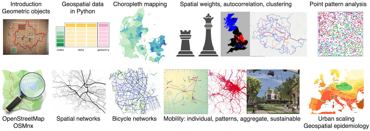
📃 Teaching spatial data science 🧑🏫🌐:geopandas: - paper published!
https://journals.aau.dk/index.php/gfp/article/view/8383
Reflections after teaching at ITU, with @ane. Access our open course materials here: https://github.com/mszell/geospatialdatascience
#geospatial #datascience #teaching #GeoAI
ane rahbek vierø boosted:
"What we see here is a contest over what informs transportation and infrastructure policy: either that irritated feeling you get when you’re stuck in traffic, or actual data-driven evidence."
My first op-ed, with the wonderful @SarahElton!
ane rahbek vierø boosted:
I have removed
the bike lanes
that were in
the road
and which
you were probably
using
to get to work
Forgive me
they were delicious
so crunchy
and so cold
ane rahbek vierø boosted:
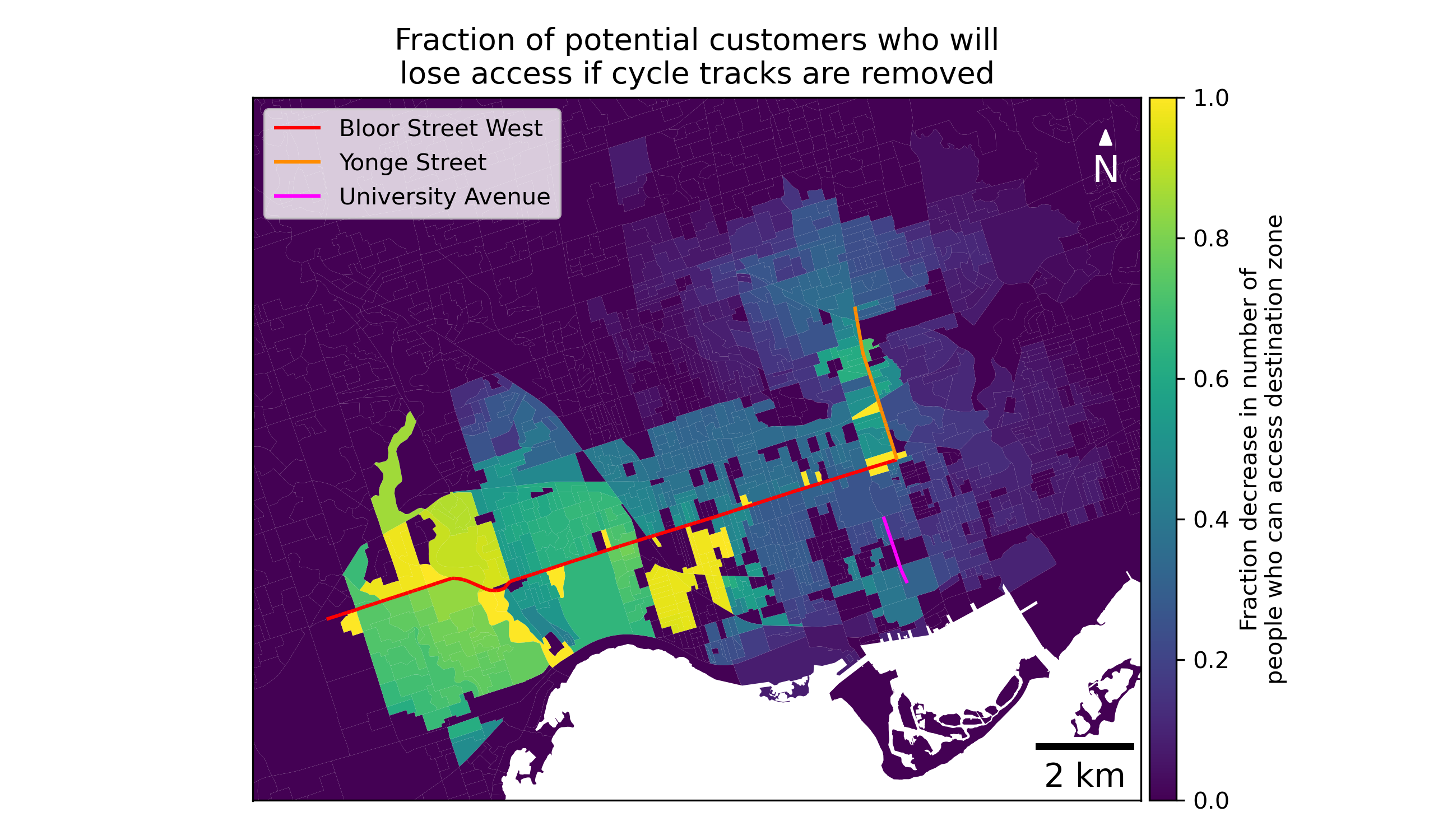
NEW from our group: businesses in Toronto will lose tens to hundreds of thousands of potential customers who can bike if the Bloor, Yonge, and University bike lanes are removed.
- Businesses along Yonge and Bloor will lose HALF of the people who can currently get there safely by bike within 30 minutes.
- Over 600,000 people in Toronto will have fewer destinations they can safely access by bike.
Check out the report here 👇
https://drive.google.com/file/d/1L1YzYJA--Yz0rIsGifP95RbzDNYTuqdf/view?usp=sharing
ane rahbek vierø boosted:
My bike ride to work takes exactly 30 minutes - rain or shine, morning or evening.
A few weeks ago I took the "car" to work, using the car lane instead of the bike lane. It took 45 minutes - 50% longer! - because traffic is just that bad. You're not stuck in traffic, you are traffic.
#CarsRuinCities
ane rahbek vierø boosted:
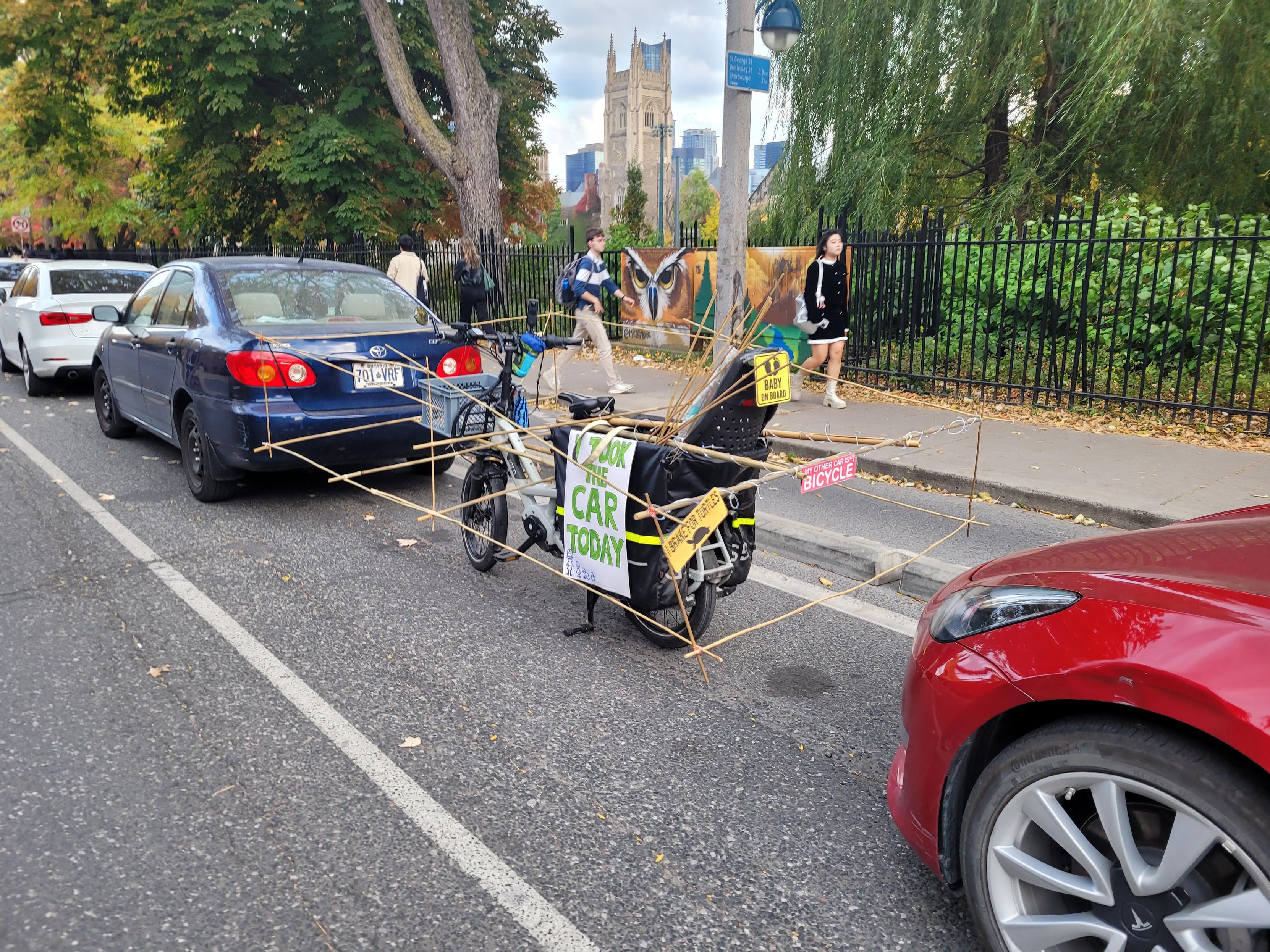
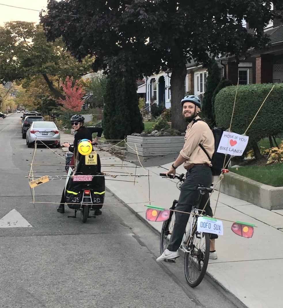
Honk if you ❤️ bike lanes
My other car is also a bicycle
ane rahbek vierø boosted:
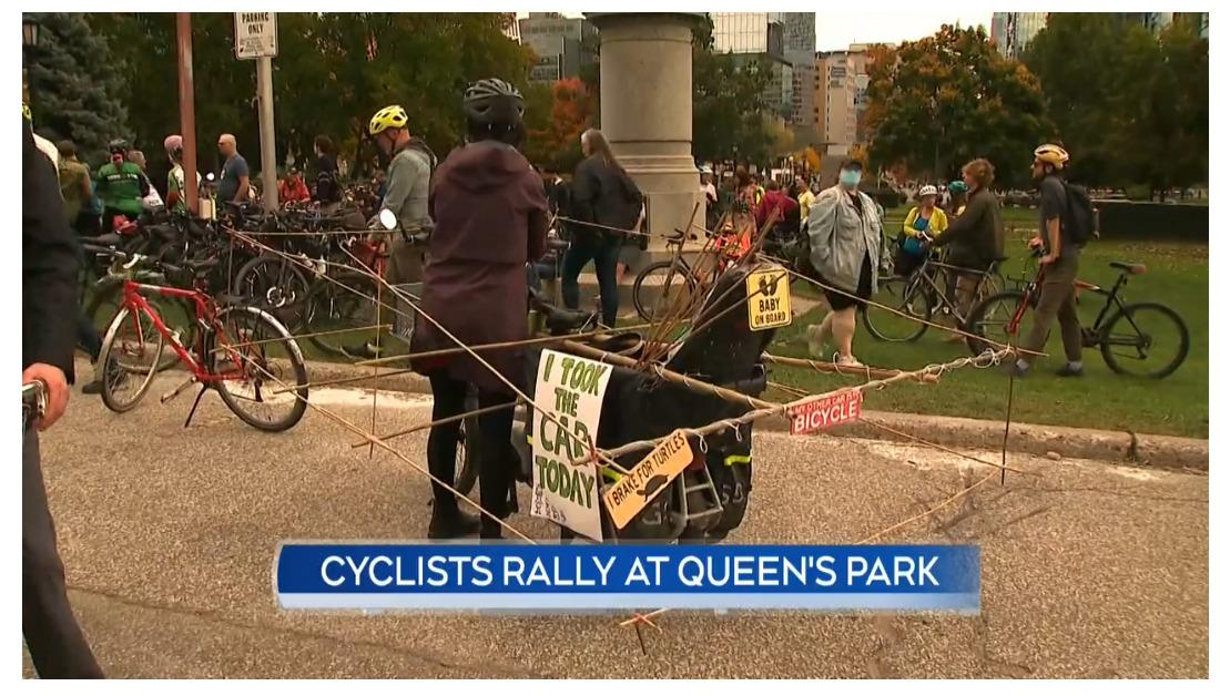
A bunch of yahoos
Out in front of Queen's Park
ane rahbek vierø boosted:
Check out our (open access!) paper here: https://doi.org/10.1016/j.jtrangeo.2024.104010
ane rahbek vierø boosted:
Happy Birthday, OpenStreetMap!
Twenty years ago on August 9, the openstreetmap.org domain was registered. Since then open map data has been making the world a better place every day.
Send a birthday card here & support OSM if you can:
ane rahbek vierø boosted:
An OSMer got official road data from their region (US-OH) & made a map of that as a raster tile map for people to consult
https://community.openstreetmap.org/t/road-map-tiles-from-ohio-government-data/115997
#OpenStreetMap
ane rahbek vierø boosted:
I see a lot of people talking about technical solutions to racist attacks on Mastodon. I used to do that too.
I was wrong.
Yes. There are things that could be done to improve technical protections. Signup validation, proactive moderation, visible replies, limiting who can reply.... But those don't actually solve the problem.
The problem is us.
The problem is what we allowed our community to be.
The tech community has a lot of racists in it. Some are billionaires. Many of those billionaires fund and support explicit racists and eugenicists. When these people, and those who want to emulate them, suffer zero consequences for their racism (and they almost always do), they get more brazen and more explicit. For some it's a thrilling game to see what they can get away with. For others it's a deadly serious ideology.
We need to make it clear that VCs, developers, managers, and influencers who don't take racism seriously won't get hired. That their companies will be boycotted. That nobody will work on their projects. It's not enough to not be racist. We need to be proactively anti-racist, and we need to hold everyone we work with to the same standard.
And when I talk about fighting racism, I'm not just talking about someone saying the n-word. The guy who says, "We don't allow politics in our company/project" has just stated that they are perfectly fine hiring and funding a racist, even if it drives others away. The company that says they don't need a DEI initiative because it "doesn't help the bottom line" has just told their employees that being biased is perfectly fine. You know what they call someone who sits down to dinner with Nazis; if you enable one, you are one. Every step backwards is one more racist who feels empowered to step out of their dank closet.
And fighting them has a cost. We may need to turn down opportunities, and be attacked in response. It's no accident that a lot of the Black (and LGBTQ+) folks who receive the most attacks are the same ones who stood up to their organizations, who called out and continue to call out the racism and bias, and who daily pay a price for it. The message is clear. "Do what they do and we'll make an example of you too."
All of this is going to be harder than we want, because the racists hold a lot of the purse strings. But the tech community is our community, we live here, and we're responsible for making it safe for others.
And I don't want to see one more post saying, "I haven't seen it myself, but...". If you're not seeing it, go out and search for it. Or turn around and look at your own organization and see how you can make it better. We can't cleanup Mastodon without cleaning up the entire community; it doesn't exist in a vacuum.
And yes, you can replace "racist" in what I wrote with any other fascist ideology. They are all cut from the same cloth, and a follower of one invariably joins the others as well.
ane rahbek vierø boosted:
Article 'processing' charges are a secret conspiracy to reduce carbon emissions by absorbing money academics would otherwise be able to spend travelling to conferences
ane rahbek vierø boosted:
We have (finally!) released @geopandas 1.0 today. While the release notes are long and full of exciting stuff, the most important from my perspective of a maintainer is a massive cleanup of internal handling of geometry engines. It was a bit pain lately.
A short reflection on that which wouldn’t fit in a toot - https://martinfleischmann.net/geopandas-1.0-is-out/
And a post I wrote when we released 1.0a1, highlighting things that have a potential to break stuff downstream - https://martinfleischmann.net/geopandas-1.0-is-coming.-what-will-change/
Please report bugs! 🐛
ane rahbek vierø boosted:
But wait! Why don't we first get the OpenStreetMap database through quality control and then re-render the map?
And here is where user expectations and reality are clashing.
is not meant as a user-friendly map or app or anything regular users are supposed to use.
It's simply a demo of what the OpenStreetMap data could produce but not meant for end users.
Turns out that's not what most users expect.
4/n
ane rahbek vierø boosted:
Hvis du kun skal læse en artikel i dag, anbefaler jeg denne (gavelink):
https://www.information.dk/udland/2024/06/stoerste-slag-100-aar-danske-areal-finder-sted-lige?kupon=eyJpYXQiOjE3MTgxNjgwMzEsInN1YiI6IjExOTU3NDo4MjE3OTAifQ.eIpVnRaF0KouhrkgJ97X5g #dkgreen #dkpol
ane rahbek vierø boosted:
Hvad er danske vejnavne opkaldt efter?
Nu har jeg lavet (en tidlig udgave) af et website, så man kan søge efter vejnavne og se, hvad de er opkaldt efter. Tjek fx diverse vejnavne, som begynder med "Lærke":
https://navne.findvej.dk/#L%C3%A6rke
Data stammer fra OpenStreetMap, hvor jeg og andre har tastet løs i det seneste års tid! Over 20.000 forskellige veje med over 6.500 forskellige emner er registreret.
Og jo, et kort (og meget andet) er naturligvis på todo-listen, så det er lettere at kigge rundt. #OSM
ane rahbek vierø boosted:
Fremragende indlæg om den stedmoderlige behandling tværkommunal cykling får pt: Staten gør ikke noget, og regionerne er ikke vejmyndighed, så de kan ikke anlægge. (Men tak for at de alligevel gør hvad de kan, via dialog, planlægning og medfinansiering.)
#dktrp #dkgreen #dkpol https://jyllands-posten.dk/debat/kronik/ECE17140742/anerkend-cyklen-som-en-afgoerende-spiller-i-den-regionale-transportplanlaegning/
ane rahbek vierø boosted:
"Desværre handler transportdiskussionen i Danmark ofte om specifikke tiltag, tog- og busruter eller udvidelse af vejnet uden at adressere det overordnede spørgsmål: Hvad vil vi med mobiliteten?"
Stærkt indlæg fra Helene Dyrhauge, RUC om behovet for en mobilitetsstrategi! https://www.altinget.dk/transport/artikel/politikerne-skal-taenke-paa-det-store-billede-hvis-fremtidens-kollektive-transport-skal-fungere #dktrp #dkpol #dkgreen
Client Info
Server: https://mastodon.social
Version: 2025.04
Repository: https://github.com/cyevgeniy/lmst