#EAS #WEA for Coweta, #GA; #Fayette, #GA: National Weather Service: #TORNADO WARNING in this area until 3:45 PM EDT. Take shelter now in a basement or an interior room on the lowest floor of a sturdy building. If you are outdoors, in a mobile home, or in a vehicle, move to the closest substantial shelter and protect yourself from flying debris. Check media. Source: NWS Peachtree City GA ** DO NOT RELY ON THIS FEED FOR LIFE SAFETY, SEEK OUT OFFICIAL SOURCES ***
#Fayette

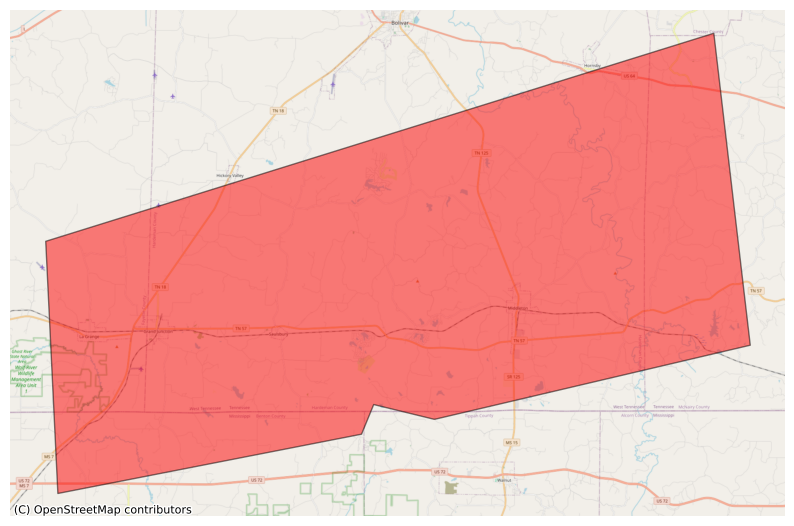
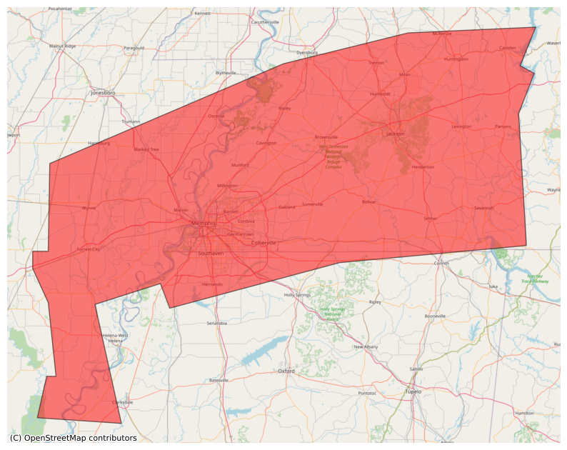
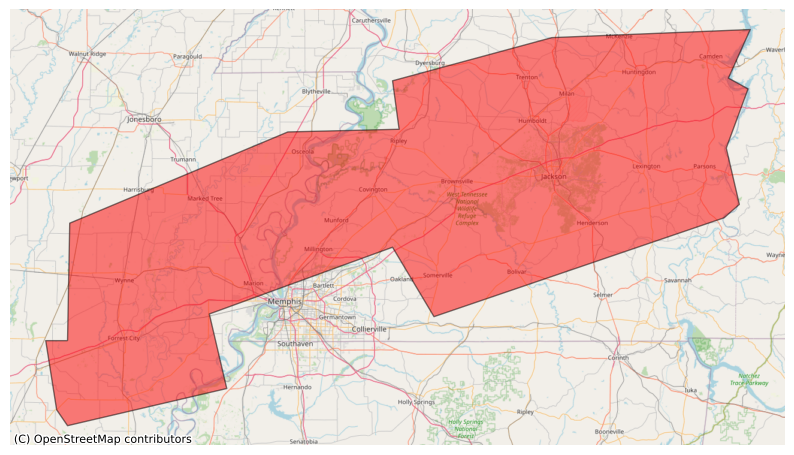
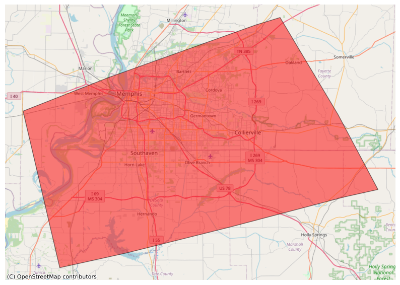
#EAS #WEA for Benton, #MS; #Fayette, #TN; #Hardeman, #TN; #McNairy, #TN: National Weather Service: #TORNADO WARNING in this area until 9:15 AM CDT. Take shelter now in a basement or an interior room on the lowest floor of a sturdy building. If you are outdoors, in a mobile home, or in a vehicle, move to the closest substantial shelter and protect yourself from flying debris. Check media. Source: NWS Memphis TN ** DO NOT RELY ON THIS FEED FOR LIFE SAFETY, SEEK OUT OFFICIAL SOURCES ***
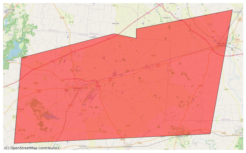
@easwatch #SevereWeather #OHwx #EAS #WEA for Clinton, #OH; #Fayette, #OH; #Highland, #OH: National Weather Service: SEVERE THUNDERSTORM WARNING in effect for this area until 10:00 PM EDT for DESTRUCTIVE 80 mph winds. Take shelter in a sturdy building, away from windows. Flying debris may be deadly to those caught without shelter. Source: NWS Wilmington OH ** DO NOT RELY ON THIS FEED FOR LIFE SAFETY, SEEK OUT OFFICIAL SOURCES ***
#EAS #WEA for Clinton, #OH; #Fayette, #OH; #Highland, #OH: National Weather Service: SEVERE THUNDERSTORM WARNING in effect for this area until 10:00 PM EDT for DESTRUCTIVE 80 mph winds. Take shelter in a sturdy building, away from windows. Flying debris may be deadly to those caught without shelter. Source: NWS Wilmington OH ** DO NOT RELY ON THIS FEED FOR LIFE SAFETY, SEEK OUT OFFICIAL SOURCES ***
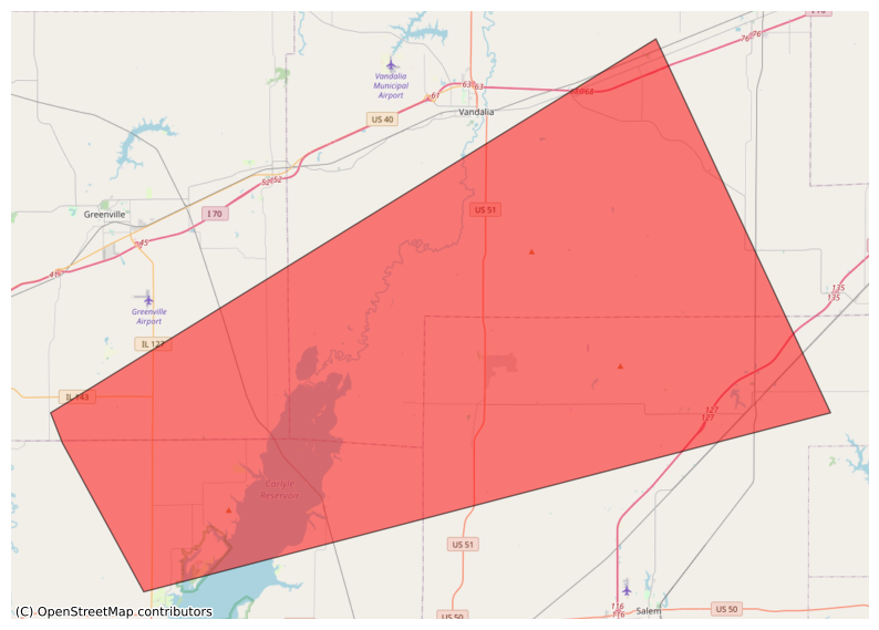
#EAS #WEA for Bond, #IL; #Clinton, #IL; #Fayette, #IL; #Marion, #IL: National Weather Service: #TORNADO WARNING in this area until 4:00 PM CDT. Take shelter now in a basement or an interior room on the lowest floor of a sturdy building. If you are outdoors, in a mobile home, or in a vehicle, move to the closest substantial shelter and protect yourself from flying debris. Check media. Source: NWS St Louis MO ** DO NOT RELY ON THIS FEED FOR LIFE SAFETY, SEEK OUT OFFICIAL SOURCES ***
#EAS #WEA for Bastrop, #TX; #Fayette, #TX: National Weather Service: A FLASH #FLOOD WARNING is in effect for this area until 10:45 PM CDT. This is a dangerous and life-threatening situation. Do not attempt to travel unless you are fleeing an area subject to flooding or under an evacuation order. Source: NWS Austin/San Antonio TX ** DO NOT RELY ON THIS FEED FOR LIFE SAFETY, SEEK OUT OFFICIAL SOURCES ***
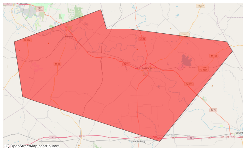
@easwatch #SevereWeather #TXwx #EAS #WEA for Bastrop, #TX; #Fayette, #TX: National Weather Service: A FLASH #FLOOD WARNING is in effect for this area until 8:45 PM CDT. This is a dangerous and life-threatening situation. Do not attempt to travel unless you are fleeing an area subject to flooding or under an evacuation order. Source: NWS Austin/San Antonio TX ** DO NOT RELY ON THIS FEED FOR LIFE SAFETY, SEEK OUT OFFICIAL SOURCES ***
#EAS #WEA for Bastrop, #TX; #Fayette, #TX: National Weather Service: A FLASH #FLOOD WARNING is in effect for this area until 8:45 PM CDT. This is a dangerous and life-threatening situation. Do not attempt to travel unless you are fleeing an area subject to flooding or under an evacuation order. Source: NWS Austin/San Antonio TX ** DO NOT RELY ON THIS FEED FOR LIFE SAFETY, SEEK OUT OFFICIAL SOURCES ***

@easwatch #SevereWeather #ILwx #EAS #WEA for #Fayette, #IL: National Weather Service: #TORNADO WARNING in this area until 8:00 PM CDT. Take shelter now in a basement or an interior room on the lowest floor of a sturdy building. If you are outdoors, in a mobile home, or in a vehicle, move to the closest substantial shelter and protect yourself from flying debris. Check media. Source: NWS St Louis MO ** DO NOT RELY ON THIS FEED FOR LIFE SAFETY, SEEK OUT OFFICIAL SOURCES ***
@easwatch #SevereWeather #ILwx #EAS #WEA for #Fayette, #IL; #Marion, #IL: National Weather Service: #TORNADO WARNING in this area until 7:15 PM CDT. Take shelter now in a basement or an interior room on the lowest floor of a sturdy building. If you are outdoors, in a mobile home, or in a vehicle, move to the closest substantial shelter and protect yourself from flying debris. Check media. Source: NWS St Louis MO ** DO NOT RELY ON THIS FEED FOR LIFE SAFETY, SEEK OUT OFFICIAL SOURCES ***
#EAS #WEA for Clay, #WV; #Fayette, #WV; #Kanawha, #WV; #Putnam, #WV: National Weather Service: #TORNADO WARNING in this area until 6:00 PM EDT. Take shelter now in a basement or an interior room on the lowest floor of a sturdy building. If you are outdoors, in a mobile home, or in a vehicle, move to the closest substantial shelter and protect yourself from flying debris. Check media. Source: NWS Charleston WV ** DO NOT RELY ON THIS FEED FOR LIFE SAFETY, SEEK OUT OFFICIAL SOURCES ***

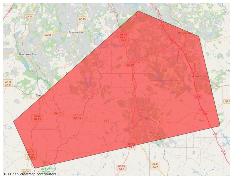
@easwatch #GAwx #EAS #WEA for Butts, #GA; #Clayton, #GA; #Coweta, #GA; #Fayette, #GA; #Henry, #GA; #Meriwether, #GA; #Pike, #GA; #Spalding, #GA: National Weather Service: #TORNADO WARNING in this area until 8:00 AM EDT. Take shelter now in a basement or an interior room on the lowest floor of a sturdy building. If you are outdoors, in a mobile home, or in a vehicle, move to the closest substantial shelter and protect yourself from flying debris. Check media. Source: NWS Peachtree City GA ** DO NOT RELY ON THIS
#EAS #WEA for Butts, #GA; #Clayton, #GA; #Coweta, #GA; #Fayette, #GA; #Henry, #GA; #Meriwether, #GA; #Pike, #GA; #Spalding, #GA: National Weather Service: #TORNADO WARNING in this area until 8:00 AM EDT. Take shelter now in a basement or an interior room on the lowest floor of a sturdy building. If you are outdoors, in a mobile home, or in a vehicle, move to the closest substantial shelter and protect yourself from flying debris. Check media. Source: NWS Peachtree City GA ** DO NOT RELY ON THIS
#EAS #WEA for Crittenden, #AR; #Cross, #AR; #Lee, #AR; #Mississippi, #AR; #Phillips, #AR; #Poinsett, #AR; #St. Francis, #AR; #Alcorn, #MS; #Benton, #MS; #Coahoma, #MS; #DeSoto, #MS; #Marshall, #MS; #Tippah, #MS; #Tunica, #MS; #Benton, #TN; #Carroll, #TN; #Chester, #TN; #Crockett, #TN; #Decatur, #TN; #Dyer, #TN; #Fayette, #TN; #Gibson, #TN; #Hardeman, #TN; #Hardin, #TN; #Haywood, #TN; #Henderson, #TN; #Lauderdale, #TN; #McNairy, #TN; #Madison, #TN; #Shelby, #TN; #Tipton, #TN; #Weakley, #TN: Nati
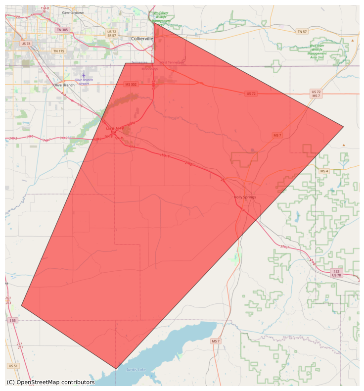
@easwatch #EAS #WEA #MSwx for Benton, #MS; #DeSoto, #MS; #Lafayette, #MS; #Marshall, #MS; #Panola, #MS; #Tate, #MS; #Fayette, #TNwx National Weather Service: #TORNADO WARNING in this area until 5:15 PM CDT. Take shelter now in a basement or an interior room on the lowest floor of a sturdy building. If you are outdoors, in a mobile home, or in a vehicle, move to the closest substantial shelter and protect yourself from flying debris. Check media. Source: NWS Memphis TN ** DO NOT RELY ON THIS FEED FOR LIFE SAFETY
#EAS #WEA for Benton, #MS; #DeSoto, #MS; #Lafayette, #MS; #Marshall, #MS; #Panola, #MS; #Tate, #MS; #Fayette, #TN: National Weather Service: #TORNADO WARNING in this area until 5:15 PM CDT. Take shelter now in a basement or an interior room on the lowest floor of a sturdy building. If you are outdoors, in a mobile home, or in a vehicle, move to the closest substantial shelter and protect yourself from flying debris. Check media. Source: NWS Memphis TN ** DO NOT RELY ON THIS FEED FOR LIFE SAFETY
#EAS #WEA for Crittenden, #AR; #Benton, #MS; #DeSoto, #MS; #Marshall, #MS; #Tate, #MS; #Tunica, #MS; #Fayette, #TN; #Shelby, #TN: National Weather Service: A FLASH #FLOOD WARNING is in effect for this area until 6:45 PM CDT. This is a dangerous and life-threatening situation. Do not attempt to travel unless you are fleeing an area subject to flooding or under an evacuation order. Source: NWS Memphis TN ** DO NOT RELY ON THIS FEED FOR LIFE SAFETY, SEEK OUT OFFICIAL SOURCES ***

#EAS #WEA for Crittenden, #AR; #Cross, #AR; #Lee, #AR; #Mississippi, #AR; #Poinsett, #AR; #St. Francis, #AR; #Tunica, #MS; #Benton, #TN; #Carroll, #TN; #Chester, #TN; #Crockett, #TN; #Decatur, #TN; #Dyer, #TN; #Fayette, #TN; #Gibson, #TN; #Hardeman, #TN; #Hardin, #TN; #Haywood, #TN; #Henderson, #TN; #Lauderdale, #TN; #McNairy, #TN; #Madison, #TN; #Shelby, #TN; #Tipton, #TN; #Weakley, #TN: National Weather Service: A FLASH #FLOOD WARNING is in effect for this area until 6:45 PM CDT. This is a da

#EAS #WEA for Crittenden, #AR; #Cross, #AR; #Lee, #AR; #Mississippi, #AR; #Poinsett, #AR; #St. Francis, #AR; #Tunica, #MS; #Benton, #TN; #Carroll, #TN; #Chester, #TN; #Crockett, #TN; #Decatur, #TN; #Dyer, #TN; #Fayette, #TN; #Gibson, #TN; #Hardeman, #TN; #Hardin, #TN; #Haywood, #TN; #Henderson, #TN; #Lauderdale, #TN; #McNairy, #TN; #Madison, #TN; #Shelby, #TN; #Tipton, #TN; #Weakley, #TN: National Weather Service: A FLASH #FLOOD WARNING is in effect for this area until 4:45 PM CDT. This is a da
#EAS #WEA for Crittenden, #AR; #Benton, #MS; #DeSoto, #MS; #Marshall, #MS; #Tate, #MS; #Tunica, #MS; #Fayette, #TN; #Shelby, #TN: National Weather Service: A FLASH #FLOOD WARNING is in effect for this area until 4:45 PM CDT. This is a dangerous and life-threatening situation. Do not attempt to travel unless you are fleeing an area subject to flooding or under an evacuation order. Source: NWS Memphis TN ** DO NOT RELY ON THIS FEED FOR LIFE SAFETY, SEEK OUT OFFICIAL SOURCES ***
Client Info
Server: https://mastodon.social
Version: 2025.04
Repository: https://github.com/cyevgeniy/lmst