#HYFeatures

💧🌏 Greg CocksGregCocks@techhub.social
2024-09-25

USGS Releases ‘The 3D National Topography Model [3DTNM] Call For Action - Part 1: The 3D Hydrography Program [3DHP]’
--
usgs.gov/news/technical-announ <-- technical announcement
--
pubs.usgs.gov/publication/cir1 <-- USGS Circular 1519 publication link
--
usgs.gov/3DHP <-- shared USGS 3DHP home page
--
internetofwater.org/ <-- shared Internet of Water home page
--
[ nice to see this, although I am maybe biased ~wink~ ]
#GIS #spatial #mapping #water #hydrology #surfacewater #3D #opendata #3DHP #3DEP #EDH #3DTNM #elevationderivedhydrology #topography #hydrography #CallForAction #publicdata #HYFeatures #opensource #IOW #InternetOfWater #DEMs #digitalinfrastructure #waterresources #resourcemanagement #inventory #planning
@USGS

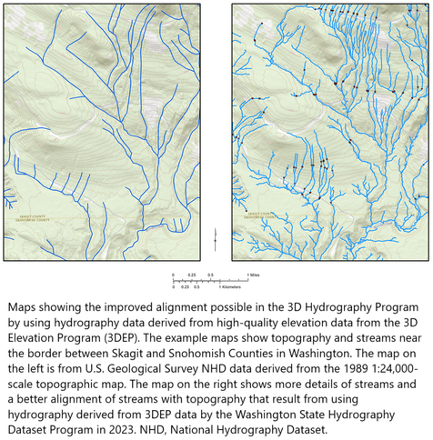
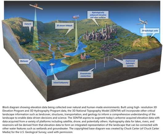
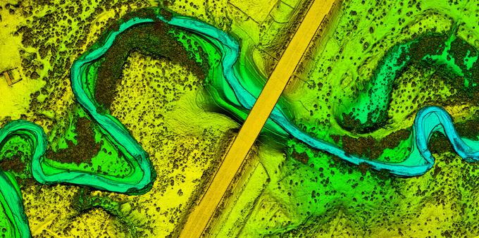
Maps showing the improved alignment possible in the 3D Hydrography Program by using hydrography data derived from high-quality elevation data from the 3D Elevation Program (3DEP). The example maps show topography and streams near the border between Skagit and Snohomish Counties in Washington.map - Example of hydrography derived from 3DEP lidar data for a section of the Marshyhope Creek near Federalsburg, Maryland.Block diagram showing elevation data being collected over natural and human-made environments. Built using high- resolution 3D Elevation Program and 3D Hydrography Program data, the 3D National Topography Model (3DNTM) will incorporate other critical landscape information such as landcover, structures, transportation, and geology to inform a comprehensive understanding of the landscape to enable data-driven decisions and science. The 3DNTM aspires to augment today’s airborne-acquired elevation data with data acquired from a variety of platforms including satellite, drone, and potentially others. Hydrography data for lakes, rivers, and reservoirs will be derived from that elevation data to form an integrated representation of the landscape that can be connected with other water features such as wetlands and groundwater.Digial elevation model of USGS site 365149109492300 Laguna Creek below Dennehotso near Kayenta, AZ.

Client Info

Server: https://mastodon.social
Version: 2025.04
Repository: https://github.com/cyevgeniy/lmst