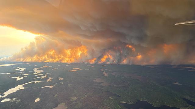
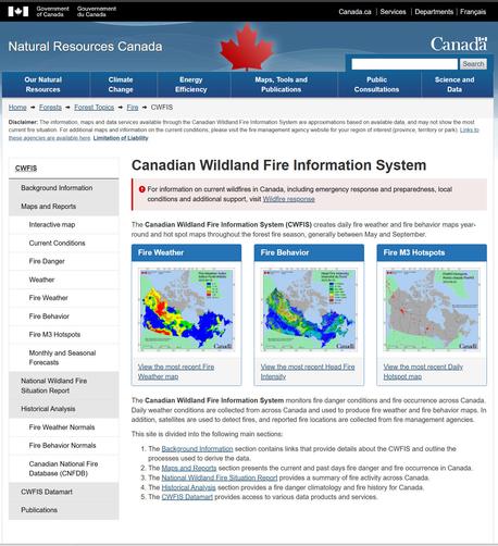
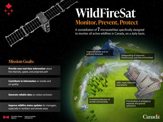
Canada Is On Fire - Maps, Satellite Data, Smoke Forecasts Powering Emergency Response [spatial resources]
--
https://gogeomatics.ca/wildfire-maps-satellite-data-smoke-forecasts-powering-emergency-response/ <-- shared technical article / resource
--
https://cwfis.cfs.nrcan.gc.ca/home <-- shared Canadian Wildland Fire Information System (CWFIS) page
--
#GIS #spatial #mapping #resources #Canada #provinces #remotesensing #fire #wildfire #monitoring #response #hazardresponse #riskassessment #risk #hazard #loss #cost #infrastructure #extremeweather #climatechange #hot #dry #fireseason #stateofemergency #humanimpacts #publichealth #smoke #publicsafety #community #urban #opendata #spatialanalysis #spatiotemporal
#spatial
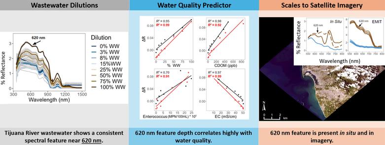
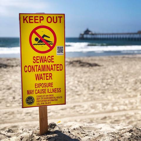
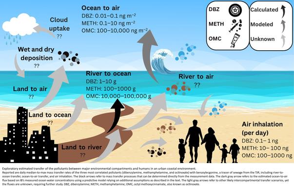
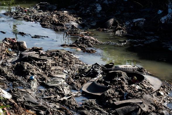
Sewage Crisis At California Coastline Can Be Seen From Space [remote sensing]
--
https://www.sfgate.com/bayarea/article/sewage-crisis-california-coastline-visible-space-20384048.php <-- shared media article
--
https://doi.org/10.1016/j.scitotenv.2025.179598 <-- shared paper
--
https://doi.org/10.1126/sciadv.ads9476 <-- shared paper
--
https://earth.jpl.nasa.gov/emit/ <-- shared NASA EMIT home page
--
#GIS #spatial #mapping #remotesensing #earthobservation #sewage #sewerage #California #coast #coastline #pollution #monitoring #spatialanalysis #spatiotemporal #Tijuana #SanDiego #USA #Mexico #NASA #publichealth #publicsafety #waterquality #airquality #marine #ocean #industrialwaster #stormwater #urban #runoff #estuary #beach #closure #contamination #contaminants #ctinoxate #methamphetamine #reflectance #wastewater #EMIT
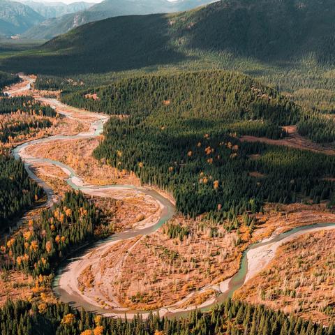
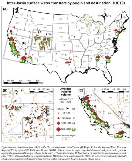
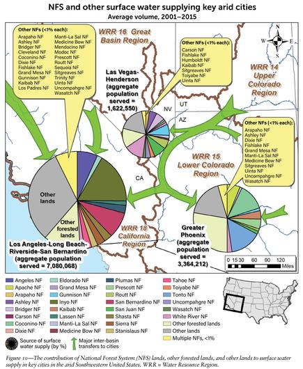
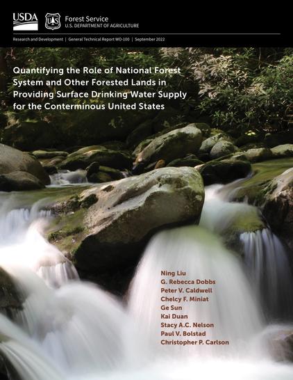
[Public Lands] National Forests Deliver Almost Half Of The West's Drinking Water Supply, [USFS] Report Shows
--
https://www.kunm.org/news/2022-10-07/national-forests-deliver-almost-half-of-the-wests-drinking-water-supply-report-shows <-- shared media article
--
https://www.fs.usda.gov/sites/default/files/fs_media/fs_document/GTR-WO-100.pdf <-- shared USFS publication
--
#water #watersupply #hydrology #publicwatersupply #PWS #USWest #publiclands #waterresources #forests #grasslands #nationalforests #nationalgrasslands #MountainWest #surfacewater #waterquality #community #watersecurity #urban #industrial #residential #drinkingwater #planning #management #watershed #GIS #spatial #mapping #spatialanalysis #spatiotemporal #model #modeling #interbasintransfers #NationalForestSystem #WaSSI #population #USA #US #publiclands
@USFS
🌀Choreography of Lines - a sculpted symphony of movement captured in space. When stillness dances, and form becomes breath.
https://rafaelsalazar.com/featured/choreography-of-lines-rafael-salazar.html
#BuyIntoArt #art #artmatters #fediverse #fediart #mastodon #mastoart #fedigiftshop #artist #mastoartist #fineart #fineartamerica #flipboard_user_group #flipboard #abstract #abstractart
#RafaelSalazar #WireSculpture #ModernArt #SpatialElegance #AbstractMovement #LineAndForm #sculpture #wire #kinetic motion; #Minimalism #lineart #spatial
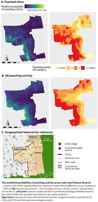
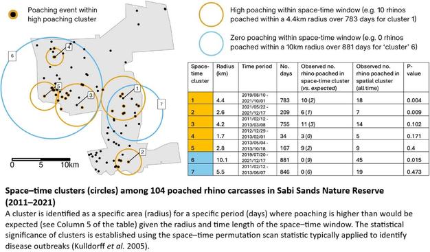
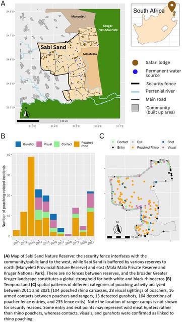
Colluding Rhino Poachers Exploit Space–Time Variation In Opportunity And Risk
--
https://doi.org/10.1111/conl.13106 <-- shared paper
--
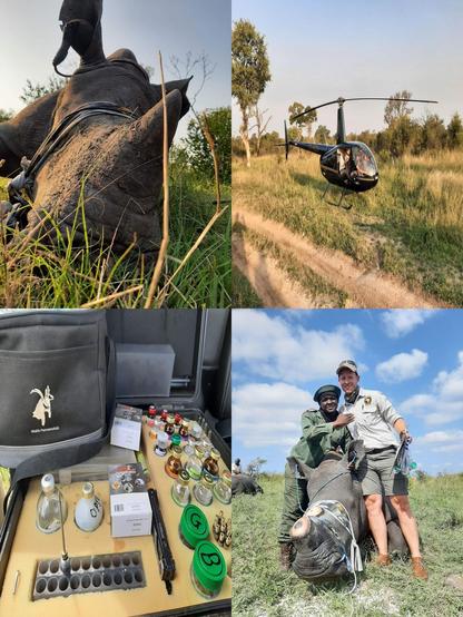
“[R]esearch analysing over 500 rhino poaching incidents and exploring what these patterns reveal about the behaviours of poachers, rangers, and rhinos. [Their] study highlights concerning evidence of criminal syndicate infiltration, space–time targeting by poachers, and how behavioural insights can inform effective responses—from targeted dehorning to bolstering ranger resilience…”
#GIS #spatial #mapping #spatialanalysis #wildlifeconservation #wildlife #conservation #statistics #geostatistics #rhino #rhinohorn #rhinoceros #poaching #rangers #criminal #syndicate #mafia #criminalsyndicate #activity #crime #illegal #behaviour #dehorning #rangerstation #protection #humanimpacts #ecosystem #habitat #deterrencetheory #deterrence #methodology #tourist #tourism #reserve #spatiotemporal #opportunity #risk #hazard #riskassessment #Africa #SouthAfrica #alldataisspatial
@Sabi Sand Nature Reserve
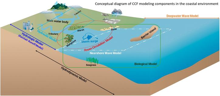
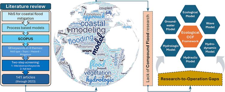
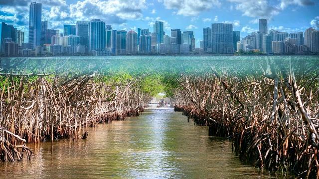
Advancing Compound Flood Modeling to Evaluate Coastal Protection Benefits of Natural Infrastructure
--
https://coastalscience.noaa.gov/news/advancing-compound-flood-modeling-to-evaluate-coastal-protection-benefits-of-natural-infrastructure/ <-- shared technical article
--
https://doi.org/10.1016/j.scitotenv.2024.173529 <-- shared paper
--
#flood #flooding #literaturesearch #compilation #coast #coastal #coastalengineering #mitigation #planning #management #framework #model #modeling #infrastructure #natural #barrier #rainfall #precipitation #climatechange #river #discharge #stormsurge #sealevel #seallevelrise #waves #tides #compoundflooding #humanimpacts #communities #publicsafety #cost #loss #economics #fedscience #fedservice #hydrology #water #marine #ocean #hydraulic #hydrodynamic #biology #ecosystems #vegetation #sedimentation #erosion #GIS #spatial #mapping #spatialanalysis #regional #local #forecasting #preparation #enduser #usecase #publicwarnings #marsh #sawmp #mangrove
@NOAA | @NOAA Ocean | @NOAA Centers for Coastal Ocean Science
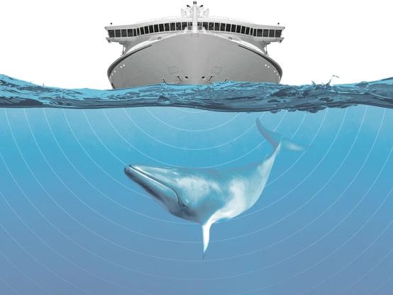
Towards A Simpler Assessment Of The Environmental Impact Of Hydrographic Echosounders
--
https://ihr.iho.int/articles/towards-a-simpler-assessment-of-the-environmental-impact-of-hydrographic-echosounders/ <-- shared paper
--
https://www.fisheries.noaa.gov/s3/2024-05/NMSFAcousticGuidance-DraftTECHMEMOGuidance-3.0-FEB-24-OPR1.pdf <-- shared NOAA 2024 guidance
--
https://doi.org/10.1098/rspb.2020.0070 <-- shared paper
--
#GIS #spatial #mapping #communityhydrography #echosounder #environmentalimpact #hydrography #marinemammals #whales #cetaceans #survey #impacts #humanimpacts #logistics #management #planning #ecosystems #seafloor #sonar #remotesensing #marine #animals #risk #hazard #multibeam #model #modeling #impactassessment #riskassessment #auditory #fish #habitat #strandings
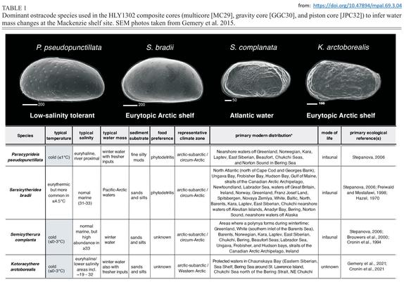
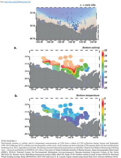
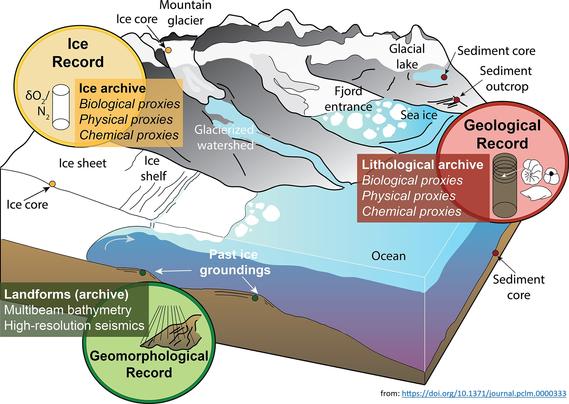
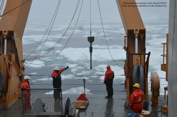
Land-Sea Linkages In The Arctic – What Is Paleoclimatology?
--
https://www.usgs.gov/programs/ecosystems-land-change-science-program/science/land-sea-linkages-arctic <-- shared technical article
--
https://doi.org/10.1371/journal.pclm.0000333 <-- shared example of paper
--
https://doi.org/10.47894/mpal.69.3.04 <-- shared example of paper
--
[who doesn’t like a good foraminifera! (memories of staring down a microscope for hours at grad school) 😊 ]
#fedscience #Paleoclimatology #Paleoecology #Paleooceanography #Icesheet #climatechange #Paleoanthropology #Seaice #Marineecosystems #GIS #spatial #mapping #spatialanalysis #model #modeling #spatiotemporal #foraminifera #arctic #change #cryosphere #ArcticOcean #glacial #interglacial #Holocene #future
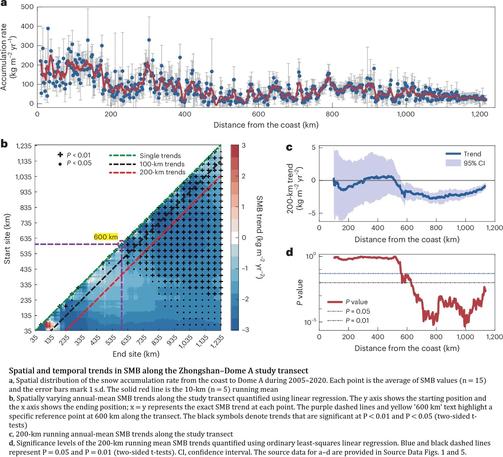
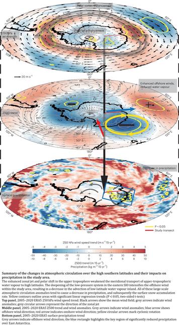
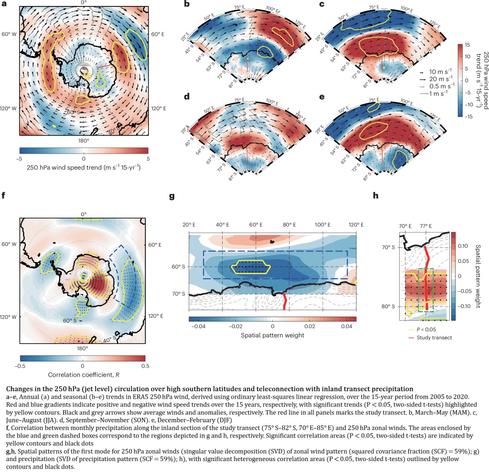
Sustained Decrease In Inland East Antarctic Surface Mass Balance Between 2005 And 2020
--
https://doi.org/10.1038/s41561-025-01699-z <-- shared paper
--
#GIS #spatial #mapping #Antarctic #EastAntarctic #icesheet #massbalance #spatialanalysis #model #modeling #spatiotemporal #water #climate #climatedynamics #monitoring #remotesensing #earthobservation #icecore #snowpit #wind #melting #water #ice #science #cryology #snow #weather #watervapour #climatemodel
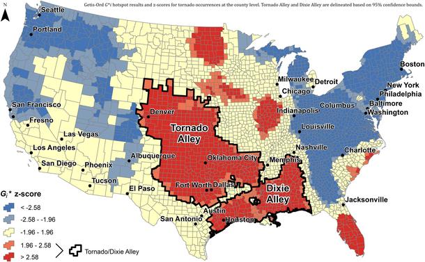
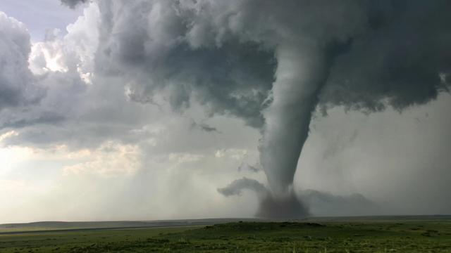
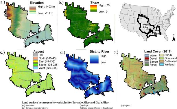
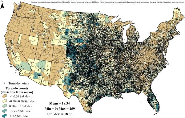
Land Surface Heterogeneity And Tornado Occurrence - An Analysis Of Tornado Alley And Dixie Alley
--
https://doi.org/10.1080/19475705.2019.1583292 <-- shared paper
--
#GIS #spatial #mapping #NLCD #climatechange #severeweather #extremeweather #environment #slope #remotesensing #landcover #extremeweather #landcover #landuse #tornado #risk #hazard #damage #cost #economics #publicsafety #infrastructure #loss #USA #TornadoAlley #DixieAlley #landsurface #topography #vegetation #spatialanalysis #model #modeling #heterogeneity #variables #parameters #factors #geostatistics #statistics #EROS #fedscience
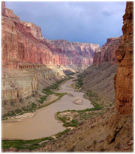
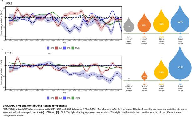
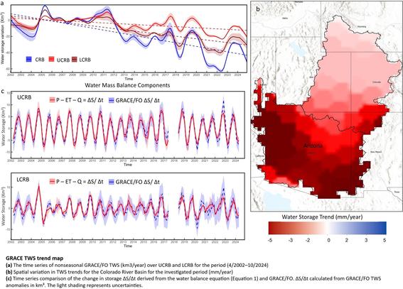
Declining Freshwater Availability in the Colorado River Basin Threatens Sustainability of Its Critical Groundwater Supplies
--
https://doi.org/10.1029/2025GL115593 <-- shared paper
--
https://www.livescience.com/planet-earth/rivers-oceans/groundwater-in-the-colorado-river-basin-wont-run-out-but-eventually-we-wont-be-able-to-get-at-it-scientists-warn <-- shared technical overview article
--
#GIS #spatial #mapping #water #hydrology #groundwater #waterresources #management #planning #ColoradoRiver #ColoradoRiverBasin #depletion #pumping #overpumping #climatechange #extremeweather #droughts #watershortage #waterstorage #remotesensing #spatialanalysis #earthobservation #satellite #spatiotemporal #GRACE #GRACEFO #model #modeling #sustainable #extraction #research
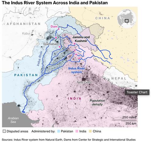
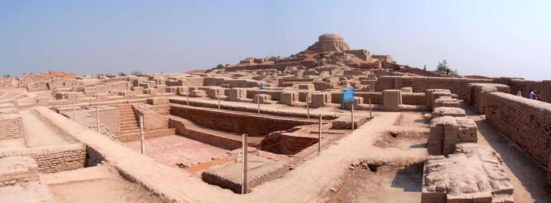
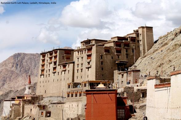
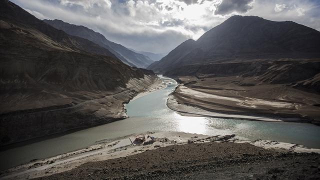
Mapping the Cradle of Civilization - How Geography Shaped the Indus Valley
--
https://americangeo.substack.com/i/166074972/mapping-the-cradle-of-civilization-how-geography-shaped-the-indus-valley <-- shared technical article
--
https://www.bbc.co.uk/programmes/p0f508nx <-- shared BBC podcast
--
#GIS #spatial #mapping #IndusWatersTreaty #IndusValleyCivilization #Harappan #agriculture #urban #cities #trade #transportation #technology #geography #BronzeAge #civilisations #hydrology #water #surfacewater #waterresources #snowmelt #watersecurity #history #ancienthistory #Indus #IndusRiver
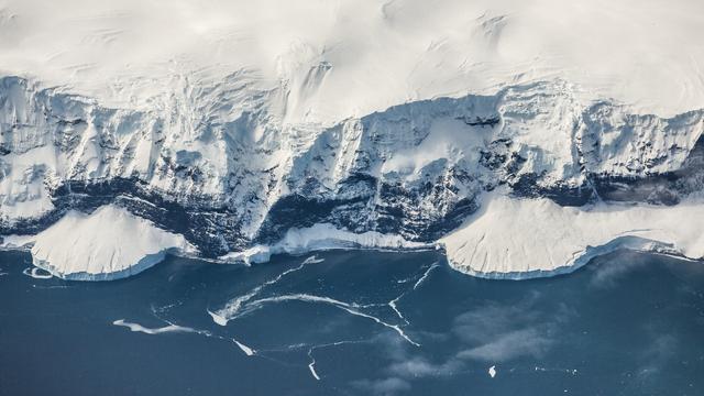
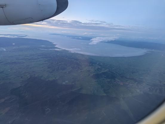
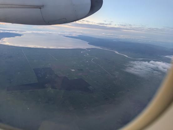
#WhereAmI ????
Clues:
• Southern Hemisphere
• the size of the aeroplane
• the geomorphology / coastline / agriculture / hydrography
#GIS #spatial #mapping #whereami #geography #geomorphology #hydrology
In 1 week, @esri webinar: Unlock the Power of #Where with #ArcGIS for #MicrosoftFabric https://tinyurl.com/yzy832tu
#location #spatial #business #intelligence #geospatial #GIS #esri #GISchat #DataScience #Microsoft #mapstodon @microsoft @MS @Businessweek @BusinessInsider @esrifederalgovt @esritraining
PyQGIS-Video: Massenberechnung mit QGIS / Mass calculation with QGIS https://geoobserver.de/2025/06/19/pyqgis-video-massenberechnung-mit-qgis/ #qgis #switch2qgis #gistribe #gischat #fossgis #foss4g #OSGeo #spatial #geospatial #opensource #mapping #DataViz #gis #geo #geoObserver pls RT via @PyQgis
In 1 week, @esri webcast: The Art of #Geospatial #Strategy https://tinyurl.com/bdv4hfuu
#location #spatial #business #intelligence #GIS #GISchat #planning #esri #arcgis @esrifederalgovt @esrislgov @esritraining @BusinessInsider
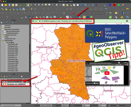
QGIS-Tipp: Plugin “SelectNotValidPolygons” https://geoobserver.de/2025/06/18/qgis-tipp-plugin-selectnotvalidpolygons/ #qgis #switch2qgis #plugin #gistribe #gischat #fossgis #foss4g #OSGeo #spatial #geospatial #opensource #gis #geo #geoObserver pls RT
The Early History of Spatial Databases and PostGIS #gis #spatial #postgresql #video https://blog.cleverelephant.ca/2025/02/postgis-day.html
Le CNES débarque à VivaTech. Pas pour vendre des satellites, mais pour vendre l’espace comme outil de demain : climat, IA, agriculture, finance. Le spatial devient service. Merci @cnes.
https://cnes.fr/actualites/salon-vivatech-cnes-y-etiez
#VivaTech2025 #ConnectByCNES #innovation #spatial #startups
Schade: Microsoft beendet freie Bing Maps-Dienste bis Ende Juni 2025 / Too bad: Microsoft is discontinuing free Bing Maps services by the end of June 2025 https://geoobserver.de/2025/06/16/schade-microsoft-beendet-freie-bing-maps-dienste-bis-ende-juni-2025/ #osm #openstreetmap #gistribe #gischat #fossgis #foss4g #OSGeo #spatial #geospatial #gis #geo #geoObserver pls RT
