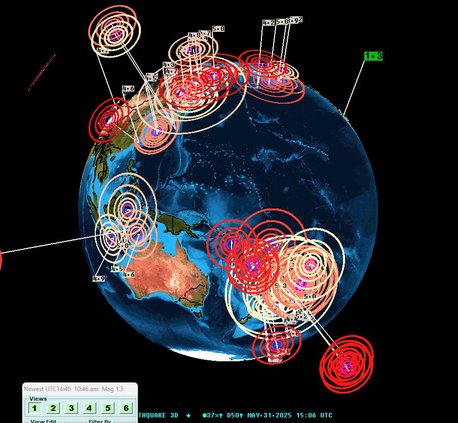
31 May 2025 - 2 today so far, from the solar flare that happened earlier:
- #Magnitude M6.1 #earthquake (21km depth) #Kushiro, #Japan
- #Magnitude M6.1 #earthquake (10km depth) #Kermadec Islands region
#Kermadec
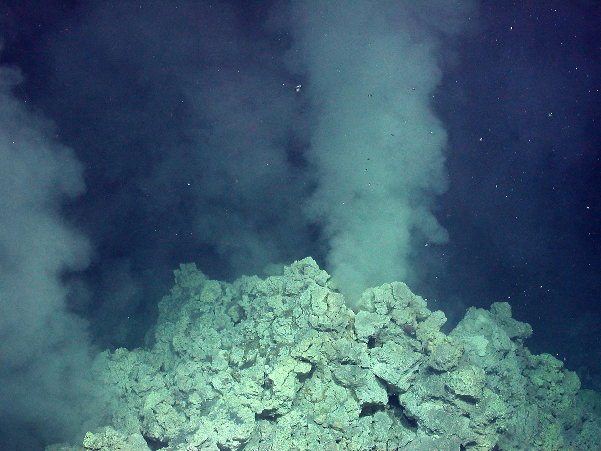
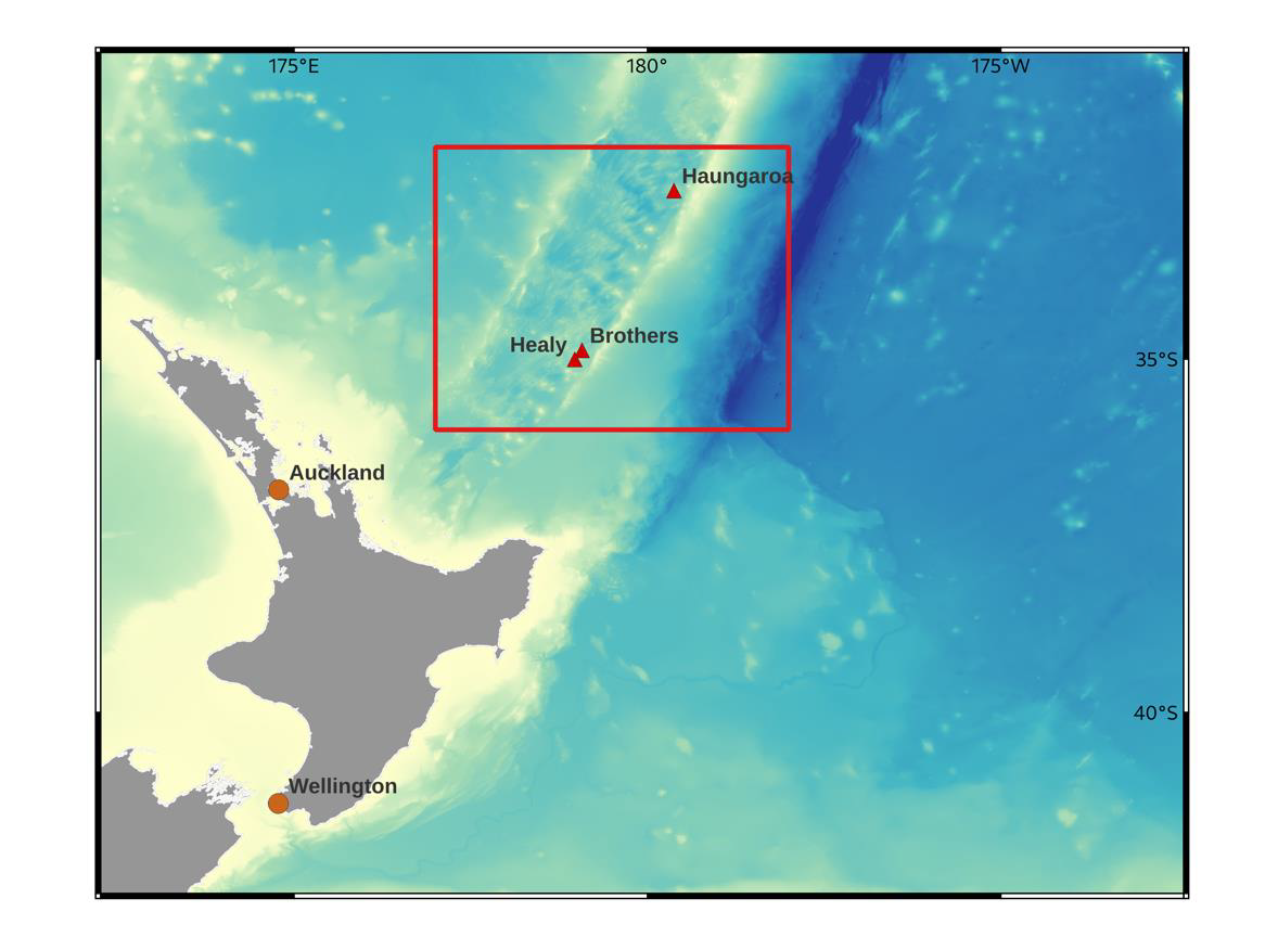
Auf den Spuren der Metalle in vulkanischen heißen Quellen 🌋
Heute startet die Expedition SO311 #DRILLBROTHERS zum südlichen #Kermadec-Inselbogen. Forschenden des MARUM & @unibremen untersuchen dort die magmatischen, hydrothermalen und mikrobiologischen Prozesse des submarinen Brothers-Vulkans. Mehr dazu hier ➡️https://www.marum.de/Start-SO311.html
The bastard coalition has killed off the Kermadec Ocean Sanctuary.
Fronting their latest ecological vandalism are the paid-for spokesperson for the commercial fishing industry, Shane Jones and the ineffective Penny Simmonds wearing her Environment Minister hat. The one with the bell on top.
https://www.stuff.co.nz/nz-news/350223648/nz-politics-live-kermadec-ocean-sanctuary-plan-halted
#EarthquakeReport for #OTD in 2023 M 7.0 #Earthquake along the #Kermadec trench
outer rise normal (extensional) earthquake (not on subduction zone megathrust fault)
generated tsunami
learn more: https://earthjay.com/?p=10902
This is a relatively unusual location for an #earthquake in this region, about 400km west of the #Kermadec Islands, and as #tsunami travel at around 800km/hour, and the quake was over an hour ago, and given that there is no sign of a troublesome tsunami on the Raoul Island sea level gauges, I think we are safe.
If a tsunami was generated it should be arriving in #NZ about now.
How we saw the #kermadec quake here in the north shore
#Tsunami #Alert issued for parts of New #Zealand after strong 7.3M #earthquake strikes the #Kermadec #Islands in the #Pacific, people who felt #quake told to move away from coasts: #sismo #NewZealand https://stuff.co.nz/national/300860984/people-who-felt-m68-earthquake-told-to-move-immediately-away-from-coast
Looks like a pretty solid aftershock sequence after the #earthquake near the #Kermadec islands.
https://www.geonet.org.nz/volcano/monitoring/kermadecislands
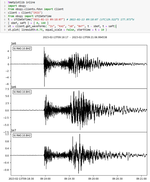
Magnitude 6.1 #earthquake in the #Kermadec islands (north of #NewZealand) one hour ago. Signal on the GSN station IU.RAO. If the location and depth are accurate, the station is 30 km away and the quake is almost 400 km deep so an almost vertical path.
https://earthquake.usgs.gov/earthquakes/eventpage/us6000jnk5/executive
#Séisme M6.9, SOUTH OF #KERMADEC #ISLANDS, Mon 10 Sep 2018 04:18:52 UTC, photos https://www.emsc-csem.org/Earthquake/earthquake.php?id=712027
Client Info
Server: https://mastodon.social
Version: 2025.04
Repository: https://github.com/cyevgeniy/lmst