Wave of (Open Street Map) Vandalism in South Korea
https://www.openstreetmap.org/user/KennyDap/diary/407844
#HackerNews #OpenStreetMap #Vandalism #SouthKorea #MappingCommunity #DigitalSafety
Wave of (Open Street Map) Vandalism in South Korea
https://www.openstreetmap.org/user/KennyDap/diary/407844
#HackerNews #OpenStreetMap #Vandalism #SouthKorea #MappingCommunity #DigitalSafety


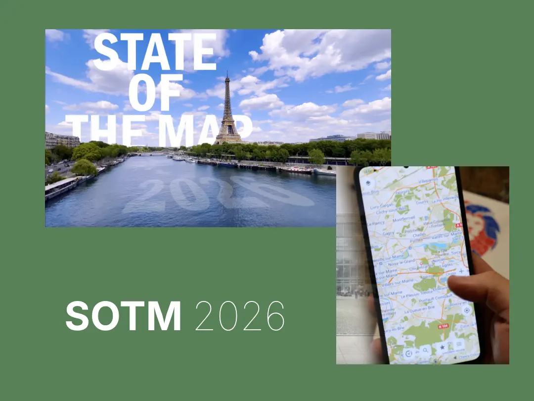
State of the Map 2026
Planning for #SOTM2026 is is well underway – Paris, France has been chosen as the host city. And CoMaps makes an appearance in the promotional video!
CoMaps perfectly embodies the vibrant energy that drives OpenStreetMap forward: collaboration, innovation, and a shared love for exploring the world one map tile at a time.
Take a look at the video: https://peertube.openstreetmap.fr/w/kme7gzVKaqaK4tztBSkkWb

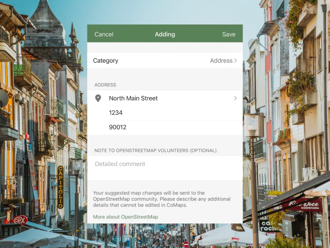
Did you know you can now add an address to OpenStreetMap directly from the CoMaps editor?
Contributing info is easier than ever:
Every address improves navigation and discovery for millions of people worldwide.
Get started today:
1) Tap ‘Add Place to OpenStreetMap’ and select point of address
2) Select the ‘Address’ Category
3) Enter the address and tap 'Save'
Your small edit can make a big difference!
#OpenStreetMap #MappingCommunity #GIS #CrowdsourcedData #DigitalCartography
Kurzer SZ-Artikel über Kartenprojektionen, Vorteile, Nachteile und alte Gewohnheiten:
"Weltkarten verzerren Afrikas wahre Größe: Dagegen wehrt es sich jetzt" https://www.sueddeutsche.de/projekte/geschenk/einloesen?token=879b9a37-bb8d-4ee1-8649-0dcb4ae702dd
(Geschenk-Link)

Cartographers!
1307 people contributed to OpenStreetMap using CoMaps in July— building maps one detail, one POI, one community at a time.
#OpenStreetMap #OSM #mapping #maps #mappingcommunity #cartography
@openstreetmap

Hurry! Early bird tickets are still available!!
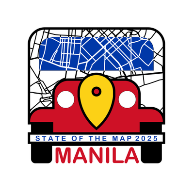
Don't miss the boat! Early Bird #tickets for State of the Map 2025 in #Manila are flying out the door!
Secure your spot NOW and get ready for an unforgettable experience with the global #OpenStreetMap community!
Enjoy discounted prices, including a special rate for community #hobbyists!
Get your Early Bird ticket here NOW!!!: https://2025.stateofthemap.org/tickets/
#SotM2025 #OpenStreetMap #Manila #EarlyBird #MappingCommunity #ConferenceVibes

Disaster Ninja is more than disaster tracking!
How reliable is the Kontur Population dataset? We've created a report cross-checking Wiki, OSM, and Kontur data to help you trust the numbers.
🔍 Curious about OSM population estimates? Check it out:
👉 disaster.ninja ⚠️ Reports -> Population tag check: (https://disaster.ninja/active/reports/population_tag_check?map=9.025/-7.0715/147.8815&event=13e02785-4c1e-4671-be26-33e832437722&layers=hotProjects_outlines%2CactiveContributors%2Ckontur_lines%2CeventShape%2Cpopulation_density%2Cfocused-geometry)
💡 Mappers, you can fix issues in JOSM right away! Trust your data with Disaster Ninja.
#DisasterNinja #DataTrust #PopulationData #OSM #MappingCommunity
Potential Topics:
* OSM mapping projects, tools, and best practices* Open data for social impact, disaster resilience, and environmental protection
* Advancing OSM through data quality, innovation, and technology
* Any other creative or impactful ideas around open geospatial data!
#OpenStreetMap #OSMKerala #OpenData #Geospatial #MappingCommunity #CallForProposals #TechForGood
2/2
We’re thrilled to announce that the #OpenStreetMap #Kerala Community Meetup 24 is just around the corner, and we’re calling for proposals for
talks and workshops from passionate contributors, mappers, and open data enthusiasts!
Session Formats:
* Lightning Talk – 7 mins
* Talk – 20 mins
* Workshop – 120 mins
👉 Apply Now: https://docs.google.com/forms/d/1muVX-2B3LE4R4xU8VjNsVrPYAjsHzDeWAaitrxqZoIA/viewform?edit_requested=true
Deadline: 4th Nov 2024
More details: https://wiki.openstreetmap.org/wiki/OSM_Kerala_Community_Meetup_2024/
#OSMKerala #OpenData #Geospatial #MappingCommunity #CallForProposals
1/2
OSM Kerala Community Meetup 2024 has been announced.
Date - Nov 16–17
Venue - Kerala Veterinary and Animal Sciences University, Wayanad
More to details to follow at https://wiki.openstreetmap.org/wiki/OSM_Kerala_Community_Meetup_2024
@mapkerala
#OpenStreetMap #OSMKerala #OpenData #Geospatial #MappingCommunity

Enjoyed #Geomob London just over a week ago! Celebrated OpenStreetMap's 20th anniversary at UCL with inspiring talks on humanitarian mapping, street-level imagery, and AI-assisted projects. Great catching up with the community over #geobeers afterward. Felt nostalgic meeting someone born in 2006—the same year I attended my first OSM mapping party!
Excited for Geomob Edinburgh tomorrow!