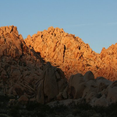
Showed the first scene of "Gravity" to my class on remote sensing last night because most of them have not heard of Kessler syndrome. Teaching them how to use satellite data, but also telling them about the perils we face with too many satellites (cough cough, Starlink) in space. #kesslersyndrome #satellites #gis #remotesensing
#RemoteSensing

📢 We are hiring at MET!
Position 2 (location in Bergen or Oslo)
Focus on ocean remote sensing using SAR missions
👉 www.jobbnorge.no/en/available...
🕒 2-year position linked to several projects with the European Space Agency.
Please help spread the word and boost 🦋⏩📧
#Ocean #SAR #RemoteSensing
Researcher (294200) | Norwegia...
📢 We are hiring at MET!
Position 1 (location in Tromso or Oslo)
Focus on climate and sea ice remote sensing using passive microwave sensors
👉 www.jobbnorge.no/en/available...
🕒 2-year position linked to projects with ESA.
Please help spread the word and boost 🦋⏩📧
#Climate #SeaIce #RemoteSensing
Researcher (294200) | Norwegia...
Brazil map showing Land cover for year 2000 🇧🇷 with Amazon Forest dominating — Making it Earth's Lungs
🗺️ Hemed Juma Lungo | Datasource GLC2000 ~ from DIVAGIS
#gischat #Brazil #LandCover #GIS #Cartography #RemoteSensing #Biodiversity


Probabilistic Modeling Of InSAR-Derived Land Subsidence Hazard In New York City For Transportation Infrastructure Damage Risk Assessments
--
https://doi.org/10.1016/j.jag.2026.105118 <-- shared paper
--
#NewYork #NewYorkCity #NYC #GIS #spatial #mapping #subsidence #InSAR #radar #elevation #remotesensing #spatialanalysis #spatiotemporal #model #modeling #probabilistic #framework #risk #hazard #infrastructure #transportation #subway #highway #roads #airports #LandSubsidence #damage #cost #economics #JFK #LaGuardia #runways #buildings #flood #flooding #floodrisk #sealevelrise #SLR #impacts #lowlying #reclaimed #urban #monitoring #mitigation #maintenance #coast #coastal #delta #sediments #megacity


Den dansk underafdeling af @CAA_int (Computer Applications in Archaeology) holder vores næste seminar på Holstebro Museum og ONLINE (gratis), 17. marts 2026:
https://dk.caa-international.org/velkommen-til-caa-dk/
Årets tema er fjerndetektering og ikke-destruktiv arkæologi. Dagen udføres i samarbejde med Luftfotoarkæologisk Center med stort fokus på resultater og konklusioner fra centerets levetid.
Tilmelding er åbent til med 3. marts.
#ComputationalArchaeology #DigitalArchaeology #RemoteSensing #Arkæologi #dkvid #dkforsk

Create universal classified #raster function templates in #ArcGISPro https://tinyurl.com/4aparvwa
#images #imagery #RemoteSensing #analysis #GIS #esri #arcgis #mapping #GISchat #geospatial @esri @arcgispro @esrifederalgovt @esrislgov @esritraining @urisa

Monitoring Snow Cover Dynamics At 30-M Resolution In Higher Latitude Regions Using Harmonized Landsat Sentinel-2 [Canada & Alaska]
--
https://doi.org/10.1016/j.isprsjprs.2026.01.032 <-- shared paper
--
https://app.geo.ca/en-ca/map-browser/record/1ed7fdec-9a50-4fe9-aa16-78f9ee3f05bc <-- shared dataset
--
#GIS #spatial #mapping #snow #snowcover #arctic #Arctic #highlatitude #harmonized #Landsat #Sentinel2 #Sentinel #remotesensing #imagery #earthobservation #HudsonBat #BrooksRange #ecozone #snowdynamics #spatialanalysis #spatiotemporal #metrics #winter
@NRCAN


How to Download and Visualize NASA-ISRO NISAR Data in QGIS | Step-by-Step Tutorial [shared]
--
https://youtu.be/oRTplHPf_T0 <-- shared video tutorial
--
https://github.com/opengeos/qgis-nasa-earthdata-plugin <-- shared NASA Earthdata Plugin for QGIS
--
https://science.nasa.gov/mission/nisar/ <-- shared #NASA NISAR mission home page
--
H/T Qiusheng Wu
#remotesensing #earthobservation #tutorial #training #onlinelearning #download #visualisation #NISAR #opendata #satellite #NASA #Earthdata #QGIS #plugin #SAR #icemovement #ecosystems #vegetation #biomass #naturalhazard #risk #hazard #NetCDF #spatialvisualisation
@QGIS | @nasa


Mexico map showing Land cover 🇲🇽 From tropical forests to desert shrublands — one of Earth's most biodiverse nations.
🗺️ Hemed Juma Lungo | GLC2000
#GISChat #Mexico #LandCover #GIS #Cartography #RemoteSensing #Biodiversity


📢 Fully funded PhD - 🌍 Dense Detection of Rare Events in Remote Sensing using Generative Models
Leverage generative models, unsupervised segmentation and explainability techniques to map disasters
w/ Javiera Castillo and Flora Weissgerber
Geosurvey Reveals Hidden Australia Magnetic Anomaly
--
https://www.csiro.au/en/news/All/Articles/2026/January/Australia-magnetic-anomaly <-- shared CSIRO (Australia) technical article
--
https://research.csiro.au/potential-fields/ <-- shared CSIRO ‘Potential Field Geophysics’ home page
--
https://www.sciencebase.gov/catalog/item/6193e9f3d34eb622f68f13a5 <-- shared @USGS tri-national (Canada, USA and Australia) geologic, geophysics, and mineral resource data release / report
--
https://www.ga.gov.au/scientific-topics/disciplines/geophysics/airborne-electromagnetics <-- shared Australian government airmag overview page
--
https://doi.org/10.5382/Mono.06.30 <-- shared paper, “The Contribution Of High Resolution Aeromagnetics To Archean Gold Exploration In The Kalgoorlie Region, Western Australia”
--
#CriticalMinerals #GIS #spatial #Mapping #CriticalMineralsMappingInitiative #geology #structuralgeology #mineralresources #exploration #discovery #remotesensing #model #modeling #mining #economics #Australia #NorthernTerritory #MagneticAnomaly #AustraliaMagneticAnomaly #geomagnetism #openscience #opendata #openaccess #geoscience #geophysics #aeromagneticsurvey #aeromagnetic #spatialanalysis #CSIRO
@CSIRO


I'm working with Sentinel 2 data in python. Anyone with experience or insight about OpenEO for accessing and processing the data? I've used the eo-learn package with SentinelHub before, but seems it's not actively developed anymore. There seems to be some push for OpenEO, but not sure if I should migrate or not.
#OpenEO #Sentinel2 #SentinelHub #RemoteSensing #EarthObservation

🌎 Detailed map reveals groundwater levels across the U.S.
https://phys.org/news/2026-01-reveals-groundwater.html
#usa #water #resources #groundwater #cartography #remotesensing #environment #conservation

China launches AlSat-3B for Algeria, further launches delayed ahead of key human spaceflight test
From Space To Field - Putting satellite insights into growers’ hands [OpenET]
--
https://irrigationtoday.org/features/from-space-to-field/ <-- shared technical media article
--
https://etdata.org/ <-- shared OpenET home page
--
https://www.nasa.gov/image-article/openet-satellite-based-water-data-resource/ <-- shared NASA technical article
--
https://youtu.be/Rbobf6aurLs?si=Q0kN9eiZH0gT8O5m <-- shared OpenET overview video
--
#OpenET #openscience #opendata #publicgood #publicservice #nonprofit #fedscience #fedservice #evapotranspiration #ET #Landsat #OLI #OperationalLandImager #groundwater #water #hydrology #spatialanalysis #spatiotemporal #agriculture #USA #farming #waterresources #watermanagement #planning #watersecurity #satellite #remotesensing #earthobservation #model #modeling #irrigation #metrology #raster #cost #economics #efficiency #foodproduction #mobileapp #FARMS #view #download #usecase #reporting
#OpenET #USGS #USDA @NASA #USGS_EROS


All PolInSAR - BIOMASS talks are available on this channel:
https://www.youtube.com/@eoopenscience4372
#EarthObservation #RemoteSensing #SyntheticApertureRadar #PolSAR #PolInSAR #Geospatial #EOOpenScience
Discussions are now open on the #PyPolSARpro repository 🎉
We’d love to hear about your use cases and how you’re working with PolSAR data — let’s build a strong community together!
https://github.com/satim-co/PolSARpro/discussions
#OpenSource #EarthObservation #Polarimetry #PolSAR #RemoteSensing #Python
🌳 AI helps find trees in a forest: Researchers achieve 3D forest reconstruction from remote sensing data
https://phys.org/news/2026-01-ai-trees-forest-3d-reconstruction.html
#trees #forests #ai #remotesensing #conservation #sensors #ecology #environment
See The Mississippi River’s Hidden History, Uncovered By Lasers
Using hyperprecise LiDAR data,. a cartographer [well, hydrographer!] maps the river’s bend and channels over time with mesmerizing results…
--
https://www.nationalgeographic.com/science/article/mississippi-rivers-hidden-history-uncovered-by-lidar <-- shared technical / media article
--
https://dancoecarto.com/ <-- shared @Daniel Coe portfolio and more
--
https://usace.contentdm.oclc.org/digital/collection/p266001coll1/id/10015/ <-- shared Harold Fisk's 1944 USACE report, “The Alluvial Valley of the Lower Mississippi River”
--
#GIS #spatial #mapping #water #hydrography #hydrology #LiDAR #remotesensing #spatialanalysis #spatiotemporal #hydrogeomorphology #Mississippi #River #Fiske #cartography #visualisation #meandering #channels #landforms #floodplains #opendata #3DEP #topography #geomorphology #levees #dikes #oxbows #channel #paleohydrology
#DanielCoe | @nationalgeographic | #USGS | #USACE


Client Info
Server: https://mastodon.social
Version: 2025.07
Repository: https://github.com/cyevgeniy/lmst