Jaffa to Jerusalem. Plain of Sharon from the tower [approximately 1900 to 1920]
American Colony (Jerusalem). Photo Department
1 negative : glass, dry plate ; 4 x 5 in. or smaller.
#Jaffa #Jerusalem #Sharon #PhotoDepartment #Byzantine #Israel #Ramlah #photography
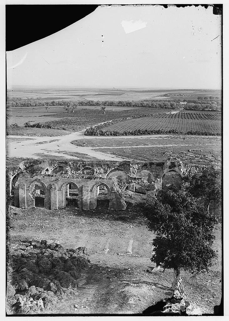
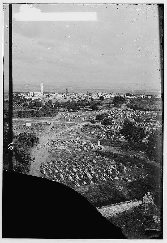
![The image depicts a historical scene captured through an arched stone doorway, providing a view of the Tower of Forty Martyrs in Ramleh. The tower stands prominently within what appears to be ruins or an old church structure, with visible Gothic architectural elements such as pointed arches and tall narrow windows. Surrounding the site is grassy terrain with scattered bushes, hinting at natural overgrowth typical of abandoned historical sites.
The photograph's monochromatic tone suggests it may have been taken in the early 20th century or earlier, indicative of its age and possibly a documentary nature capturing the ruins during that period. The framing through an archway adds to the sense of viewing history from another time, emphasizing both the passage of time since these structures were fully intact as well as their historical significance.
Additional context is provided by reference information indicating this photograph was part of "Jaffa to Jerusalem," likely a collection or publication about various locations in Israel and Palestine. The mention of American Colony (Jerusalem) Photo Department suggests that it could have been taken within the premises of an institution with connections to photography, possibly associated with Christian missionary activities during late 19th-early 20th centuries.
The reference number "691e" along with a unique identifier "[approx [...]](https://files.mastodon.social/cache/media_attachments/files/115/712/323/963/883/952/original/bbb7f2bc1681422e.jpeg)
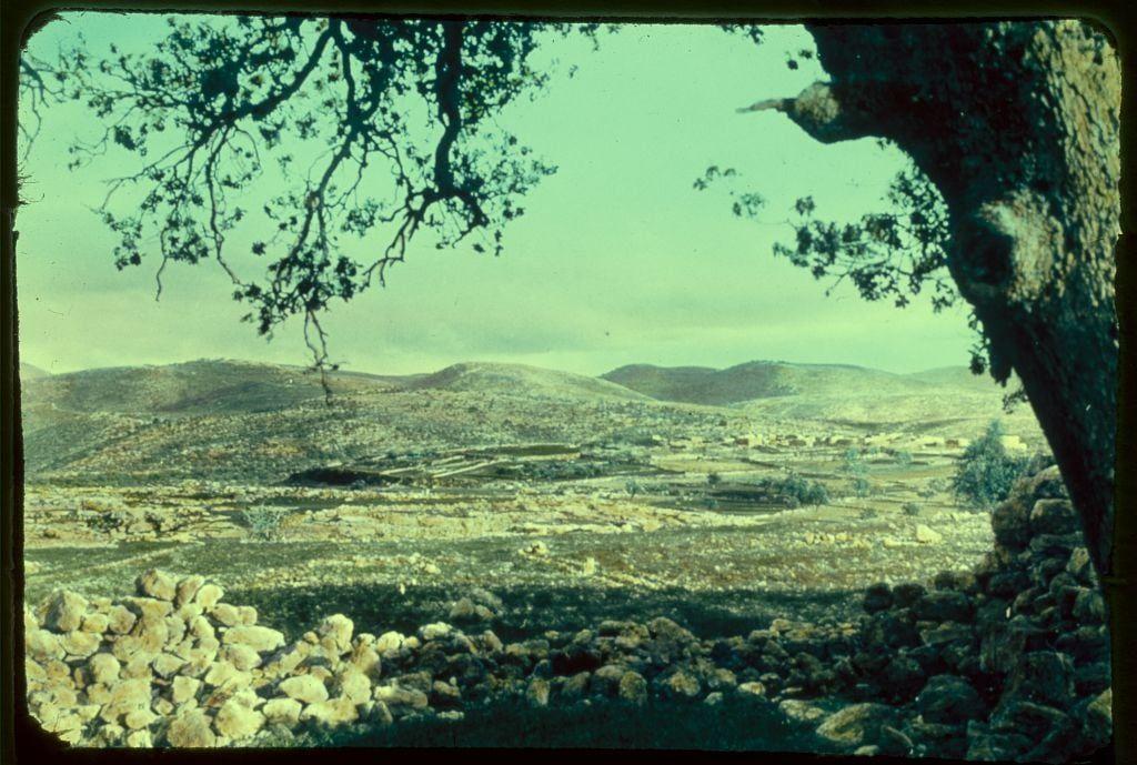
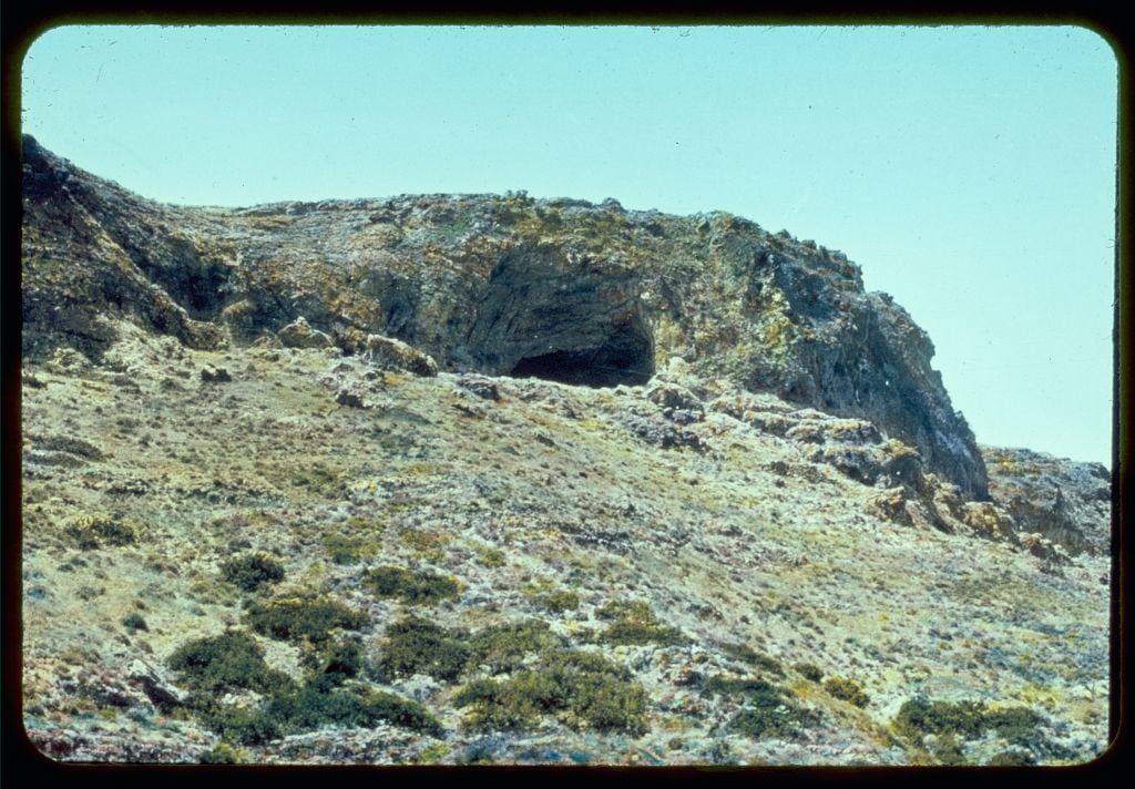
![This image depicts a rural landscape, possibly from the Middle East or North Africa. The scene shows a rugged terrain with rocky outcrops and sparse vegetation, including trees that appear to be olive groves scattered across the fields. There is a winding path cutting through the middle of the photo, suggesting access for people or animals.
The background reveals a series of small buildings or houses in what could be a village setting, with some larger structures possibly indicating storage facilities like silos or barns. The sky above has a hazy quality, perhaps due to atmospheric conditions or photographic processing, and gives an overall impression that the image is somewhat old-fashioned, likely from mid-20th century.
The coloration of the photo leans towards cooler tones with a greenish tint, which might be indicative of film stock used at the time. The presence of this particular landscape in "Jaffa to Jerusalem" suggests it could have been taken during an archaeological or anthropological expedition between 1950 and 1977.
The photograph is credited to Matson Photo Service, indicating that they were responsible for capturing such images as part of their work. The specific image dimensions are provided in the alt text reference ("Matson Photo Service" with "2 x 2 in"), which may be relevant information if you're looking at this within a larger collection or databa [...]](https://files.mastodon.social/cache/media_attachments/files/115/708/985/649/490/833/original/be9f44dd44ffa1ba.jpeg)


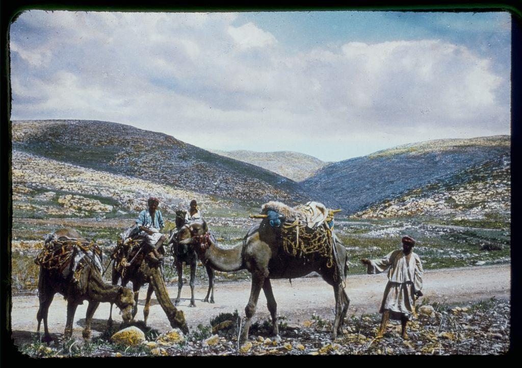
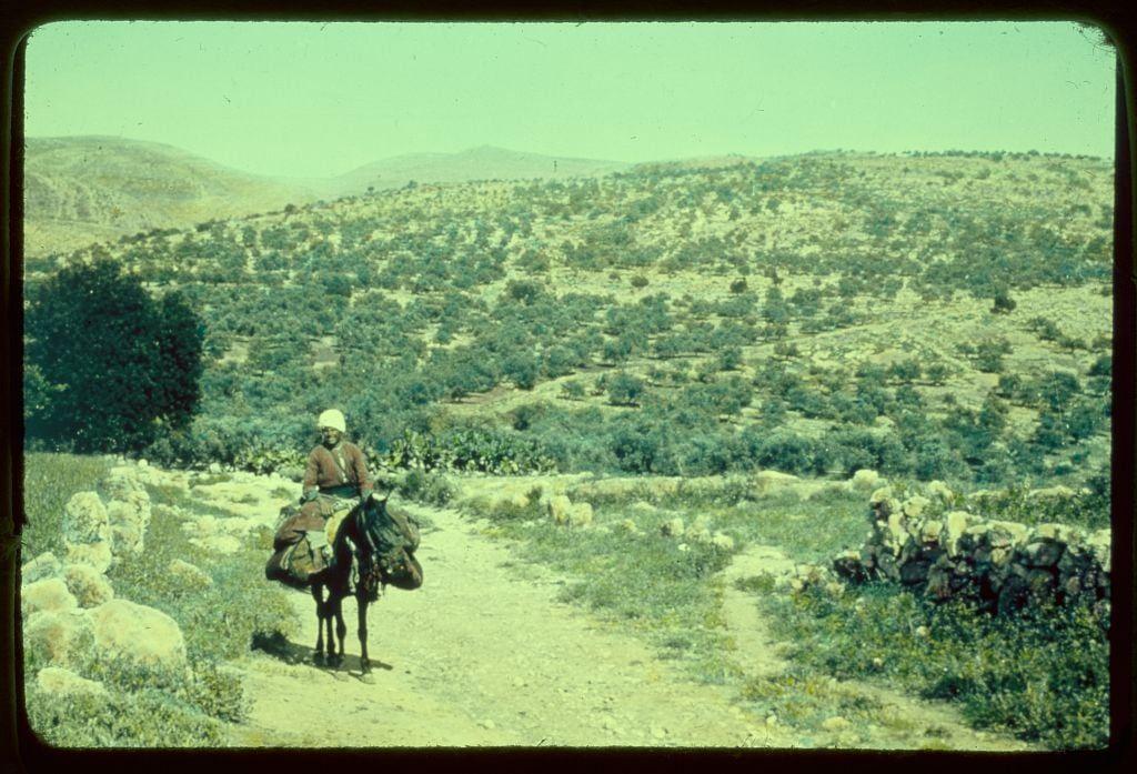
![The image depicts a pastoral scene with two individuals and their animals in an open, rural landscape. In the foreground stands a camel adorned with colorful baskets on its back, suggesting it is used for carrying goods or water during travel across arid regions. A person sits atop one of these baskets, reinforcing this interpretation.
Adjacent to the camel, another individual rides a dark-colored donkey equipped with simple saddle gear. This person appears to be engaged in grazing, as they have their foot on the ground and are bending down slightly towards the dry grass covering the terrain.
The background is dominated by vast expanses of flat land under a bright blue sky, indicating an arid environment that might typically occur in Middle Eastern or North African regions. The horizon features gentle hills or low mountains, adding depth to the landscape but providing no significant landmarks for precise location identification.
Overall, this image captures a moment from everyday life where individuals rely on camels and donkeys as modes of transportation across open land, likely reflecting historical agricultural practices before motorized vehicles became prevalent in such regions. The color tones are naturalistic with hints of faded reds, greens, blues, and browns contributing to the earthy palette.
The caption "Jaffa to Jerusalem. Gezer." suggests that this image m [...]](https://files.mastodon.social/cache/media_attachments/files/115/707/463/957/367/785/original/3848380b90a28037.jpeg)

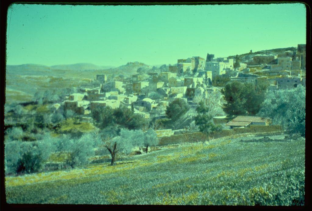
![The image depicts a vast, arid landscape with rolling hills and wide-open plains. The terrain appears dry and sparsely vegetated, suggesting an environment that is likely to be subject to limited rainfall or drought conditions.
A winding dirt road cuts through the center of the photograph from left to right, which indicates human activity in this otherwise desolate area. Alongside the road are what appear to be small settlements with structures clustered together, possibly indicating rural communities living on these lands for agricultural purposes.
The overall color palette consists of muted earth tones such as yellow, brown, and greenish-yellow hues that dominate due to sunlight's effect on the landscape. The photograph has a vintage look, likely from an early 20th-century archive or documentary collection capturing scenes in various regions across Israel during significant historical periods.
This particular image is part of Jaffa to Jerusalem: Beth Shemesh from Beit Jamal between 1950 and 1977 by the Matson Photo Service. The photograph's dimensions are listed as a slide measuring approximately two inches on each side, indicating its compact size typical for vintage photo archives.
The source attribution is linked through an image URL that directs to a larger collection of similar photographs from Eric & Edith Matson, showcasing their extensive coverage in capturi [...]](https://files.mastodon.social/cache/media_attachments/files/115/704/397/441/955/822/original/aafe7149c264d69e.jpeg)