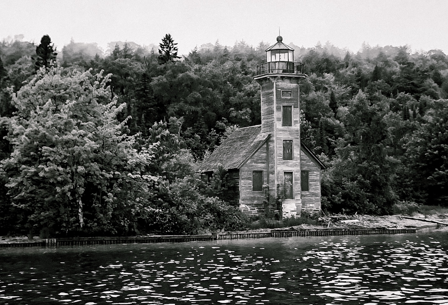
The East Channel Lighthouse gave off some good #spooktober vibes👻 - #31DaysOfHalloween #photography #ClassicMono #EastCoastKin #art #nature#trees #photohour #scape #landscape #ghost #ArtYear #nature #ClassicMono #monochrome #b&w #BNW #blackandwhite #picturedrocks #michigan
#picturedrocks

One day I'll be smart about it and get some outdoor pictures that include some of my rope art. Until then you'll just have to keep getting both in separate posts.
Here is a picture of a rock formation on the west side of Grand Island near Munising, MI
#LakeSuperior #PicturedRocks #RockPosting #KatPics #NaturePhotography
A picture taken near the Grand Island Northern Lighthouse in the #PicturedRocks National Lakeshore on #LakeSuperior
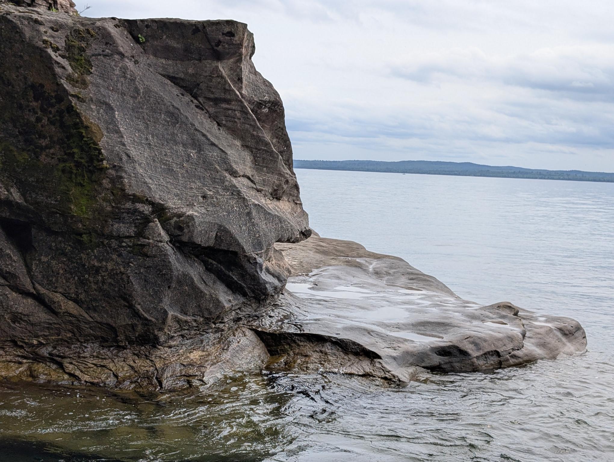
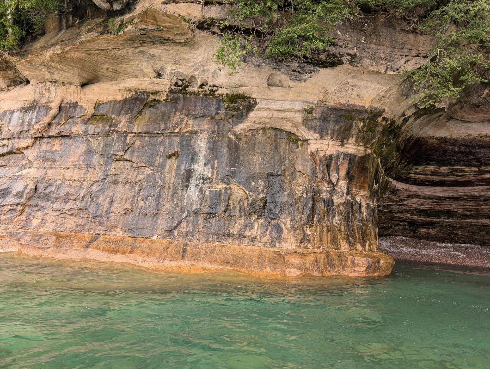
I really like the texture here carved from the wind, ice and waves that invariably crash against this cliff. So many nooks! The moss and lichen were thriving in this environment which made me happy.
More #PicturedRocks around Grand Island near Munising, MI. Nobody said they were tired of #rocks yet.
This one is near a little alcove that is pretty neat. You can see a part of it on the right. If I had posted only the alcove it wouldn't make as much sense visually. It's very pretty. The water is a gorgeous green hue, partially from the copper in the lake. It's a teal blue in deeper parts.
I hope I don't wear folx out with more rocky features. I will get back to posting selfies and rope pics very soon, don't worry!
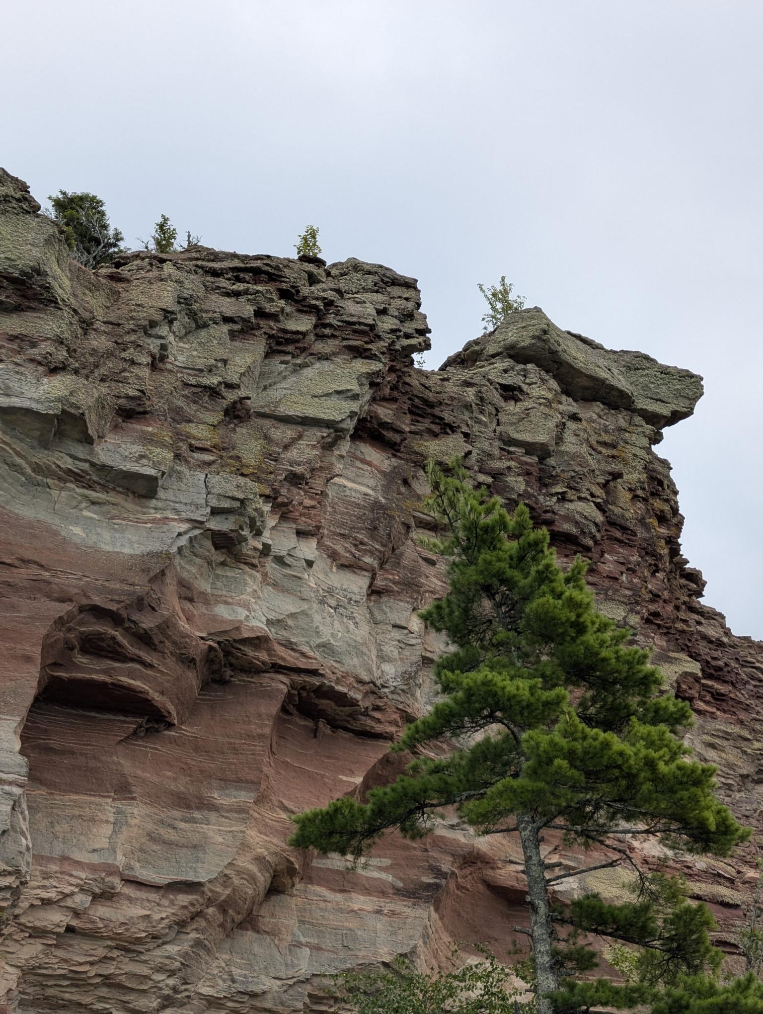
This one is from the western part of Grand Island near Munising. I feel like it looks like a sort of helmet but I'm blanking on how to describe it.
In the alt text I went with describing it as an Amtrak cabbage car, which isn't bad, but not the descriptor I was looking for.
#PicturedRocks #Rocks #LakeSuperior #NaturePhotography #KatPics

I still haven't sorted through all the pictures I took this weekend. Especially the DSLR pics, as those are on an SD card and I need to filter through several hundred files, tweak/tune, etc. before those will be "postable"
Fortunately, phone pictures are easy to sort through on the go. Even if the quality isn't quite as good, they're certainly not bad. Here is one of the rock formations we checked out while exploring around the Munising area
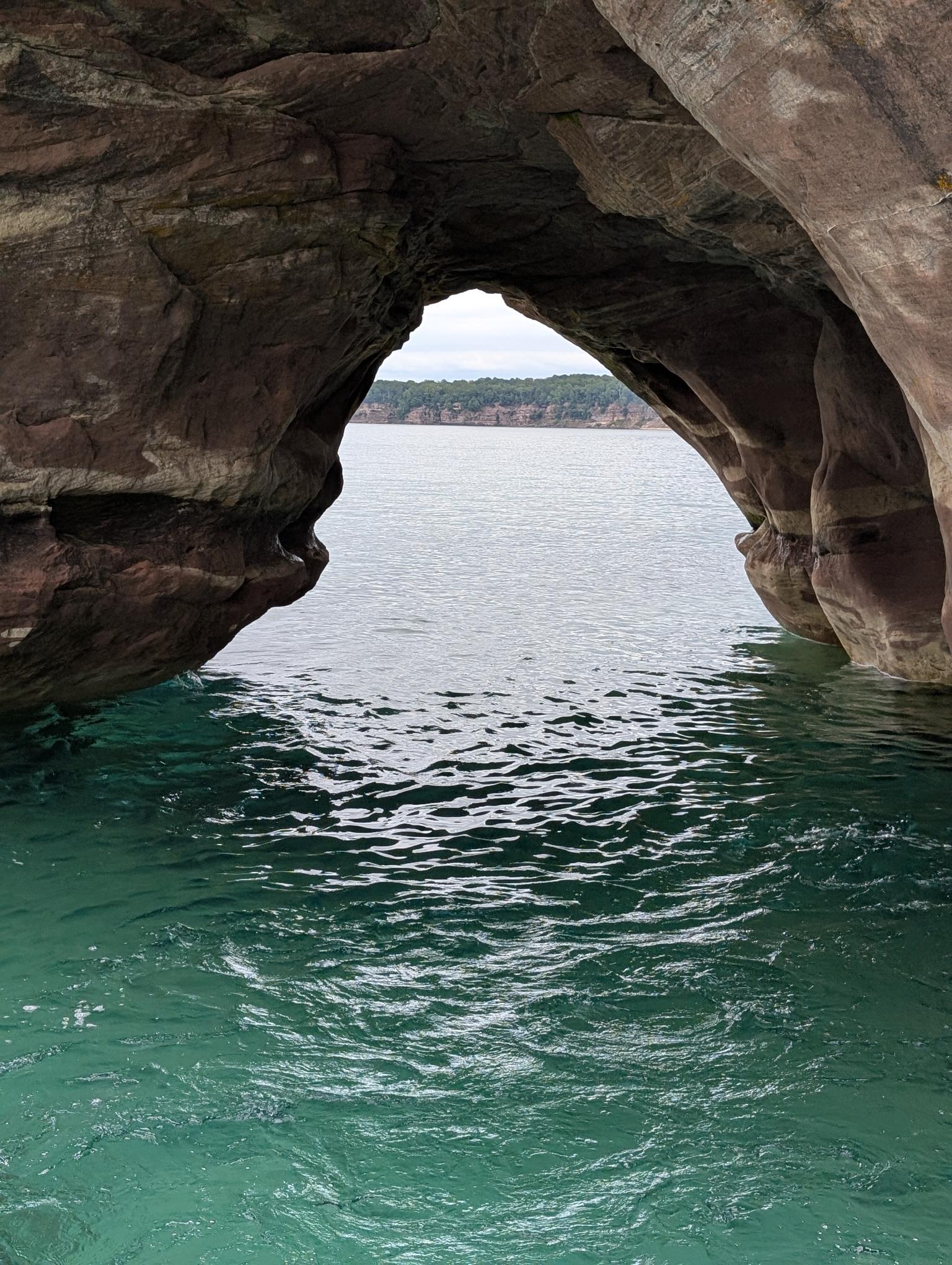

#TravelThursday #Travel #LakeSuperior #RockFormations #Arch #PicturedRocks #Munising #Michigan #Photography #Photo from 2025.
#PhotoMonday #photography #PicturedRocks #UpperPeninsulaMich #LakeSuperior #travelphotography Munising
#SilentSunday #travelphotography #photography #sandstone #Rockformation #PicturedRocks, #Munising #Michigan
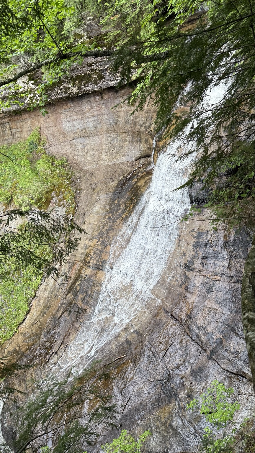
#WaterfallWednesday #Wednesday #waterfall #UpperPeninsula #Michigan #PicturedRocks #Munising #photography #Photo from June 25.

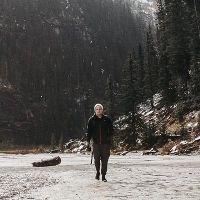
"This golf club has been to more national parks than most people. It was my uncle’s and I can’t even use it since I’m left handed! But by bringing this he’s coming along with me in a way."
-- Daniel
#StreetPortrait #Hiking #Backcountry #Camping #panasoniclumix #panasonicgx8 #PureMichigan #upmichigan #picturedrocks #michiganphotographer #michigan #golfclub
-- Daniel
#StreetPortrait #Hiking #Backcountry #Camping #panasoniclumix #panasonicgx8 #PureMichigan #upmichigan #picturedrocks #michiganphotographer #michigan #golfclub

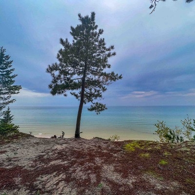
Wishing I was back at last weekend's end of season backpacking adventure on the #NorthCountryTrail #PicturedRocks #NationalLakeShore #LakeSuperior #Mosstadon Had to cancel the year before due to major storm, but this year lucked out with perfect weekend weather and we kept the total mileage short to explore more near each campsite, that was a brilliant choice.

Pictured Rocks
Pictured Rocks National Lakeshore lies on the southern shore of Lake Superior outside of Munising, Michigan. There are miles of trails to hike, beaches to lie on, and of course, Lake Superior to swim in if you dare.
The best way to visit the park is to get out on the water by boarding one of the commercial boats that operate in the area.
https://pixels.com/featured/pictured-rocks-bill-gallagher.html
#PicturedRocks #BillGallagherPHotography #BuyIntoArt #AYearForArt #PicturedRocksNationalLakeshore #LakeSuperior
Pictured Rocks Panorama
Pictured Rocks National Lakeshore on the south shore of Lake Superior is certainly worth the time and money to visit.
We only had a short time so we took the boat out of Munising, Michigan for their "3 Hour Tour".
The shoreline is absolutely beautiful with all of the different rock formations, arches, towers, caves, and beaches. https://pixels.com/featured/pictured-rocks-panorama-bill-gallagher.html
#PicturedRocksPanorama #BillGallagherPHotography #LakeSuperior #picturedrocks #AYearForArt #BuyIntoArt #LakeSuperior
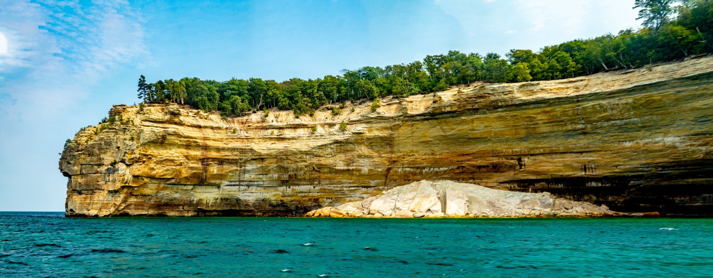
Pictured Rocks Panorama
Pictured Rocks National Lakeshore located on the south shore of Lake Superior is certainly worth the time visit.
We only had a short time so we took the boat out of Munising, Michigan for their "3 Hour Tour".
The shoreline is absolutely beautiful with all of the different rock formations, arches, towers, caves, and beaches. See the full image here: https://fineartamerica.com/featured/pictured-rocks-panorama-bill-gallagher.html #Pictured RocksPanorama #BillGallagherPhotography #BuyIntoArt #AYearForArt #PicturedRocks
Pictured Rocks
Pictured Rocks National Lakeshore lies on the southern shore of Lake Superior outside of Munising, Michigan. There are miles of trails to hike, beaches to lie on, and of course, Lake Superior to swim in if you dare.
The best way to visit the park is to get out on the water. Most do this by boarding one of the commercial boats that operate in the area. See the full image here: https://fineartamerica.com/featured/pictured-rocks-bill-gallagher.html #PicturedRocks #BillGallagherPhotography #BuyIntoArt #AYearForArt #LakeSuperior
Pictured Rocks National Lakeshore
Pictured Rocks National Lakeshore is a 42 mile long shoreline of Lake Superior near Munising Michigan. The makeup of this shoreline is mainly sandstone with a couple of sand beaches dotting the shoreline.
See the full image here: https://fineartamerica.com/featured/pictured-rocks-national-lakeshore-bill-gallagher.html #PicturedRocksNationalLakeshore #BillGallagherPhotography #AYearForArt #BuyIntoArt #LakeSuperior #GreatLakes #PicturedRocks
Pictured Rocks Petit Portal
We caught a boat out of Munising for a "3 Hour Tour".
Once we reached Sand Point we were exposed to the beautiful shoreline that is Pictured Rocks. The colors in the cliffs and the rock formations make for a bbeautiful boat ride.
This formation is known as the Petit Portal, otherwise known as Lovers Leap. See the full image here: https://fineartamerica.com/featured/pictured-rocks-petit-portal-bill-gallagher.html #PicturedRocksPetitPortal #BillGallagherPhotography #BuyIntoArt #AYearForArt #LakeSuperior #PicturedRocks #munising

Spent a lovely day at #PicturedRocks National Lakeshore - it became the nation’s first national lakeshore back in the 1960s. It also marks the third lake of this #GreatLakes road trip: the mighty Lake Superior!
Client Info
Server: https://mastodon.social
Version: 2025.07
Repository: https://github.com/cyevgeniy/lmst