#soaker

2025-04-27

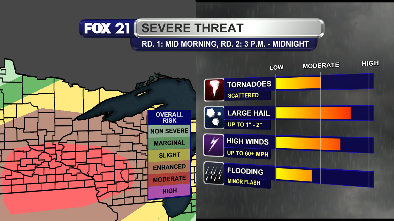
NORTHLAND SEVERE WEATHER THREAT:

A #storm system will bring plenty of #showers and #thunderstorms through the #Northland Sunday night and Monday. It will be a #soaker with #breezy #winds.

The afternoon and evening hours are the biggest risk for #severe #storms, and all threat are possible. That means the potential for large #hail, high winds, and multiple #tornadoes.

#wxtooter #weather #wx #WIwx #UPwx #MNwx

A graphic that shows the threat level for severe weather over the Northland and western Great Lakes region for Monday, April 28, 2025.  The moderate risk is just to the south of the Northland, with locations along and south of Highway 2 in the Enhanced risk category.  The Iron Range, Boundary Waters, and Arrowhead regions are in a Slight risk, while most of Koochiching County is in a Marginal Risk.

For the afternoon and evening hours of April 28, 2025, the risk is high for thunderstorms in the Northland, especially along and south of Highway 2, to possibly have hail up to 2-inches in diameter, wind gusts over 60 mph, multiple tornadoes, and heavy rainfall that could lead to minor flash flooding.

Client Info

Server: https://mastodon.social
Version: 2025.04
Repository: https://github.com/cyevgeniy/lmst