@borlafgis thanks a lot. I will try this tomorrow morning.

Philipp Gärtner
Daytime: German Environmental Agency
| Nighttime: Remote Sensing Advocate 🛰️ | Freetime: #Father #Blogger #CycleToWork 🚲
My GitHub
My Twitter
My linkedin
@IngolfKuehn looks very nice. According to the tracks, East Berlin is frequently visited.
@borlafgis thanks Ignacio, that would be terrific.
I added to "band_data" a '_CRS' attribute as dict with 'url', 'wkt' & 'projjson' infos (EPSG 3857), saved the whole thing as :zarr: file and hoped :gdal: can open it in :qgis:
However :gdal: seems to have trouble finding the coordinate reference and assumes the origin is 0,0 (Extent 0.0, -8192.0 : 4096.0, 0.0).
Now, my question: where do I store the "_CRS" dict correctly? Do I also need to add a GeoTransform infos? If yes, where?
Sorry, that I misuse this platform for my silly question:
I have a :xarray: dataset
Dimensions: (time: 1, band: 4, y: 8192, x: 4096)
Coordinates:
* time datetime64[ns] 8B 2023-06-15
* band <U5 80B 'Red' 'Green' 'Blue' 'Alpha'
* y float32 33kB 7.064e+06 7.064e+06
* x float32 16kB 1.194e+06 1.194e+06
Data variables:
band_data (time, band, y, x) uint8 134MB dask.array<chunksize=(1, 4, 1024, 1024), meta=np.ndarray>
spatial_ref int64 8B ...
Philipp Gärtner boosted:

Have you ever thought to yourself: "It sure would be nice to see the geometry for baseball fields of Nebraska" or "raceways of Germany"... wow, me too! That's fun.
X-of-Y may be the perfect thing. You give it an overpass query and it does it's best to show you everything neatly side by side.
Here's every jetsprint boat lake in the world (on OSM!).

Philipp Gärtner boosted:

How much vegetation does Australia have? It has 13 gigabytes of vegetation.


Philipp Gärtner boosted:

Whilst everyone is sharing their #SpotifyWrapped, the band Los Campesinos! shared how much they made from streaming services for their album All Hell:
🔗 https://loscampesinos.com/heres-how-much-money-los-camp-make-from-streaming/
#Music #MusicIndustry #Streaming #Bandcamp #Tidal #AppleMusic #Spotify #YouTube #Amazon


Philipp Gärtner boosted:
last update on the small town. https://osm.org/go/T7cEgoDCN- #osm #openstreetmap #Maps #mapping #smalltowns - Before and After


Philipp Gärtner boosted:

@terence very cool. +1
Philipp Gärtner boosted:

#30DayMapChallenge · Day 19 · Projections. Here's a visualisation of eight map projections.

@lenarena reminds me of the book "A stadium goes - the legend remains" from Michael Holler. #LostGrounds

Philipp Gärtner boosted:

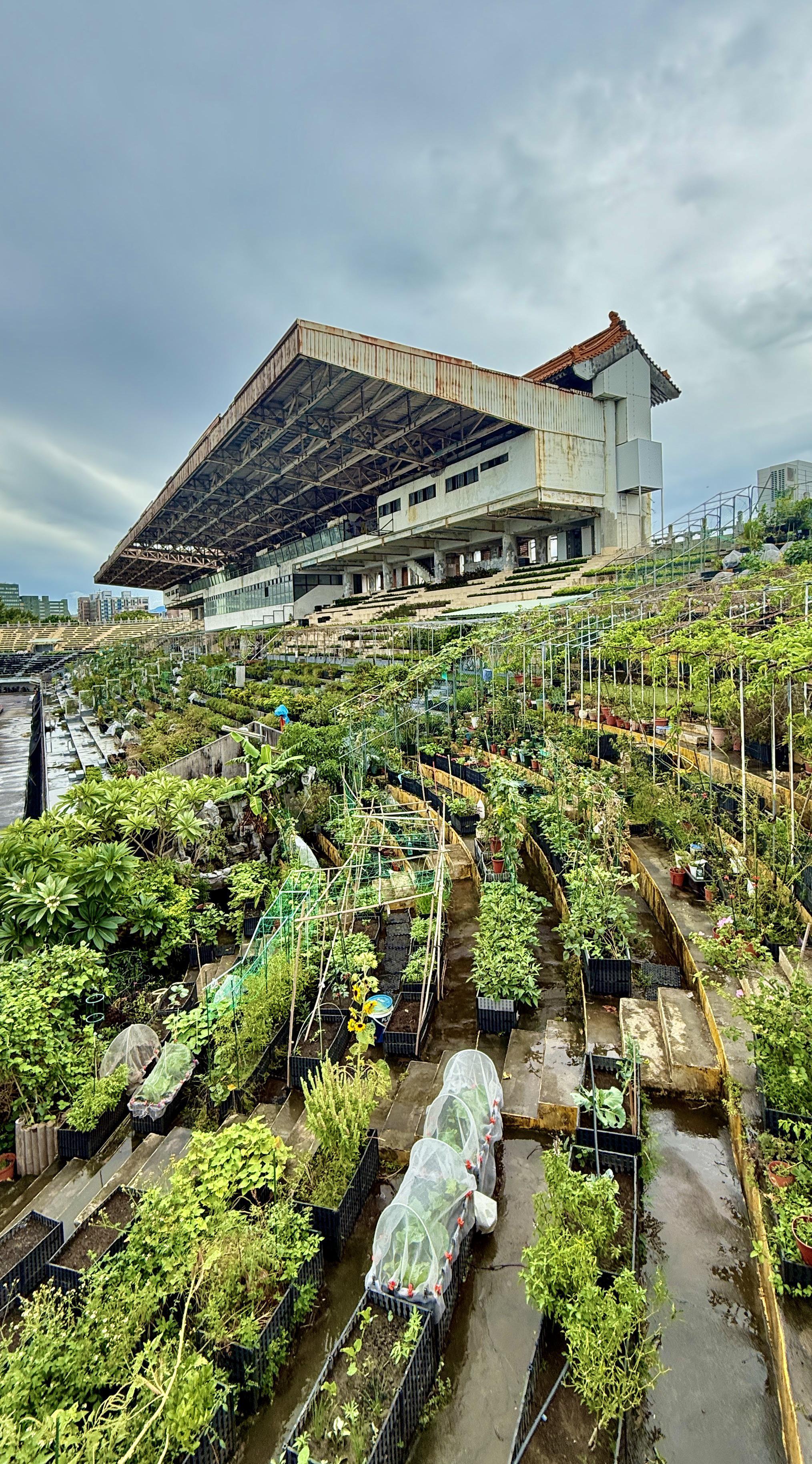
Now this. This is #solarpunk.
A true community-owned gardening project. So many stadiums and sports institutes are just left to rot once they're no longer profitable, instead of being reused for the greater good. Remember, repurposing is always easier than recycling.
Image source: https://redlib.catsarch.com/r/solarpunk/comments/1oatw62/taipeis_old_stadium_turned_into_a_community_garden/

Client Info
Server: https://mastodon.social
Version: 2025.07
Repository: https://github.com/cyevgeniy/lmst