Wir dürfen die Klimakrise nicht aufhalten. Wir müssen sie inhaltlich stellen.
Daniel
Hi, I'm Daniel! My content is licensed under CC BY-NC-SA. Usage for text and data mining prohibited under § 44b UrhG
Daniel boosted:
Last Wednesday the Birchgletscher in the Swiss Alps collapsed, devastating large parts of the village #Blatten and blocking the Lonza river which created a small lake which destroyed even more houses.
Thanks to aerial images shared by #swisstopo, I was able to create a 3D model of the area.
You can explore it here 👉 https://skfb.ly/pxHLC
#glacier #lotschental #disaster #switzerland #photogrammetry
Daniel boosted:
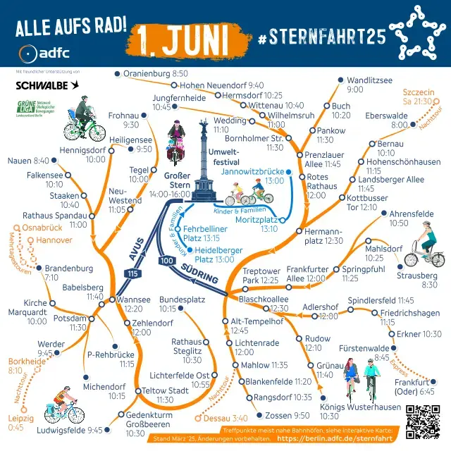
Oh, eine #Sternfahrt2025 in #Berlin. Gleich mal aufstehen und für die #Mobilitätswende aufs 🚲 steigen. Guten Morgen Internet 🌈☀️
Daniel boosted:
Für mehr Radwege!
Für sicheres Radfahren!
Für gute Laune im Straßenverkehr!
🧡 Berlin, wir sehen uns heute auf der #Sternfahrt25 🌟
Alles Infos 👇
https://berlin.adfc.de/sternfahrt
tomorrow #Poland will elect a new president; it's not a good sign that the result is unpredictable; impact will be #EU-wide
Daniel boosted:
OpenStreetMap/FOSSGIS Stammtisch Berlin-Brandenburg im Juni:
Wo: https://www.kouzina-berlin.de/
https://www.openstreetmap.org/node/1934175781
Wann: Freitag 13.06.2025 18:00
https://osmcal.org/event/3777/
#OpenStreetMap #fossgis #opendata #opensource #berlin #brandenburg #osgeo
Daniel boosted:
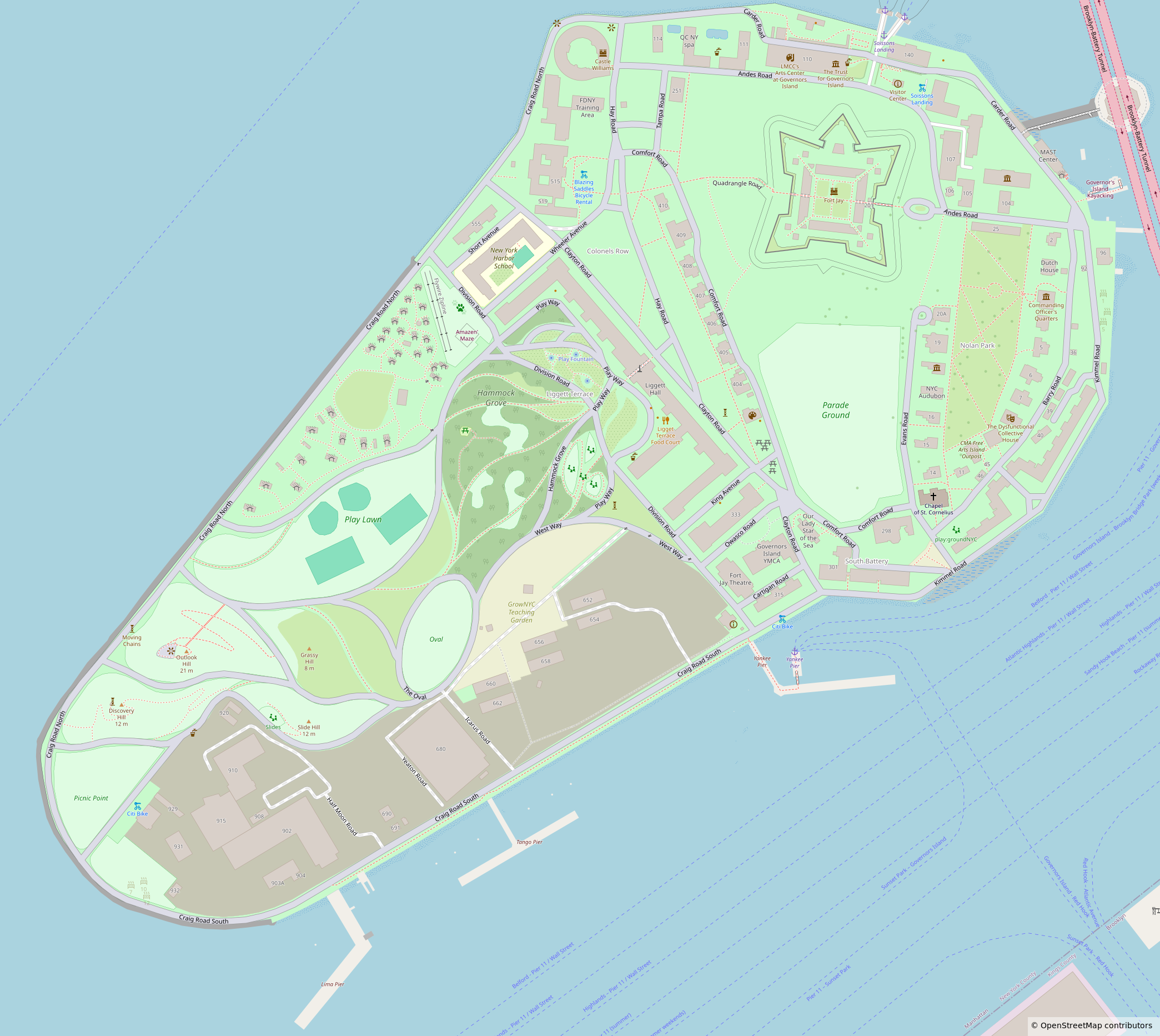
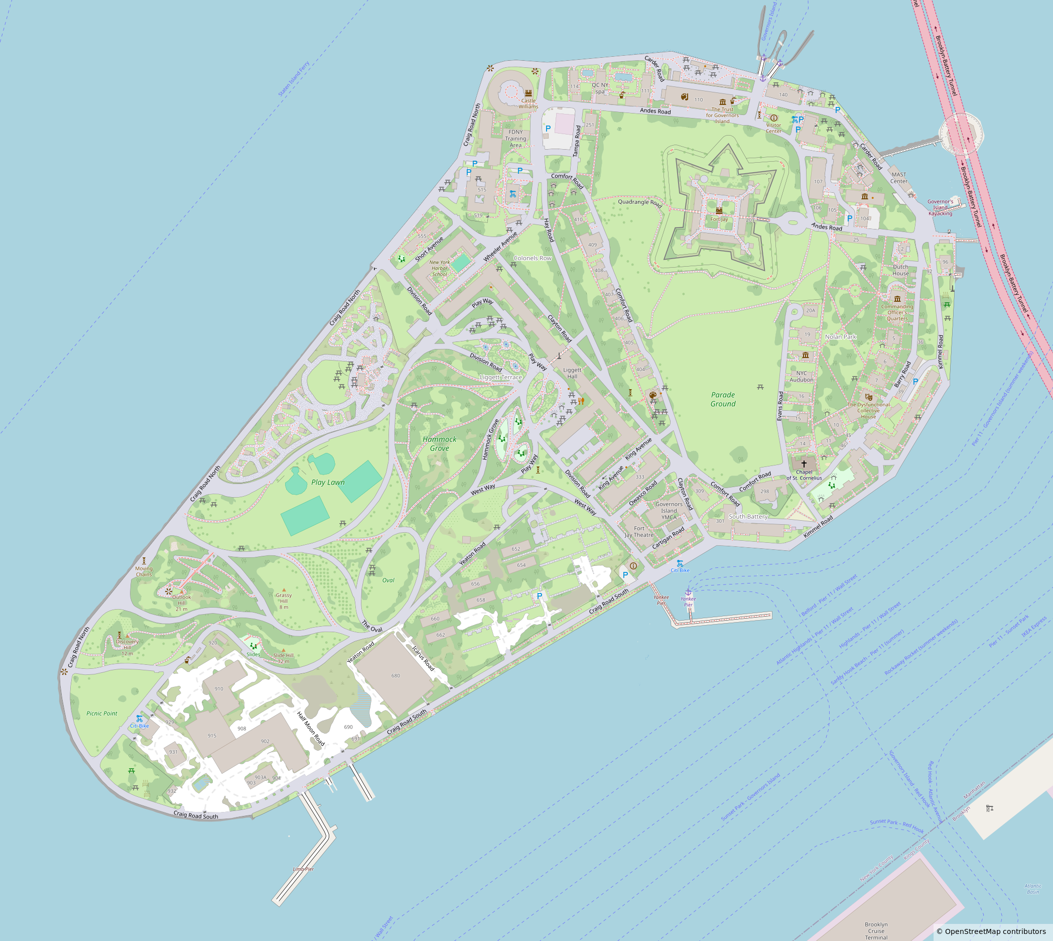
Finished micromapping Governors Island in New York a few days ago!
For anyone curious, I used a combination of Bing and NYS Orthos Online aerial imagery. The footpaths in the older areas came from a 1960’s US Department of Engineers tree survey map that had the island drawn in great detail. The rest of the information came from wikipedia articles and wikimedia + other license compatiable images. This resulted in 37,376 changes and a lot of hours of work
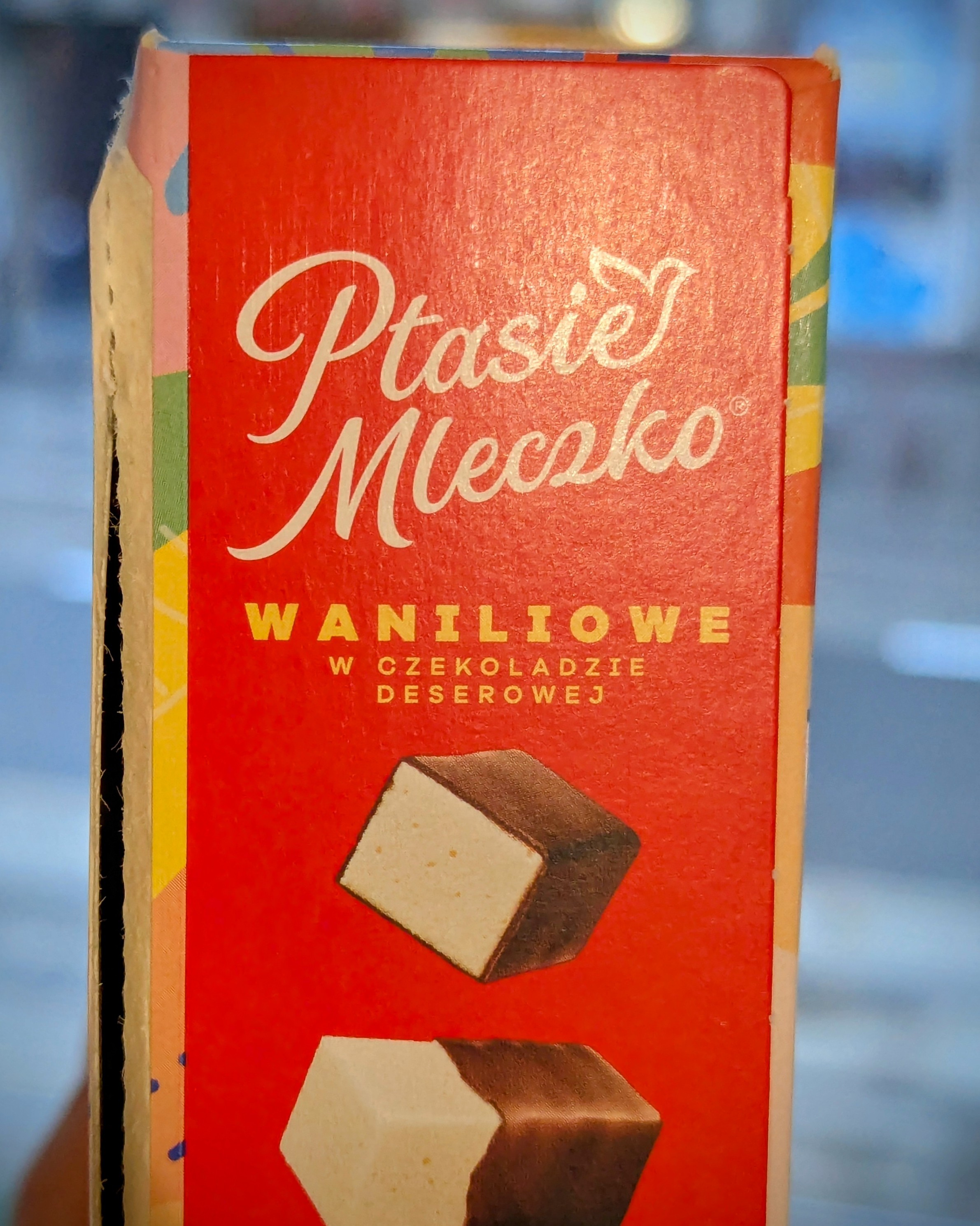
#Wedel #PtasieMleczko for the love of bird's milk kern we please improve your packing 😱 🍫 #Typography #Design
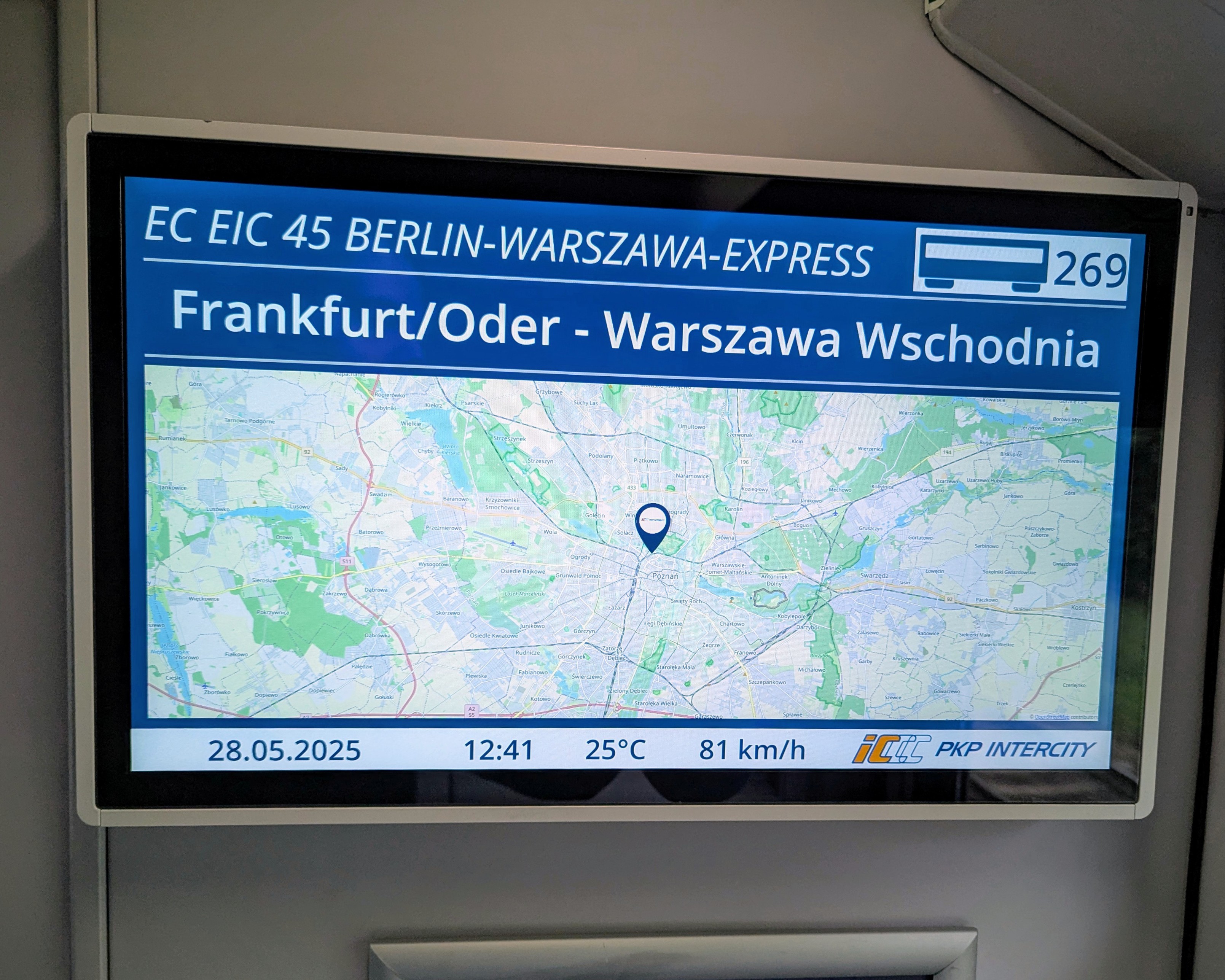
#Berlin • #Warsaw 🚂💨 With #OpenStreetMap based #map — including proper attribution 😍 #Mapstodon #PKP
Daniel boosted:
Tuesday morning before work, a.k.a. the time to make #OpenStreetMap improvements based on the surveying I did during my weekend bike rides. Mostly adding `surface=` tags, but also a historical marker, deleting a non-existent road, updating `opening_hours` for a coffee shop, ... (see https://www.openstreetmap.org/user/hobbesvsboyle/diary/404272)
Daniel boosted:
🎉 Hit 300 followers! 🌍🗺️
I’m a #Geospatial analysis nerd, solving strategic spatial problems across Europe with #QGIS & #GIS and tinkering in #OpenStreetMap.
If you love puzzles made of pixels and place, stick around and please follow or retoot so other map magicians can find us. 🙌
@mvexel I've been toying around with @Codeberg #codeberg and I like them a lot so far!
I've been testing their public pages feature with a custom domain for a while and it works nicely; except for a few times when they had to fight downtimes and AI scrapers and stuff like that.
If you like a bunch of folks putting their hearts into a project and at the same time don't expect everything to be perfect all the time, codeberg it is! ♥️
#DKB app jetzt auch mit #KI inklusive unverbindliche Antworten 🤡
"diffusor of responsibility through algorithms" — #Weizenbaum

Daniel boosted:
I did my tempo running and now there is nothing planned for my day but planting vegetables and flowers, drinking beer, and shit posting.
@eliasp ist das quasi schon KI
@eWalthert isn't the boyfriend of one of them working at Anthropic 👀
@schenklklopfer Vielleicht hilft dir das weiter
https://protomaps.com + https://maplibre.org
Und bisschen runtergeschrieben ✍️
Client Info
Server: https://mastodon.social
Version: 2025.04
Repository: https://github.com/cyevgeniy/lmst