#BristleconeBLM

Valerie Nortonvalhikes@en.osm.town
2024-01-10

My second day backpacking the South Egan Range Wilderness, I climbed up the high point in the morning. That's Adams benchmark. Then I got back to Ninemile Canyon for water, then traveled down to Sheep Pass Canyon and found camp on a small branch.

New blog post here: valhikes.blogspot.com/2023/11/

#hiking #nature #landscape #travel #hike #outside #mountains #peakbagging #peakbagger #highpoint #SouthEganRangeWilderness #Nevada #BristleconeBLM #CalienteBLM #ElyBLM #backpacking #publiclands
On the way up to Adams benchmark, the high point of South Egan Wilderness, Nevada

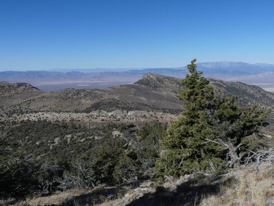
Standing on a high slope dropping to a this valley with a crest of rock on the far side. Beyond the crest, triangular hills rise to unseen cliff faces. Beyond, a very low flat expanse is interrupted only by distant lines of low mountains.At Adams benchmark, the high point of South Egan Range Wilderness, Nevada

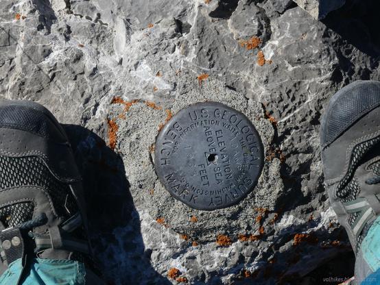
A metal benchmark with the usual markings is stamped "ADAMS" at the top and "1965" at the bottom. It is the year, not the feet. Two feet in Xero shoes and cheap gaters are on either side of the benchmark.North view from the top of the high point of South Egan Range Wilderness, Nevada

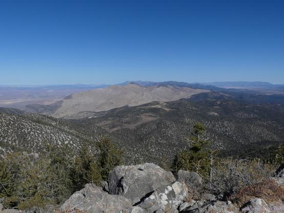
A few rocks in the foreground top a steep slope that a few distant trees can be growing on. (They are pines.) Further, hills roll away covered in thin juniper. Past that, a peak covered in tan of sagebrush and dried grasses rises to a line of points that happen to contain one almost as high as here. More mountains are beyond.Down in a wash that feeds into Sheep Pass Canyon in South Egan Range Wilderness, Nevada. Golden hour.

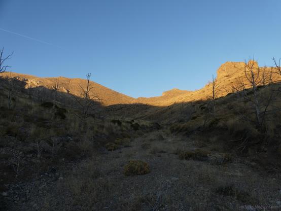
A wide flat gravel spreads rather like a road, but this is naturally made. The sides show short cuts from water erosion before rising in slopes. They are covered in sagebrush and dried grass with a sparse collection of burned trees. At the top of the right edge, there are stout pillars of rocks. The left side and ahead is higher with a line of rocks about midway.
Valerie Nortonvalhikes@en.osm.town
2023-12-29

#SacramentoPassRecreationArea had one trail I hadn't gotten to try. Aimed at horses rather than mountain bikes, it started off trail-like enough, but is mostly signed along decaying roads. It does wander some pretty hills with a few nice views plus I discovered the American Discovery Trail on the way.

New blog post: valhikes.blogspot.com/2023/10/

#hiking #nature #landscape #travel #hike #outside #dayhike #mountains #Nevada #ElyBLM #BristleconeBLM #trails #trailspotting #horsetrails

Galling. These brown tipped blue roses flowering next to the "berries" of the Utah juniper are actually galls of a midge.Two track road crosses sandy sagebrush covered hills toward hills greener with pinion and juniper. A sign on the left marks this as the Weaver Creek Trail at mile 3.Near the end of Weaver Creek Trail, but off to the side where there are some springs marked, looking back. A flat area of sagebrush has tall but dead trees lining one side. Well, some are just wintered, but some are dead. A hill rises on the right, but doesn't quite block the view of distant mountains. Clouds echo the mountain shape above them.Sunset at the upper campground at Sacramento Pass Recreation Area. Clouds turning blush colors stretch in line diagonally from hills on the lower right to the upper left. There is a ripple of color as they disappear in the distance. Lower small puffy clouds pick up pinker colors just above the hills.
Valerie Nortonvalhikes@en.osm.town
2023-11-29

Following the solar eclipse, I took to wandering the looping trails found at the Sacramento Pass Recreation Area. For more information and pictures, the blog post is here: valhikes.blogspot.com/2023/10/

#hiking #BristleconeBLM #ElyBLM #dayhike #landscape #Nevada #SacramentoPass #nature #SacramentoPassRecreationArea

A sign at a junction of a trail. The trail is lined with rocks cleared from its middle and otherwise surrounded by juniper and pinion pine.A rock balances atop a ridge of similar rocks at the top of a short and steep canyon. Behind it, a wide field of brown scrub can just be seen and low hills beyond that.A long canyon showing off a thin line of golden trees in the fall. Mountains rise to the left of this treed canyon.Rounded rocks top a ridge. Juniper grows nearby. High mountains rise in the distance.
Valerie Nortonvalhikes@en.osm.town
2023-11-29

Finally found a library that works, so got my eclipse photos up. Perhaps they are such that only a mother could love. I had fun. The post is here: valhikes.blogspot.com/2023/10/

#hiking #BristleconeBLM #ElyBLM #eclipse #solarEclipse #dayhike #Nevada #moonshadow #nature

The overexposed sun leaves a pinhole image in the camera as the moon starts to cross in front of it.The overexposed sun leaves a pinhole image in the camera as the moon is entirely in front of the sun.Two pinholes projected on a rock show the moon shadow as it leaves from in front of the sun during the annular solar eclipse.
Valerie Nortonvalhikes@en.osm.town
2023-11-06

Touring the cemetery and mining district of Black Horse, a vanished ghost town that was most active 1906-1913. The post is here: valhikes.blogspot.com/2023/10/

#hiking #Nevada #BristleconeBLM #ElyBLM #mining #cemetery #desert

A gate proclaiming "Blackhorse Eldridge Cemetery" in front of Wheeler Mountain, a sharp peak with a bit of snow. Other peaks, the tallest also snow topped, stand in front of it, but the general area of the cemetery is flat. It is part of the high, flat area of Sacramento Pass.A road extends toward sage covered hills and pinion pine covered taller hills behind them.Bars top a wide and deep diagonal hole in the ground. A regular grid of round wood beams bridge the gap below the bars, stabilizing the gap.A metal hopper stands at the end of a disused road. Surrounding it are lumps of waste rock from mining. Pinion and sage grow at the edges of the road and tops of the mounds.

Client Info

Server: https://mastodon.social
Version: 2025.04
Repository: https://github.com/cyevgeniy/lmst