#Floodwatch

Houston Public Mediahoustonpublicmedia
2025-06-12

The National Weather Service has issued a flood watch in Harris, Galveston, Montgomery and Fort Bend counties through Thursday evening, warning of up to seven inches of rain in some isolated areas.

houstonpublicmedia.org/article

2025-05-12

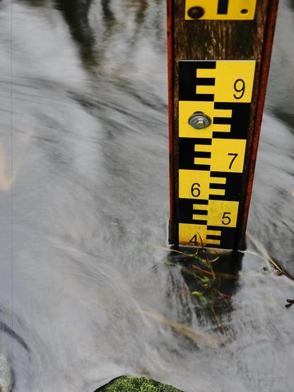
This image shows a water level gauge, often used to measure the height of water in a river, stream, or other body of water. The gauge has numerical markings and is partially submerged, indicating the current water level. The background consists of flowing water.

#WaterLevel #NatureSnapshot #FloodWatch #Hydrology #WaterMeasurement #WaterMonitoring #RiverFlow #NatureObservation #Ruler #EnvironmentalScience

This image shows a water level gauge, often used to measure the height of water in a river, stream, or other body of water. The gauge has numerical markings and is partially submerged, indicating the current water level. The background consists of flowing water.
2025-03-14

Just got a #FloodWatch alert for the #OregonCoast

Looks like we got us a sky river!

#ORWX

A flood watch notification detailing severe weather conditions, including significant rainfall and the potential for flooding in northern California and southwest Oregon. The event is expected to begin at 5:00 PM PDT on March 15, with impacts identified for urban areas, streams
Meteorologist Austen OnekWDEFAustenOnek
2025-02-13

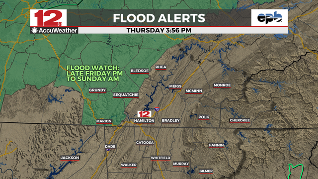
- to be re-issued for new storm system which will bring another 2-3" of rain, locally higher amounts of 4", to areas already saturated by the last storms. More flood watches possible towards the weekend.

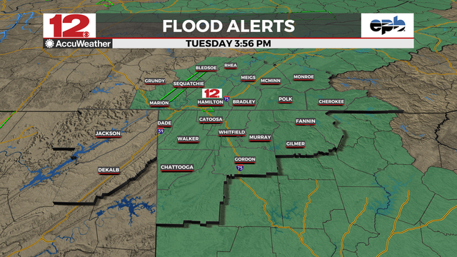
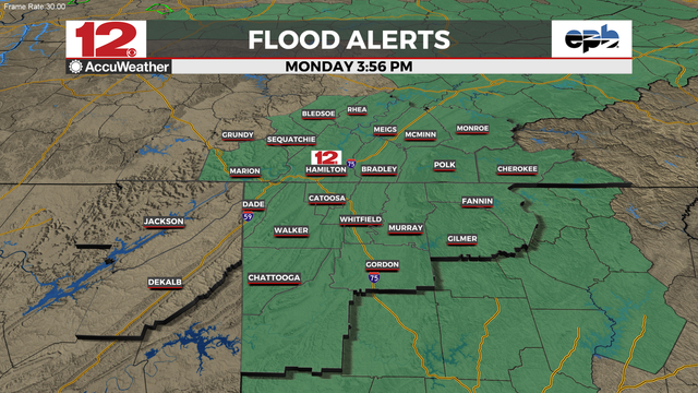
#WDEFWeather #News12Weather - #FloodWatch to be re-issued for new storm system which will bring another 2-3" of rain, locally higher amounts of 4", to areas already saturated by the last storms. More flood watches possible towards the weekend.

#WDEFWeather #News12Weather - #FloodWatch to be re-issued for new storm system which will bring another 2-3" of rain, locally higher amounts of 4", to areas already saturated by the last storms. More flood watches possible towards the weekend.
2025-02-13

FLOOD WATCH,
IN EFFECT THRU SUNDAY EVE (2/16)

Flooding caused by excessive rainfall continues to be possible.

WHERE: Entire North SF Bay. #California

IMPACTS: Excessive runoff may result in flooding of rivers, creeks, streams & low-lying & flood-prone locations. Creeks & streams may rise out of their banks. Flooding may occur in poor drainage & urban areas. Low-water crossings may be flooded. Area creeks & streams are running high & could flood with more heavy rain & continuous runoff.

*ADDITIONAL DETAILS:
- Excessive runoff & elevated levels on area rivers, streams & creeks as well as near-saturated soil will resulting in an increased flood potential as the Atmospheric River brings moderate to heavy rain to the region.

- weather.gov/safety/flood

PRECAUTIONARY/PREPAREDNESS ACTIONS: Monitor later forecasts & be alert for possible Flood Warnings. Those living in areas prone to flooding should be prepared to take action.

#FloodWatch #CAwx #CaliforniaWeather #SFBay #NorCalWx

forecast.weather.gov/showsigwx

2025-02-13

FLOOD WATCH,
FROM 10 PM THIS EVE (2/12) THRU SATURDAY EVE

Flooding caused by excessive rainfall possible.

WHERE: Entire North SF Bay. #California

IMPACTS: Excessive runoff may result in flooding of rivers, creeks, streams & other low-lying locations. Creeks & streams may rise out of their banks. Flooding may occur in poor drainage & urban areas. Low-water crossings may be flooded. Area creeks & streams are elevated & could flood with more heavy rain.

ADDITIONAL DETAILS:
- Elevated levels on area rivers, streams & creeks as well as near-saturated soil will result in an increased flood potential as the next Atmospheric River brings moderate to heavy rain to the region beginning tonight & into Thursday.
- weather.gov/safety/flood

PRECAUTIONARY/PREPAREDNESS ACTIONS: Monitor later forecasts & be alert for possible Flood Warnings. Those living in areas prone to flooding should be prepared to take action if flooding develop.

#SFBay #CAwx #CaliforniaWeather #FloodWatch #NorCalWx

forecast.weather.gov/showsigwx

Meteorologist Austen OnekWDEFAustenOnek
2025-02-11

- " REMAINS IN EFFECT THROUGH THURSDAY AM

Storm system will continue to bring multiple rounds of moderate to heavy rain tonight and again on Wednesday afternoon and evening. Additional rainfall amounts of 2-4" are possible." NWS Morristown

#WDEFWeather #News12Weather - "#FLOODWATCH REMAINS IN EFFECT THROUGH THURSDAY AM

Storm system will continue to bring multiple rounds of moderate to heavy rain tonight and again on Wednesday afternoon and evening. Additional rainfall amounts of 2-4" are possible." NWS Morristown
Meteorologist Austen OnekWDEFAustenOnek
2025-02-10

Monday Evening: Outside of a few drizzles, things are dry... for now. Heavy rain in the next few days and a going into effect tomorrow.
Details tonight on @WDEFNews12 at 5:30, 6, 7 & 11, and at wdef.com/weather

Meteorologist Austen OnekWDEFAustenOnek
2025-02-10

IN EFFECT FROM TUESDAY AFTERNOON THROUGH THURSDAY MORNING
A storm system will bring multiple rounds of moderate to heavy rain on Tuesday and again on Wednesday afternoon and evening. This will bring two-day rainfall totals of 2-4" across the area with locally higher amounts.

#FLOODWATCH IN EFFECT FROM TUESDAY AFTERNOON THROUGH THURSDAY MORNING
A storm system will bring multiple rounds of moderate to heavy rain on Tuesday and again on Wednesday afternoon and evening. This will bring two-day rainfall totals of 2-4" across the area with locally higher amounts.
deewanideewani
2025-02-05

NAPA OES: member.everbridge.net/33796668

Specific road closures added:

-Wooden Valley Rd to Wooden Valley Cross Rd
- Redwood Rd (Browns Valley Rd to Mt. Veeder Rd via Dry Creek Rd)
- Petrified Forest Rd (Sonoma County)
- Spring Mountain Rd (Sonoma County)
-Silverado Trail between Lincoln Avenue and Hagen Road

Please avoid these areas and drive safely. Reference link for additional closure information.

2025-02-04

Napa OES:

Due to the atmospheric river several county roads are currently flooded, or in danger of flooding. Please use caution when navigating roads as not all flooded areas have yet been identified. You are encouraged to keep driving to a minimum until the rains subside. Remember turn around, don’t drown and never drive through a flooded road or area.

#Napa #California #Flood #FloodWatch #CAwx #CaliforniaWeather

member.everbridge.net/33796668

2025-01-31

FLOOD WATCH,
FROM NOON TODAY (1/31) THRU SUNDAY EVENING

Flooding caused by excessive rainfall possible.

WHERE: The following counties: #Sonoma, #Napa, #Marin, #ContraCosta, #Alameda, #SanFrancisco, #SanMateo, #SantaClara, #SantaCruz. #Callifornia

IMPACTS: Excessive runoff may result in flooding of rivers, creeks, streams & low-lying and flood-prone locations. Flooding may occur in poor drainage & urban areas.

ADDITIONAL DETAILS:
- Excessive rainfall is forecast through the region. Around 1-3 inches of rain is expected across the warned region by Sunday afternoon, with locally higher totals up to 5 inches in the higher elevations.

- weather.gov/safety/flood

PRECAUTIONARY/PREPAREDNESS ACTIONS: Monitor later forecasts and be alert for possible Flood Warnings. Those living in areas prone to flooding should be prepared to take action should flooding develop.

#CAwx #CaliforniaWeather #NorCalWx #FloodWatch #SFBay

forecast.weather.gov/showsigwx

iWeatherNet 🌪⚡️StormNet
2025-01-29

☔️Flood Watch begins at 6pm. Most of the heavier rain moves in overnight into the Thursday morning commute.
iweathernet.com/dfw-weather
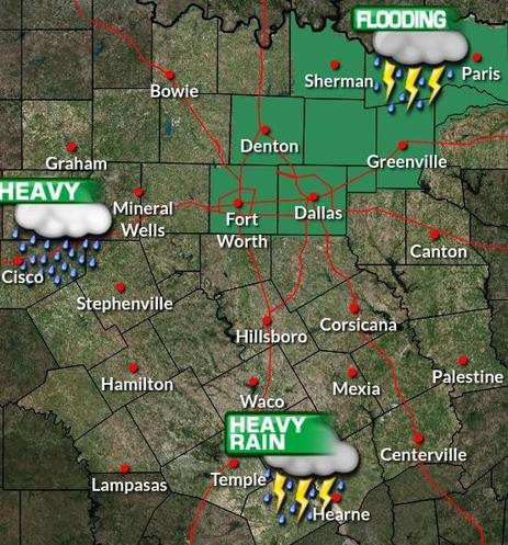
A covers the Metroplex into Northeast Texas where isolated totals of 5-7" will be possible. Some severe storms may also occur, particularly across Central Texas.

Go here for our Browser iweathernet.com/weathernet-sev ⚡️

2025-01-27

Risk rises for #mudslides around #LACounty fire zones; prepare for worst-case scenario, officials warn

Alene Tchekmedyian, Rong-Gong Lin II, Melody Gutierrez, LA Times
January 26, 2025

"With more rain on the way, officials warned Sunday of an increasing risk of mudslides in #LosAngelesCounty's burn areas, with a 10% to 20% chance of significant #FlashFlooding and #DebrisFlows capable of damaging roads and homes in and around areas devastated by #wildfires.

"'This is the worst-case scenario to prepare for,' said Kristan Lund, a meteorologist with the National Weather Service in Oxnard.

"'We do have increasing concern for the #BurnScars,' Lund said. The charred footprint of the Eaton fire, which blackened more than 14,000 acres, is the most worrisome. 'These #FlashFloods and these debris flows could happen in and near or below these burn scars.'

"A #FloodWatch took effect at 10 a.m. Sunday and was set to continue through 4 p.m. Monday for the burned areas of the #EatonFire in the #Altadena and #Pasadena areas; the #PalisadesFire and #FranklinFires in the Pacific Palisades and Malibu areas; the Hughes fire around Lake Castaic; and the Bridge fire in the San Gabriel Mountains west and southwest of Wrightwood. The flood watch started six hours earlier than originally anticipated as rain began falling steadily around Los Angeles."

Read more:
aol.com/news/risk-rises-mudsli
#ClimateCrisis #CaliforniaFires #BurnScar #FlashFloodWarning #FloodDanger #Mudslides #CaliforniaWx
2024-12-13

Napa Farmers Market will be CLOSED this Saturday, Dec 21 due to heavy rain forecast.

They will be OPEN as usual Tuesday, Dec 17 & Saturday Dec 21, 2024

#Napa #California #FarmersMarket #rain #FloodWatch

2024-12-13

Sandbag Program at City of Napa Corp Yard

Where: City of Napa Corp Yard - 770 Jackson Street, Napa, California

When: Friday, December 13, 2024
8 AM to 2 PM

#Napa #California #FloodWatch

Client Info

Server: https://mastodon.social
Version: 2025.04
Repository: https://github.com/cyevgeniy/lmst