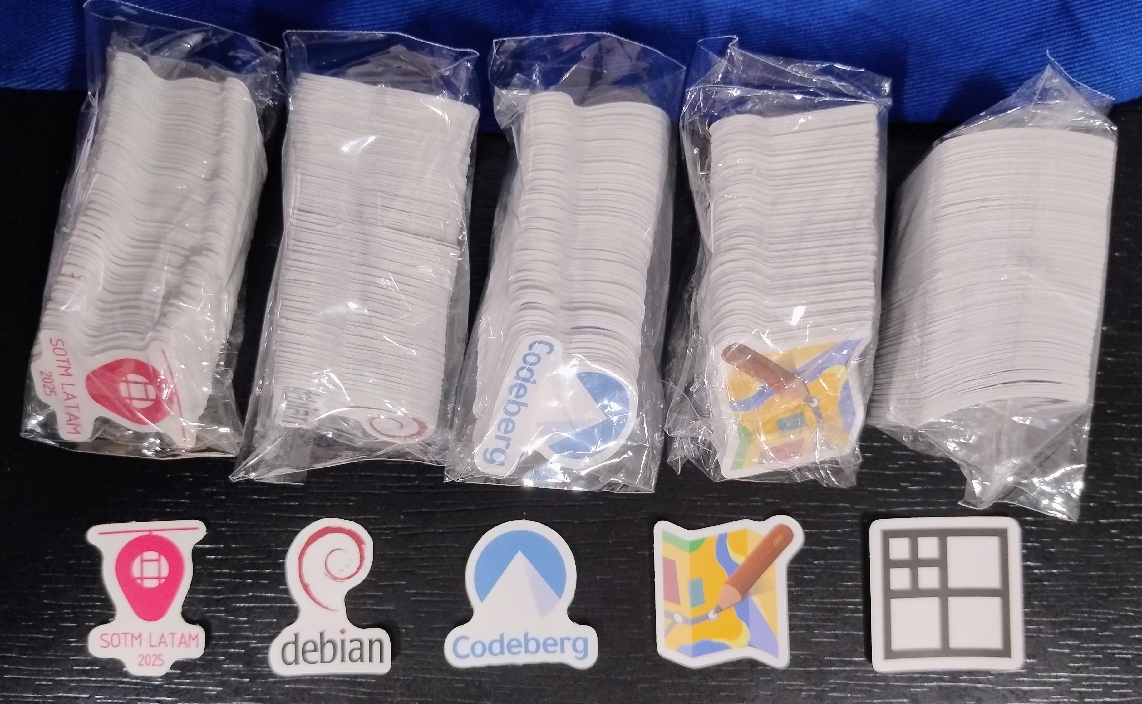
Primera prueba de stickers para el #sotmlatam2025 #debian #codeberg #josm #damn
#Josm
Just found out how to multi-select a whole sequence of images in JOSM to update their position (GPS is hard in tunnels) thanks to @francois 👏
https://2metz.fr/blog/josm-multiple-image-selection/
Question for #JOSM users:
When JOSM is full screen, it seems to forget where my menu / toolbar items are in relation to the window position. It uses, instead, where previous not-fullscreen window was at.
Say the window was 100 pixels to the right of the upper-left screen corner. To click on a menu item, the mouse has to be 100 pixels to the right of what I *want* to click on.
Any ideas where this is coming from?
I have finally released new #Mapathoner version.
https://mapathoner.mapathon.cz/
- Use mapathoner.mapathon.cz domain
- Increase JOSM version to build against
- Add Faroese language
It took me longer because I needed to find a bit of time to get familiar with recent #JOSM changes that influenced #Maven builds.
@tho ja, ich glaube, das war der Tenor gestern beim #osm Treffen: Unterwegs mit #Streetcomplete, #everydoor oder #SCEE und zu Hause mit #josm oder #id Editor.
#OSMAnd und #Organicmaps zum Eintragen von Fehlern. #Komoot wurde noch genannt.
#Vespucci habe ich gestern nicht gehört.
https://streetcomplete.app/
https://every-door.app/
https://vespucci.io/
https://osmand.net/
https://organicmaps.app/
https://www.komoot.com/
https://openstreetmap.de/beitragen/editoren/
@hdvalentin @tyr wurde da zufällig besprochen was eine gute Kombination für die vor-Ort Recherche und das Eintragen zuhause ist?
Ich benutzte #Streetcomplete unterwegs und #josm zuhause. Bei Radtouren oder Wanderungen trage ich Hinweise in #OrganicMaps ein.
Geht das effektiver? Lerne gerne dazu.
If you're the type of person who maps power infrastructure in OpenStreetMap, you may be interested in my new PowerNetworkTools plugin:
https://github.com/openinframap/josm-power-network-tools/
The first tool allows you to estimate the voltage of a substation busbar from aerial imagery. Full details in the git README. Hopefully more tools available soon!
Available wherever you usually get your JOSM plugins (i.e. the settings dialog).
Lors de ma dernière sortie à vélo avec les enfants j'ai repéré des outils en libre service le long de l'itinéraire, des bancs, des arceaux. Je n'avais pas de temps à y consacrer sur l'instant. Autre chose à faire, genre les enfants à gérer.
J'ai juste pris des photos géolocalisées. De retour au calme à la maison je fais glisser les photos sur l'éditeur JOSM et je regarde si l'objet existe déjà où si je l'ajoute. Méthode de terrain minimaliste.
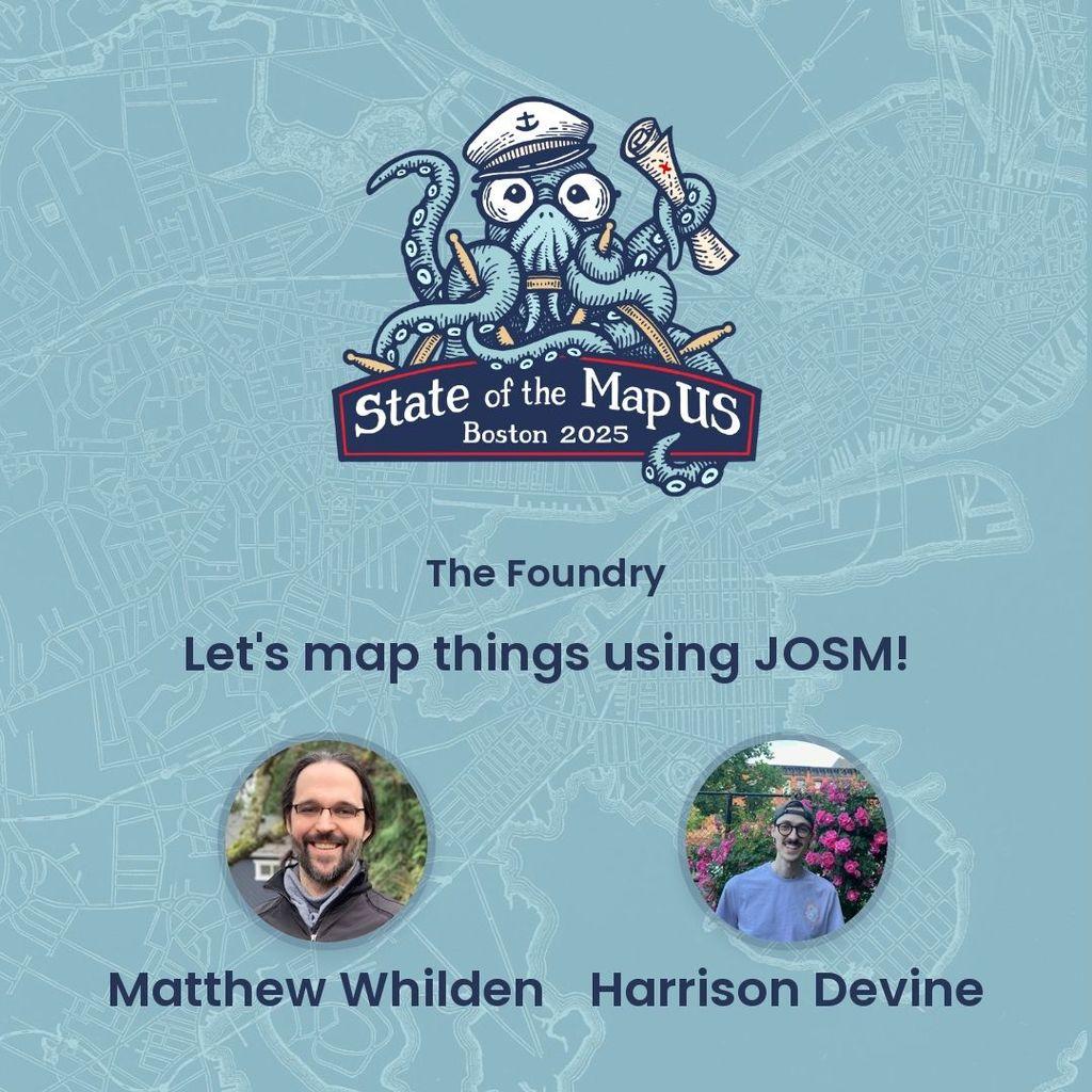
#SOTMUS workshops kick off on Thursday, June 19th at The Foundry in Cambridge. Join OSM US board members Matthew Whilden and Harrison Devine for a workshop with #JOSM.
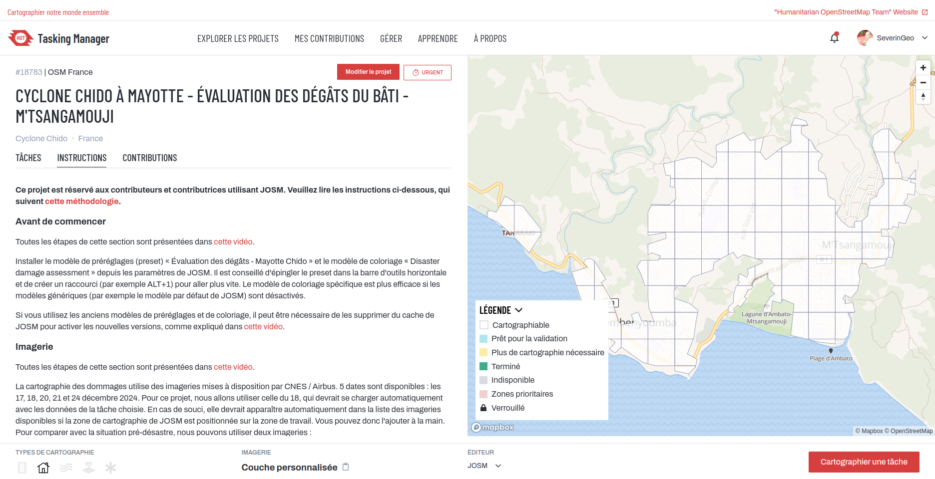
Après Mamoudzou, Tsingoni, Bandraboua, M'Tsamboro et Acoua, M'Tsangamouji dans le nord-ouest de Grande-Terre est le nouveau projet @osm_fr@fr.osm.socialproject dans le #taskingmanager pour cartographier dans #josm #openstreetmap les dégâts des bâtiments après le cyclone #chido à #mayotte en utilisant l'imagerie post-catastrophe de @CopernicusEU.
Nous manquons de volontaires, n'hésitez pas à venir ce jeudi apprendre une cartographie différente sur #osm ! https://osmcal.org/event/3673/
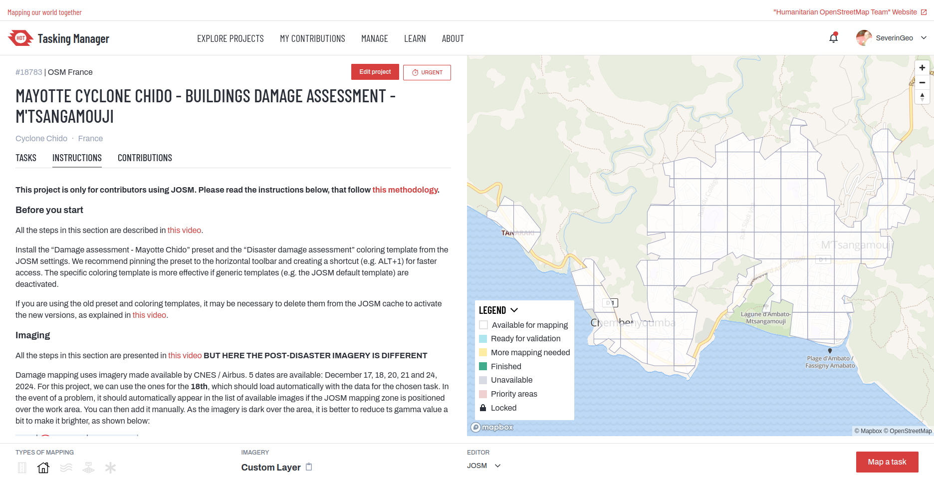
After Mamoudzou, Tsingoni, Bandraboua, M'Tsamboro and Acoua, M'Tsangamouji in the northwest of Grande-Terre is the a new @osm_fr@fr.osm.socialproject project in the #taskingmanager to map #josm #openstreetmap #osm building damage after cyclone #chido in #mayotte using @CopernicusEU post-disaster imagery.
4ième vidéo tuto @josmeditor
On rentre dans le dur, avec l'utilisation du calque de corrélation à travers 5 exemples :
- Aligner des photos
- Repositionner des photos décalées
- Nettoyer des photos
- Gérer des photos en indoor
Sauver des données embarquées à dos d'outarde
https://linuxfr.org/users/siltaar/journaux/sauver-des-donnees-embarquee-a-dos-d-outarde
Ou comment l'association @GEBULL, petit GUL de province, a contribué à une étude scientifique.
À la fin du mois de novembre 2021, une balise de suivi d’oiseau nous a été confiée par le Groupe Ornithologique des Deux-Sèvres. Muette depuis 4 ans sur le dos d’une outarde canepetière, perdue pour la science mais recapturée dernièrement, nous avions pour consigne d’en extraire coûte que coûte les dernières données relevées.
#LinuxFr #GUL #GODS #BassinesnonMerci #embarqué #ornithologie #regex #vim #sciences #récupération #gps #zigbee #josm #osm #eeprom #TotOutarde
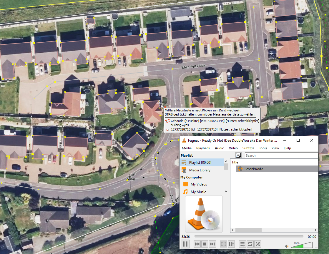
#JOSM für #Maproulette und nebenzu dem @Blumi147 im #SchenklRadio lauschen!
Und ihr so?
Josm - Gestion des photos - Corrélation
https://peertube.openstreetmap.fr/videos/watch/77bb225f-fa30-45bb-8ee8-294d93e046f6
@BjoernBeck
Wenn du dich ein bisschen eingearbeitet hast und mit #iD oder #JOSM halbwegs zurecht kommst sucht #HOT #HumanitarianOpenstreetmapTeam immer nach Leuten die ein bisschen Zeit haben zu helfen. Ich habe im Moment leider nicht die Zeit um reinzuschauen, bin aber sicher da brauchen gerade ganz viele Karten für Myanmar Aktualisierung.
Spent almost an equal amount of time on #JOSM to resolve the notes. Most of the time was used in trying into figure out how to best map `traffic_sign`.
The limiting factor is that the Croatian's website for traffic sign codes doesn't exist anymore and thus decided to use the German ones with a `fixme` key to update them.
@dasgrueneblatt Locally, you can easily display #OsmAnd favorites by just open it in #JOSM, but it does not looks very nice. For local customization, it is quite easy to enable labels with just a few clicks in #QGIS. Or (esp. if you want to publish the map) you can use service like https://umap.openstreetmap.de (you also need to enable labels either as always-on or on-popup in GPX layer)
zoomé dans #josm ça donne ceci, les panneaux ne sont pas dédupliqués

I'm nearing the completion of mapping the basic road surface types for the whole Eastern Cape province of South Africa in #OpenStreetMap. Many months using the new 25cm ZA aerial imagery to help me identify the surface. #JOSM "colourful" setting to the max helps a lot. 98% done. 🇿🇦
Client Info
Server: https://mastodon.social
Version: 2025.04
Repository: https://github.com/cyevgeniy/lmst