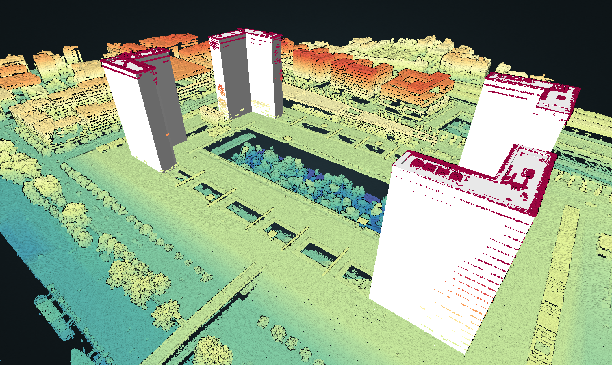
Bricolage de l'après-midi avec #potree et #roofer à partir des données #LidarHD.
#Potree
here's my first attempt at using #Potree to display a small area of point clouds!
https://sarahdal.github.io/pointclouds/goswick/Goswick.html
I exported a las file from WebODM at 0.25 resolution, and used portreeconverter. The resolution seems too big though? I also had all sorts of issues with github pages when I tried bigger files, really I need to devote some energy to setting up an actual website..
Is there a way to set the settings automatically when the page is loaded?
Testing a new feature I just discovered on #Potree within #WebODM : record movie.
Is there a way to improve the video quality? @OpenDroneMap
Before I only captured the screen with OBS.
Point Cloud experience in ALL GIS (#ArcGisPro 3.2 and #QGIS 3.34) really sucked today. The only reliable viewer was, as usual, #Potree
Looking forward to Potree with #COPC support!
Tomorrow at the University of Guanajuato, within the "Engineering Week" event, I will be presenting, as part of the Official QGIS Mexico User Group :qgis:, the #GIS :earth_photo: of the Government of #Guadalajara 🇲🇽 done in the last two years of work (Only the new developments)
Using #FOSS geospatial :osgeo:
#QGIS #Potree #PostGIS #Geoserver #Leaflet #OpenDroneMap #WebODM #WhiteboxTools #Lastools #CloudCompare #GeoSAM
For #LiDAR #webmapping #drones #photogrammetry #cadastral #survey #AI #mobility
""El Charro" in Guadalajara - WebODM" in YouTube https://youtube.com/shorts/S5HBoHLFXR0?feature=share
El Charro sculpture, 3d model created with Opendronemap and a Mavic 2 Pro. Author: Hennessy Becerra
@OpenDroneMap #WebODM #3d #Potree #drones
#30DayMapChallenge Day 28. 3D
Almost all my maps were 3D this year... here's another one. 🙂 Coloured LiDAR for Dublin.
'Dublin, Ireland in #3D 🌆'
Live: https://maptheclouds.com/playground/30-day-map-challenge-2022/dublin-lidar
So DIY #3D scanner and point cloud visualisation:
https://media.ccc.de/v/fossgis2019-589-pointclouds-fr-osm
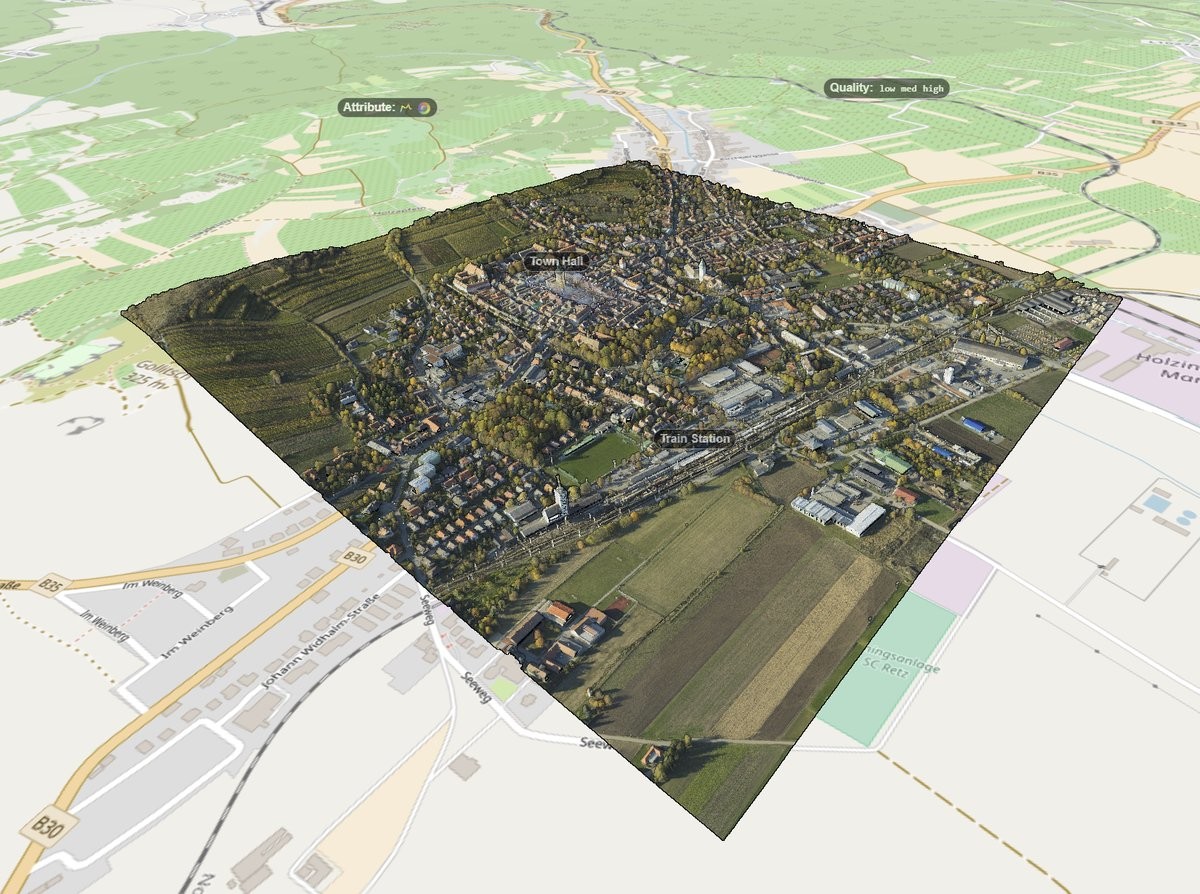
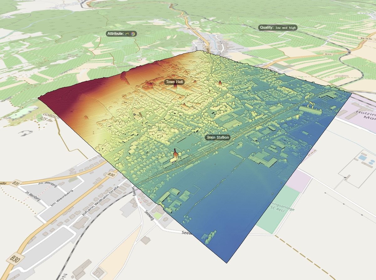
RT @m_schuetz@twitter.com: New #Potree with @CesiumJS@twitter.com (OSM) demo:
http://mschuetz.potree.org/potree_2018.02.14/examples/cesium_retz.html
with a scan of Retz, courtesy of @RIEGL@twitter.com
https://twitter.com/m_schuetz/status/963869611103080448
Client Info
Server: https://mastodon.social
Version: 2025.04
Repository: https://github.com/cyevgeniy/lmst