
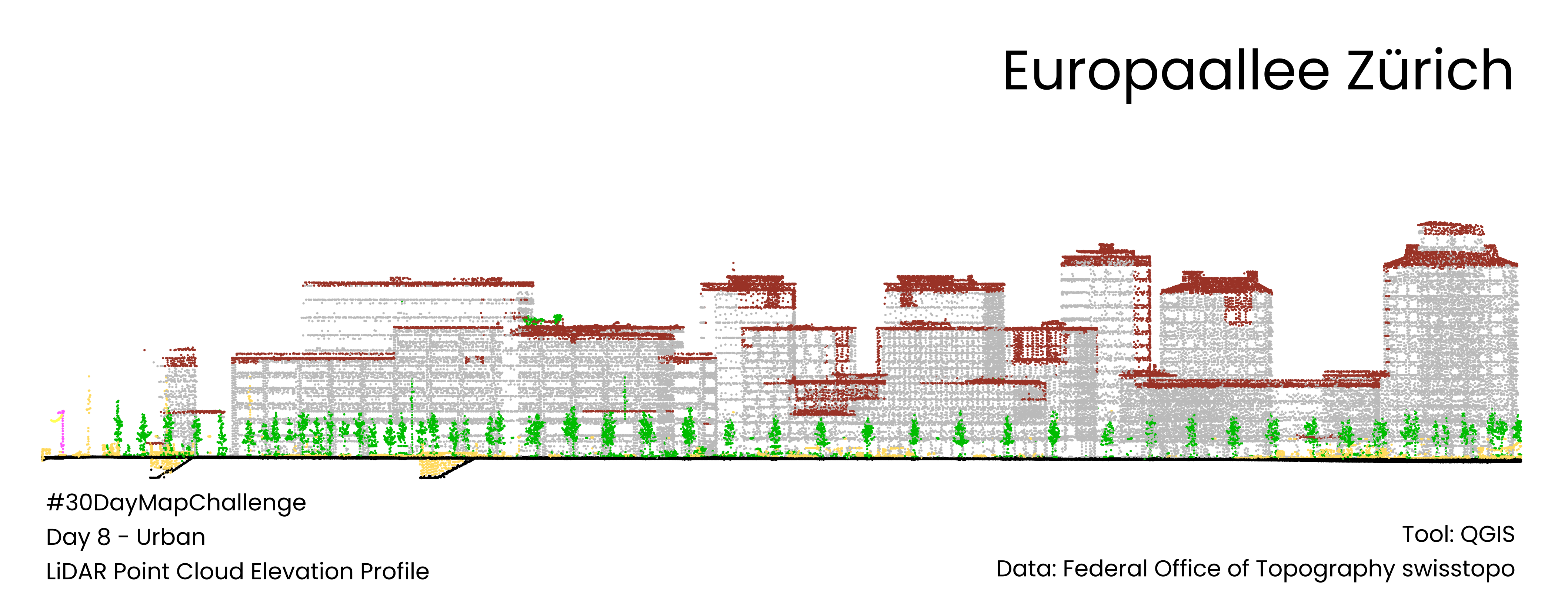
#30DayMapChallenge Day 8: Urban
#QGIS #LiDAR #PointCloud
#PointCloud
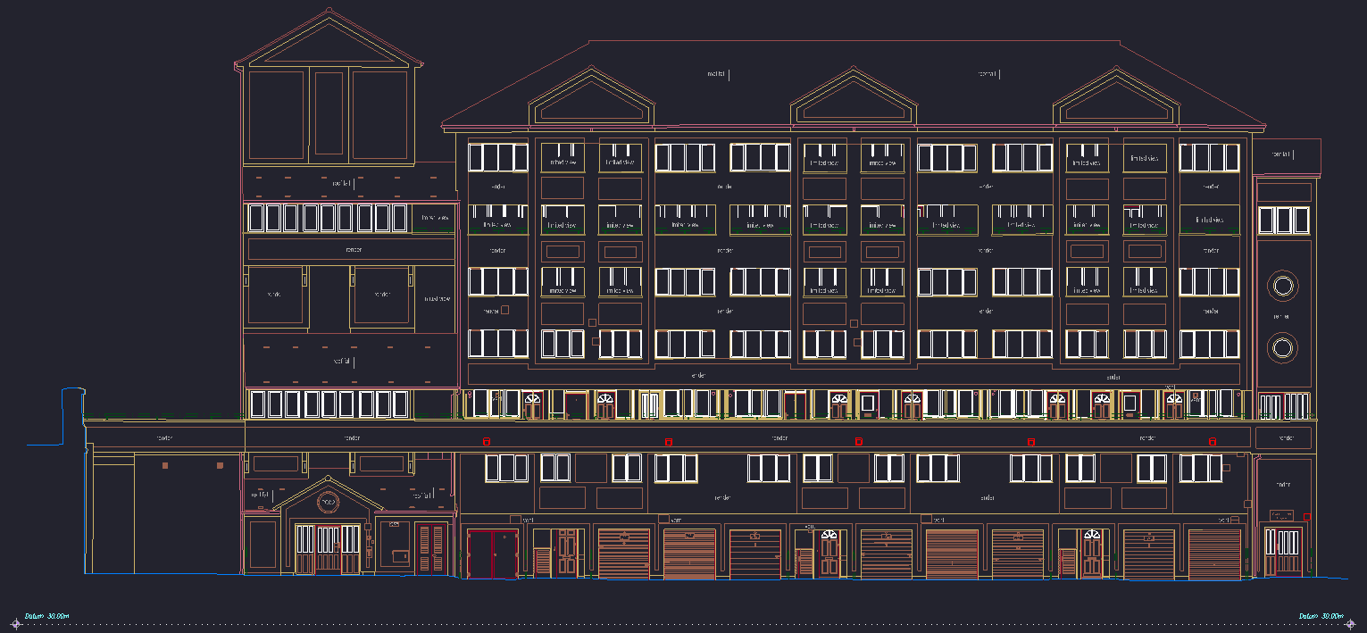
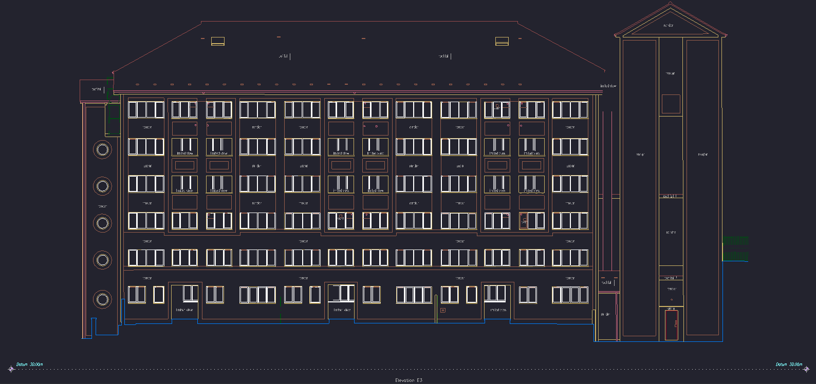
What a year it's been!🎉 Feeling immense gratitude and pride as I look back at some of my latest architectural elevation drawings. Each line, every detail, crafted with passion and precision.
Ready to jump into new challenges and projects! #Architecture #Elevations #Portfolio #2Ddrawing #CADdrafting #geodesy #pointcloud #laserscanning #survey


I released an update to my libE57Format library—version 3.3—to fix some build warnings & to update the build system (cmake)🏗️.
It is a C++ library which provides read & write support for the ASTM-standard E57 file format on Linux, macOS, and Windows. E57 files store 3D point cloud data, attributes associated with 3D point data (color & intensity), and 2D images (photos).
https://github.com/asmaloney/libE57Format/releases/tag/v3.3.0
#3DScanner #PointCloud #GIS #Geospatial #LiDAR #LaserScanner #E57 #OpenSource #FileFormat #cpp #FOSS

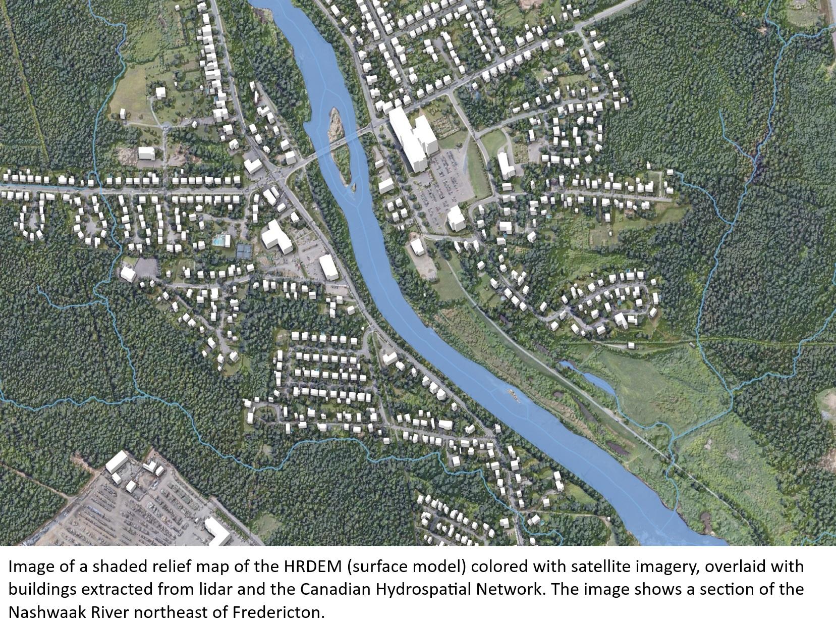
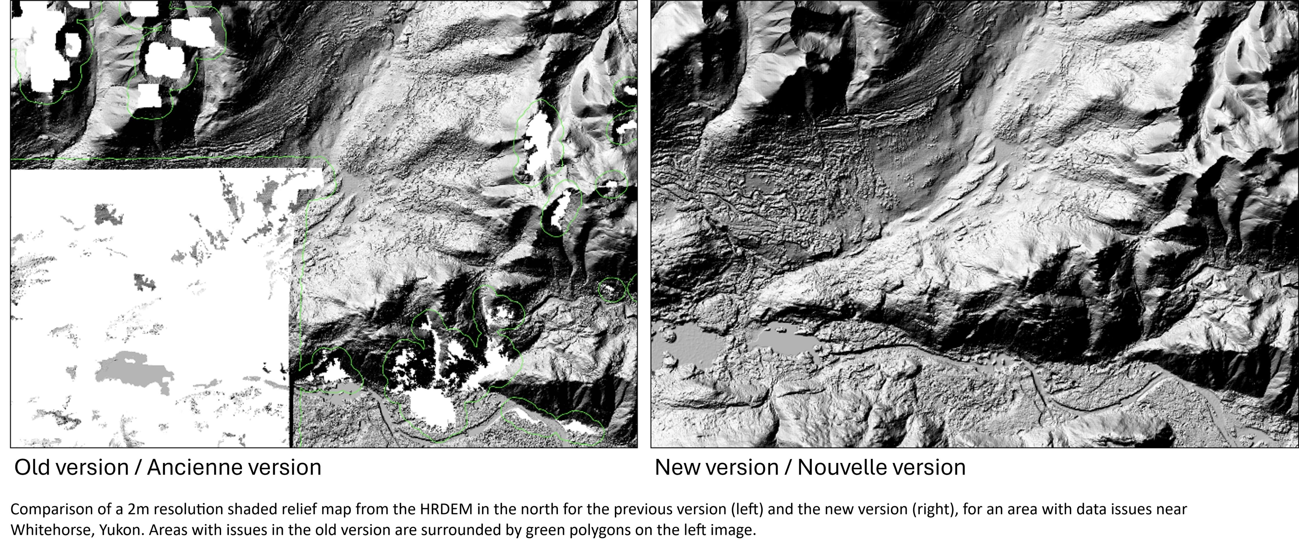
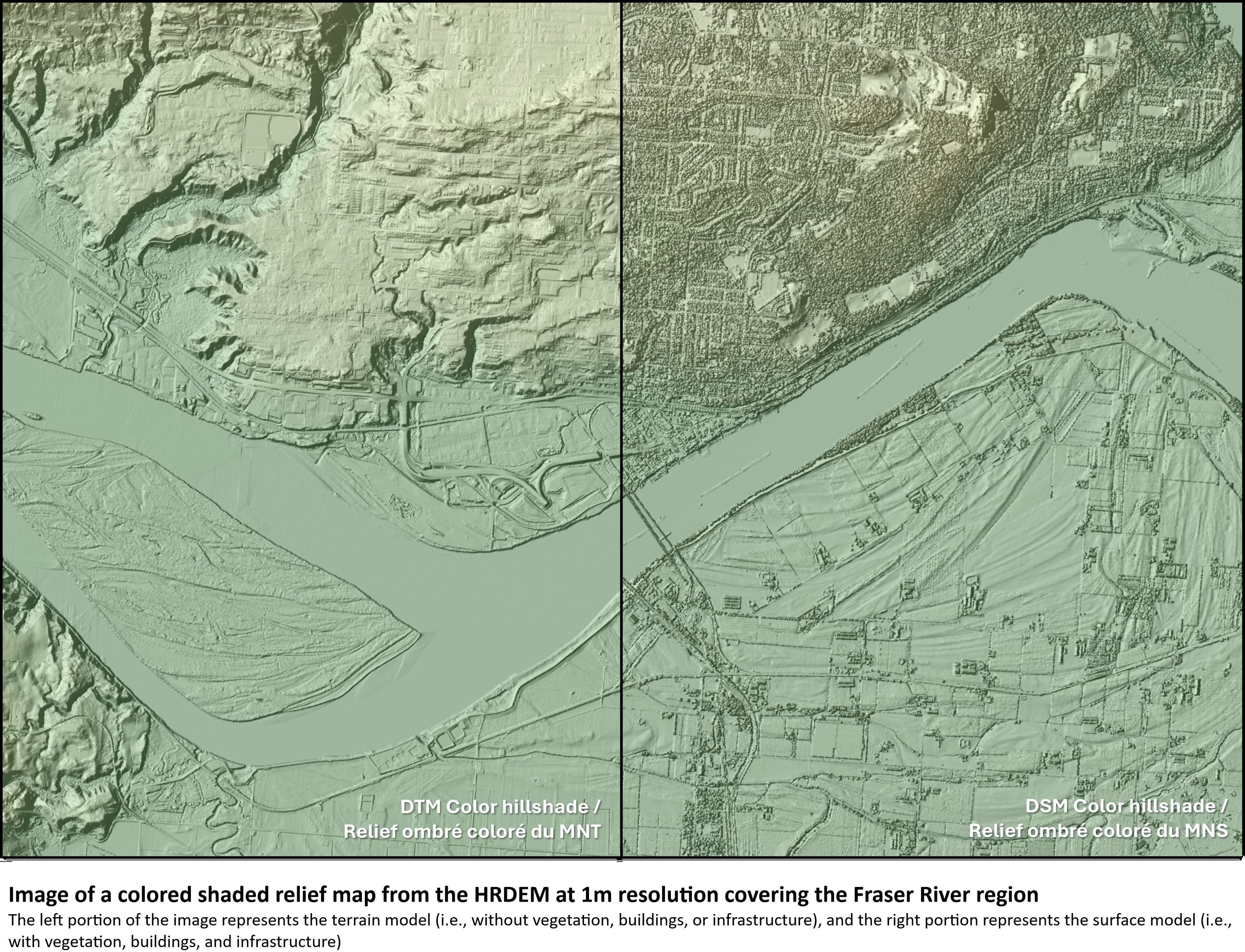
More [Canadian] High-Resolution Lidar [HRDEM] And Elevation Data Now Available
--
https://natural-resources.canada.ca/science-data/science-research/geomatics/more-high-resolution-lidar-elevation-data-now-available <-- shared technical press release
--
“... In this first article, highlights include:
• HRDEM & HRDEM Mosaic - over 709,000 km² of new LiDAR-derived elevation data added since May 2024, increasing coverage by 54%. This product now covers 244 of Canada’s 250 largest cities, and over 95% of the population.
• Northern HRDEM data - fully updated using ArcticDEM v4.1, improving quality for the entire Canadian Arctic.
• Automatically Extracted Buildings - Added 61 new projects and over 2.58 million building footprints, bringing the total to over 13.6 million.
• LiDAR Point Clouds - Expanded by over 200,000 km2, now totalling close to 364,000 km²…”
#GIS #spatial #mapping #Canada #HRDEM #mosaic #LiDAR #elevation #NationalElevationDataStrategy #pointcloud #ArcticDEM #building #footprints #geographic #coverage #progress #opendata #Canadian #arctic #remotesensing #earthobservation #NaturalResourcesCanada


🚀 Mẹo mới về công cụ lần lượt chụp và chỉnh sửa điểm/js trên iOS! Làm được việc quét, chỉnh sửa 3D tổng thể (bộ lọc, tịa, màu sắc, Polonia, effect...), xuất ra định dạng PLY/OBJ. Cần người thử nghiệm beta qua TestFlight và Discord. 🌐📱
#PointCloud #iOS #3Dtechnology #BetaTesting #iOSApp #3DModeling
https://www.reddit.com/r/SideProject/comments/1oe4usn/point_cloud_capture_and_editing_tool_for_ios/

Why hasn't this gained traction?
It seems like a good step forward in #SurfaceReconstruction and working with #PointClouds and correctly oriented normals.
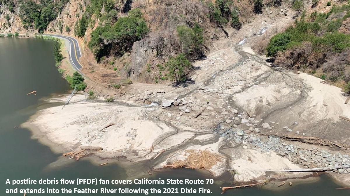
Deep-Learning-Based Object Detection And Tracking Of Debris Flows In 3D Through Lidar-Camera Fusion
--
https://doi.org/10.1109/TGRS.2025.3609573 <-- shared paper
--
[As an engineering geologist, I have been fortunate enough (sic) to see debris flows in action (indeed, I was rerouted on the motorcycle because of them) on the Poudre Canyon Road in Colorado, after the 2020 Cameron Peak Fire]
#GIS #spatial #mapping #debrisflow #geology #engineeringgeology #geology #massmovement #postfire #wildfire #water #sediment #hydrology #extremeweather #model #modeling #AI #deepleaning #algorithms #objectdection #monitoring #remotesensing #LiDAR #pointcloud #landform #geomorphometry #video #massmovement #risk #hazard #assessment #damage #infrastructure #rock #boulder #cost #economics #realtime #3D #wave #flow #dynamics
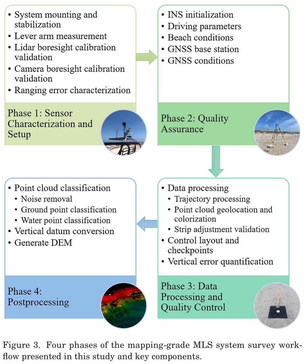
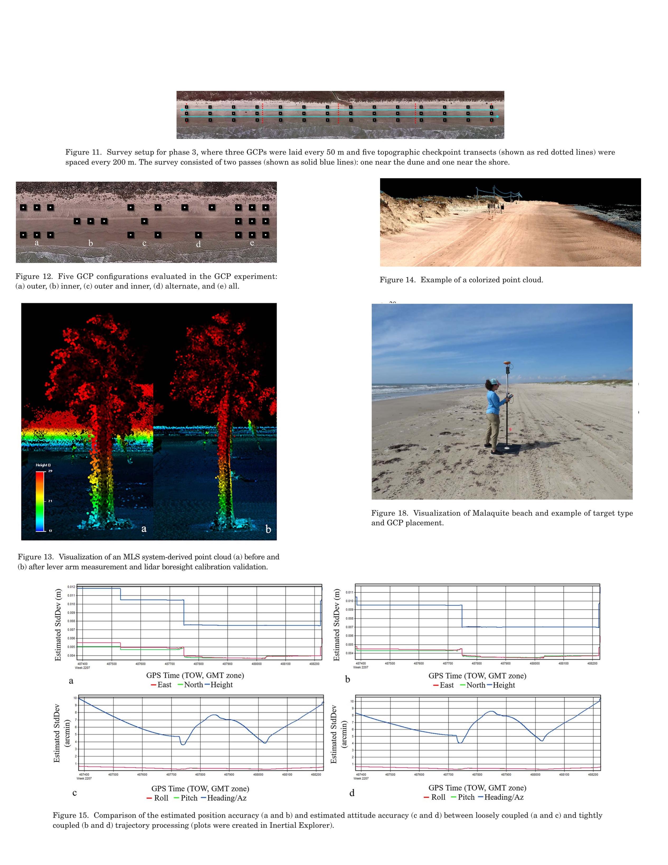
Development Of An Optimized Survey Workflow For Sandy Beaches With Mapping-Grade Mobile LIDAR
--
https://doi.org/10.2112/JCOASTRES-D-24-00056.1 <-- shared paper
--
#GIS #spatial #mapping #beach #sandy #coast #coastal #corridor #surveying #remotesensing #LiDAR #workflow #calibration #HiWayMapper #vehicle #UTV #4wd dataprocessing #postprocessing #GNSS #navigation #imagery #pointcloud #dunes #foredunes #geomorphology #geomorphometry #rmse #error #accuracy #precision #evaluation #metrics #shoreline #seasonal #dynamics #marine #waves #erosion #deposition


OpenGeoAI - Artificial Intelligence for Geospatial Data
--
https://opengeoai.org/ <-- OpenGeoAI home page
--
https://github.com/opengeos/geoai <-- shared #GitHub #repository
--
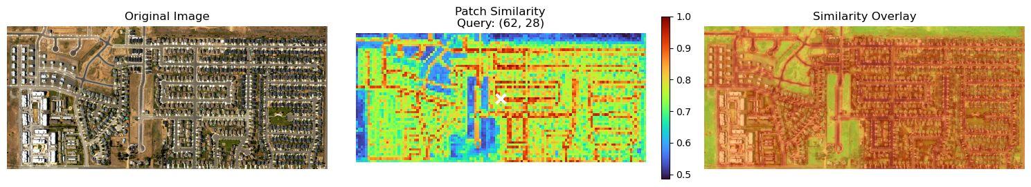
“[A] powerful new capability is coming to the GeoAI Python package: finding similar features in remote sensing imagery with DINOv3.
This feature leverages the DINOv3 pre-trained model to find similar features in remote sensing imagery with a single click…”
#GIS #spatial #mapping #dinov3 #GeoAI #AI #python #library #github #remotesensing #processing #imagery #comparasion #machinelearning #LiDAR #pointcloud #vector #model #modeling #earthobservation #software #opensource #geoai


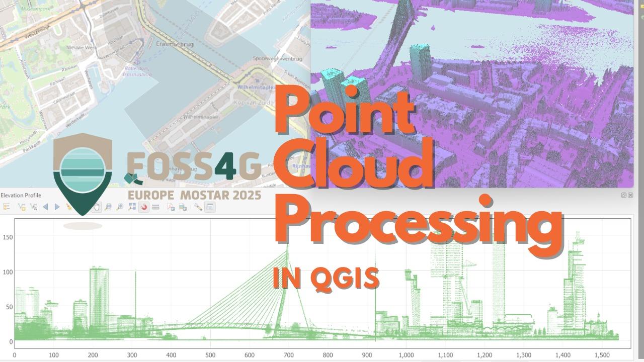
🚀 Today, I'm running a workshop on #PointCloud Processing in #QGIS at #FOSS4GEurope 2025 in #Mostar! We'll dive into the newest features in QGIS. 💻 Can’t join in person? Free access at @gisopencourseware.bsky.social: courses.gisopencourseware.org

🚀 Today, I'm running a workshop on #PointCloud Processing in #QGIS at #FOSS4GEurope 2025 in #Mostar! We'll dive into:
🔹️ Downloading & preprocessing data
🔹️ Creating DSMs with interpolation
🔹️ 3D visualization & styling
🔹️ Elevation profiles & filtering
🔹️ Automation with #PDAL Wrench
🔹️ Editing point clouds
💻 Can’t join in person? Free access at @gisocw
🔗https://courses.gisopencourseware.org/

Every once in a while I get to play with #Blender #b3d on a weekend. These are my favorite days! Here is the result of messing around with a #pointcloud #scan of a historic saw mill in my home town, then messing with things in #GeometryNodes

Sie möchten eine PointCloud mit CloudCompare bearbeiten, wissen aber nicht, wie Sie starten?☁️
Unser Azubi Jannik hat genau dafür ein leicht verständliches Tutorial geschrieben!
Von der Installation unter Linux bis zum Zuschneiden, Einfärben und Speichern Ihrer Punktwolke – alles Schritt für Schritt und mit vielen Screenshots. Perfekt für alle, die mit 3D-Daten arbeiten wollen. 🗺️
Jetzt im Blog lesen: 👇
https://wheregroup.com/blog/details/verarbeiten-einer-pointcloud-mit-cloudcompare/
#PointCloud #CloudCompare #Tutorial #OpenSource #MapComponents

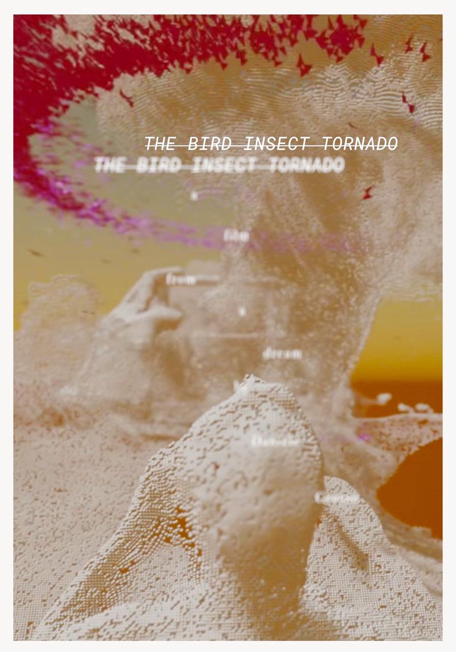
A poster for a 90 seconds film about a dream. I've made it to take part in the "Dream Animation Festival".
#mywork #art #animation #dream #blender #3D #pointcloud #boids #particles

Updated my 3D render, left my GTX1070 running for 18 hours...
#blender #blender3d #3drender #3d #video #bumper #audio #AV #pointcloud #3dmodelling #3dmodel #wyrd #creativity
I made a preroll for my plex movies...except, after rendering from blender, I realised that I'd changed the aspect ratio, so I'll need to re-render it again when I have a spare 12 hours.
#blender #plex #bumper #prerolls #3d #pointcloud #animation #physics #simulation
The Affordable DIY Mandeye Lidar System For Surveying Caves, And How To Convert 3D Clouds Into Traditional Cave Ground Plans And Extended Profiles
--
https://doi.org/10.5038/1827-806X.53.3.2535 <-- shared paper
--
#GIS #spatial #mapping #LiDAR #cave #cavediving #cavemapping #speleology #workflow #survey #remotesensing #pointcloud #mobilemapping #3Dmapping #profile #model #modeling #3dmodel #opensource #openhardware #reproducible #affordable #DIY #Mandeye

(@)"Takashi Yoshinama" [LinkedIn]: #augmentedreality #mixedreality #VirtualReality #metaquest #metaquest3 #pointcloud
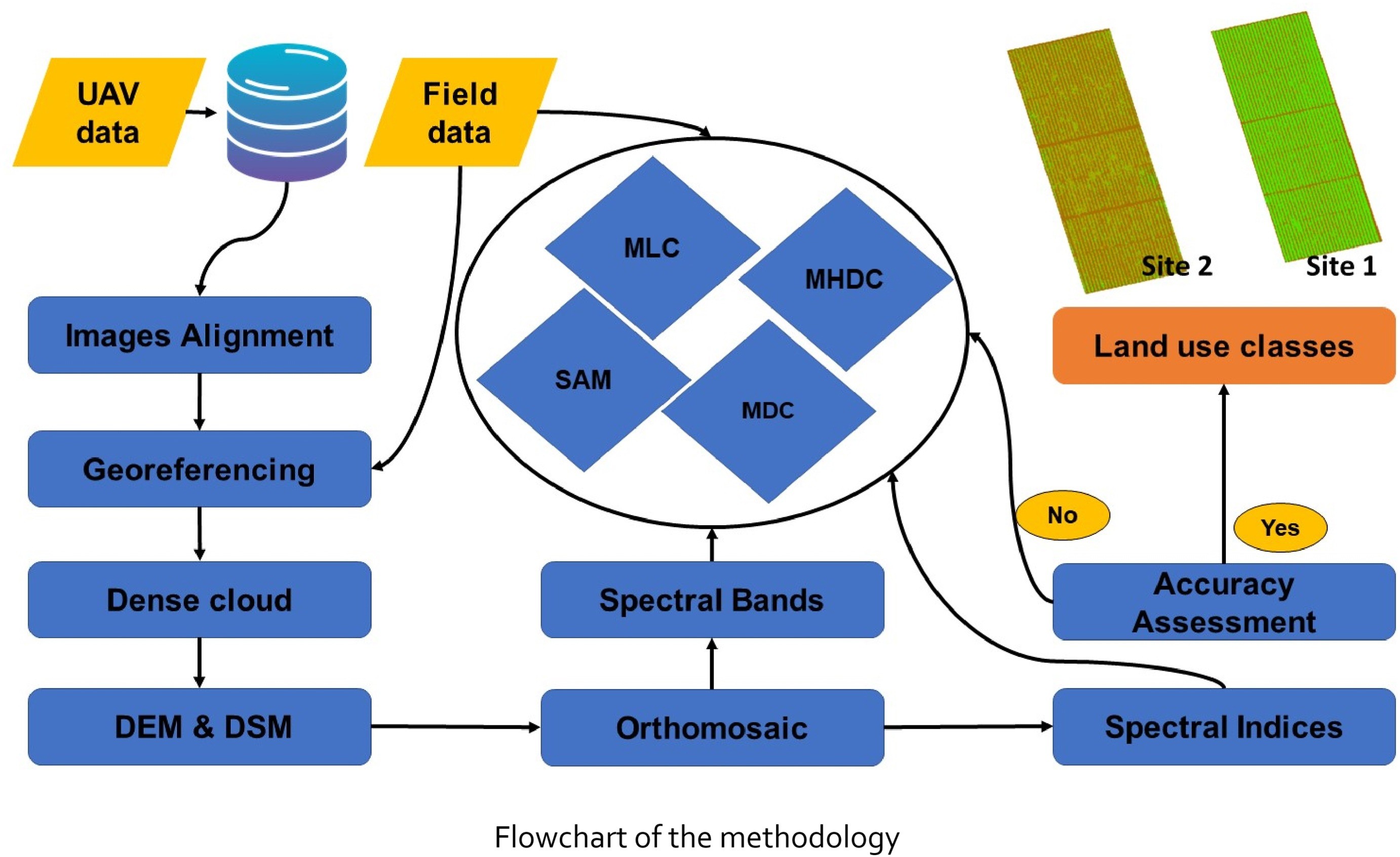
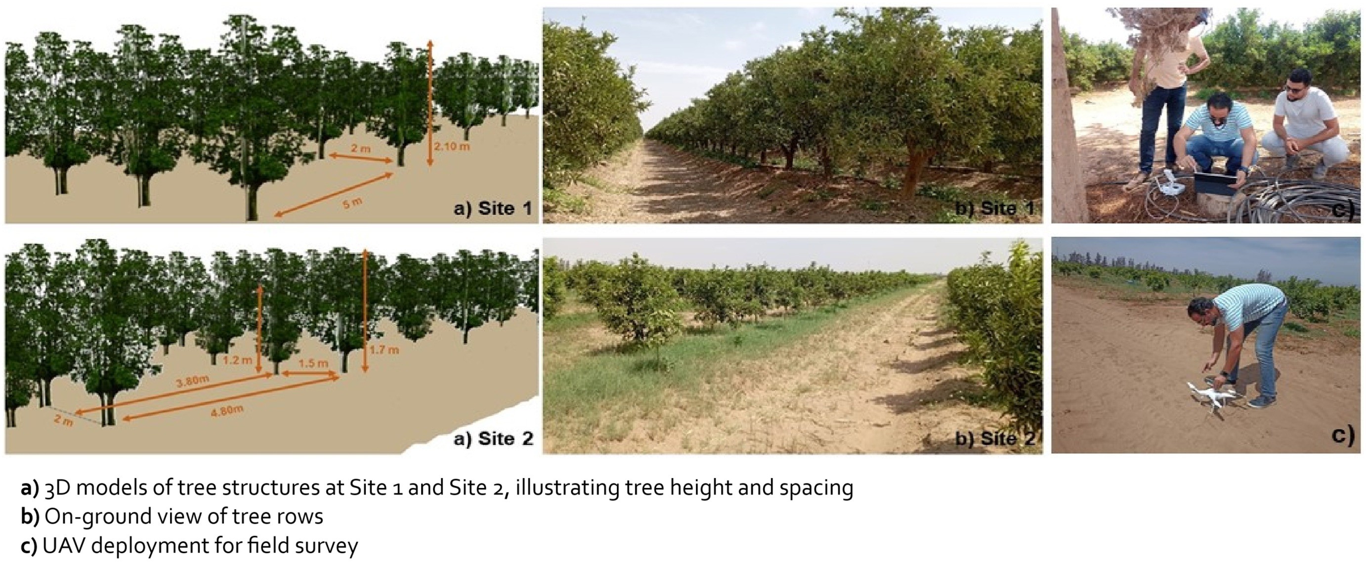
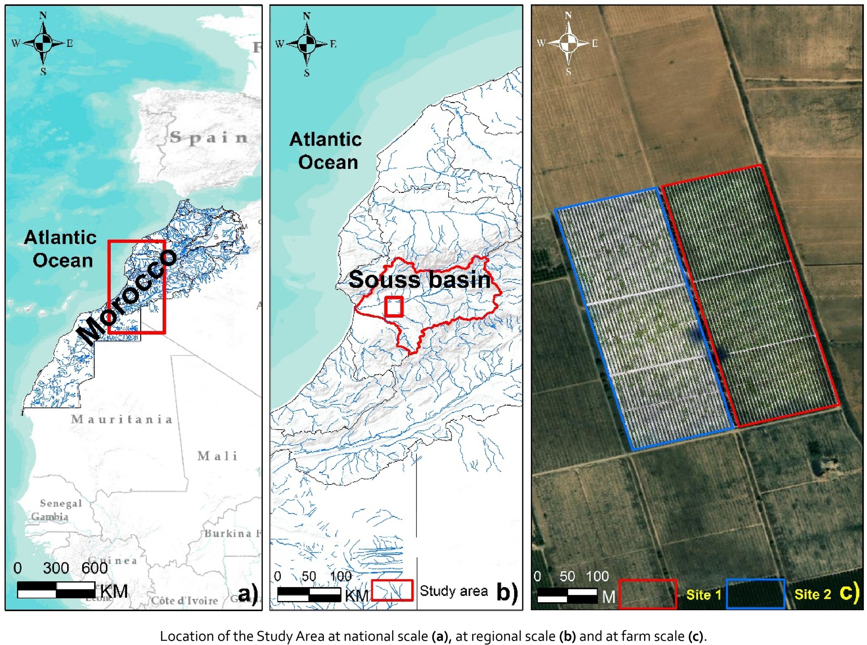
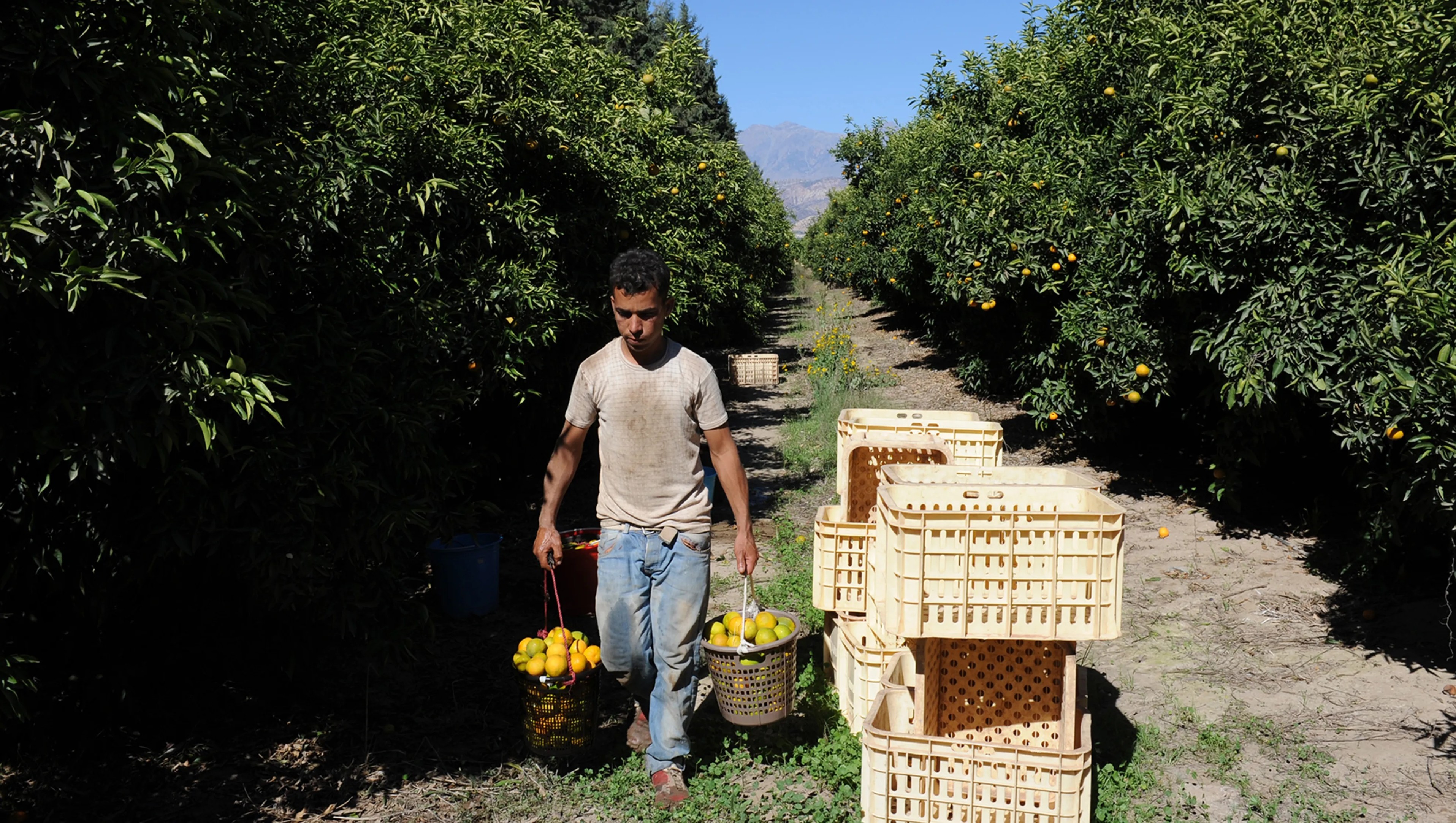
Weeds Detection In A Citrus Orchard Using Multispectral UAV Data And Machine Learning Algorithms - A Case Study From Souss-Massa Basin, Morocco
--
https://doi.org/10.1016/j.rsase.2025.101553 <-- shared paper
--
#GIS #spatial #mapping #seedsdetection #citrusorchard #unmannedaerialvehicle #UAV #multispectralsensors #machinelearning #AI #modeling #model #deeplearning #agriculture #orchard #SoussMassa #Morocco ##citrus #groundcontrol #pointcloud #DSM #imagery #NDVI #NDWI #MLC #data #production #food #management #water #hydrology #fertiliser

#PointCloud on the world map – now live with #MapComponents!
Our new demo shows how a point cloud can be placed on a map and dynamically adjusted. With the GPU-powered https://deck.gl PointCloudLayer and seamless MapComponents integration, analyzing large data sets is effortless.
🔹 Dynamic PointCloud customization
🔹 Connecting #deckgl with MapLibre
🔹 Full compatibility with MapComponents
👉 Try it now: https://catalogue.mapcomponents.org/de/component-detail/PointCloud
📚 Learn more: https://github.com/mapcomponents/react-map-components-apps/tree/main/pointcloud
Client Info
Server: https://mastodon.social
Version: 2025.07
Repository: https://github.com/cyevgeniy/lmst