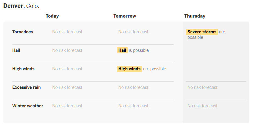
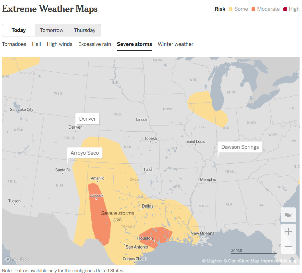
Extreme Weather Maps - Track the Risks for Your [USA] Places [NYT]
--
https://www.nytimes.com/interactive/2023/us/extreme-weather-forecast-maps.html <-- shared media article / technical resource
--
“[The NYTs is ] monitoring the possibility of extreme weather in places that are important to you...
When forecasters see a risk of tornadoes, hail, high winds, excessive rain, hurricanes, tropical storms or winter storm conditions for any of the places you care about, [they will] send you a morning email to help you plan ahead…"
#GIS #spatial #mapping #USA #extremeweather #weather #risk #hazard #naturalhazard #publicsafety #dangerousweather #risklevel #forecasting #tornado #hail #excessiverain #flood #flooding #extremesnow #ice #hurricane #tropicalstorm #winterstorm #resource #publichealth #NationalWeatherService #StormPredictionCenter #WeatherPredictionCenter #yellow #orange #red #prediction #notifaction
@nytimes @nwsspc_bot @nws
#risklevel
Client Info
Server: https://mastodon.social
Version: 2025.04
Repository: https://github.com/cyevgeniy/lmst