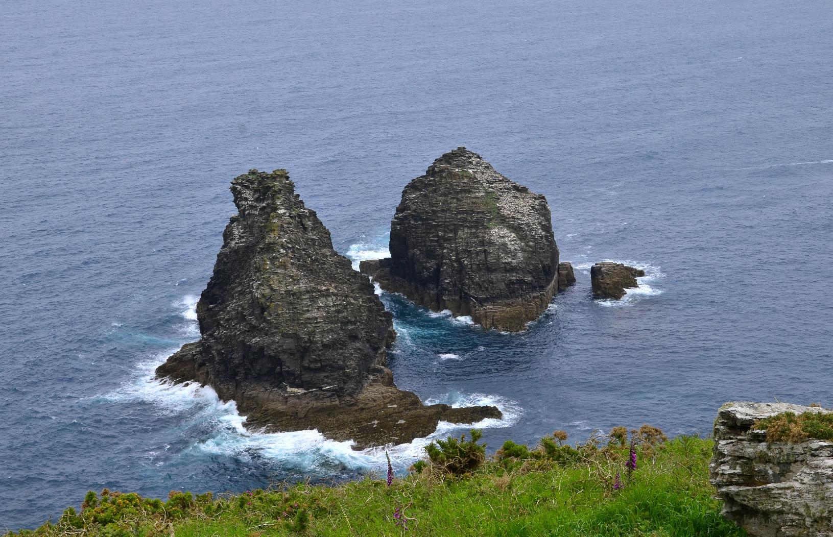
Just north of the #headland are two large rocks which are called #TheSisters according to my #OSMap. A safe place for #gulls to congregate.
#MyWork #MyPhoto #CCBYSA #DSLR #Nikon #D7000 #Android #Spring #Hiking
Just north of the #headland are two large rocks which are called #TheSisters according to my #OSMap. A safe place for #gulls to congregate.
#MyWork #MyPhoto #CCBYSA #DSLR #Nikon #D7000 #Android #Spring #Hiking
@ralpho
mit der deutschen #OpenStreetMap Karte geht das
https://openstreetmap.de/karte/
Alternativ gibts auch noch #osMap
https://www.osmap.de/
For the #walking trip from #DulvertonToTarrSteps, I planned it using and #OrdnanceSurveyMap or #OSMap. I prefer using these tried-and-trusted methods for #hiking since they are less prone to #TechonolgyFailures and it forces you to consider what you will encounter, rather than always be looking at your #mobile.
@whatzaname @Lyle 100% I use physical maps still. Unfortunately they are often 10+ years out of date because map companies were crushed. Augmenting with #openStreetMap or #OSMap (in offline mode, pre-downloaded) helps.
Once we passed this #StoneCircle, I knew we were on the right track as it’s marked on the #OSMap. The journey from there was quite straightforward, although still another 5-6 km to go.
The last leg of the journey was on a main road, without a separate footpath but just before getting onto that, I looked at the path we’d taken and also to the other side of Dartmoor.
#MyWork #MyPhoto #CCBYSA #DSLR #Nikon #D7000 #Summer #Countryside #Moorland
#OpenStreetMap visualizza normalmente i nomi degli stati e delle città nella loro lingua originale, ma per visualizzarli in italiano si può andare qui:
▶️ Italiano: https://www.osmappa.it
E nelle altre lingue...
▶️ Inglese: https://www.osmap.uk/
▶️ Francese: https://www.osmap.fr/
▶️ Tedesco: https://www.osmap.de/
▶️ Spagnolo: osmap.es
#OSM #OSMAP #mappe @scuola @maupao @informapirata @euklidiadas @wikimediaitalia @napo
C'est moi ou on ne peut plus modifier #osmap avec @OrganicMapsApp ?
#osMap ofrece #mapas en línea en nueve idiomas diferentes basados en datos © de colaboradores de #OpenStreetMap con licencia de base de datos abierta de #OpenData #Commons (ODbL).
https://osmap.info/