#OpenTracks

Das Wetter war sehr durchwachsen, aber die Graveltour hat trotzdem Spaß gemacht.
Zu doof, dass ich mich nach über 40 Kilometer vor der eigenen Haustür mit dem Bike auf die Klappe gelegt habe.

Dafür gab's dann im Anschluss leckeren Kuchen, ganz nach @NoNoBrainer Manier.

fittrackee.de/workouts/N9amB2t

#gravel #gravelbike #niederlande #scott #scottbikes #fittrackee #opentracks

Ein helles Gravelbike steht angelehnt an einem Picknicktisch. Im Hintergrund ein Radweg.
slackline :emacs: :orgmode:slackline
2025-11-28

Start of the year I set myself an arbitrary goal of running 1000km, reached that by end of August so added 500km. Tuesday I passed the 1500km mark.

All runs from not to end of Dec are a bonus.

Enjoying my running usually 10-14km 4 times a week and averaging ~11.50km/h

Best of all...no injuries (few niggles but kept under control, Pilates helps)

All tracked using and logged using @FitTrackee

Bar chart showing distance run in km by month.

2024-12 91.65km
2025-01 115.82km
2025-02 118.23km
2025-03 137.30km
2025-04 132.51km
2025-05 132.15km
2025-06 129.48km
2025-07 109.19km (low due to climbing holiday)
2025-08 127.72km
2025-09 154.71km
2025-10 173.82km
2025-11 182.60km and counting (will get one more run in before 2025-12)
Bar chart showing distance run in km by year.

2019 553.74km
2020 1430.21km
2021 963.84km
2022 1266.38km
2023 721.18km
2024 674.42km
2025 1513.57km and counting...
Philip Gillißenguerda@ruhr.social
2025-11-27

I recorded a gpx track with #OpenTracks. Not sure if I'm missing something but I'm not seeing a way to use that track in #Vespucci. Any idea how that could work?

#OpenStreetMap

ghose 🍉 👣ghose@gts.xmgz.eu
2025-10-25

#Opentracks +OSM Dashboard (mapas en liña pa non complicarse de inicio, se o usas moito pois descargas o mapa ao dispositivo)

https://f-droid.org/packages/de.dennisguse.opentracks.playstore

@fedello @roicou

ghose 🍉 👣ghose@gts.xmgz.eu
2025-10-21

Opentracks

Engade marcadores mentras gravas as túas actividades, paseos, rutas, etc.

#opentracks para :android: : https://opentracksapp.com

#hiking #walking #cycling #sendeirismo #camiñar #natureza

captura de pantalla da aplicación opentracks onde mostra a interface para engadir a posición dun lugar, un marcador que gardas na aplicación, ao que lle podes engadir unha foto e un texto explicativo, para lembralo posteriormente e/ou compartilo

@ascentale @rasterweb @bikenite A5: I use the open source tool OpenTracks (Android) to track all my tours. Afterwards I upload these GPX files to strava, because I haven't decided between @endurain and @FitTrackee, yet (and want to migrate all my sports history since 2009 in this process).
#OpenTracksApp #OpenTracks #bikenite

Sam Whitedsam@social.coop
2025-09-05

@ascentale @TicklishHoneyBee @bikenite I don't really use anything except a basic (non-bicycle-specific) mapping app (@CoMaps) if I need general directions (the bicycle directions don't really work since #OSM data isn't great around here). I also use #OpenTracks to record my rides, but that's more for seeing where I went later than for directions or routing.

Mostly I'm just pretty good about thinking where I was trying to go, then heading in that general direction.

#BikeNite

@phranck My cycling companions: Tracking with #Opentracks, which has visualisation onboard.
For further visualisation I upload the tracks to my selfhostet #Fittrackee instance.
You can check it out here: fittrackee.de

2025-08-08

#Moin. Kann mir wer mit guten #FDroid -#Android -#Apps -Kenntnissen helfen?

Ich habe einen #OpenTracks -#Track und #Osmand installiert. Aber #OpenTracksApp kann mir das nicht als #Karte ausgeben, weil angeblich keine App installiert sei, die die API unterstützt? 🤷 Was kann ich tun?
Ich will den Track in #OsmandApp haben...
#fedihelp_de #fedihelp #fedihelpde

Zuschnitt eines Screenshots aus OpenTracks. Es kommt die unvollständige Fehlermeldung: "Es ist kein Anwendung installiert, die die OpenTracks Dashboard API u...".
2025-07-26
@clickhere @JasonLee
On Android, two open source tracking apps are #FitoTrack and #OpenTracks, both are available on F-Droid.

I used the former for a couple years before getting a Garmin GPS device.

As for web-based tools, I think #FitTrackee more closely resembles Strava than #Wanderer does, but it can only be self-hosted. FitTrackee seems more focused on personal stats; Wanderer is focused on sharing trails.
Marcos Dionemdione@en.osm.town
2025-07-16

#OpenTracks for recording #hiking and #biking tracks. I'm slowly uploading some tracks for sharing via my #NextCloud
#Baba for taking and uploading GPS'd pics (disabled on main camera app), but also testing #Panoramax's
MyGeo for sharing location (yes, because it includes gmaps links; geo: support is terrible).
2 night sky apps, they're great! #stellarium
NeoStumbler for adding wifi and 4G towers to #BeaconDB.
SatStat for quickly checking something about GPS.

/end

#OpenStreetMap

2025-07-03

Dneska jsem shodou okolností zjistil, že se mi podařilo u #BoneConduction sluchátek #Mojawa #HaptiFit Terra propojit snímač tepovky s #OpenTracks

Stačí se připojit k zařízení "HT" a o zbytek se postará appka.

Nenechte se zviklat tím, že zpočátku nic nehlásí - chce to čas, chytne se.

Graf OpenTracks se zobrazenou tepovou frekvencíStatistika OpenTracks průměrnou a maximální tepovou frekvencí
2025-06-29

Hey peps,

I could use some testing for a maintenance change in #OpenTracks.
This is mainly the export and the automatic export (instant post-workout export).

Everything should be working, but i would love to get some feedback on this as breaking the export is a huge pain.

Code is here: github.com/OpenTracksApp/OpenT

axolotl solidarioaxolotl@kolektiva.social
2025-06-26

#Visualizing #biking (and some #walking) routes. #OpenTracks for the #gps #mapping. #Qgis for the render. Had trouble with the #kml and #kmz formats but #gpx worked fine. Cropped in #gimp

/////////////////

#Visualizando rutas de #bici (y un poco de #caminar). Usé OpenTracks para el gps y Qgis para el render. No me funcionaron los formatos kml o kmz pero gpx si.

#opensource #foss #badsecurityculture

2025-05-19

#android #FOSS folks, is there a gap in the automated #DataExport / #backup space?

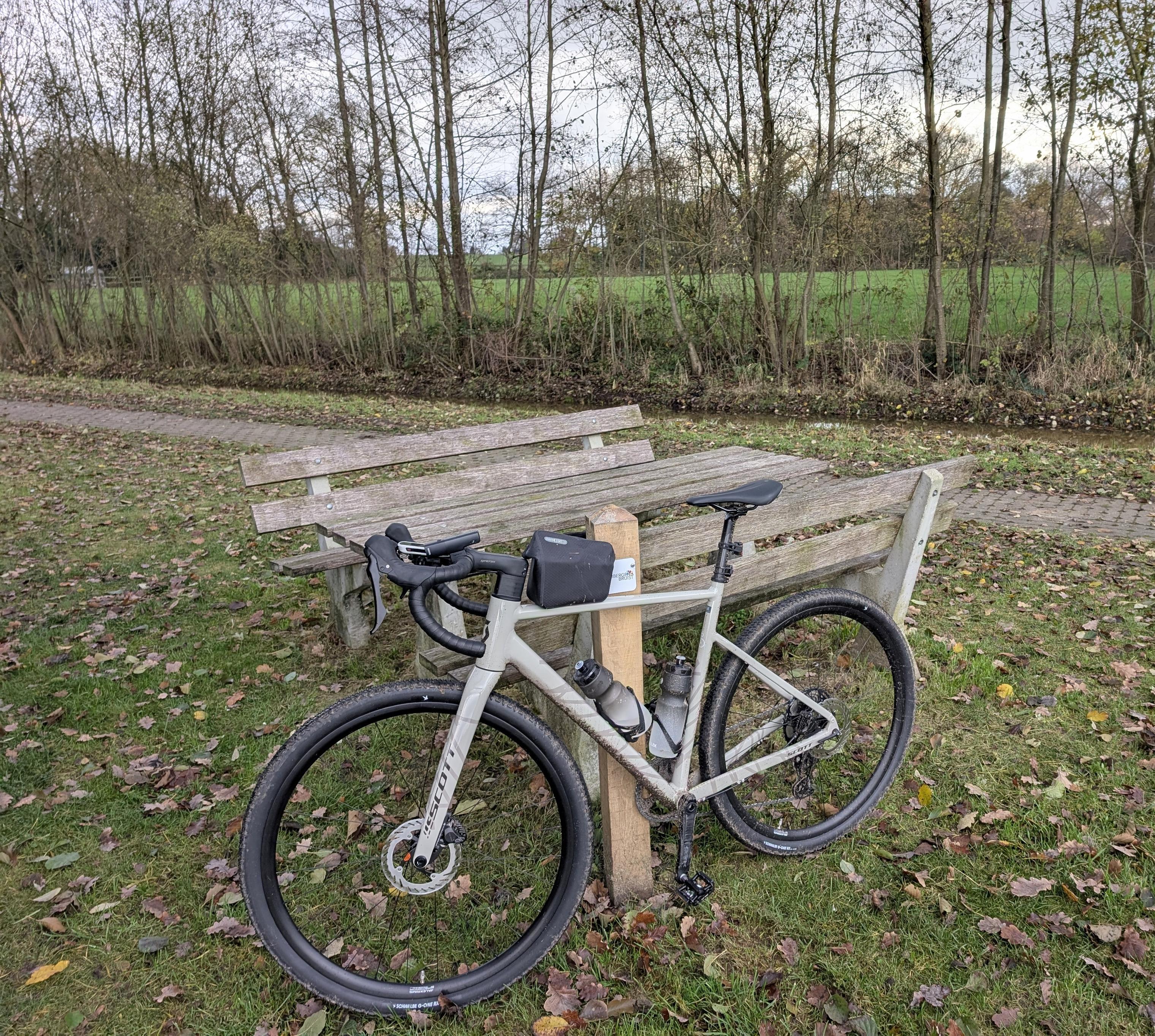
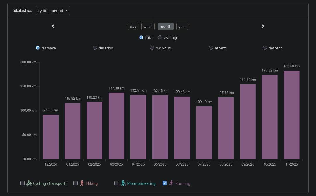
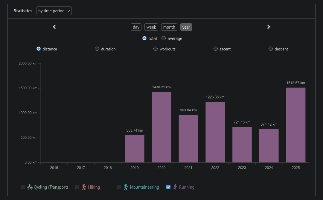
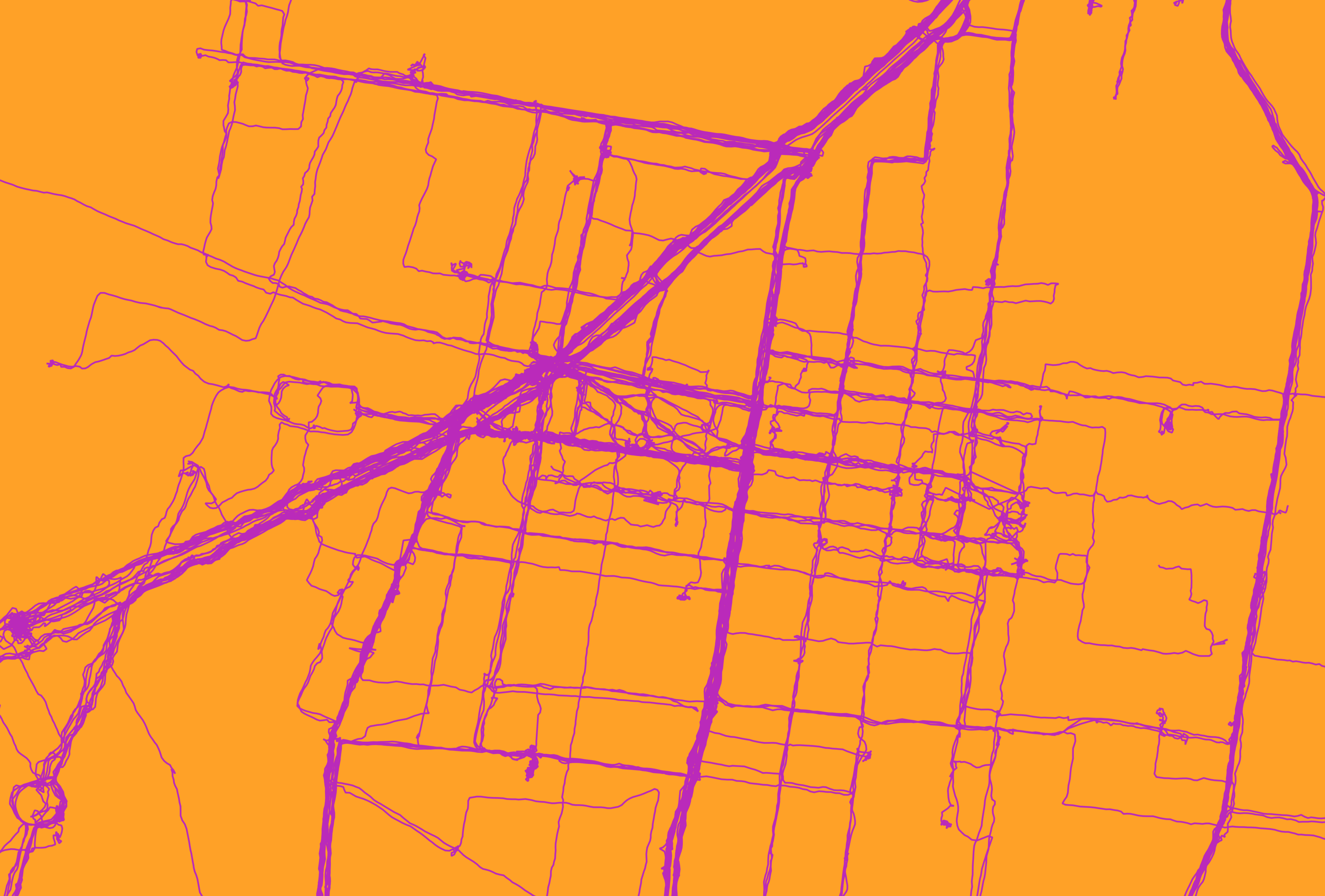
I use #OpenTracks to track fitness activities (it's not quite the Google Fit replacement I was hoping it would be: See github.com/OpenTracksApp/OpenT) and #OsmAndMaps, and I use Nextcloud. However, backing up my cycling/walking/running tracks from OpenTracks and my bookmarks from OsmAnd to Nextcloud requires manual action.

If this is indeed a gap, I was thinking of putting up an open source recurring automated data export protocol for public comment.

1. Any data producing app (like OpenTracks) can include a small library that implements the protocol, allowing users to define the automated recurring data export frequency, how many old backups to keep etc.
2. Any data backup app (like Nextcloud) can include a different library that broadcasts an intent at a regular frequency that all protocol-compliant data producing apps can handle. When the broadcast is received, data producers can generate/hand over the file(s) to be backed up by the data backup app.

I'm tempted to build a #WebDAV-compliant open source app as well (as an example of a protocol-compliant data backup app) but that might be a grand undertaking.

Thoughts?

#DataSovereignty #decentralization #androiddev #opensource #OSM

une famille à vélounefamilleavelo@masto.bike
2025-05-05

J'ai testé l'application OpenTracks (trouvée sur FDroid) pour enregistrer des traces GPS. Le hic c'est qu'elle ne gère pas les tunnels. Donc il y a un segment avant, un segment après, mais pas d'option pour extrapoler une ligne entre les deux. Les autres applications font comment ?
Bon en vrai ce n'est pas bien grave parce que le but c'est plutôt de mémoriser les sentiers quand je pars pédaler le nez au vent. Mais c'est quand même dommage.

#vélo #gps #OrganicMaps #Osmand #OpenTracks

Poujol 𝖱𝗈𝗌𝗍 ✅poujolrost@mstdn.jp
2025-03-25

@ftregan

J'utilise #OpenTracks @opentrack @Mastodon.social , avec en plus “OSM Dashbord (Offline)„ pour avoir une carte. (J'ai galéré à configurer d'une les deux.)
opentracksapp.com

Sinon, le greffon « enregistrement d'itinéraires » sur OSMAnd.
osmand.net/docs/user/plugins/t

#marche #randonnée #10000pas #wellness #app

Florian WeckerleFloW@freiburg.social
2025-03-13

Meine #MTB Fahrten tracke ich mit einer Smartwatch über GPS. Die gpx Datei exportiere ich von #Gadgetbridge zu #Opentracks.
Durch das #OSMDashboard für open tracks kann ich eine offline Karte anzeigen lassen.Es fehlen leider Höhendaten und Steigungen in der vorhandenen Karte. Vermutlich gibt es Karten des Schwarzwaldes (insbesondere Region Freiburg), die solche Daten dabei haben? #openstreetmap ? Wo finde ich die? Hat mir da vlt jemand eine Quelle? Oder Idee?
@mastobikes_de

edit: also, mein Ziel: nämlich die Steigungen an bestimmten Stellen meines gefahrenen Tracks zu analysieren ist wunderbar mit #OSMand zu erreichen.

Einen exportierten gpx track kann ich dortdirekt importieren und Details anzeigen lassen.

Der Lösungsansatz via #opentracks und #OSMDashboard ist hinfällig bzw nicht notwendig.

Vielen Dank! für die vielen Hinweise und Ideen, die schlußendlich die richtige RIchtung wiesen.

Client Info

Server: https://mastodon.social
Version: 2025.07
Repository: https://github.com/cyevgeniy/lmst