Py3DEP [hydroclimate analysis]
--
https://pypi.org/project/py3dep/ <-- link to app / resources
--
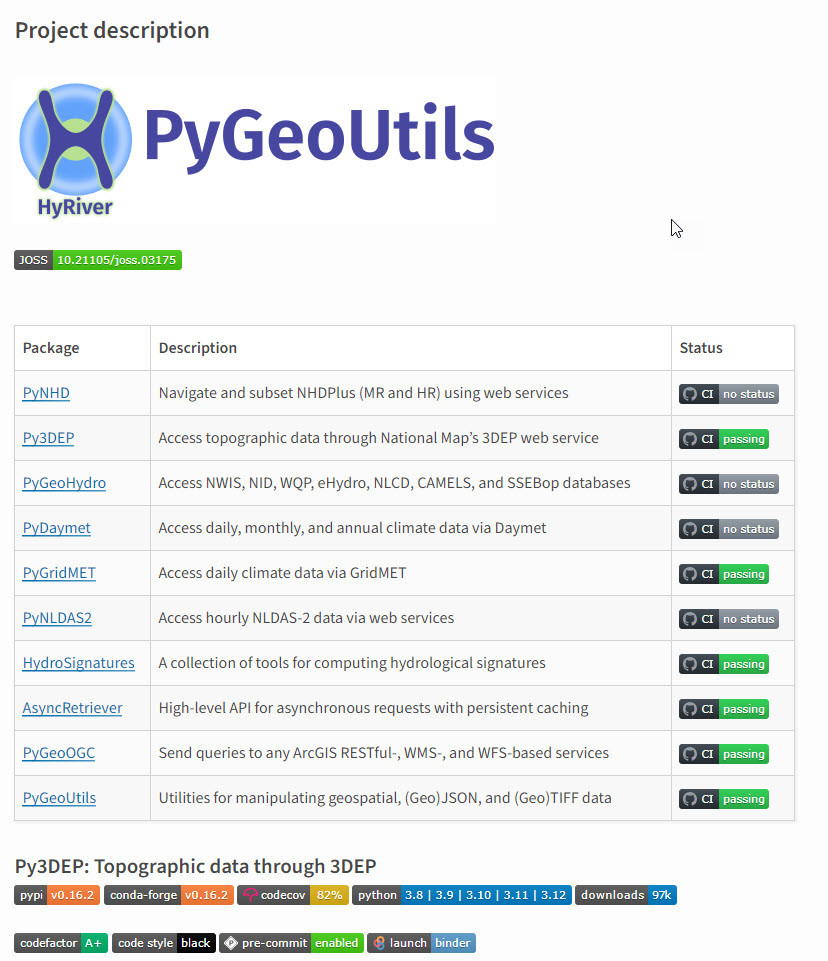
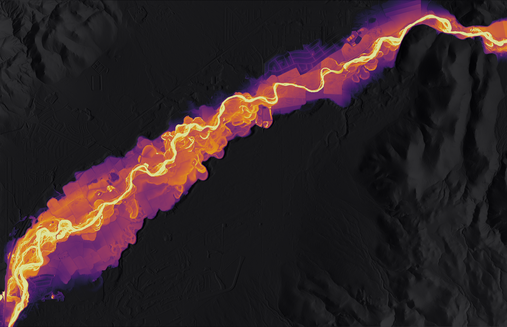
“Py3DEP is a part of [PyGeoUtils] HyRiver software stack that is designed to aid in hydroclimate analysis through web services. This package provides access to the 3DEP database which is a part of the National Map services. The 3DEP service has multi-resolution sources and depending on the user-provided resolution, the data is resampled on the server-side based on all the available data sources. Py3DEP returns the requests as xarray dataset…”
#GIS #spatial #mapping #Py3DEP #PyGeoUtils #HyRiver #softwarestack #elevation #3DEP #USGS #NationalMap #opendata #processing #spatialanalysis #hydroclimate #water #hydrology #webservices #xarray
@HyRiver @USGS
#PyGeoUtils
Client Info
Server: https://mastodon.social
Version: 2025.04
Repository: https://github.com/cyevgeniy/lmst