
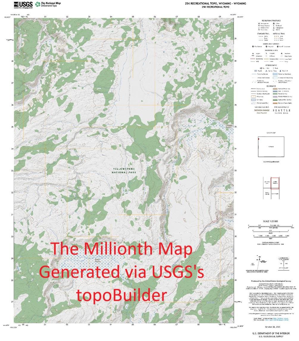
USGS topoBuilder Milestone of 1 Million Maps Delivered
--
https://www.usgs.gov/programs/national-geospatial-program/topobuilder <-- USGS topoBuilder Open Source / Open Data creation page, make your own custom USGS ‘topo map’!
--
“Each year, [the #USGS has] seen steady growth in map requests, underscoring the public’s trust and appreciation for these innovative products.
This [USGS topoBuilder Milestone of 1 Million Maps Delivered] is a testament to the dedication and expertise of colleagues across the National Geospatial Program and the National Geospatial Technical Operations Center. The success of topoBuilder is built on the collective efforts behind The National Map...
[The USGS] has modernized and advanced #topographic mapping…”
#GIS #spatial #mapping #NGP #NGTOC #usecase #fedscience #fedservive #topomap #ondemand #custom #USGS #topobuilder #opendata #publicservice #publicgood #milestone #TNM #NationalMap #free #recreation #usecase #agriculture #hiking
@USGS
#NationalMap


Adding 3D Elevation Program's Dynamic Elevation Web Coverage Services To ArcGIS Pro And AGOL [training video]
--
https://www.usgs.gov/ngp-user-engagement-office/news/new-training-video-dynamic-elevation-service-arcgis-pro-and-agol <-- shared technical article
--
https://youtu.be/sDEMHT2CmZw?si=u90-966VvslM6RXc <-- shared video
--
https://www.usgs.gov/3d-elevation-program/about-3dep-products-services <-- about 3DEP products & services
--
https://apps.nationalmap.gov/services/ <-- link to USGS National Map Web Services
--
#GIS #spatial #mapping #elevation #LiDAR #ifSAR #3dep #ArcGISPro #AGOL #training #video #learning #NationalMap #services #raster #topography #opendata #DynamicElevationWebCoverageService #DigitalElevationModels #DEM #DTM #onlinelearning #tutorial
@USGS


USGS Releases New Topographic Maps For Puerto Rico & The U.S. Virgin Islands – Updated Maps For Essential Needs
--
https://www.usgs.gov/programs/national-geospatial-program/news/usgs-releases-new-topographic-maps-puerto-rico-and-us <-- shared article
--
https://apps.nationalmap.gov/downloader/ <-- USGS National Map Downloader
--
https://www.usgs.gov/programs/national-geospatial-program/topobuilder <-- USGS OnDemand Topo
--
#GIS #spatial #mapping #cartography #PuertoRico #USVI #USVirginIslands #topomaps #20K #UStopomaps #topographic #map #NationalMap #TheNationalMap #TNM #NationalMapCorp #volunteers
@USGS


Lesson 10k1 - Using LiDARExplorer [USGS National Map training video]
--
https://youtu.be/36cfnwFWzj4?si=Ne5uk_jjbAjIaSGE <-- shared technical tutorial video
--
https://apps.nationalmap.gov/lidar-explorer/#/ <-- link to USGS app
--
https://www.usgs.gov/3d-elevation-program <-- USGS 3DEP home page
--
“This [USGS] National Map training video is an introduction to using the LidarExplorer application to easily access lidar data and derived products. In LidarExplorer, you can search for lidar projects, digital elevation models, and lidar point cloud files to meet your needs…”
#GIS #spatial #mapping #remotesensing #LiDAR #LidarExplorer #app #webmap #data #opendata #NationalMap #training #video #tutorial #selfhelp #onlinelearning #3dep #US #USA #DEM #elevation
@USGS


Py3DEP [hydroclimate analysis]
--
https://pypi.org/project/py3dep/ <-- link to app / resources
--
“Py3DEP is a part of [PyGeoUtils] HyRiver software stack that is designed to aid in hydroclimate analysis through web services. This package provides access to the 3DEP database which is a part of the National Map services. The 3DEP service has multi-resolution sources and depending on the user-provided resolution, the data is resampled on the server-side based on all the available data sources. Py3DEP returns the requests as xarray dataset…”
#GIS #spatial #mapping #Py3DEP #PyGeoUtils #HyRiver #softwarestack #elevation #3DEP #USGS #NationalMap #opendata #processing #spatialanalysis #hydroclimate #water #hydrology #webservices #xarray
@HyRiver @USGS

