FOSS4G 2025 Auckland recap: QField is production infrastructure now.
The pattern across deployments: QGIS Desktop → QField (offline) → QFieldCloud → Enterprise APIs
Not "can this work?" anymore. It's "how do we optimize this workflow?"
FOSS4G 2025 Auckland recap: QField is production infrastructure now.
The pattern across deployments: QGIS Desktop → QField (offline) → QFieldCloud → Enterprise APIs
Not "can this work?" anymore. It's "how do we optimize this workflow?"

🖼️ #Qalendrier - jour 23
Aujourd'hui on fête la sortie de QField 4, au travers de cette référence géomusicale de 1979 🪩

Hi fellow #Qfield users,
I need your help to find a good name for a small QField plugin I’m building.
It automatically reopens a form after saving, making fast data entry much easier.
Right now, I’m hesitating between two ideas:
- QuickEntry
- BoxBox!
Which one would you choose? If you have any other ideas, let me know!
I like to verify my remote-sensing results directly in the field. Besides basic self-validation, field walks often generate new ideas and hypotheses.
For mobile field GIS, I use QField, loading both final map layers and custom templates for data collection.
Here’s an example from Nose Hill Park, where I checked several locations that showed a consistent NDVI increase in 2025 compared to 2024.
Field observations help confirm whether the spectral trends match real vegetation changes on the ground.
#RemoteSensing #EarthObservation #GIS #QGIS #QField #NDVI #VegetationMonitoring #Sentinel2 #FieldWork #GeoSpatial #OpenData #GeoDataScience #UrbanEcology #Calgary #NoseHillPark #Alberta #Canada #Copernicus #CopernicusSentinel #GreennessOfCalgary


We were delighted to join the @georomandie in Lausanne on November 13th.
It was great to present @qfield, #QGIS, #Georama, and #Egeniouss, and to connect with so many engaged geospatial professionals.
Thanks to everyone for the inspiring conversations and your interest in open-source innovation!
#opensource #qgis #qfield #qfieldcloud #georama #fieldwork #horizoneurope #innovation #geolocation #smartcities #lausanne #gis

I’m super excited to head to @FOSS4G2025 next week, and honestly amazed by what you can do with #QField nowadays.
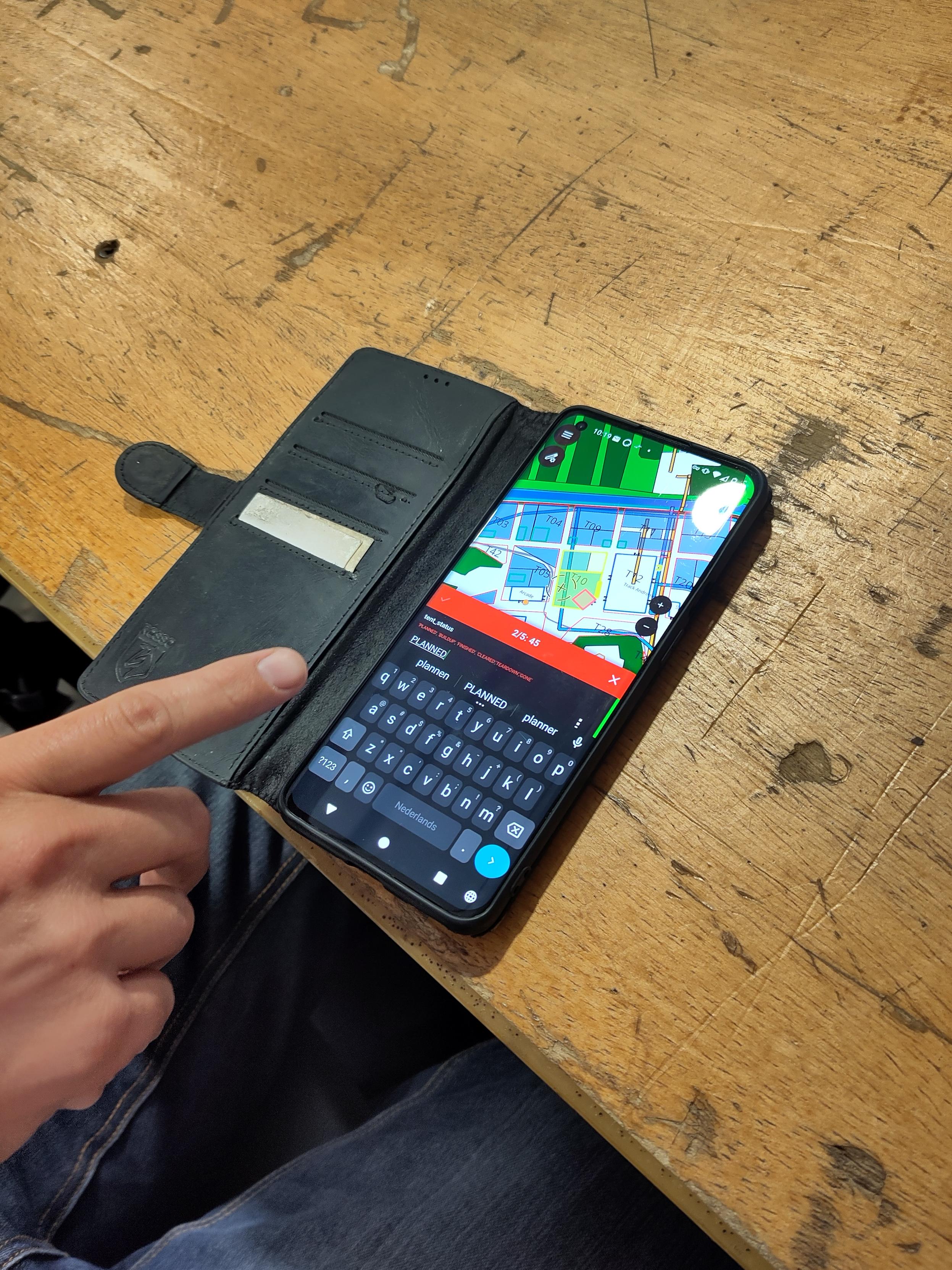
The QField-based conference app gives you a searchable schedule, multi-floor room maps, real-time transport info, points of interest, and a private place for your own notes and photos — all offline 🚀
Just install @qfield and go to https://onelink.to/foss4g25
See you there!
Ein Blick in die #Ratinger Wälder mit einem FFH #Naturschutzgebiet und Besonders geschützten Biotopen wie dem Dickelsbach. Das ist ein wirklich sehr schöner Weg zur Arbeit, den ich von Essen nach Ratingen zurücklege. Die Karte ist mit #QGis und #QField erstellt.


Hey masto, I am looking to purchase a rugged tablet for #GIS applications (#QGIS, #QField) in #archaeology (mainly to work in caves, where humidity can reach 90%). I am looking for a model that can run Ubuntu (not Windows or Android). Ruggtek seems to sell what I'm looking for (https://www.ruggtek.com/en/product/rtl613/). Do you have any other recommendations? All feedback is welcome! #gischat
cc @jeremy
Vom Papierbogen zum digitalen Qualitätsmonitoring 🗺️🖥️
Für die Deutsche Wanderverband Service GmbH (DWV) haben wir eine Geodaten-Infrastruktur entwickelt, mit der Wanderwege digital und präzise erfasst werden. So wird die Qualität effizient geprüft und Zertifizierungen laufen schneller – ein Meilenstein für den DWV. 💪
Ein Workflow aus #Mapbender, #QGIS, #QField, #QFieldCloud und #PostGIS sorgt für strukturierte Datenerfassung und Auswertung.

Lesen Sie den @wheregroup Blogartikel zu #QField und #Mapbender sowie #QGIS2Mapbender im Einsatz bei der Deutsche Wanderverband Service GmbH zur Erfassung von Daten und dem Qualitätsmonitoring von Wanderwegen des #DWV. 🚀
👉🏻 https://wheregroup.com/blog/details/entwicklung-eines-geodatenbasierten-digitalen-qualitaetsmonitorings-fuer-die-deutsche-wanderverband-service-gmbh/
#FOSSGIS #FOSS4G #OSGeo #QGIS #GIS #WebGIS #QFieldCloud

I forgot to post this. The organizers at #WHY2025 had been using #QField, #QGIS and #Postgresql for the festival's spatial planning!
I can't fault this stack. But I vaguely remember them telling about new features they would have enjoyed.
I hope they will share their experience on an NL-based or international GIS event.
New favourite companions when doing field work. (Bt GNSS+NTRIP+TCP Server->#QField)

What a day at the #QGISch User Meeting 2025 in Bern! 🗺️💚
We were thrilled to:
🧩 Present updates on #QGIS4
📱 Share the latest in #QField
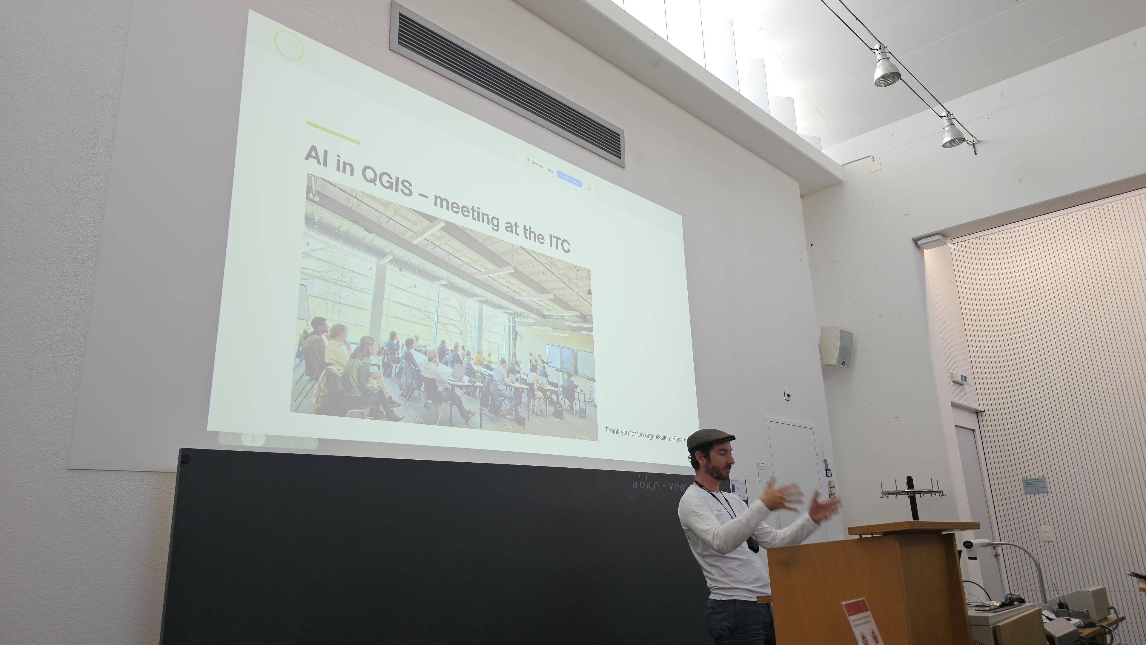
🧠 Explore #AI & ML in QGIS
🛠️ Co-present TEKSI module tools
🌍 Host a full QField workshop (25 participants!)
🛡️ Support the #QGIS Security Project
A big thanks to the organisers & community!
#OpenSource #GIS #QFieldCloud #ModelBaker #Geospatial #FOSS4G #OSGeo


📣 We're proud to support the @qgis User Conference 2025 in Norrköping with something special: a custom-built Conference app in #QField!
✅ Searchable schedule
✅ Floor selector
✅ Real-time public transport
✅ Restaurants, hotels & more
✅ A memory layer for your notes
All offline (except real-time data). Just install the latest QField and grab the app here 👉 https://onelink.to/uc-2025
Big thanks to the organisers for the great collaboration – see you in the field!
@mbernasocchi on QField: A recent #Mapscaping podcast episode features Marco Bernasocchi who shares the story behind #QField – a mobile app for field data collection. Marco Bernasocchi discusses the evolution of QField and QFieldCloud, #QGIS and the broader open-source movement.
https://spatialists.ch/posts/2025/05-04-marco-bernasocchi-on-qfield/ #GIS #GISchat #geospatial #SwissGIS
We’ve spent the last 10 years building powerful open-source geospatial tools — and we’re just getting started 💚
The next decade will be all about deepening our impact, growing our community, and continuing to push the boundaries of what’s possible in the field and geospatial tech.
Want to be part of the journey?
👉 Join our newsletter https://buff.ly/n3g6c6a to stay in the loop, share your voice, and shape the future with us.
A few weeks back, we marked 10 years of https://OPENGIS.ch with our wonderful clients and partners 💚
Stories, smiles… and fondue 🫕
Because teamwork, like fondue, is best when everyone contributes.
Ready to be part of what’s next? Let’s work together → https://opengis.ch


We turned 10! 🎉
A decade of #opensource GIS, community-driven dev & building a company rooted in transparency, sustainability & collaboration.
We’re proud to be #QField makers and the top two contributors to #QGIS, having shaped it into the world-class GIS it is today.
Our values:🌱 Give back🌍 Love nature🟰 Reduce inequalities❤️ Our team – our heart[h]
Thanks to everyone who's been part of the journey. Here's to the next 10! 💚


We’re proud to be leading the pack in sponsoring QGIS User Conference 2025 – a key event for the global open-source GIS community! 🌍
Using and building open-source is great — but sustaining it financially is just as important. That’s how we keep projects like QGIS & QField healthy and thriving. 💚
See you in Norrköping, Sweden this June!
🔗 https://uc2025.qgis.org/
#QGIS #QField #FOSS4G #OpenSourceGIS #QGISUC2025

Used Python to quickly scrape megalithic.co.uk to get 75 prehistoric sites in Shetland, download shetland.gov.uk's paths and routes shapefiles, then upload them all to my phone with QField and an Thunderforest topo map...
Megalithic basic API: https://www.megalithic.co.uk/modules.php?op=modload&name=FAQ&file=index&myfaq=yes&id_cat=26&categories=Query%2Bthe%2BMegalithic%2BPortal%2BAPI
Shetland Access Routes & Core Paths: https://www.shetland.gov.uk/downloads/download/18/access-routes-and-core-paths-map-data
Thunderforest: https://www.thunderforest.com/docs/map-tiles-api/
QField https://qfield.org/