@froufox I actually did #fieldWork for it by going to casinos to learn what people considered when betting… it was fun and a lot of free food
#FieldWork
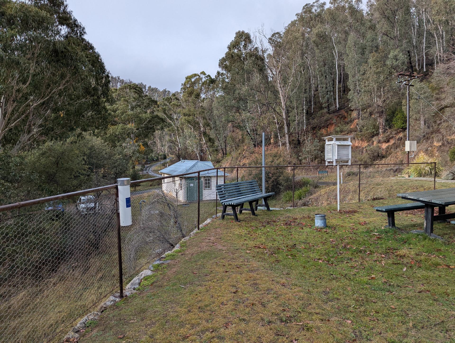
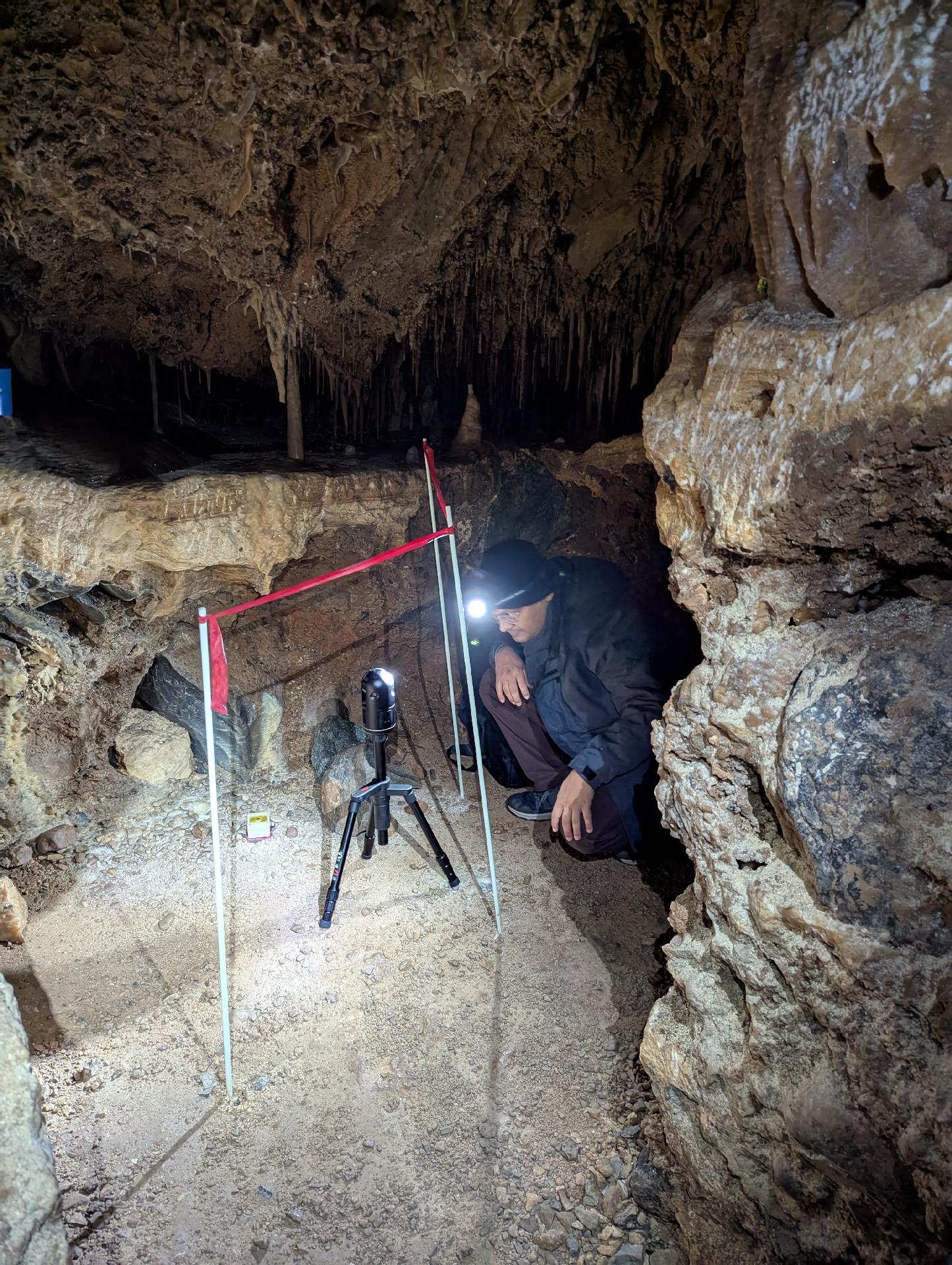
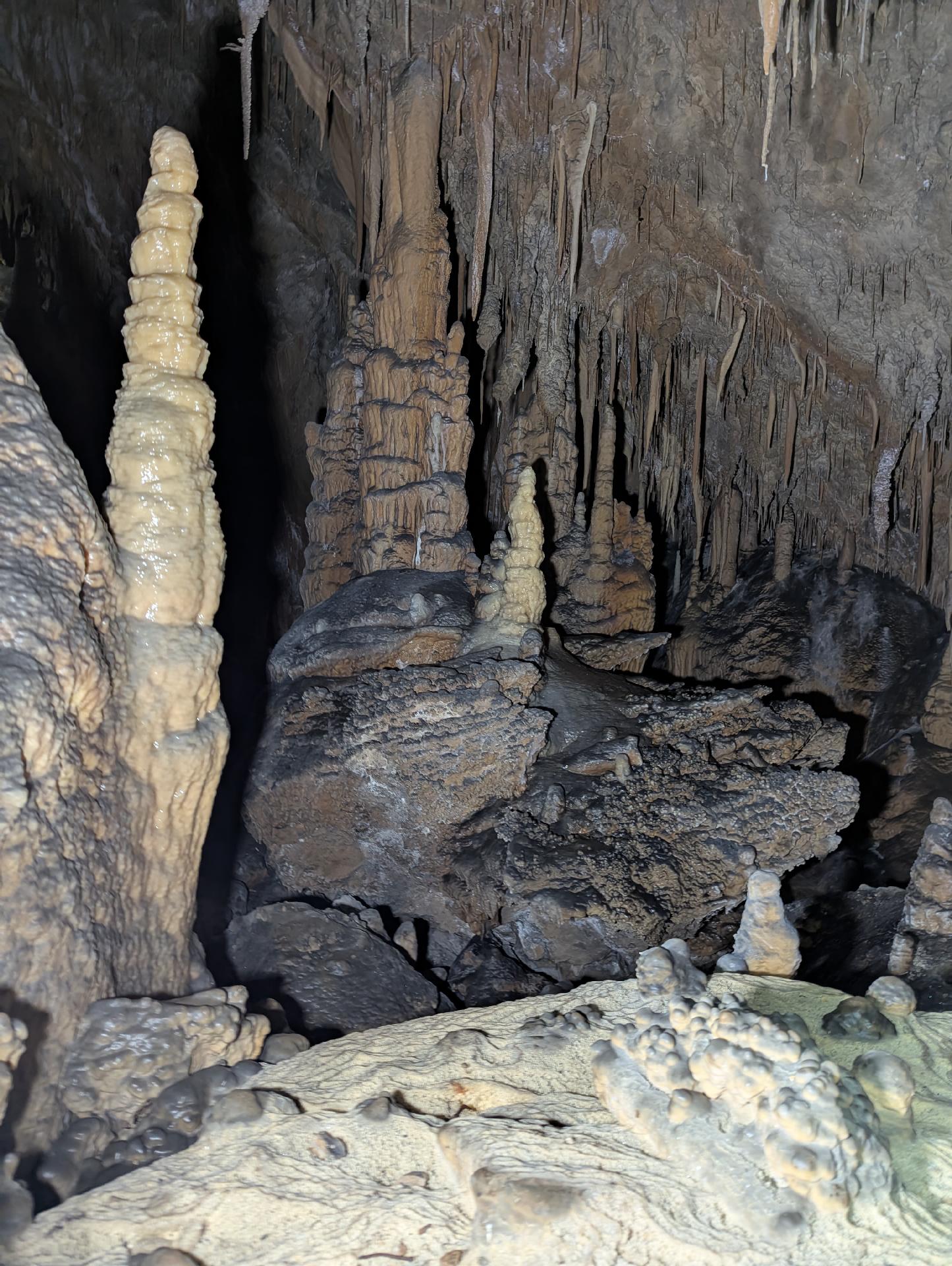
Snowy Mountains fieldwork today: Lidar cave scanning, hydrology logger downloads, pluvimate installation,.. plus snow, windblown dust, roo and a well earned curry.
#fieldwork #academia
TFW you've spent ages trying to solve a tricky problem and it. just. does. not. work. You take a break, come back, try something new, nope still nothi... Wait! It's there, there it is! That's the data...
🥳🎊
That is why we love doing #science and in an increasingly packed day, the opportunity to work away uninterrupted* on a focused problem is increasingly rare. *That's* why I love fieldwork...
Details in a #FieldDiary soon.
*Uninterrupted time helped today by failure of all internet + phone communication in Qaanaaq..
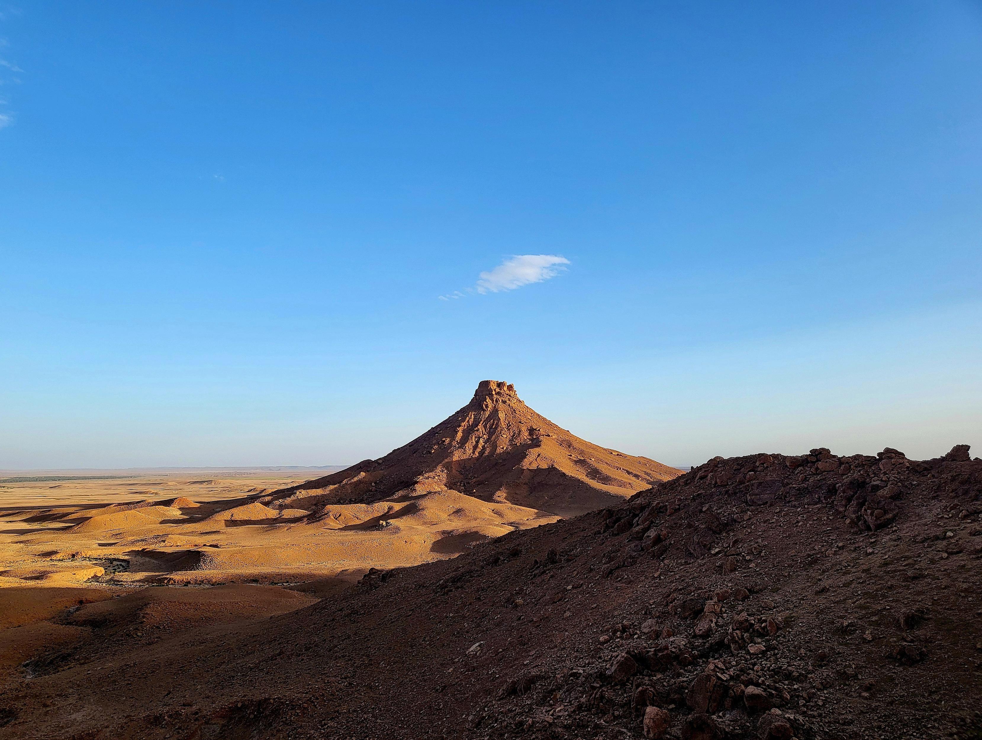
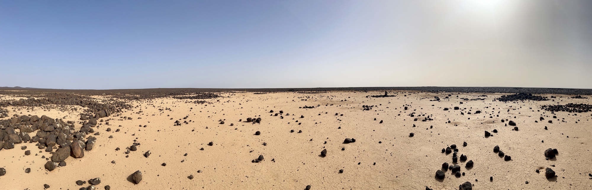
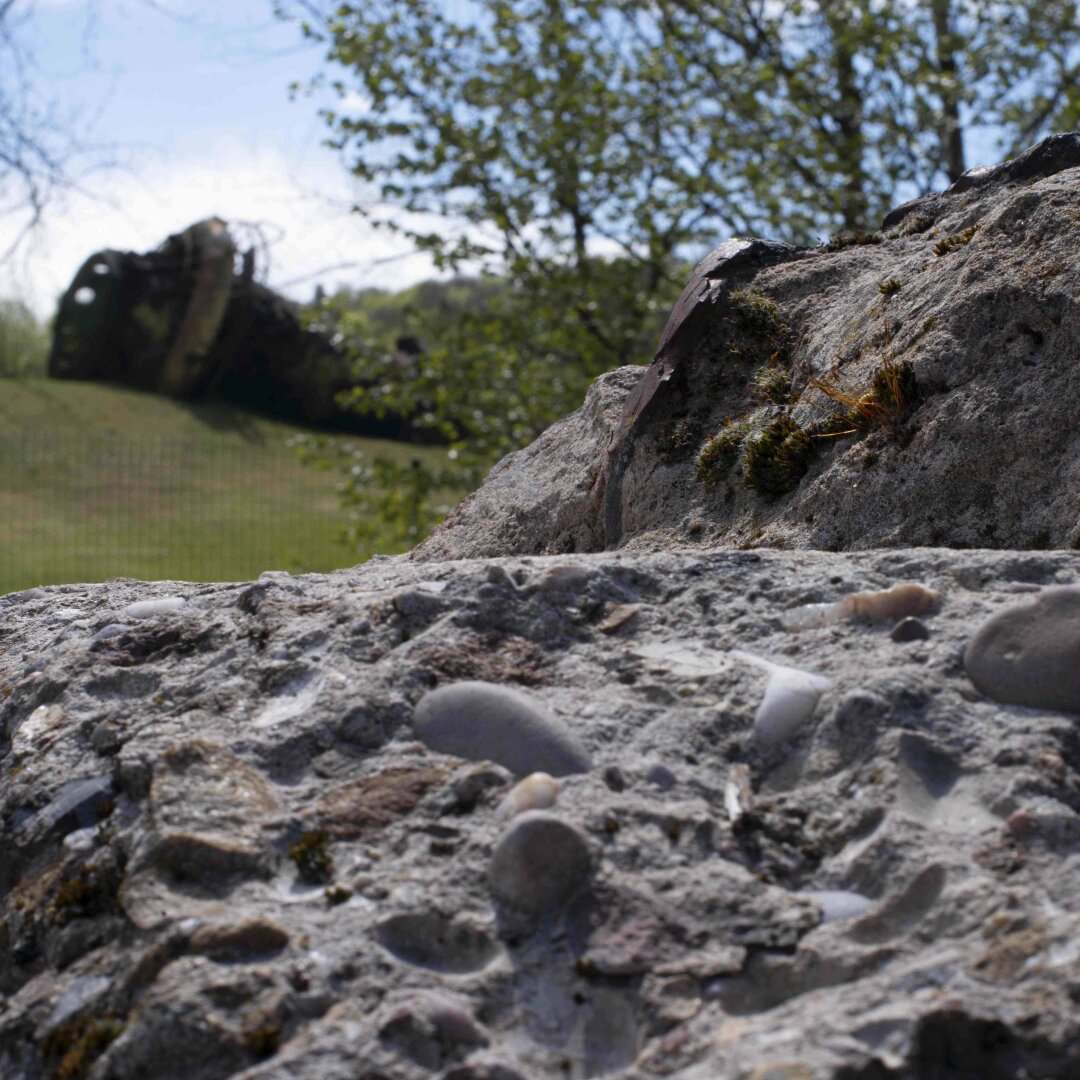
Afternoon in the Kem Kem.
#paleontology #fieldwork #spinosaurus #exploration #landscapes #sahara #kemkem #morocco
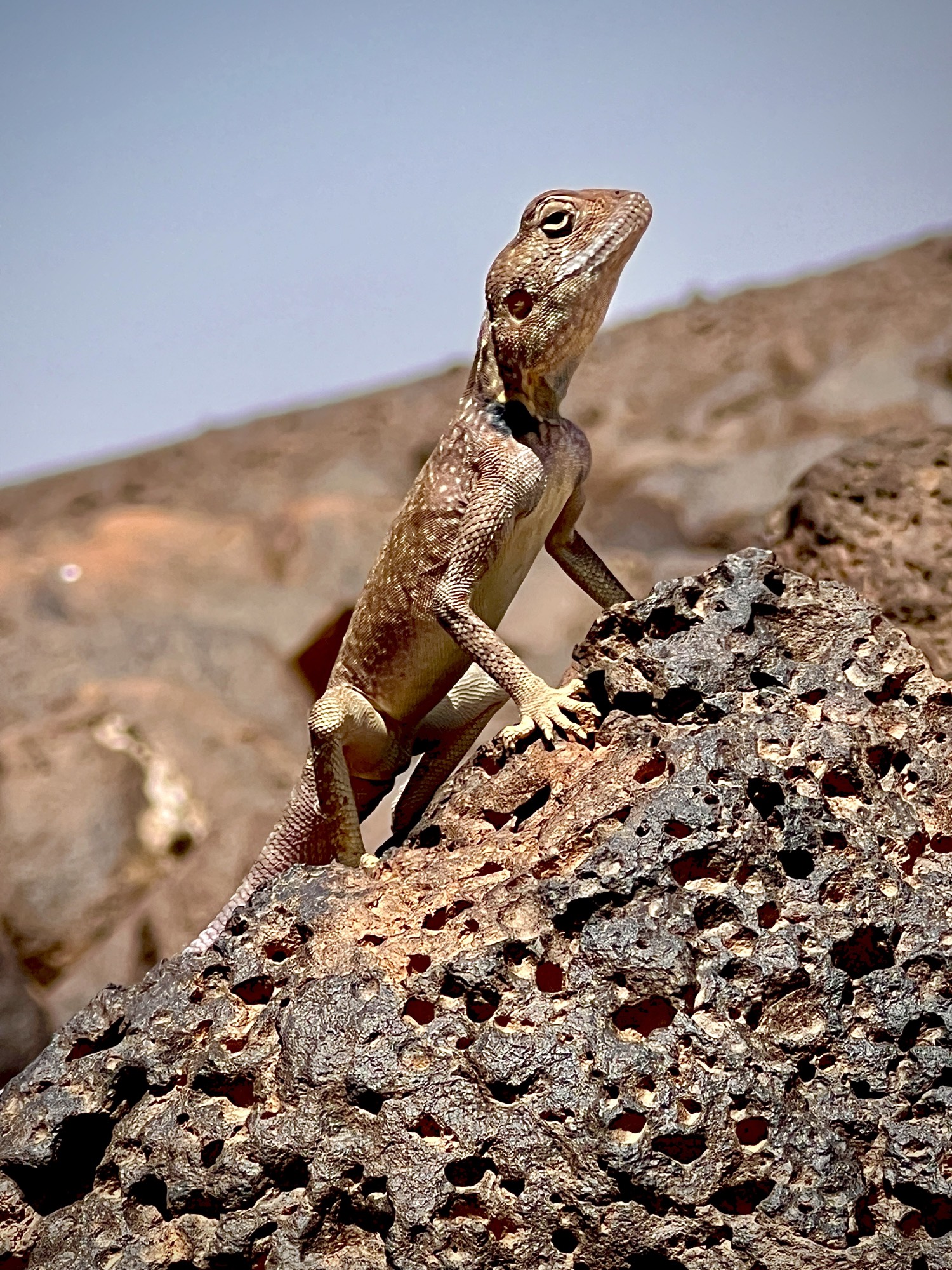
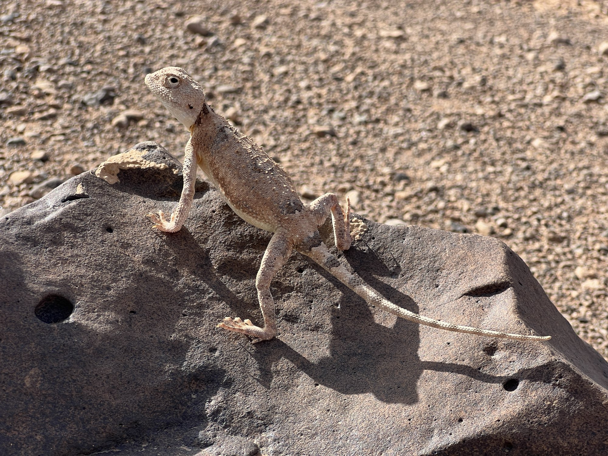
Makin friends, eastern Jordan 2025 This agama let me get real close with my cell phone and then struck quite the pose. #Fieldwork #Jordan #agama
Field Diary 2025
I very rarely have time to write a proper field diary, our time in the field is usually extremely hectic and filled with 12-18 hour working days that blend seamlessly together. I suspect this week is also going to be busy, but Nature has offered an olive branch in the shape of an early break-up of the sea ice, so I’m taking a moment to write a few things down. Updates will be posted at the top so scroll down to read the first day.
Day 4
Day 4 was pretty typical of the highs and lows of fieldwork. We finished (or I should say my colleagues finished) a new mounting for the snow site logger box so hopefully the icing problem will be reduced, we (re-)installed all the instruments except for the new loggers and generally tidied up. It’s looking pretty nice now. This was a high.
Part way through the reinstallation at the snow siteThen, I struggled and failed for about 4 hours to try and get the snow drift sensors to talk to the new logger. That was frustrating low. low. However, a walk around on the fast ice in the bay to try and take a new sea ice core was some valuable breathing space – a little bit of rewiring later and the first numbers started ticking in as planned…. Hurray! That was a high!
It’s immensely satisfying solving these kind of problems. And it was the first time I’ve programmed one of these loggers – new skills are also always rewarding to learn, even if the process is frustrating. I’ve learnt a lot about SDI-12 interfaces and how the instruments actually work too. I need to remember to give myself more deep work time back in the office too. It’s much more personally rewarding and advances the science much more than endless emails and meetings.
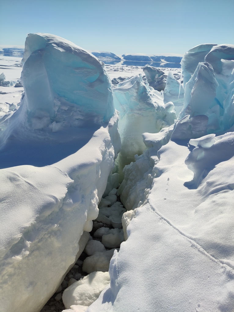
While the attempt to get an ice core was interesting, ultimately we failed due to very broken and uneven ice that made access with our kit too difficult – that was another low. I am simply counting the attempt as my evening walk, in which case maybe it counts as a high? I’ve often thought of Caspar David Friedrich’s famous Arctic paintings in the coastal part of the fast ice. It’s spectacularly fractured and churned up.
Where the fast ice meets the land…We also did lots of preparation for day 5’s trip to the local glacier, planned a final UAV structure-from-motion mapping campaign on land and got software working to download data on permafrost from sub-surface loggers for colleagues at the University of Copenhagen – that will all however have to wait until tomorrow, our last full day in the field. Today, we have a date with a tiny local glacier.
Day 3
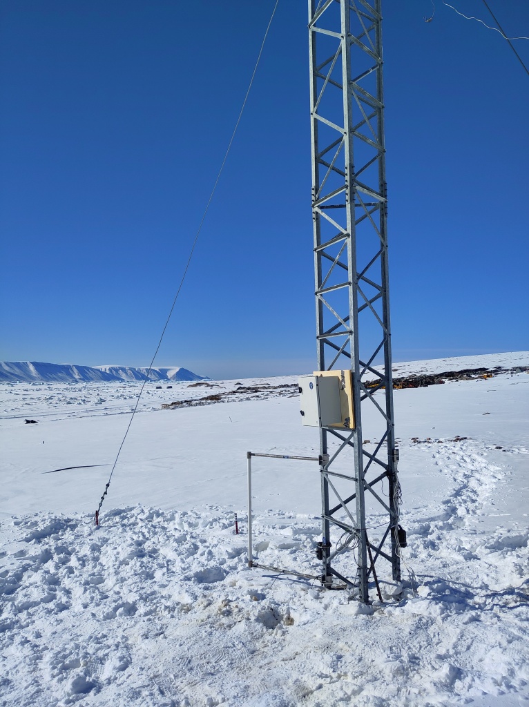
I’d originally assigned only one day in the fieldwork plan for the snow site work, but given we missed our prep day to go directly into the field, we have missed a few crucial steps, so we have been busy today trying to catch up, but mostly in the workshop here at the DMI geophysical facility in Qaanaaq with a couple of visits out to the snow site.
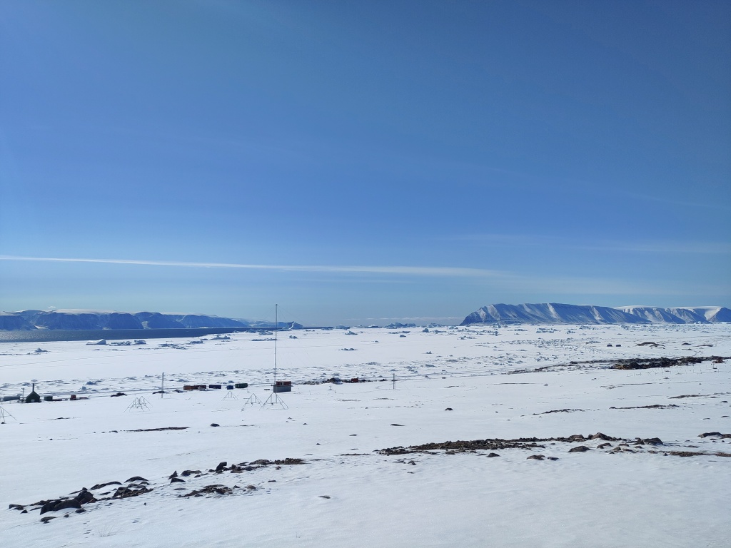
I realised I haven’t introduced the snow site.
View over towards the south west from the old ionospheric research station on the edge of Qaanaaq. Our snow site in the foreground. It has a great view, if you ignore the town dump at the coast!It is a small area on the edge of the village (unfortunately near the town dump, but otherwise perfect) where we are conducting a long-term (hopefully) series of observations – we’re currently only at the end of the first year so there are a few teething troubles to sort out. We’re installing a new logger for our snow drift sensors, adding a new snow cam and downloading data from the current one. We also have a standardised set of measurements of snow properties (density, temperature, reflectivity) that we carry out whenever time and opportunity permits, that we will hopefully use to better understand how the snowpack evolves through time. The land based side is a kind of complement to a longer set of observations I have from throughout the region – all point measurements made at rather random times so the constant monitoring site will hopefully help us to understand the wider context in space and time of those point data.
Snow is incredibly important in the Arctic: it forms an insulating layer over sea ice that prevents futher formation in the winter, but also helps to stop or delay surface melt in the spring and summer. On land the insulating properties also help to preserve vegetation, insects and mammals through the winter, with specific vegetation assemblages being very much determined by the local snow patterns. And that’s without even discussing the importance of snow to glaciers and ice sheets.
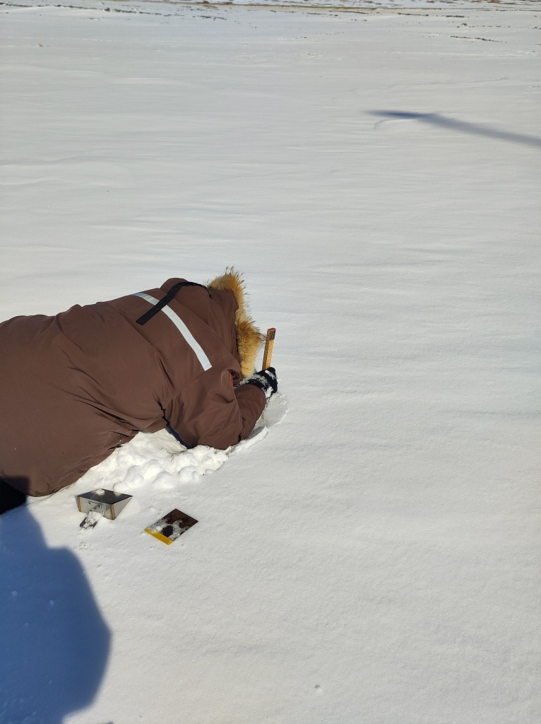
Do you want to do a snow pit? (I asked) Yes! said my colleague. It’s always good to get the modellers to understand just how hard observations can be.However, it turns out to be difficult to measure when it falls, difficult to work out how much blows around, challenging to model when it melts and when it refreezes and generally a larger than we’d hope uncertainty in weather and climate models. Much of the work developing parameterisations that describe snow properties has been done at lower latitudes too. High Arctic snow is certainly different in many respects to more southerly locations and that needs to be accounted for…
Hence the establishment of our snow programme. Which sounds rather big and impressive, but we’re hoping to set it up sufficiently smoothly this year that it will almost run itself with minimal input from us and assistance from colleagues. Let’s see, there are still some teething troubles to sort out.
The sea ice has now cleared out of a huge part of the bay in front of Qaanaaq and the hunters have been busy taking boats out from the edge of the ice so there are clearly narwhals expected soon. Although, we’ve spent most of the last two days indoors, I keep looking outside, hoping to see some of the marine mammals that visit here. There are already masses of sea birds arriving. Yesterday managed to spot a rather handsome snow goose couple on my evening walk at 11pm.
On my evening walk today I went to the very eastern edge of the town to get a look at the sea ice in the fjord – it’s quite clearly retreating rapidly now; much of the area we travelled over on Friday has gone.
View down Inglefield Fjord with the sea ice breaking up in the distanceDay 2
After Day 1’s rather hectic and busy time, Day 2 was assigned post-processing status. We had a slightly later than the 6am start yesterday, and put some serious effort into assessing our results from the previous day. That means downloading data, clearing up wet kit to dry it off properly, repacking stuff we don’t need further. Then there is the computer work, doing some initial processing, backing up files, writing field notes and doing some measurements (of salinity) on the sea ice cores we collected.
Conductivity/salinity measurements of a melted sea ice core in the workshop, fieldwork is very diverse. And fun.We also made time to visit our snow site to download data from the instruments there. Unfortunately, it was clear that we need to somewhat reorganise the site, the logger box was completely snowed in, and I was a bit sceptical there would be any data at all. So we collected in some of the instruments for testing and further data downloads in the workshop instead of trying it out in the field. In fact, fieldwork means a lot of tidying up and computer work! I used the opportunity to reorganise and standardise the way we archive all our data, including the UAV images as well as the meteorology instruments, which will also hopefully mean we have an easier time to find and use it in the future.
It wasn’t all laptop work though, we did a few snow pits and some further testing of the Infrasnow system we have borrowed. I’m actually quite impressed with it – very straightforward to use and very consistent data produced.
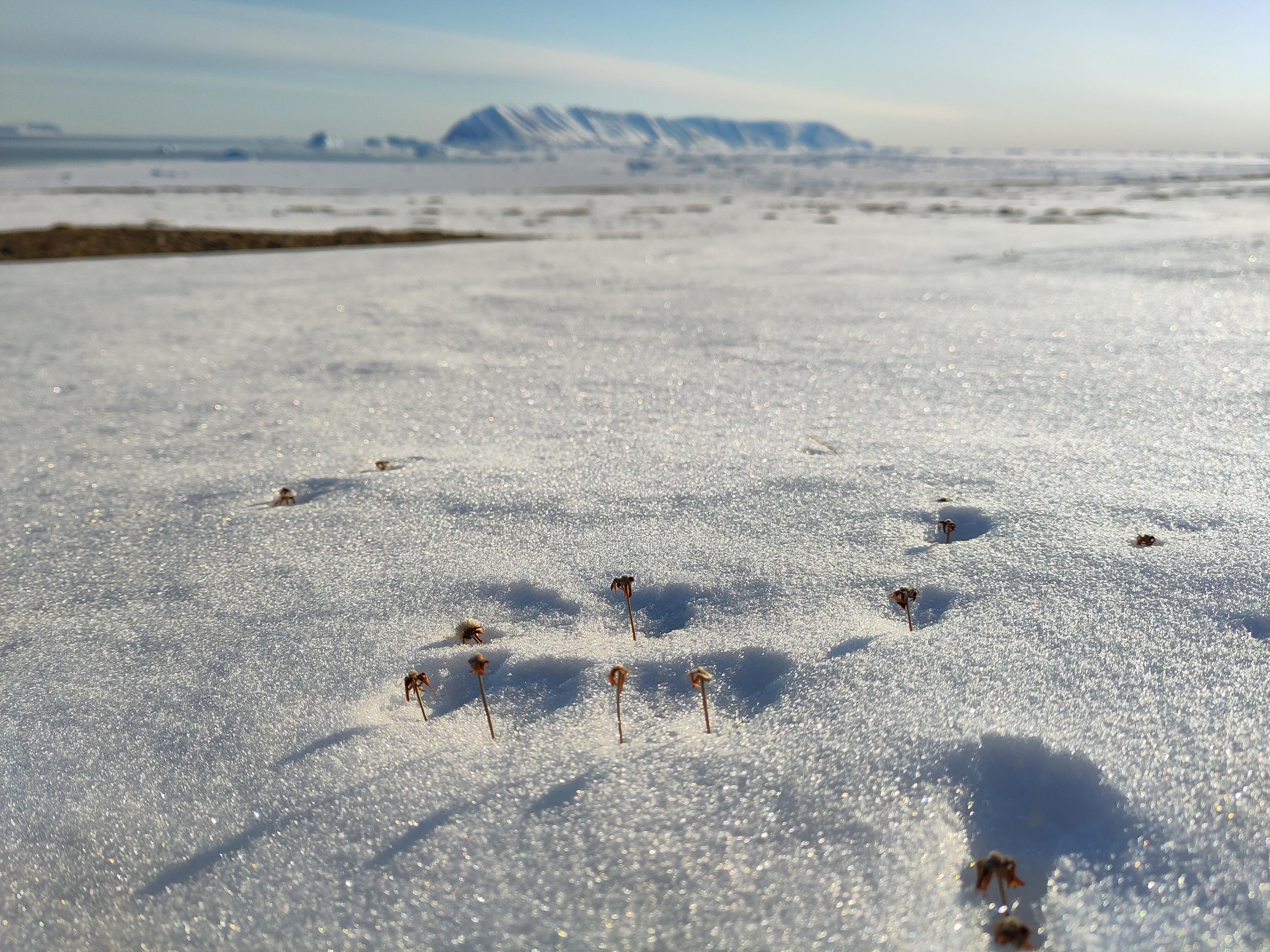
It’s also always fun to check our snowcam – this takes a photo of a stake every 3 hours to monitor the depth of the snow pack, and quite often we get beautiful views and some cheeky ravens hopping past too – I live in hope for an Arctic fox, or even a bear.
Two ravens in the snow, exploring some leftovers apparently.On the subject of bears, I had heard there were rumours of one near the snow site, but sure enough there were the footprints – rather small and filled in with snow but quite distinctive and heading up towards the ice cap. We shall be extra careful when we go up on to the glacier later this week.
Day 1
We had originally planned terrestrial, glacier and sea ice work, primarily focused on snow processes. The sea ice part though was altered and expanded when the rapid break up in April and again this month was observed. Normally, we’d have a preparation day between arrival and going into the field, but the threat of winds and high temperatures meant we decided not to risk it and we went out straight away on the first full day. Our instincts to just go yesterday turned out to be correct, we had perfect weather and with the help of Qillaq, one of the local hunters we still made it out on to the sea ice. So all is not lost. I woke up this morning to see a wide blue sea just off the last pieces of fast ice on Qaanaaq, so I’m very happy with that decision. Sentinel-2 captured this yesterday while we were out in fact.
It probably looks more dangerous than it is. We were working on the stable fast ice to the east of the big flake, that stretches right into the fjord. The local topography make it very stable and our measurements yesterday confirmed it’s pretty typical for the time of year in thickness, though there was a surprising amount of snow on top, which can actually help to protect the ice from melt at this time of year.
Getting around the coast was surprisingly straightforward, the fast ice has a very stable platform, though some large churned up part of the ice with cracks made for some slightly bumpy manoeuvres to get on and off the stable parts.
Manoeuvring the sled through the coastal zoneThe dogs were I think happy when it was over. But in fact it was much more straightforward than I’d feared. The large crack we noticed earlier in the week that opened into a wide lead further extended while we were out, see below, and I woke up this morning to a wide open lagoon. It’s an extraordinarily beautiful place to work and I feel so privileged, especially on days like today when the weather is also being extra nice.
Happy dogs on the way home. Note the large area of open water behind that opened up while we were out.Work wise it was a successful day, we managed 2 stations, where we did very extensive work. I’d have liked a third but the deep snow made it very heavy and slow going to travel on and in spite of the early start we basically ran out of time and had to return home.
Qillaq and Abraham taking a manual measurement of snow depth and ice thickness next to target for the UAV calibration flights.We flew the UAV for surface properties, did a lot of snow pits and snow surface properties work, drilled some ice cores (which I will be working on this morning) and even got our loaned EM31 working to do automated ice thickness mapping. We will hopefully start to look at the data later on today to make sure it makes sense before we leave on Thursday.
Our first sea ice core of the seasonThe reduction in ice means we can actually concentrate on the terrestrial part of the work plan for the rest of the week. And there’s a lot to do!
Last year I set up a semi-permanent snow site to monitor conditions on land through the year. It is going to get a bit of an upgrade this week with some new instruments and of course we need to get the rest of the data downloaded and processed from here too.
Onwards.
#Arctic #ArcticScience #fieldwork #Greenland #Science #SeaIce
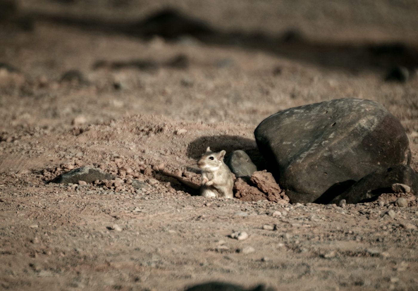
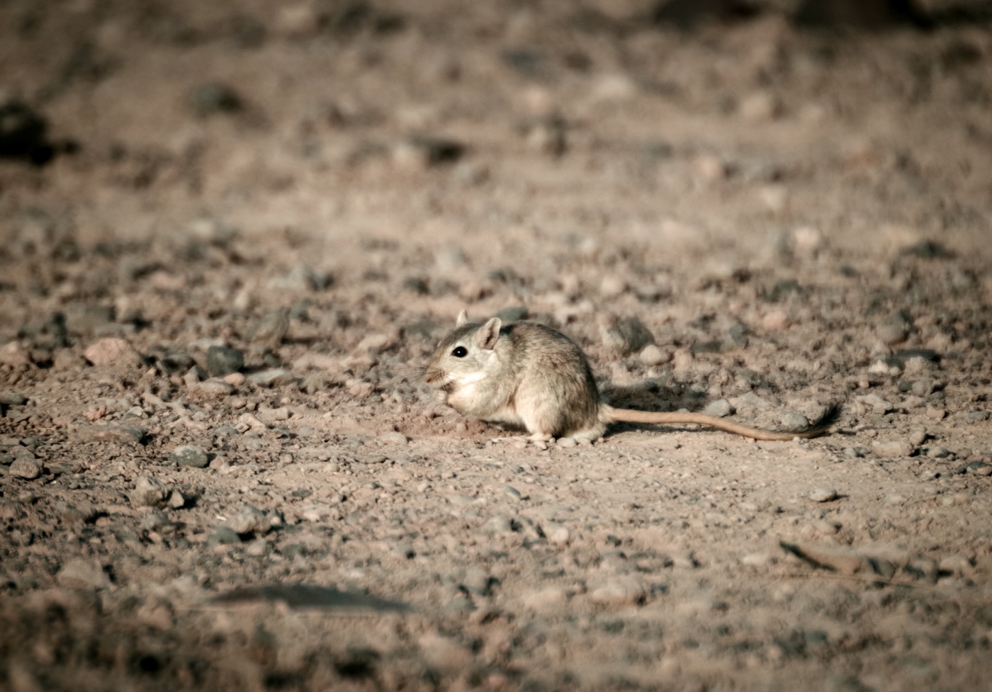
Making friends, eastern Jordan 2025 Pentax K1-ii, sigma 135-400 These little jirds, with their tufted tails, are very cute but also very happy to burrow into our food storage! #Fieldwork #Jordan
Just logged Field Case 002 — a geolocation trace from one of OSINT Dojo’s most infamous challenges.
Terrain. Shadow. A river bend that gave it away — if you squinted just right.
Blog’s up for those who like their puzzles dusty and real.
#OSINT #Geolocation #CTF #OSINTDojo #Fieldwork
https://medium.com/@txrattler/field-case-002-curvy-rivers-6f5d4ce83c15
Making friends, eastern Jordan 2025 This little agama let us walk right up to him before running away. I even got some film photos. 😅 #Fieldwork #Jordan
Out surveying, Eastern Jordan 2025 Trichrome, Pentax K1-ii, D-FA 24-70 2.8 #Fieldwork #Jordan
Falling Apart…
I’m writing this from a hotel room in Ilulissat, rather than Qaanaaq where I had intended to be arriving shortly, because our plane has been cancelled due to bad weather (at time of writing the airport was measuring gusts of 14 m/s, so I’m actually quite glad it was cancelled).
Weather and flight cancellations are an eternal hazard when doing fieldwork in Greenland, but in this case it also means an impact on our planned fieldwork, because the sea ice is falling apart. And rather earlier than usual (though we have not yet done a systematic review to prove this). In fact, part of the reason for coming here in May (instead of my usual March trip) was to investigate an interesting event that happened earlier this spring. In the animation of satellite pictures below you can see the sea ice rather dramatically falling apart in mid-April and then again at the end of April.
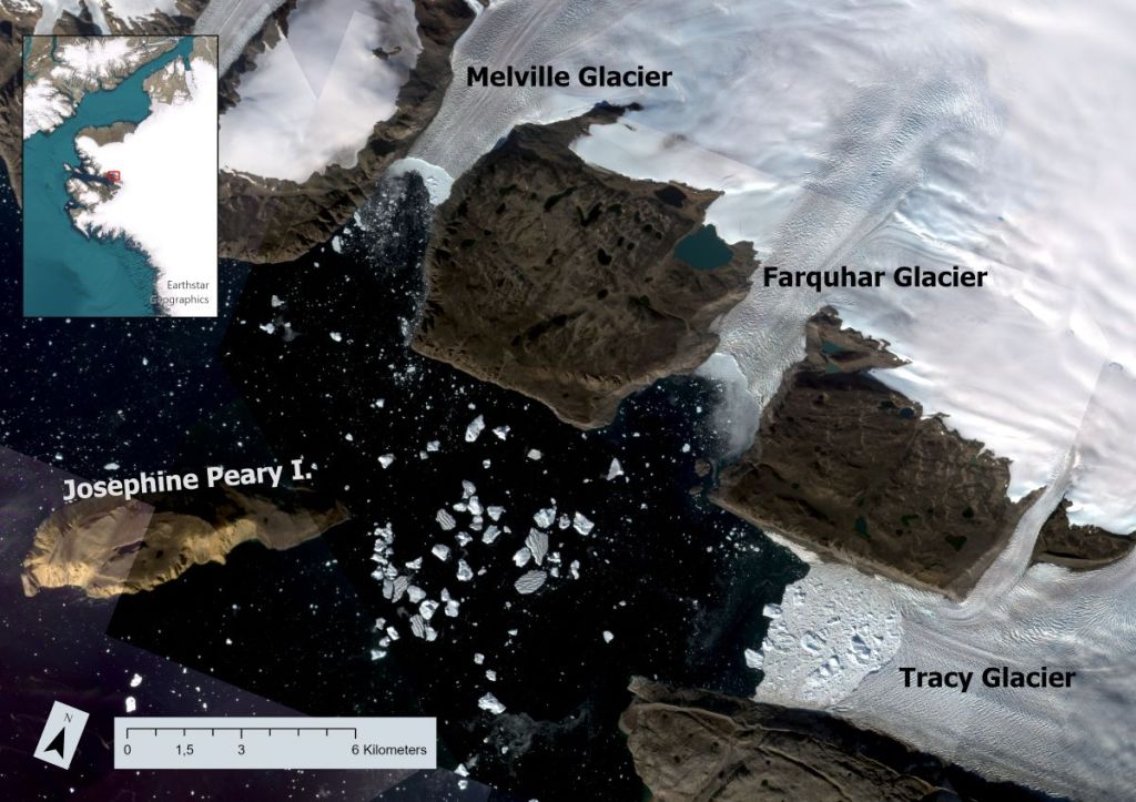
The March to May sea ice season from Sentinel 2 in NW GreenlandTo understand what is happening and why it’s unusual, first a bit of background. As I have written before, my DMI colleagues have been working up in NW Greenland for about 15 years on a programme of ocean measurements in the fjord (see map below). I joined about 5 years ago, working in the melange zone of the glaciers at the head of Inglefield Bredning (PSA: a paper we recently submitted about this programme will hopefully be online soon). We use the sea ice as highway and stable platform for observations, so it’s pretty important for us and came to the conclusion it wa squite important for some parts of the glaciers too. The local community, with whom we work closely use it also for travelling, hunting and fishing from. It’s extremely important for them.
The region of North West Greenland we’re talking aboutNormally there’s pretty thick (~1m) sea ice covering the whole of Inglefield Bredning (Gulf of Inglefield, also known as Kangerlussuaq, but not that one) out to the islands of Qeqertarsuaq and Kiatak. You can seen an example of what this looks like normally in the satellite animation from 2020, which happens to be when my first trip out on to the sea ice in Qaanaaq took place at the end of May and beginning of June. We were actually very lucky, we had great weather, got very close to the ice edge and watched narwhals swimming out in the North Water polynya. (Yes, sometimes I wonder how I managed to get this job too). The animation below is Sentinel-2 images as cloud free as I could find them from that first field season. As you can see, the sea ice already in March was much much more extensive than this year at the same time. And perhaps that is part of the answer.
It’s probably worth pointing out at this stage that although there were some pretty warm (unusually so) spikes in March and April, the sea ice breakup in April was probably largely driven by ocean swell, and perhaps some winds which were strong, though not excessively so as far as we can see in the observations. The latest break-up seems to be driven also by high winds.
Back to our current field season. We had in fact planned a brief trip up here already – I am currently setting up a project looking at snow processes with the team and we had planned to install and test some new instruments and protocol that we hope to use in Antarctica later this year (more on all of that later hopefully). However, as the soon to be published preprint shows, I and the team have developed pretty extensive sea ice interests recently, so this unusual behaviour rather piqued our curiosity.
We have a lot of questions:
Why did it happen this year? Is it really the earliest in the satellite record? What makes the ice vulnerable? Composition, thickness, temperature? Is the ocean driving it or the atmosphere or both (it’s usually both), and what makes this year so unusual? Further down the line, can we model it and use those simulations to understand if this is a single aberration or likely to be more common in the future? And what impact will the earlier breakups have on the ecosystem, the adjacent glaciers and the local community?
Or fieldtrip thus appeared an excellent opportunity to grab some real data on all of these points. Our colleague Henriette Skourup at DTU-Space was kind enough to lend us one of her instruments, which we shipped up last minute to allow us to do an add-on. It is all currently sitting there waiting for us.
Unfortunately the sea ice is not waiting for us, if the photos from my colleague in Qaanaaq, Aksel are anything to go by.
A large and widening crack in the sea ice in front of Qaanaaq. The small objects on the sea ice (fishing gear?) suggest we were not the only ones surprised). Credit: Aksel Ascanius, DMIThe high winds which grounded our plane have also been busy on the sea ice, which is falling apart in the bay with surprising speed as far as I can see. We are still waiting for today’s optical imagery but the quick look from radar based Sentinel-1 suggests cracks widening rapidly as the photo above confirms.
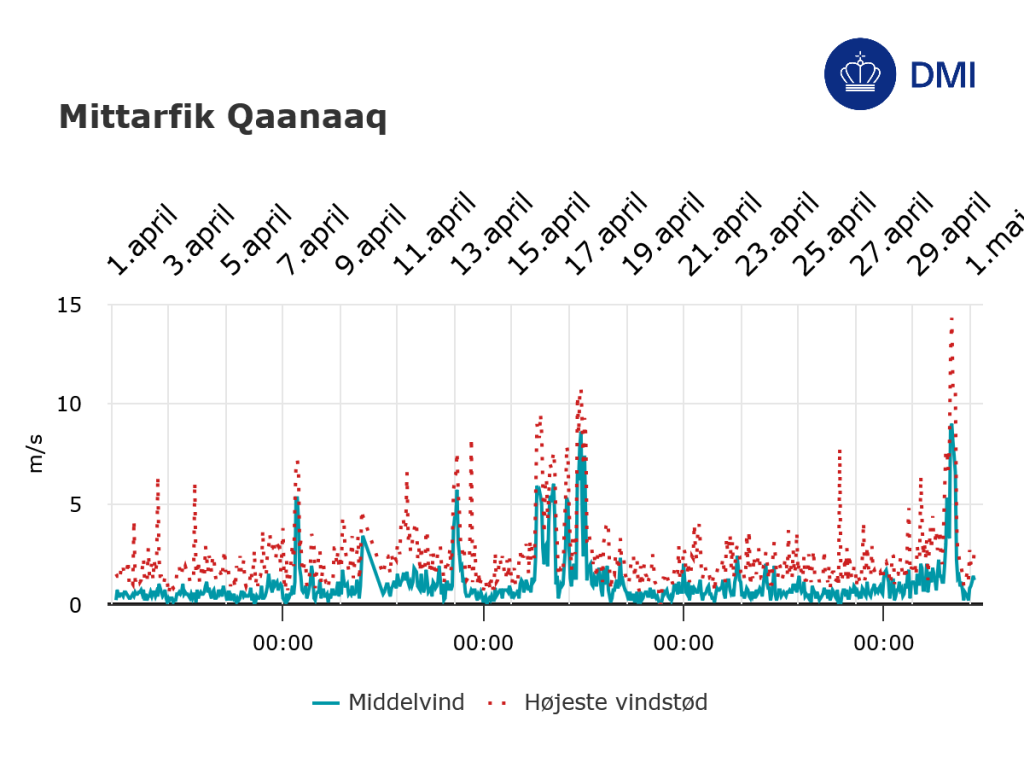
Temperature observations from Qaanaaq airportWith a bit of luck we will get to Qaanaaq on Thursday (immaqa) to see if our sea ice research plan can go ahead. At this stage I rather doubt it. But it will very much depend on the next few hours. The wind speeds are quite high still but the temperature which was well above freezing has now dropped down to just below.
Wind observations from Qaanaaq airportWe are fortunate that we work with local hunters on the sea ice who are immensely experienced. The first rule is always safety first. We do have *a lot* of other work to do and rather fewer days to do it all in, so either way we’ll be busy. Ffor now, it’s keep checking in with the weather, the satellite images and our friends in Qaanaaq and use the time in Ilulissat wisely – in our case, it’s time to write some papers. And one of them is all about sea ice.
To be continued…
All satellite imagery on this page is from the European Space Agency Sentinel-2 mission, processed on the Copernicus EO Browser – a FREE!! and easy to use entry point to use ESA data. Weather observations are from Qaanaaq airport, operated by Mittarfeqarfiit A/S – Grønlands Lufthavne (Greenland Airports) and processed by DMI. It’s actually pretty nice how much high quality data we have access to these days…
This fieldwork is undertaken as part of the PRECISE (Predicting Ice Sheets on Earth) project funded by the Novo Nordisk Foundation and by the ESA Climate Change Initiative for Sea Ice and the Climate Modelling Research Group
#Arctic #fieldwork #Greenland #Qaanaaq #satelliteData #Science #SeaIce
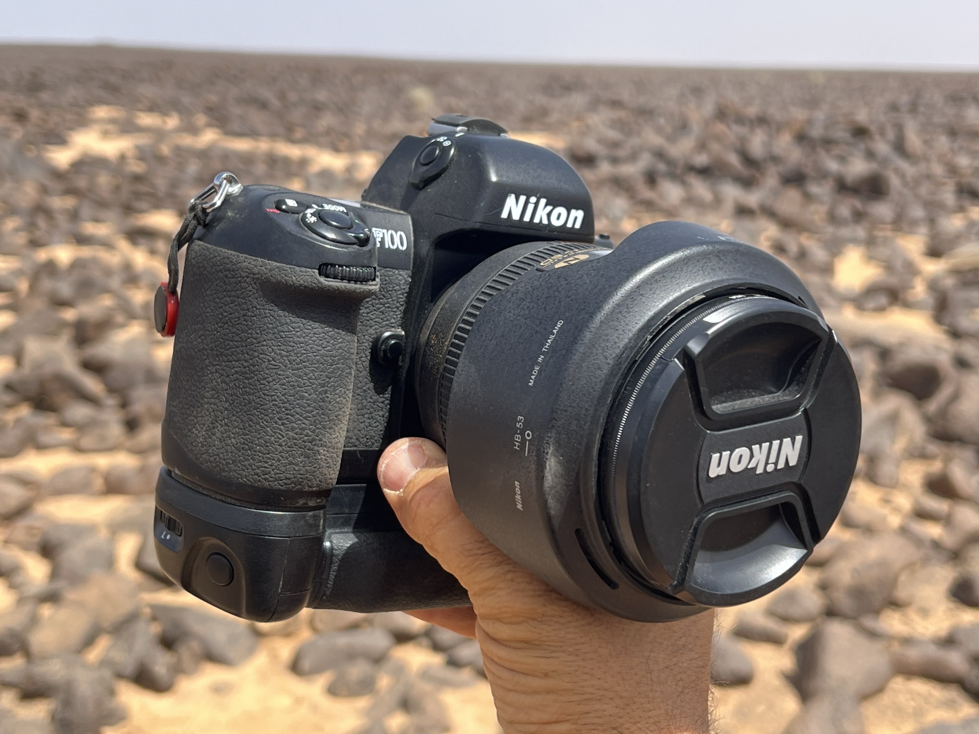
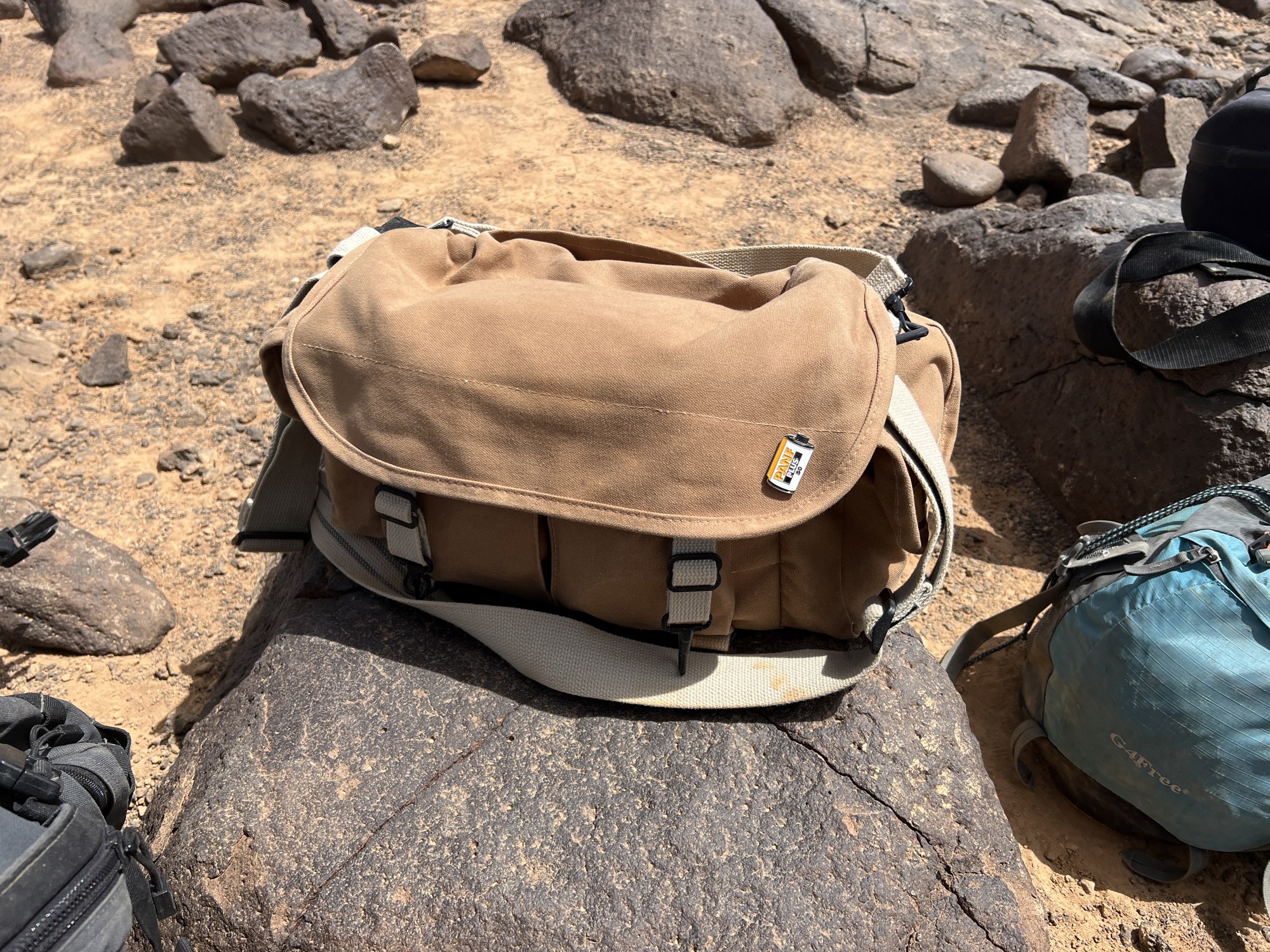
Camera gear in the field: Primary film setup this season is this Nikon f100 with a combo of a 24-120 f4 vr (vr with film = 🤯!), 17-35 2.8, and 50 1.4. #BelieveInFilm #CameraGear #Fieldwork
Current landscape. Limited internet. #Fieldwork #Jordan
Nature's Scientific Fieldwork Photo Competition. https://www.nature.com/immersive/d41586-025-01398-0/index.html
Nice to see images of something other than lab equipment and white coats! #science #fieldwork #photography
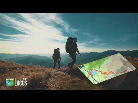
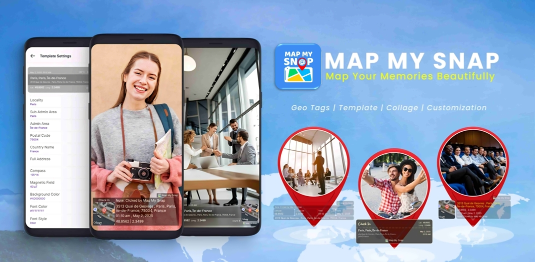
📸 Capture your moments with location using " Map My Snap – GPS Proof Camera "
🌍 Get timestamped location stamps on every photo.
✅ Perfect for travel logging.
🔗 Explore the app 👉https://play.google.com/store/search?q=map%20my%20snap&c=apps&hl=en
#MapMySnap #GPSProof #GeoTagPhoto #LocationCamera #FieldWork


Sharing this again in case any Royal Geographical Society Fellows missed it the first time around. Do vote in the Council elections...preferably for me 😉... but use your vote.
The deadline for voting is 5.00pm on Thursday 29 May.
#FRGS #Geography #CGeog #Fieldwork #Expeditions
RE: https://bsky.app/profile/did:plc:mjbwf5dsjbup6ruwrp4svnfi/post/3lnzbbmvtmc2y
[ARCHIVES 2021]
[journal de terrain, semaine 10, Longwy] Une longue journée.
Je déjeune à l’hôtel et part à mon rendez vous à Longwy-bas. Mon sac est lourd. Manque de chance, une fois arrivée le rendez vous est décalé à une prochaine fois. Je me retrouve bloquée avec mon sac trop lourd pour moi après 2 heures à marcher et tourner en rond et un temps plus qu’incertain. Je me réfugie à la mairie, Serge et Éric m’accueillent avec plaisir. J’avance un peu sur le projet puis je laisse une bonne partie de mes affaires pour aller faire des photos au golf (là où réside le haut fourneau). En chemin je me laisse happer par le « sentier de senelle », nom d’une des 4 usines de sidérurgie. Mêlant bruit de voiture, forêt et oiseau, je prend du son tout en avançant sur le chemin. Arrivé au haut fourneau, je remarque que quelque chose dans mon appareil déconne. Tout est sombre, comme si un filtre polarisant était activé. J’étais déjà à une bonne heure de marche de la mairie. Qu’à cela ne tienne, j’essaie tant bien que mal de faire des photographies avec l’histogramme. Merci à Ivan Mathie , Baptiste Cozzupoli et Clément Martin pour vos conseils. Je reste sur place 3 heures à découvrir de nouveaux endroits et vestiges incroyables de cette usine. De retour, je reprends mes affaires et me dirige vers le bus. En voulant prendre mon ticket, l’application ne fonctionne plus pour les cartes solidaires et bien sûr, les tarifs réduits ne sont pas donnés dans le car. Le chauffeur est super, comprend ma situation et m’attend le temps de prendre le billet en gare. Malgré cette journée qui a mise mes nerfs à rude épreuve, je reste sous le charme de ces vestiges cachés du passé.
~~~🇬🇧🇬🇧🇬🇧~~~
[field note, Longwy, week 10]. A long day
#socialsciences #DocumentaryPhotography #PhotographieDocumentaire #journaldeterrain #longwyvivra #fieldwork #FieldResearch #visualanthropology #photography #landscape #usine #paysage
Get your hands dirty with Season 5 of The Story of Us! 🌍🎥 Join us on-site with paleoanthropologists, uncover real fossils, and journey through human evolution. Subscribe and learn what makes us… us. 🔔 #StoryOfUs #PaleoPost #FieldWork #DeepHistory #FossilFriday https://www.youtube.com/playlist?list=PLTLR_GEbTEYunvGlvoPiGb36kVgyPzvDn
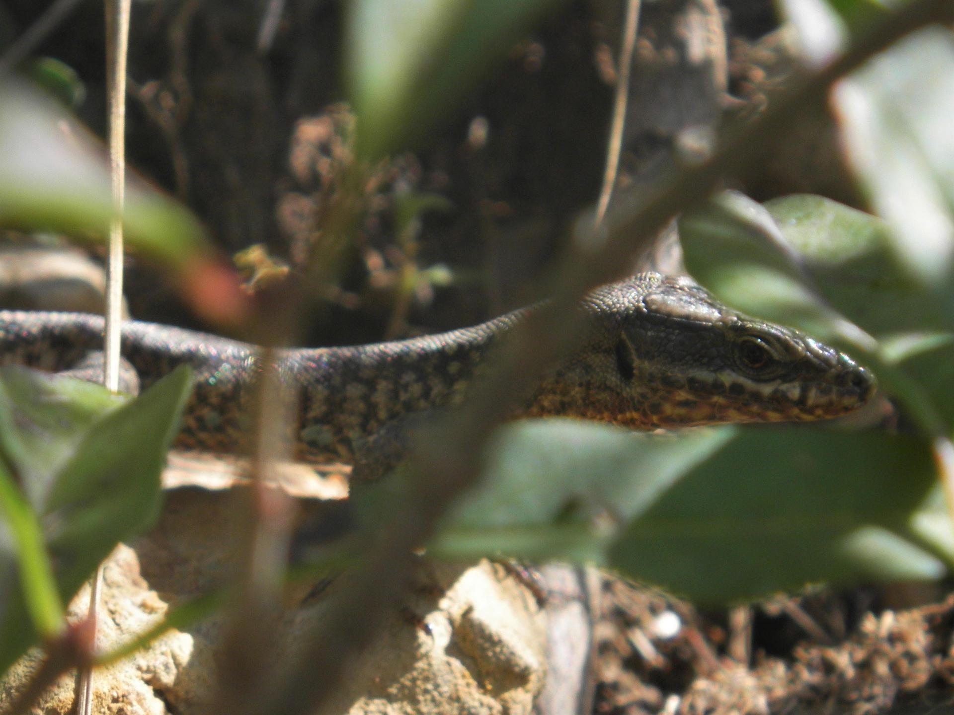
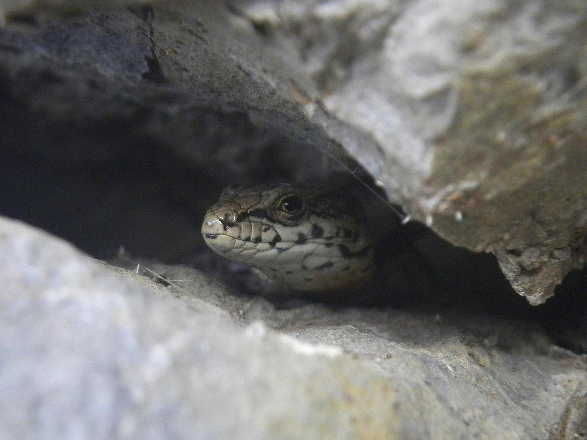
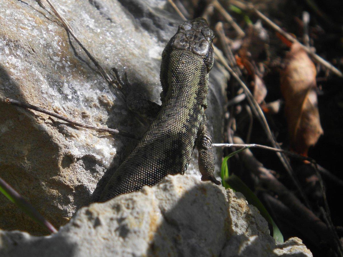
Curious little wall lizards in the Spanish Pyrenees. 🦎
#science #fieldwork #mapping #animals #animalphotography #lizard #walllizard #lacertid #podarcis #pyrenees #spain

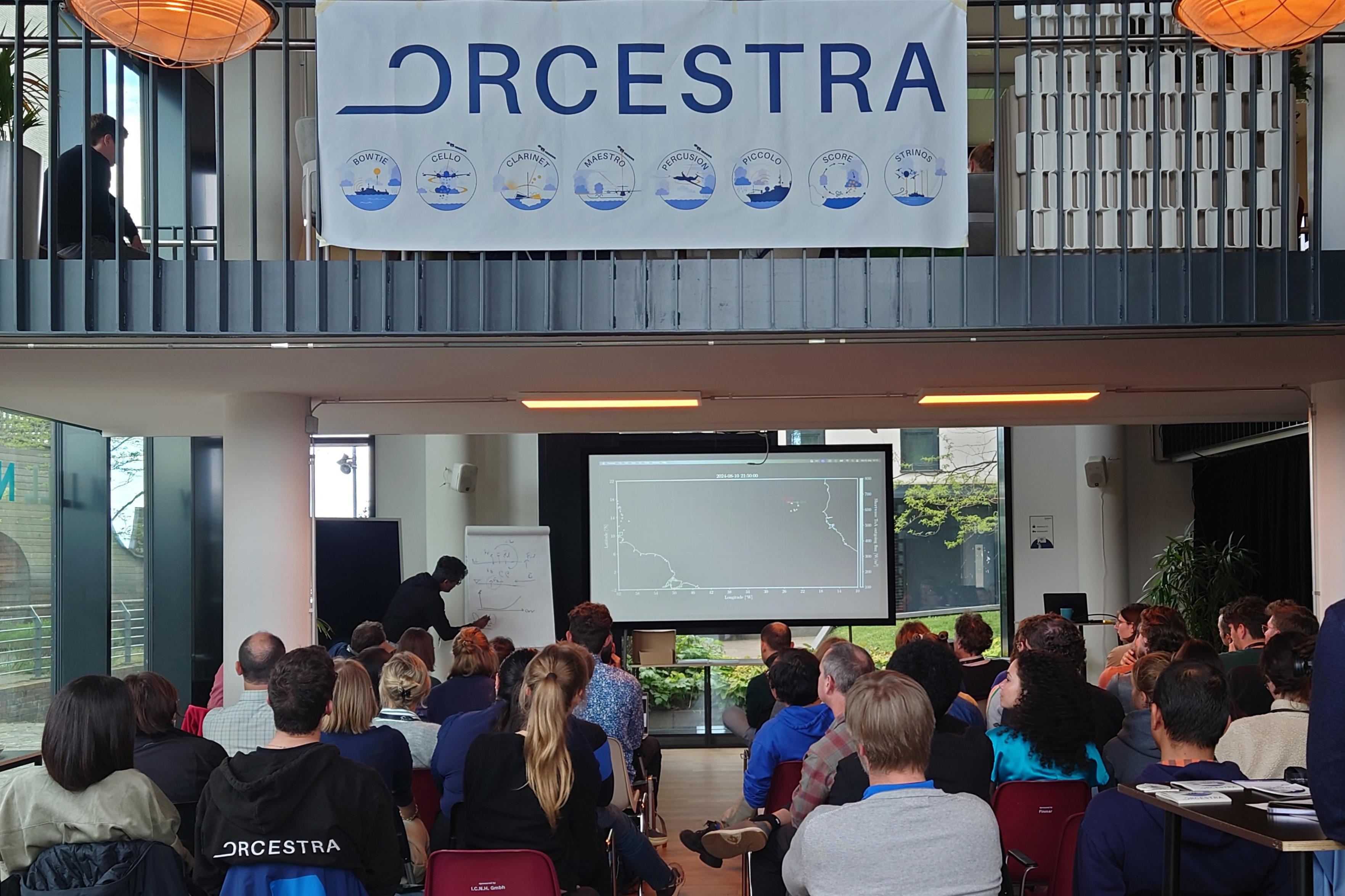
🎶 This week, we are having the full ensemble in action: At the “ORCESTRA Convergence”, all eight sub-campaigns of the ORCESTRA field campaign are gathered for a #workshop here in #Hamburg. The nearly 60 scientists are exchanging ideas and presenting their scientific progress before continuing collaboration in an ORCESTRA #hacking for the rest of the week.🧑💻
🔗 Learn more about our 2024 field campaign ORCESTRA: https://orcestra-campaign.org/orcestra.html
#fieldwork #ClimateScience
Credit: Y. Wu/MPI-M
Client Info
Server: https://mastodon.social
Version: 2025.04
Repository: https://github.com/cyevgeniy/lmst