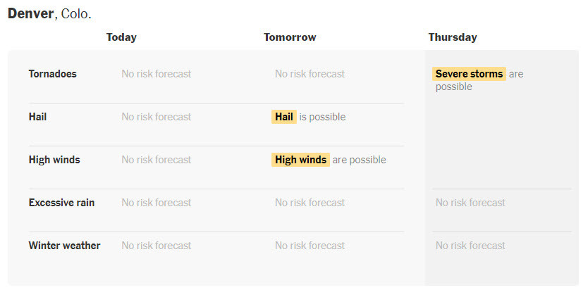
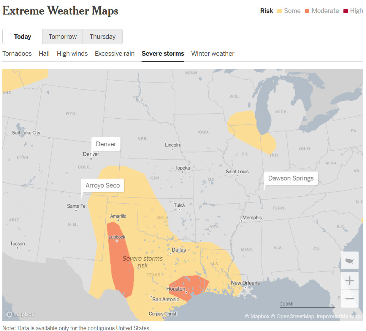
Extreme Weather Maps - Track the Risks for Your [USA] Places [NYT]
--
https://www.nytimes.com/interactive/2023/us/extreme-weather-forecast-maps.html <-- shared media article / technical resource
--
“[The NYTs is ] monitoring the possibility of extreme weather in places that are important to you...
When forecasters see a risk of tornadoes, hail, high winds, excessive rain, hurricanes, tropical storms or winter storm conditions for any of the places you care about, [they will] send you a morning email to help you plan ahead…"
#GIS #spatial #mapping #USA #extremeweather #weather #risk #hazard #naturalhazard #publicsafety #dangerousweather #risklevel #forecasting #tornado #hail #excessiverain #flood #flooding #extremesnow #ice #hurricane #tropicalstorm #winterstorm #resource #publichealth #NationalWeatherService #StormPredictionCenter #WeatherPredictionCenter #yellow #orange #red #prediction #notifaction
@nytimes @nwsspc_bot @nws
#DangerousWeather
The weather has hit the edge of the radar D:
SCANNER FEED - Freezing rain incoming!!
(This feed picks up snowplows/police/EMS in Eastern #Ontario
https://www.youtube.com/live/jjM3KtbdB-g
#OnStorm #Weather #PoliceScanner #canada #icestorm #live #severeWeather #EMS #SnowDay #DangerousWeather
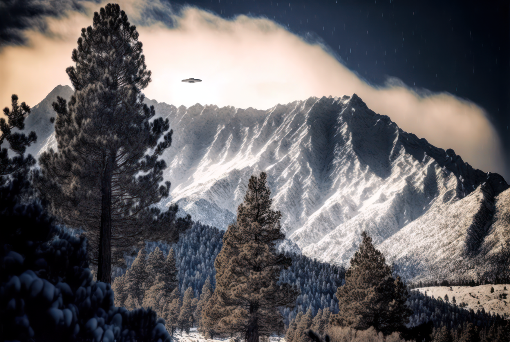
Be careful up in Mt. Baldy this weekend, with all the missing hikers and Chinese weather balloons and all.
#MtBaldy #AngelesCrest #UFOsighting #DangerousWeather #WeatherBalloon #Chineseweatherballoon #ChineseSpyBalloon #HikingMtBaldy #AngelesNationalForest #SocalHiking #SocalUFOs #Aiphotography
Why do I feel like the weather has taken plot tips from "The Day After Tomorrow"?
Hoping everyone in its path stays safe. #BombCyclone #ArticWeather #DangerousWeather #FlashFreeze