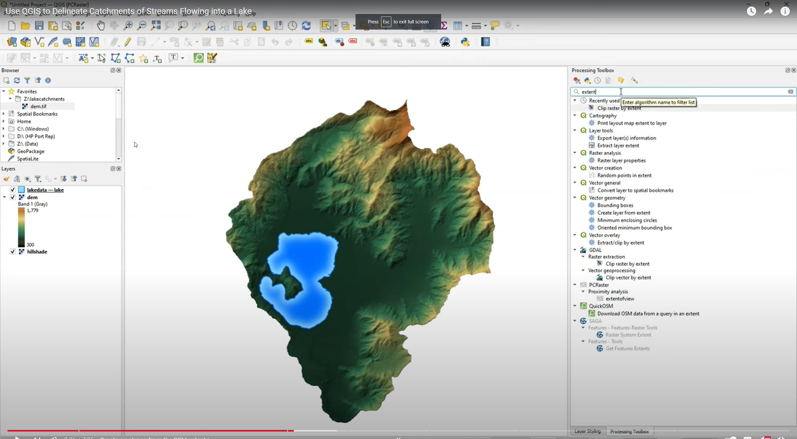
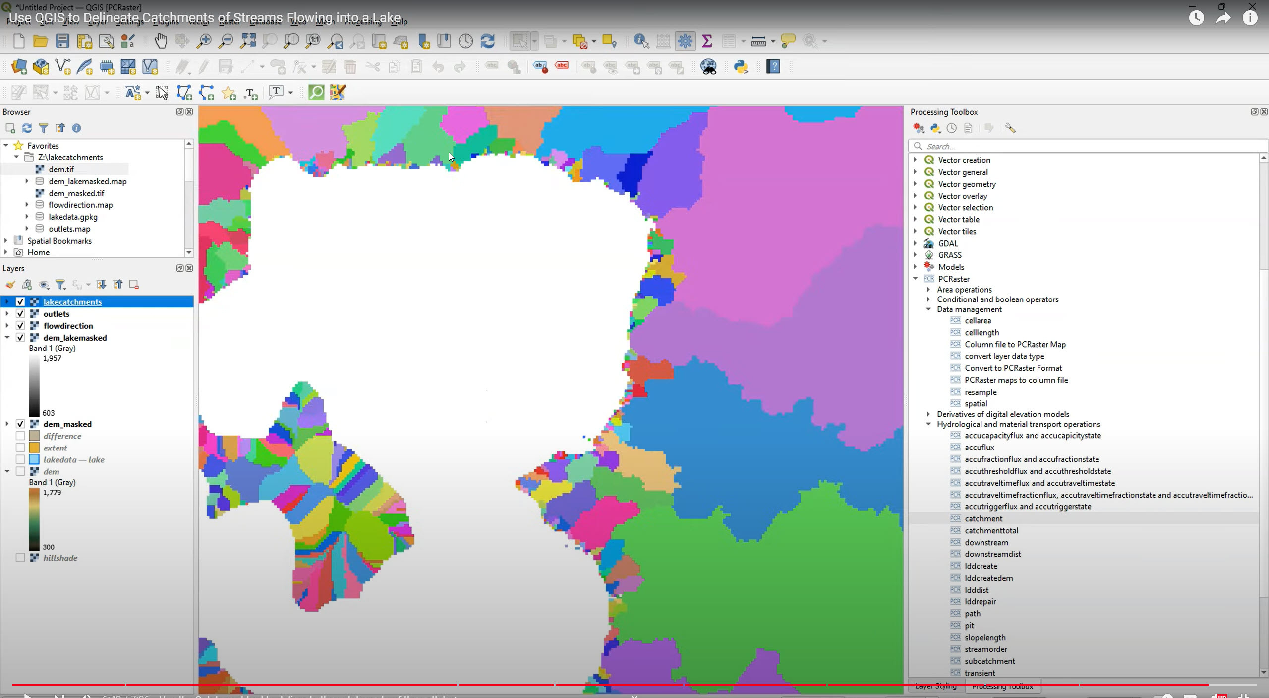
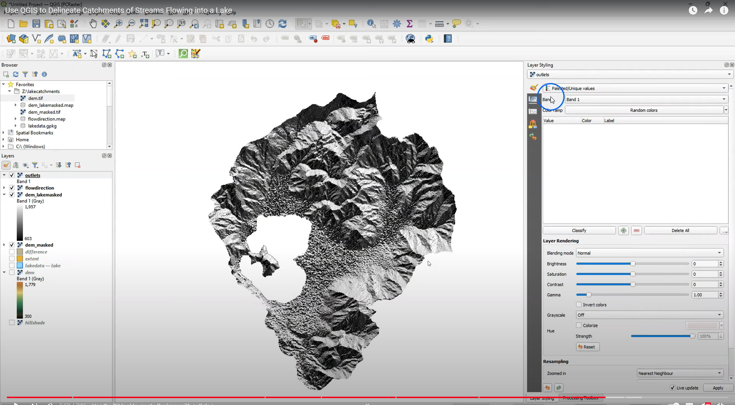
Use QGIS To Delineate Catchments Of Streams Flowing Into A Lake [video tutorial]
--
https://youtu.be/jSc3HDN6yEM?si=ZkC2lKyZb5-lO894 <-- shared tutorial video
--
[sharing is not considered an endorsement of this product]
#QGIS #PCRaster #QGISHydro #QuickOSM #opendata #GIS #spatial #mapping #tutorial #video #hydrology #catchment #flowline #catchment #lake #waterbody #water #surfacewater #spatialanalysis #elevation #DEM #LiDAR
#QuickOSM
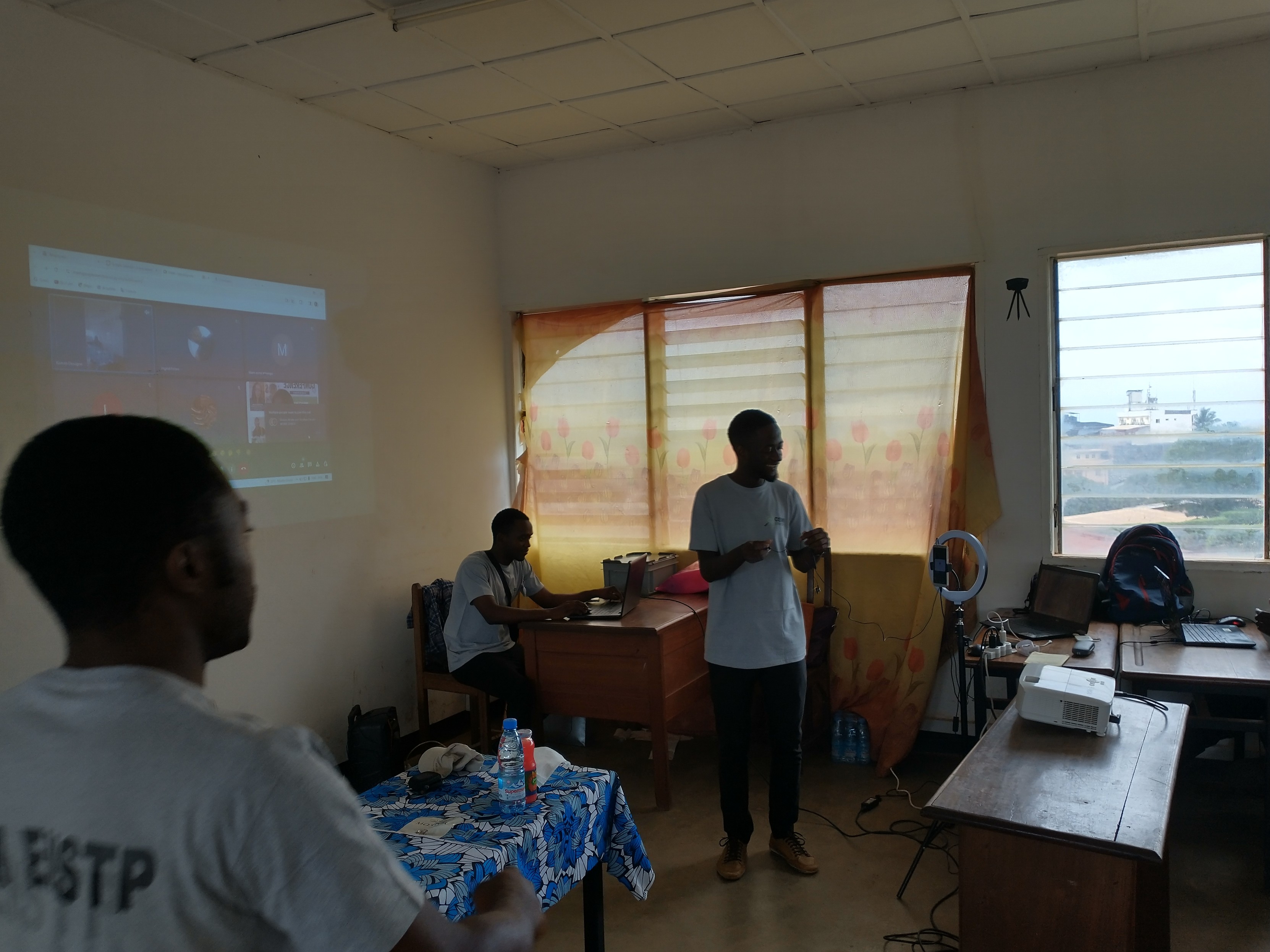
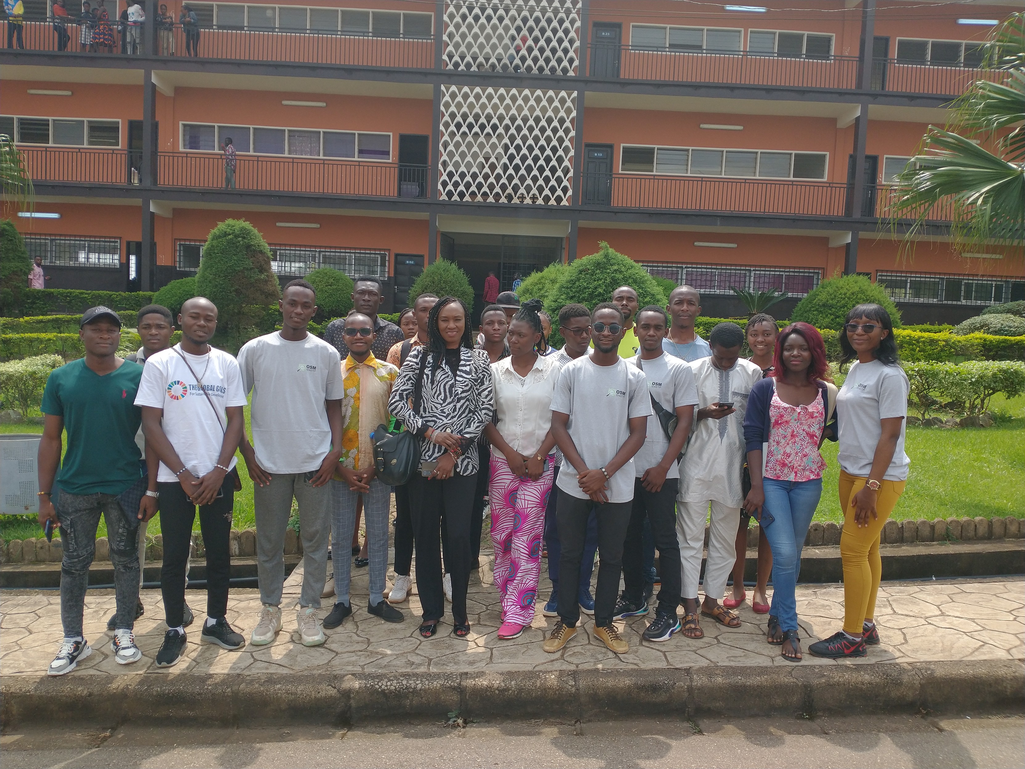
December 7 afternoon #openstreetmap awareness, sharing
#unmapslearninghub resources, field experience and data recovery with #QuickOSM in @qgis. Organized by the local #osm club, #unmaps and Nathalie Sidibé from #osmmali for students at the École Nationale Supérieure de Travaux Publics #ENSTP in #yaounde, #cameroon


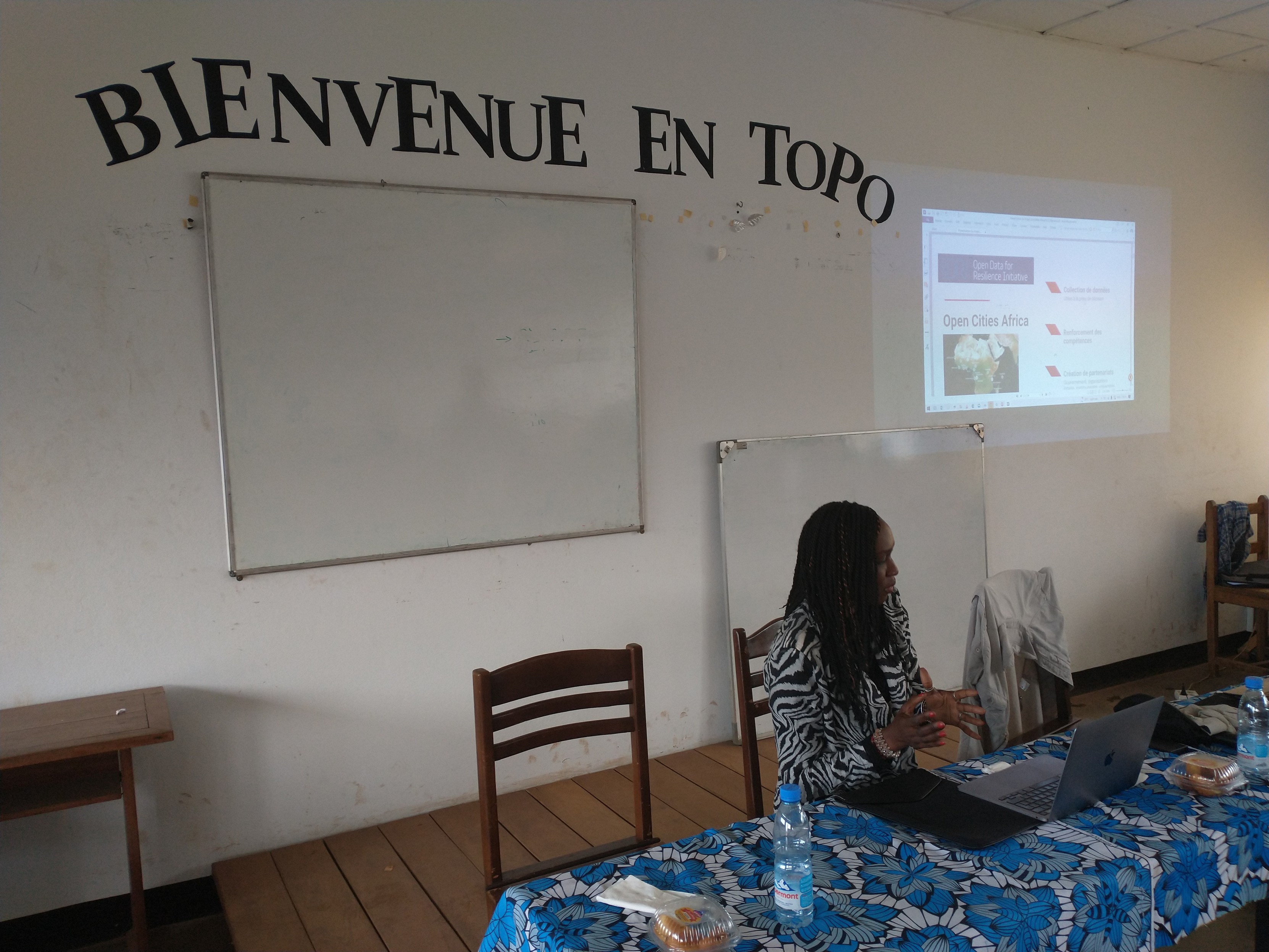
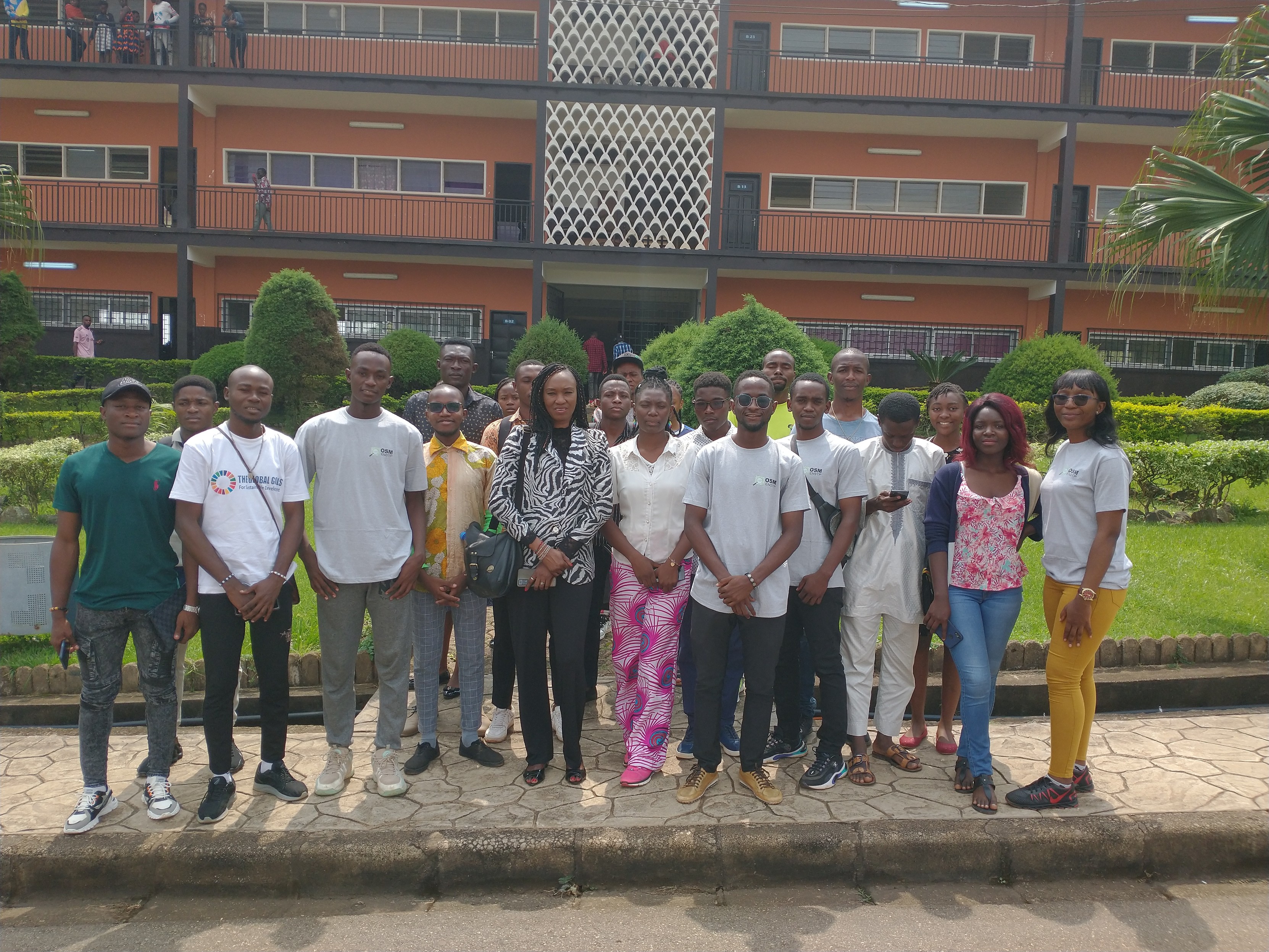
Après-midi 7 décembre sensibilisation #openstreetmap, partage des ressources #unmapslearninghub, expérience de terrain et récupération de données avec #QuickOSM dans @qgis organisée par le club #osm, #unmaps et Nathalie Sidibé de #osmmali pour les étudiants de l'École Nationale Supérieure de Travaux Publics #ENSTP de #yaoundé au #cameroun


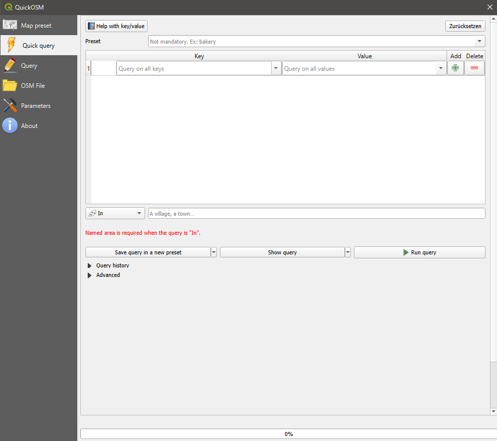
You can easily import #OpenStreetMap elements into #QGIS with the #QuickOSM Plugin. Building the Overpass turbo query is now straightforward with the interactive dialogue.
https://plugins.qgis.org/plugins/QuickOSM/
Uniquement pour les Bretons bretonnant l'organisation de l'événement sur Qgis prévu à Rennes cette semaine en présentiel a du pousser les murs et refuser ou ne pas prévoir une visio. Se réclamer pour le libre et communiquer par tweeter et fb c'est vraiment triste
#Qgis #Qgis_Bzh #quickosm #logiciellibre #cartographie #agendadulibre
What rabbit hole did I get myself into?
In order to speed up my #QGIS experiments with #QuickOSM, I wanted to run Overpass API locally, and make use of the existing #OpenStreetMap .osm.pbf planet dump I have (downloading would take ages).
But the API server tooling does not understand osm.pbf format, so I'm slowly converting it to osm.gz so that the server can convert it into its own format, and I'm considering adding support for reading osm.pbf..
THAT'S NOT WHAT I WANTED TO DO TO BEGIN WITH!
QGIS + QuickOSM is a nice way to build maps with OpenStreetMap data, but damn, the QuickOSM plugin is stubborn...
If you try to save a preset and then load it, and it happens to contain any keys that are not present in the "blessed" josm_preset.xml (like let's say "water"), they are silently cleared and as consequence you can't generate an Overseer query and it all just breaks apart.
The quick fix was to add desired keys to josm_preset.xml copying from existing.
📺 Aujourd'hui la #GeoITW de @etrimaille de chez #3Liz, auteur de #QuickOSM et contributeur au cœur de #QGIS :
https://www.youtube.com/watch?v=1Vo6LiySDVA&list=PLm8_Gh1bXPzqCCBDVhibk-uDKwFZTWl9G&index=3
@JourneesQgis @geojulien @Data_Wax @osgeofr :geotribu:
1. In #QGIS, create a bounding box for the area you're interested in
2. Use the #QuickOSM plugin to download the #OpenStreetMap features
3. create a #ShapeFile using "Export->Save Features As..."
@beyondwatts what you see on the #map is a simple #visualization of an #OSM query. you can use the #QuickOSM plugin in #QGIS for this.
Client Info
Server: https://mastodon.social
Version: 2025.04
Repository: https://github.com/cyevgeniy/lmst