Former Nets F DeMarre Carroll joins Jordan Ott as assistant with Suns https://www.rawchili.com/nba/92981/ #Basketball #Brooklyn #BrooklynNets #BrooklynNets #carroll #demarre #DemarreCarroll #National #NationalSports #NBA #Nets #Overall #OverallPositive #Phoenix #PhoenixSuns #Positive #Sports #suns
#carroll

DeMarre Carroll joins Phoenix Suns staff as coaching dominoes start to fall https://www.rawchili.com/nba/92946/ #as #Basketball #bright #carroll #coaching #demarre #dominoes #fall #FrontPage #joins #NBA #of #Phoenix #PhoenixSuns #PhoenixSuns #side #staff #start #sun #suns #SunsNews #the #To

#Carroll: I was walking over to the #officer, tried to explain who I was, who I was with. He said, I'd like you to turn around. I turned around, I put my hands behind my back. They did not put me in zip ties, but they did grab both my hands as I was escorted over to the side, they said, you are being detained.
MLB All-Star Game 2025 picks, predictions: DBacks’ Corbin Carroll, Ketel Marte starters? https://www.rawchili.com/mlb/92202/ #Arizona #ArizonaDiamondbacks #ArizonaDiamondbacks #AtlantaBraves #Baseball #BrendanDonovan #BriceTurang #Carroll #CorbinCarroll #Diamondbacks #FernandoTatisJr. #JacksonMerrill #JuanSoto #KetelMarte #KyleTucker #MLB #NationalLeague #NicoHoerner #Padres #PeteCrowArmstrong #RonaldAcuñaJr. #SeattleMariners

Aviation weather for Arthur N Neu airport in Carroll area (USA) is “KCIN 011735Z AUTO 12007G12KT 100V160 10SM CLR 28/12 A2991 RMK AO2” : See what it means on https://www.bigorre.org/aero/meteo/kcin/en #carroll #usa #arthurnneuairport #kcin #cin #metar #aviation #aviationweather #avgeek #airport vl
Five local high schoolers sign with Carroll College basketball | Montana High School Sports https://www.rawchili.com/nba/46919/ #Basketball #carroll #CollegeBasketball #mcdonald #NBADraft #ncaa #NCAABasketball #ncaab

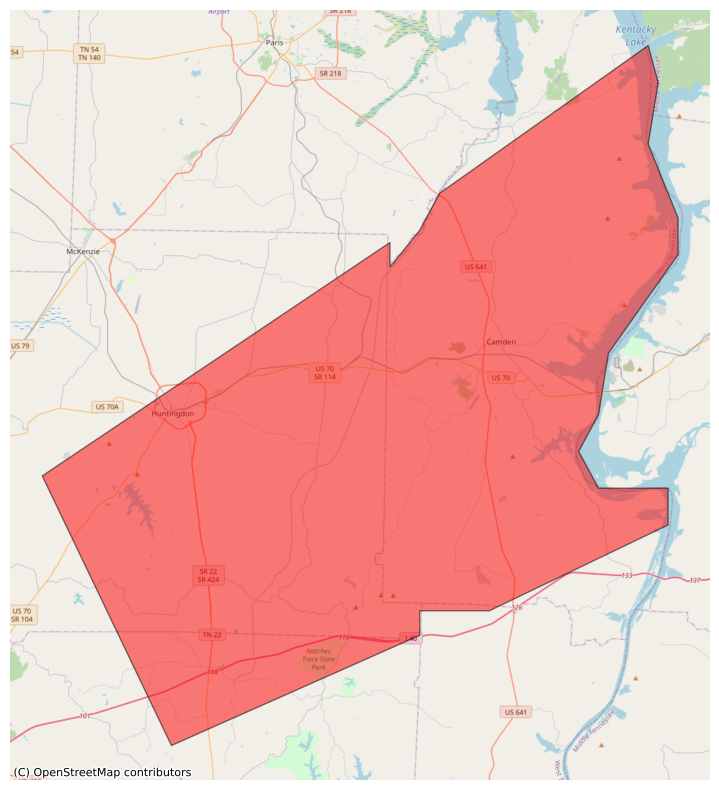
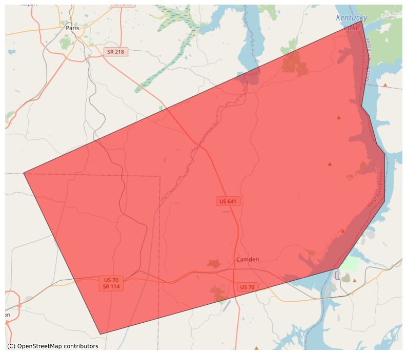
@easwatch #SevereWeather #TNwx #EAS #WEA for #Benton, #TN; #Carroll, #TN; #Henderson, #TN: National Weather Service: #TORNADO WARNING in this area until 5:00 PM CDT. Take shelter now in a basement or an interior room on the lowest floor of a sturdy building. If you are outdoors, in a mobile home, or in a vehicle, move to the closest substantial shelter and protect yourself from flying debris. Check media. Source: NWS Memphis TN ** DO NOT RELY ON THIS FEED FOR LIFE SAFETY, SEEK OUT OFFICIAL SOURCES ***
#EAS #WEA for Benton, #TN; #Carroll, #TN; #Henderson, #TN: National Weather Service: #TORNADO WARNING in this area until 5:00 PM CDT. Take shelter now in a basement or an interior room on the lowest floor of a sturdy building. If you are outdoors, in a mobile home, or in a vehicle, move to the closest substantial shelter and protect yourself from flying debris. Check media. Source: NWS Memphis TN ** DO NOT RELY ON THIS FEED FOR LIFE SAFETY, SEEK OUT OFFICIAL SOURCES ***
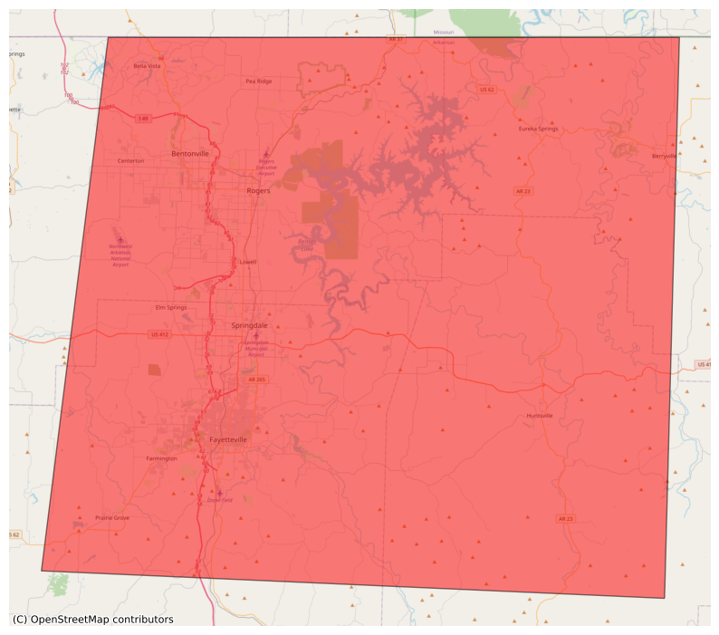
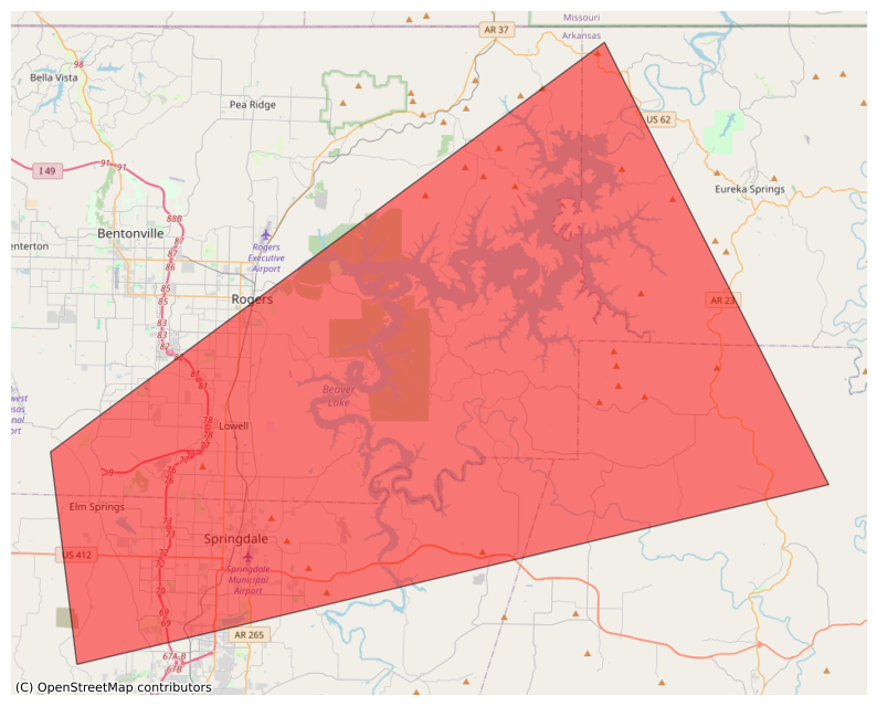
#EAS #WEA for Benton, #AR; #Carroll, #AR; #Madison, #AR; #Washington, #AR: National Weather Service: SEVERE THUNDERSTORM WARNING in effect for this area until 5:15 PM CDT for DESTRUCTIVE baseball size hail. Take shelter in a sturdy building, away from windows. People and animals outdoors will be severely injured. Source: NWS Tulsa OK ** DO NOT RELY ON THIS FEED FOR LIFE SAFETY, SEEK OUT OFFICIAL SOURCES ***
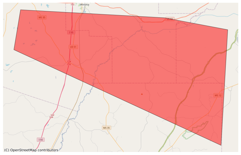
#EAS #WEA for Attala, #MS; #Carroll, #MS; #Choctaw, #MS; #Montgomery, #MS: National Weather Service: #TORNADO WARNING in this area until 4:30 AM CDT. Take shelter now in a basement or an interior room on the lowest floor of a sturdy building. If you are outdoors, in a mobile home, or in a vehicle, move to the closest substantial shelter and protect yourself from flying debris. Check media. Source: NWS Jackson MS ** DO NOT RELY ON THIS FEED FOR LIFE SAFETY, SEEK OUT OFFICIAL SOURCES ***
Detroit Tigers take Slater de Brun in MLB Pipeline mock draft https://www.rawchili.com/mlb/7179/ #Astros #Baseball #Carroll #Corbin #CorbinCarroll #Detroit #DetroitTigers #DetroitTigers #draft #Houston #HoustonAstros #MLB #MLBDraft #National #NationalSports #news #Overall #OverallPositive #Positive #Sports #SportsNews #Tigers

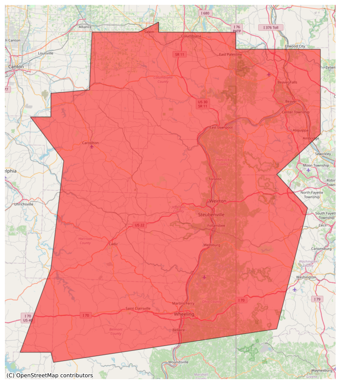
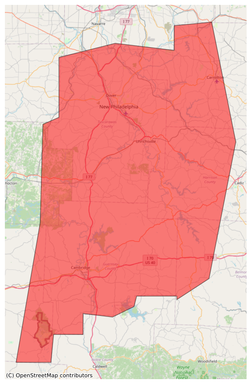
@easwatch #SevereWeather #OHwx #PAwx #EAS #WEA for #Carroll #OH; #Columbiana, #OH; #Harrison, #OH; #Jefferson, #OH; #Beaver, #PA; #Washington, #PA; #Brooke, #WV; #Hancock, #WV: National Weather Service: #TORNADO WARNING in this area until 5:00 PM EDT. Take shelter now in a basement or an interior room on the lowest floor of a sturdy building. If you are outdoors, in a mobile home, or in a vehicle, move to the closest substantial shelter and protect yourself from flying debris. Check media. Source: NWS Pittsburgh PA ** DO NOT RELY
#EAS #WEA for Belmont, #OH; #Carroll, #OH; #Columbiana, #OH; #Guernsey, #OH; #Harrison, #OH; #Jefferson, #OH; #Noble, #OH; #Tuscarawas, #OH; #Allegheny, #PA; #Beaver, #PA; #Lawrence, #PA; #Washington, #PA; #Brooke, #WV; #Hancock, #WV; #Marshall, #WV; #Ohio, #WV: National Weather Service: SEVERE THUNDERSTORM WARNING in effect for this area until 5:00 PM EDT for DESTRUCTIVE 80 mph winds. Take shelter in a sturdy building, away from windows. Flying debris may be deadly to those caught without shel
#EAS #WEA for Belmont, #OH; #Carroll, #OH; #Coshocton, #OH; #Guernsey, #OH; #Harrison, #OH; #Muskingum, #OH; #Tuscarawas, #OH: National Weather Service: SEVERE THUNDERSTORM WARNING in effect for this area until 4:30 PM EDT for DESTRUCTIVE 80 mph winds. Take shelter in a sturdy building, away from windows. Flying debris may be deadly to those caught without shelter. Source: NWS Pittsburgh PA ** DO NOT RELY ON THIS FEED FOR LIFE SAFETY, SEEK OUT OFFICIAL SOURCES ***
#EAS #WEA for Benton, #AR; #Carroll, #AR; #Madison, #AR; #Washington, #AR: National Weather Service: #TORNADO WARNING in this area until 1:45 AM CDT. Take shelter now in a basement or an interior room on the lowest floor of a sturdy building. If you are outdoors, in a mobile home, or in a vehicle, move to the closest substantial shelter and protect yourself from flying debris. Check media. Source: NWS Tulsa OK ** DO NOT RELY ON THIS FEED FOR LIFE SAFETY, SEEK OUT OFFICIAL SOURCES ***
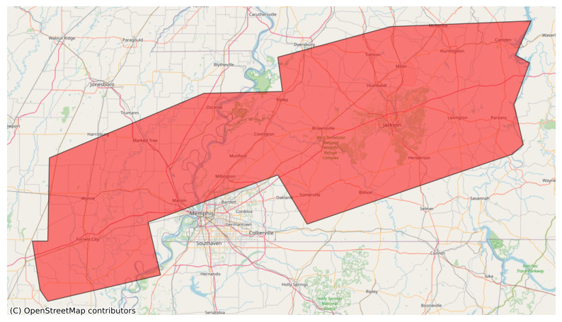
#EAS #WEA for Crittenden, #AR; #Cross, #AR; #Lee, #AR; #Mississippi, #AR; #Phillips, #AR; #Poinsett, #AR; #St. Francis, #AR; #Alcorn, #MS; #Benton, #MS; #Coahoma, #MS; #DeSoto, #MS; #Marshall, #MS; #Tippah, #MS; #Tunica, #MS; #Benton, #TN; #Carroll, #TN; #Chester, #TN; #Crockett, #TN; #Decatur, #TN; #Dyer, #TN; #Fayette, #TN; #Gibson, #TN; #Hardeman, #TN; #Hardin, #TN; #Haywood, #TN; #Henderson, #TN; #Lauderdale, #TN; #McNairy, #TN; #Madison, #TN; #Shelby, #TN; #Tipton, #TN; #Weakley, #TN: Nati
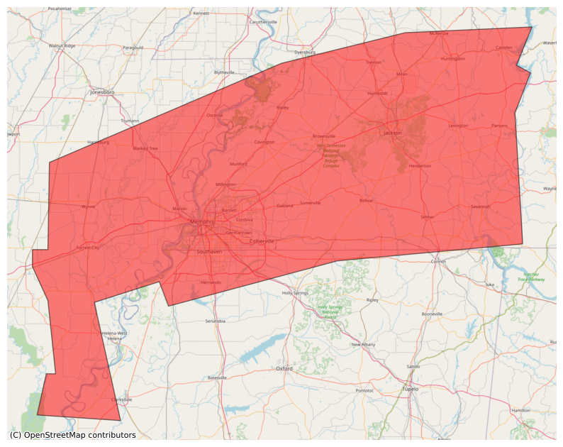
#EAS #WEA for Crittenden, #AR; #Cross, #AR; #Lee, #AR; #Mississippi, #AR; #Poinsett, #AR; #St. Francis, #AR; #Tunica, #MS; #Benton, #TN; #Carroll, #TN; #Chester, #TN; #Crockett, #TN; #Decatur, #TN; #Dyer, #TN; #Fayette, #TN; #Gibson, #TN; #Hardeman, #TN; #Hardin, #TN; #Haywood, #TN; #Henderson, #TN; #Lauderdale, #TN; #McNairy, #TN; #Madison, #TN; #Shelby, #TN; #Tipton, #TN; #Weakley, #TN: National Weather Service: A FLASH #FLOOD WARNING is in effect for this area until 6:45 PM CDT. This is a da

#EAS #WEA for Crittenden, #AR; #Cross, #AR; #Lee, #AR; #Mississippi, #AR; #Poinsett, #AR; #St. Francis, #AR; #Tunica, #MS; #Benton, #TN; #Carroll, #TN; #Chester, #TN; #Crockett, #TN; #Decatur, #TN; #Dyer, #TN; #Fayette, #TN; #Gibson, #TN; #Hardeman, #TN; #Hardin, #TN; #Haywood, #TN; #Henderson, #TN; #Lauderdale, #TN; #McNairy, #TN; #Madison, #TN; #Shelby, #TN; #Tipton, #TN; #Weakley, #TN: National Weather Service: A FLASH #FLOOD WARNING is in effect for this area until 4:45 PM CDT. This is a da

#EAS #WEA for Crittenden, #AR; #Cross, #AR; #Lee, #AR; #Mississippi, #AR; #Poinsett, #AR; #St. Francis, #AR; #Tunica, #MS; #Benton, #TN; #Carroll, #TN; #Chester, #TN; #Crockett, #TN; #Decatur, #TN; #Dyer, #TN; #Fayette, #TN; #Gibson, #TN; #Hardeman, #TN; #Hardin, #TN; #Haywood, #TN; #Henderson, #TN; #Lauderdale, #TN; #McNairy, #TN; #Madison, #TN; #Shelby, #TN; #Tipton, #TN; #Weakley, #TN: National Weather Service: A FLASH #FLOOD WARNING is in effect for this area until 2:45 PM CDT. This is a da
#EAS #WEA for Benton, #TN; #Carroll, #TN; #Henry, #TN: National Weather Service: #TORNADO WARNING in this area until 5:45 AM CDT. Take shelter now in a basement or an interior room on the lowest floor of a sturdy building. If you are outdoors, in a mobile home, or in a vehicle, move to the closest substantial shelter and protect yourself from flying debris. Check media. Source: NWS Memphis TN ** DO NOT RELY ON THIS FEED FOR LIFE SAFETY, SEEK OUT OFFICIAL SOURCES ***
Client Info
Server: https://mastodon.social
Version: 2025.04
Repository: https://github.com/cyevgeniy/lmst