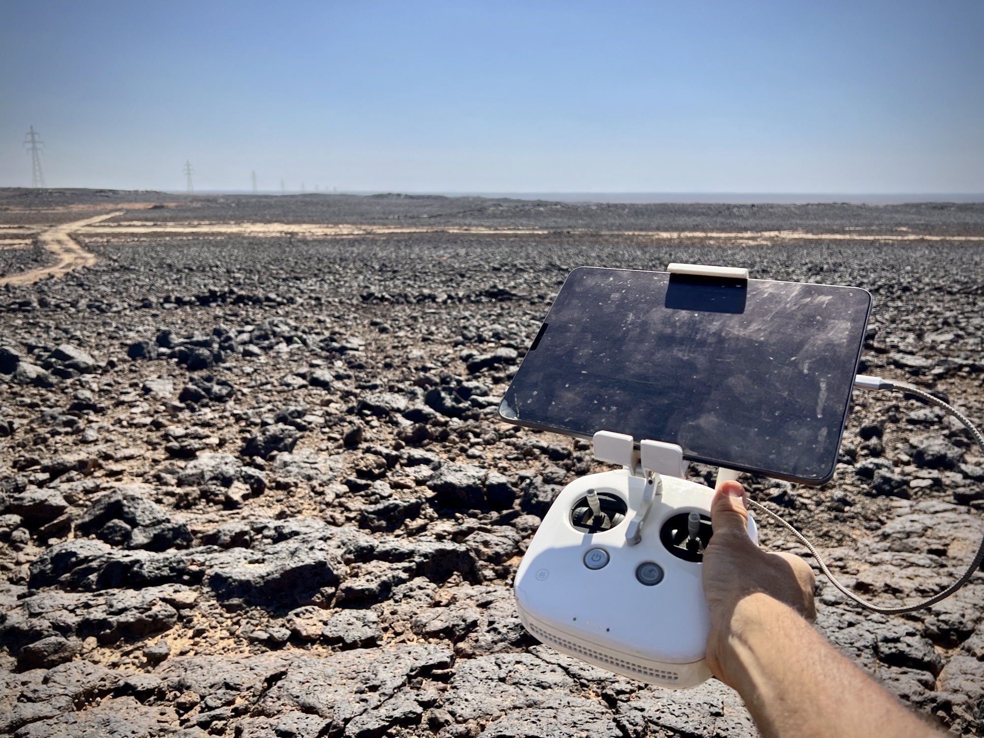
Ancient animal trap, eastern Jordan 2025 DJI Mini 3 Pro I often think of myself as primarily a film photographer, who mostly eschews digital. But so far this week, Ive recorded some 14,000+ digital images and just a few rolls of film! So, 🤷♂️😅! #Fieldwork #Jordan #DronesForGood #AerialPhotography
#dronesforgood
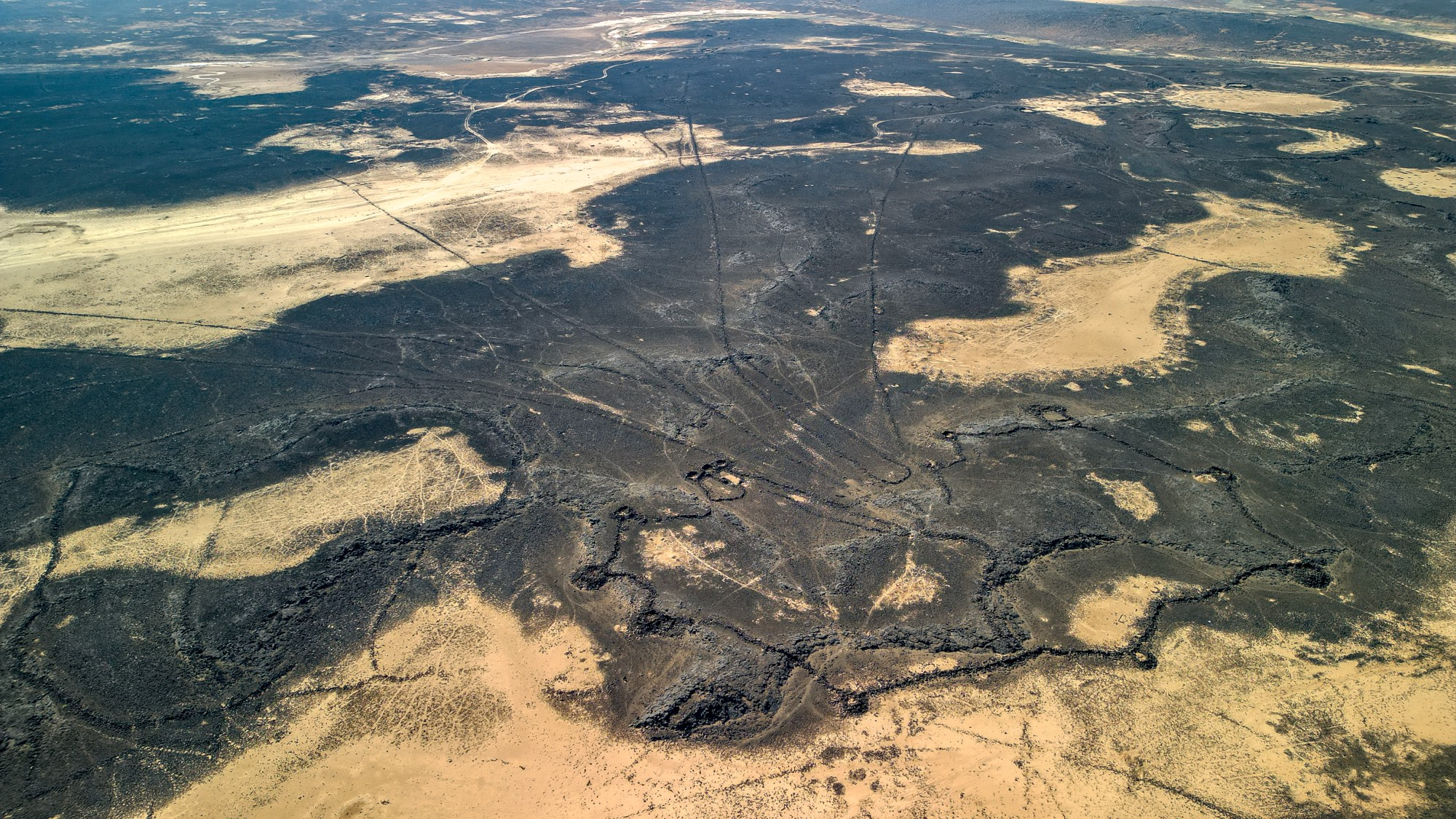
View from my “office” this morning. #Fieldwork #Jordan #DronesForGood
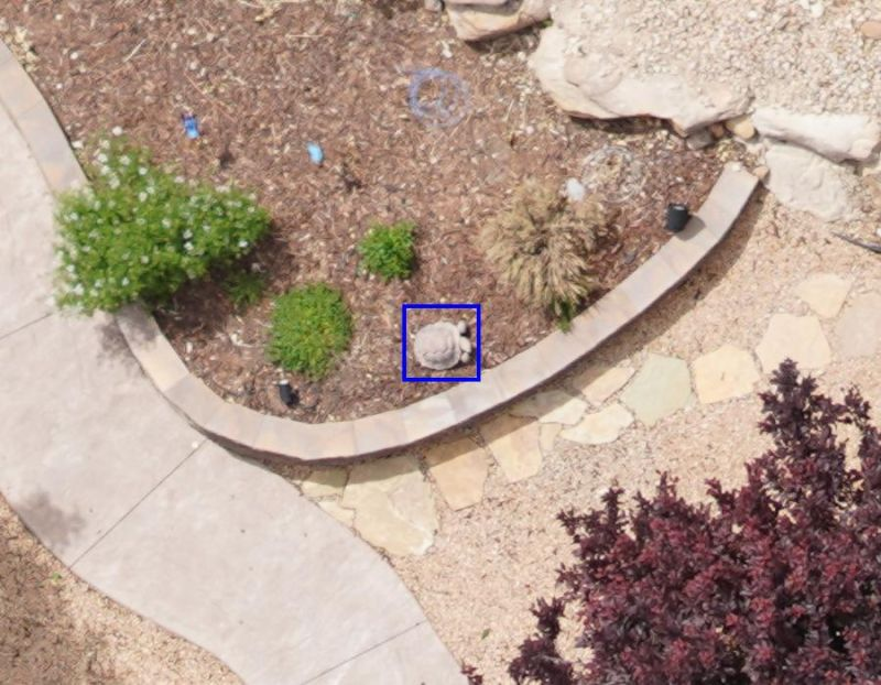
This is the kind of thing your model detects while conducting #drone/ #ai surveys for the #mojave desert #tortoise in a wildland/urban interface.
1️⃣
NYC explores drones for sanitation enforcement:
Address illegal garbage dumping & trash violations
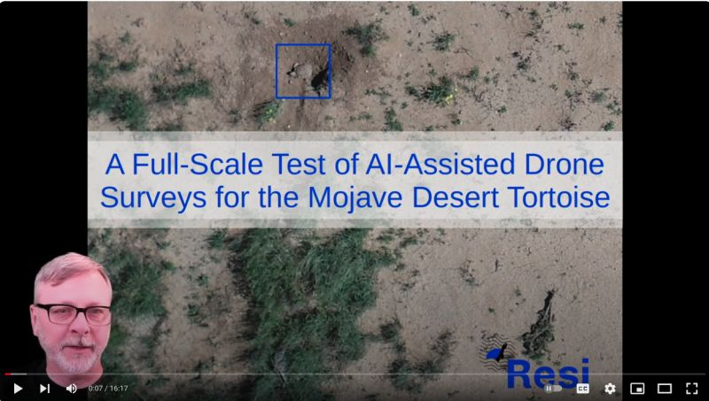
Please enjoy this recording of my 2023 presentation at the Desert Tortoise Council annual symposium. We've made some improvements since then, but it's still a good introduction to the #mojave #deserttortoise survey method we have developed at Resi.
#drones #dronesforgood #aiforconservation #ai #computervision
Free downloads for iOS and Android are available through links at our website, https://theta.limited.
To get directly in touch with our developers, please email:
support@theta.limited
,with subject "Maui Wildfire Recovery". Support services provided gratis.
#mauifires #mauiwildfires #dronesforgood #publicsafety #disasterrecovery #gis #dronetechnology #dronephotography
Theta Informatics stands ready to assist with Maui Wildfire recovery efforts.
Our free software, #OpenAthena for Android, allows a precise ground location to be obtained from any point in an image taken by common #drones. This may be useful for quickly marking damaged buildings, structures, and infrastructure from aerial images taken by drones.
#Maui #mauifires #mauiwildfires #dronesforgood #publicsafety #disasterrecovery #gis #dronetechnology #dronephotography
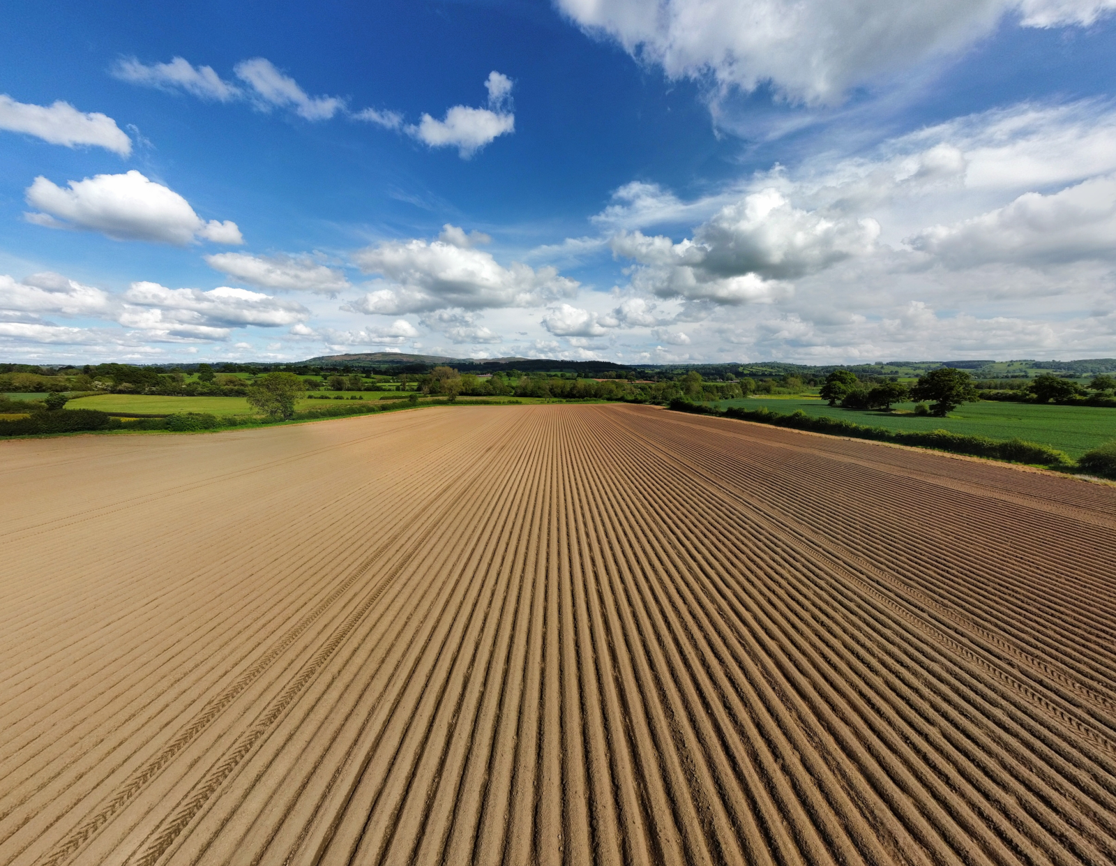
Hopefully not too long until the sun's out and it warms up a bit.
We potentially have a few agricultural trials to visit and document.
#Drone #DronesForAgriculture #DronesForGood #Agriculture #Farm #DronepPhoto #AerialPhotography #DronePhotography #Countryside #Landscape #Photography #Shropshire #England #UK #WelshMarches
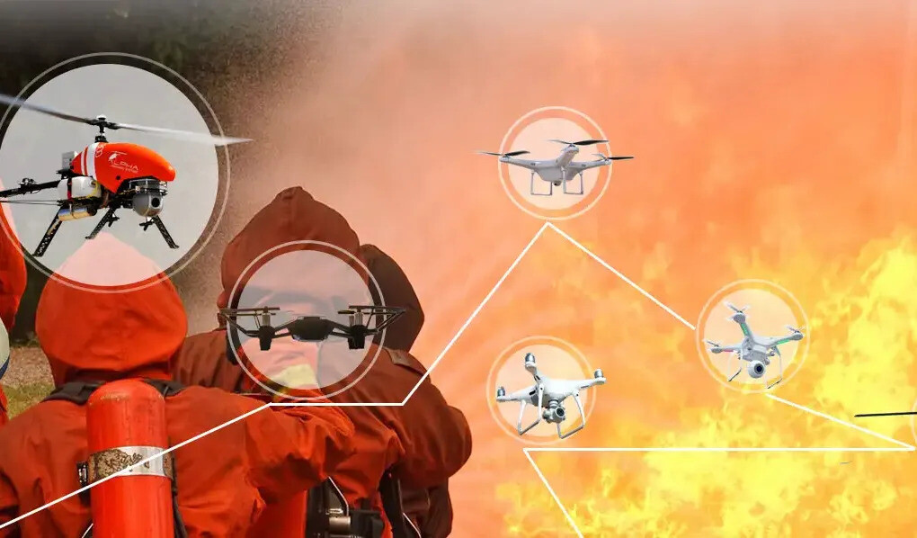
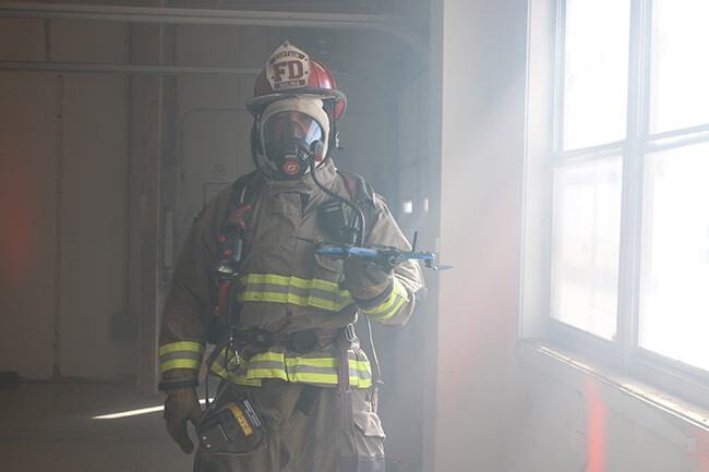
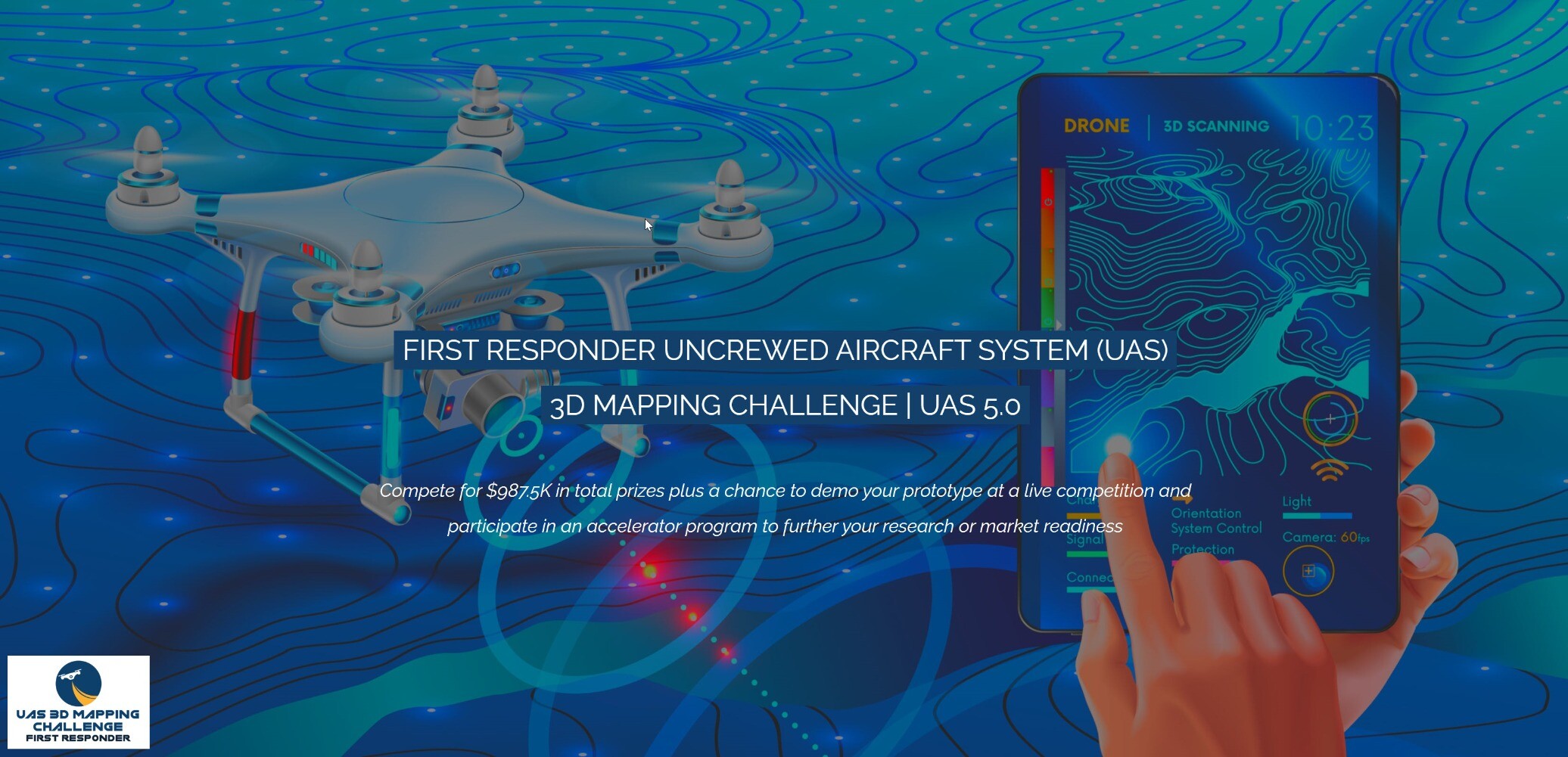
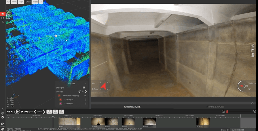
First Responder UAS 3D Mapping Challenge (UAS 5.0)
--
https://www.challenge.gov/?challenge=uas5 challenge details
--
https://firstresponderuaschallenge.org/uas5/ <-- application page
--
[total cash prizes of ~ $1,000,000; note that I have ZERO involvement with this challenge]
#GIS #spatial #mapping #indoors #UAS #drones #drone #dronesforgood #dronesurvey #dronesurveying #emergencyresponse #firstresponders #firefighting #firefightingequipment #challenge #competition #gischat #infrastructure #design #people #safety #buildings #survey #response #3D #3dmodeling #3dscanning #3dmapping #aerialsurvey #buildinginspection #NIST
Client Info
Server: https://mastodon.social
Version: 2025.04
Repository: https://github.com/cyevgeniy/lmst