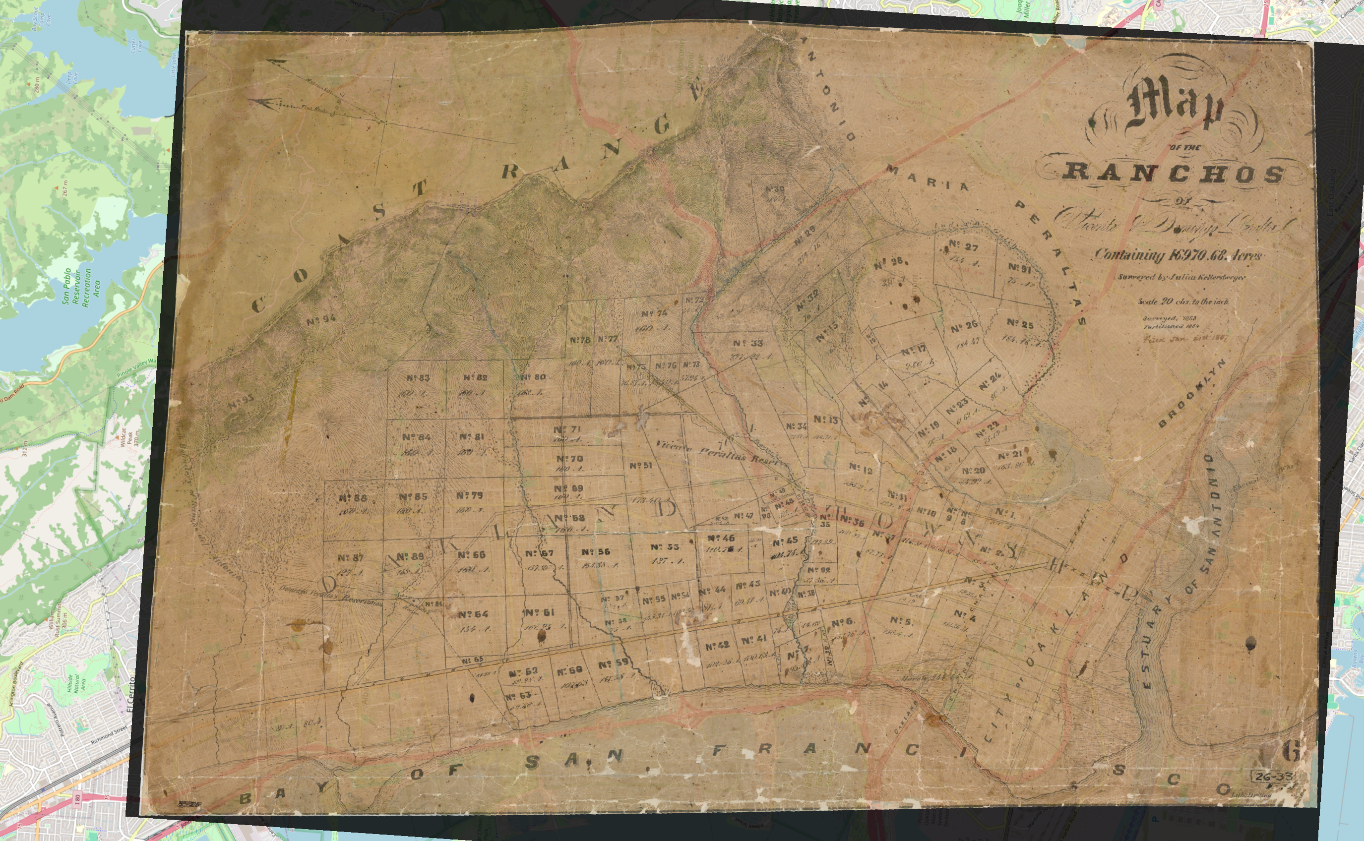
#oldMaps
Hey #Oakland & #Berkeley: I #georeferenced the 1854 Julius Kellersberger "#Map of the Ranchos of Vicente and Domingo #Peralta" using #QGIS. I've exported a 300dpi (zoomable) image of it with some transparency and a modern #OpenStreetMap base map, so you can see how it relates to the modern world.
I will write a blog post about it, with zoomed-in sections, but for now, a few observations:
* There are some very old roads.
* Why the streets and neighborhoods are cattywampus.
* Domingo's home (cordornices) is a landmark, as is Vicente's preserve.
* The brothers had a road between their homes, mostly gone, but traces remain. Vicente Way at Claremont Ave is the beginning.
https://drive.google.com/file/d/1368I2BSZEIlXS8CdqEGpwCh5wh_gazQW/view?usp=sharing
I'll also upload a 72 dpi version here, but the useful version is at the google drive link. It's big. You might want to download it.
One of the reasons I did this was because of "Brik Kilns" at Adams Point, where the Grand Lake Theater is, now. I've been researching #bricks ...
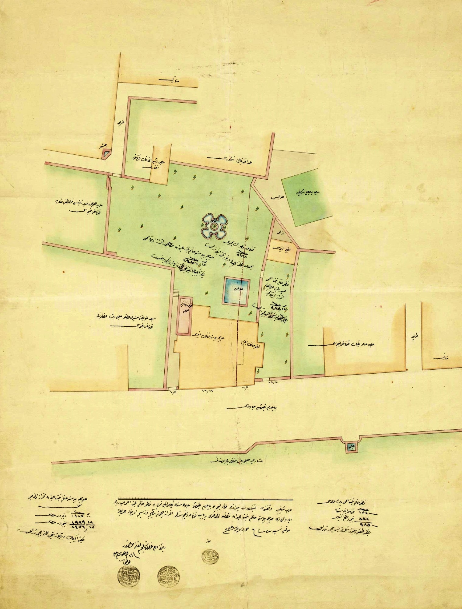
📜 A Plan Showing the Subdivision of a Mansion and Its Garden Belonging to Two Ladies Named Fatma and Hatice, Located on Bayıldımyokuşu Street in Dolmabahçe, Beşiktaş, Istanbul, September 3, 1872 #OldMaps #Archive
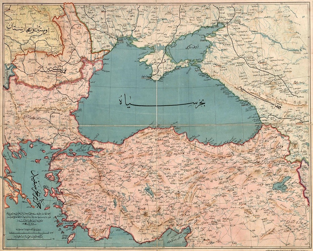
🗺️ A Map of the Ottoman Empire in Asia and Europe, 1877 #OldMaps
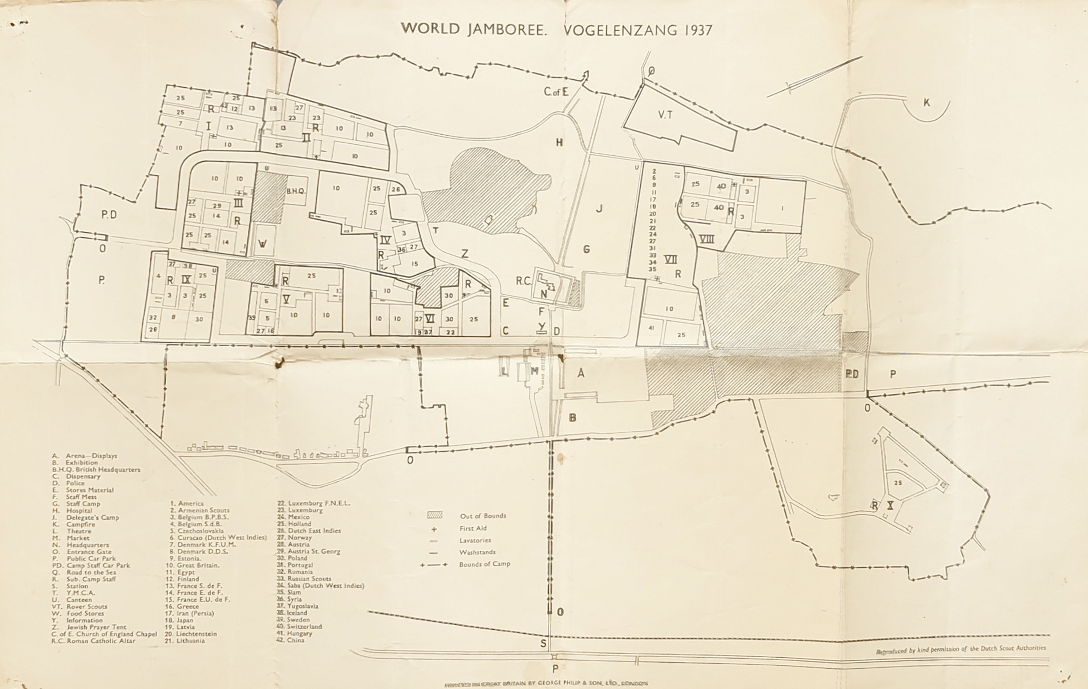
#Vogelenzang in North Holland was the site of the 5th World Scout Jamboree, held in 1937, which brought together 28,750 Scouts and Guides from all over the world.
I guess that I picked this old map up clearing old paperwork out of our Scout hut 45 or more years ago and it's been in amongst my old maps ever since.
#Scouts #Scouting #OldMaps
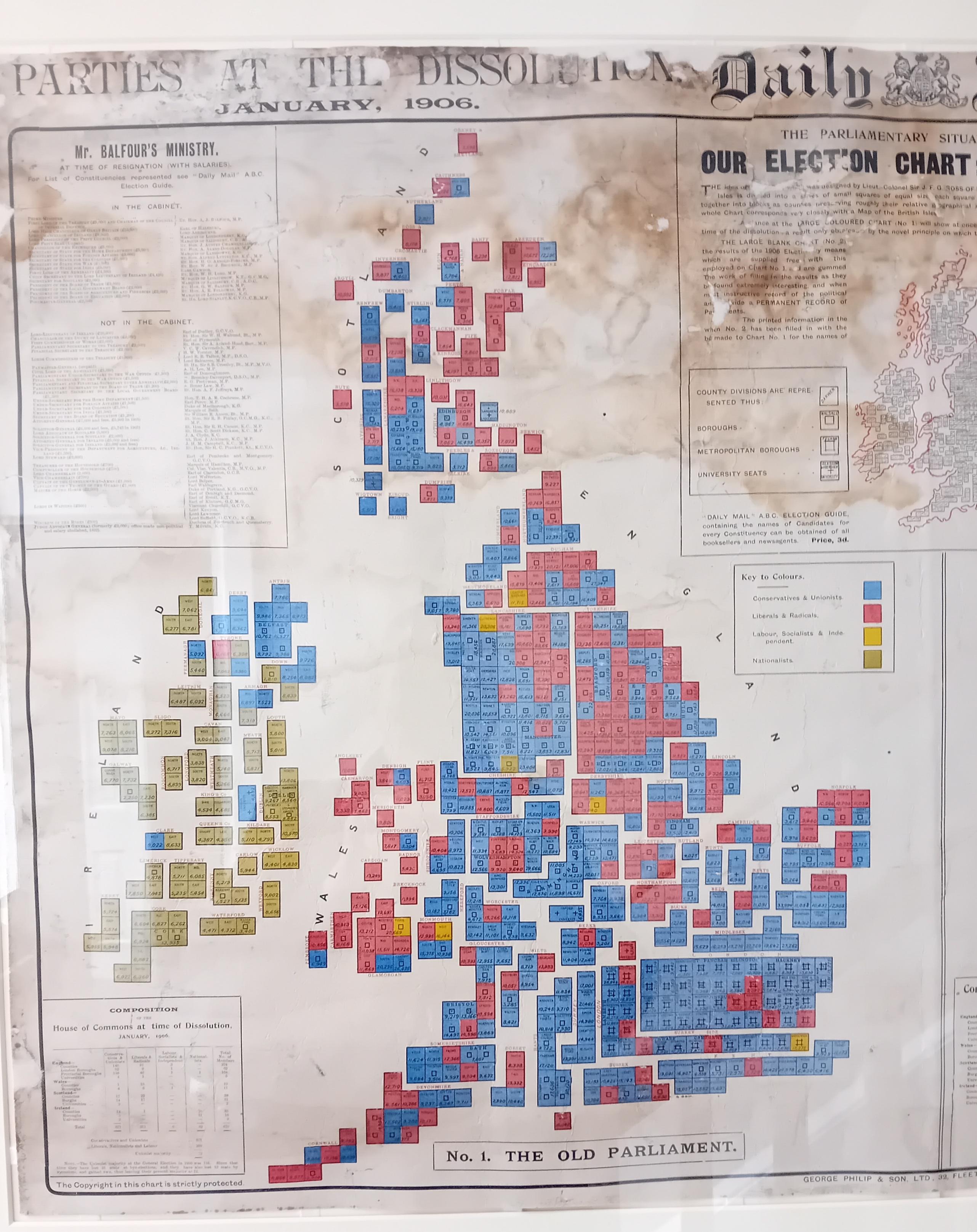
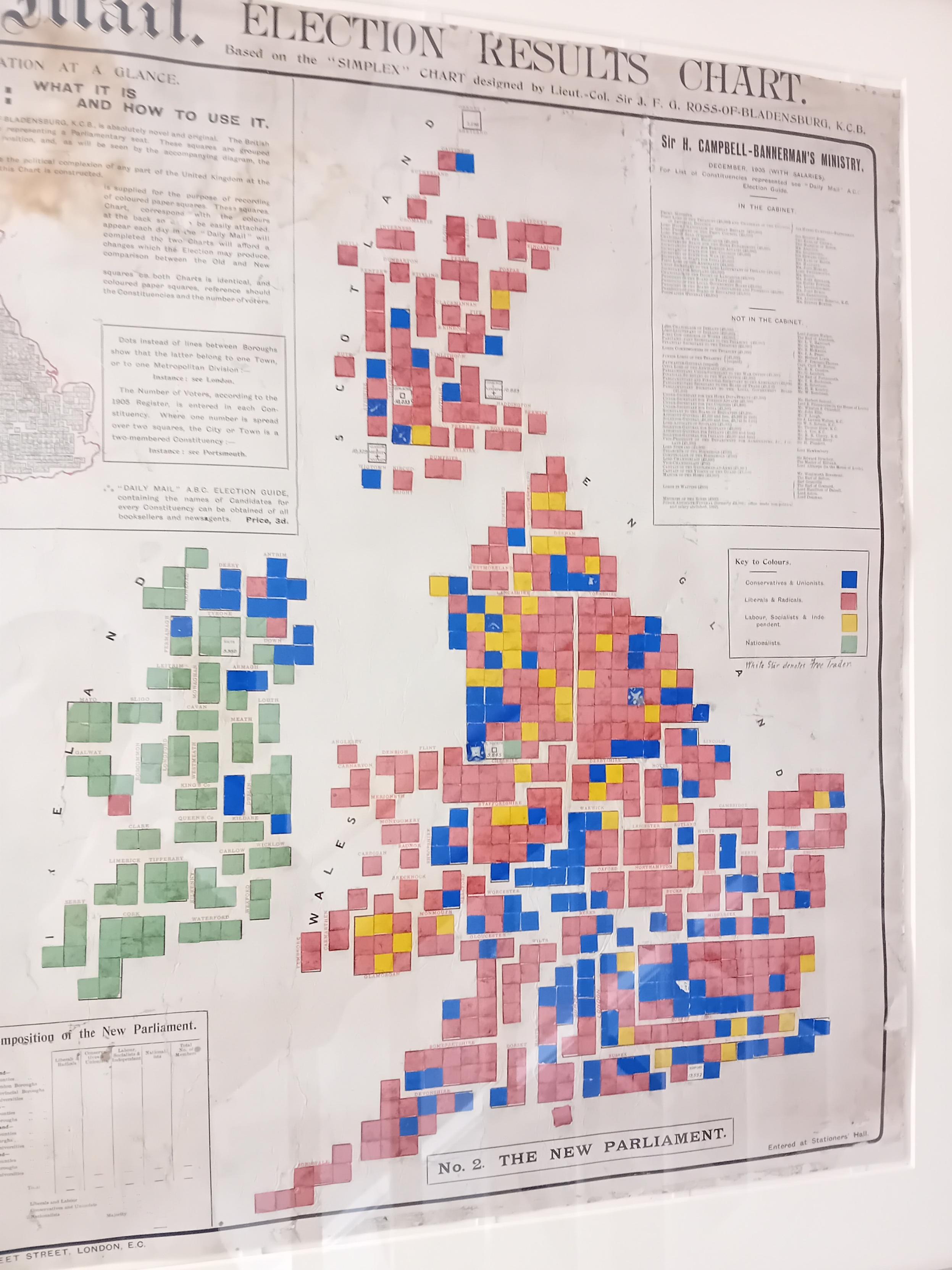
A pair of cartograms from the 1906 UK General Election. Seen framed on the wall of Bromley House Library.
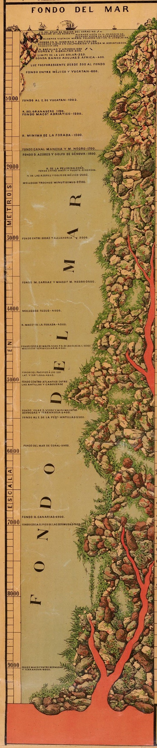
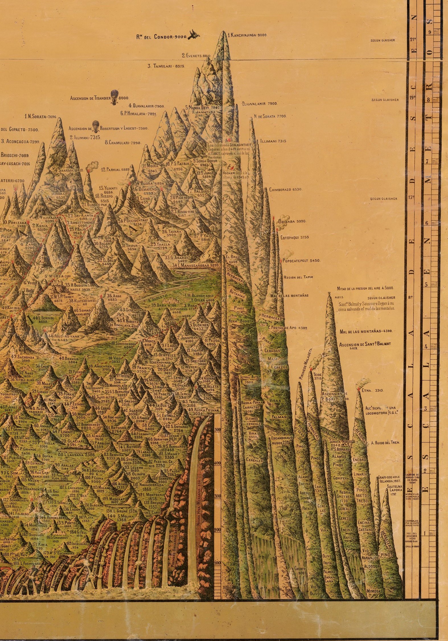
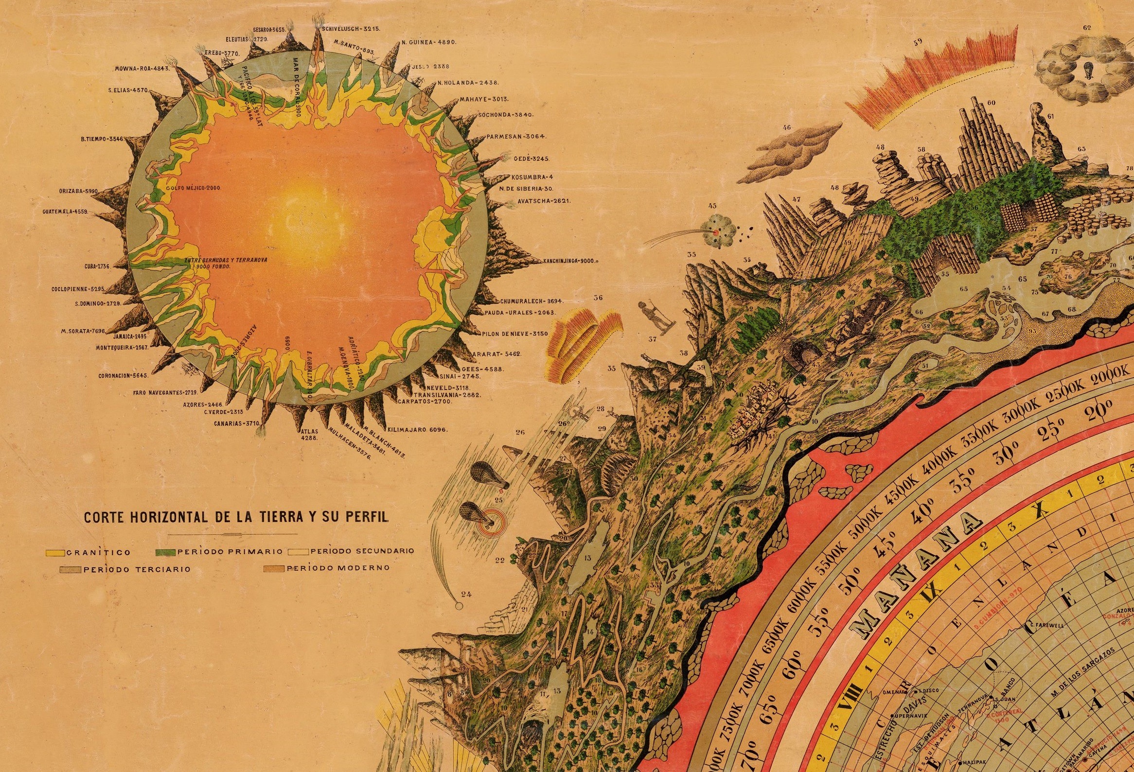
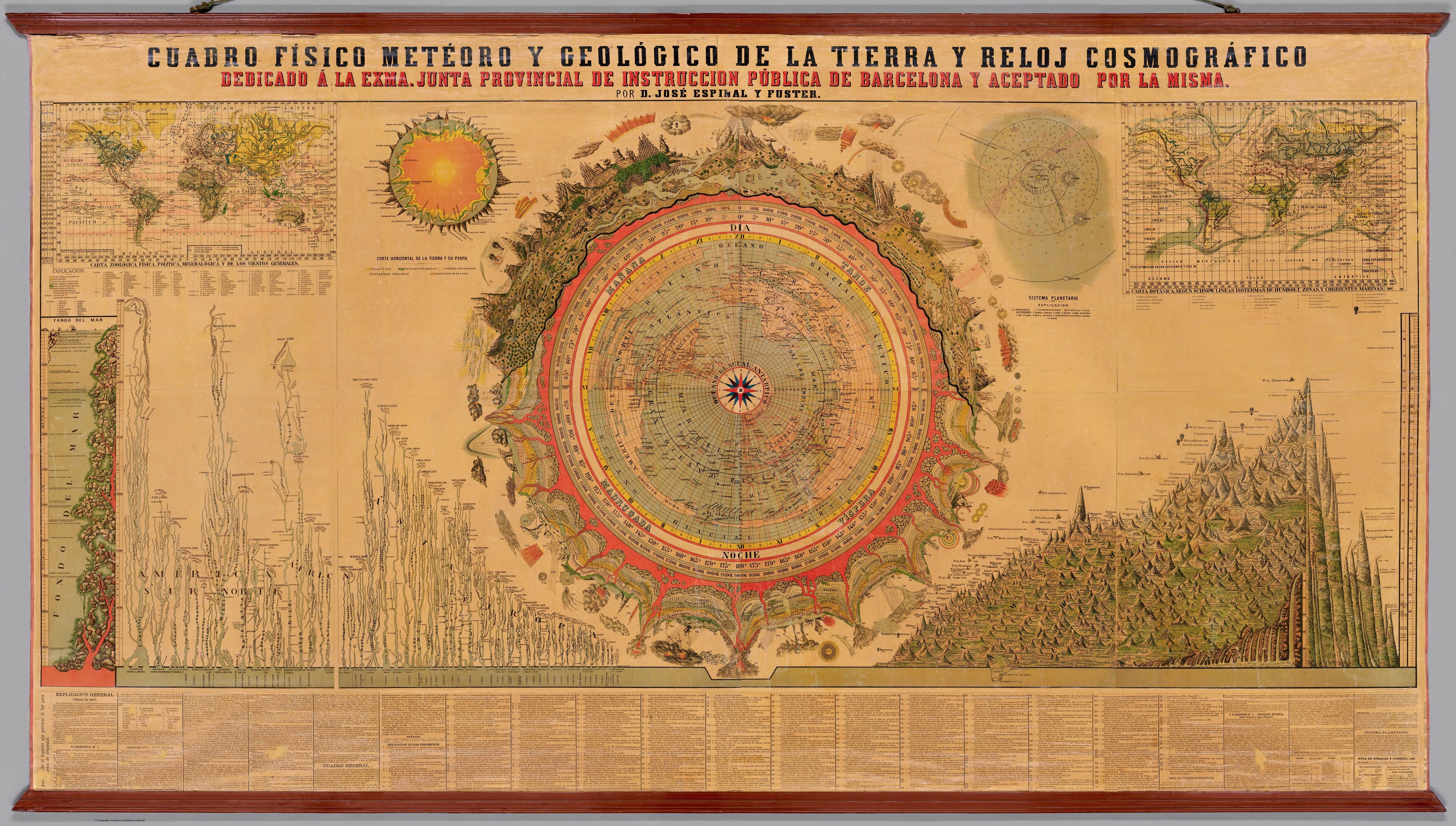
Cuadro Físico Meteoro y Geológico de la Tierra y Reloj Cosmográfico. (Physical, Meteorological, and Geological [1879] Chart of the Earth and Cosmographic Clock.)
--
https://www.davidrumsey.com/luna/servlet/detail/RUMSEY~8~1~366459~90133720:Cuadro-Fisico-Meteoro-y-Geologico <-- shared David Rumsey Map Collection holding, and download the high resolution digital copy of the map…
--
[the level of detail - with the ballon and other cartographic affectations…]
#GIS #spatial #mapping #cartography #maps #oldmaps #global #world #geography #geology #flora #fauna #terrestrial #FridayFeeling #gischat #Spain #rivers #mountains #humanity #globe #earth
@DavidRumseyMapCenter
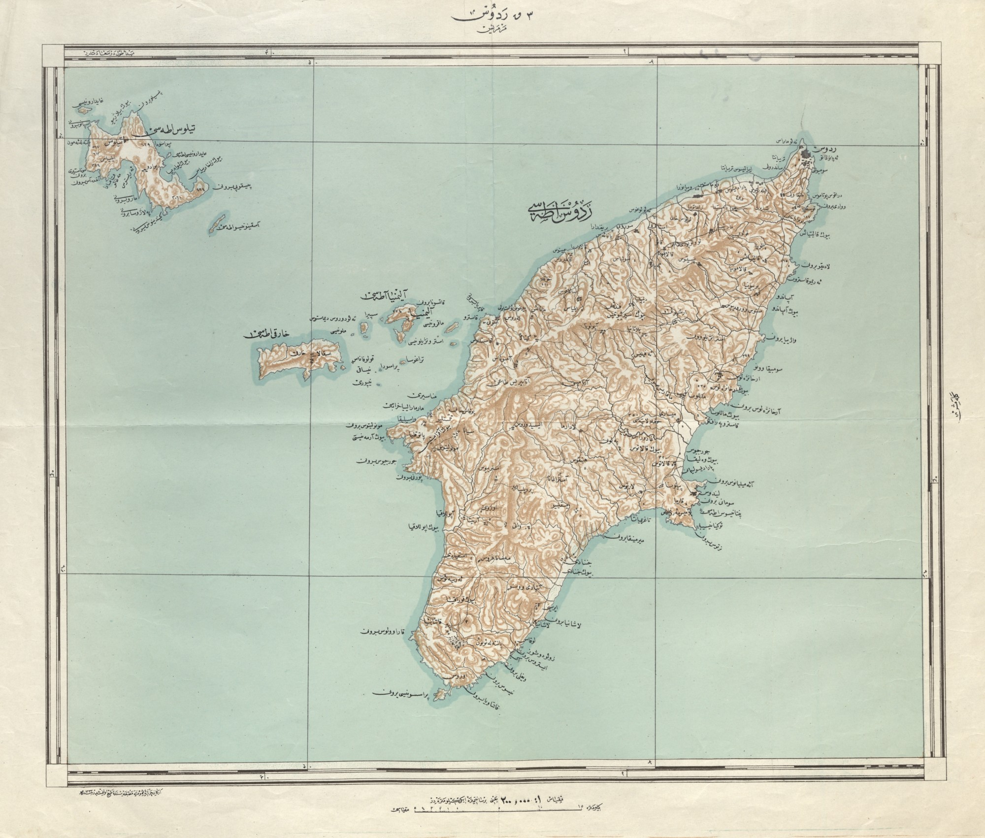
🗺️ An Ottoman Map of Rhodes, 1914 #Map #OldMaps #Rhodes #Historical
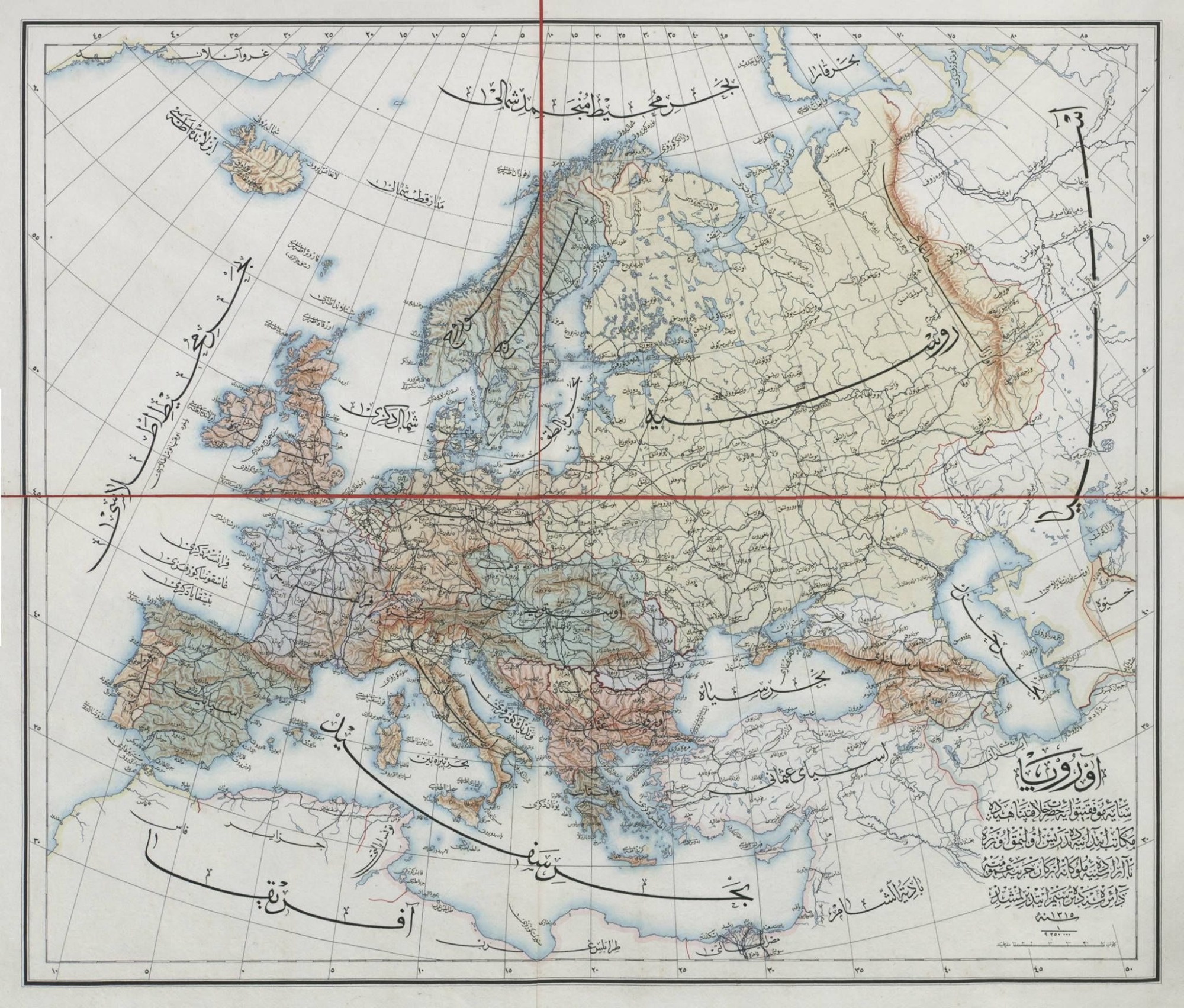
🗺️ An Ottoman Map of Europe, 1897 #Map #OldMaps #Europe #Historical

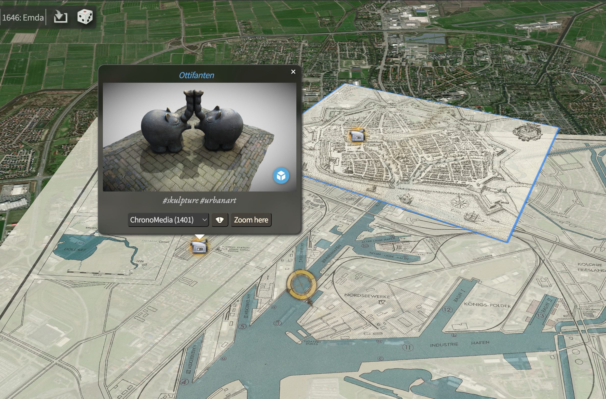
Moin. Chronoscope ist wenn…
https://mprove.de/chrono?q=53.35491,7.19822&z=14&t=53&m=LH100623190,YL15476450&o=0.8&s=1&i=1
🗺️ An Ottoman Map of #Canada, #Alaska, and #Greenland, 1907 #OldMaps #Map
Der #Rhein von Basel bis Lauterburg 1852 :: https://mprove.de/chrono?q=47.5535,7.47889&z=10.16&m=BFbtv1b102338381-2&o=0.95&s=1&i=1&c=A
Mit dem Parameter c=A,h,17*w,H,n ergibt das eine wunderbare Animation: https://mprove.de/chrono?q=47.55304,7.56502&z=12.15&r=-85&t=16&m=BFbtv1b102338381-2&o=0.95&s=1&i=1&c=A,h,17*w,H,n
A wie Alle
h wie Home
17 mal w wie Weiter
H wie Home für alle Karten
n wie Norden
🗺️ An Ottoman City Map of Selanik (Thessaloniki, Greece), 19th Century #OldMaps #Maps #OttomanEmpire
🗺️ An Ottoman Map of Mexico, Gulf of Mexico, Mexico-America Border, 1895 #Mexico #AmericanHistory #OldMaps #Map #MexicoHistory #History #Historical
🗺️ An Ottoman Map of the Yemen Vilayet, Late 19th Century #Map #OldMaps #HistoricalMaps #Yemen
Leaked concept study of a holo 3D Chronoscope World.
Check out the upside down map
here:https://mprove.de/chrono3d?q=40.25848,7.21744&z=2.32&r=-134&m=LBx633f954g&s=1
#geoixd #oldmaps #chronomedia #digitalhumanities #timetravel
and #DoNotBelieveAnythingOnlyBecauseItIsOnSocialMedia
🗺️ Wall Map of South America, 1920s #oldmaps #map #america #southamerica
🗺️ An Ottoman World Map, 1908 #history #oldmaps #map #worldmap #ottomanempire