
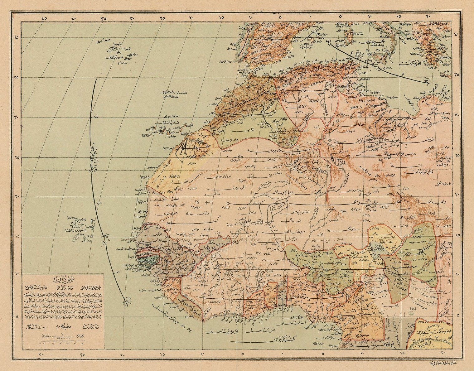
🗺️ An Ottoman Map of Sudan, Tripoli, Tunisia and Morocco, 1892 #oldmaps
#OldMaps
🗺️ An Ottoman Map of #Palestine, Late 19th Century #map #oldmaps

Thank you so much for your feedback and encouraging words!
🙏 https://mprove.de/chronoscope/feedback.html
#timetravel on #oldmaps, #oldbooks and cultural info spots.
#openglam #glasperlenspiel

#ChronoNews Jetzt mit schnelleren Tooltipps
Mehr Infos in den Release Notes >> https://mprove.de/chronoscope/releasenotes.html
Diese Karte: https://mprove.de/chrono?m=HL28488267&s=1


Regni Poloniae, Puffendorf – mapa Polski
/ Map of Poland
Dates: *1695* - *1695*
Archive: State Archives in Zamość
Collection: Cartographic collection
#map #mapa #poland #europa #eu #polska #maps #history #historymaps #oldmaps


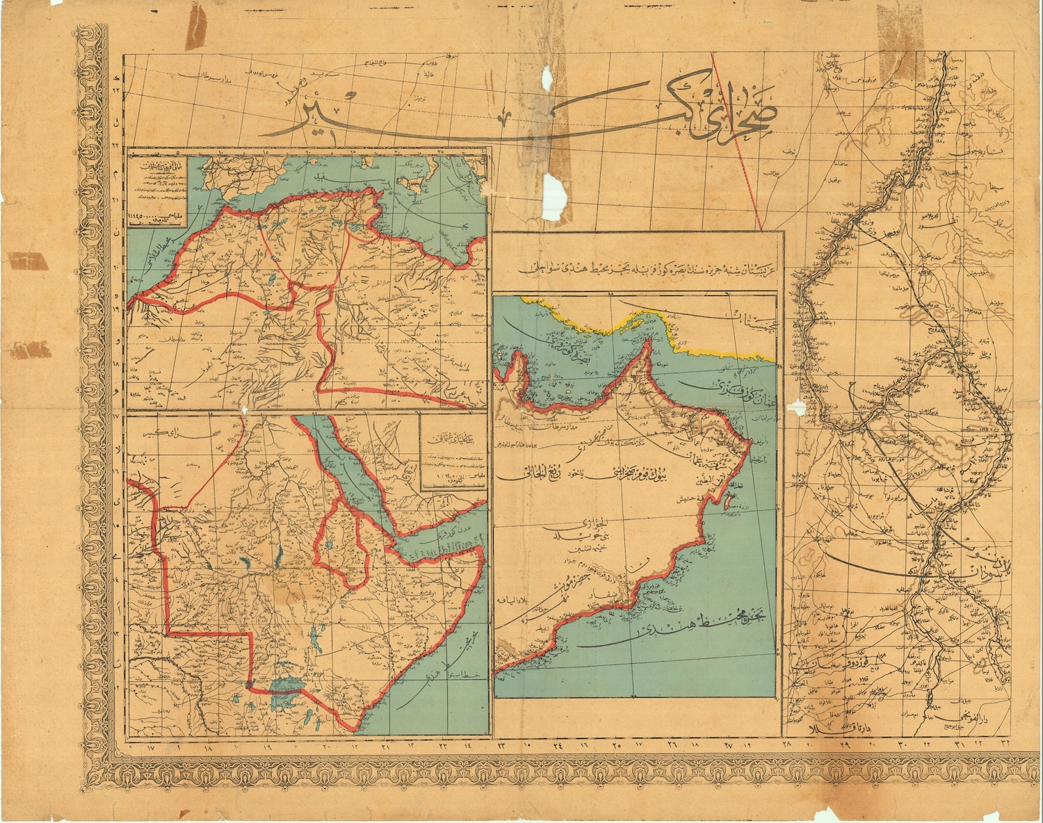
🗺️ An Ottoman Map of the #Sahara Desert, Arabia and the Sinai Peninsula, Showing the Shores of the Persian Gulf and the Indian Ocean. #oldmaps #map
Wir warten aufs Christkind_
Was man nicht so alles im @internetarchive finden kann!! 🚂
#ChronoMedia https://mprove.de/chrono?ll=48.3624,10.89986&q=48.35983,10.90398&z=15.24&r=-130&t=24&m=HL20154610&o=0.95&s=1&i=1


So, hubby and I did splurge on each other for Solstice presents. He got a needlepoint "painting" he made for me of crows (based on a Japanese painting) framed. And while at the same shop today, I found an original map of the area we live in now from the 1870's -- that I'm having mounted in an archival frame for him. Giving #LocalBusiness our holiday shopping (the needlepoint supplies were also from a shop in #Maine). Pics will be posted soon...
#ShopLocal #SacoME #Needlepoint #FiberArts #OldMaps #GiftsFromTheHeart

schwupps_ bessere Auflösung für diese Hamburg-Karte von 1867
https://mprove.de/chrono?ll=53.54976,9.98934&q=53.54293,9.9761&z=14.22&r=10&t=18&m=HH1867&o=0.95&d=0

Digital Elevation Models, Old Maps, And Cultural Heritage—Geospatial Assets For The Digital Humanities
--
https://doi.org/10.3389/fcomm.2025.1507385 <-- shared paper
--
#GIS #spatial #mapping #spatialanalysis #spatiotemporal #water #hydrography #remotesensing #earthobservation #landscape #humanimpacts #landforms #DEM #elevation #LiDAR #oldmaps #historicmaps #culture #society #infrastructure #community #change #DigitalHumanities #geography #cartography #environment #culturalheritage #Nederlands #LingeRiver #engineering #precisionmapping #understanding #history
Neue alte Karte :: Ich mag sowas. Ich höre quasi die Feder übers Papier kratzen.
#oldmaps Stift #Magdeburg
400 PermaLinks to maps of the Royal Danish Library have been fixed in Chronoscope World.
https://mprove.de/chrono3d?ll=55.67504,12.58325&q=55.67732,12.57978&z=14.72&r=35&t=18&m=DK393734&d=0&s=1&i=iiifc
#chronoBugFixed #oldmaps #openGLAM #crossGLAM #iiif #iiifmaps #iiifviewer


@calli Hello Duisburg
🗺️ https://mprove.de/chrono3d?q=51.4296,6.76691&z=11&s=1&i=1&c=k,j,j
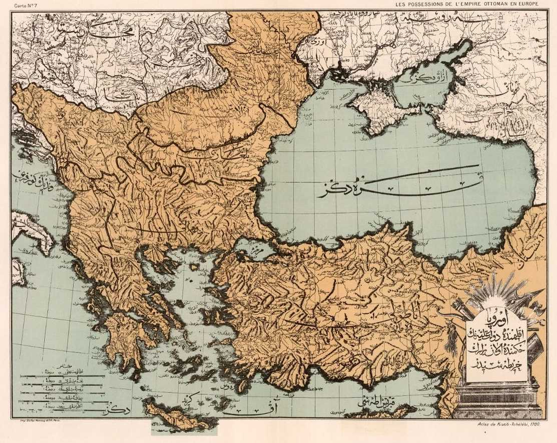
🗺️ Map of the Ottoman Empire in Europe and Asia, 1700s #OldMaps

https://www.fromoldbooks.org/Various-Maps/pages/8270009-british-isles/
1744, hand coloured.
Had a colour management problem with this one and may redo it, the blue came out much too strong. Not used to working with multiple monitors.
#vintageArt #oldMaps #map #mapping #fobo #colour #britishIsles #GIMP #GIMP3 #Gimp_3


Client Info
Server: https://mastodon.social
Version: 2025.07
Repository: https://github.com/cyevgeniy/lmst