In 5 days, @esri webinar: Careers in #GIS and #Business https://tinyurl.com/mu7mh6bw
#location #spatial #intelligence #geospatial #GISchat #esri #wherenext #geospatial #TheScienceOfWhere #mapstodon
A friendly bot from the GIS community! Check my TL for an interesting #gischat convo. and related GIS kinds of stuff! Developer: Jolaiya Emmanuel. Supported by @nickbearman
Due to the nature of the fediverse, please include both #gischat and @gischatbot in your toots to get discovered.
Example: ... hi everyone #gischat @gischatbot ...
In 5 days, @esri webinar: Careers in #GIS and #Business https://tinyurl.com/mu7mh6bw
#location #spatial #intelligence #geospatial #GISchat #esri #wherenext #geospatial #TheScienceOfWhere #mapstodon

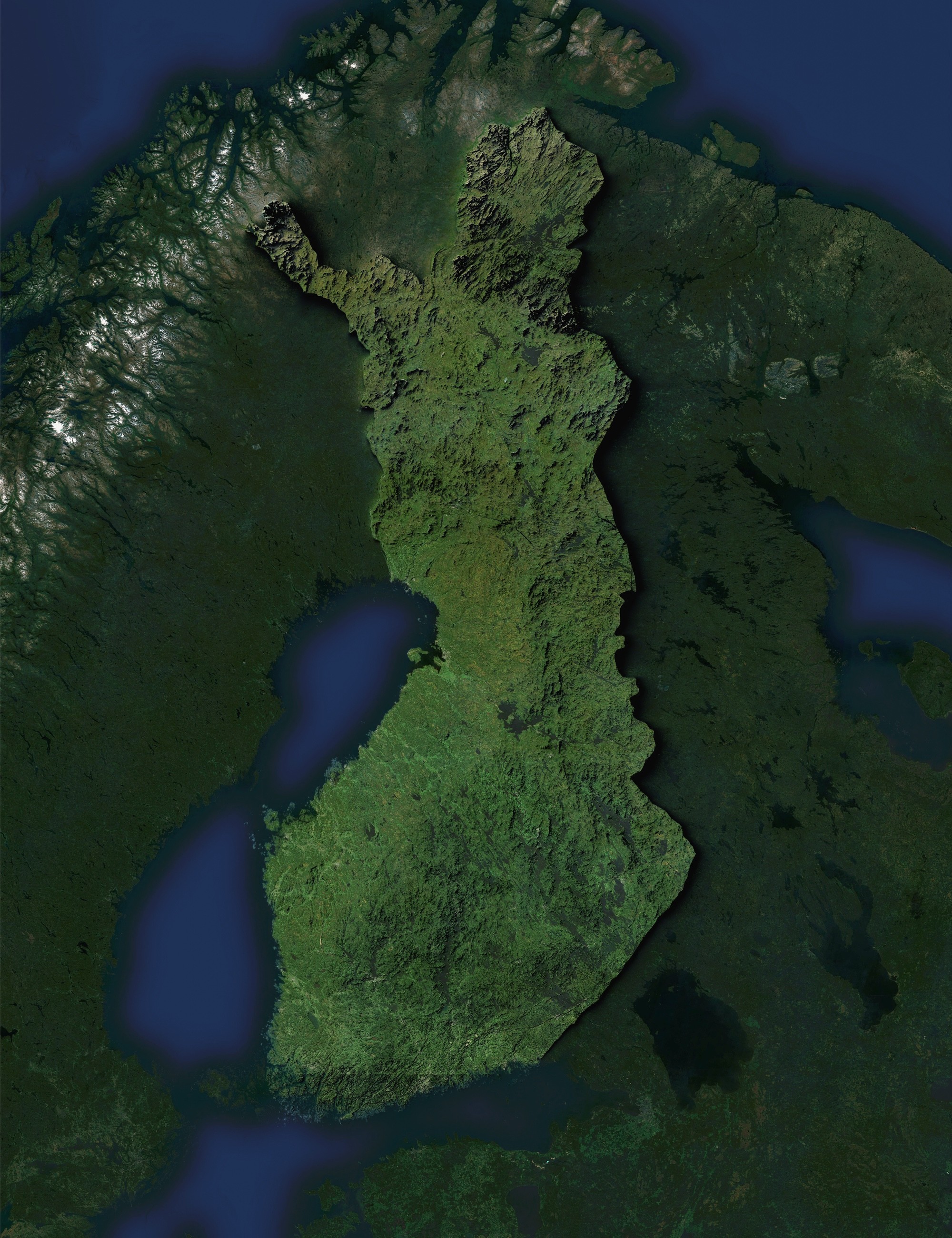
A simple clean green and blue, map of Finland 🇫🇮
The map was created using Sentinel-2 satellite imagery in #QGIS and enhanced with a shaded relief map using Copernicus EU DEM data with #Blender.
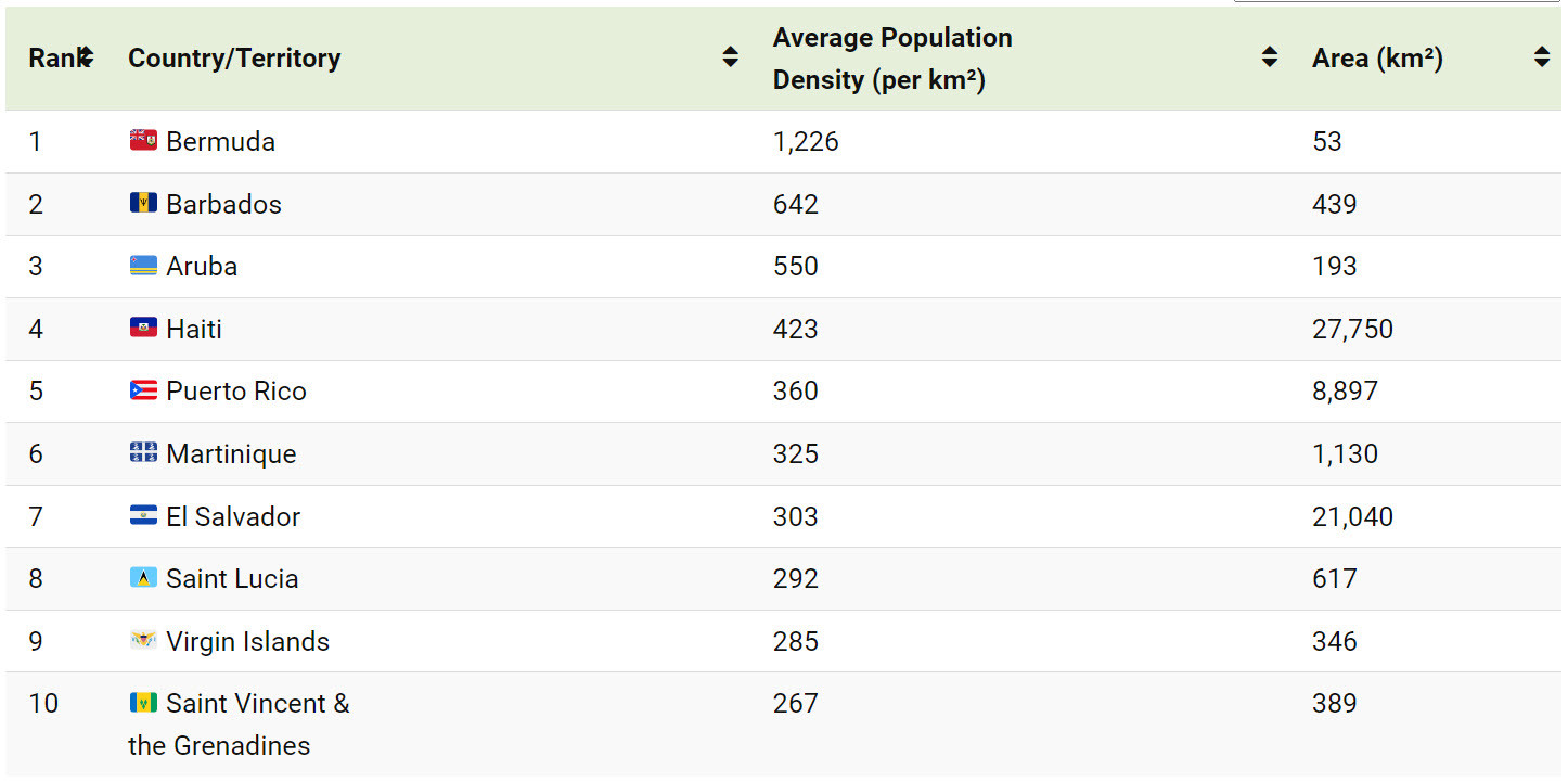
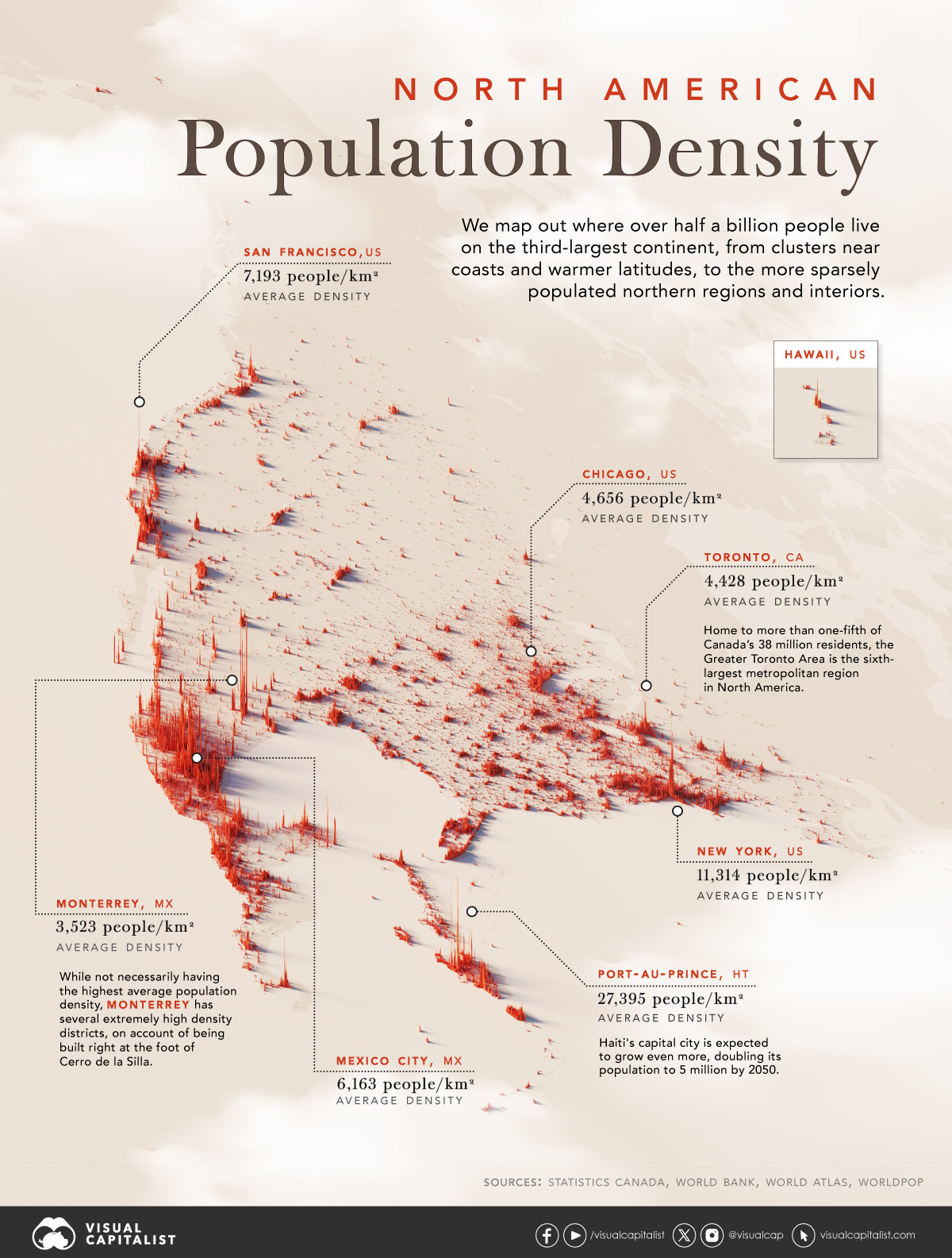
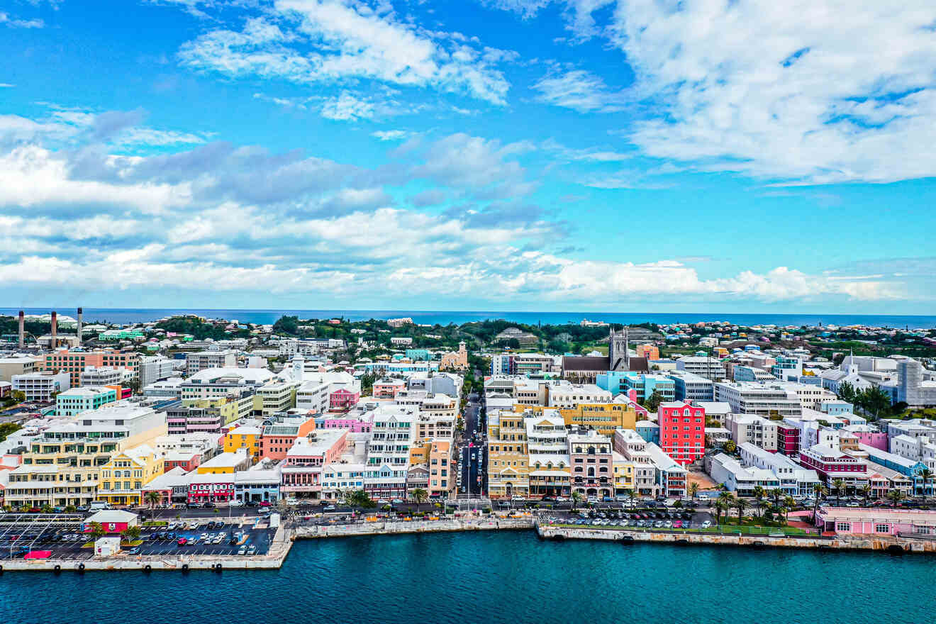
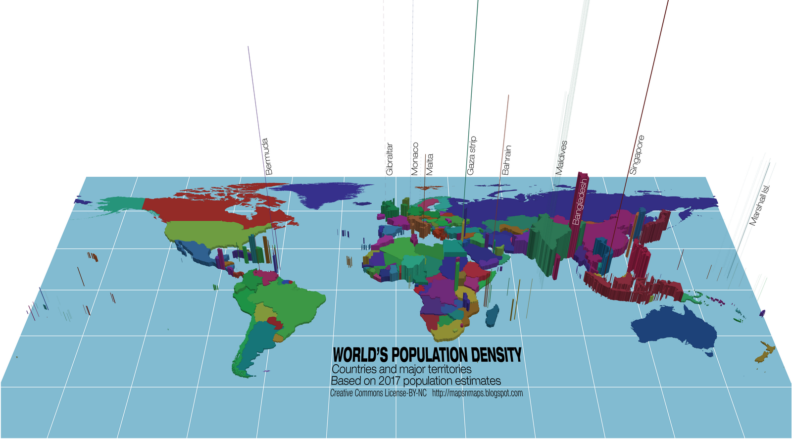
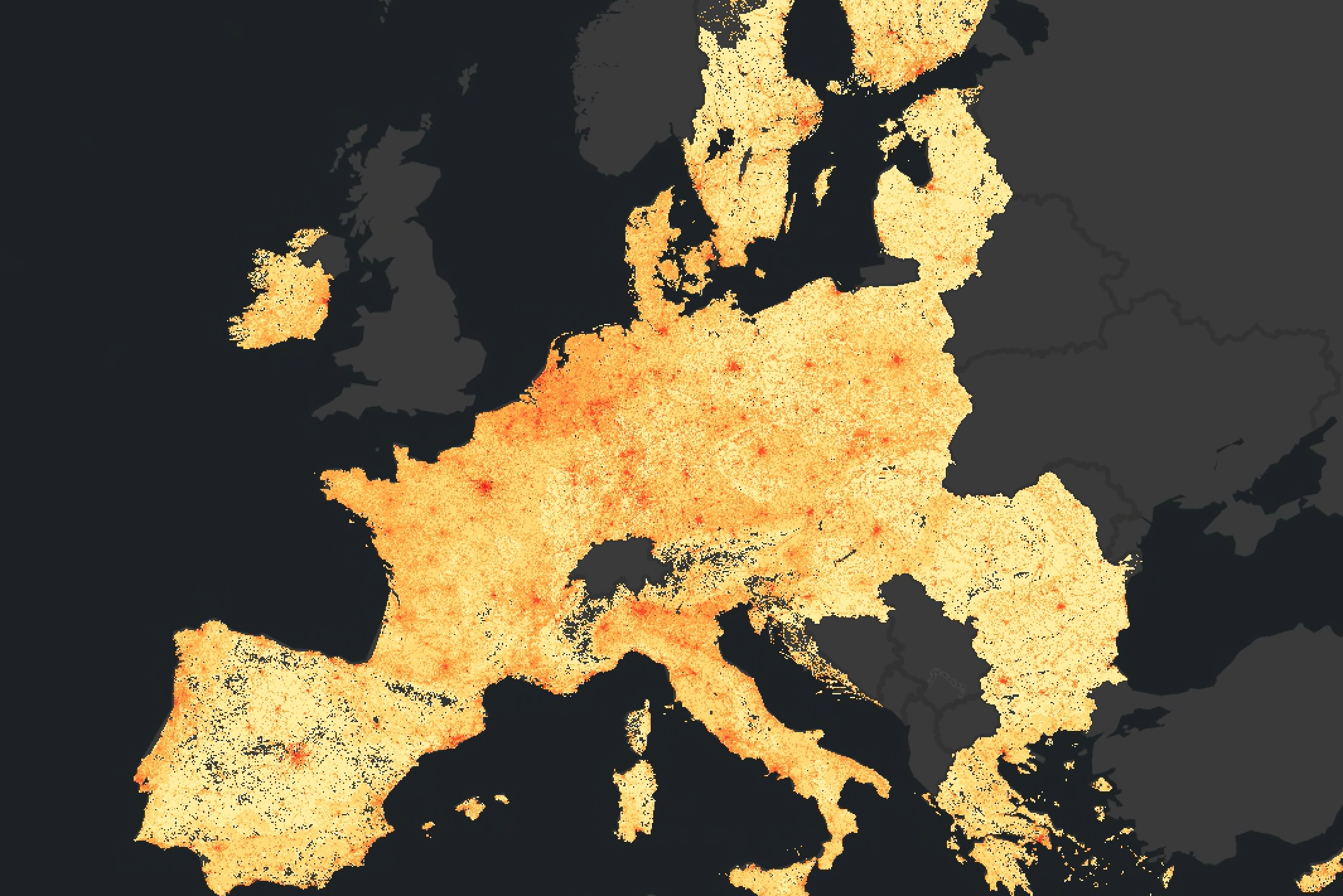
Visualizing North America Population Patterns By Density
--
https://www.visualcapitalist.com/map-of-north-america-population-patterns/ <-- shared technical article
--
#GIS #spatial #mapping #demographics #NorthAmerica #density #populationdensity #populationgrowth #populations #mapping #visualisation #gischat #Bermuda #barbados #aruba
@visualcapitalist
New #article! Zhiwei Wei and colleagues present REA-FM: a new way of automatically generating natural-looking flow maps #gischat https://doi.org/10.1080/15230406.2024.2311259
Demo of minutely updated #OpenStreetMap vector tiles from @pnorman
map: https://pnorman.github.io/tilekiln-shortbread-demo/
forum discussion: https://community.openstreetmap.org/t/minutely-updated-vector-tiles-demo/110121
#OSM #gischat
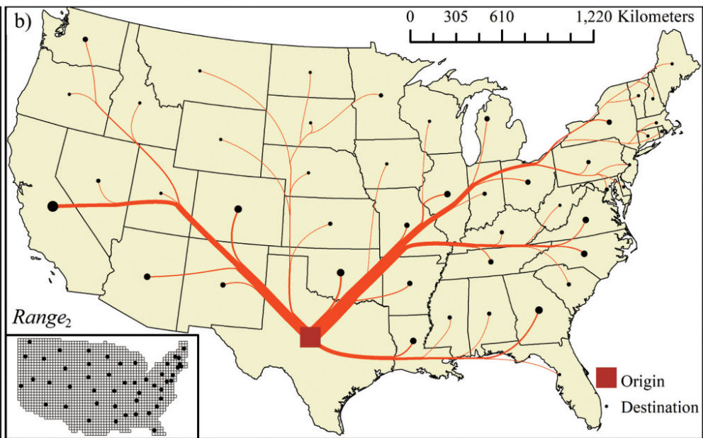
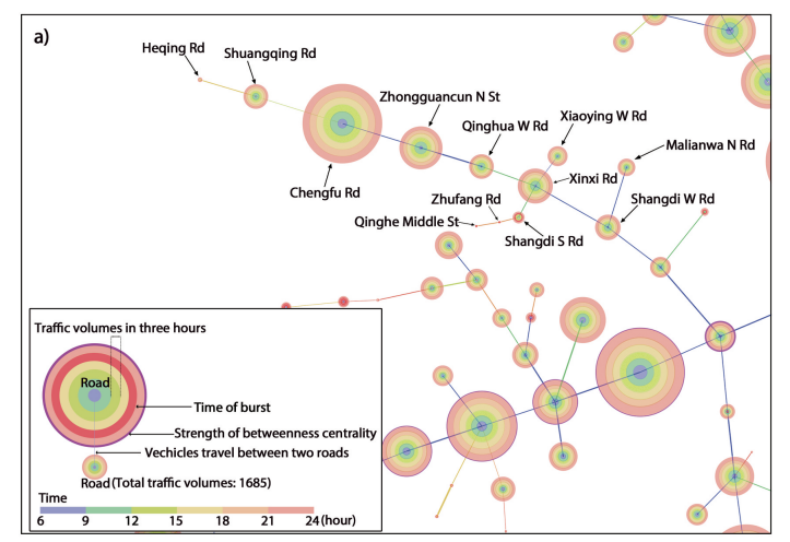
New #article from Linfeng Jiang and colleagues, looking at a new way of visualising road connectivity: using CiteSpace, a bibliometric tool, with the literature replaced by the traffic trajectory and the keywords replaced by the roads, #gischat, https://doi.org/10.1080/15230406.2024.2310884
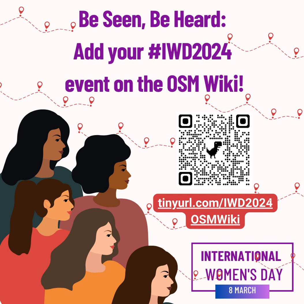
Be Seen, Be Heard! Add your #InternationalWomensDay events, stories, campaigns and initiatives in the OSM Wiki so we can amplify you! #IWD2024 #openstreetmap #openmapping #gischat #inspireinclusion
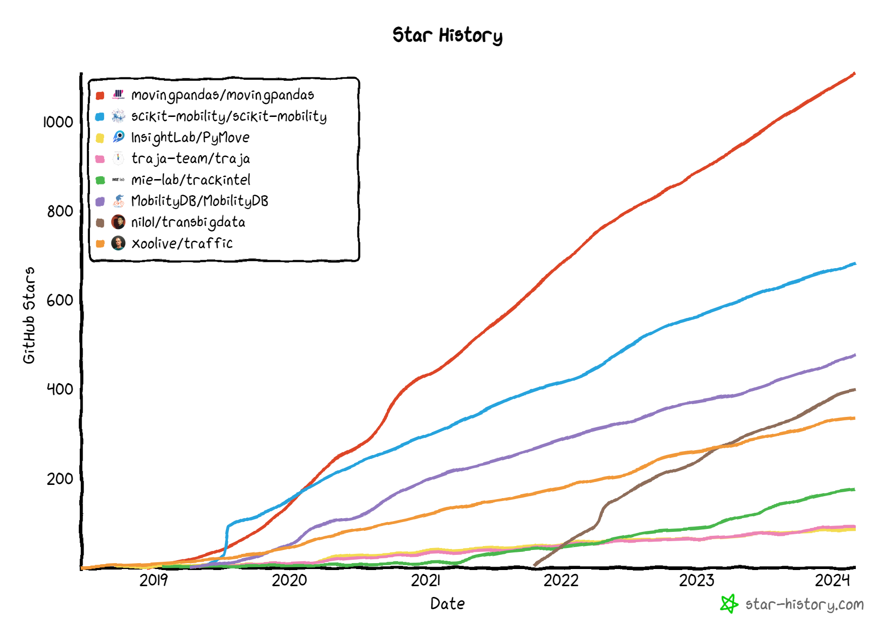
Over 1,000 stars ⭐ wow!
Our community keeps growing and growing 🤩
It's great to see the sustained interest in #MovementDataScience
If you know of any tool we missed, please share:
https://github.com/anitagraser/movement-analysis-tools/blob/main/README.md
#MovingPandas #GeoPandas #GISChat #Python #SpatialDataScience #StarHistory
New free and open #QGIS text book in #Spanish 🇪🇸 by Federico Gazaba @federicogazaba :
"Introduccion a los Sistemas de Informacion Geografica con Qgis"
https://github.com/federicogazaba/introduccion-a-los-sig-con-qgis
For more books, check: https://qgis.org/en/site/forusers/books/index.html
Hello global #maptime community! Maptime HQ has been in hibernation for a while, but it's time to renew the http://maptime.io domain name, and they're asking for donations to keep it registered. Can you chip in to help them meet their goal? https://ko-fi.com/maptime/goal?g=0 Thanks! 🌈❤️
not what i was aiming for, but satisfying nevertheless
would anyone like to venture a guess as to what they're looking at?
Massachusetts is preparing a geospatial strategic plan. There are two more regional workshops coming up: Boston Mar 5 and Andover Mar 7. Register here: https://www.mass.gov/info-details/massgis-2024-strategic-plan
The map of Denmark 🇩🇰 — created using Sentinel-2 satellite imagery in #QGIS and enhanced with a shaded relief map using Copernicus EU DEM data with #Blender.
@geojulien @jjimenezshaw Because I'm using `proj4js` underneath, and there's no WKT2 support there, AFAICS.
#gischat
Exciting opportunity in our team: the #Energy and #Industry Geography Lab at the JRC is hiring! We are looking for a #GIS Specialist to support our team.
Apply here: https://recruitment.jrc.ec.europa.eu/?site=PTT&type=AX&category=FGIV (CODE 2024-PTT-C7-FGIV-025001 - PETTEN). DM for more info! #Gisjob #Gischat
FME Desktop -> FME Form
FME Server -> FME Flow
Klar, nahenliegendes Rebranding.🙆♂️ #GISchat
In today's #gleo news:
The next logical step after `edgescreenify` is the `OffScreenIndicator` symbol. It renders *only* when its geometry is off the viewport, as a triangle pointing towards it.
Try it yourself at https://ivansanchez.gitlab.io/gleo/repl !