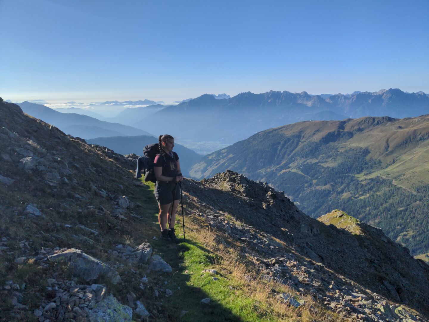
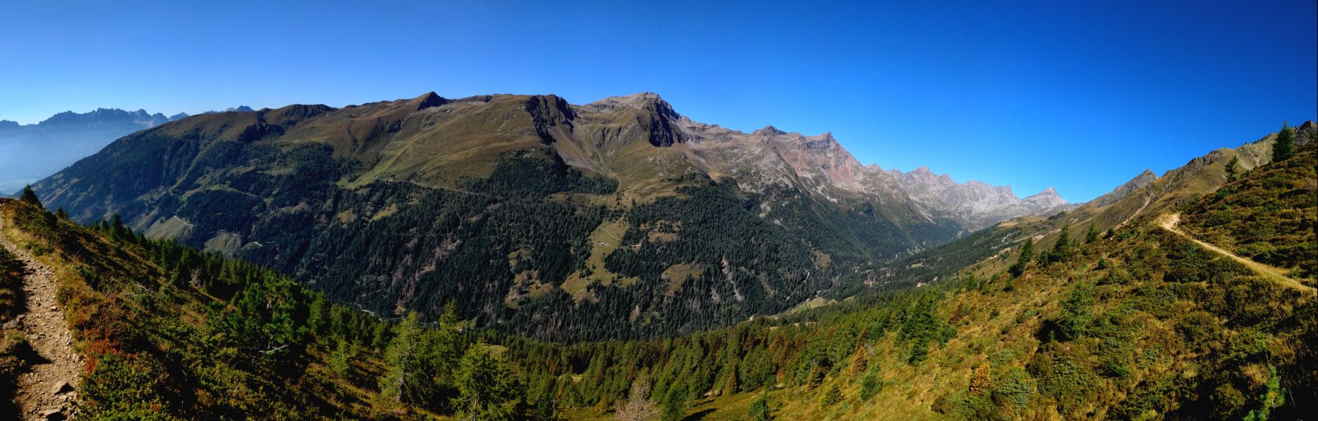
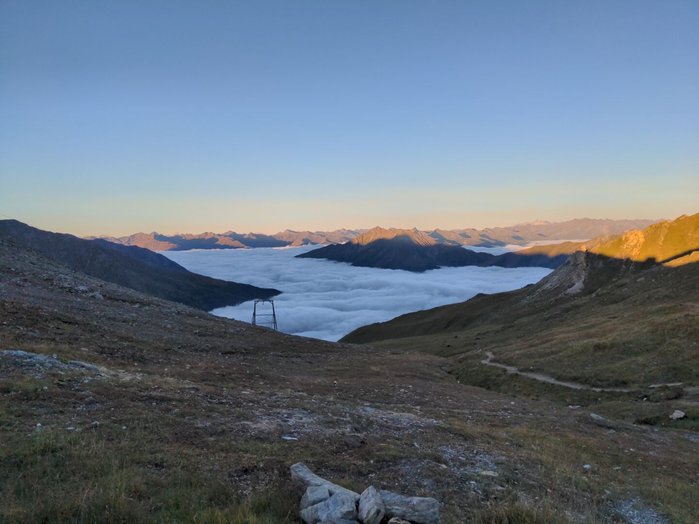
Temperature rose to 30 °C before midday on day eight of our crossing of the Alps and although the hike was not really challenging, we sweated a lot. After a long way down from Wangenitzseehütte to Iselsberg, we took the bus to Lienz, had a stroll though the city, boarded an ÖBB CityShuttle and finally reached our final destination for this day: Sillian near the Austrian-Italian border.
Duration: 6 hours (including breaks)
Length: 14.5 km
Elevation: 1120 m to 2620 m
Ascent/Descent: 150 m ↑ and 1550 m ↓
#TBT #ThrowbackThursday #Throwback #Hiking #Hike #Hikes #Hiker #HikingTrail #GoHiking #HikingView #HikingAdventures #Wanderlust #Wandern #Alpenuberquerung #Alpenüberquerung #Alpentraversale #Alpentraum #WalkAcrossTheAlps #CrossingTheAlps #Österreich #Austria #Alpen #Alps #AlpineHut #AlpineHuts #Berge #Mountains #MountainLovers #Bergliebe #Bergsee #MountainLake #BahnzumBerg #BzB #FensterAuf #ScenicsNature #Nature #OutdoorAdventure #Summer #Sunrise #SunriseMagic #Alpenglow #Alpenglühen #Wangenitzseehütte #Lienz #Schobergruppe #Osttirol #EastTyrol #Tirol #Tyrol
#AlpineHut
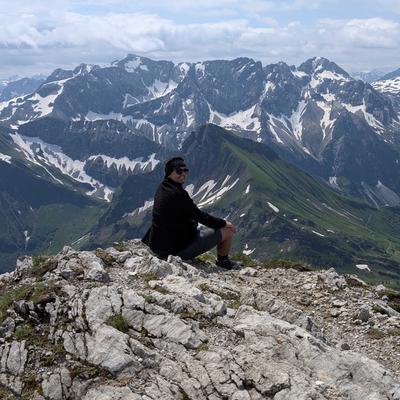
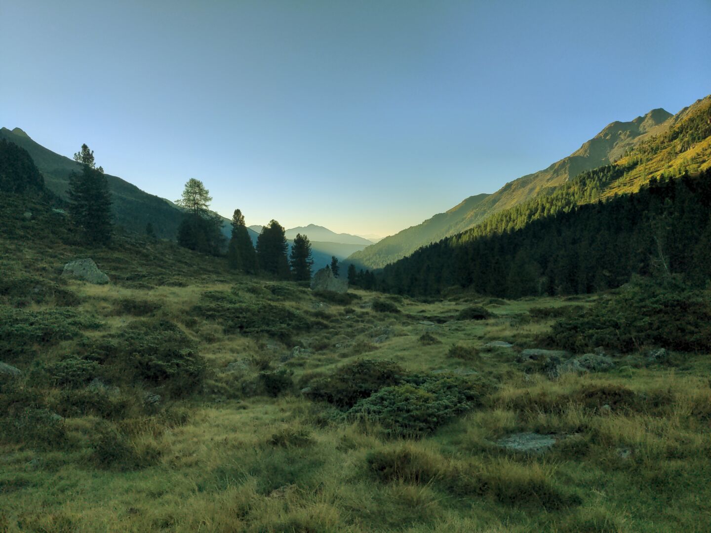
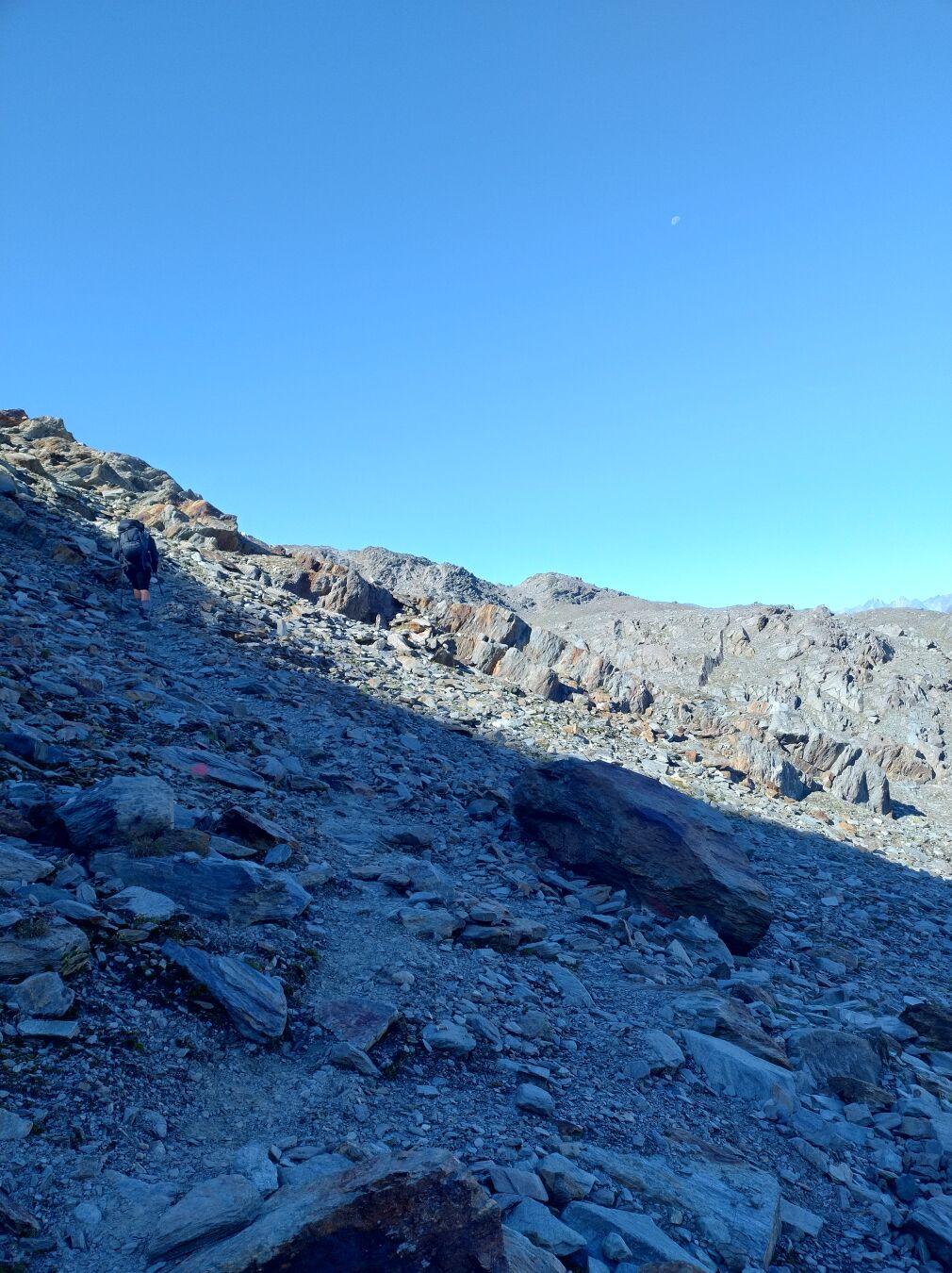
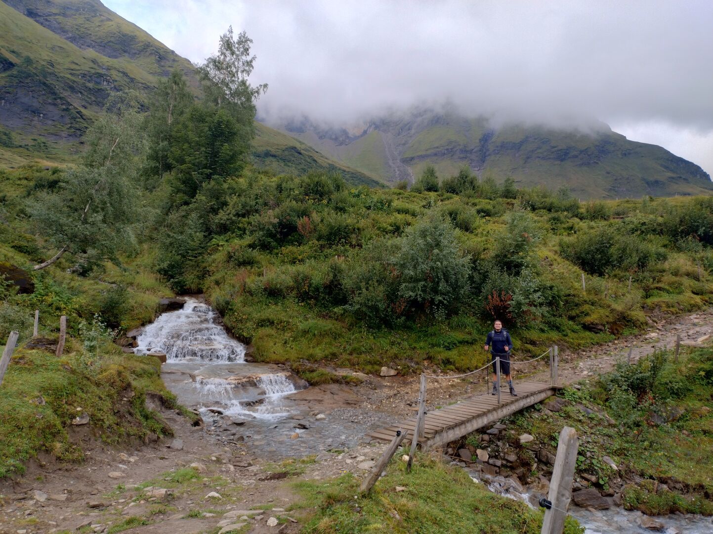
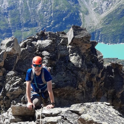
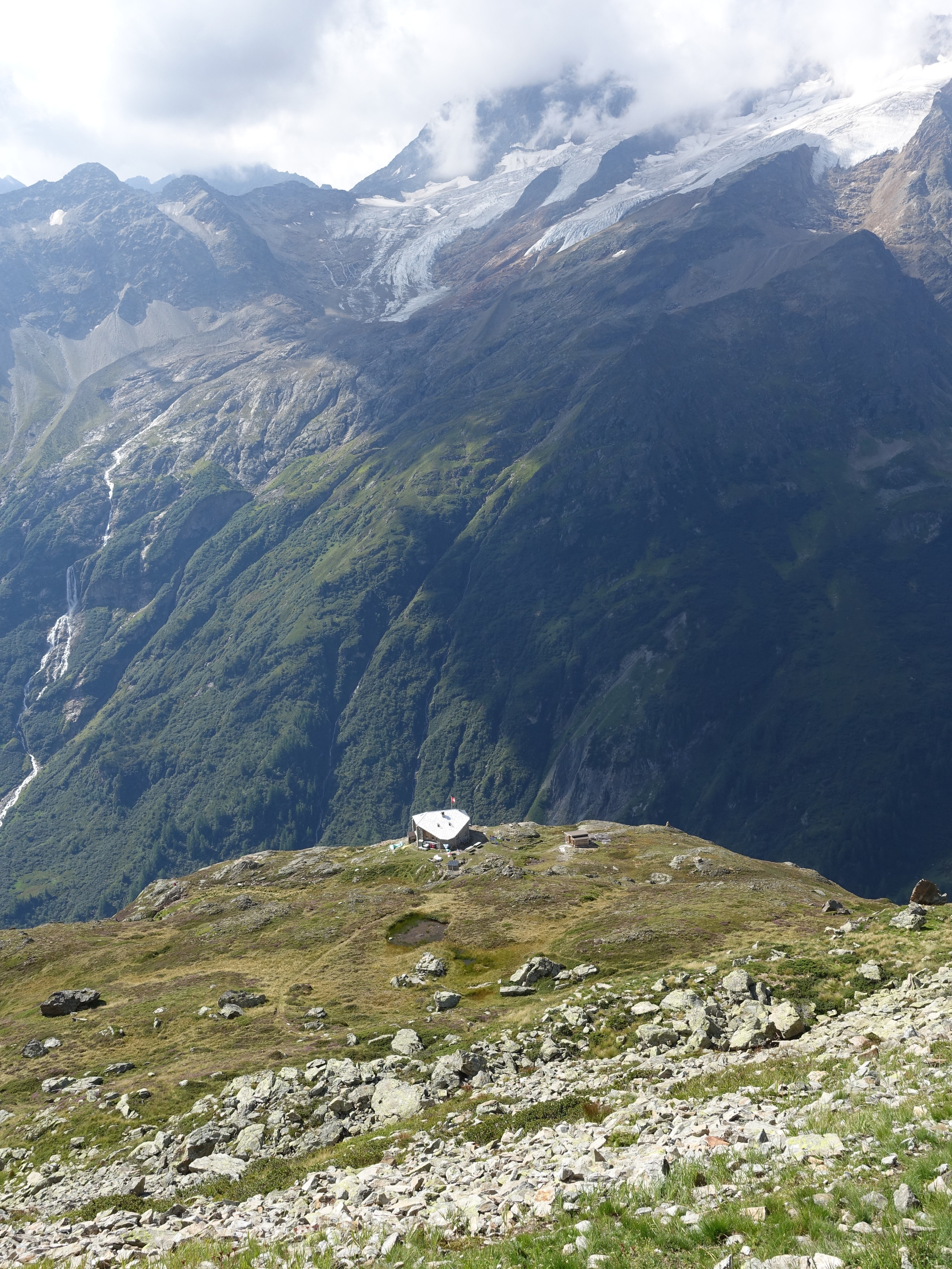
A woman with two sick kids (fever and coughing) had to sleep in our dorm at Lienzer Hütte, because she couldn't descent further, so our sleep wasn't too restorative. Nevertheless we continued our adventure "crossing of the Alps" on day seven. After a diverting hike to the Wangenitzseehütte (2508 m), the highest situated Alpine hut in the Schober group, we attempted the climb to the top of Petzeck (3283 m) to finally get our first three-thousand-metre mountain done. However, rather sooner than later our concentration was used up, so with a heavy heart we turned around at roughly 2900 m, descended back down to the hut and took a swim in the cold lake.
Duration: 2 hours and 45 minutes to Wangenitzseehütte and another 3 hours and 10 minutes up and down the Petzeck (both including breaks)
Length: 6 km to Wangenitzseehütte + 4 km up and down the Petzeck
Elevation: 1970 m to 2925 m
Ascent/Descent: 1000 m ↑ and 450 m ↓
#TBT #ThrowbackThursday #Throwback #Hiking #Hike #Hikes #Hiker #HikingTrail #GoHiking #HikingView #HikingAdventures #Wanderlust #Wandern #Alpenuberquerung #Alpenüberquerung #Alpentraversale #Alpentraum #WalkAcrossTheAlps #CrossingTheAlps #Österreich #Austria #Alpen #Alps #AlpineHut #AlpineHuts #Berge #Mountains #MountainLovers #Bergliebe #Bergsee #MountainLake #ScenicsNature #Nature #OutdoorAdventure #Summer #Nationalpark #NationalparkHoheTauern #NPHT #HoheTauern #Petzeck #LienzerHütte #Wangenitzseehütte #Schobergruppe #Osttirol #EastTyrol #Tirol #Tyrol

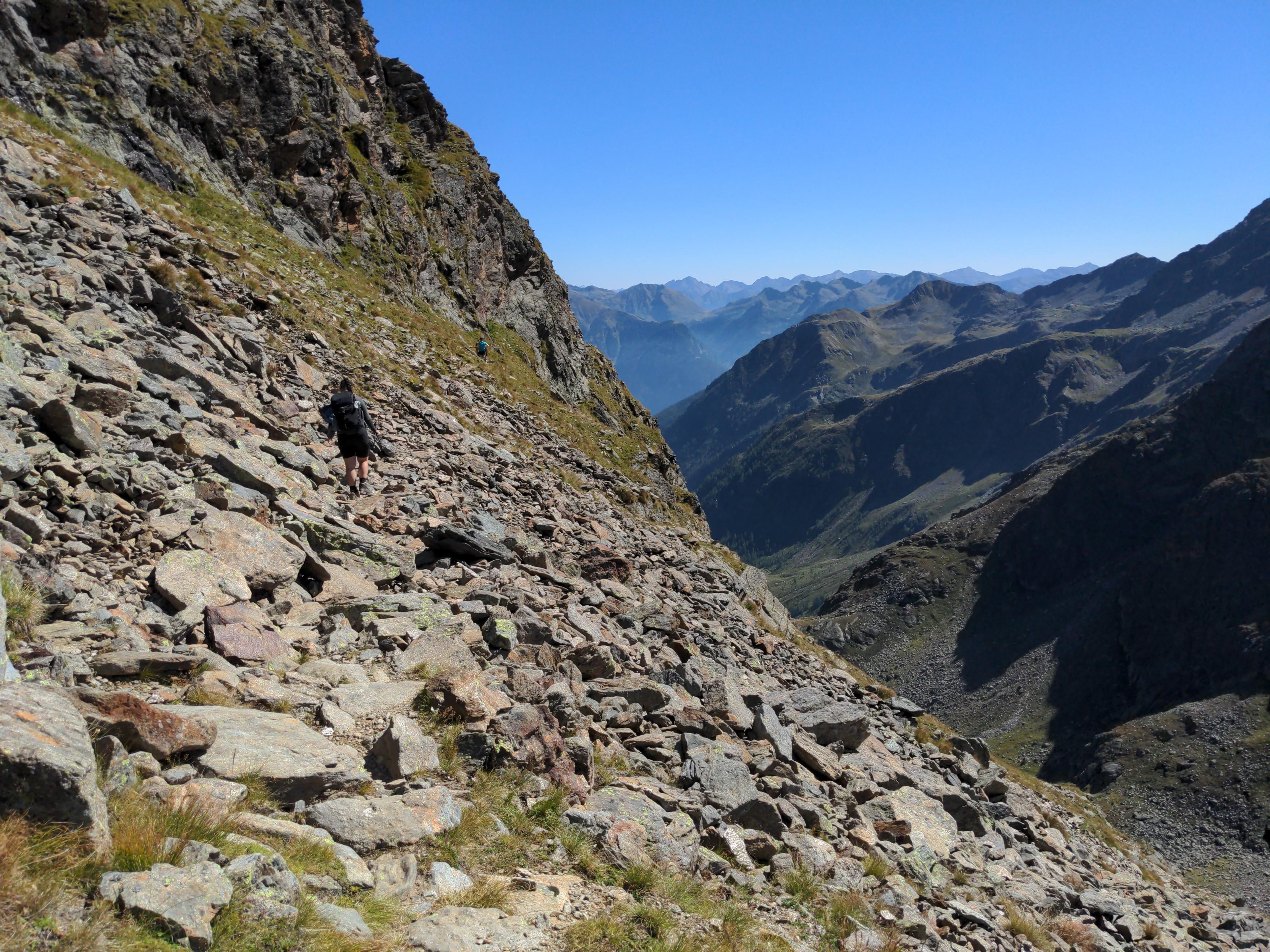
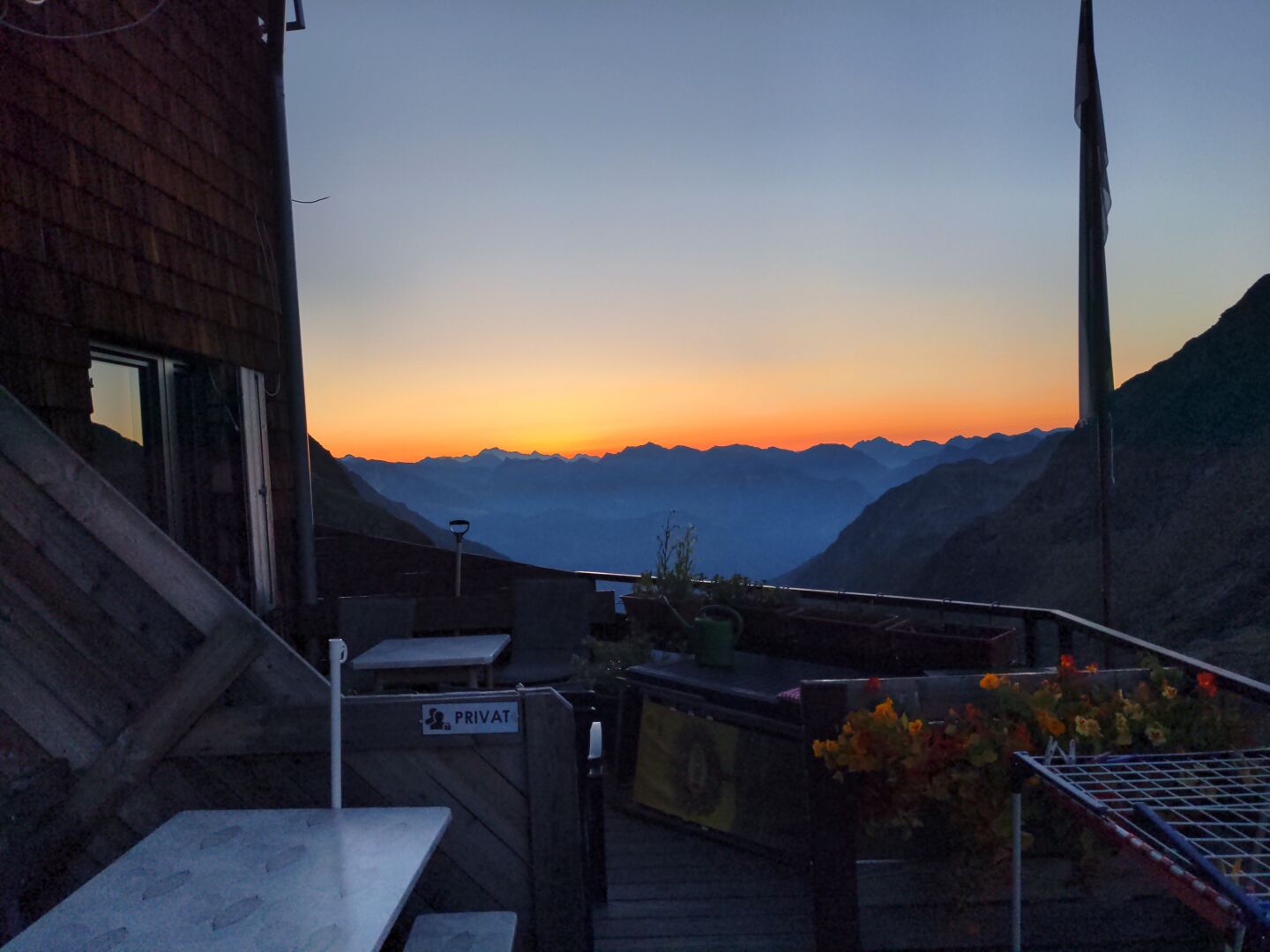
Longest stage on day six of our crossing of the Alps. We hiked from Glorer Hütte (2651 m) via Peischlachtörl (2490 m), Gernot-Röhr-Biwak (2926 m), Elberfelder Hütte (2346 m) and Gößnitzscharte (2737 m) to Lienzer Hütte (1977 m) into the heart of the Schober group. As we knew beforehand that this day would be rather long, the discussion about climbing the Böses Weibl (3121 m) at the Gernot-Röhr-Biwak was settled quickly. We skipped it and the second chance to climb our first three-thousand-metre mountain went out the window. In hindsight this was not the wrong decision, because we then would have missed out on dinner at the Lienzer Hütte. We enjoyed watching different marmots along the way and even captured a decent photo of one.
Duration: 9 hours and 45 minutes (including various breaks)
Length: 15.6 km
Elevation: 1970 m to 2926 m
Ascent/Descent: 1050 m ↑ and 1725 m ↓
#TBT #ThrowbackThursday #Throwback #Hiking #Hike #Hikes #Hiker #HikingTrail #GoHiking #HikingView #HikingAdventures #Wanderlust #Wandern #Alpenuberquerung #Alpenüberquerung #Alpentraversale #Alpentraum #WalkAcrossTheAlps #CrossingTheAlps #Österreich #Austria #Alpen #Alps #AlpineHut #AlpineHuts #Berge #Mountains #MountainLovers #Bergliebe #ScenicsNature #Nature #OutdoorAdventure #Summer #Nationalpark #NationalparkHoheTauern #NPHT #HoheTauern #Biwak #BösesWeibl #GlorerHütte #ElberfelderHütte #LienzerHütte #Schobergruppe #Sonnenaufgang #Sunrise #Murmeltier #Marmot #Food
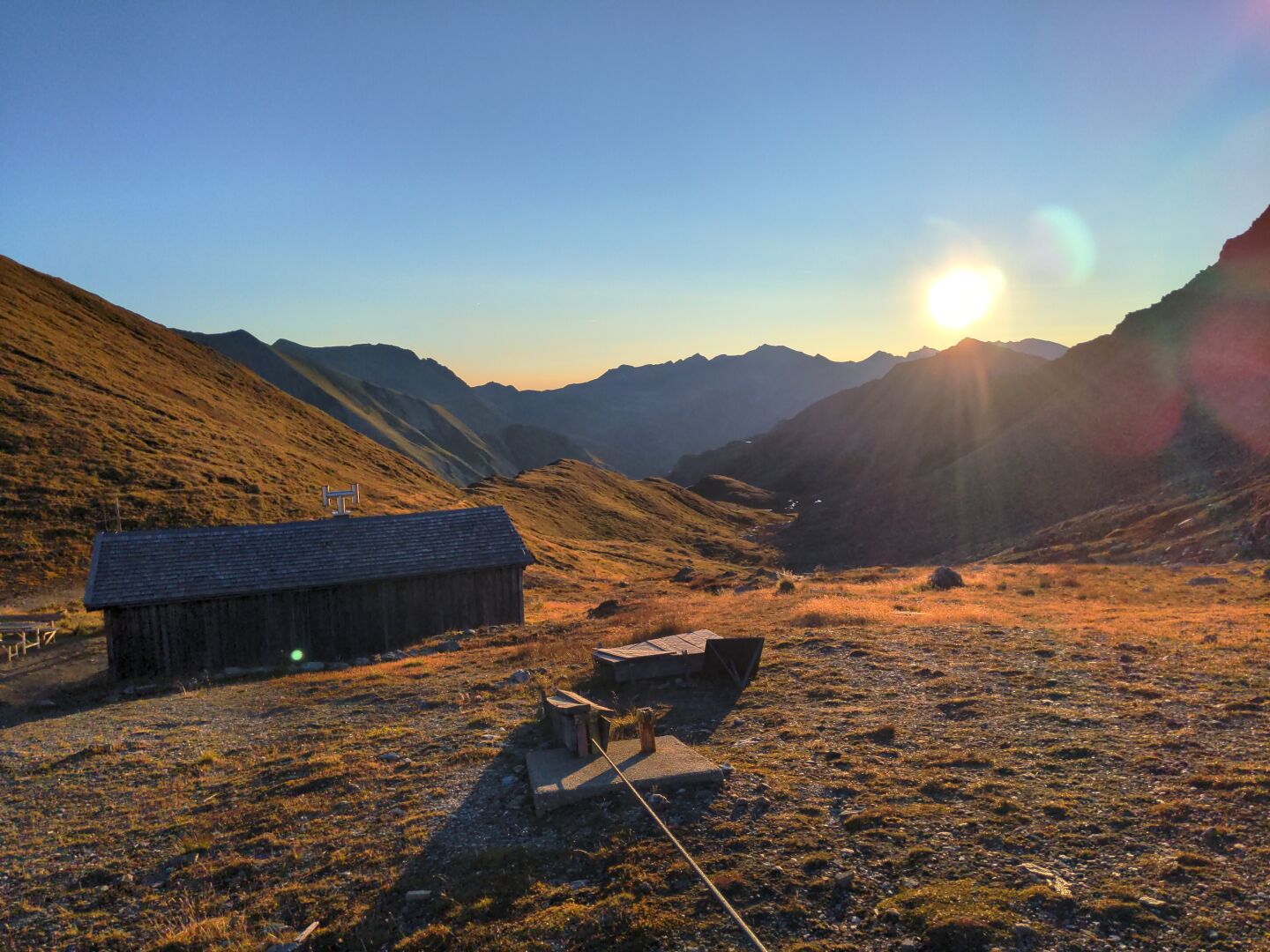
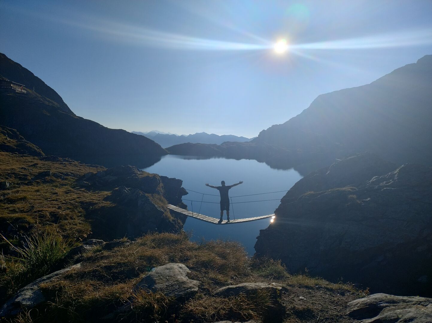
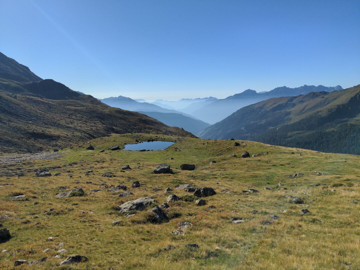
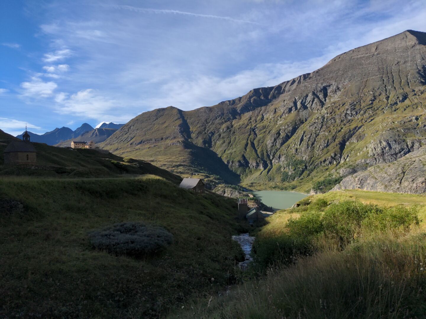
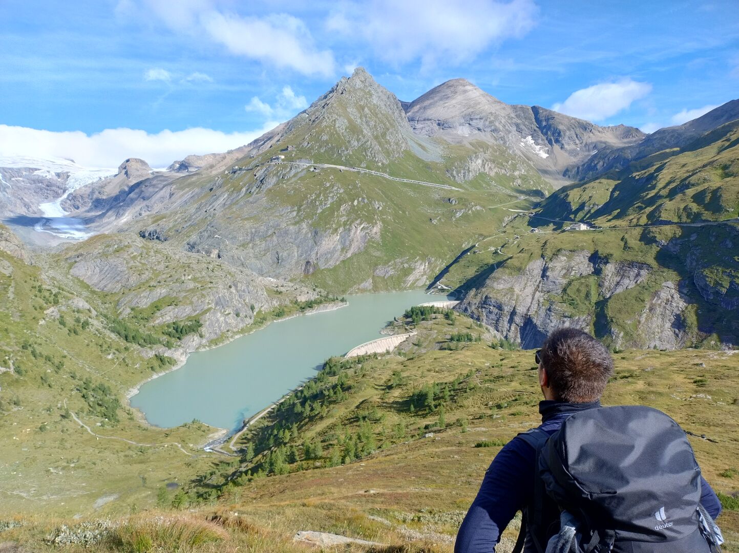
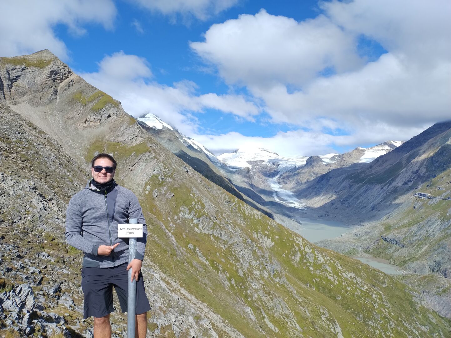
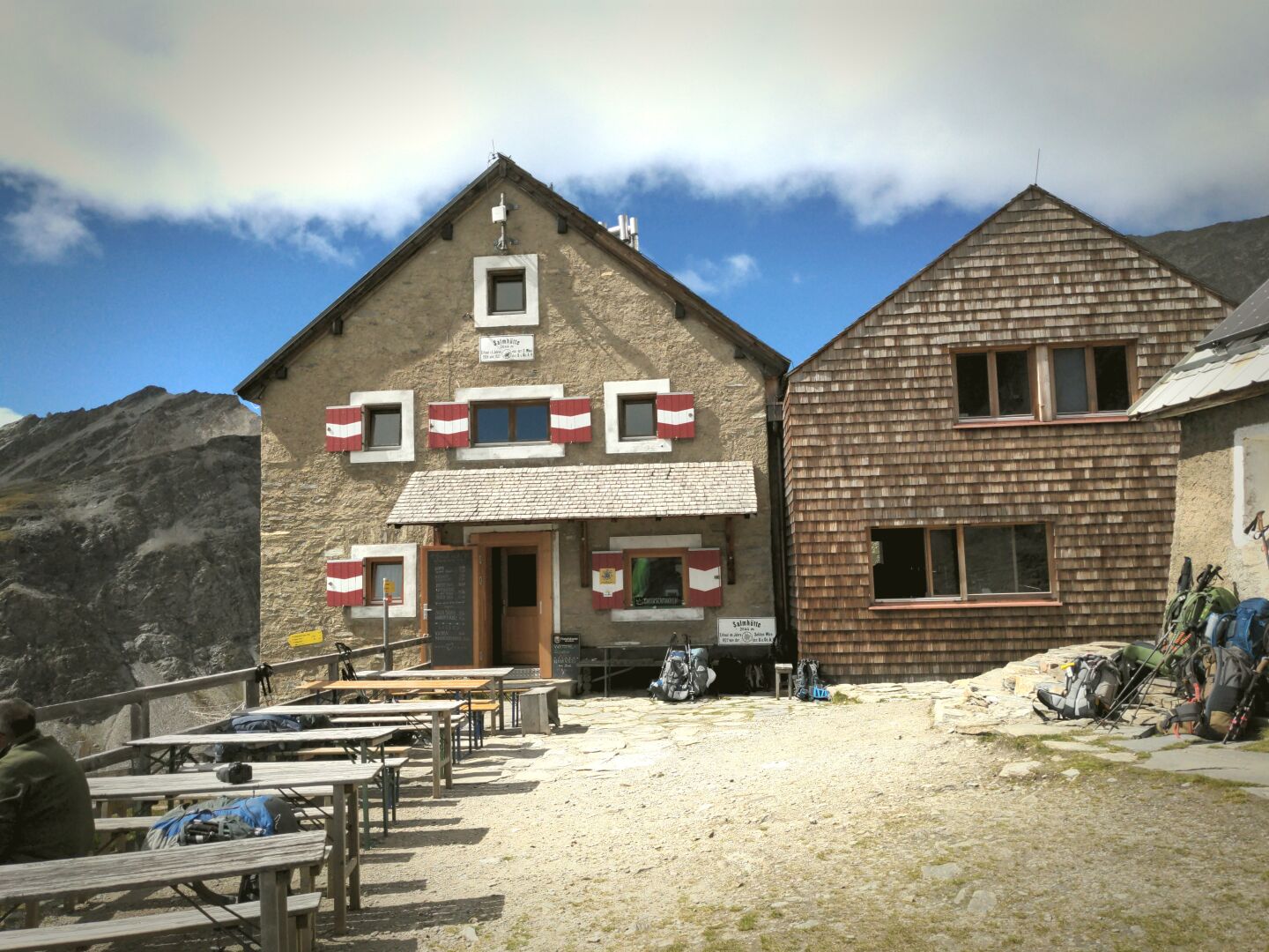
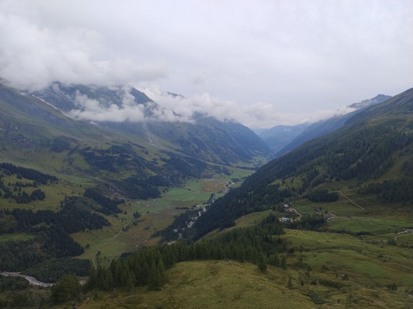
After a good nights sleep at the quiet Pasterzenhaus, an auxiliary building to the Glocknerhaus, we were welcomed by warm sunlight in the morning on the fifth day of our crossing of the Alps. About roughly 90 minutes into the tour we reached the Obere Stockerscharte with a perfect view back onto the Glaciers. From there on we saw many marmots on both sides of the hiking path - unfortunately no good photos! - till we reached the Salmhütte. After we refilled our stomachs and continued for a another one and a half hour, we ended the hike in the early afternoon at the Glorer Hütte (2642 metres).
Duration: 4 hours and 15 minutes (excluding some smaller breaks accumulating to 30 minutes and an hour long lunch break at the Salmhütte)
Length: 10.5 km
Elevation: 2000 m to 2665 m
Ascent/Descent: 960 m ↑ and 450 m ↓
#TBT #ThrowbackThursday #Throwback #Hiking #Hike #Hikes #Hiker #HikingTrail #GoHiking #HikingView #HikingAdventures #Wanderlust #Wandern #Alpenuberquerung #Alpenüberquerung #Alpentraversale #Alpentraum #WalkAcrossTheAlps #CrossingTheAlps #Österreich #Austria #Alpen #Alps #AlpineHut #AlpineHuts #Berge #Mountains #Bergliebe #ScenicsNature #Nature #OutdoorAdventure #Summer #Nationalpark #NationalparkHoheTauern #NPHT #HoheTauern #Glocknerhaus #Pasterzenhaus #Pasterze #Gletscher #Glacier #Salmhütte #GlorerHütte #Großglockner #Hochalpenstraße #ObereStockerscharte #ObererGlatzsee #Sunset #Food #AlpineFlowers
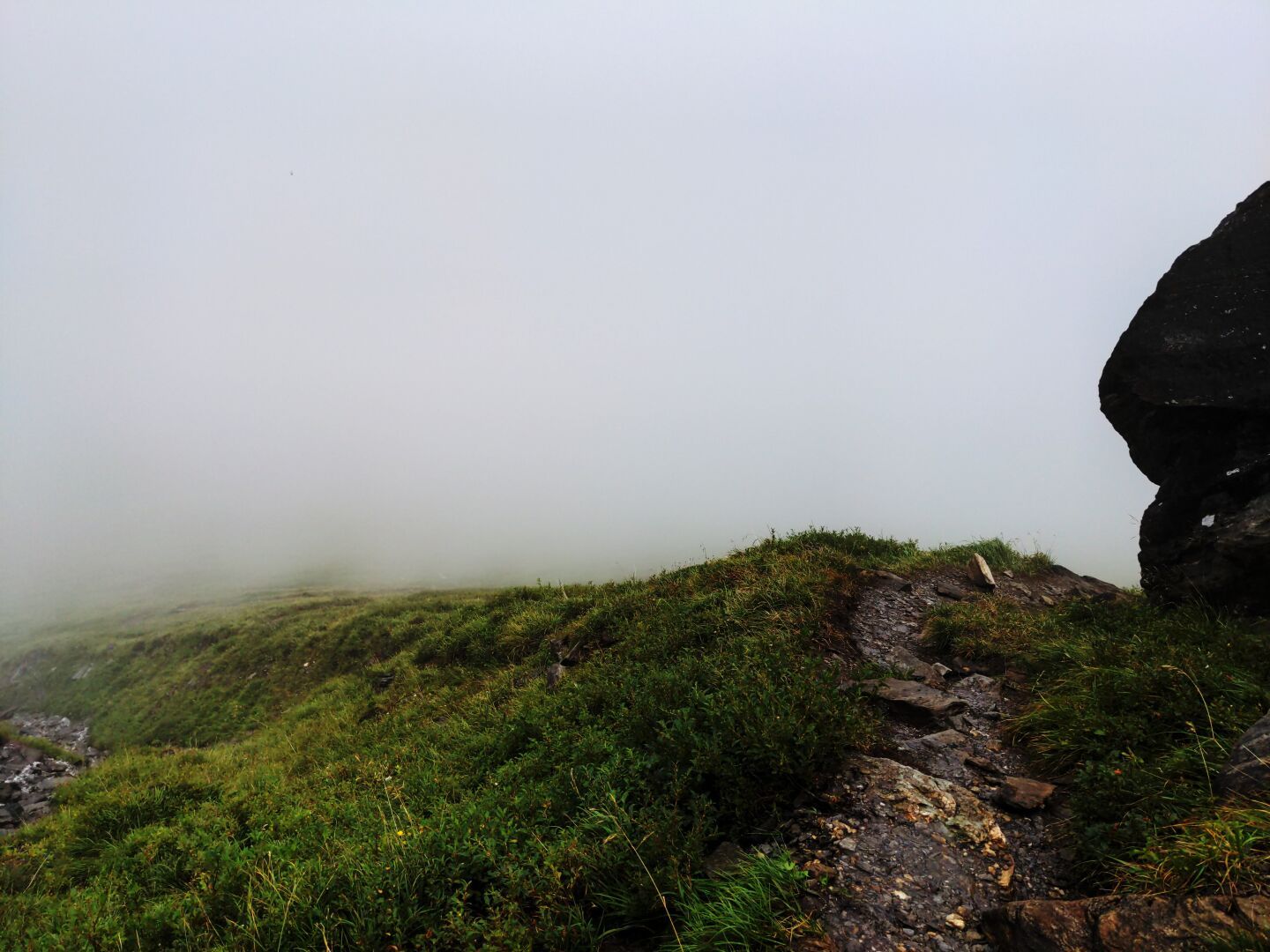
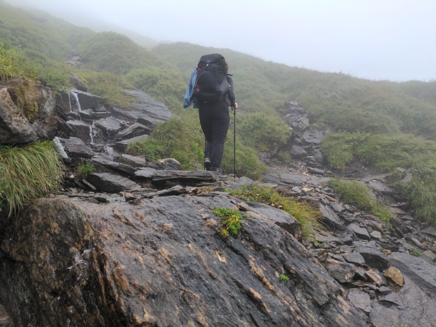
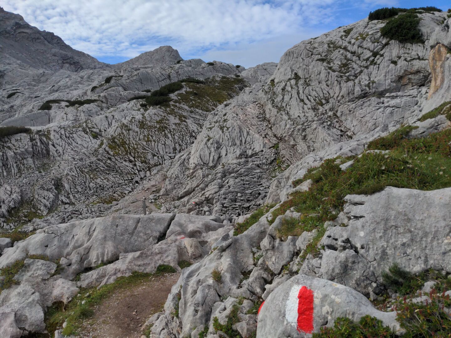
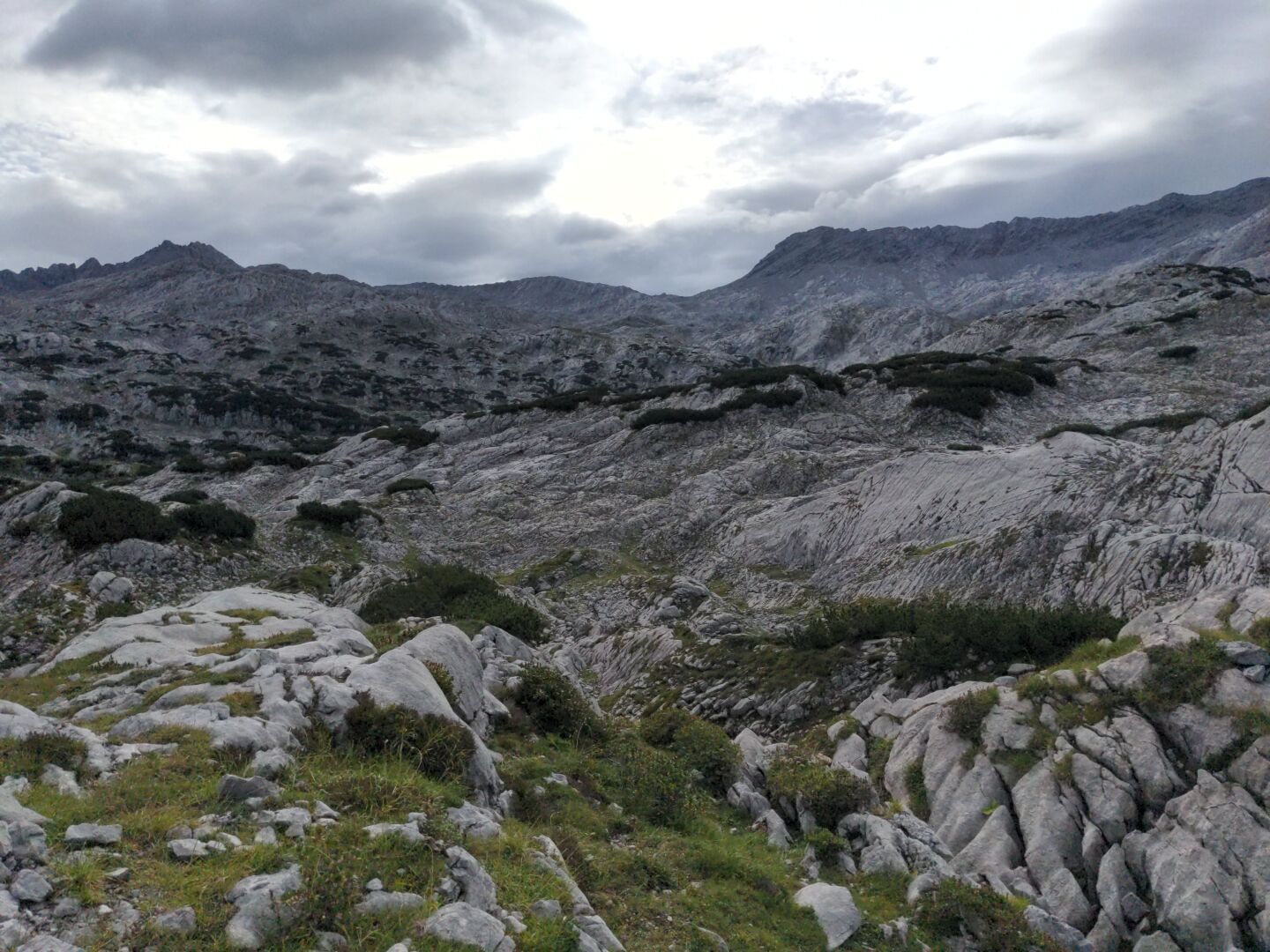
We had changeable weather on the fourth day of our crossing of the Alps - moderate rain, dense fog, chill wind and some rays of sunshine sprinkled in between. The landscape tried to match the variety of the weather, from Alpine meadows at the Trauneralm to large scree fields near the Untere Pfandlscharte and the rather busy Pasterzenhaus at the Großglockner-Hochalpenstraße. During a short break in the Untere Pfandlscharte, we decided against ascending even further to the top of the Spielmann, because it was already cold and very(!) windy. Sadly this meant we missed the chance to climb our first three-thousand-metre mountain.
Duration: 5 hours and 30 minutes (including various breaks)
Length: 9 km
Elevation: 1522 m to 2663 m
Ascent/Descent: 1230 m ↑ and 610 m ↓
#TBT #ThrowbackThursday #Throwback #Hiking #Hike #Hikes #Hiker #HikingTrail #GoHiking #HikingView #HikingAdventures #Wanderlust #Wandern #Alpenuberquerung #Alpenüberquerung #Alpentraversale #Alpentraum #WalkAcrossTheAlps #CrossingTheAlps #Österreich #Austria #Alpen #Alps #AlpineHut #AlpineHuts #Berge #Mountains #Bergliebe #ScenicsNature #Nature #OutdoorAdventure #Summer #Nationalpark #NationalparkHoheTauern #NPHT #HoheTauern #SalzburgerLand #Trauneralm #Glocknerhaus #Pasterzenhaus #Großglockner #Hochalpenstraße #UnterePfandlscharte #FoggyDay
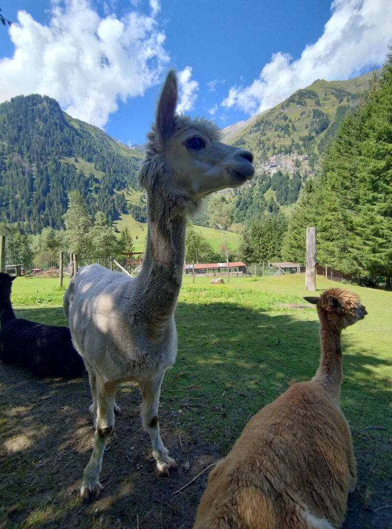
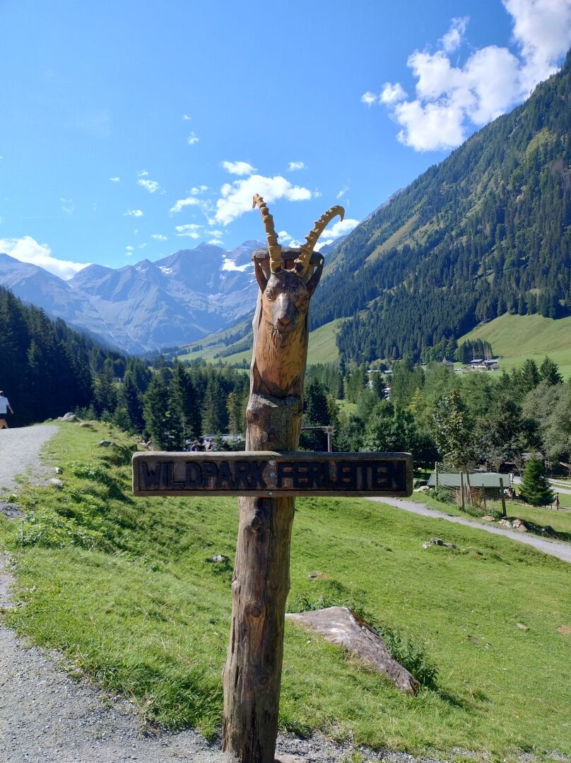
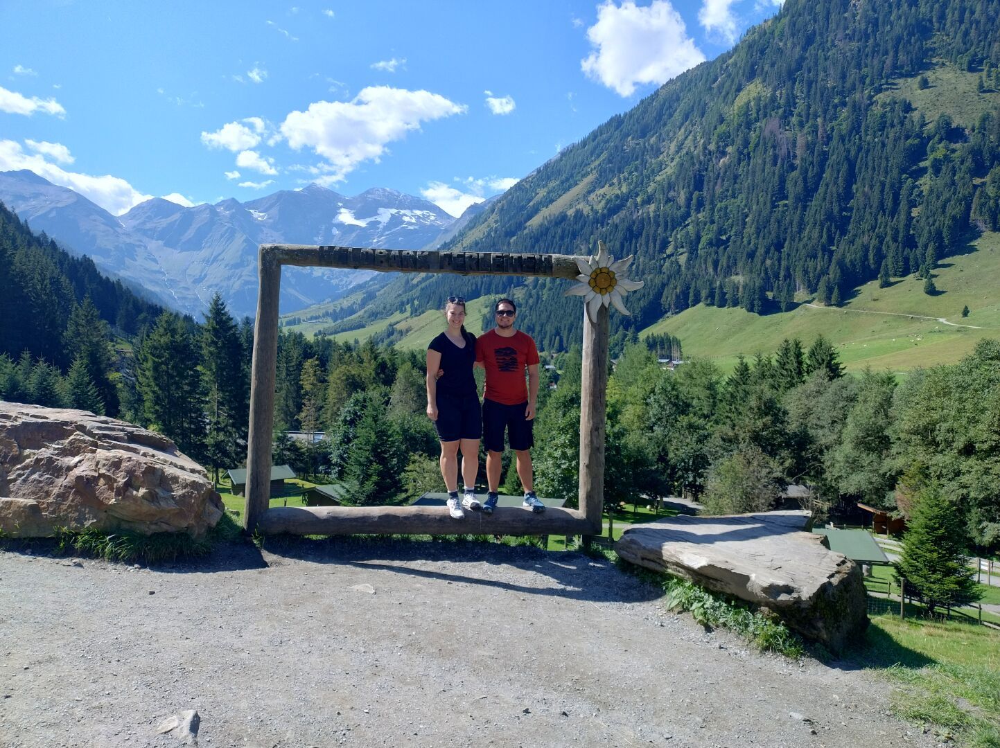
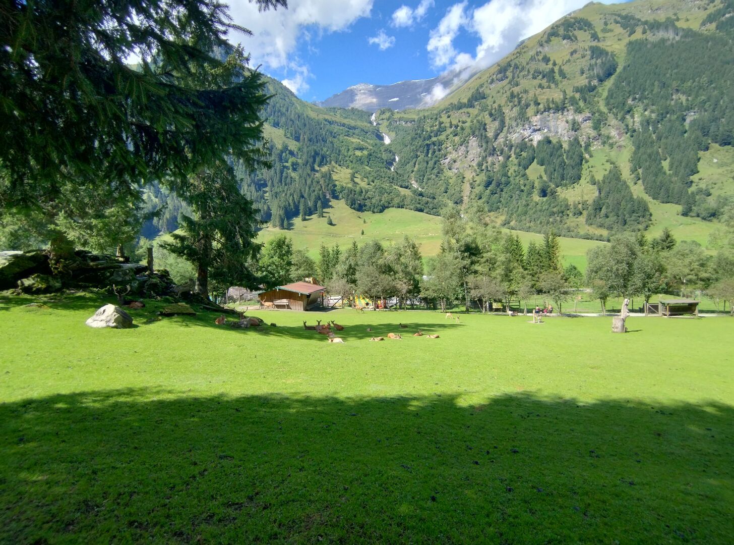
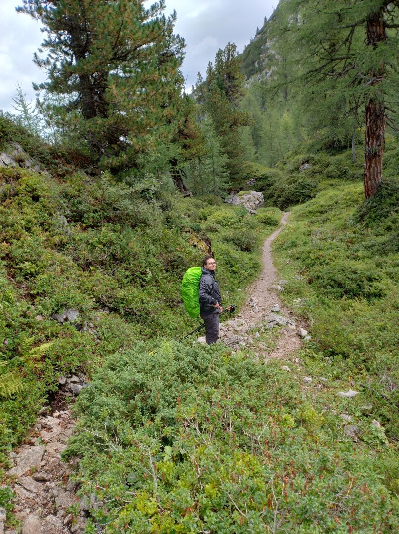
Day 3 of our crossing of the Alps was kind of a rest day with much less walking. After breakfast we took the bus from Zell am See to the wildlife park Ferleiten. There weren't many people there in the morning, so we had some time to enjoy the calm nature and animals. Around lunch time the park got busier. That was our sign to leave for the private alpine guest house Trauneralm situated at an altitude of 1530 metres at the end of the romantic Käfer valley and get enough rest as the more challenging hikes awaited us the next days.
Duration: 1 hour and 50 minutes (excluding breaks)
Length: 7 km
Elevation: 1150 m to 1530 m
Ascent/Descent: 390 m ↑ and 10 m ↓
#TBT #ThrowbackThursday #Throwback #Hiking #Hike #Hikes #Hiker #HikingTrail #GoHiking #HikingView #HikingAdventures #Wanderlust #Wandern #Alpenuberquerung #Alpenüberquerung #Alpentraversale #Alpentraum #WalkAcrossTheAlps #CrossingTheAlps #Österreich #Austria #Alpen #Alps #AlpineHut #AlpineHuts #Berge #Mountains #Bergliebe #BahnZumBerg #BzB #ScenicsNature #Nature #OutdoorAdventure #Summer #Nationalpark #NationalparkHoheTauern #NPHT #HoheTauern #SalzburgerLand #Trauneralm #Wildpark #WildparkFerleiten #Ferleiten #Wildtiere #Animals #Tierpark #Alpaca #Alpacas
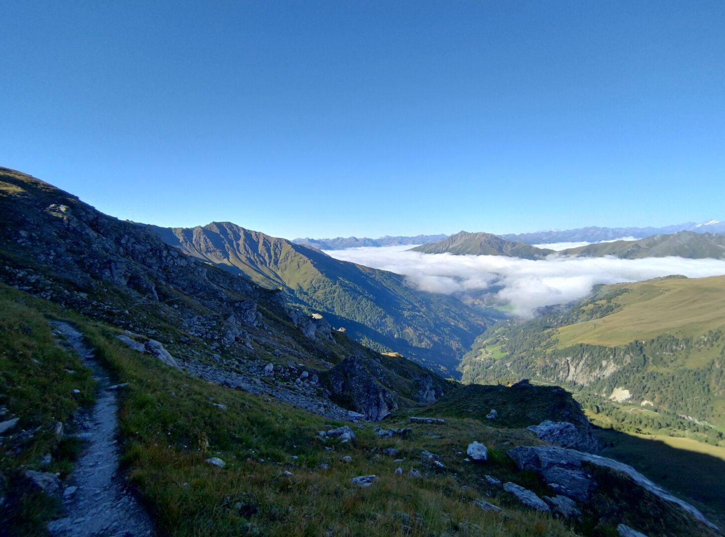
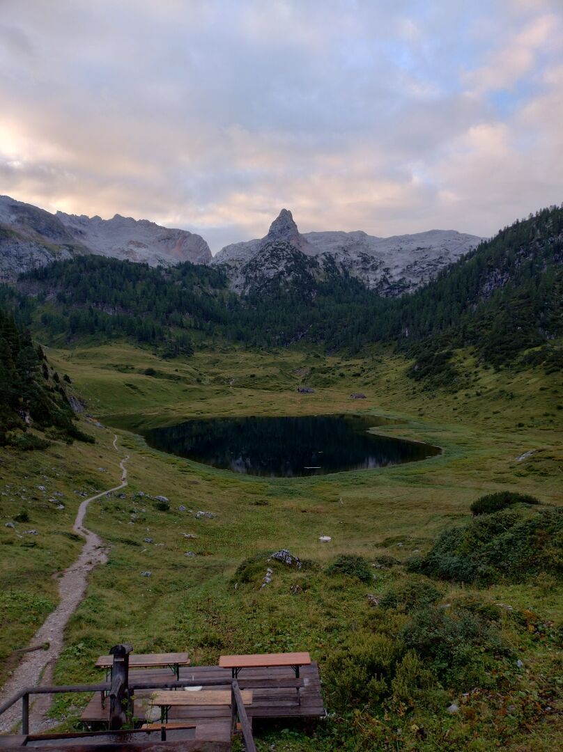
Second day of our crossing of the Alps on 1 September 2023. With a rough night and little sleep on the Kärlingerhaus behind us, it was hard to get going at first. But we soon did overcome the reluctance, had a wonderful hiking day with great conditions and a varying, impressive landscapes. After crossing the German-Austrian border and a small break at the Riemannhaus we descended to the small village of Maria Alm. By bus and train we reached Zell am See where we stayed the night.
Duration: 7 hours and 10 minutes (including various, uncounted breaks)
Length: 14,5 km
Elevation: 800 m to 2200 m
Ascent/Descent: 600 m ↑ and 1500 m ↓
#TBT #ThrowbackThursday #Throwback #Hiking #Hike #Hikes #Hiker #HikingTrail #GoHiking #HikingView #HikingAdventures #Wanderlust #Wandern #Alpenuberquerung #Alpenüberquerung #Alpentraversale #Alpentraum #WalkAcrossTheAlps #CrossingTheAlps #Bayern #Bavaria #Österreich #Austria #Alpen #Alps #AlpineHut #AlpineHuts #Berge #Mountains #BahnZumBerg #BzB #ScenicsNature #Nature #OutdoorAdventure #Bergsee #MountainLake #MariaAlm #SteinernesMeer #Kärlingerhaus #Riemannhaus #Schaf #Sheep #Funtensee
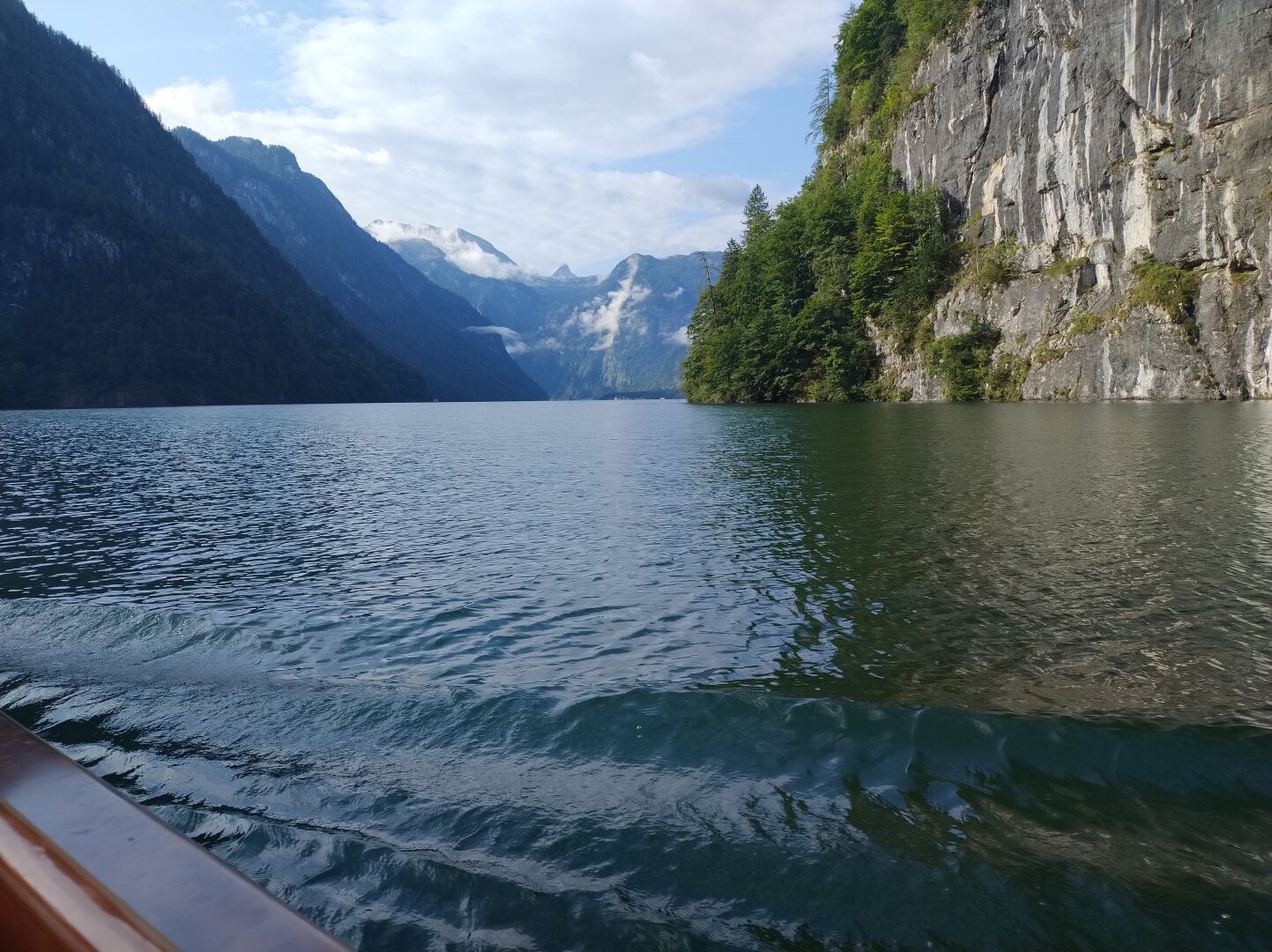
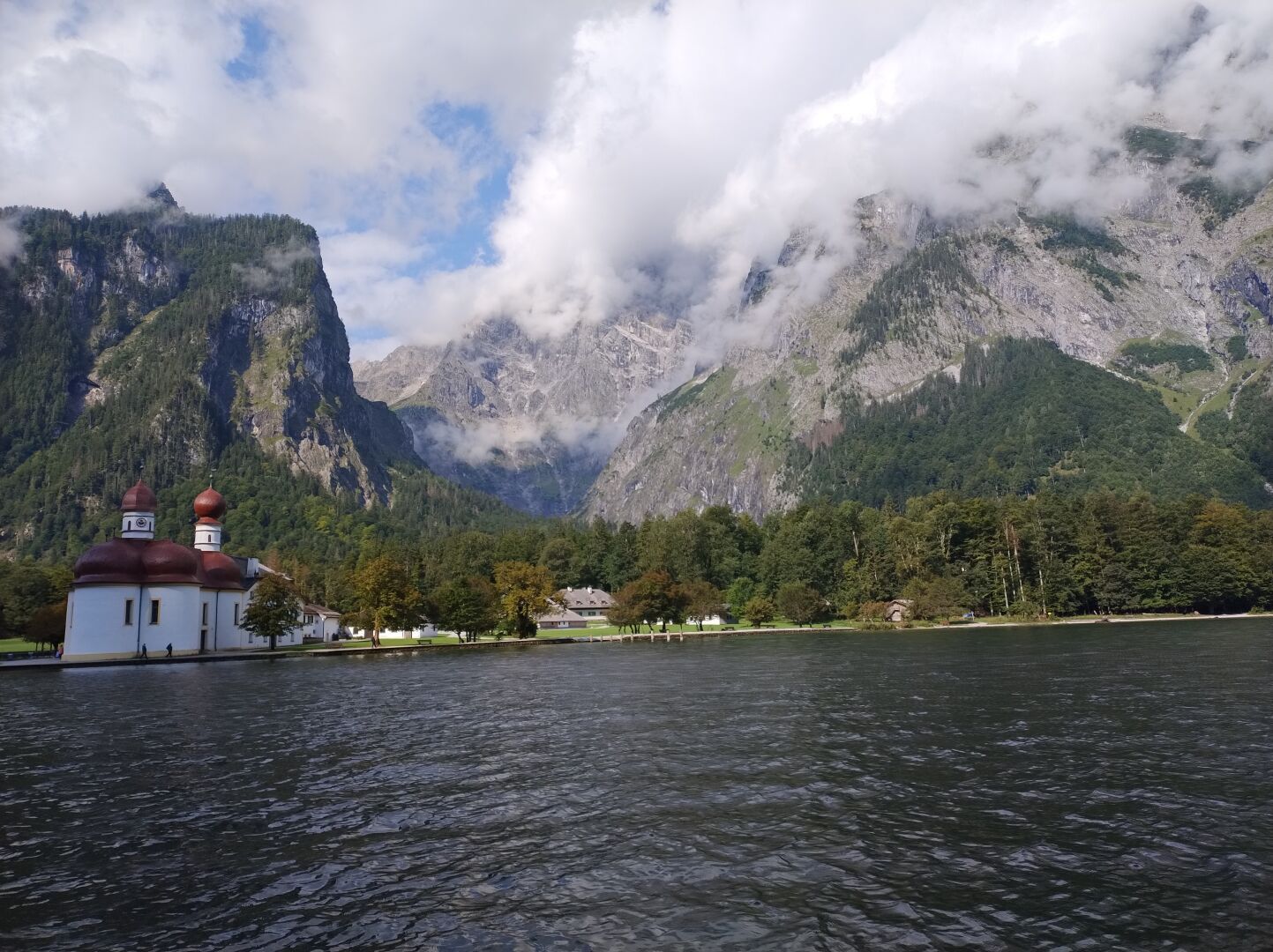
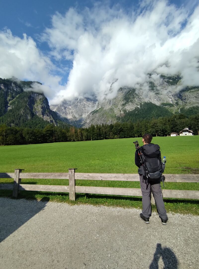
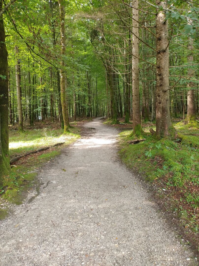
First day of our crossing of the Alps on 31 August 2023. After taking the elctric boat to St. Bartholomew's Church at the western shore of the Königssee we faced a steep incline through the Saugasse with 32 hairpin turns until we reached our first alpine hut, the Kärlingerhaus, at 1638 metres above sea level.
Duration: 3 hours and 30 minutes (including various, uncounted breaks)
Length: 11 km
Elevation: 600 m to 1685 m
Ascent/Descent: 1300 m ↑ and 250 m ↓
#TBT #ThrowbackThursday #Throwback #Hiking #Hike #Hikes #Hiker #HikingTrail #GoHiking #HikingView #HikingAdventures #Wanderlust #Wandern #Alpenuberquerung #Alpenüberquerung #Alpentraversale #Alpentraum #WalkAcrossTheAlps #CrossingTheAlps #Bayern #Bavaria #Alpen #Alps #Huttentour #Huttenwanderungen #Alpenhutten #HuttenTrekking #AlpineHut #AlpineHuts #MountainHuts #Berge #Mountains #BahnZumBerg #BzB #ScenicsNature #Nature #OutdoorAdventure #Berchtesgaden #Bergsee #MountainLake #MountainLakes #Königssee #Kärlingerhaus #Funtensee
Client Info
Server: https://mastodon.social
Version: 2025.07
Repository: https://github.com/cyevgeniy/lmst