Aircraft perfomance database
Database with detailed info about 398 aircrafts:
Type of Aircraft
Recognition
Supplementary
Technical
Performance
https://learningzone.eurocontrol.int/ilp/customs/ATCPFDB/default.aspx
Tip by Linkedin Boudjenane Soufiane
Aircraft perfomance database
Database with detailed info about 398 aircrafts:
Type of Aircraft
Recognition
Supplementary
Technical
Performance
https://learningzone.eurocontrol.int/ilp/customs/ATCPFDB/default.aspx
Tip by Linkedin Boudjenane Soufiane

Google Street View Pano Date Resolver
A free online tool for determining the exact time a photo was taken on Google Street View. Just copy paste link to panorama.
How it works:
https://silliest.website:3/blog/google-maps-dates/
Source code:
https://github.com/itisem/pano-date-resolver
OSINT International
Links to online resources for gathering information about more than 50 countries around the world.
https://start.me/p/7kDabv/osint-international
By Mario Macias

WhereIsThisPhoto
Another online service for approximate geolocation of photos using AI. Partly free.

The Pika OSINT Toolbox
I already wrote about it a few months ago, but since then a lot of new stuff has been added to the list, and it now has not only a repository but also a website https://pikaosint.pages.dev/

GeoVLM
Free Huggingfaces space for photo location prediction.
(Nothing happens after clicking the button, but after a couple of minutes a response appears)

OSINT HUB FR🇫🇷
OSINT Resources
OSINT Community
OSINT Courses
OSINT Jobs

Does any #GEOINT nerd could recognize the feature present in the following satellite picture? It kind of looks a bridge atop of a deep black sea
via @weirdsatellite
EthnoGuessr
A free online game in which you have to guess the average portrait of a people shown to you and indicate their habitat on the map.
A new game every day (hint for today's game: there are no Eskimos there!)

World Media Map
Resources for monitoring news and fact checking in different countries around the world.

The Oceans Investigations Guide by GIJN
Ship’s Criminal History
Resources for Tracking Ships
Seafood Companies Information
Universal investigation tips and resources

Planet Labs wins $12.8 million NGA contract for maritime intelligence in Asia-Pacific
Open Source Intelligence: Free Satellite Services for Investigations
Detailed article with technical specifications and limitations by _aircorridor for Hackers Arise.
NASA Earth, EOSDA, Copernicus and Google Earth.
https://hackers-arise.com/open-source-intelligence-free-satellite-services-for-investigations/

YouStitch
Free and very simple online tool for creating panoramas from videos and photos.
Just capture frames and put on canvas.
Tip by OsintJobs

????
National Geospatial-Intelligence Agency (NGA) – Argos (watch)
????
--
https://axiatime.com/products/national-geospatial-agency-nga-argos <-- shared #NGA watch?????
--
[note that I am most certainly NOT suggesting this product (because, ummmmm, well…), have NO connection with it, and am not sure of NGA does; I just stumbled across it and found it to be oddly specific merch.]
#GIS #spatial #mapping #geoint #watch #merch #odd #merchandise
@NGA
Satellite Imagery
List of 40+ tools and resources by i-intelligence

Check out my latest OSINT investigation for free with by clicking the link.
Any support will be highly appreciated! #opensource #intelligence #geoint #bellingcat #investigation #medium https://medium.com/@Lucamuss/ice-ice-baby-osint-bellingcat-challenge-c1aacd315f32?sk=dec197d87abfac3dafeb659427005929
Legendary OSINT by K2OSINT
Github repo with with hundreds of #osint tools in different categories: people search, aviation, reverse image search, dark web etc

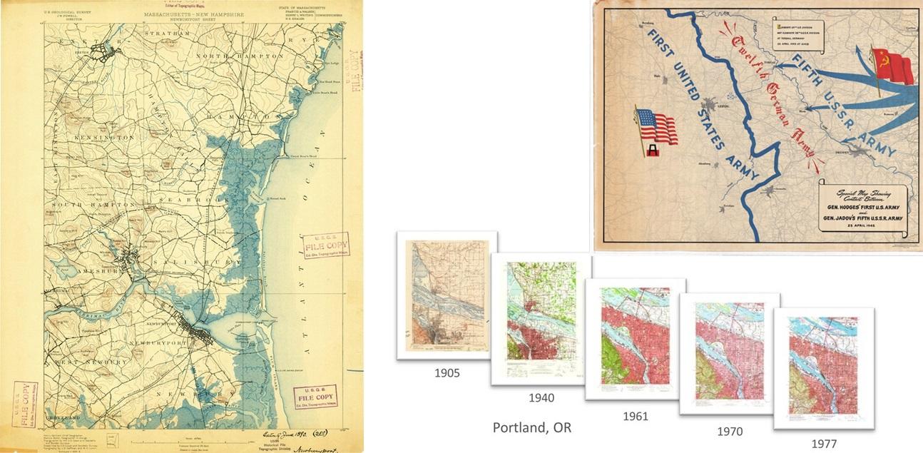
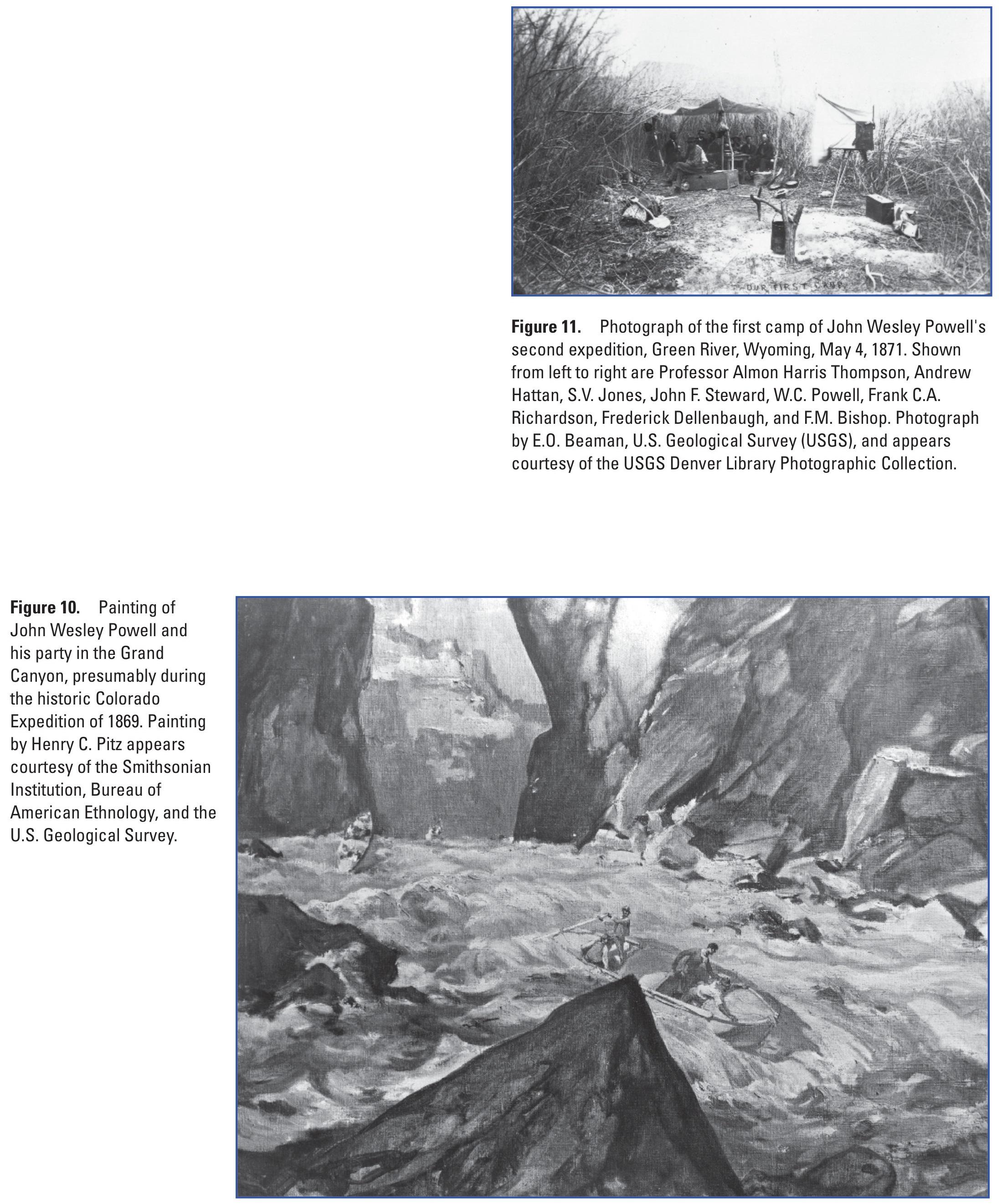
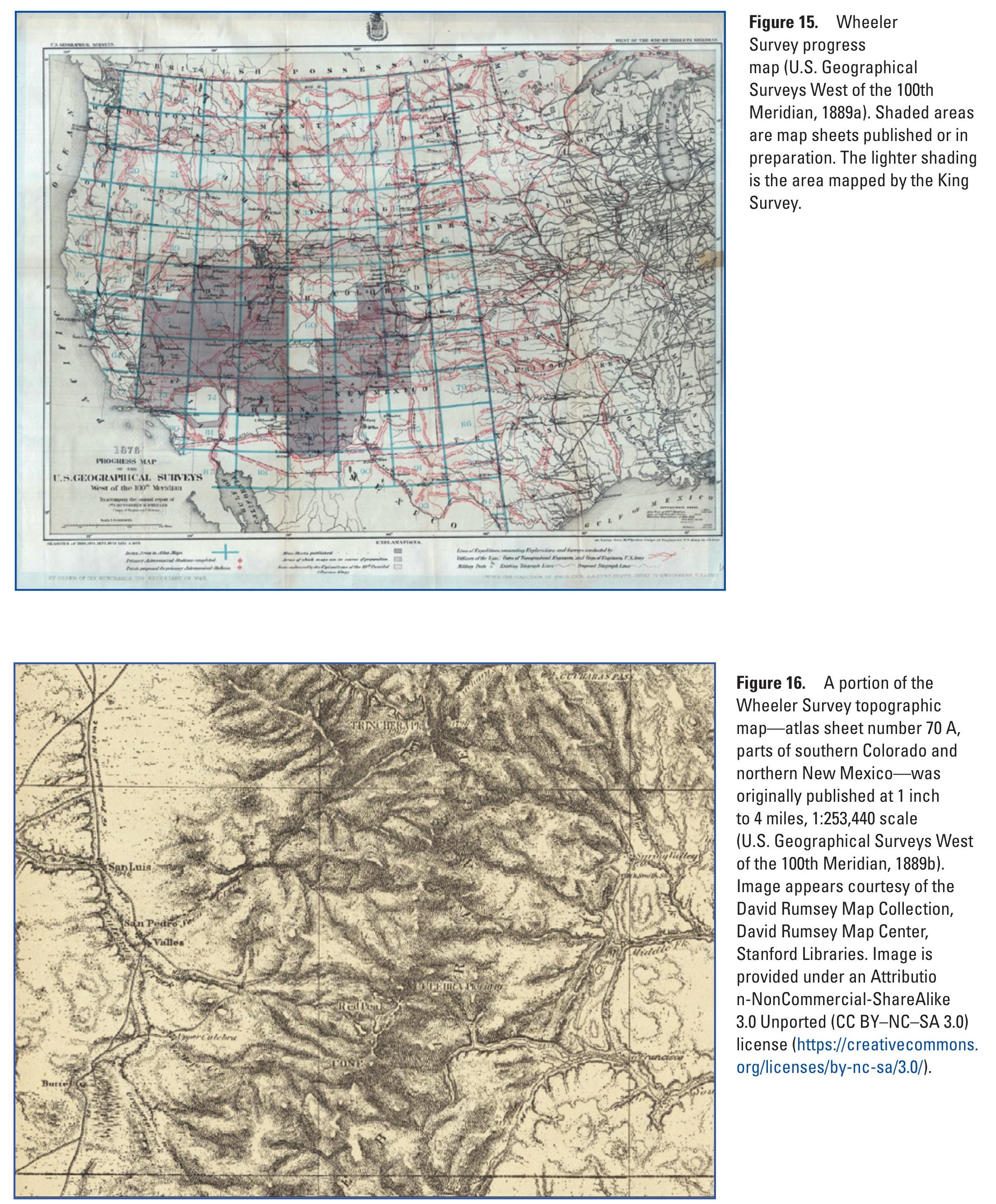
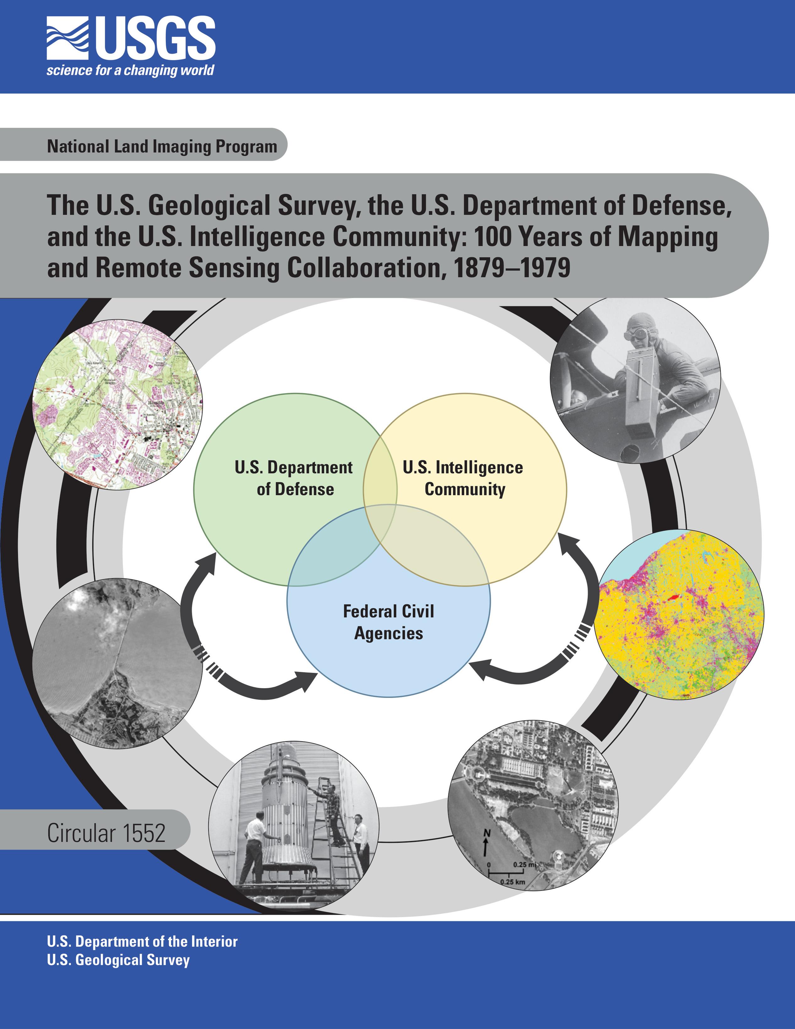
The U.S. Geological Survey [USGS], The U.S. Department Of Defense [DoD], And The U.S. Intelligence Community [various] - 100 Years Of Mapping And Remote Sensing Collaboration, 1879–1979
--
https://pubs.usgs.gov/publication/cir1552 <-- link to USGS circular
--
#GIS #spatial #mapping #maps #sharing #spatialanalysis #history #military #intelligence #geointelligence #GEOINT #remotesensing #satellite #earthobservation #datasharing #technology #mission #fedservice #fedscience #wholeofgovernment #interactions #sectors #collaboration #interagency #interdepartmental #governmentbranches
@USGS DoD #CIA #FBI
+200 armes antisatellites sont en orbite #canada #france #military #space #satellites #reconnaissance #intel #elint #geoint #imint #technologies #signal #radars #surveillance #electronics #electromagnetic #weapons #lasers #jamming #spoofing #systems #warfare #incident #threats [ https://www.lindependant.fr/2025/09/19/brouillages-lasers-cyberattaques-larmee-francaise-denonce-une-augmentation-significative-des-actes-hostiles-de-la-russie-dans-lespace-12940830.php ]