#HotOSM

2025-06-23

How community-generated open data is helping Mexican cities

At Smart City Expo LATAM 2025, our Leonardo Gutierrez shared community mapping makes informal public transport visible and reliable
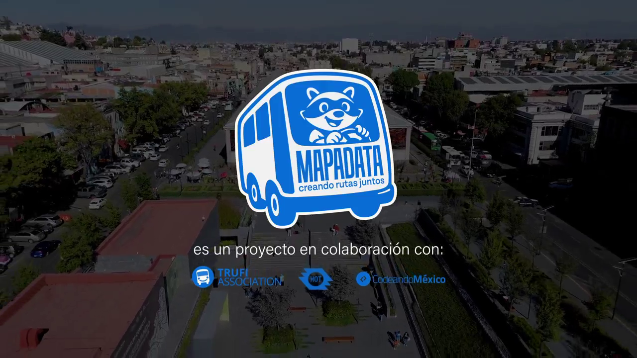
video: MapaData

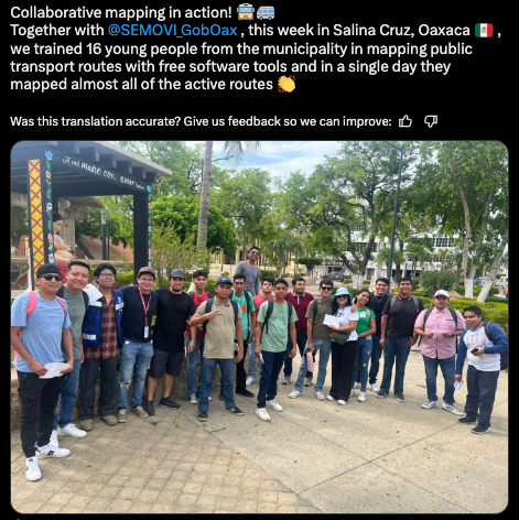
#Mexico #Oaxaca #Toluca #SalinaCruz #Zamora #PuertoEscondido #informaltransport #populartransport #mapping #OpenStreetMap #HOTOSM #TrufiAssociation

2025-06-19

I made a bunch of OSM related pin button designs for State of the Map US. You never know what’s gonna resonate but I am glad this one seems to be a hit.

#hotosm #OpenStreetMap #sotmus

A circle denoting the button face with a reimagined HOTOSM logo that now reads H O T T O G O. A reference to the Chapell Roan song of the same name.
2025-06-16

Our project in Toluca and Oaxaca—with Codeando México, and HOT. Community-led mapping can transform informal networks into structured, data-informed systems.

via GIZ Mexico

xitter @mapeadora @SmartCityLATAM @hotosm @CodeandoMexico

#Mexico #Oaxaca #Toluca #SalinaCruz #informaltransport #populartransport #mapping #GIS #GeospatialData #OpenStreetMap #HOTOSM #publictransit #publictransport #TransportationJustice #TrufiAssociation

2025-06-11

Trufi's Leonardo Gutiérrez with Anahi Gonzalez at Smart City Expo LATAM in Mexico

Leo speaks today "Training for Mayors: Collaborative Mapping of Informal Transport."

Xitter @SmartCityLATAM @hotosm @CodeandoMexico

#Mexico #Oaxaca #Toluca #SalinaCruz #GlobalSouthTransportMapping #mapping #GIS #GeospatialData #OpenStreetMap #HOTOSM #TransportationJustice #Gender #Photography #OriginalPhoto #TrufiAssociation

Anahi Gonzalez and Leonardo Gutiérrez smiling together at Smart City Expo LATAM in Mexico
2025-06-05

Puerto Escondido and Salina Cruz’s transport networks are now where they belong: on the map

Community-led mapping in Oaxaca from our project with Codeando Mexico and HOTOSM.

via
LinkedIn @MapaData
Xitter @CodeandoMexico @hotosm

#Americas #NorthAmerica #Mexico #Oaxaca #Toluca #SalinaCruz #GlobalSouthTransportMapping #mapping #GIS #GeospatialData #OpenStreetMap #HOTOSM #TransportationJustice #TrufiAssociation

2025-05-28

Trufi, HOTOSM, and Codeando México are turning riders into public transport architects.

Via xitter @CodeandoMexico @SEMOVI_GobOax

#Mexico #Oaxaca #Toluca #SalinaCruz #mapping #GIS #GeospatialData #OpenStreetMap #HOTOSM #TrufiAssociation

Social post in Spanish about a Trufi-led mapping workshop in Salina Cruz, Oaxaca, where 16 youth mapped nearly all local public transport routes in one day using free software.
2025-05-27

OpenStreetMap turns games into tools for understanding—and improving—real-world mobility.

HT Lemmy @schnurrito

via threads @verge

theverge.com/games/672035/open

#mapping #gaming #GIS #GeospatialData #opendata #OpenStreetMap #HOTOSM #TrufiAssociation

2025-05-19

Now with English captions: Oaxaca’s residents are mapping their public transport routes to demand better mobility. Watch the video.

xitter @hotosm @codeandomexico

tinyurl.com/ynqja396

#Americas #NorthAmerica #Mexico #Oaxaca #Toluca #SalinaCruz #cityplanning #urbandesign #urbanism #urbanismo #urbanplanner #urbanplanning #inclusiveplanning #SDG11 #mapping #GIS #GeospatialData #OpenStreetMap #HOTOSM #TransportationJustice #Gender #TrufiAssociation

2025-05-16

Collaborative mapping in Oaxaca empowers communities to improve public transport

Residents are mapping routes to make mobility more visible, equitable, and efficient.

via MapaData

xitter @hotosm @codeandomexico

#Mexico #Oaxaca #cityplanning #urbandesign #urbanism #urbanismo #urbanplanner #urbanplanning #inclusiveplanning #SDG11 #mapping #OpenStreetMap #HOTOSM #TransportationJustice #TrufiAssociation

2025-05-16

This work is about more than data—it’s about quality of life. One mapper said, "The information we collect will benefit people in their daily lives, whether they’re going to work, school, or anywhere else."

Without accurate data, cities can’t plan for better transport. Open-source tools like OpenStreetMap are proving their value, and as more governments adopt them, the impact will grow.

#OpenStreetMap #HOTOSM #TrufiAssociation

luiseme ⁂ 🍉luiseme@en.osm.town
2025-05-05

Hoy, 5 de mayo, se inicia el #Mapatón Nacional de #Colombia 2025 para la gestión de riesgo, organizado por la Unidad Nacional para la Gestión del Riesgo de Desastres (UNGRD) con el apoyo de #HOTOSM y otras organizaciones. Del 5 de mayo al 27 de junio, se podrá participar en varias sesiones a elegir. Si se acredita 5 h de mapeo y se participa en mínimo 2 sesiones, podrá reclamarse una constancia oficial de participación. Registrarse aquí 👇
forms.gle/CT97zfkcwmBhkLoy5

La imagen muestra el cartel de la convocatoria del evento. En el mismo se puede ver una fotografía en la que aparecen varias personas alrededor de un mapa.
luiseme ⁂ 🍉luiseme@masto.es
2025-04-04

Este caso de #NOAA 👇, por desgracia, ilustra lo que puede llegar a ocurrir cuando confiamos en servicios privativos como #aws.
Espero que proyectos como #hotosm vayan tomando buena nota.

This #NOAA case 👇 unfortunately illustrates what can happen when we rely on proprietary services like #aws.
I hope projects like #hotosm take note.

forum.safeguar.de/t/noaa-all-s

Guido Gallenkampgg@tuffidon.de
2025-03-29

HOTOSM (Humanitarian OpenStreetMap Team) ist eine Organisation, die gemeinnützig die Welt aus Luftbildern in Karten überträgt, damit Hilfsorganisationen besser arbeiten können.

Aktuell wird für das Erdbeben in Myanmar viel Handarbeit benötigt.

tasks.hotosm.org/explore?omitM

#hotosm

2025-03-29

現在、ミャンマーを中心に東南アジアで3/28に発生したM7.7 地震に対応して、Open Mapping Hub と米国赤十字から MapSwipe を用いたクライシスマッピング要請がきました。ご支援よろしくお願いいたします。

現時点では建物判読と衛星画像の品質確認タスク、そして既存のOpenStreetMap建物データのValidationがメインの作業です。特に建物判読の Finding Buildings プロジェクトを優先してお願いいたします。簡単なチュートリアル動画アップします。建物見つけたらタップして緑にするだけの簡単なタスクです。

プロジェクトフィルタ機能で Myanmar と絞り込むと見つけやすいです。
web.mapswipe.org/#/en/projects

#Myanmar #HOTOSM #CrisisMapping #DRONEBIRD #FuruhashiLab #古橋研究室 #AoyamaGSC #青学 #GEOlab #PoliMI

Marcos Dionemdione@en.osm.town
2025-03-21

Greetings to the whole community!

📝 🇦🇷 We continue with tasks to continue to finish the project of #BahiaBlanca in #Argentina. This mapping to be done with intermediate users progresses a little slower, but the city needs it. Here are some statistics and a view of the progress. You are invited to make a last effort 🙌🏼

tasks.hotosm.org/projects/1852

#OpenStreetMap #HOTOSM

2025-03-13

AI is changing how OpenStreetMap grows, mapping buildings at scale. But informal transport networks thrive even deeper in the gaps AI already struggles to see.

Xitter @openstreetmap
bsky @heigit[.]org
mstdn @heigit @openstreetmap

heigit.org/new-paper-ai-genera

#informaltransport #populartransport #mapping #GIS #GeospatialData #OpenStreetMap #HOTOSM #TrufiAssociation

Amᵃᵖanda 🔜 CFCamapanda@en.osm.town
2025-03-04

Erk. Unsurprisingly, #HOTOSM is affected by recent US drastic cut backs to foreign aid.

> As a recipient of US funding and an organization with strong connections to communities that rely on US foreign development assistance […]
> We call on the US federal government to immediately resume humanitarian assistance and its funding for international development

hotosm.org/updates/hot-stateme

#uspol #OpenStreetMap #OSM #US #USAID

Pierre Bélandpierzen@en.osm.town
2025-02-16

#missingmaps Qc part 2
I just discovered that there is a major flooding in Bas-Saint-Laurent, Qc OSM map, in the area mapped by #missingmaps #hotosm. A complete OSM wood relation has been flooded !!

OpenStreetMap for Bas-Saint-Laurent, Québec shows a huge lake following a wood relation transformed into a water relation !!
Sabine Hiller 💔🍉💪sabinehiller@mastodon.ie
2025-02-13

#HOTOSM is announcing an Open Maps for #Humanitarian Needs Campaign

"Anticipating a potential drop in information on humanitarian contexts in the coming months, and while humanitarians find a way forward, we are launching a 90 day campaign of Open Maps for Humanitarian Needs"

#usaidfreeze #mapping #osm #OpenMaps #OpenStreetMap #maps

hotosm.org/updates/announcing-

Norbert 'Nodi' DichterNodiTiooyk@frankfurt.social
2025-02-12

Wednesday, March 5, 2025 from 7:00 PM to 10:00 PM (German Time)
Missing Maps - DRK & MSF Online Mapathon

Endlich wieder gemeinsames Mappen! Unterstützt unsere Arbeit und helft uns, Kartenmaterial für nicht kartierte Regionen zu erstellen!

#RotesKreuz #DRK #füreinander #MSF #HotOSM #openStreetMap

Online Missing Maps Mapathon DRK & MSF

Digital via Zoom

Registrierung hier: eventbrite.de/e/1227813887389?

Missing Maps 
Deutsches Rotes Kreuz
Ärzte ohne Grenzen

Client Info

Server: https://mastodon.social
Version: 2025.04
Repository: https://github.com/cyevgeniy/lmst