Satellite-Based Spatial-Statistical Modeling Of Daily Stream Water Temperatures At The CONUS Scale
--
https://doi.org/10.1016/j.jhydrol.2025.133321 <-- shared paper
--
#GIS #spatial #mapping #Streamtemperature #Rivertemperature #Watertemperature #Statisticalmodel #Satellite #remotesensing #ContiguousUnitedStates #CONUS #Lower48th #spatialstatistics #geostatistics #earthobservation #water #hydrology #stream #river #temperature #surfacewater #model #modeling ##seasons #weather #TempEst2 #climate #urban #natural #rural #ecoregions #ecosystems #streamgage #USGS #fedscience
#Rivertemperature
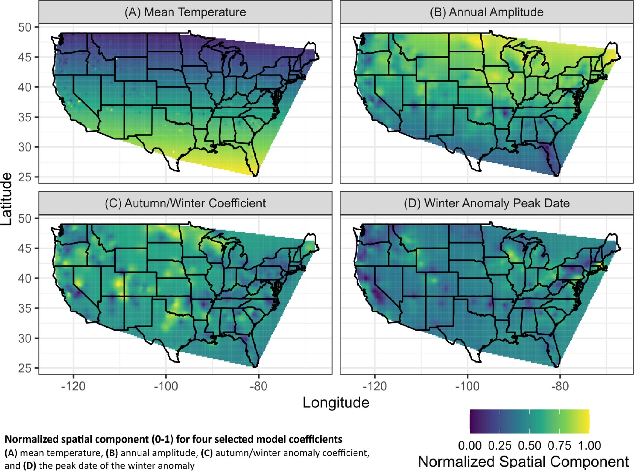
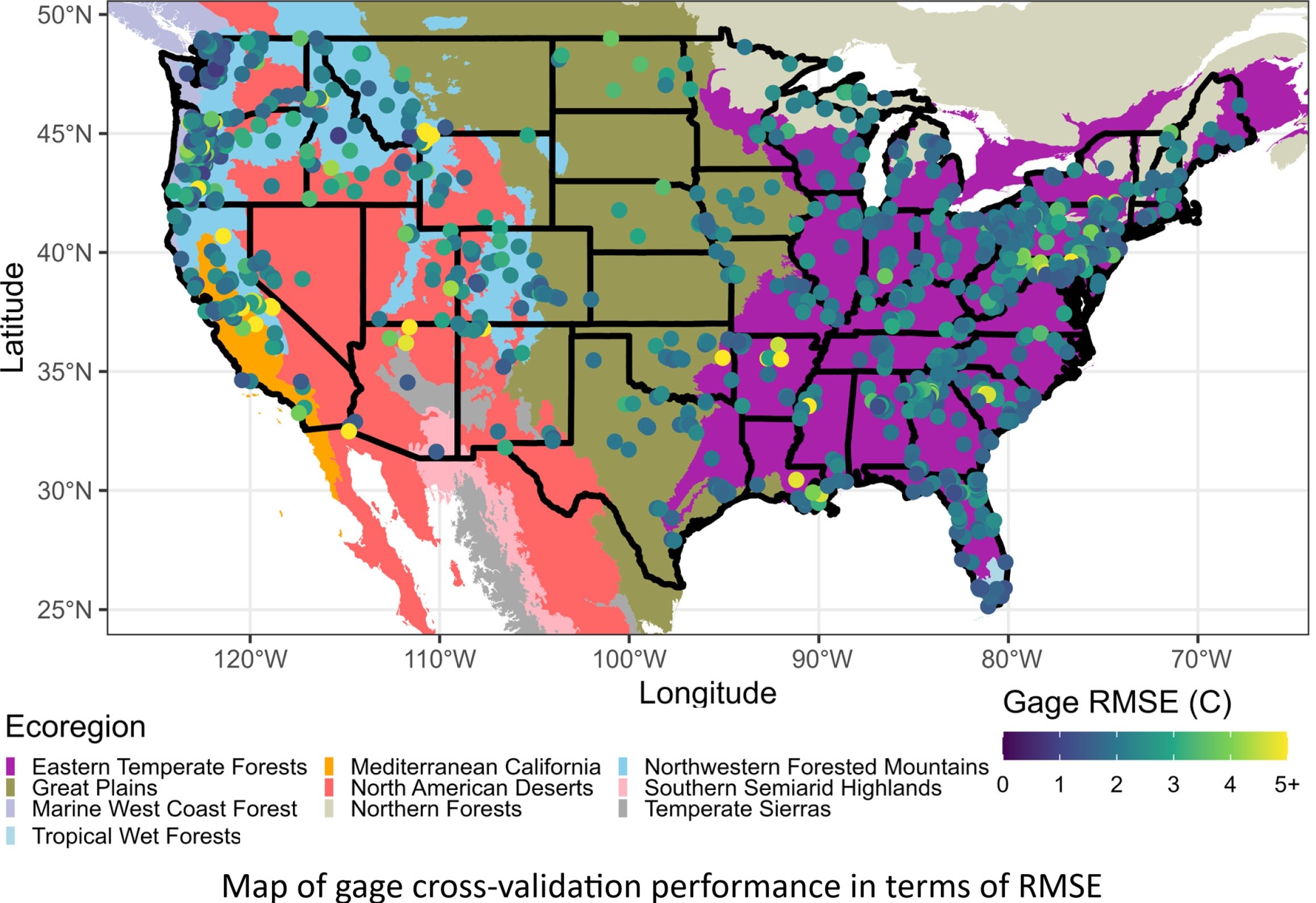
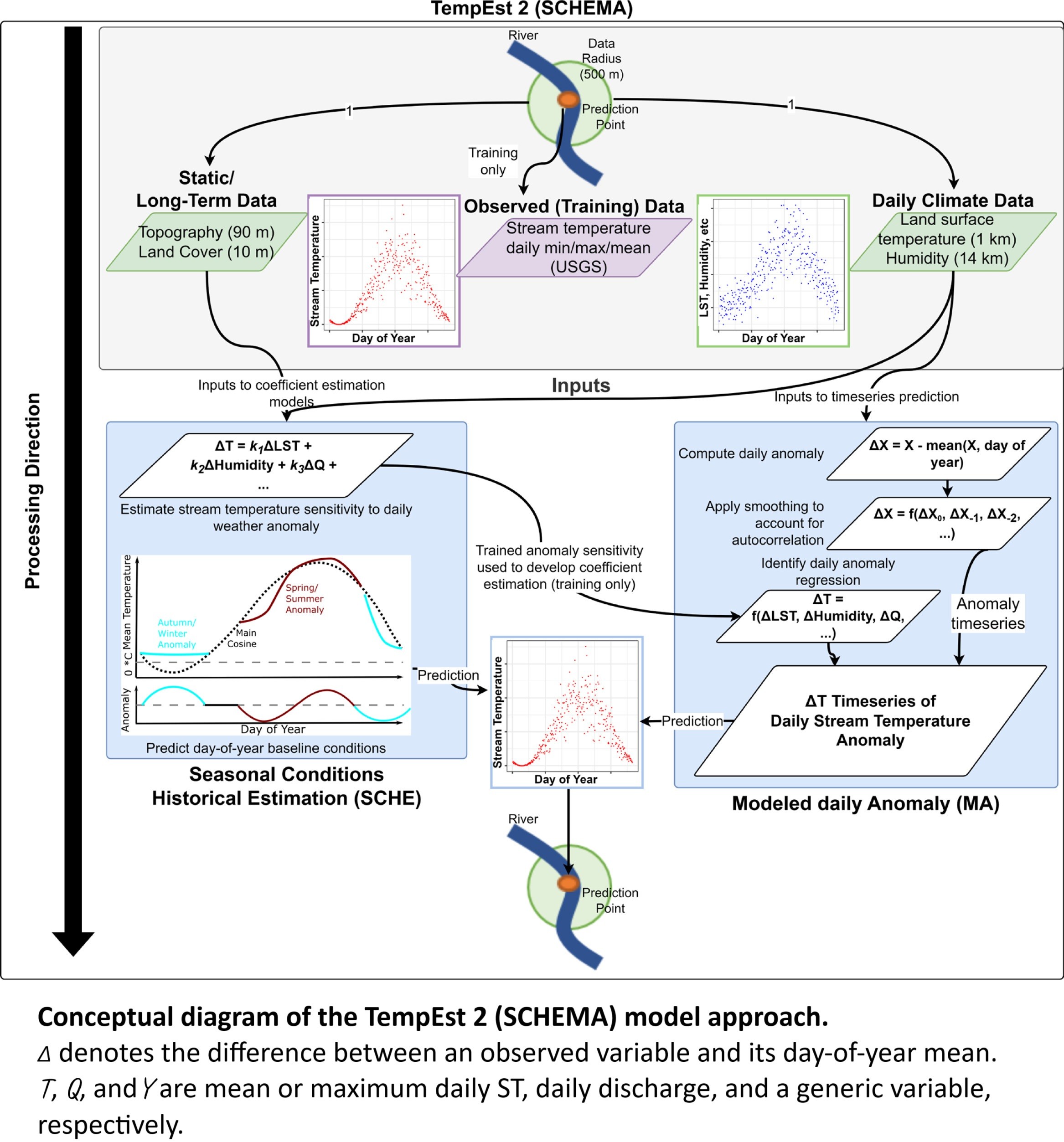

For the last few years, I've been working on making it possible to estimate high-resolution (daily, 1-km) river temperatures anywhere in the contiguous US. I'm delighted to announce that the paper introducing TempEst 2, the first high-resolution, ungaged river temperature model for the CONUS, has just been published in the Journal of Hydrology. TempEst 2 comes with a data retrieval script (Google Earth Engine) and a pretrained model, so you just provide the coordinates for your points of interest - on any stream, any size, urban or less-disturbed, etc - and get estimates with a typical RMSE of 2.0 C. I've found that it's practical to use for up to 10,000 sites or so for a given analysis (though you do need to split the data retrieval into blocks of <1500 sites). The paper also introduces a modeling framework for ungaged rivers called SCHEMA, which takes advantage of highly seasonal conditions to build well-performing models with few coefficients suitable for ungaged coefficient estimation.
Open-access paper (with Claudia R. Corona, Katie Schneider, Ashley Rust, and Terri S. Hogue): https://doi.org/10.1016/j.jhydrol.2025.133321
Model source code and usage information: https://github.com/mines-ciroh/tempest2
Open data: https://doi.org/10.4211/hs.a8b243957f7946e388d10ab206990675
TempEst 2 builds on our work with river temperature seasonality (https://doi.org/10.1111/1752-1688.13228).
Client Info
Server: https://mastodon.social
Version: 2025.04
Repository: https://github.com/cyevgeniy/lmst