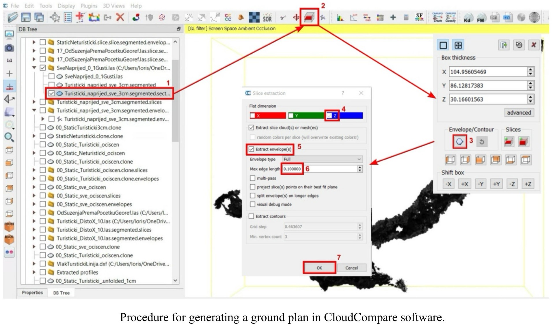
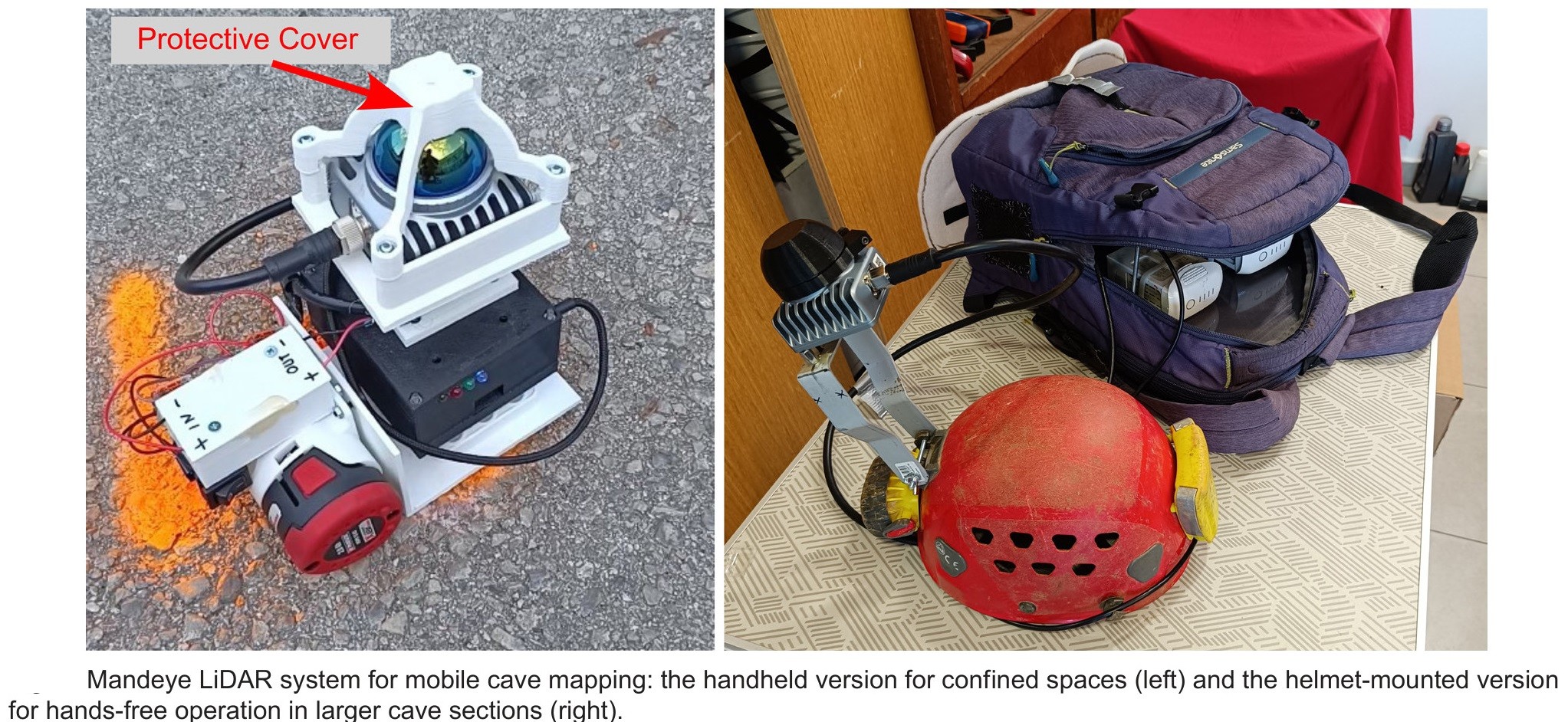
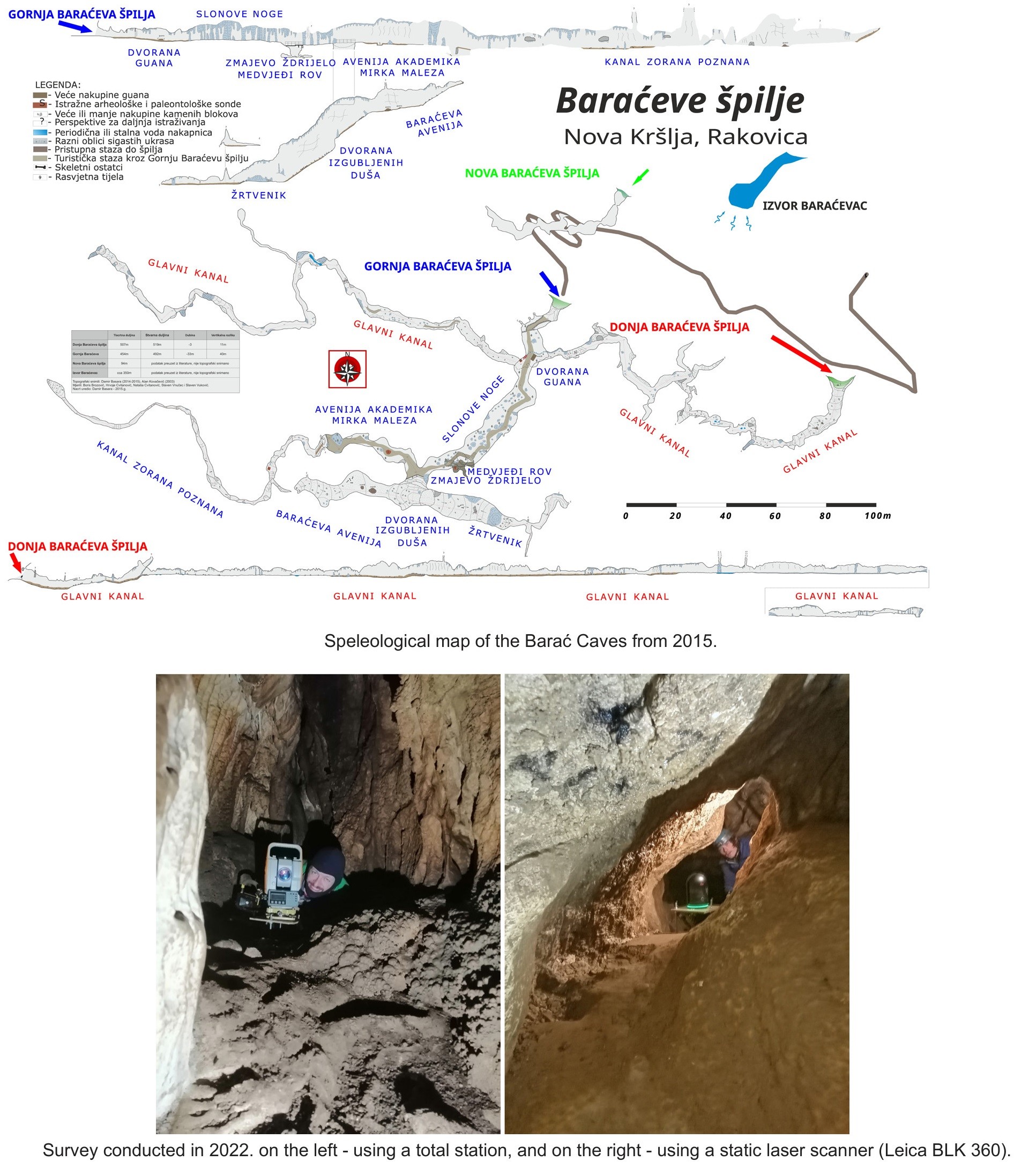
The Affordable DIY Mandeye Lidar System For Surveying Caves, And How To Convert 3D Clouds Into Traditional Cave Ground Plans And Extended Profiles
--
https://doi.org/10.5038/1827-806X.53.3.2535 <-- shared paper
--
#GIS #spatial #mapping #LiDAR #cave #cavediving #cavemapping #speleology #workflow #survey #remotesensing #pointcloud #mobilemapping #3Dmapping #profile #model #modeling #3dmodel #opensource #openhardware #reproducible #affordable #DIY #Mandeye
#cavemapping
Client Info
Server: https://mastodon.social
Version: 2025.04
Repository: https://github.com/cyevgeniy/lmst