This made us think
Tyler Sutterley
Research Scientist at the University of Washington Applied Physics Laboratory
Looking at the icy regions of our planet using lasers and gravity
#Antarctica #Greenland #icesheets #glaciers #sealevelrise #tides #cryosphere #geodesy #earthobservation #remotesensing #dataviz #NASA #openscience #opensource #UW #PNW #Seattle
Tyler Sutterley boosted:
"Spatial Data Science Languages: commonalities and needs" - that a preprint 11(!) of us wrote together as one of many outcomes of two workshops held in Münster (2023) and in Prague (2024). It summarised where we are, what we share between R, Python and Julia, what are the common challenges, lessons and recommendations - https://arxiv.org/abs/2503.16686
Big thanks belongs especially to @edzer who kickstarted the whole initiative! And to all the others who participated!
Tyler Sutterley boosted:
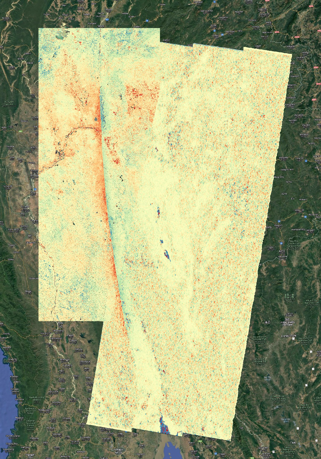
NASA JPL ARIA project analysis of data from Copernicus Sentinel-2 optical and Sentinel-1 radar images measured the slip on the Sagaing Fault in Myanmar. Quick preliminary map. More details later. Fault ruptured about 500 km (300 miles) in the magnitude 7.7 earthquake on 28 March 2025. Red is northward movement and blue is southward movement. This is pixel offset tracking or optical image correlation measurements of horizontal displacements.
Tyler Sutterley boosted:
UAF Cooperative Extension is hosting a webinar at Noon AKDT Thursday and I’ll be not only talking about how Alaska’s environment is changing, but how that plays out in our lives and how to better understand the interplay between long term change and short term extremes. Register at:
https://bit.ly/ThomanClimate
Tyler Sutterley boosted:
#ClimateDiary The ice is not freezing as it should’: supply roads to Canada’s Indigenous communities under threat from climate crisis
This article is not just about supply roads, but all the challenges First Nation communities in Northern Ontario face. The injustice of it all.
Tyler Sutterley boosted:
🧵 4/5
This graphic from the WMO report is one of the best visuals I have seen that clearly illustrates the connection between increasing greenhouse gas concentrations, rising temperatures, and reinforcing feedback loops that lead to devastating high-impact events with consequent risks to populations around the world.
It's not a pretty picture.
LEARN MORE HERE ➡️ https://storymaps.arcgis.com/stories/43a9c636ab3345bfabcb11236c266153
#Science #Environment #Climate #ClimateChange #ClimateCrisis
Tyler Sutterley boosted:
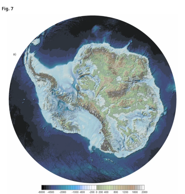
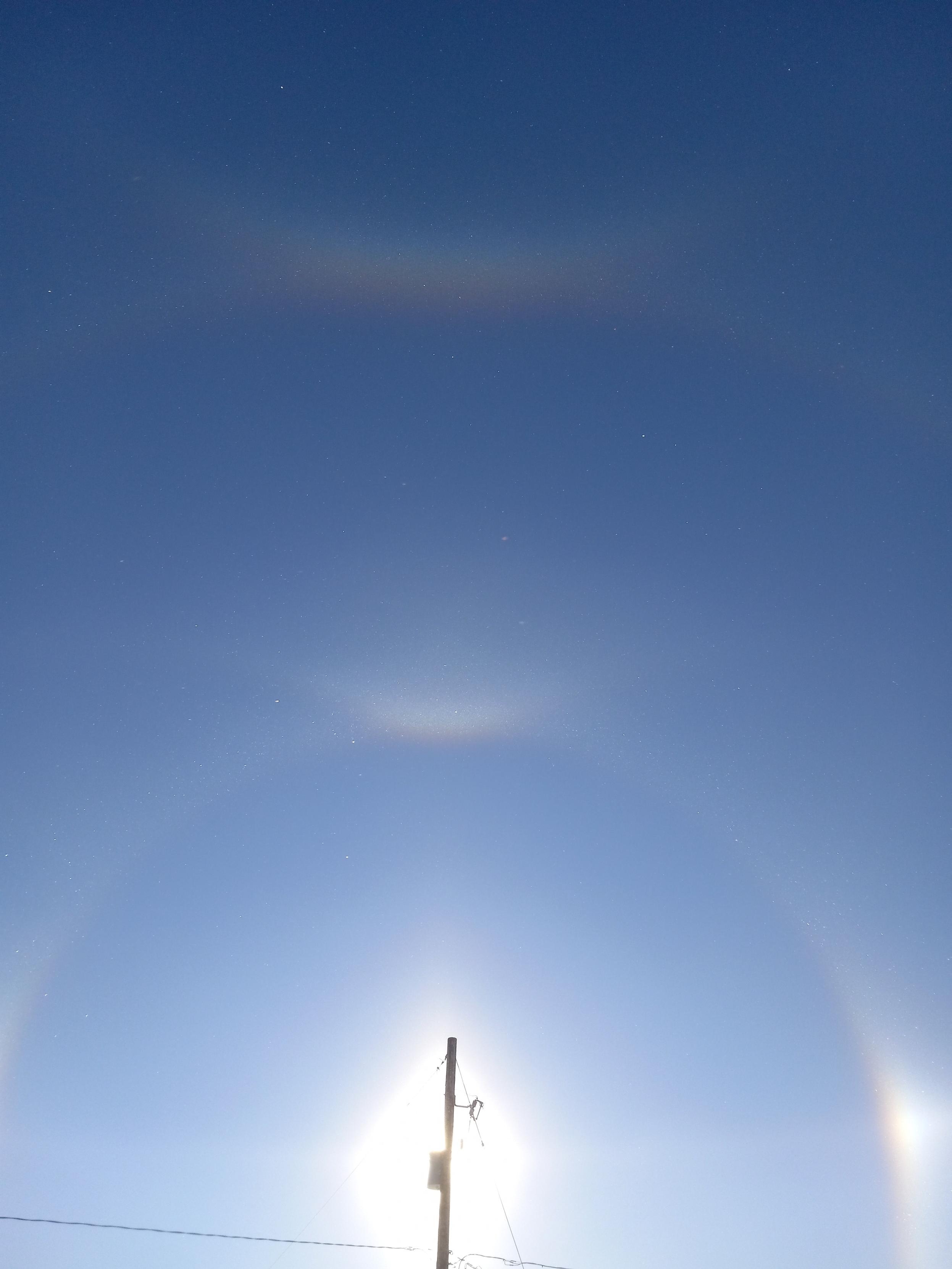
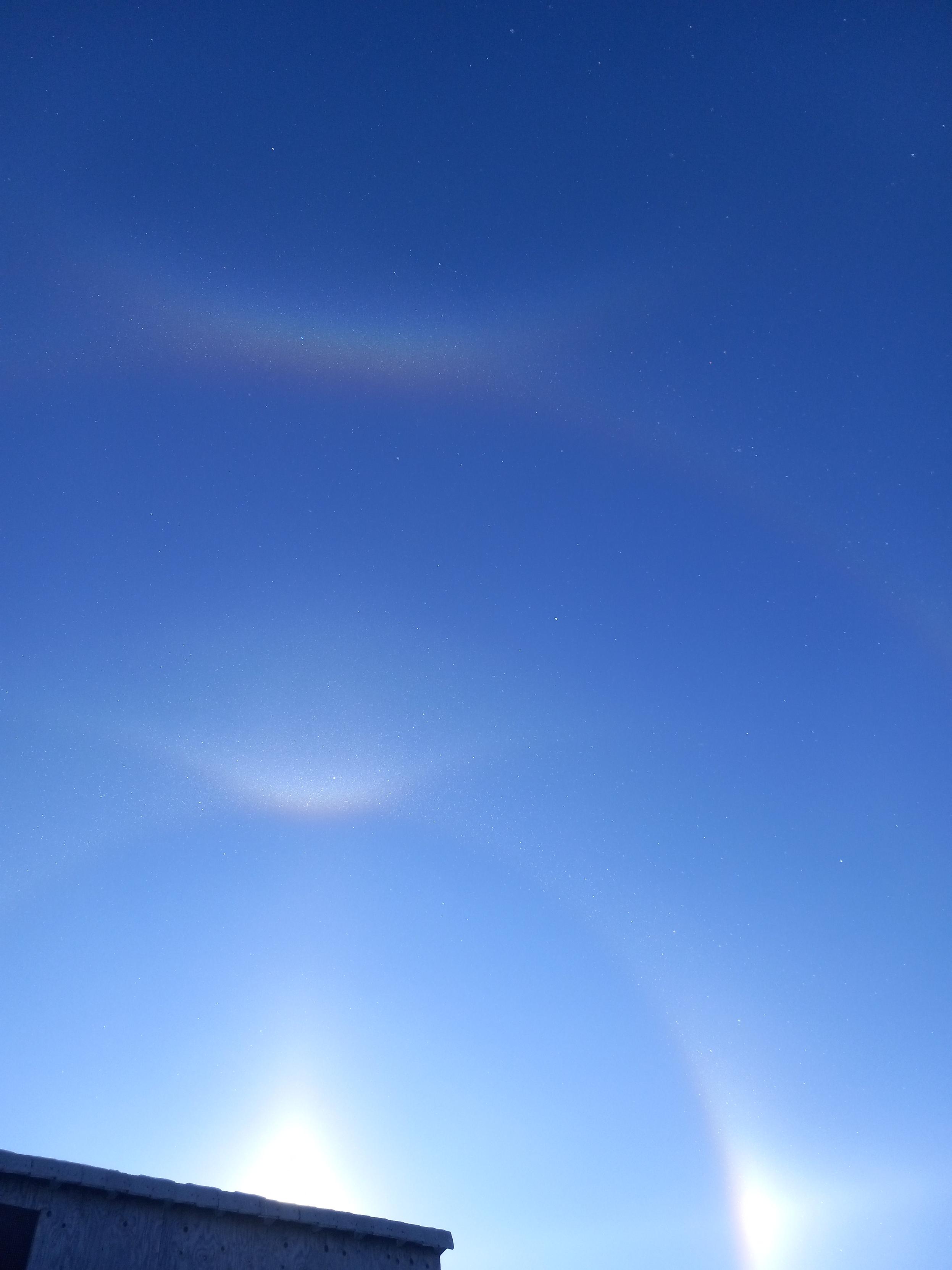
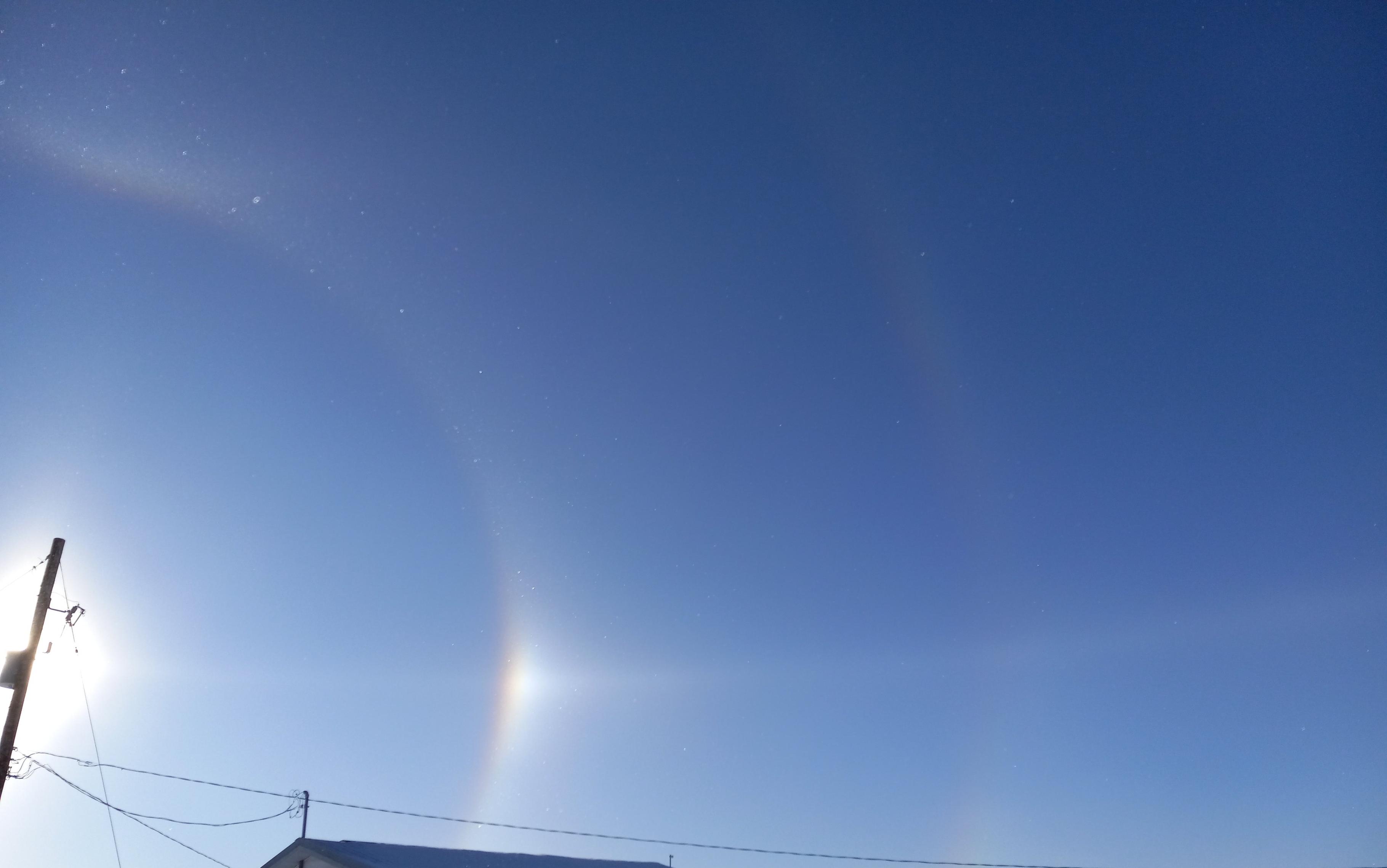
Hello, Antarctica.
Tyler Sutterley boosted:
Want to understand the importance of #salmon to #Alaska and a way forward? Read this:
https://storymaps.arcgis.com/stories/43ae5f7ae3b84a85889e7b8ada4561f0
Tyler Sutterley boosted:
I wrote a quick summary about this paper.
Enjoy:
http://sternaparadisaea.net/2024/11/23/on-the-devil-in-the-climate-model-details/
https://fediscience.org/@Ruth_Mottram/113528932391756884
Ruth_Mottram - New paper alert 🚨
Glaude et al 2024 @H2020PROTECT on #Greenland #IceSheet surface melt:
"With identical forcing, Greenland Ice Sheet surface mass balance from 3 regional climate models shows a two-fold difference by 2100"
https://agupubs.onlinelibrary.wiley.com/doi/10.1029/2024GL111902?af=R
Tyler Sutterley boosted:
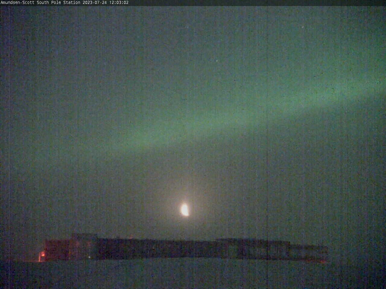
Amundsen-Scott South Pole station via https://www.usap.gov/videoclipsandmaps/spwebcam.cfm
Tyler Sutterley boosted:
Trust me, I’m an oceanographer.
Tyler Sutterley boosted:
Six sailboats currently in Nome's small boat harbor after transiting the NW passage from the Greenland side. [edit] - now 7, or I miscounted earlier.
Tyler Sutterley boosted:
Also representibg @OceanIceEU, Tore Hatteman on subshelf melting at #AntarcticaInSync
It is indeed an embarrassing travesty for the #IceSheet community that we cannot rule out 5m.of #SeaLevelRise by 2150 (though most feel it's unlikely)
Tyler Sutterley boosted:
I'm currently hiring a PhD student to develop an instrument for studying water flow in water channels inside glaciers. There's opportunities for fieldwork in Greenland. It would best suit a mechanical engineer - if you are interested, please get in touch. Due to restrictions imposed on us by the funding agency, you will need to be a "UK resident" (i.e. have lived in the UK for the last 3 years and have no restriction on your right to live and work here).

Tyler Sutterley boosted:
I published geoarrow-rust v0.3 and updated Python bindings!
- Latest GeoArrow: 3D & GeometryCollection
- Read/write GeoParquet 1.1, including fast bbox reads from spatially-partitioned datasets
- Pyodide support
- Better Arrow interoperability
Tyler Sutterley boosted:
That's a wrap for this 2024 UW Hackweek! It's been amazing, getting to connect with passionate open science advocates, developers, students and researchers from so many places. This week scratched a deep itch I had for a while, teaching! Hadn't realized how much I missed that, giving a tutorial with good QnA interaction, pair programming 1:1 and seeing them figure things out in an aha moment, and finding out what matters to kids these days! Need to blog about this, stay tuned!
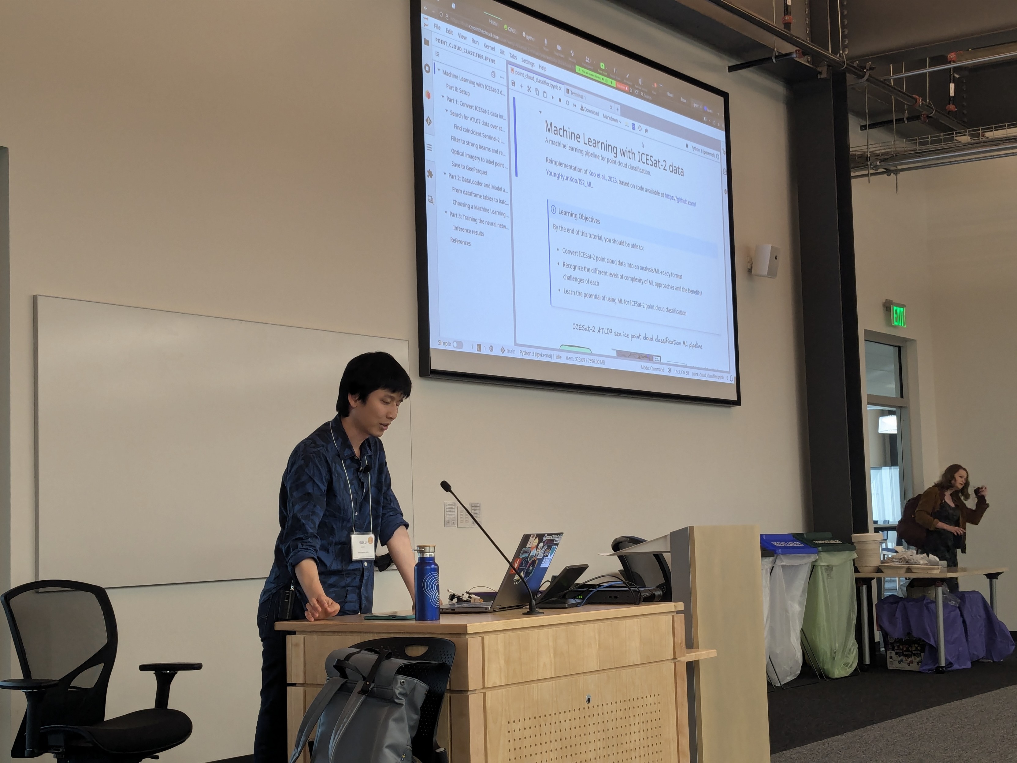
@weiji14 starting us out this morning at the 2024 #NASA #UW #Hackweek with #ML using data from #ICESat2 and #Sentinel 🛰️
Tyler Sutterley boosted:
Mikala and Gail presenting their tutorial on Data Access, specifically SnowEx and ICESat-2 data, using earthaccess (A Python library for NASA Earthdata APIs).
Docs for the library is at https://earthaccess.readthedocs.io, and tutorial content is at https://snowex-2024.hackweek.io/tutorials/Data_access/index.html
Tyler Sutterley boosted:
JP Swinski presenting a tutorial on accessing ICESat-2 data using libraries like icepyx and sliderule. Also demo-ing how to use h5coro to directly read ICESat-2 granules from an s3 bucket.
Tutorial page at https://icesat-2-2024.hackweek.io/tutorials/data_access/ICESat2_Data_Access_Tutorial.html
#Python #icepyx #SlideRule #h5coro #NASA #ICESat-2 #UW #HackWeek
Client Info
Server: https://mastodon.social
Version: 2025.04
Repository: https://github.com/cyevgeniy/lmst