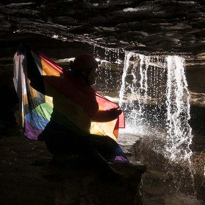
I'm...really not sure what we are looking at here but it made me happy, growth breaking through ice as it melts.
#Cold


LAKE EFFECT SNOW CONTINUES:
The #SouthShore region continues to see #lakeeffect #snow #showers along the shoreline region this evening.
The rest of the #Northland will see #clearing skies and bitter #cold #windchills.

NORTHLAND FORECAST FOR JANUARY 30, 2026:
The #Northland will see bitter #cold #temperatures Thursday night with most lows in the teens and 20s below zero thanks to mostly #clear skies. #Windchill readings at times could be as low as -35°.
An #arctic high-pressure system will #clear away the clouds Friday. Highs will be in the single digits and low teens with light #winds.
VIDEO: https://www.fox21online.com/2026/01/29/thursday-evening-northland-forecast-1-29-2026/
Happy #Thursday afternoon from the #Northland!
Other than #lakeeffect #snow #showers along the South Shore region, it's another #cold and relatively 3dry day for us.
It will feel quite #chilly tonight, but a #warm up is coming soon.


Raven On A Snowy Branch, Ohara Koson
I love this.
#art #voice #noise #heart #cold #here #now #wakeUp #raven #print #ukiyo-e #japan


😴😴😴😴💁🏼♀️*I think they forgot the most important one!*They sleep better because they can breathe better but they still need to be warm!👉😴😴😴😴💁🏿♀️*People Who Sleep Better In Cold Rooms Under Big Blankets Usually Have These 11 Distinct Personality Traits👉
#Cold #Room #People #Sleep #Better
People Who Sleep Better In Cold Rooms Under Big Blankets Usually Have These 11 Distinct Personality Traits | YourTango
https://www.yourtango.com/self/people-sleep-better-cold-rooms-under-big-blankets-personality-traits


The first passes through Saturday night into Sunday and the other is middle to late next week. Total snowfall across the region from the Saturday/Sunday system will be a dusting to an inch.
The system later next week is still very much up in the air in terms of impact. The two main model camps show us returning to arctic air or we stay close to normal like we had been.
REGIONAL FORECAST DISCUSSION
BLACK SHEEP WEATHER - APPLE VALLEY, MN
THU JAN 29, 2026 - 12:00 PM
Continued sunny skies and light winds have made for chilly but manageable weather and will continue to do so through the weekend.
Temperatures will stay chilly the next couple of days before an actual warm up occurs and we return to normal temperatures. There are only a couple of minor snow chances in the next seven days.

How Cold Is It?!
The retreating tide has created SandBergs. Yes - that ice is as slippery as it looks~
#Sea
#cold
Fun fact: Nothing is melting - the local hardware store has police directing traffic due to th demand for salt!!! I simply hucked sand home from the beach - makes for good traction and is better for my dormant plants:)

Flying out of DCA to New Orleans right now on a Bombardier CRJ900A. They just told us it's so cold out that the plane's water pipes are frozen and they can't serve coffee or tea and there's no bathroom sink water.
That's a first. It's cold. ❄️✈️
#flying #flights #AmericanAirlines #planes #cold #DC #winter

#hiver #winter #neige #snow #froid #cold #coldweather #coldoutside #nature #arbres #trees #paysage #landscape #winterscape #openspace

Situation in US South grows more dire after days of ice, frigid temperatures, widespread power outages
It could be days before power is restored across the South, where more subfreezing temperatures are expected by Friday in areas unaccustomed to and ill-equipped for such cold.

The coldest air in 16 years arrives in #Florida Sunday morning. Here’s a look at lows and wind chills. A wind chill of 6° in Gainesville, 11 in Crystal River, 16 in Port St Lucie! Holy cow! 🥶 #cold
Notice the immediate West Coast is spared a #freeze due to NW wind off the Gulf keeping it milder. Bundle up!

It's cold! Anyway, I'm off to the phlebotomist. Anyone need anything? #winter #cold #NewJersey #blood


HANA米津玄師比較するから炎上🔥 #メダリスト #hana #Cold Night https://www.yayafa.com/2706413/ #米津玄師


Winter-Idylle
#Winter #Schnee #Snow #Winterzauber #Cold #WinterVibes #Natur #Draußen
#Fahrrad #Cycling #Rennrad #RoadBike #BikeLife #WinterCycling #Fahrradliebe #FrostyRide #altenbochum #bochum
#Winter #Schnee #Snow #Winterzauber #Cold #WinterVibes #Natur #Draußen
#Fahrrad #Cycling #Rennrad #RoadBike #BikeLife #WinterCycling #Fahrradliebe #FrostyRide #altenbochum #bochum


Client Info
Server: https://mastodon.social
Version: 2025.07
Repository: https://github.com/cyevgeniy/lmst