
S2Coast-2023 - The First Global 10-Meter Resolution #Coastline Dataset Derived From Enhanced #Sentinel2 Composite #Imagery Using #GoogleEarthEngine
--
https://doi.org/10.1016/j.rse.2025.115186 <-- shared paper
--
https://zenodo.org/records/17092775 <-- shared data
--
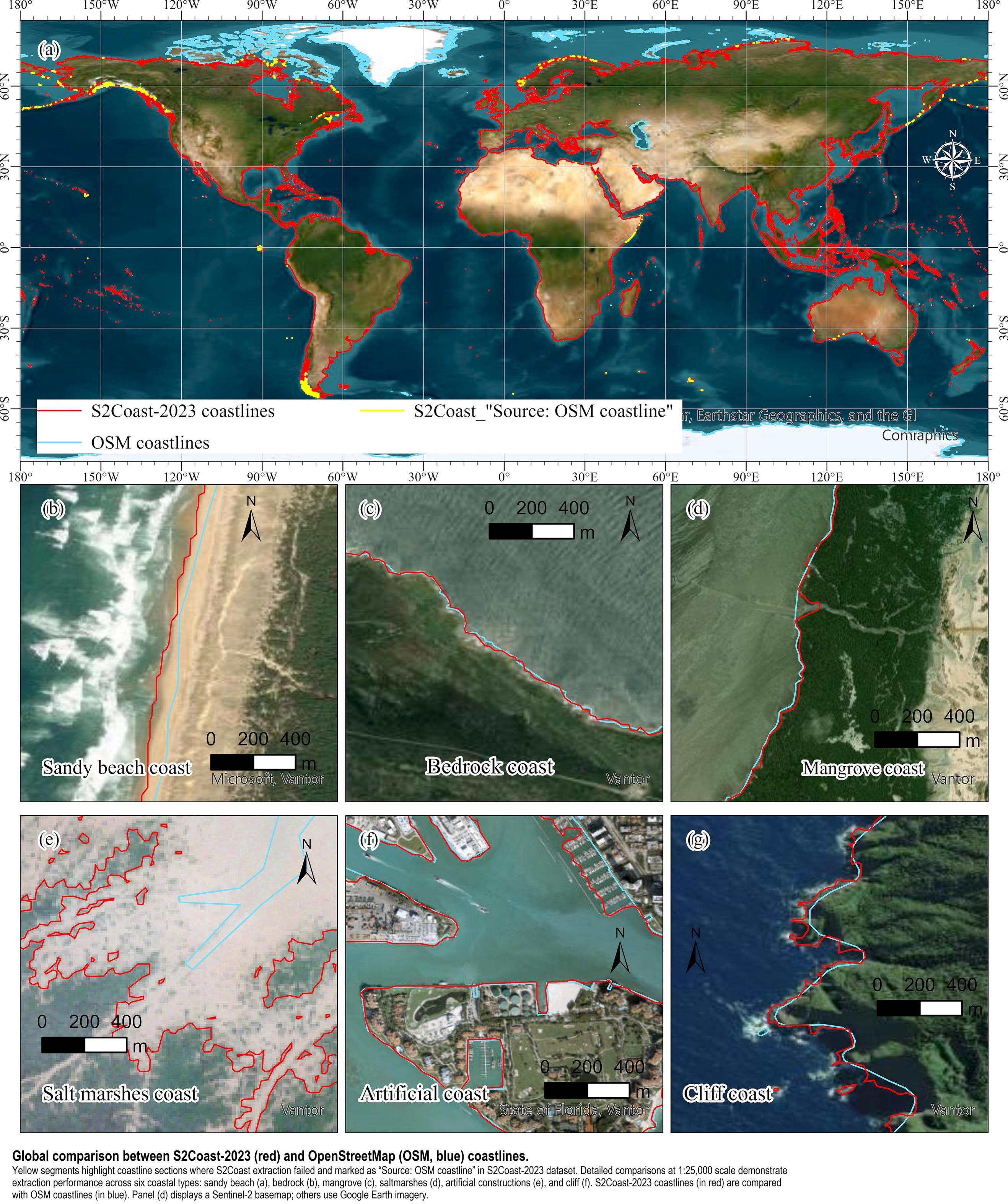
“HIGHLIGHTS:
• Developed a GEE-based global coastline detection framework (S2Coast).
• HWLSentinel-2 serves as a unified and stable indicator for global coastline detection.
• The S2Coast-2023 coastline dataset is generated from annual Sentinel-2 imagery.
• Pixel-level accuracy compared with VHR-based OpenStreetMap coastlines..."
#GIS #spatial #mapping #RemoteSensing #CoastalResearch #ClimateChange #EarthObservation #Globalcoastlinemapping #Senitinel #googleearthengine #GEE #Compositing #coast #globe #global #model #modeling #detection #marine #terrestrial #ecosystems #knowledgebased #framework #spatialanalysis #spatiotemporal #QAQC
#Senitinel


Client Info
Server: https://mastodon.social
Version: 2025.07
Repository: https://github.com/cyevgeniy/lmst