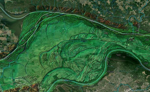
#digitalelevationmodel

2025-05-12

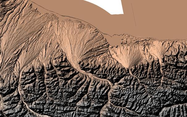
"ETOPO 2022 is an updated topographicโ€“bathymetric dataset at 15โ€‰arcsec global resolution that incorporates bare-Earth datasets with forests and buildings removed. ETOPO 2022 integrates more than a dozen source datasets for land topography, sea bathymetry, lake bathymetry, and ice-sheet bed elevation data, all of which have been carefully evaluated for quality, accuracy, and seamless integration."

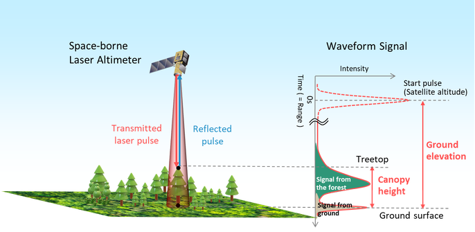
Quality controlled with nearly a trillion #ICESat2 #LIDAR shots.

Did some successful microwave keyhole shots back in the day, using #SRTM data. This would have been even better.
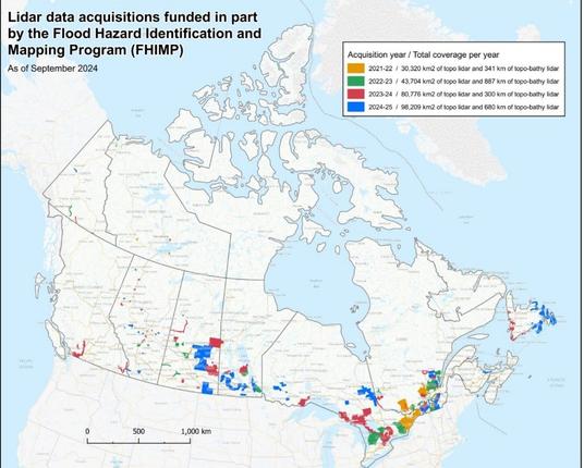
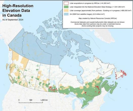
#DigitalElevationModel
#DEM

essd.copernicus.org/articles/1

2025-03-26

I was going to ask the #Earth #Observation community, including @EOMasters, if there were good online resources to access and process #DigitalElevationModel (DEM) data.

But just found out that my ace colleague @LukeDataManager had done a detailed workflow and published it online.

nordatanet.github.io/Exploring

Note to self: be more like Luke and publish my workflows

#OpenScience

๐Ÿ’ง๐ŸŒ Greg CocksGregCocks@techhub.social
2024-07-31

The Basics of LiDAR - Light Detection and Ranging - Remote Sensing [tree focused]
--
neonscience.org/resources/lear <-- shared tutorial
--
[this post should not be considered an endorsement of any organisation, but is shared for learning purposes]
โ€œLiDAR or Light Detection and Ranging is an active remote sensing system that can be used to measure vegetation height across wide areas.
This [tutorial] pageโ€ฆ introduce[s the] fundamental LiDAR (or lidar) concepts including:
โ€ข What LiDAR data are.
โ€ข The key attributes of LiDAR data.
โ€ข How LiDAR data are used to measure trees...โ€
#GIS #spatial #mapping #elevation #spatialdata #spatialanalysis #data #digital #DEM #digitalelevationmodel #spatialanalysis #LiDAR #remotesensing #model #modeling #IFSAR #onlinelearning #onlinelessons #tutorial #landform #geomorphology #landforms #guide #vegetation #forest #forestry #tree #trees

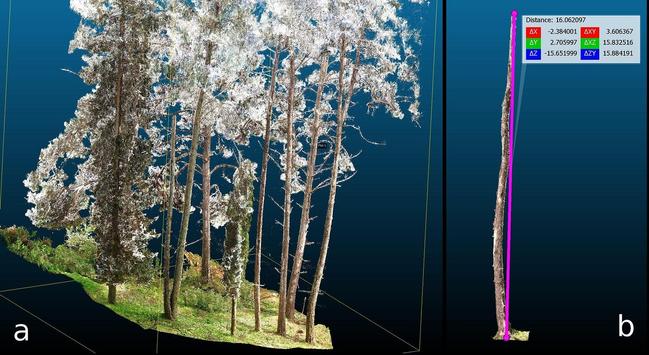
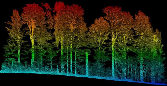
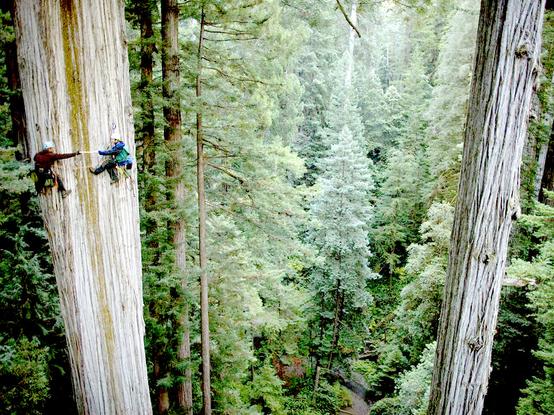
graphic / 3D visualisation - LiDAR data used to measure a tree standgraphic / 3D visualisation - LiDAR data image of a stand of trees, side view, colour coded by depth from the groundgraphic / 3D visualisation - basics of the physics / technical aspects of how LiDAR data used to measure a tree standphoto - two foresters measuring a tree manually by climbing
2024-03-09

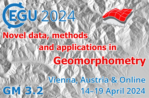
๐Ÿ‡ฆ๐Ÿ‡น Dear colleagues, the session ๐—ก๐—ผ๐˜ƒ๐—ฒ๐—น ๐—ฑ๐—ฎ๐˜๐—ฎ, ๐—บ๐—ฒ๐˜๐—ต๐—ผ๐—ฑ๐˜€ ๐—ฎ๐—ป๐—ฑ ๐—ฎ๐—ฝ๐—ฝ๐—น๐—ถ๐—ฐ๐—ฎ๐˜๐—ถ๐—ผ๐—ป๐˜€ ๐—ถ๐—ป ๐—š๐—ฒ๐—ผ๐—บ๐—ผ๐—ฟ๐—ฝ๐—ต๐—ผ๐—บ๐—ฒ๐˜๐—ฟ๐˜† at European Geosciences Union (EGU) 2024 is scheduled for Mon, 15 Apr, 10:45โ€“12:30 (CEST) in Room G1 ๐ŸŸช (orals) and 16:15โ€“18:00 (CEST) in Hall X1 ๐ŸŸช (posters)

๐Ÿ‘‰ Join us to attend great oral & poster contributions!

๐Ÿ“‹ Full list of contributions & info about the session:
lnkd.in/dtSkqt6V

#EGU2024 #geomorphometry #spatialanalysis #spatialdata #geomorphology #lidar #digitalelevationmodel

๐Ÿ’ง๐ŸŒ Greg CocksGregCocks@techhub.social
2023-05-04

What Is A Digital Elevation Model (DEM)?- A Practical Guide
--
equatorstudios.com/what-is-a-d <-- shared tutorial
--
โ€œA Digital Elevation Model (DEM) is a digital cartographic dataset that represents a continuous topographic elevation surface through a series of cells. Each cell represents the elevation (Z) of a feature at its location (X and Y). Digital Elevation Models are a โ€œbare earthโ€ representation because they only contain information about the elevation of geological (ground) features, such as valleys, mountains, and landslides, to name a few. They do not include any elevation data concerning non-ground features, such as vegetation or buildings...โ€
[read more at the link above...]
#GIS #spatial #mapping #elevation #spatialdata #spatialanalysis #data #digital #DEM #digitalelevationmodel #spatialanalysis #LiDAR #remotesensing #model #modeling #IFSAR #onlinelearning #onlinelessons #guide #tutorial #landform #bathymetry #geomorphology #geology #landforms

2023-01-19

Does anyone know of any concrete ways the old USGS scribed map products or their derivatives are used today?

For a while, the line work was turned into raster products, I believe, and then into digital elevation models?

Do any part of of the old topo map products still have use or relevance, or have they seen their last hurrahs?

#Maps #GIS #Cartography #DigitalElevationModel #Topography

Client Info

Server: https://mastodon.social
Version: 2025.04
Repository: https://github.com/cyevgeniy/lmst