
📢 Meet our #IOER_Fellow Prof. Saswat Bandyopadhyay from India. In his lecture (📅 12 Jan, ⏳ 3:30 p.m., 📌 online) he will addresses development and use of robust digital data ecosystems for managing land, infrastructure, and environmental systems at metropolitan and regional scale.
More information & Zoom link 👉 https://www.ioer.de/en/events/ioer-forum/ioer-forum-2026-01-12
#ioerforum #stadtplanung #raumentwicklung #Spatialdata #Geoinformatics #geospatial
@saxfdm @KAT_Transformationszentrum @ratswd
#spatialdata


Acabo de actualizar mi dataset sobre contaminación lumínica nocturna global generado con mi herramienta radiance-geojson (https://codeberg.org/imigueldiaz/radiance-geojson). Contiene archivos JSON (.json.gz) y un dump completo en PostGIS (restaurada ocupa 27GB, con casi 140 millones de puntos georreferenciados), con datos de radiancia, brillo del cielo y clasificación Bortle para 173 países a 0.5 km de resolución. Basado en imágenes VIIRS de Earth Observation Group, Colorado School of Mines.
Puedes descargarlo gratis desde: https://archive.org/details/radiance-geojson-data-2025
Ideal para análisis geoespaciales, ambientales y astronómicos, en mi caso lo usaré para astrofotografía si me da la vida. Licencia CC BY 4.0.
#opendata #geospatial #lightpollution #VIIRS #PostGIS #gis #spatialdata #dataset #CCBY4 #opensource #radiance #astrophoto #astrophotography

Latest Hindi News: Drone survey for digital mapping in UP will start from next year
https://hindi.vaartha.com/national/drone-survey-for-digital-mapping-in-up-will-start-from-next-year/72185/
#उत्तरप्रदेश #डिजिटल_मैपिंग #ड्रोन_सर्वे #तकनीकी_प्रगति #उत्तर_प्रदेश_सरकार #DigitalMapping #DroneSurvey #SmartCity #TechInIndia #GeospatialTechnology #MappingInnovation #UpcomingProjects #TechnologyNews #SpatialData
Geospatial Imaging Market Update
The global geospatial imaging market was valued at USD 2.36 billion in 2024. It’s projected to grow from USD 2.77 billion in 2025 to USD 7.42 billion by 2032, at a CAGR of 15.1%. North America held a 34.68% share in 2024.
Source: https://www.fortunebusinessinsights.com/geospatial-imaging-market-107834
#Geospatial #Imaging #RemoteSensing #SpatialData #GIS #MarketResearch #EarthObservation #Aerospace


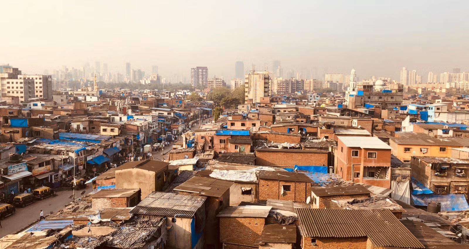
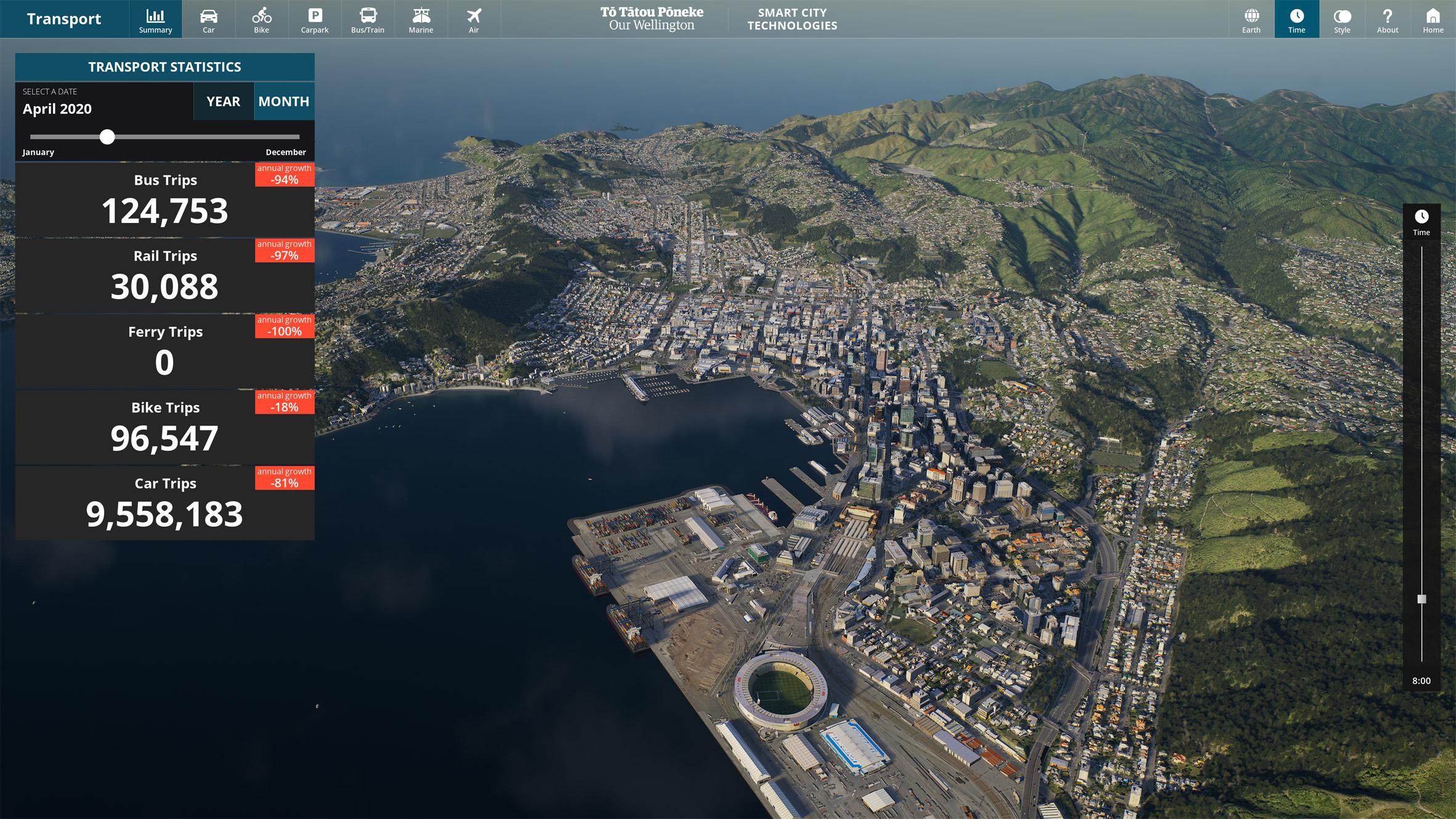
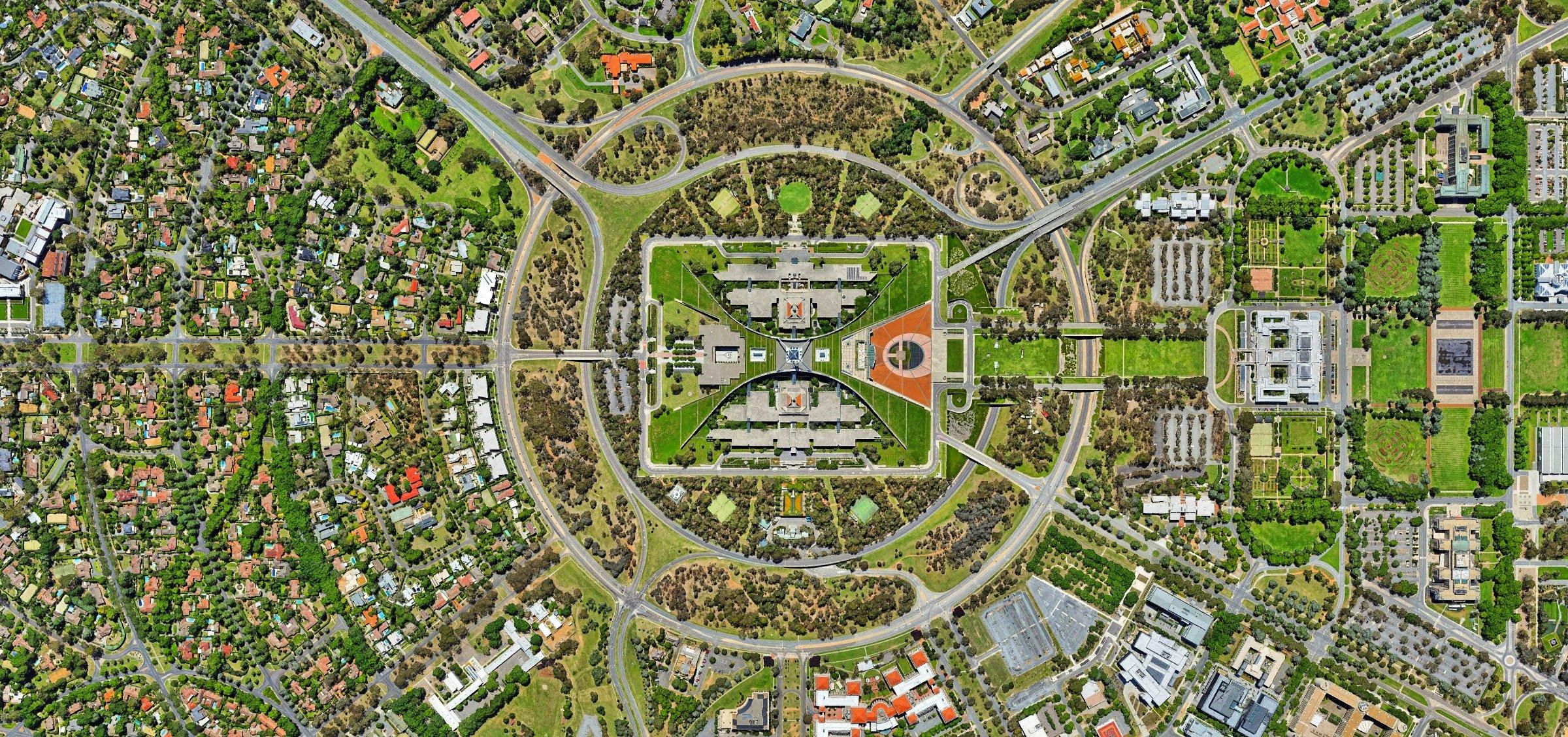
AAG Call For Papers - Urban Spatial Analytics - Toward Problem-Driven Methods Instead Of Methods-Driven Problems
--
https://geoffboeing.com/2025/10/aag-urban-spatial-analytics/ <-- AAG Call For Papers
--
#GIS #spatial #mapping #callforpapers #AAG #annualmeeting #spatialanalysis #urban #city #usecase #approach #urbandatascience #datascience #cities #design #urbanplanning #methods #approach #realworld #research #papers #urbanliving #model #modeling #spatialdata #datavisualisation #publicgood #wickedproblems #homelessness #unaffordability #planning #funding #infrastructure #services #utilities
#AmericanAssociationofGeographers
🧩 New R package: h3sdm 🐦🌿
Model species distributions using the H3 hexagonal spatial index — a fast and scalable way to bring ecological modeling into the spatial data age!
🔹 Integrates easily with sf, terra, and tidymodels
🔹 Enables spatial cross-validation and H3-based predictors
🔹 Built for real-time or large-scale SDM applications
📦 GitHub: https://github.com/ManuelSpinola/h3sdm
#rstats #Ecology #SpatialData #SDM #OpenSource #GIS #Biodiversity #H3
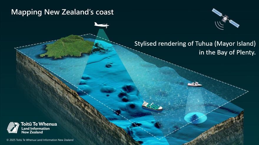
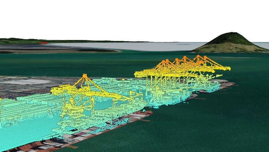
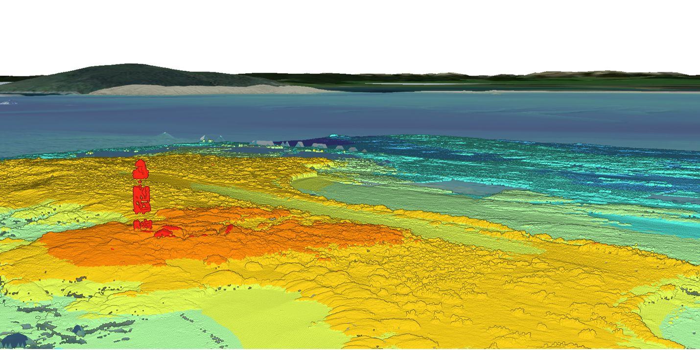
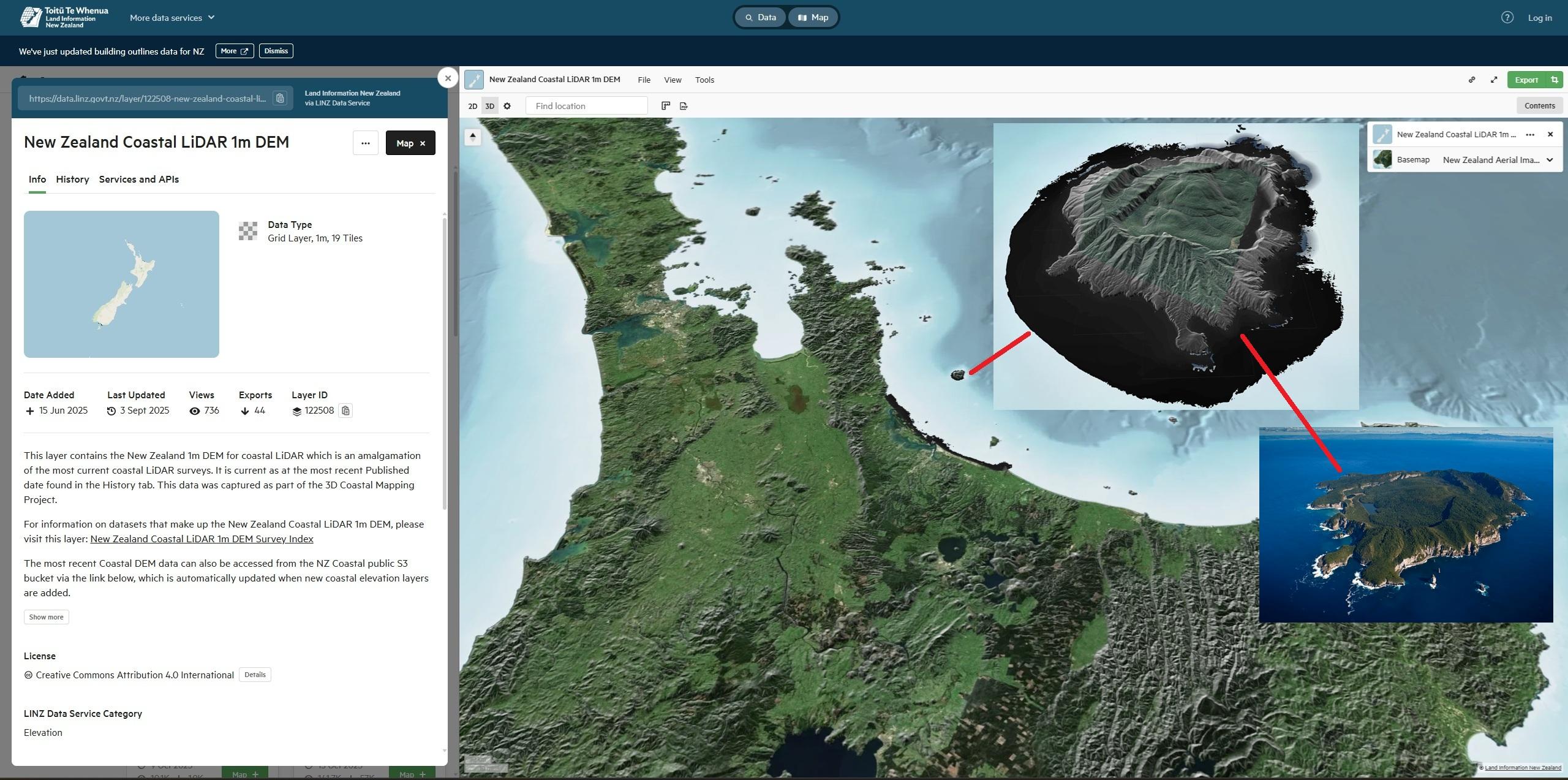
3D Coastal Mapping [New Zealand]
--
https://www.linz.govt.nz/products-services/data/3d-coastal-mapping <-- shared technical overview
--
https://data.linz.govt.nz/layer/122508-new-zealand-coastal-lidar-1m-dem/ <-- shared New Zealand Coastal LiDAR 1m DEM
--
#GIS #spatial #mapping #coast #coastal #opendata #NewZealand #remotesensing #LiDAR #earthovservation #3D #3DCM #climatechange #sealevel #sealevelrise #SLR #risk #hazard #spatialdata #mitigation #topography #bathymentry #geomorphmetry #humanimpacts #seafloor #marine #ocean #policy #planning #communities #infrastructure #biodiversity #habitat #tsunami #earthquake #RingOfFire #flood #innundation #flooding #LINZ #hydrology #hydrography #maritime #safety
@Toitū Te Whenua Land Information New Zealand @LINZ
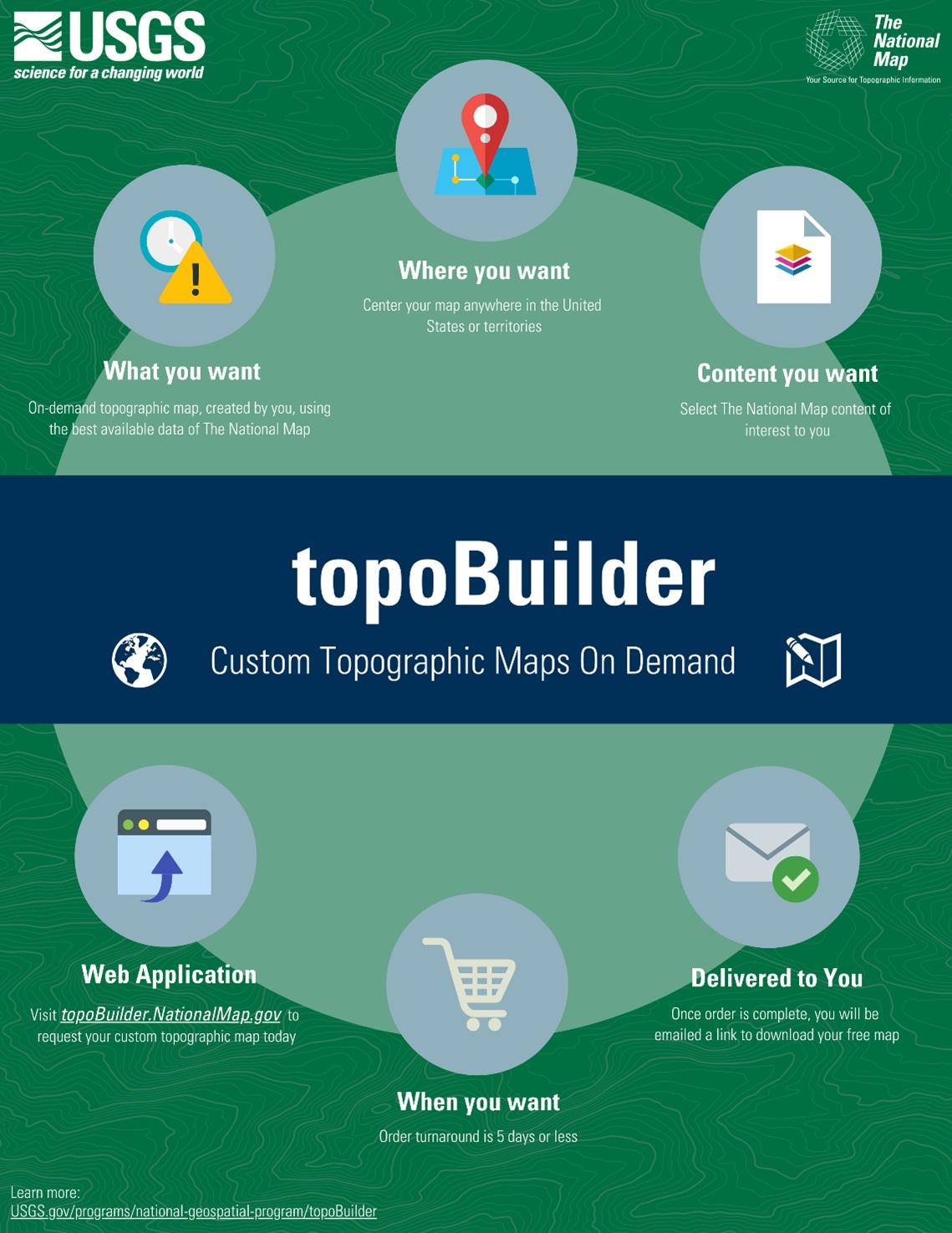
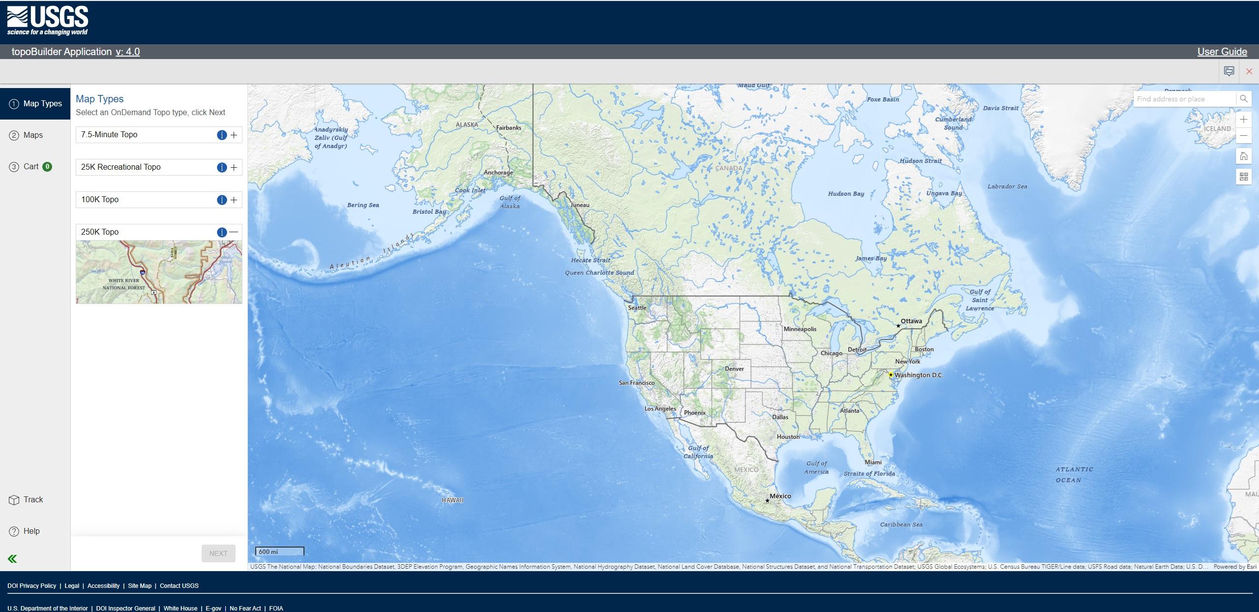
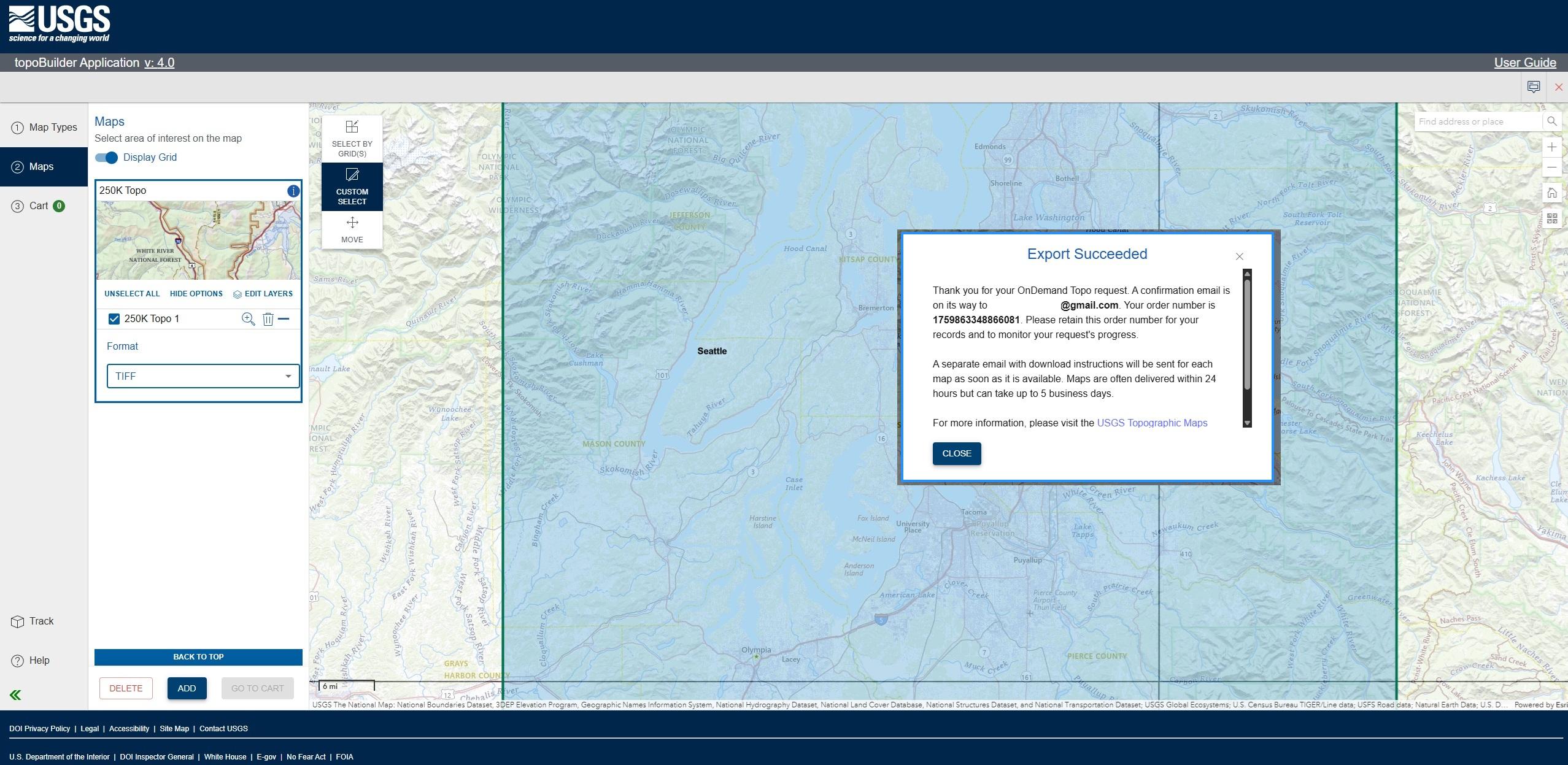
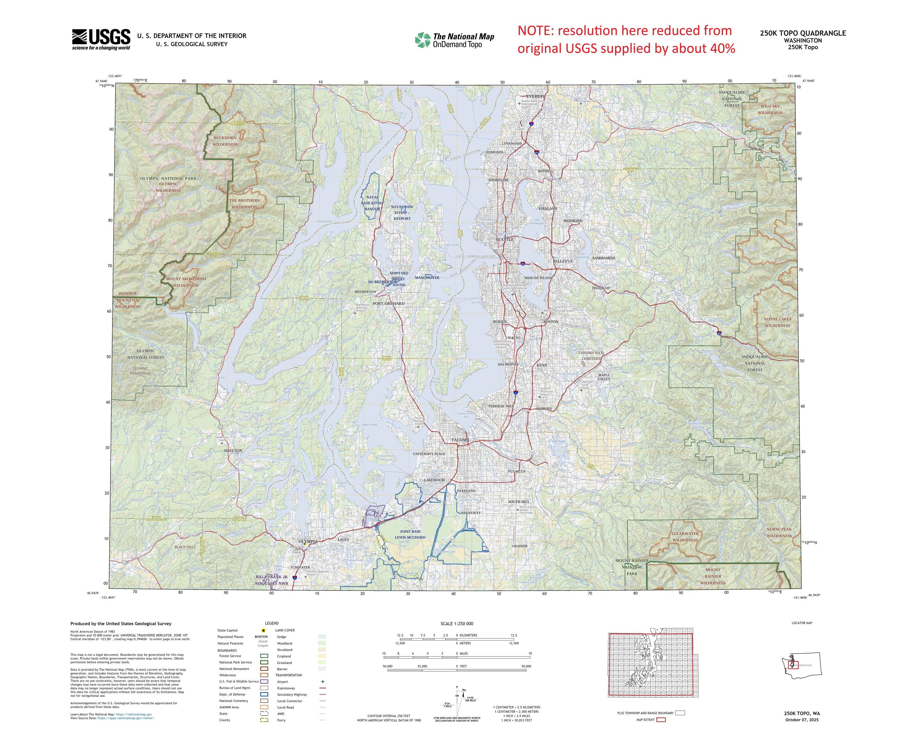
Latest #USGS Map-Product Release - 250K Topo OnDemand Topo Products Now Available Through The Topobuilder Application
--
https://www.usgs.gov/programs/national-geospatial-program/news/regional-view-reliable-data-introducing-usgs-250k-topo <-- USGS product announcement page and topoBuilder custom map construction application access
--
“The U.S. Geological Survey (USGS) has launched the 250K Topo, a new digital map product designed to support regional planning, land and resource management, and emergency response coordination…”
--
#GIS #spatial #mapping #USGS #OnDemandTopo #NGP #topoBuilder #OnDemand #250KTopo #Geospatial #TopographicMaps #GIS #MappingInnovation #OpenData #Maps #NGTOC #NGP #custom #opendata #latest #spatialdata #topomap #fedservice #fedscience #publicgood
@USGS

Safe Software Partners with Vancouver Canucks https://www.rawchili.com/nhl/229456/ #BritishColumbia #Canucks #DataIntegration #EnterpriseIntegration #FME #Hockey #NHL #SafeSoftware #SpatialData #Vancouver #VancouverCanucks #VancouverCanucks

A New Geodatabase Of Fuel Treatments Across Federal Lands In The USA
--
https://doi.org/10.1038/s41597-025-05859-z <-- shared paper
--
https://nft.garphub.org/ <-- National Fuels Treatments Initiative (NFT) page
--
“The National Fuels Treatments Initiative (NFT) is a collaborative, scalable data collection effort which aims to build a standardized map of nationwide fuels treatment locations occurring across all land ownership types…”
--
#NationalFuelsTreatmentsInitiative #NFT #datacollection #fedscience #fedservice #opendata #fire #fuel #fedopendata #wildfire #bushfire #risk #hazard #damage #infrastructure #GIS #spatial #map #mapping #economics #publicgood #landownership #federalland #mitigation #technical #database #naturalhazard #infrastructure #residential #transportation #accessibility #portal #online #coordination #teatment #WildfireInteragencyGeodatabase #TWIG #nation #nationwide #management #landuse #landcover #policy #research #spatialdata
@DOI @USFS @USGS


Happy 7th Birthday to Quarticle! 🎂
A huge thank you to our brilliant team, amazing clients, and trusted partners who make this journey possible.
Here’s to the next chapter of innovation, impact, and collaboration!
#geoinformation #geointelligence #geospatial #geospatialtechnology #locationintelligence #spatialdata #geospatialdata #datavisualization #gissystems #Quarticle #mapping #Qarta #GIS


🌍 Which geospatial conferences are you excited about in 2026?
I'm compiling a list at https://github.com/Nowosad/conferences_2026 -- please contribute events you know about!
What am I missing?

@derf i feel so stupid everytime #rstats #spatialdata #maps
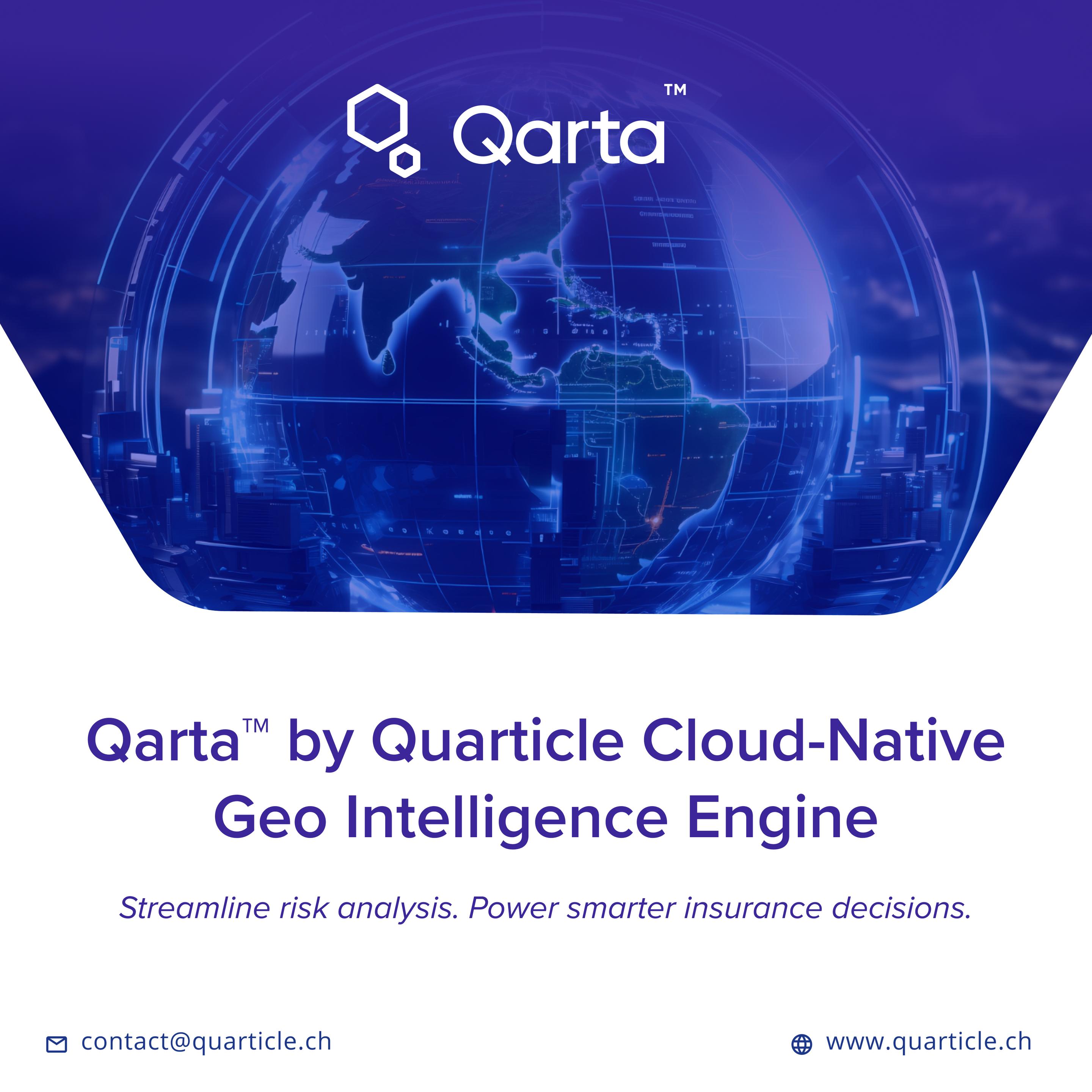
For insurers, static maps aren’t enough. You need a geospatial engine built to integrate, scale, and perform at the speed of risk.
Qarta™, Quarticle’s geo‑intelligence engine, was built with modern insurance workflows in mind.
Find more information here: https://quarticle.ch/products/qarta
#GeoIntelligence #Underwriting #RiskAnalytics #InsurTech #Qarta #Geospatial #GeospatialAI #MachineLearning #GIS #BusinessIntelligence #PredictiveAnalytics #Quarticle #SpatialData #LocationIntelligence
Check out "Scaling the r-spatial ecosystem" by Dewey Dunnington 🌍📦
An exploration of how R’s spatial tools can be used for big(ger) data.
Video: https://youtu.be/tjNEoIYr_ag?feature=shared
Slides: https://dewey.dunnington.ca/slides/rspatial2025


The future of smarter business strategies lies at the intersection of Geospatial AI and Machine Learning.
Explore this blog post and dive deeper into how cutting-edge technologies are unlocking new levels of spatial intelligence, helping businesses anticipate trends, optimize decisions, and gain a competitive edge: https://quarticle.ro/blog/geospatial-ai-and-machine-learning-the-key-to-smarter-business-strategies
#GeospatialAI #MachineLearning #GIS #BusinessIntelligence #PredictiveAnalytics #Quarticle #GeoIntelligence #SpatialData #LocationIntelligence #Innovation


In our latest blog post, our Data Scientist Osheen MacOscar shares a great overview of how to use {ggplot2} and {gganimate}, when dealing with spatial data.
#rstats #datavis #spatialdata #maps
https://www.jumpingrivers.com/blog/animated-map/
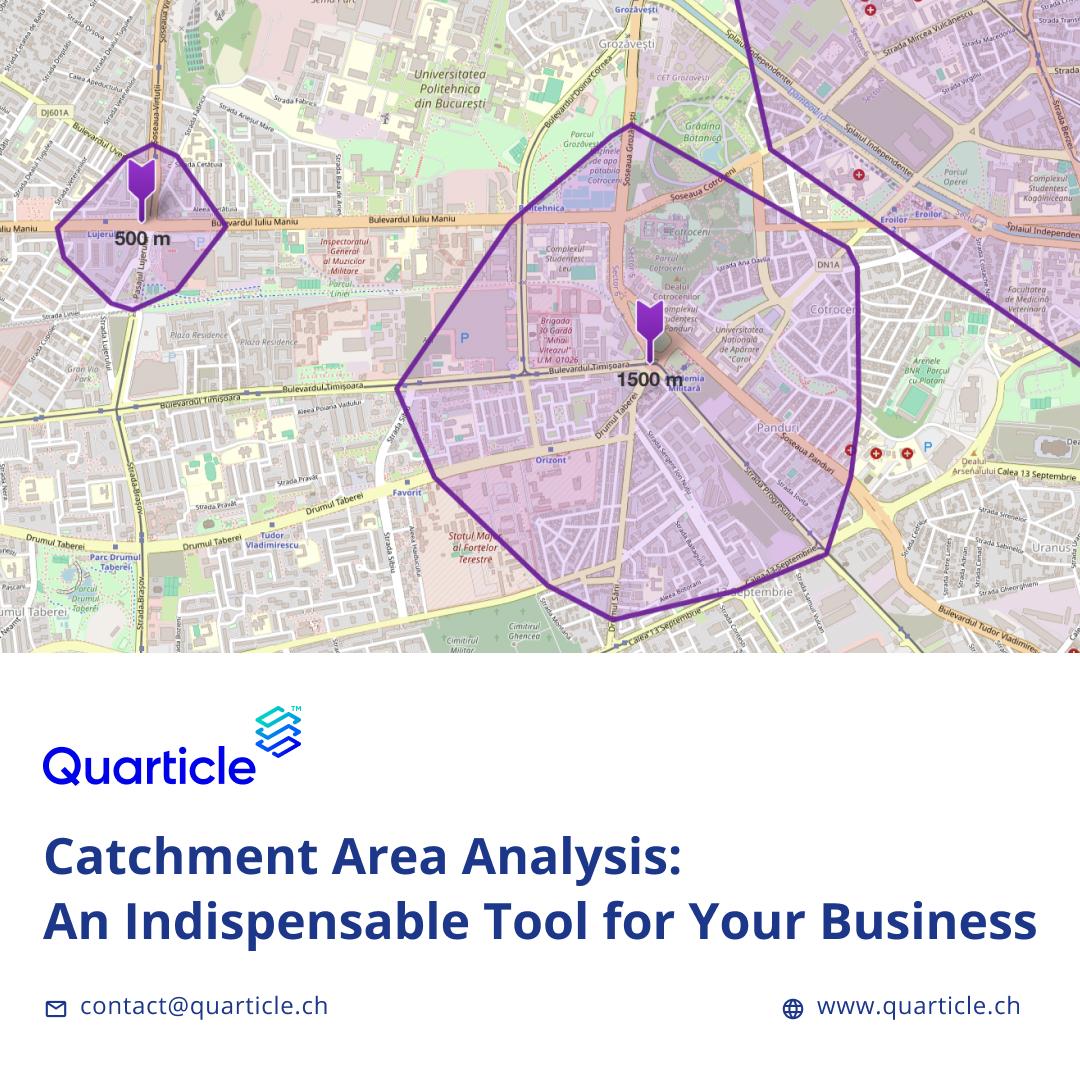
📍Where are your customers—and where should you grow next?
Catchment area analysis helps you map reality, not assumptions.
✅ Know your service reach
✅ Make smarter site & growth decisions
✅ Target the right customers
🗺️ A must for insurers, retailers, public services & logistics.
🔗 Dive in: https://quarticle.ro/blog/catchment-area-analysis-an-indispensable-tool-for-your-business
#geointelligence #locationintelligence #GIS #Quarticle #Qarta #catchmentarea #spatialdata #mapping #geospatialdata

Why does Kontur use hexagons?
Because borders lie.
Hex grids =
✅ Equal area
✅ Seamless coverage
✅ Fast queries
✅ No square bias
✅ Scalable from local to global
One shared frame. One honest view.
#Hexagons #GIS #Geospatial #Mapping #Kontur #SpatialData

South Korea's Ministry of Land has completed core Geo-AI technology, paving the way for AI-driven real estate searches and broader geospatial data applications.
#YonhapInfomax #GeoAI #MinistryOfLand #RealEstate #SpatialData #Commercialization2027 #Economics #FinancialMarkets #Banking #Securities #Bonds #StockMarket
https://en.infomaxai.com/news/articleView.html?idxno=74184
Client Info
Server: https://mastodon.social
Version: 2025.07
Repository: https://github.com/cyevgeniy/lmst