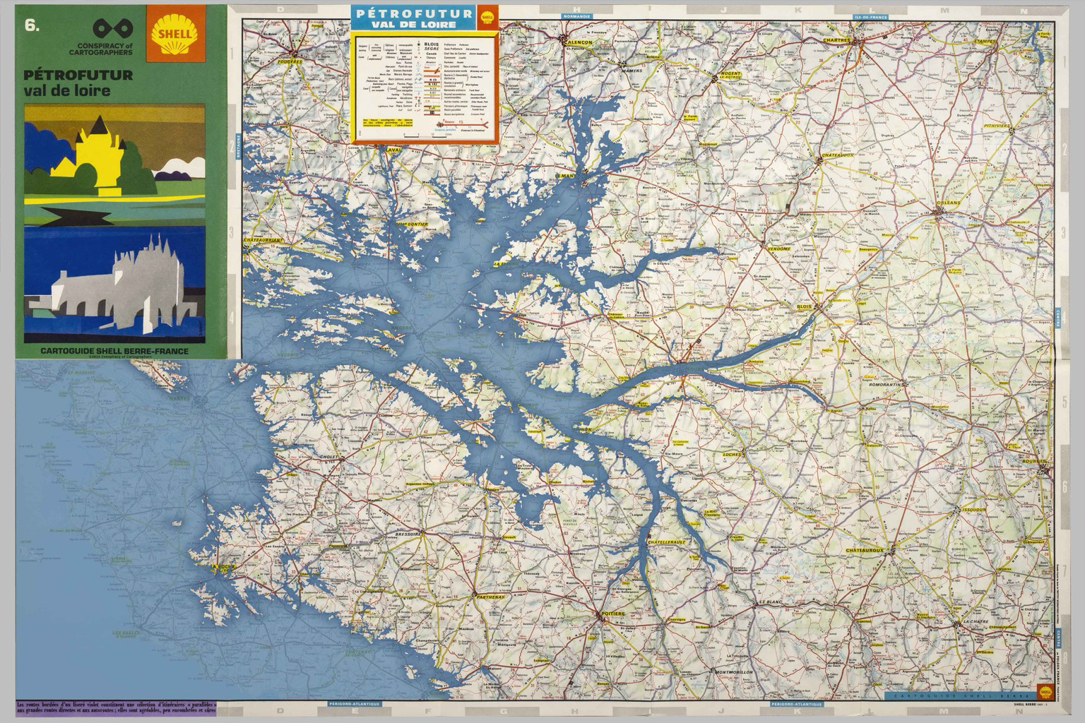
The #Petrofuture Val de Loire -- 66m sea level rise on a vintage 1969 Shell Oil map of the Loire River Valley and coast of France. More: https://conspiracyofcartographers.com/ #ClimateArt #climateChange #maps #cartography #clifi #greenwashing #ConspiracyOfCartographers #Loire #Nantes #ValdeLoire #LaRoche #Angers #Tours #France
#conspiracyOfCartographers
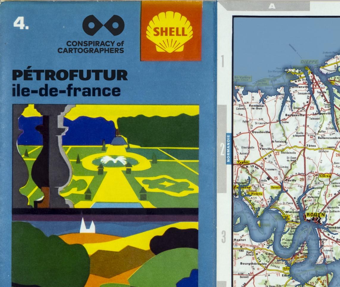
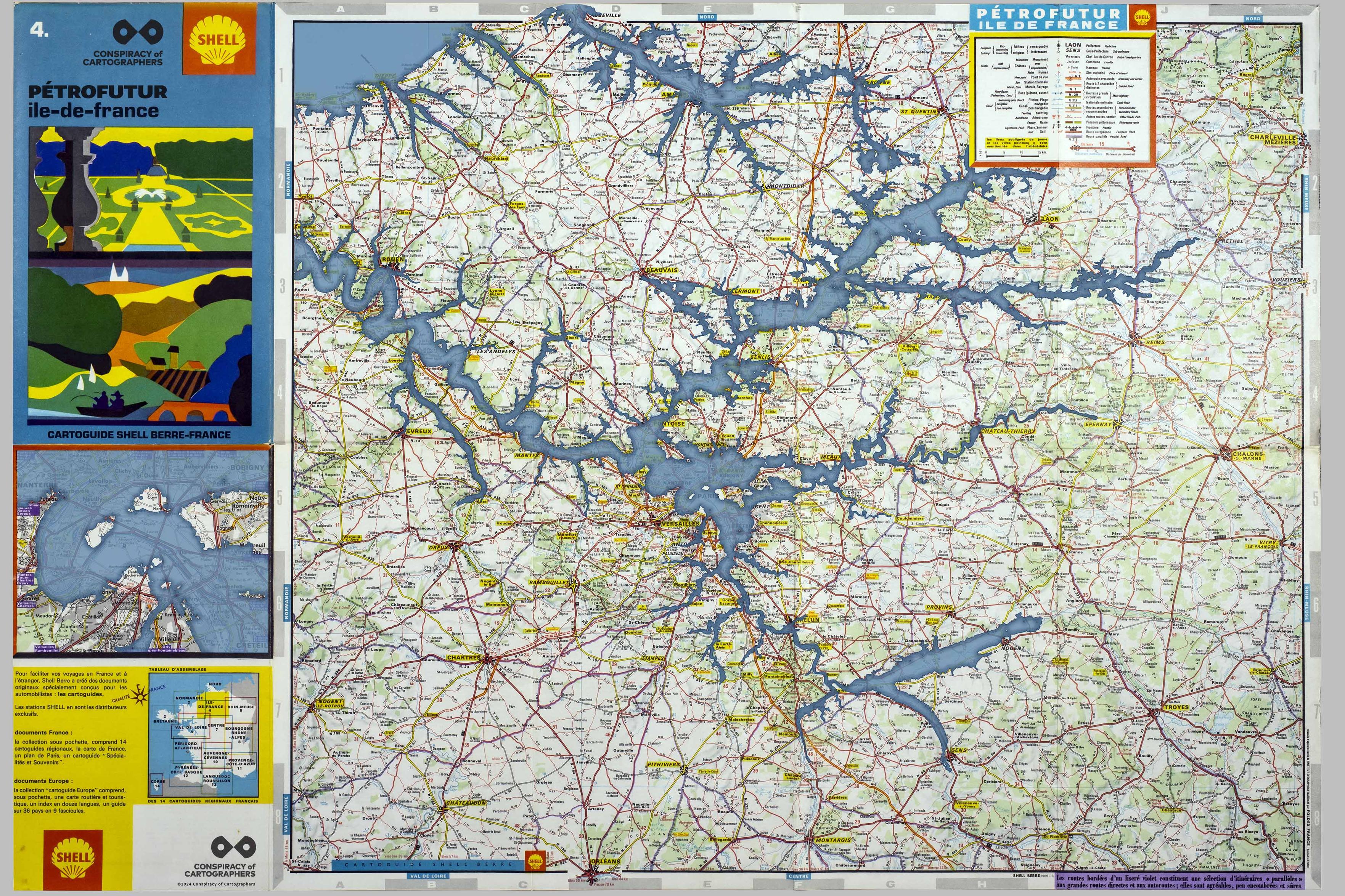
When the ice caps melt, the Seine becomes a long inlet to a flooded Paris.
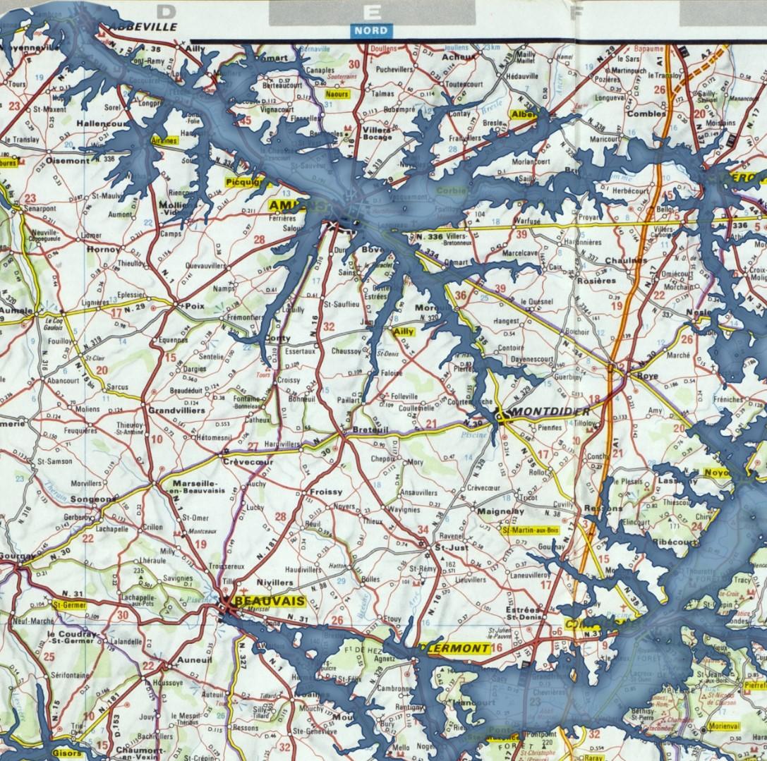
The #Petrofuture of Île de France -- 66m sea level rise on a vintage 1969 Shell Oil map.
More: https://conspiracyofcartographers.com/petrofuture-france-gallery/
#ClimateArt #climateChange #maps #cartography #clifi #greenwashing #ConspiracyOfCartographers #Seine #Paris #IledeFrance

As the #Petrofuture series expands, here are just a few of the maps the Conspiracy will be working on.
More: https://conspiracyofcartographers.com/
#roadMaps #greenwashing #maps #cartography #outsiderArt #climateChange #conspiracyOfCartographers
Petrofuture #CoteBasque--66m sea level rise on a 1969 Shell Oil road map of Pyrénées & Cote Basque #france.
#greenwashing #climateChange #seaLevelRise #outsiderArt #conspiracyOfCartographers #cartography #Petrofuture
#greenwashing #climateChange #seaLevelRise #outsiderArt #conspiracyOfCartographers #cartography #Petrofuture
Petrofuture #Corse--66m sea level rise on a 1969 Shell Oil road map of #Corsica, #france.
#greenwashing #climateChange #seaLevelRise #conspiracyOfCartographers #cartography #Petrofuture
#greenwashing #climateChange #seaLevelRise #conspiracyOfCartographers #cartography #Petrofuture
Hello world. My first post here is my first post of Petrofuture Cote d’Azure.
66m sea level rise on a 1969 Shell Oil road map of Cote d’Azure, #france.
#greenwashing #climateChange #seaLevelRise #conspiracyOfCartographers #cartography
66m sea level rise on a 1969 Shell Oil road map of Cote d’Azure, #france.
#greenwashing #climateChange #seaLevelRise #conspiracyOfCartographers #cartography
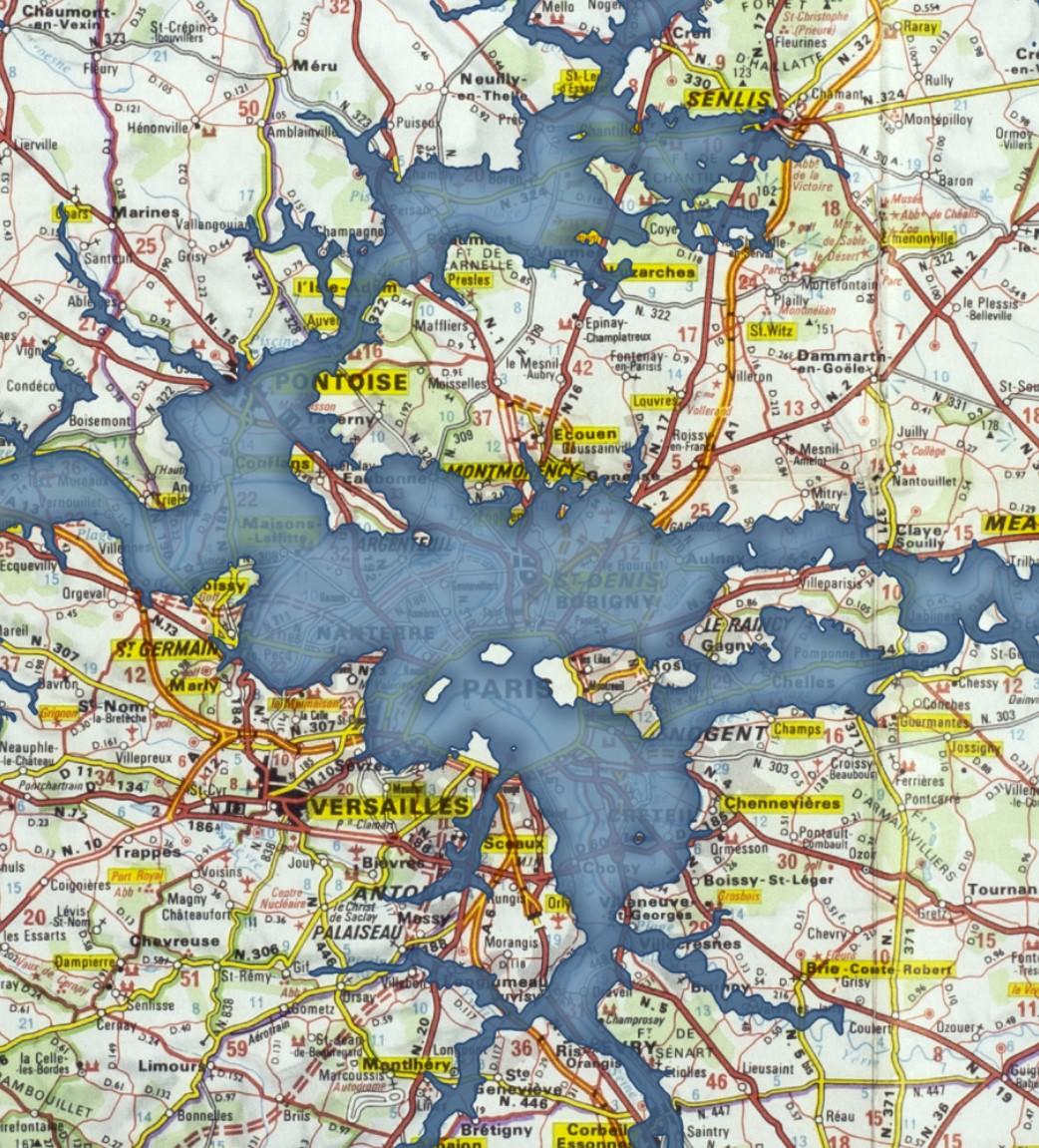
When the ice caps melt, the #Seine becomes a long inlet to a flooded #Paris.
The #Petrofuture of #IleDeFrance -- 66m sea level rise on a vintage 1969 Shell Oil map.
#ClimateArt #climateChange #maps #cartography #clifi #greenwashing #ConspiracyOfCartographers
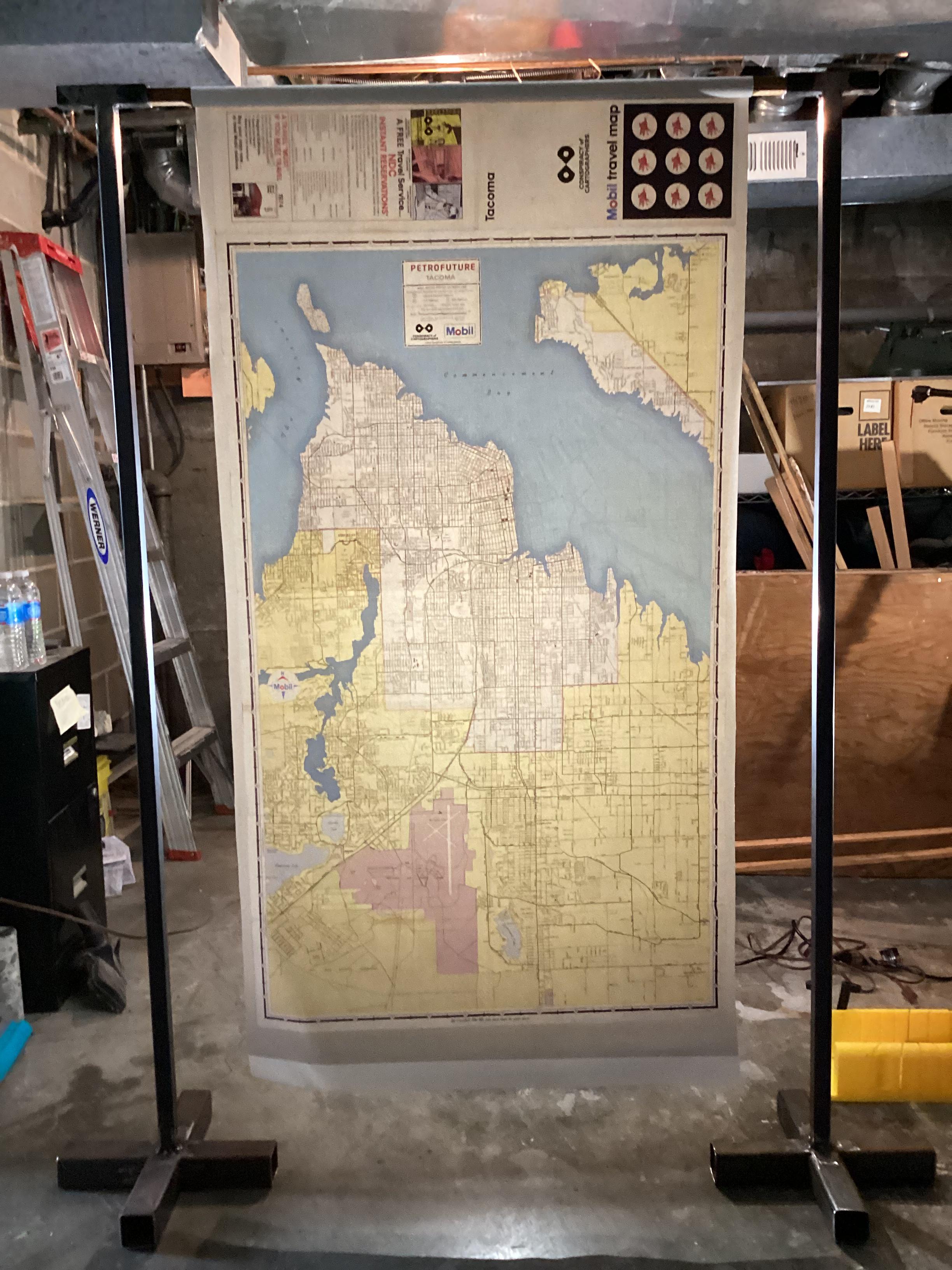
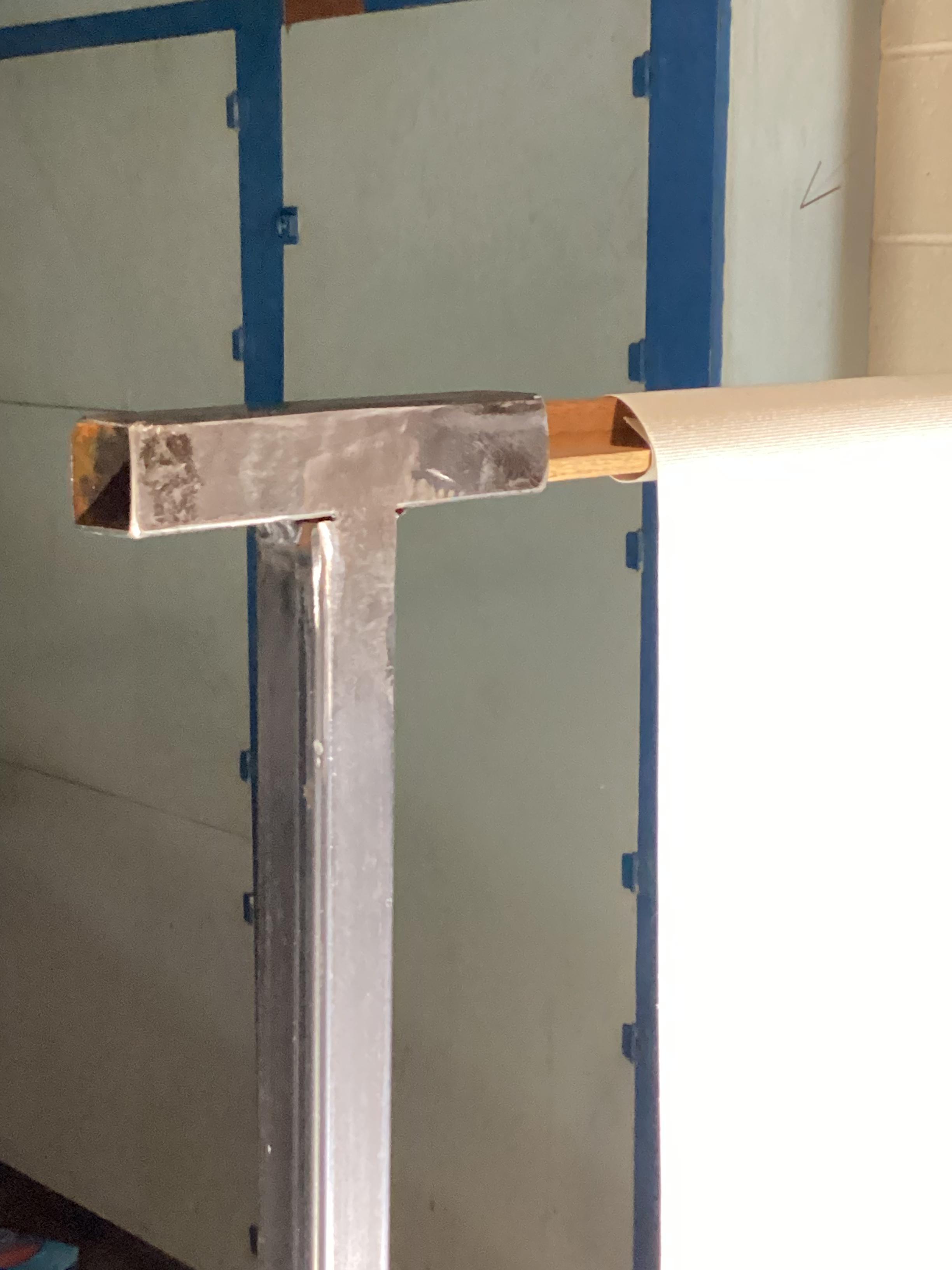
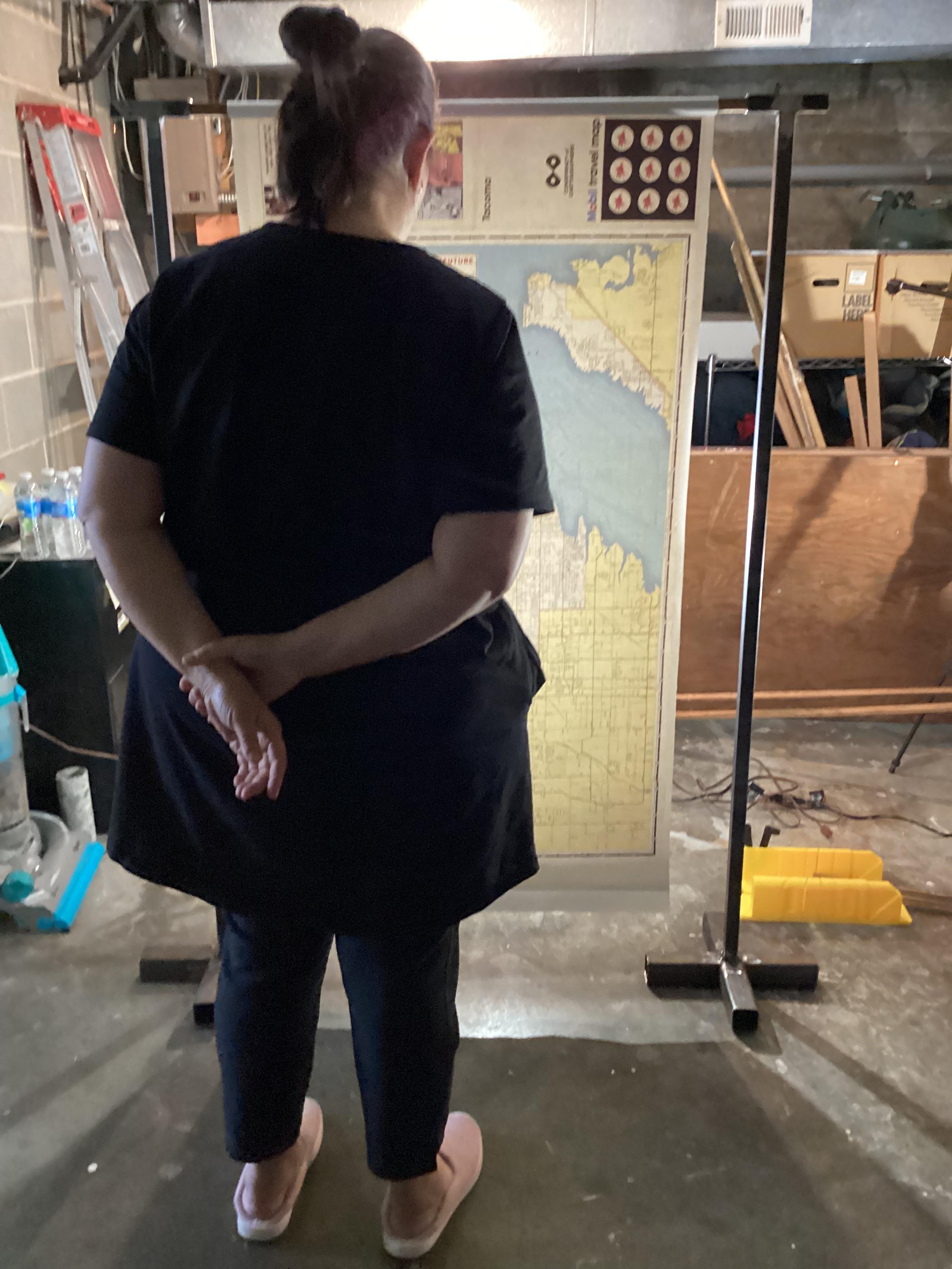
I spent the weekend welding steel supports for large maps. Displayed is the #Petrofuture map of #Tacoma …66m sea level rise on a 1974 Mobil gas station map.
See you at the Georgetown Steam Plant Science Fair!
#Seattle #Tacoma #PNW #vintagemaps #sealevelrise #climatechange #maps #cartography #clifi #conspiracyofcartographers
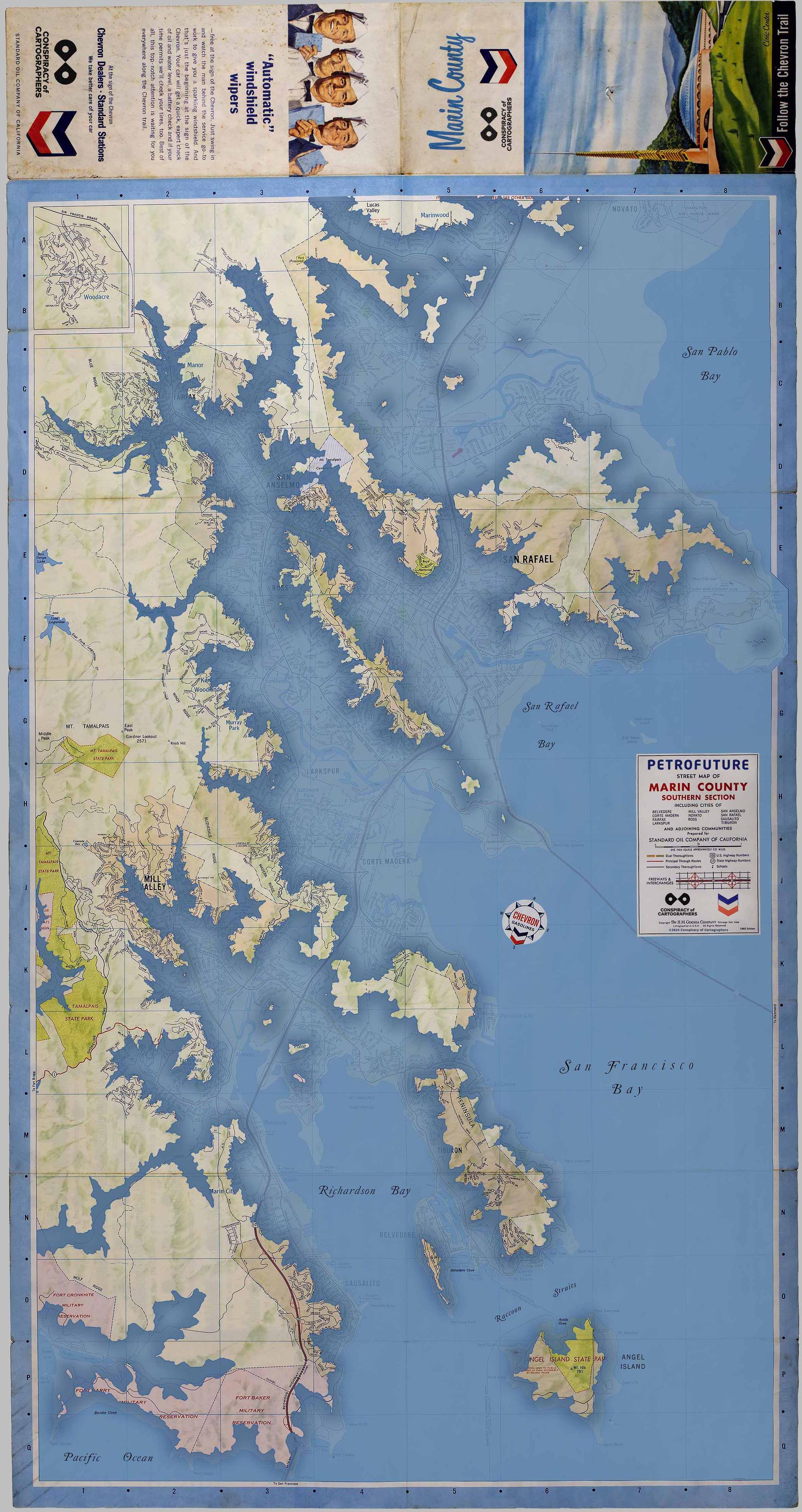
The Petrofuture of Marin County...
Once you get past the freeways and strip malls, Marin can be idyllic, but just across the bay in Richmond...oof, the scene is ugly with refineries.
The Petrofuture maps show 66m of sea level rise layered on top of vintage gas station maps. This one uses an old #Chevron map.
More at
https://conspiracyofcartographers.com
#MarinCounty #SanFrancisco #SFBay #vintagemaps #petrofuture #sealevelrise #climatechange #maps #cartography #clifi #conspiracyofcartographers
Petrofuture of #Tacoma …66m sea level rise on a 1974 Mobil gas station map. I digitized the base map from a garage sale find.
More at
https://conspiracyofcartographers.com
#Seattle #PNW
#vintagemaps #petrofuture #sealevelrise #climatechange #maps #cartography #clifi #conspiracyofcartographers

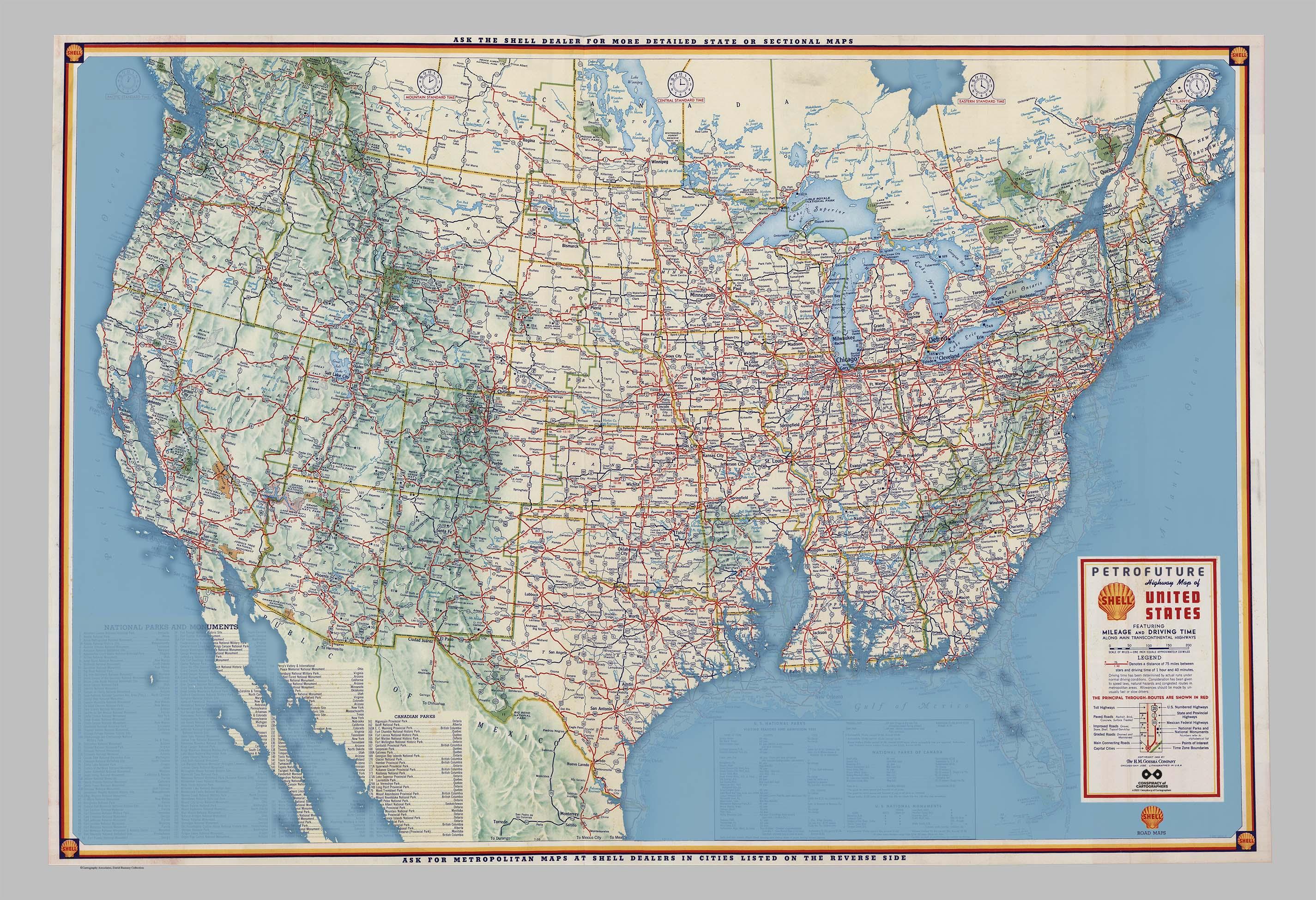
Petrofuture of the United States…66m sea level rise on a 1956 gas station road map.
Original Shell Oil basemap found at David Rumsey Maps.
More at
https://conspiracyofcartographers.com
#vintagemaps #petrofuture #sealevelrise #climatechange #maps #cartography #clifi #conspiracyofcartographers
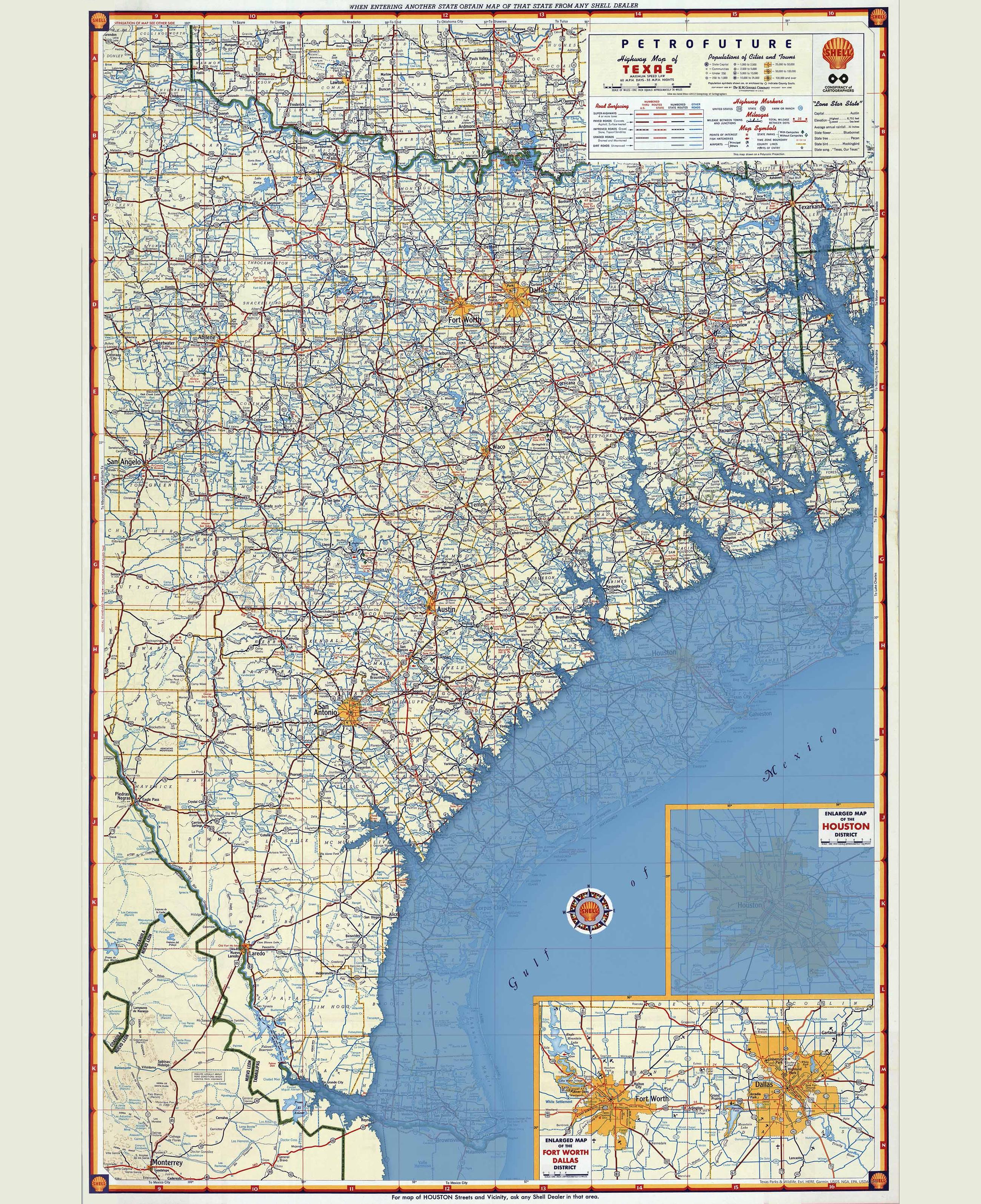
A different, but related, type of flooding along the #Texas coast.
The Petrofuture maps are editorials on the role of petro corporations in climate change.
The vintage base maps invoke nostalgia, but nostalgia is a dead end that delays needed change, and will lead to disaster.
1956 Shell map base from David Rumsey Maps
#houston #galveston #retrofuture #petrofuture #climatearson #solarpunk #climatechange #maps #cartography #clifi #conspiracyofcartographers
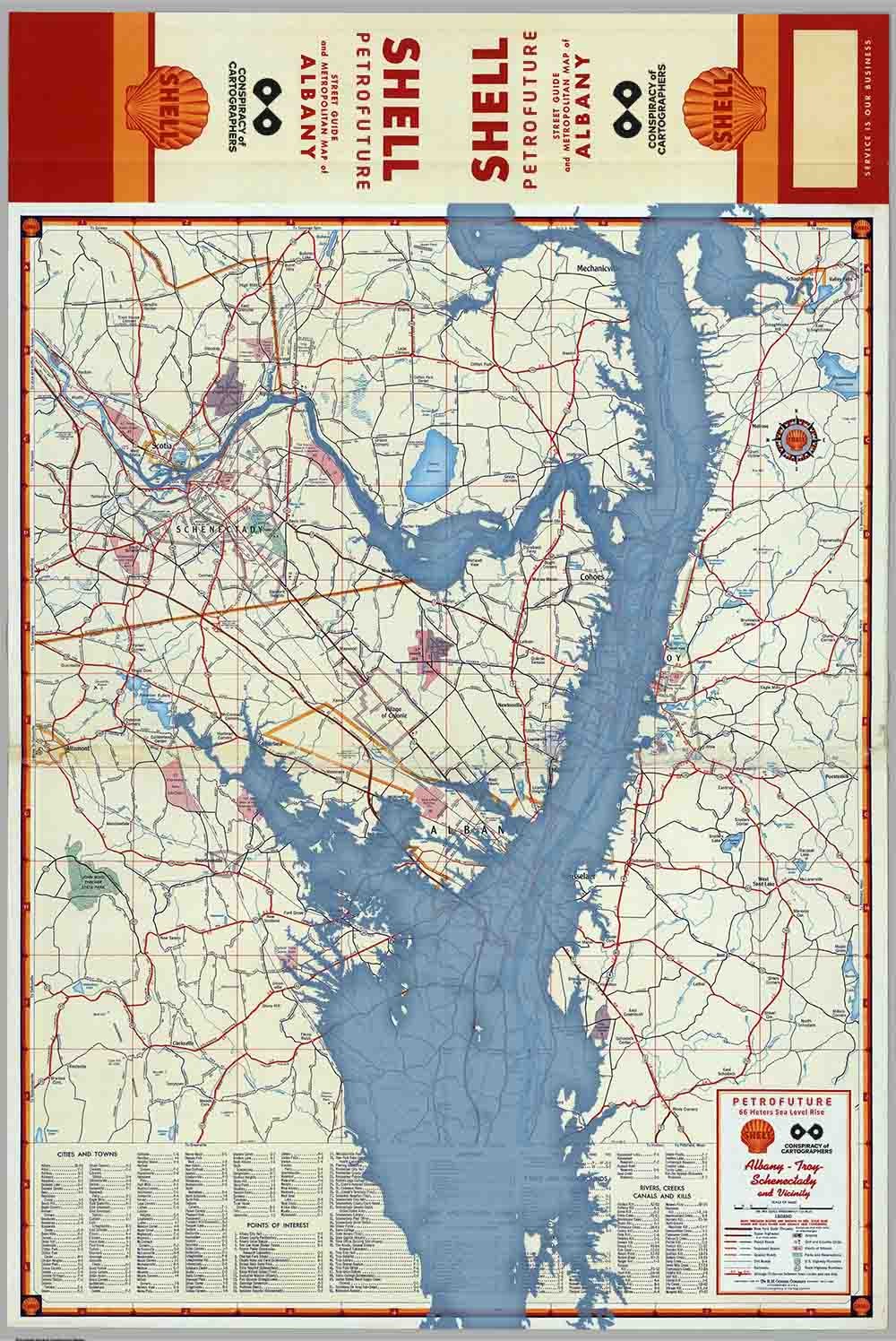
Abany, NY Petrofuture...
The Petrofuture series reimagines our memories, altering the tropes of nostalgia. These maps take on the promotions of petro-corporations, turn them around, depicting the ultimate consequences of car culture and the burning of fossil fuels.
More: https://conspiracyofcartographers.com/
#AlbanyNY #HudsonRiver #UpstateNY #NYState #petrofuture #steampunk #MapArt #solarpunk #oilandgasindustry #climatechange #maps #cartography #clifi #climateart #conspiracyofcartographers
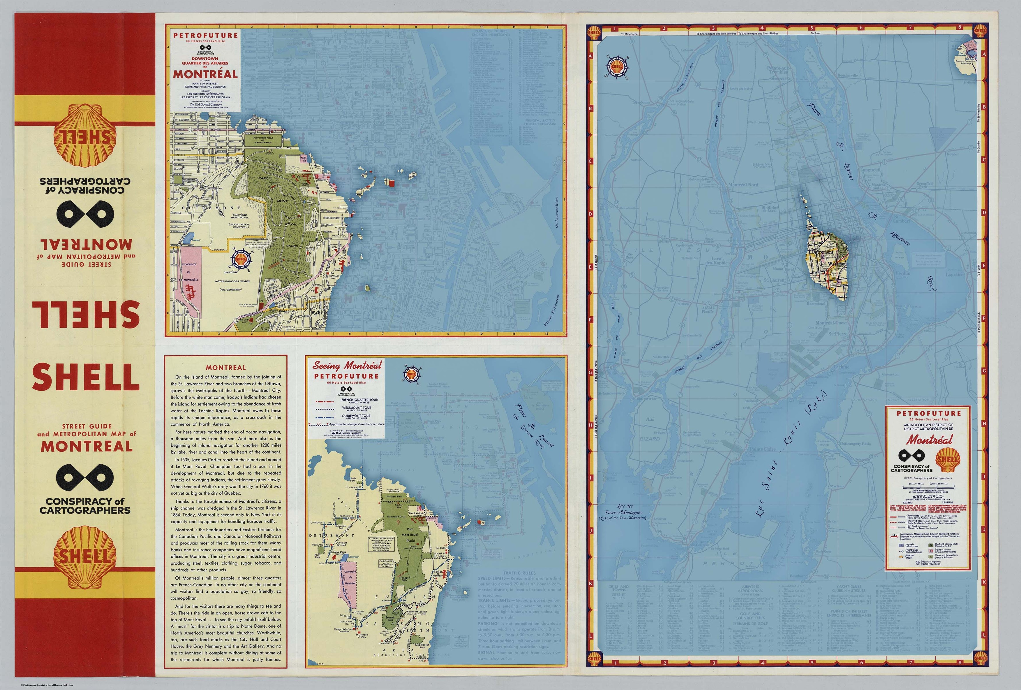
Following up yesterday's post...the Montreal Petrofuture, reverse side.
.
The Petrofuture series reimagines our memories, altering the tropes of nostalgia. These maps take on the promotions of petro-corporations, turn them around, depicting the ultimate consequences of car culture and the burning of fossil fuels.
.
#Montreal #Quebec #StLawrenceRiver #petrofuture #steampunk #MapArt #solarpunk #oilandgasindustry #climatechange #maps #cartography #clifi #climateart #conspiracyofcartographers
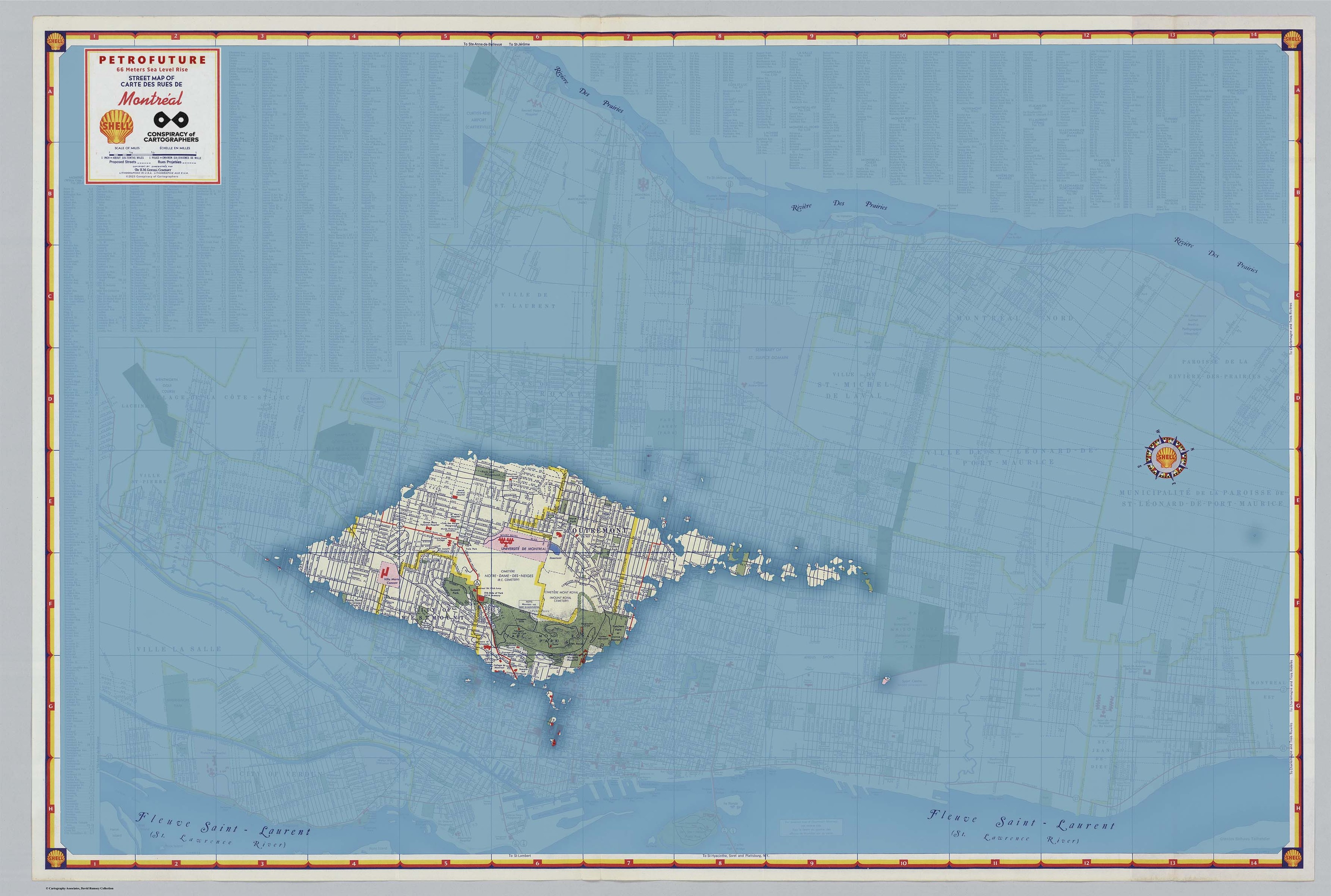
New work...the Montreal Petrofuture.
.
The Petrofuture series reimagines our memories, altering the tropes of nostalgia. These maps take on the promotions of petro-corporations, turn them around, depicting the ultimate consequences of car culture and the burning of fossil fuels.
.
#Montreal #Quebec #StLawrenceRiver #petrofuture #steampunk #MapArt #solarpunk #oilandgasindustry #sealevelrise #sealevelrisemaps #climatechange #maps #cartography #clifi #climateart #conspiracyofcartographers
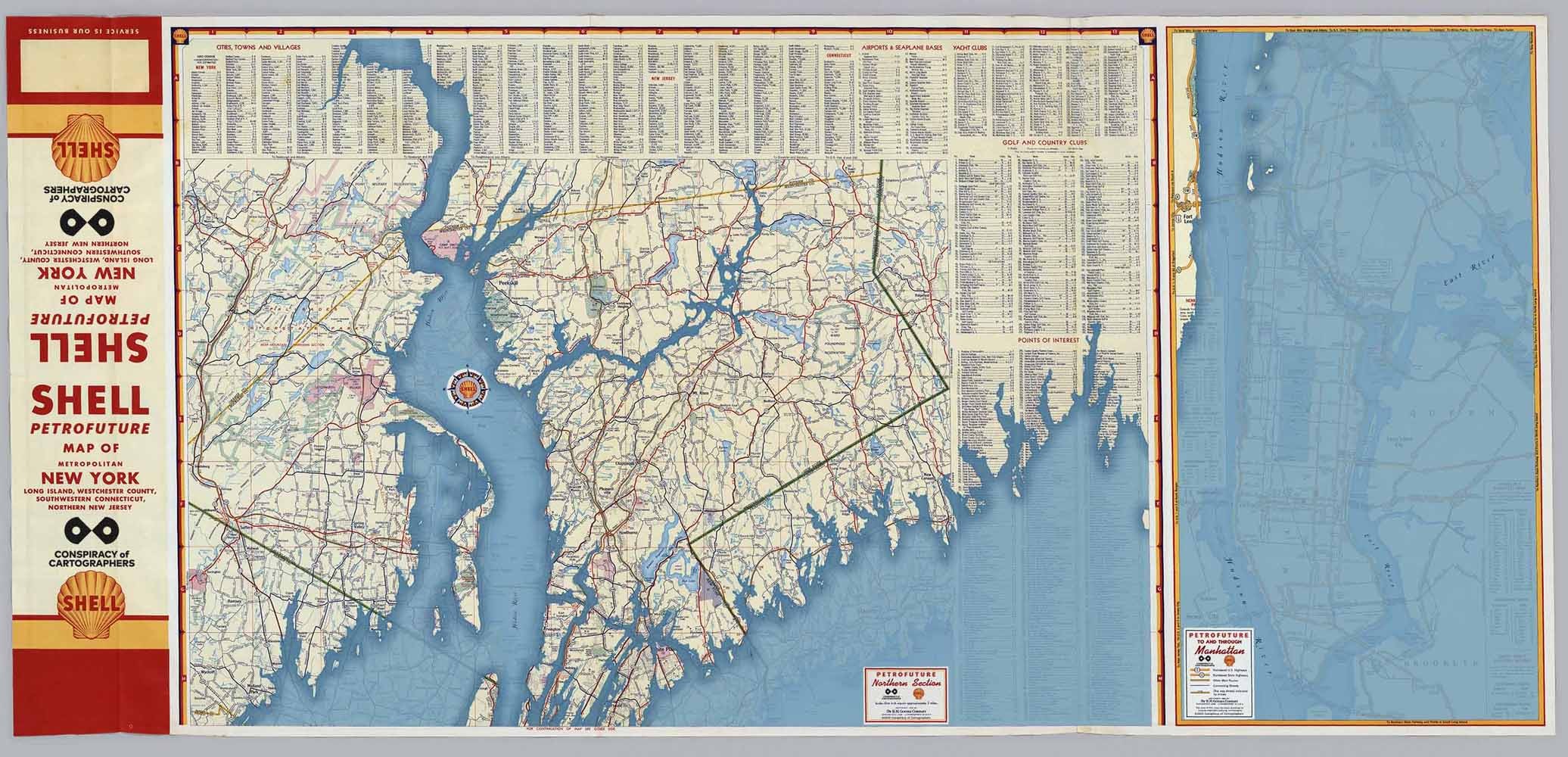
Following up to the Petrofuture of NYC and Long Island, here's NYC, New Jersey, and the Hudson River.
66m sea level rise on a 1956 #ShellOil gas station map
More:
https://conspiracyofcartographers.com
Base map courtesy of David Rumsey Maps.
#NYC #HudsonRiver #StormKing #PalisadesHudson #queensny #StatenIsland #NewJersey #vintagemaps #retrofuture #solarpunk #clifi #petrofuture #sealevelrise #sealevelrisemaps #climatechange #climateemergency #maps #cartography #conspiracyofcartographers
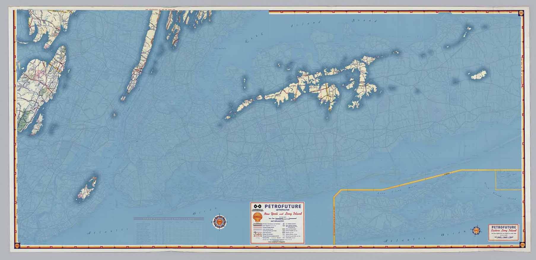
Here's the Petrofuture of NYC and Long island...
66m sea level rise on a 1956 #ShellOil gas station map
More:
https://conspiracyofcartographers.com
Base map courtesy of David Rumsey Maps.
#NYC #LongIsland #Brooklyn #queensny #StatenIsland #NewJersey #vintagemaps #retrofuture #solarpunk #clifi #petrofuture #sealevelrise #sealevelrisemaps #climatechange #climateemergency #maps #cartography #conspiracyofcartographers
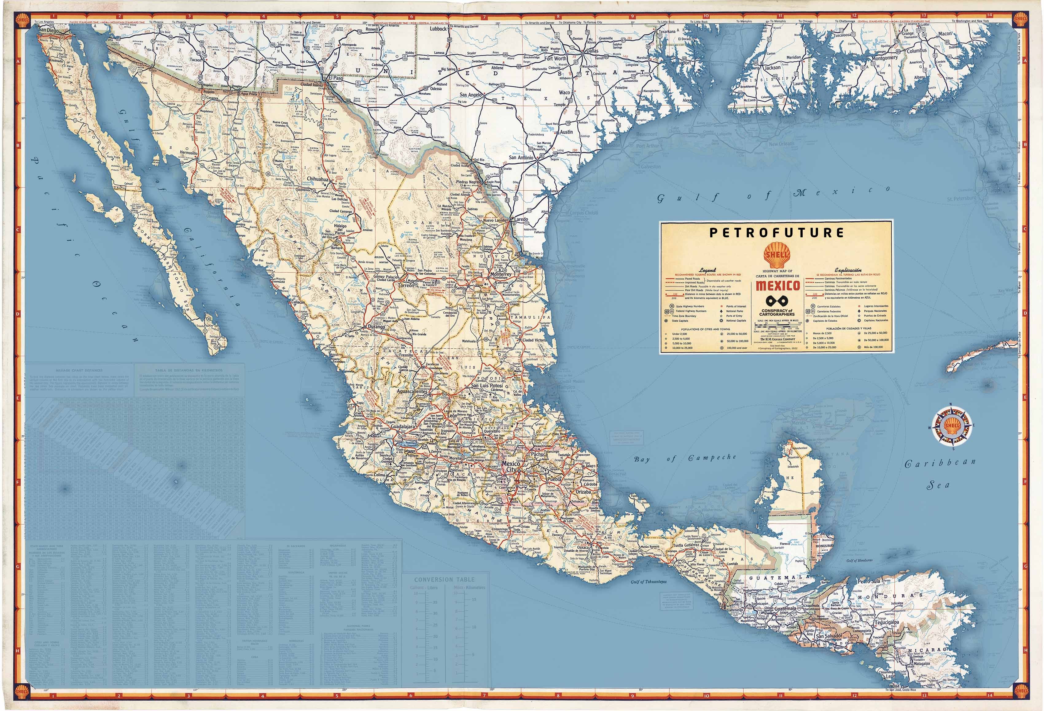
Petrofuture Mexico…66m sea level rise on a 1956 road map.
#Pemex would be more appropriate, but #ShellOil will have to do
Base from David Rumsey Maps
More at
https://conspiracyofcartographers.com
#mexico #Belize #Guatemala #Honduras #Nicaragua #ElSalvador #Caribbean #GulfOfMexico #BajaCalifornia #vintagemaps #petrofuture #sealevelrise #climatechange #maps #cartography #clifi #conspiracyofcartographers
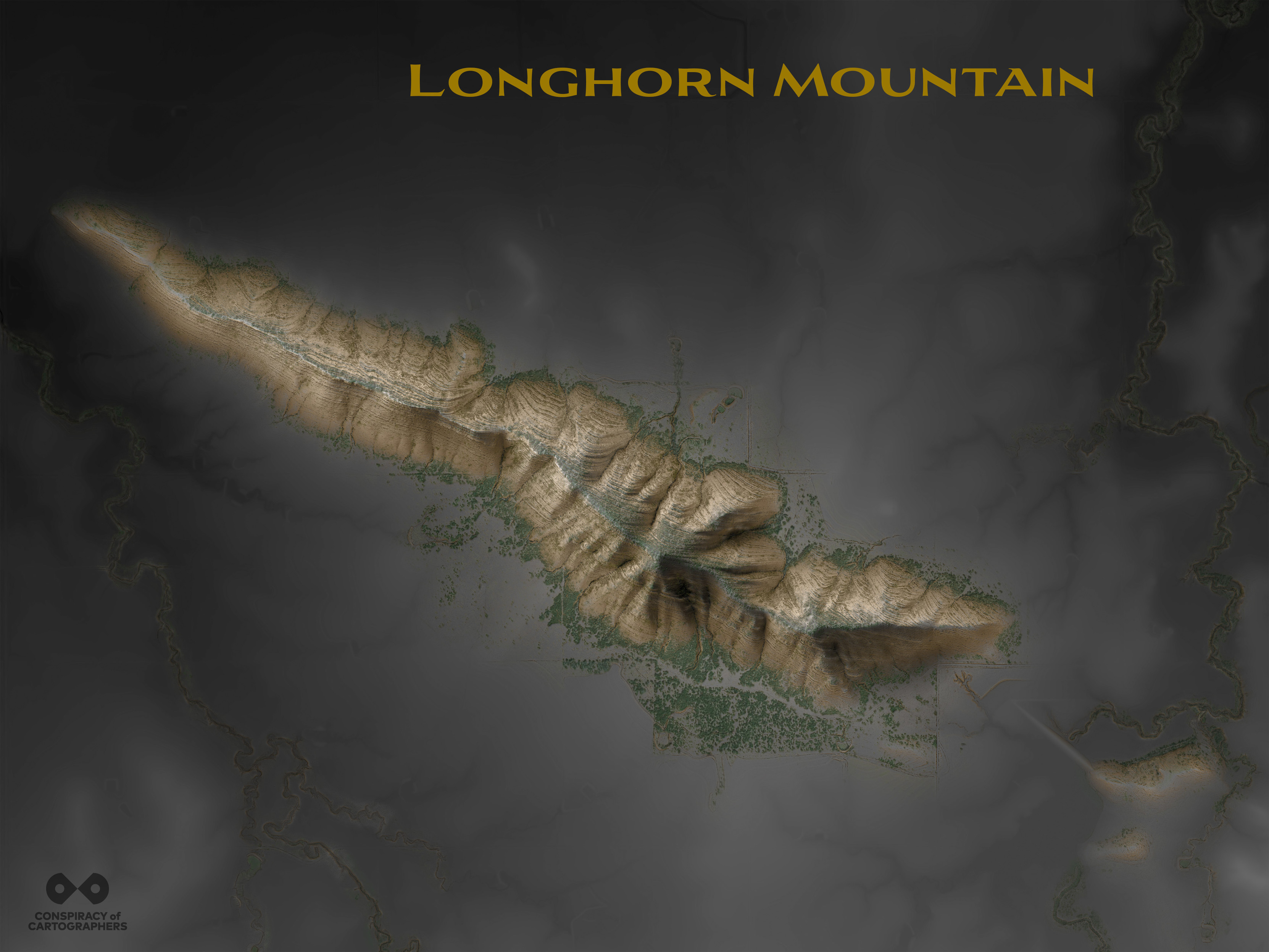
For #indigenouspeoplesday, a map of #LonghornMountain, an endangered #Kiowa sacred site.
Client Info
Server: https://mastodon.social
Version: 2025.04
Repository: https://github.com/cyevgeniy/lmst