#geotiff

2025-05-29

Published my first crate today to crates.io/crates/nvtiff-sys! Rust bindings to the nvTIFF (Nvidia TIFF encoder/decoder) library.

Interface is not very friendly (need to use lots of unsafe), so definitely don't use it in production yet. But hoping it'll help to GPU-accelerate TIFF image processing (especially for geospatial or medical imaging workloads) once I wrap my head around how to handle raw pointers and lifetimes.
#rustlang #bindgen #tiff #GeoTIFF

Oliver Ammannoa@swiss.social
2025-05-28

1,000+ newly digitised and georeferenced historical #maps from the ETH Library collection are now online! 🗺️ Take a look!

daas.library.ethz.ch/rib/v3/e-

#ethlibrary #carte #georeference #geotiff #historicalmaps #bibliothek #library #perpignan #france #opendata #publicdomain #foret

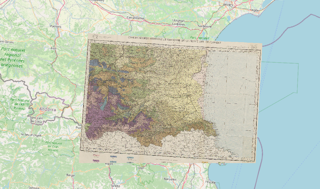
📷 "Essai d'une carte botanique et forestière de la France", Feuille de Perpignan, Paris 1897. ETH Library, Public Domain Mark / OpenStreetMap, 28.05.2025, Lizenz: ODbL 1.0

A digitized and georeferenced historical map of the Perpignan region overlaid on an OpenStreetMap background.
Oliver Ammannoa@swiss.social
2025-05-28

1000+ neue digitalisierte und georeferenzierte historische #Karten aus dem Bestand der ETH-Bibliothek: Schaut rein!

daas.library.ethz.ch/rib/v3/e-

#ethbibliothek #maps #carte #georeference #geotiff #georeferenzierung #historicalmaps #bibliothek #library #Kartensammlung #perpignan #france #publicdomain #foret

📷 "Essai d'une carte botanique et forestière de la France", Feuille de Perpignan, Paris 1897. ETH-Bibliothek, Public Domain Mark / OpenStreetMap, Stand: 28.05.2025, Lizenz: ODbL 1.0

Eine digitalisierte und georeferenzierte historische Karte der Region um Perpignan vor dem Hintergrund einer OpenStreetMap-Karte.
2025-02-19

A Zine from @developmentseed illustrated by @gus on Cloud Optimized Geospatial Data! Read @kiricarini's blog post at developmentseed.org/blog/2025-

#gischat #geospatial #GeoTIFF @zarr #GeoParquet

2025-02-17

Salut les cartographes numériques ! Si vous avez un instant pour jeter un coup d’œil à notre description de #GeoTIFF dans une perspective de préservation à long terme (rappel : la fiche fournit un niveau d'info minimal sur les caractéristiques génériques du format mais s'appesantit surtout sur ce qu'on considère être un risque de préservation) :

github.com/hackathonBnF/Fiches

On prend les critiques et les corrections ! (je me permets notamment de pinger @EvenRouault là-dessus...)

#DigiPres_FR

2024-12-23

Hier gibt es doch bestimmt Leute, die sich gut mit #GeoDaten auskennen. Ist dies wirklich eine #GeoTIFF Datei?

opendata.schleswig-holstein.de

Normalerweise werden die von QGIS gleich an der richtigen Stellen platziert, diese aber nicht. Die TIFF-Datei scheint nicht die benötigten Metadaten zu haben.

#gischat #gis

2024-11-14

How much can we gain from GeoTIFF compression? You can learn it from a blog post by Jens Wiesehahn.

Post: buff.ly/4havwHh

#gischat #gdal #geotiff

a screenshot of the blog post
Francesco P Lovergine :debian:gisgeek@floss.social
2024-10-15

I just found a pure Python #geotiff implementation; it has been experimental for 3 years. It has a series of contributors, too.
Quite a long time ago, I wrote my own implementation of a TIFF library in C. That was before the well-known SGI libtiff implementation, and I know that writing such a lib from specs is not for the faint of heart: I was perfectly able to write legal TIFF files that caused segfaults for many applications at the time (but for Adobe ones).

github.com/KipCrossing/geotiff
1/2

2024-09-06

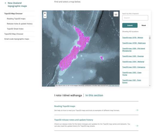
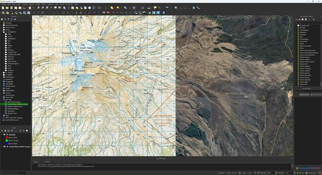
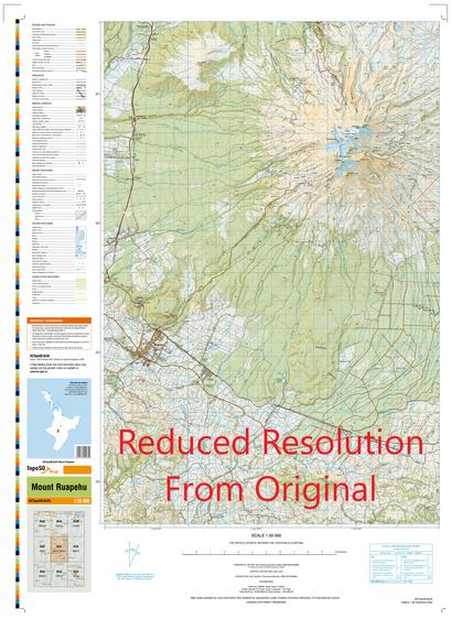
Thinking about creating a GeoTIFF of a topo map where the overviews are actually different zoom levels (with different labelling etc.) rather than just different resolutions of the same image.

Does anyone already have a workflow for this? (GDAL commands, etc.)

Or is this a bad idea?
#gdal #geotiff

2024-03-28

@pokateo

Checking in from New Zealand! I'm developing a library to decode #GeoTIFF files in #rustlang (without using GDAL 😂). Currently trying to add an #xarray backend (in Python) at github.com/weiji14/cog3pio/pul.

David Oeschdavidoesch
2024-03-13

Rendering a true color image from a 4 band 16int Cloud Optimized file data.geo.admin.ch/ch.swisstopo.s… size approx 4GB in via
cms.geo.admin.ch/Topo/umweltbeo…
results in very slow performance on loading -> any hints @gdal

Iván Sánchez OrtegaIvanSanchez
2024-02-28

@pokateo I attended an OGC+OSGeo+ASF codesprint, and worked on and @pygeoapi and projections and whatnot, while tooting about it.

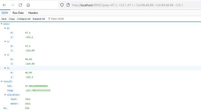
"What would you need this f-" max elevation. I need to find the highest elevation given a GPS coordinate polygon that may cover 4 #GeoTIFF tiles, fast enough to be easily called every half second so that a virtual airplane can use that information to automatically set its autopilot altitude.

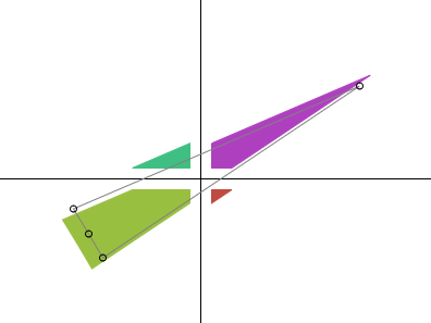
The actual polygon I need is a triangle that's wide enough at the plane to cover "emergency turns", and extends ~10NM ahead, so processing a 2°×2° "rectangle" at 30M resolution in ~500ms is encouraging.

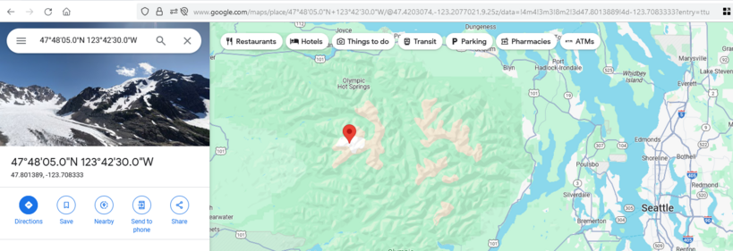
The "cone" for which we need to calculate the maximum ground elevation for an airplane. It needs to be wide enough at the plane itself to cover emergency turning, but the further out we go, the less wide it needs to be, because the idea of flying a heading is that we don't constantly turn.An API response to a simple elevation server written on top of the JAXA ALOS World 3D (30m) dataset, showing an uncached response for a query to find the highest elevation in a two by two degree geo-"rectangle" taking about 550ms (this drops to 200ms after caching)To confirm it found the correct point: the lat/long we got back corresponds to the West Peak of Mount Olympus in Olympic National Park in Washington, US, which is indeed the highest point inside that area.
2024-02-05

"What would you need this f-" max elevation. I need to find the highest elevation given a GPS coordinate polygon that may cover 4 tiles, fast enough to be easily called every half second so that a virtual airplane can use that information to automatically set its autopilot altitude.

The actual polygon I need is a triangle that's wide enough at the plane to cover "emergency turns", and extends ~10NM ahead, so processing a 2°×2° "rectangle" at 30M resolution in ~500ms is encouraging.

The "cone" for which we need to calculate the maximum ground elevation for an airplane. It needs to be wide enough at the plane itself to cover emergency turning, but the further out we go, the less wide it needs to be, because the idea of flying a heading is that we don't constantly turn.An API response to a simple elevation server written on top of the JAXA ALOS World 3D (30m) dataset, showing an uncached response for a query to find the highest elevation in a two by two degree geo-"rectangle" taking about 550ms (this drops to 200ms after caching)To confirm it found the correct point: the lat/long we got back corresponds to the West Peak of Mount Olympus in Olympic National Park in Washington, US, which is indeed the highest point inside that area.
2024-01-30

cloud optimized #geotiff (#cog) question:
I've got a layer that renders fine in @qgis when is stored in a local drive & from a S3 URL.

But when its on a network drive (well, a "drive" through an S3 storage gateway), I get the following when zooming in:
[layername]: IReadBlock failed at X offset 21, Y offset 22: TIFFReadEncodedTile() failed.

Thought maybe its a file system thing & I need to use #gdal virtual file system paths, but not getting that to work at all. Any ideas? #gischat

2024-01-29

Бесплатные векторные карты на своём хостинге

Векторные карты Protomaps на базе OSM Каждый веб-разработчик знает о OpenStreetMap (OSM), свободной альтернативе Google Maps. Несмотря на всеобщую известность OSM, у некоторых всё-таки возникают вопросы: как сделать веб-карту с открытыми данными OSM, как самостоятельно публиковать карты? На эту тему есть популярные руководства , в том числе по работе с базами PostGIS и запуску тайлсерверов для реализации бесшовных карт OSM. Но есть принципиально иной подход — векторные карты Protomaps , которые обеспечивают более высокое разрешение, настройку внешнего вида и наложение произвольных меток. Они изначально предполагают максимальную простоту в создании своих карт. А главное, что разместить тайлы можно на своём хостинге или в облаке.

habr.com/ru/companies/ruvds/ar

#ruvds_статьи #Protomaps #PMTiles #векторные_карты #Google_Maps_API #OpenStreetMap #protomapsleaflet #protomapsjs #тайлы #Leaflet #MapLibre_GL_JS #OpenLayers #GIS #Mapbox_Vector_Tile #Protocol_Buffers #PostGIS #Mapbox_GL #MapLibre_GL #GeoTIFF #COG #OpenMapTiles #Maputnik

2024-01-25

GeoTIFF (Cartography 🗺️)

GeoTIFF is a public domain metadata standard which allows georeferencing information to be embedded within a TIFF file. The potential additional information includes map projection, coordinate systems, ellipsoids, datums, and everything else necessary to establish the exact spatial reference for the file. The GeoTIFF format is fully compliant with TIFF 6.0, so software incapable of re...

en.wikipedia.org/wiki/GeoTIFF

#Geotiff #Cartography #GisRasterFileFormats

2024-01-24

I've used @pwramsey brilliantly simple how-to guide on geotiff compression for a few years now, it makes large orthomosaics easily viewable with no loss of quality. I got a 3gb geotiff down to 300mb!

blog.cleverelephant.ca/2015/02

#Geotiff #GIS

2023-10-11

The second fun part was going back to my #GeoTiff extraction. My initial attempt at dumping interleaved data to file ran in 40 min pr GB file. Straight dumping each component took 20min.
Started embedding #python in rust, due to GeoTiff library, but realized I was shaving yaks.

So today I rewrote to interleave using numpy array to file, and it took over 30 minutes. Switched to struct.pack and it did it in 6-7 minutes. Good enough, for now :)

Next up processing the data in rust!

Client Info

Server: https://mastodon.social
Version: 2025.04
Repository: https://github.com/cyevgeniy/lmst