
You will probably need a map when you travel China. Google's map does not work well over here, amap is the Chinese alternative. But what if you lack reading skills in Chinese? Open Street Maps is there to help you out 🙂
#openStreetMaps

@gedankenstuecke@scholar.social
Very interesting.
May I ask a couple of questions about your python scripts? #RTFM is a valid response, but I'm not at pc now...
1) is it possible to keep track of maps' updates?
2) what the difference between #OpenStreetMaps' maps, the ones from #CoMaps and the one from #OrganicMaps (I didn't know there was a dedicated organic maps server, I thought all maps were from open street maps!)
3) I see the server.py "just" wraps an #HTTPServer: is it possible to publish the downloaded maps on a public (static) shared hosting to be shared with friends?
Given how cheap is shared web hosting these days, this feature might turn #CoMaps to one of the best #privacy preserving tools for people and small communities!
@cnx@awkward.place

#openstreetmaps can't seem to find a route between two major cities 😕 Do you have to be signed in to do this or what? Not a very good thing, imo.😠

First release for processing and plot the collected data from WiFi-Map FlipperZero

RE: https://hessen.social/@ralpho/115683690885665335
Also liebe Leute:
Für PCs und Notebooks: #Linux
Handys: #eOS, #Lineage und gibt bestimmt noch mehr googlefreie Androids
Statt #Office #Libreoffice
#OpenStreetMaps statt #googlemaps
#Signal oder #matrix statt #WhatsApp
Nur statt Steam.. Steam nutzen?
Wenn selbst Techniknoobs wie ich das können, könnt ihr das auch!
This is a detail of the data that the hover shows; AP hash and estimated distance in meters (also thinking about give this data on "Emperor Penguin" units just for lmao) also shows the latitude and longitude that are blurry to keep some privacy.
BTW: the colected data about AP (stored on FlipperZero) is a hash to keep some privacy.

Today I'm dealing with some improvements on CSV processing of WiFi Map for FlipperZero and its ESP32 companion https://github.com/carvilsi/flipper0-wifi-map
Drawing circles over @openstreetmap for estimation distance to detected APs during "warwalking" to the grocery store.
Despite implementing a basic cli I'm close to release the processing code.


Te quiero mucho #openStreetMaps

Oggi vi parlo di un hobby che ho da molti anni: mappare il mondo su OpenStreetMap.
È piacevole sapere che ci sono zone del mondo che ho disegnato io, parte di un progetto mondiale per creare un'alternativa libera e gratuita a disposizione di tutti.
In foto uno screenshot di CoMaps con una porzione di una mappa che ho realizzato su OpenStreetMap.


One of my favourite apps and an easy way to contribute to #openstreetmaps is @streetcomplete@mastodon.social Give it a try 🙂


Is there a way to download a transit layer for Amsterdam for comaps?

Alright OSM fans, I have questions :blobhaj_plead:
CoMaps vs Organic Maps and why?
Is there anything that uses open street maps AND shows public transit directions (in the Netherlands, today, that doesn't require me to write an app)?
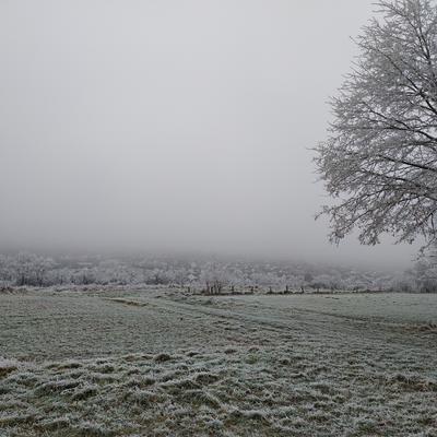
Der heutige #Ausflug endete mit Waffel, einer Kugel Eis und einem Cappuccino.
Außerdem bin ich versorgt mit Gemüse und Obst für die Woche und im #Weltladen erstand ich Nudeln von befreitem Mafiagelände aus Italien.
Ein neuer #Friseur eröffnet bald in der #Innenstadt. Den konnte ich direkt in via #streetcomplete in #openstreetmaps eintragen.
Zwischendurch hat es angefangen zu nieseln. Kein Showstopper aber blöd.
War trotzdem schön an der Luft zu sein und das Ritual wurde gepflegt.

@daringfireball now is the time to get behind #OpenStreetMaps and Organic Maps.
My hiking mapping software GaiaGPS started to become enshitteified a few years ago and became unusable last year.
Apple started adding some of the hiking features to AppleMaps, but they have also already added some other features that are nearly as bad as GaiaGPS+Outside.
@organicmaps is a suitable replacement for GaiaGPS. They have a bit of work before they can replace AppleMaps, but the data is solid.

Van de week hadden we een discussie aan tafel, na het krijgen van de kandidatenlijsten, over het vermoeden dat de meeste SGP-kandidaten in de bible belt wonen. Het liet me niet echt los, dus gisteravond heb ik een paar uurtjes zitten klussen met data van de #Kiesraad en #OpenLayers / #OpenStreetMaps. Met dit tot nu toe als resultaat:
https://waar-woont-mijn-stem.simply-life.net/
#WaarWoontMijnStem #TK2025 #TweedeKamerVerkiezingen #Verkiezingen #NLPol

One of the things that I love about putting all my folk tale translations into a wiki is that I am also using this as an opportunity to remove another #Google service from my life.
My old interactive map was done with Google MyMaps:
https://sunkencastles.com/german-folklore-map/
My new interactive map (still a work in progress) is created dynamically by a combination of #MediaWiki with the #SemanticMediaWiki and Maps extensions, and displayed via the #Leaflet API (which uses #OpenStreetMaps ).
https://wiki.sunkencastles.com/wiki/Main_Page
This gives me _far_ more flexibility in how to construct my interactive map - and it will give me the opportunity to dynamically create thematic maps, too!
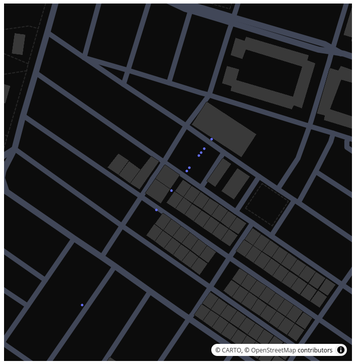
Some progress processing the collected APs data from ESP32 as a companion for FlipperZero, right now able to draw some points, over a OpenStreetMaps, representing my route during the "WarWalking", to the grocery store.
Processed with the CSV stored at FlipperZero side and providing starting and ending latitude and longitude.

Zoals het er staat.
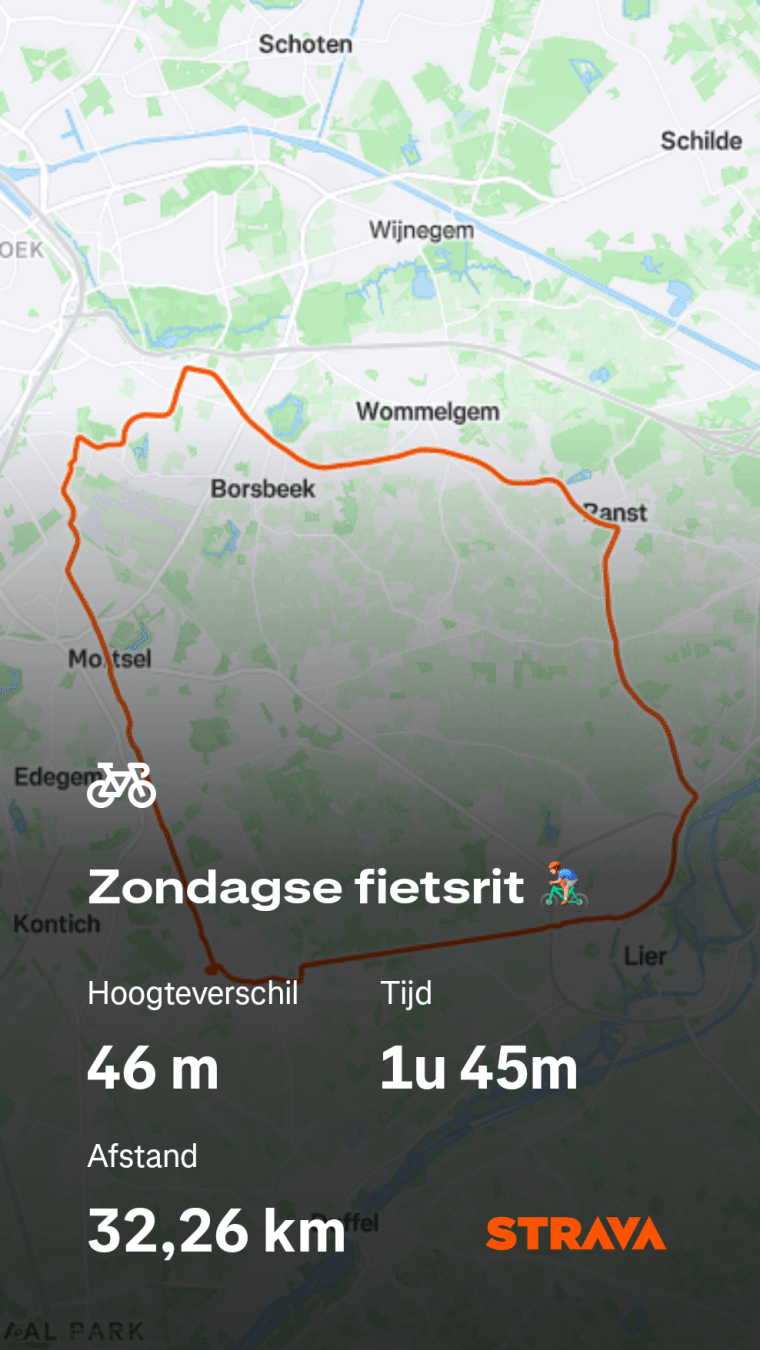
Zondagse fietsrit 🚴♂️ met dank aan OpenStreetMaps & Strava + goede aangelegde fietspaden en mijn beste vriend, de fiets 🚲
#LoveFietssnelwegenVlaanderen
#ZondagFietsdag #Sunday #Zondag #Fietsdag #Fietsrit #OSM #OpenStreetMaps #Strava #Lier #Antwerpen #F16 #Fietssnelweg
Zondagse fietsrit 🚴♂️ met dank aan OpenStreetMaps & Strava + goede aangelegde fietspaden en mijn beste vriend, de fiets 🚲
#LoveFietssnelwegenVlaanderen
#ZondagFietsdag #Sunday #Zondag #Fietsdag #Fietsrit #OSM #OpenStreetMaps #Strava #Lier #Antwerpen #F16 #Fietssnelweg
software I use

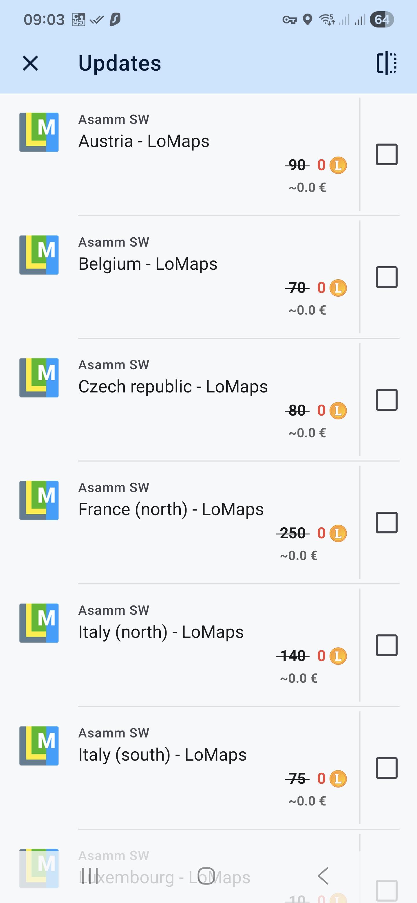
Bin etwas spät dran, deshalb für alle spät Updater. Es gibt ein Karten Update. ☝️
#locusmap #locusmap4 #premium #AsammSoftware #openstreetmap #openstreetmaps #map #Routing #Karten #navigation
Client Info
Server: https://mastodon.social
Version: 2025.07
Repository: https://github.com/cyevgeniy/lmst