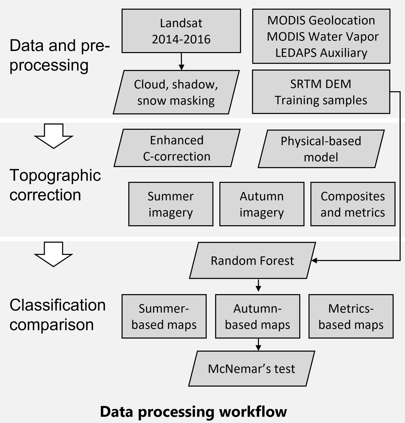
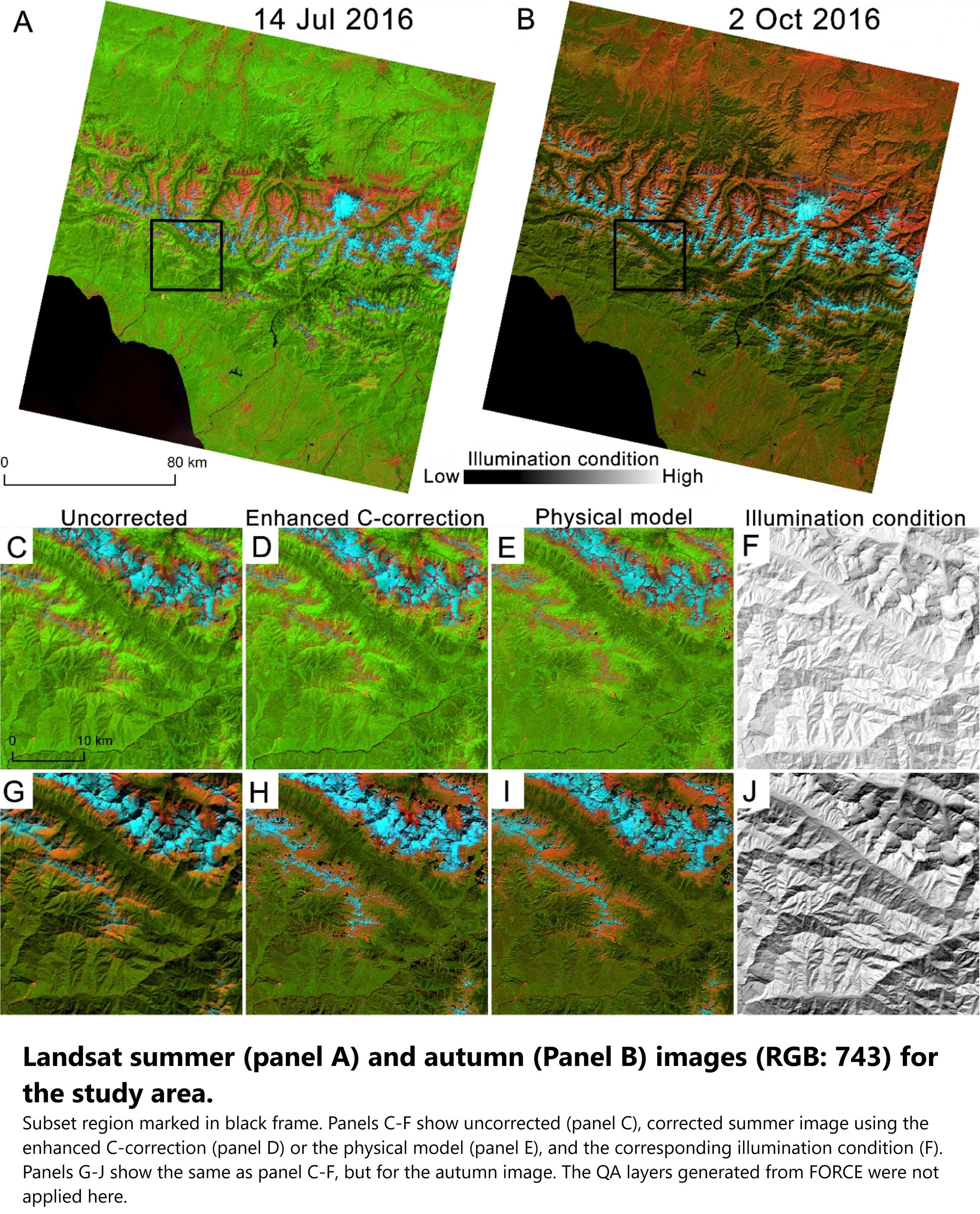
Integrated Topographic Corrections Improve Forest Mapping Using Landsat Imagery
--
https://doi.org/10.1016/j.jag.2022.102716 <-- shared 2022 paper
--
“HIGHLIGHTS:
• [They] evaluated the impacts of topographic correction on forest mapping in the mountains.
• The enhanced C-correction and the physical model reduced topographic effects.
• The corrected Landsat imagery time series resulted in higher accuracy.
• Terrain information improved classification but not as much as topographic correction.
• [They] recommend using topographic correction for forest cover mapping..."
#GIS #spatial #AtmosphericCorrection #IlluminationCondition #LandCover #ModelComparison #TimeSeries #TopographicCorrection #remotesensing #comparasion #topographic #correction #NDVI #forest #vegetation #model #modeling #spatialanalyis #accuracy #forestcover #Russia #Georgia #CaucasusMountains #spatiotemporal #landsat #elevation #DEM
#spatialanalyis
![map - Forest cover classification agreement among the 18 sets of input variables. Pixels in red color were classified by all sets of input variables as coniferous, in green color as broadleaf forest, and in blue color as mixed forest. Black color indicates that no forest was predicted by any set of input variables. Two subsets A and B which are marked in white frames were zoomed in for a detailed map comparison in [another figure]](https://files.mastodon.social/cache/media_attachments/files/113/587/533/215/723/867/original/052c2a4ce1a6e92b.jpg)
Study Provides New Global Accounting Of Earth's Rivers
--
https://phys.org/news/2024-04-global-accounting-earth-rivers.html <-- shared technical article
--
https://doi.org/10.1038/s41561-024-01421-5 <-- shared paper
--
#GIS #spatial #mapping #water #hydrology #global #waterresources #model #modeling #numericalmodeling #spatialanalyis #flow #river #storage #watersecurity #spatiotemporal #estimates #management #planning #runoff #remotesensing #earthobservation
Client Info
Server: https://mastodon.social
Version: 2025.04
Repository: https://github.com/cyevgeniy/lmst