MINERAL CUSTOM - a surreal prose-poem from ATHENALOGIA by C. A. Corbell
#writing
#poetrybook
#poetry
#surrealism
#newpoem
#newpoetry
#oracle
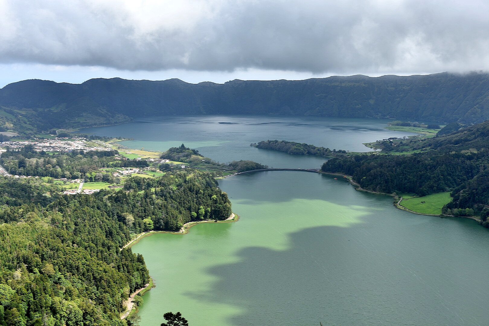
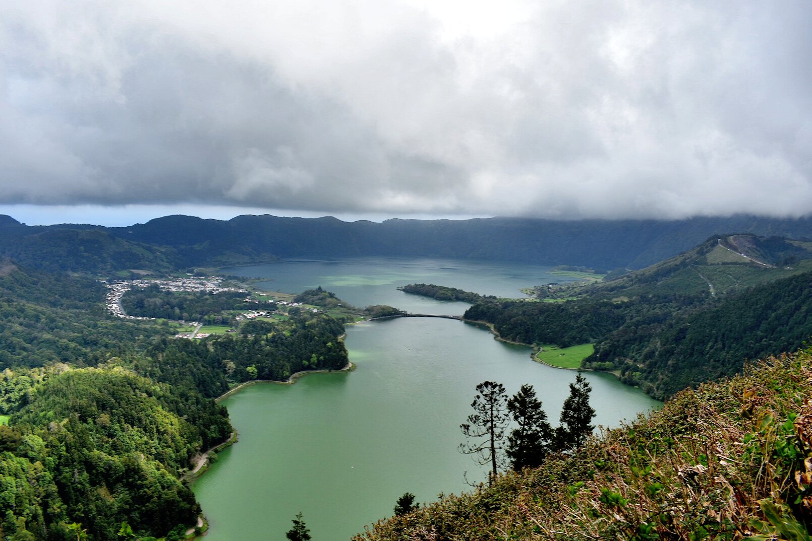
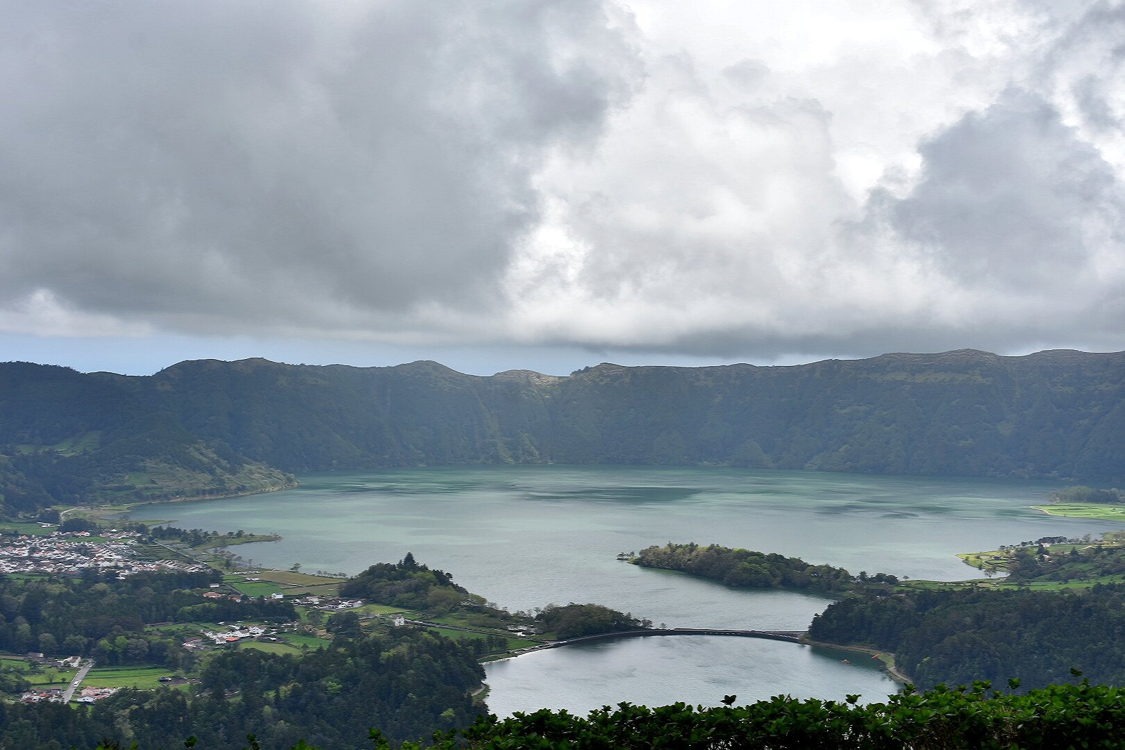
#mineral
#caldera
#doves
#corrugated
#eyelid
#insectwings
#worldview
#navel
#surrealpoetry
MINERAL CUSTOM - a surreal prose-poem from ATHENALOGIA by C. A. Corbell
#writing
#poetrybook
#poetry
#surrealism
#newpoem
#newpoetry
#oracle
#mineral
#caldera
#doves
#corrugated
#eyelid
#insectwings
#worldview
#navel
#surrealpoetry
Videos: CIMAR explica las causas del alto oleaje que afectó Caldera
Este lunes en horas de la tarde se reportó un fuerte oleaje en Caldera, al punto que, por varios lapsos, el mar ingresó a la carretera que conecta esta zona con Puntarenas. El Centro de Investigación en Ciencias del Mar y Limnología (CIMAR), de la Universidad de Costa Rica (UCR), explicó la causa del fenómeno. […]
#Caldera #Nacionales #Oleaje #Sucesos #VisualA
https://www.crhoy.com/nacionales/videos-cimar-explica-las-causas-del-alto-oleaje-que-afecto-caldera/
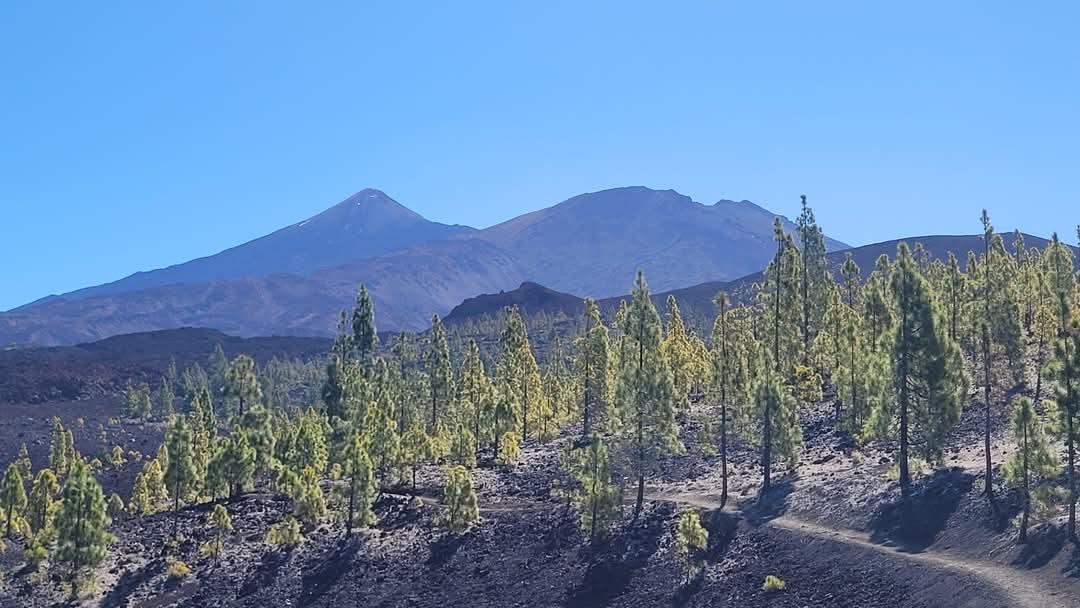
🇪🇸 #tenerife - amazing #elteidevolcano (#canaryislands, #spain, april 2025)
#travelvideo #youtube #travel #volcano #caldera
https://youtu.be/jX2e85eP8OQ
Puerto de Caldera no operó durante 8 días en abril debido a marejadas
Durante abril, la terminal portuaria de Caldera permaneció inoperativa durante 8 días, debido a condiciones climáticas adversas y fenómenos naturales como marejadas (mar de fondo) y fuertes lluvias. Estas situaciones afectaron las líneas de atraque y provocaron el cierre del puerto en 2 tractos de 4 días cada uno. De acuerdo con datos proporcionados por […]
VIDEO | #CampiFlegrei, cos'è il #bradisismo e la '#caldera': la videoguida
https://www.larampa.news/2025/03/campi-flegrei-bradisismo-caldera-videoguida/
🔎 #Caldera: Yenilikçi Blockchain Protokolü ile Geleceğe Adım Atın
🔸 Caldera, ölçeklenebilirlik ve performans sorunlarına çözümler sunan bir protokoldür.
🔸 ERA Coin, ağın yönetimi ve işlem ücretleri için kullanılacak.
#CampiFlegrei: il #terremoto di Md 4.4 del 13 marzo 2025 e lo stato della #caldera
"Alle ore 01:25 del 13 marzo 2025 si è verificato un terremoto di magnitudo preliminare 4.4 ± 0.3 ai Campi Flegrei alla profondità di 2.5 Km, con epicentro in prossimità della costa su via #Napoli nel comune di #Pozzuoli
L’accelerazione al suolo prodotta dal terremoto è stata significativa, come evidenziato dalla mappa di scuotimento in Figura 2 (cfr. dati di scuotimento), infatti è stato avvertito anche in un’ampia area della città di Napoli."
#INGVvulcani #volcano #earthquake
@geography
https://ingvvulcani.com/2025/03/13/campi-flegrei-il-terremoto-di-md-4-4-del-13-marzo-2025-e-lo-stato-della-caldera/
Defensoría pide claridad en controles de concesión en Puerto Caldera
La Defensoría de los Habitantes solicitó mayor claridad en los controles de la concesión en Puerto Caldera, Puntarenas. La institución efectuó un análisis sobre las disconformidades expresadas por los usuarios respecto a los servicios que se brindan actualmente en el muelle del Pacífico Central. De acuerdo con el órgano defensor, la Contraloría General d [...]
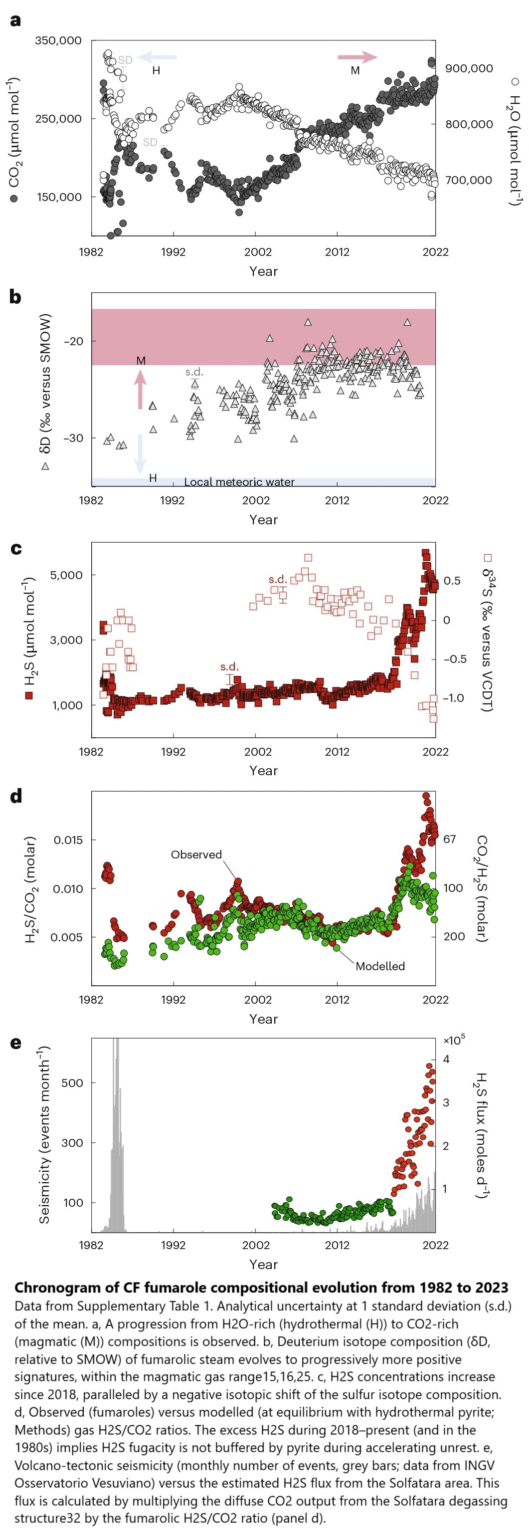
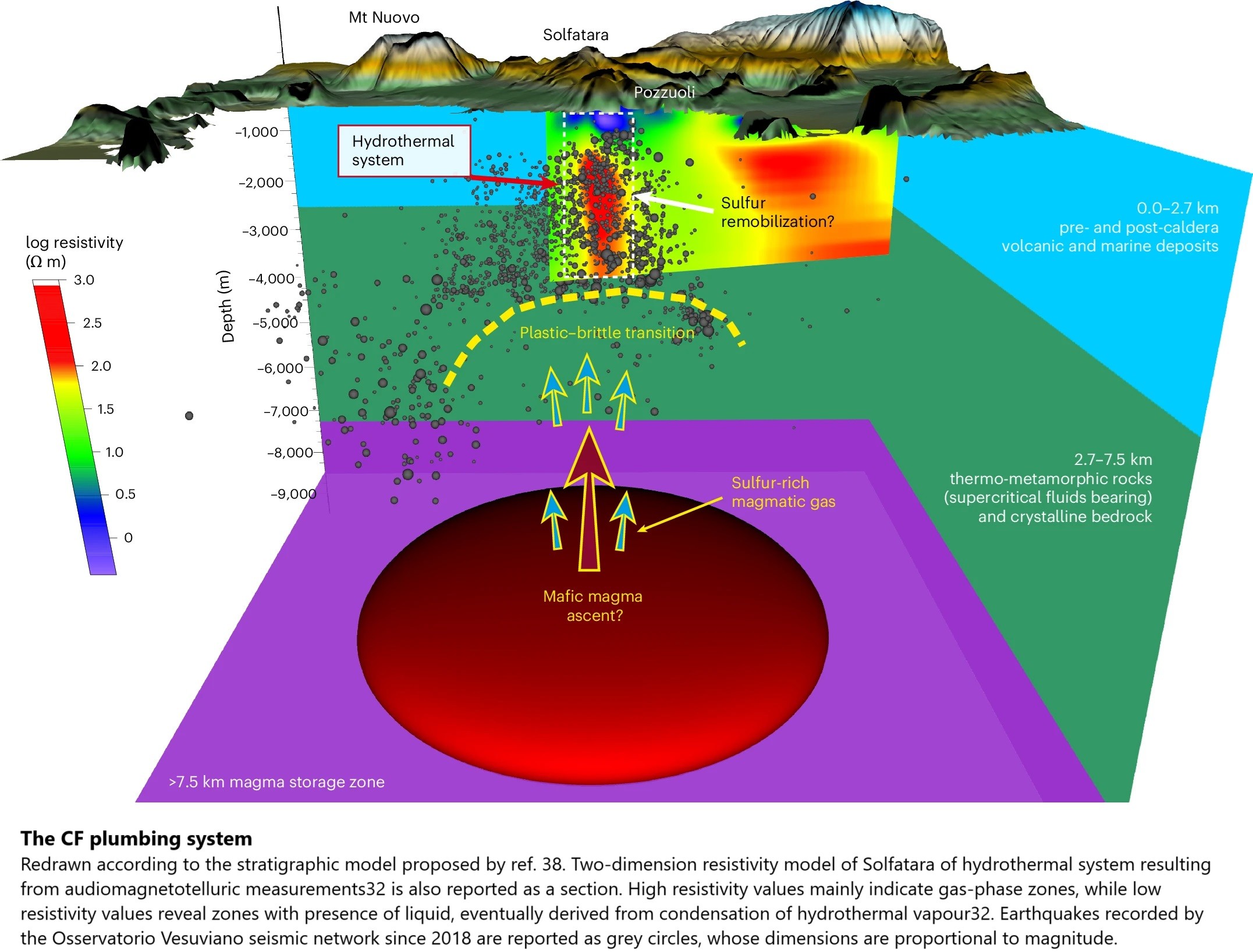
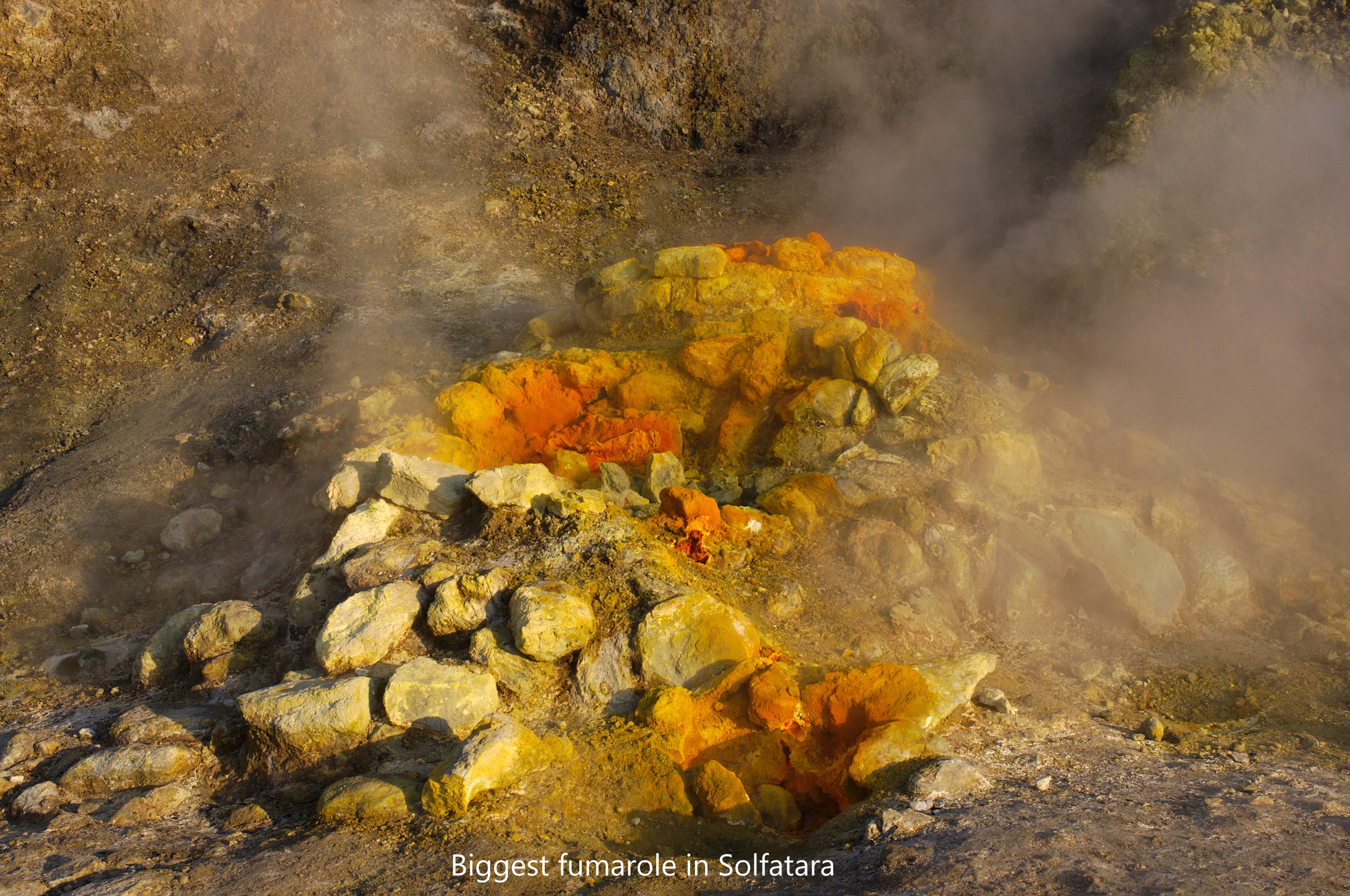
Escalation Of Caldera Unrest Indicated By Increasing Emission Of Isotopically Light Sulfur
--
https://doi.org/10.1038/s41561-024-01632-w <-- shared paper
--
#GIS #spatial #mapping #geology #structuralgeology #volcano #vulcanism #caldera #numerical #model #modeling #eruption #risk #hazard #seismicity #deformation #gases #engineeringgeology #physicochemical #monitoring #CampiFlegrei #Italy #sulfur #fumaroles #hydrothermal #magma #dataanalysis #global

SciTech Chronicles. . . . . . . . .Feb 1, 2025
#Yellowstone #rhyolitic #magma #caldera #magnetotellurics #Alvin #abyssal #hadal #extremophilic #HOV #AI-designed #3D-printed #nanomaterials #nanolattice #geometries #MAV #SUPER #lidar #two-trajectory #mini-brains #HSV-1 #Alzheimer’s #latent #infections
#Fotovorschlag 'Farbe: Weiß'
auf Watte gehen...
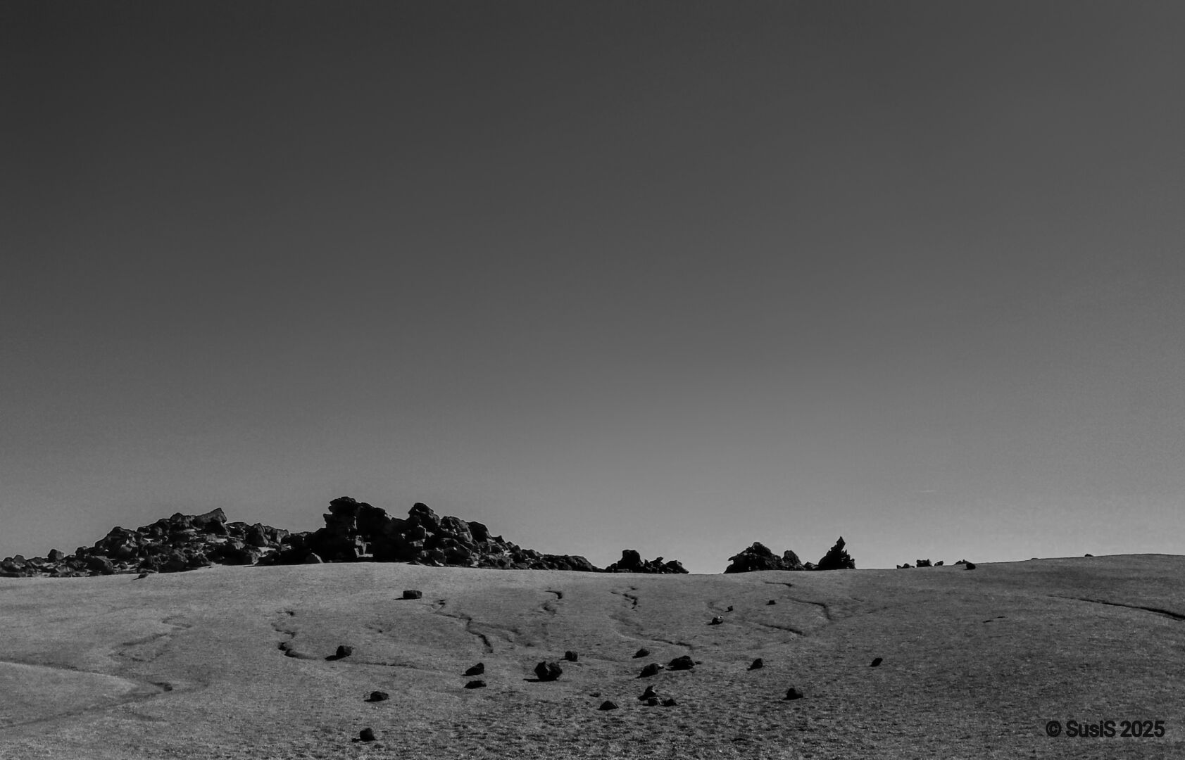
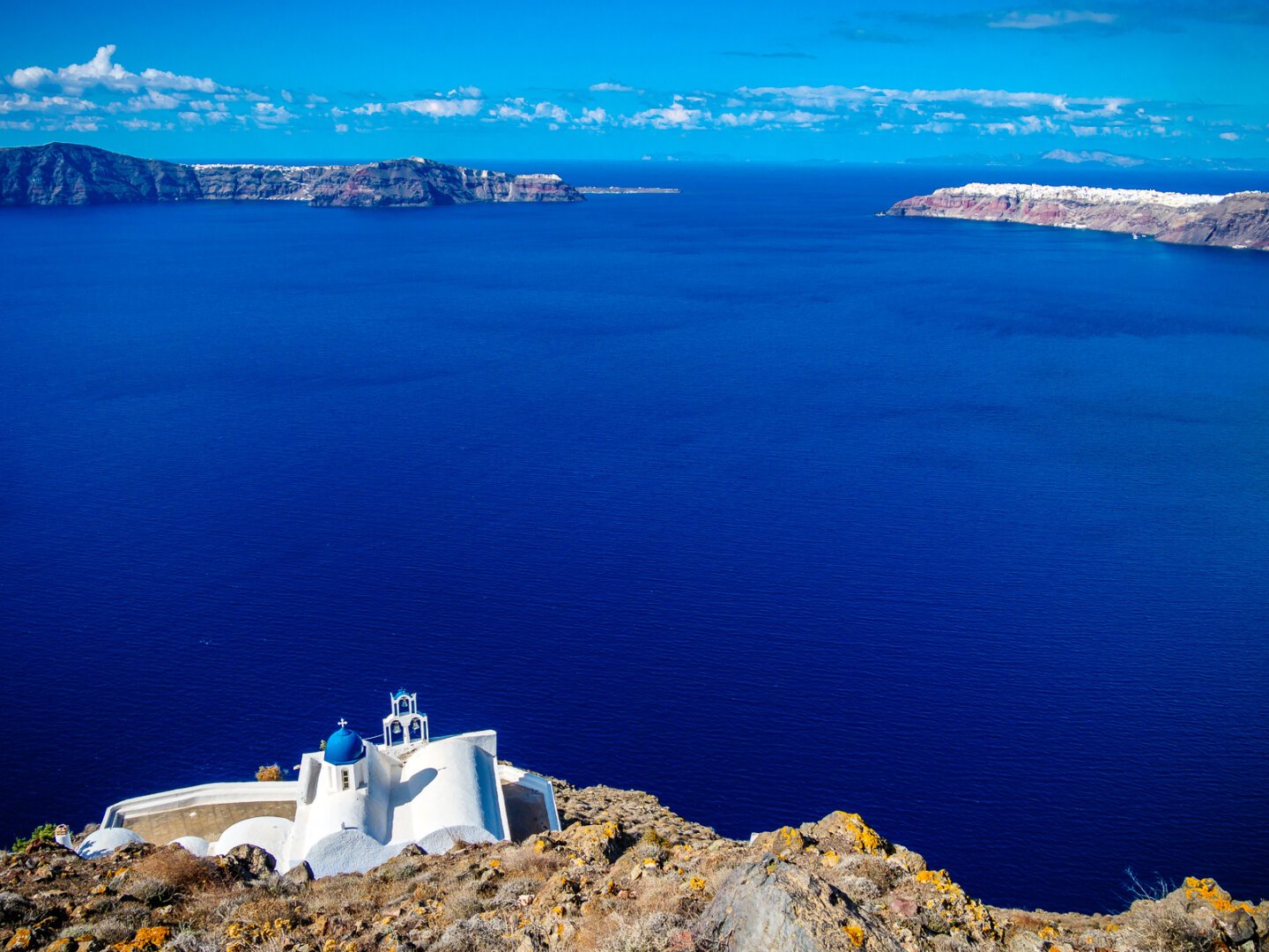
#Canarias #LaPalma #Caldera #hinking #Wandern #outdoors #travel #photography
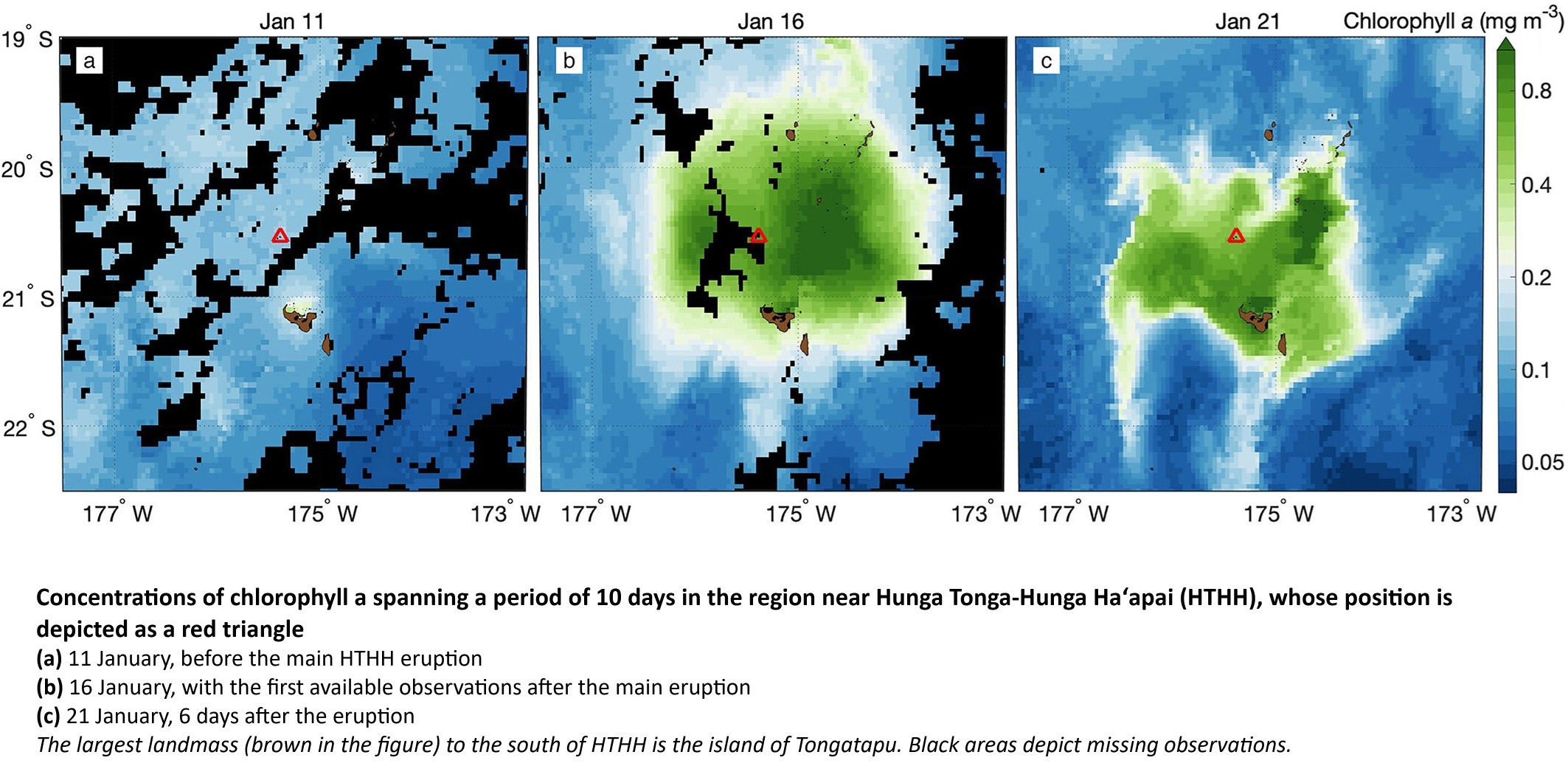
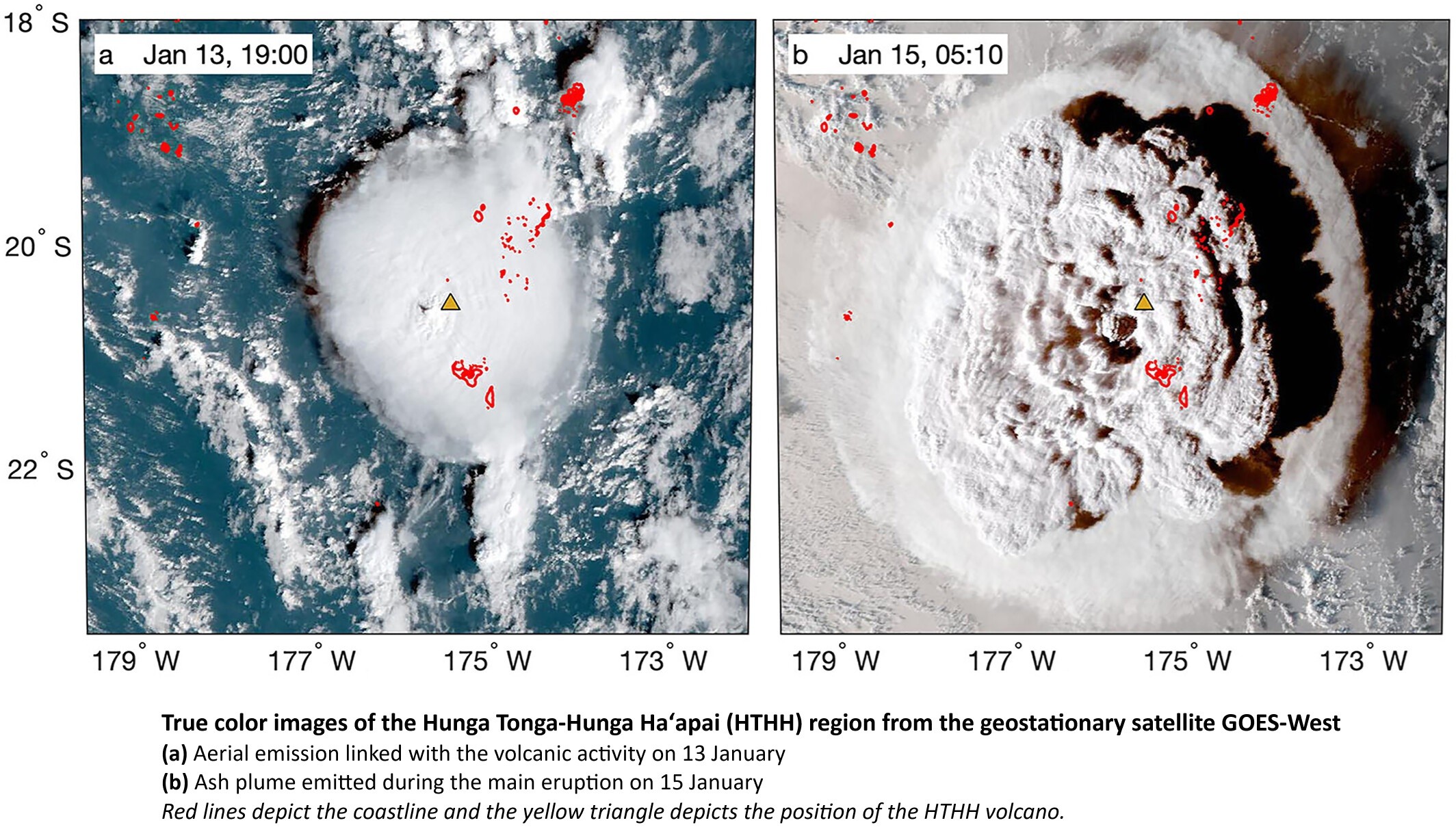
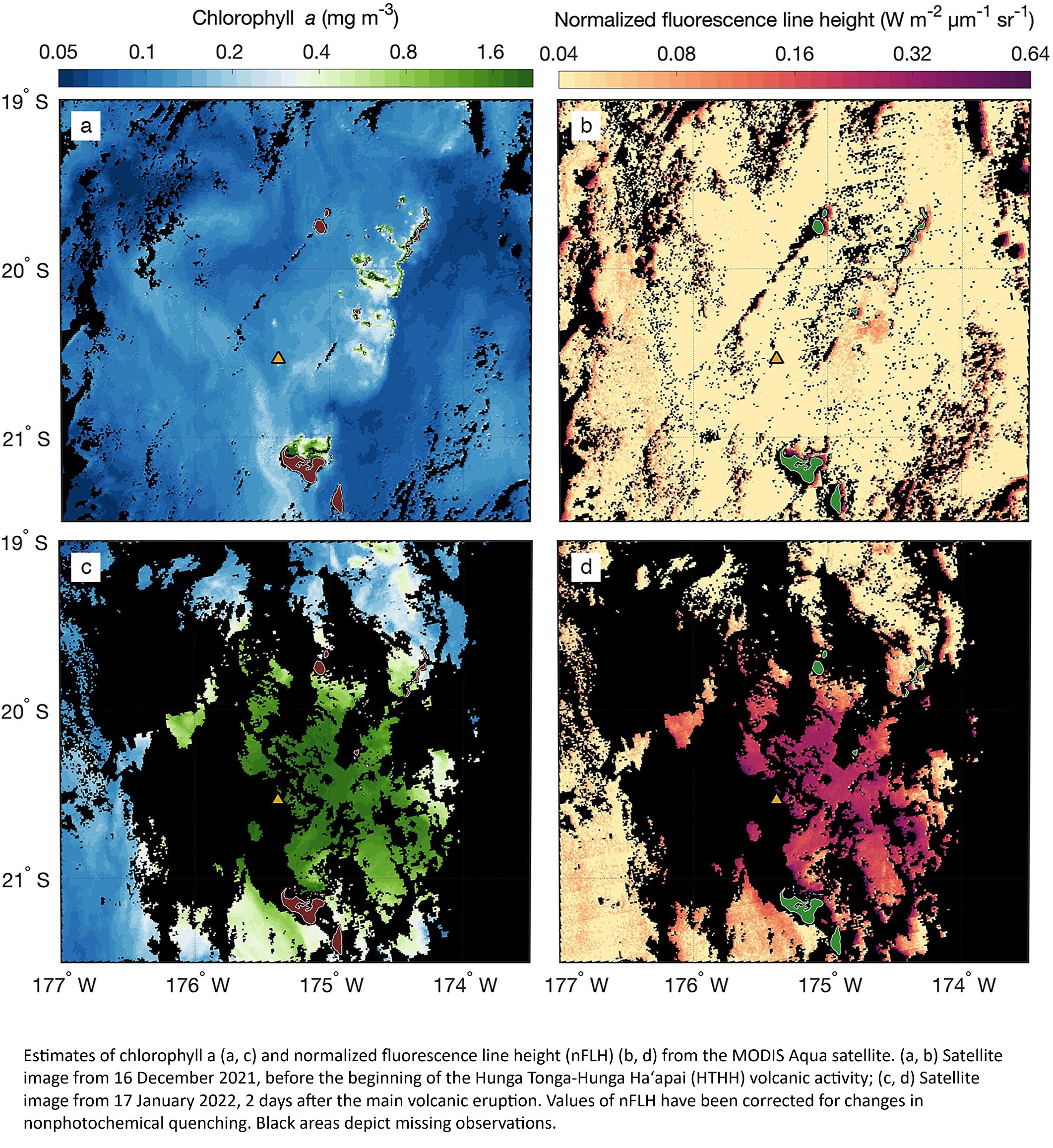
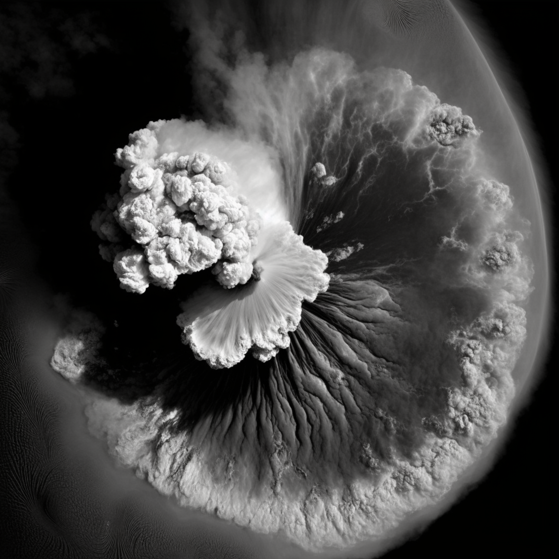
Satellite Detection Of A Massive Phytoplankton Bloom Following The 2022 Submarine Eruption Of The Hunga Tonga-Hunga Haʻapai Volcano
--
https://doi.org/10.1029/2022GL099293 <-- shared paper
--
#GIS #spatial #mapping #phytoplankton #bloom #remotesensing #satellite #Tonga #volcanic #volcano #submarine #eruption #ocean #marine #spatialanalysis #spatiotemporal #HungaTongaHungaHaapai #HungaTonga #Tongatapu #nutrients #ash #volcanicash #caldera #imagery
Contraloría obliga a Incop a cambiar condiciones de millonaria licitación para ampliar Caldera
Las empresas que plantearon los recursos son APM Terminals B.V., SAAM Puertos S.A., DP World CL Holding Americas INC e International Container Terminal Services, INC.
La entrada Contraloría obliga a Incop a cambiar condiciones de millonaria licitación para ampliar Caldera aparece primero en Semanario Universidad.
Todo el mundo preocupado por muchas cosas, pero yo me preocuparía mucho más por este artículo (así copiais el DOI y lo leéis en abierto en donde ya sabéis, guiño) y su contenido: https://www.nature.com/articles/s41586-024-08286-z