
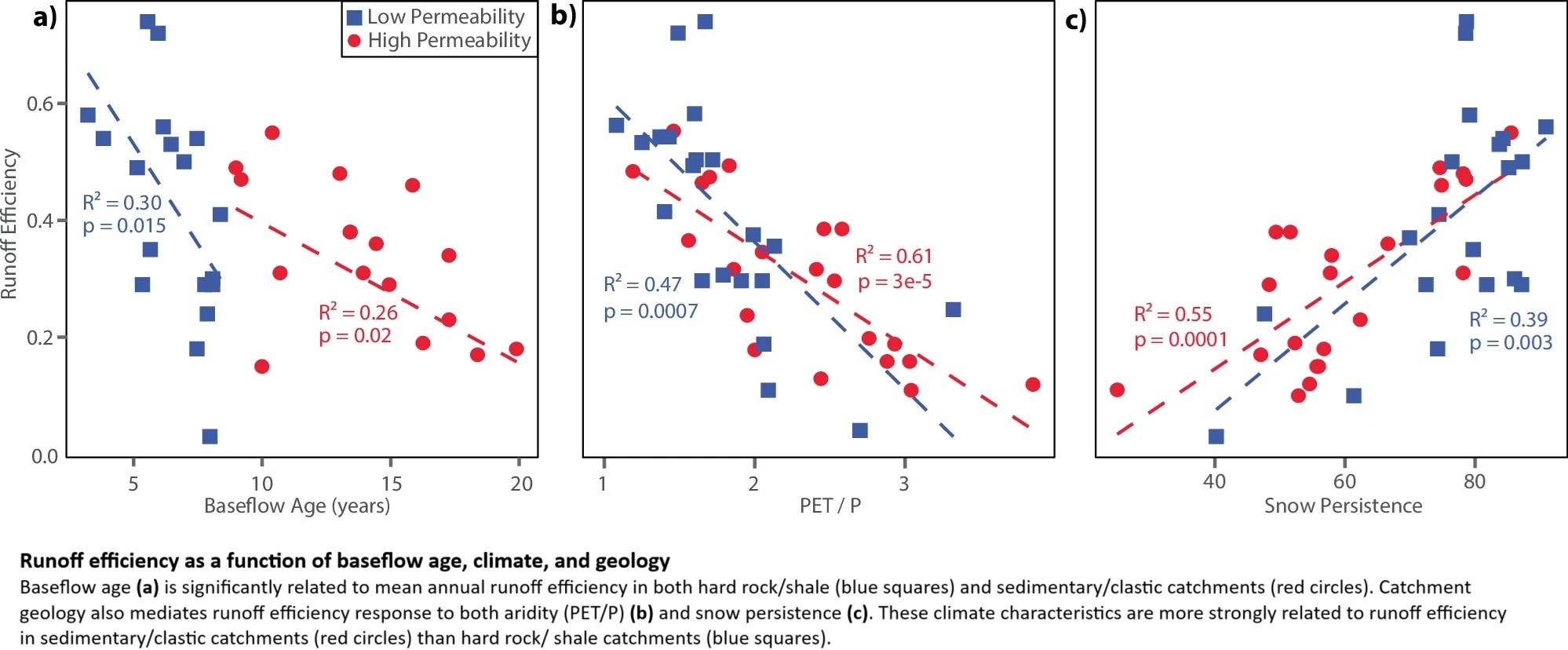
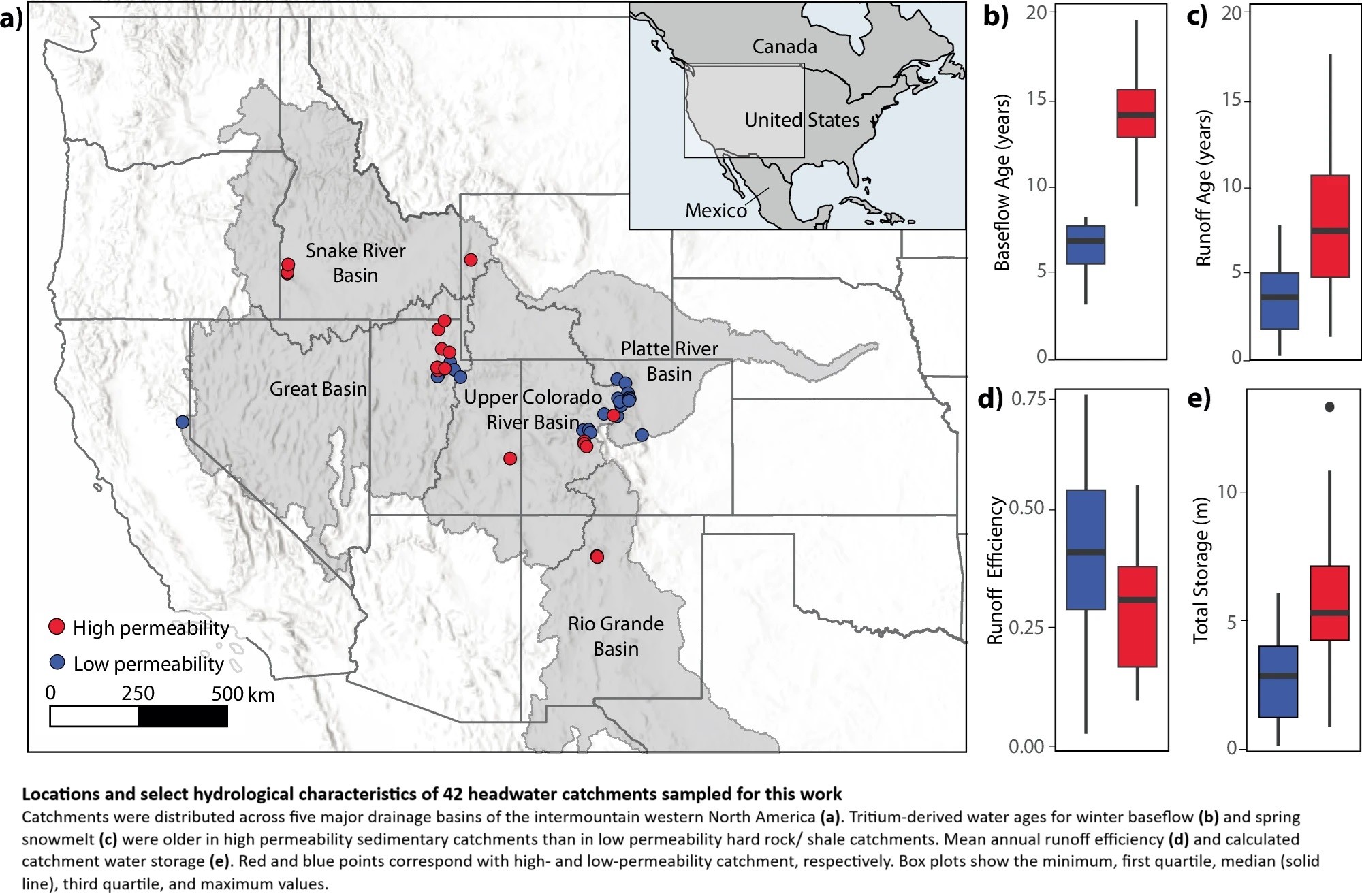
Groundwater Dominates Snowmelt Runoff And Controls Streamflow Efficiency In The Western United States
--
https://doi.org/10.1038/s43247-025-02303-3 <-- shared paper
--
#GIS #spatial #mapping #water #hydrology #fedscience #climatechange #snowmelt #waterresources #watersupply #management #planning #watersecurity #USWest #Rockies #snow #winter #mountain #catchment #dating #tritium #spatialanalysis #spatiotemporal #runoff #streamflow #infiltration #model #modeling #geology #geomorphology #groundwater #storage #surfacewater #streamwater #precipitation #bedrock #soils #sediments #permability #porosity #watershed #subsurfaceflow #storage #climate #future #landscape
#subsurfaceflow


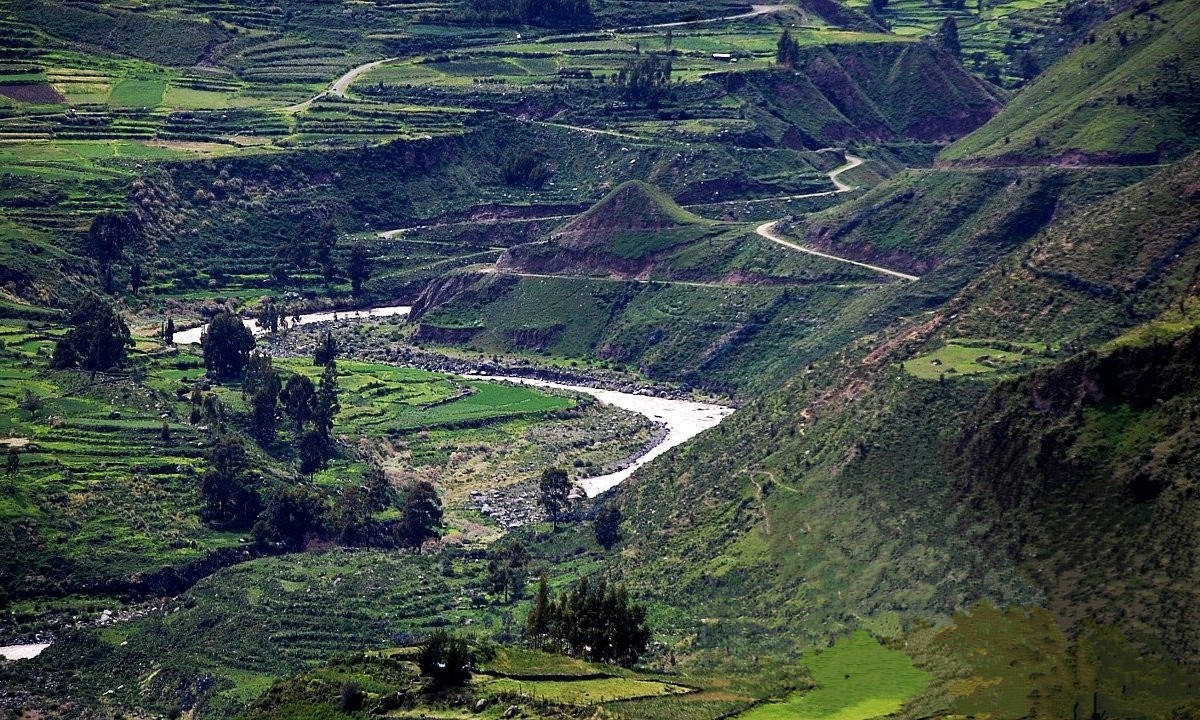
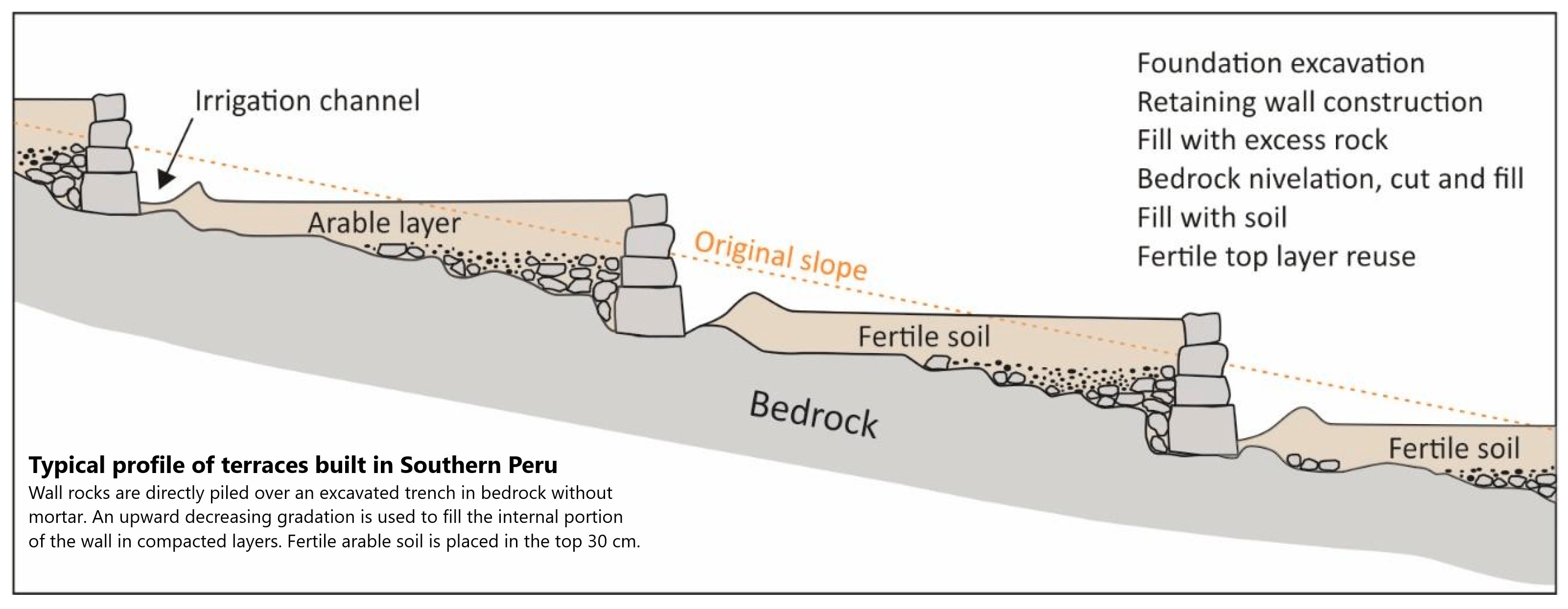
Linking Inca Terraces With Landslide Occurrence In The Ticsani Valley, Peru
--
https://doi.org/10.3390/geosciences14110315 <-- shared paper
--
[takes me back to my engineering geology days in the Southern Hemisphere, including my thesis – with a healthy dose of spatial analysis and modeling – and all with a specific use; what is not to like?]
#GIS #spatial #mapping #landslides #massmovement #Inca #Andes #irrigation #terraces #Peru #SouthAmerica #confusionmatrix #logisticregression #geohazards #spatialanalysis #spatiotemporal #terracing #water #hydrology #surfaceflow #geomechanical #geotechnical #Ticsani #algorithm #processes #geostatistics #river #slope #agriculture #farming #soils #geology #risk #hazard #publicsafety #fem #model #modeling #rainfall #precipitation #permeability #groundwater #subsurfaceflow #instability #fluvial #erosion
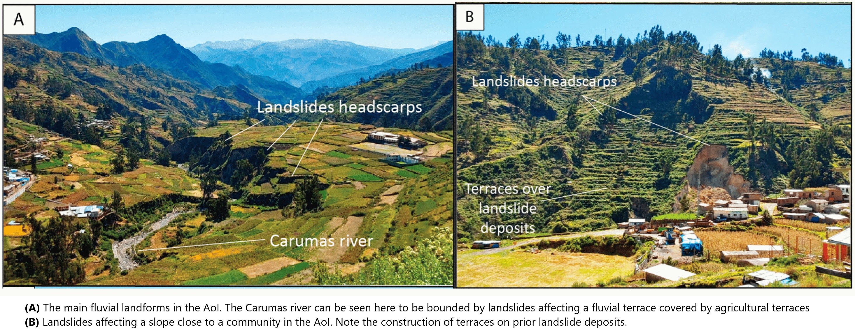
![imagery / map / schematic cross-section - (A) A 3D view of the San Cristobal landslide. (B) A 1:50,000 geological map of the landslide area, modified from [33]. Ki-mat = Matalaque Fm. P-Pi = Puno Fm. Q-pl = colluvial deposits, debris avalanche. Qp-vl-pi = pyroclastic deposits. Red line marks the topographic cross-section shown in A. (C) Cross-section of the San Cristobal landslide with estimated base groundwater conditions (blue) and materials boundaries (green) to be used for modeling and interpreted potential failure surfaces (dashed red).](https://files.mastodon.social/cache/media_attachments/files/113/529/374/814/146/822/original/b7ebfbc1af8a96b3.jpg)
Client Info
Server: https://mastodon.social
Version: 2025.07
Repository: https://github.com/cyevgeniy/lmst