
USGS Releases New Topographic Maps For Puerto Rico & The U.S. Virgin Islands – Updated Maps For Essential Needs
--
https://www.usgs.gov/programs/national-geospatial-program/news/usgs-releases-new-topographic-maps-puerto-rico-and-us <-- shared article
--
https://apps.nationalmap.gov/downloader/ <-- USGS National Map Downloader
--
https://www.usgs.gov/programs/national-geospatial-program/topobuilder <-- USGS OnDemand Topo
--
#GIS #spatial #mapping #cartography #PuertoRico #USVI #USVirginIslands #topomaps #20K #UStopomaps #topographic #map #NationalMap #TheNationalMap #TNM #NationalMapCorp #volunteers
@USGS
#TheNationalMap


Mapping The Land [USGS 3DEP program]
--
https://connectedworld.com/mapping-the-land/ <-- shared technical article
--
#GIS #spatial #mapping #LiDAR #opendata #3DEP #3DHP #elevation #remotesensing #TNM #QL1 #TheNationalMap #USA #NGTOC #3delevation #data #infrastructure #natural #constructed #engineering #publicsafety #planning #model #modeling #urbanplanning #agriculture #economicdevelopment #economicbenefits #coastal #risk #hazard #geology #engineeringgeology #massmovement #USGS
@USGS


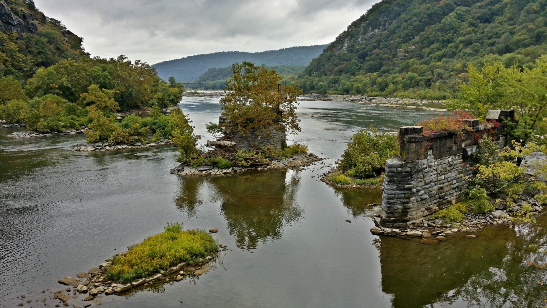
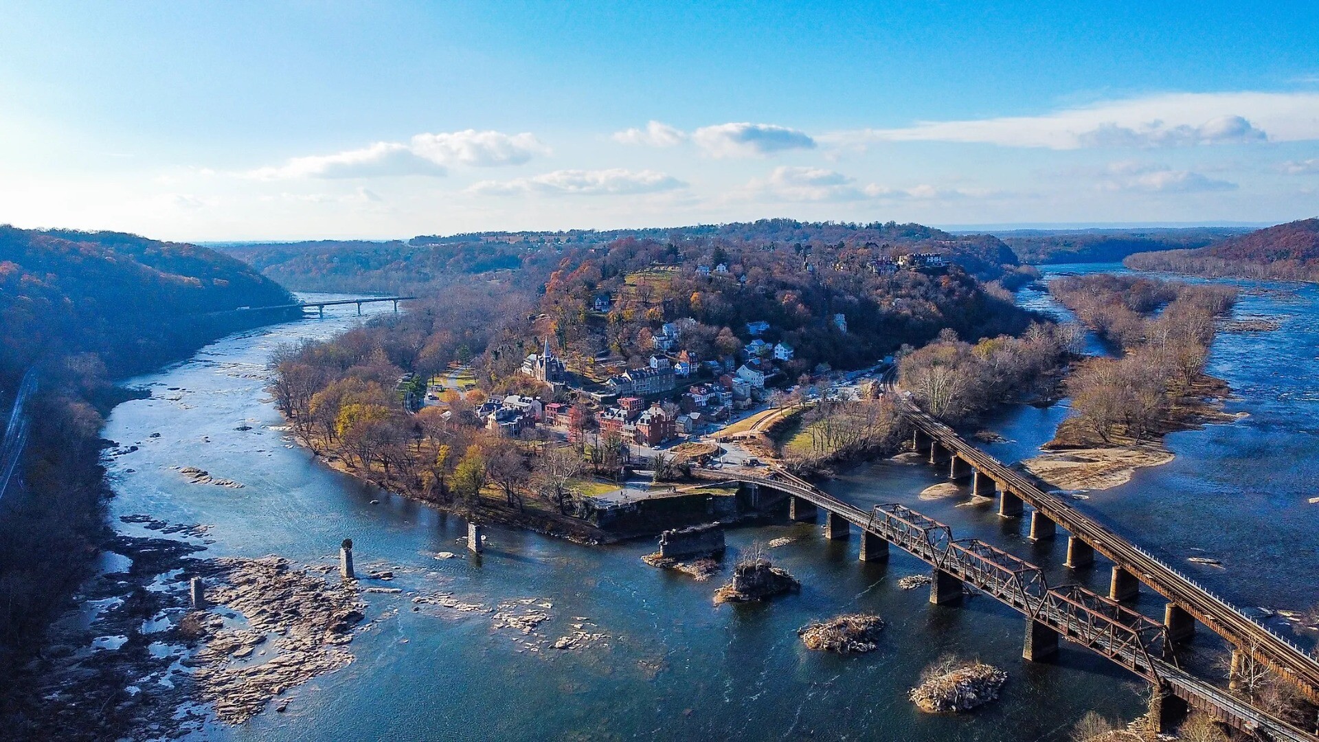
New USGS National Map Data Reveals The Potomac River’s Submerged Topography
--
https://www.usgs.gov/news/technical-announcement/new-usgs-national-map-data-reveals-potomac-rivers-submerged-topography <-- shared technical article
--
#GIS #spatial #mapping #remotesensing #LiDAR #opendata #HarpersFerry #westvirginia #virginia #USA #potomac #river #water #hydrology #hydrospatial #TheNationalMap #USGS #ICPRB #bathymetry #topobathy #elevation #3dep #3dntm #inflationreductionact #riverflow #appliedscience #model #modeling #inlandbathymetry
#fateandtransport #waterquality #waterresources #waterresourcemanagement #engineering #infrastructure #transportation #usecase #ecosystems #environment
@usgs


Instructional Videos on Using [USGS’s] The National Map [Open Data] Products and Services [3DEP Elevation, Hydrology, etc]
--
https://www.usgs.gov/programs/national-geospatial-program/training <-- shared technical training resource
--
https://www.usgs.gov/programs/national-geospatial-program/national-map <-- background to the USGS’s Accessible National Map Open Data
--
#GIS #spatial #mapping #USGS #opendata #elevation #hydrography #hydrology #NGTOC #NGP #3DEP #3DHP #topoBuilder #USA #gischat #TNM #TheNationalMap #products #services #dataportal #tutorials #tutorial #trainingvideos #videos #learning #continuingeducation #education #educationandtraining #free #videolessons #videolearning #topographic #topographicmaps #instructional #onlineclasses #onlineeducation #onlinelearning
@usgs
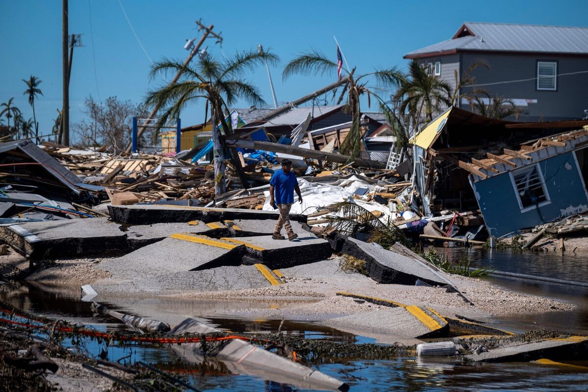
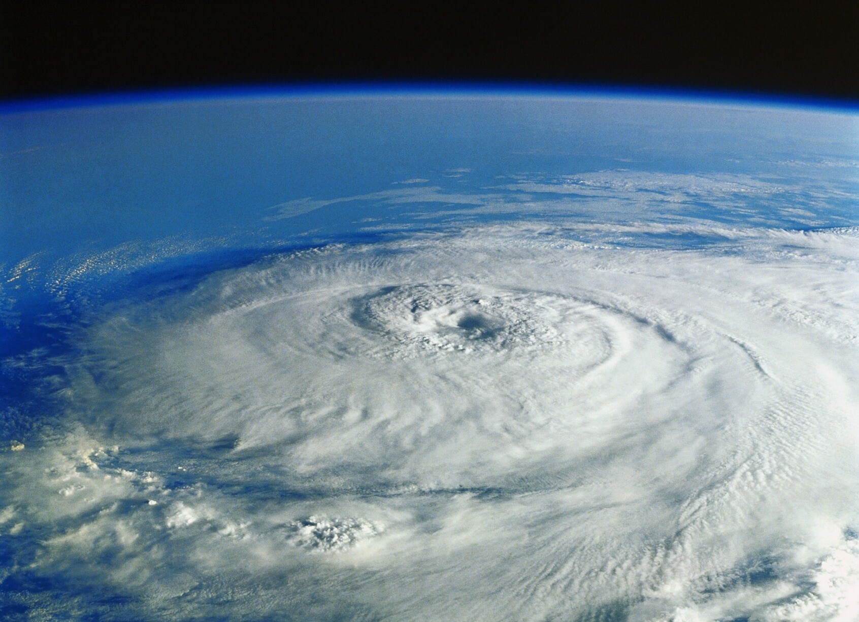
The USGS Provides Maps & Imagery For Hurricane Response
--
https://www.usgs.gov/news/featured-story/usgs-provides-maps-and-imagery-hurricane-response <-- link to technical article
--
https://apps.nationalmap.gov/event-support-map-hub/ <-- Geospatial Information Response Team (GIRT) hazard USGS The National Map (TNM) page
--
H/T #XanFredricks
“🌊For this hurricane season, the [U.S. Geological Survey (USGS) Geospatial Information Response Team] GIRT has a newly designed, publicly available Event Support Map HUB site that offers access to applications, resources and information for hurricanes and other natural disasters…”
#GIS #spatial #mapping #USGS #NGP #GIRT #EROS #NGTOC #HDDS #3DEP #TheNationalMap #science #maps #imagery #hurricanes #tropicalstorms #hazards #emergencyresponse #disasterresponse #firstresponders #supportmaps #realtimedata #information #response #gischat #appliedscience
@usgs #USGS


Client Info
Server: https://mastodon.social
Version: 2025.07
Repository: https://github.com/cyevgeniy/lmst