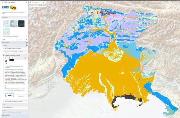
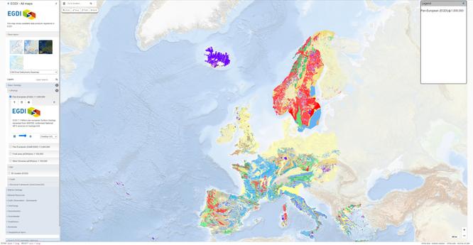
European Geological Open Data (Map And Data) From The European Geological Data Infrastructure (EGDI)
--
https://www.europe-geology.eu/data-tools/map-viewer/ <-- shared link to map viewer
--
#geology #geosciences #earthsciences #data #spatialdata #criticalminerals #mining #geothermal #netzero #groundwater #carboncapture #ccs #GIS #spatial #mapping #opendata #webmapping #mapportal #Europe #EGDI #framework #GSEU #resources #naturalresources #opendata #water #naturalresources #geomorphology #bathymetry #geophysics #topobathy #remotesensing #earthobservation #waterresources
#topobathy
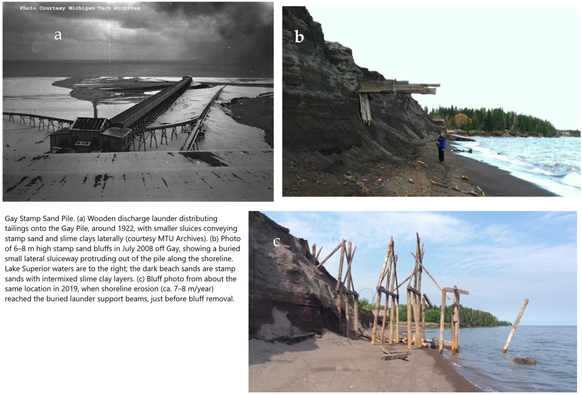
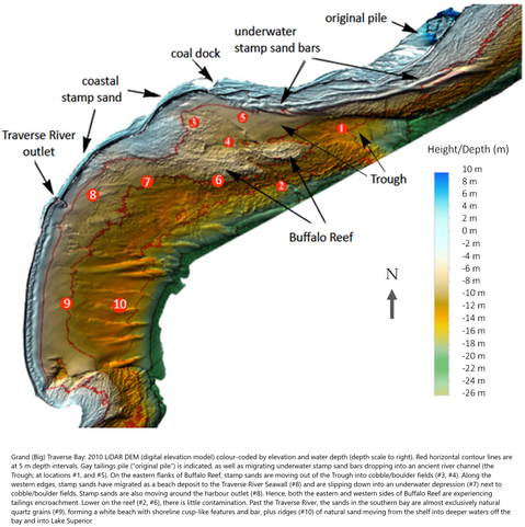
Coastal Environments - LiDAR Mapping of Copper Tailings Impacts, Particle Retention of Copper, Leaching, and Toxicity
--
https://doi.org/10.3390/rs17050922 <-- shared paper
--
#GIS #spatial #mapping #remotesensing #earthobservation #coastalenvironment #coast #coastal #mine #tailings #minetailings #GlobalTailingsManagementStandard #Keweenaw #LiDAR #bathymetry #topobathy #UAS #drone #particledispersal #copper #retention #leaching #BuffaloReef #toxicity #Daphnia #benthic #organisms #risk #hazard #contamination #impacts #sediment #water #hydrology #Michigan #USA #LakeSuperior #PortageLakeVolcanic #geology #spatialanalysis #biology #ecosystems #fisheries #trout #enviornmentalimpacts #leaching #riparian #systems
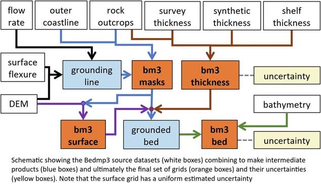
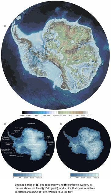
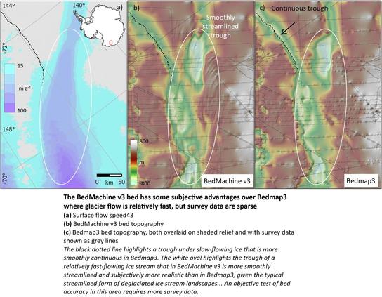
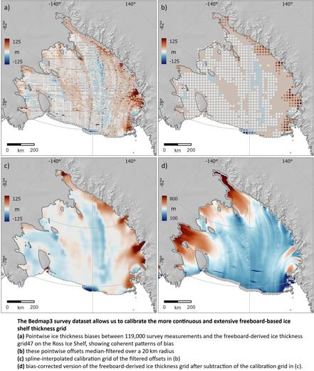
New Map Of Landscape Beneath Antarctica Unveiled
--
https://phys.org/news/2025-03-landscape-beneath-antarctica-unveiled.html <-- shared technical article
--
https://doi.org/10.1038/s41597-025-04672-y <-- shared paper
--
#GIS #spatial #mapping #Bedmap3 #icebed #surface #thickness #gridded #datasets #Antarctica #raster #model #modeling #landscape #elevation #icesheet #survey #remotesensing #earthobservation #climatechange #warming #climate #melt #melting #seafloor #subglacial #geophysical #survey #topography #geology #bathymetry #topobathy #BritishAntarcticSurvey
@BritishAntarcticSurvey
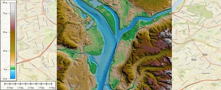
Data Request For Potomac River Tragedy - National Centers For Environmental Information (NCEI), NOAA In The News
--
https://www.ncei.noaa.gov/ <-- shared NCEI home page
--
“A CNN Reporter requested data to portray the depth of the Potomac River near the site of the tragic plane and helicopter crash. The Digital Elevation Model Bathymetry (DEM) Team responded with information on how to use NCEI’s high-resolution Continuously Updated Digital Elevation Models (CUDEMs) to generate a map of the Potomac River and provided an example map…”
#GIS #spatial #mapping #remotesensing #bathymetry #topobathy #DEM #elevation #depth #NCEI #opendata #CUDEM #disaster #collision #air #potomacriver #potomac #crash #airdisaster #Washington #helicopter #ArmyHelicopter #blackhawk #NOAA #aviation #midair
@NOAA @NCEI
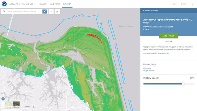
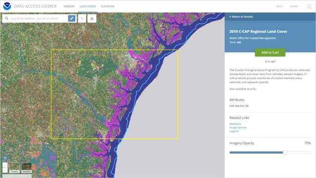
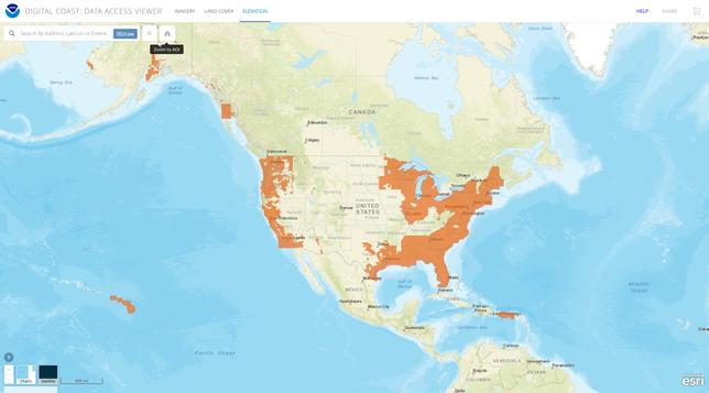
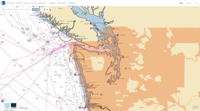
NOAA Digital Coast – Data Access Viewer [USA]
--
https://coast.noaa.gov/digitalcoast/tools/dav.html <-- shared link to viewer
--
[lots of new data added in the last 6 months]
“This online tool allows a user to search for and download lidar, imagery, and land cover data by user-defined geography. Once found, the data can be downloaded with an easy-to-use checkout interface. Users can select from multiple file formats, projections, and datums.
Features:
• View image services for applicable data
• View technical specifications and metadata for each data set
• Access data in several projections and datums…”
#GIS #spatial #mapping #spatialdata #opendata #LiDAR #imagery #NOAA #digitalcoast #USA #DataAccessViewer #landcover #topobathy #topography #bathymetry #charts #coast #coastal #CoastalChangeAnalysisProgram #CCAP #NLCD
@NOAA
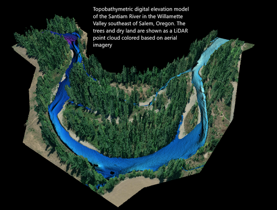
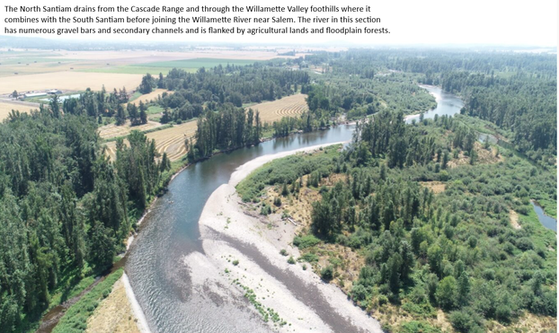
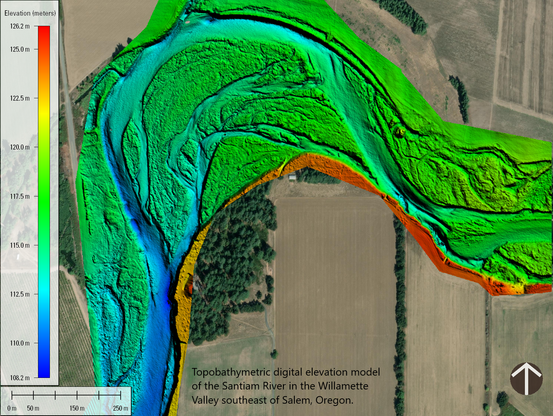
New USGS Dataset Uncovers The Santiam River’s Underwater Topography To Aid In Fish Habitat And Water Flow Management
--
https://www.usgs.gov/news/national-news-release/new-usgs-dataset-uncovers-santiam-rivers-underwater-topography-aid-fish <-- shared article
--
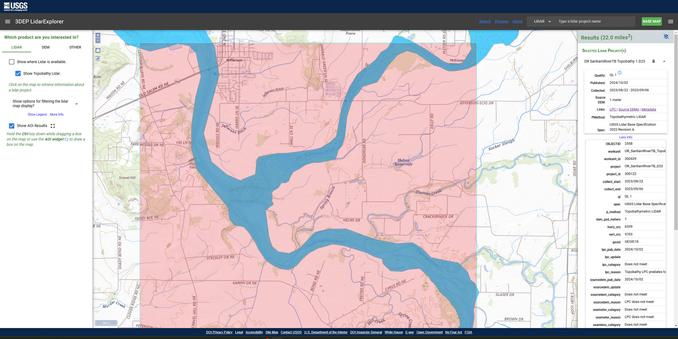
https://apps.nationalmap.gov/lidar-explorer/#/ <-- USGS 3DEP LiDAR Explorer (open data)
--
#GIS #spatial #mapping #remotesensing #LiDAR #topobathymetry #topobathy #example #usecase #wildfires #rivermanagement #climatechange #waterresources #SantiamRiver #Oregon #KlamathRiver #PotomacRiver #ColoradoRiver #USGS #USACE #3DEP #opendata #topography #elevation #3DTNM #water #hydrology #hydrospatial #pilotproject #prototype #infrastructure #navigation #engineering #riverbed #sediment #sedimentation #habitat #river #waterbody #flowmanagement #dams #salmon #steelhead #fish #WillametteValley #flood #flooding #risk #hazard #model #modeling #FIM #watersupply #agriculture
@USGS @USACE
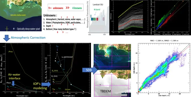
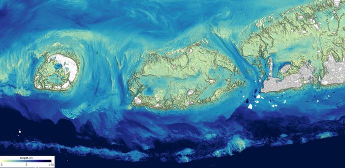
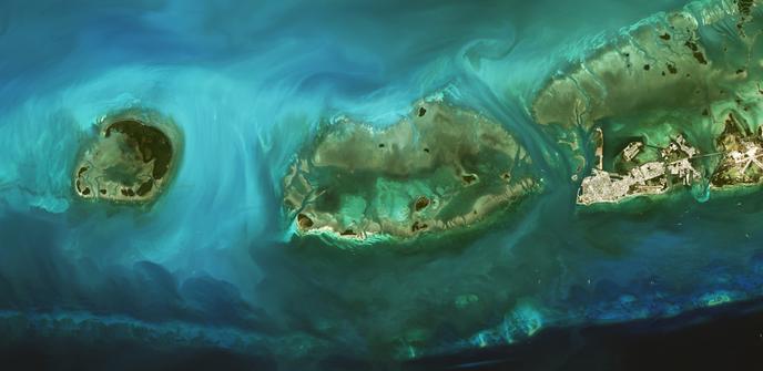
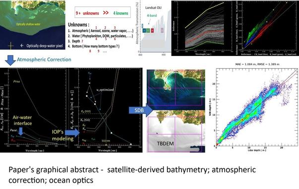
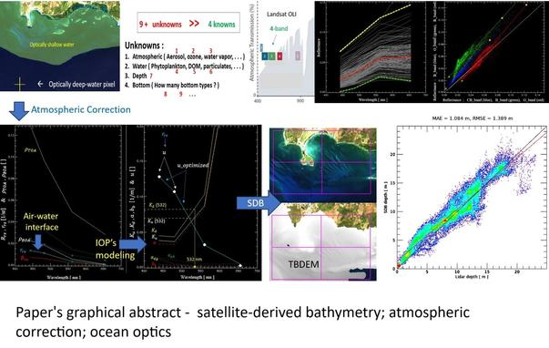
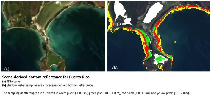
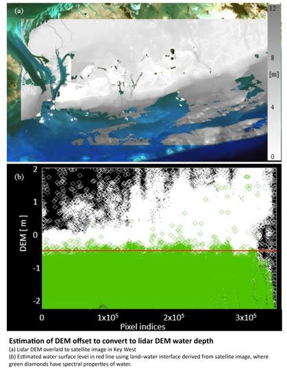
Landsat Plumbs The (Shallow) Depths [Near Shore TopoBathy]
--
https://earthobservatory.nasa.gov/images/153529/landsat-plumbs-the-shallow-depths <-- shared NASA images
--
https://doi.org/10.3390/rs16050843 <-- shared paper
--
#GIS #spatial #mapping #landsat #coast #coastal #topobathy #remotesensing #bathymetry #depth #shallowwater #hydrography #hydrospatial #modeling #OLI #OperationalLandImager #landsat8 #landsat9 #algorithm #spatialanalysis #physics
@USGS
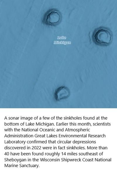
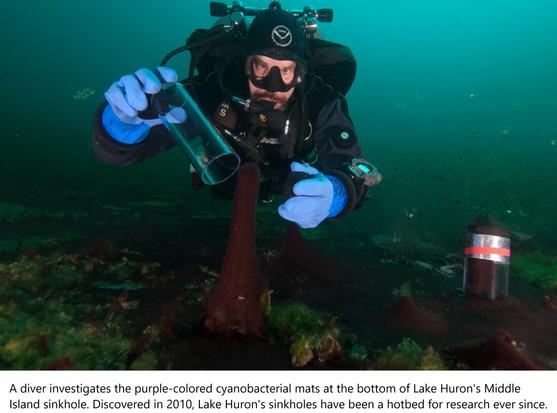
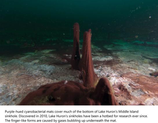
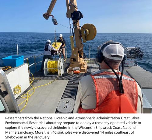
A Crew Was Searching For Shipwrecks In Lake Michigan—But They Found Something Completely Different
--
https://www.popularmechanics.com/science/environment/a62501711/lake-michigan-holes/ <-- shared media / technical article
--
“ • A survey of Lake Michigan located at least 40 large craters on the lakebed.
• Initial studies highlighted the spots as unknown shapes, but additional research revealed the craters are filled with marine life.
• Researchers expect to investigate further, seeing how these craters formed and if they’re really sinkholes…"
#GIS #spatial #mapping #water #hydrology #groundwater #crater #sinkhole #bathymetry #topobathy #remotesensing #sonar #LakeMichigan #Michigan #research #GreatLakes #geomorphology #geomorphometry #ROV #ecology #ecosystems #cyanobacteria #WisconsinShipwreckCoastNationalMarineSanctuary #Sheboygan #Wisconsin #extremeecosystems #extremophiles #offgassing #hydrocarbons
@NOAA
Eyes on Earth Episode 120 – Mapping the California Coastline [podcast]
--
https://www.usgs.gov/centers/eros/science/eyes-earth-episode-120-mapping-california-coastline <-- shared link to podcast
--
https://doi.org/10.1017/cft.2022.4 <-- shared paper
--
#GIS #spatial #mapping #research #remotesensing #earthobservation #water #hydrology #marine #hydrospatial #bathymetry #topobathy #elevation #seafloor #landsat #Landsat9 #LandsatNext #resolution #coast #coastline #podcast #interview #California #USA #model #modeling #spatialanalysis #sealevelrise #SLR #sealevel #erosion #climatechange #risk #hazard #opendata #machinelearning #AI #oceangraphy
@USGS | @USGS_EROS
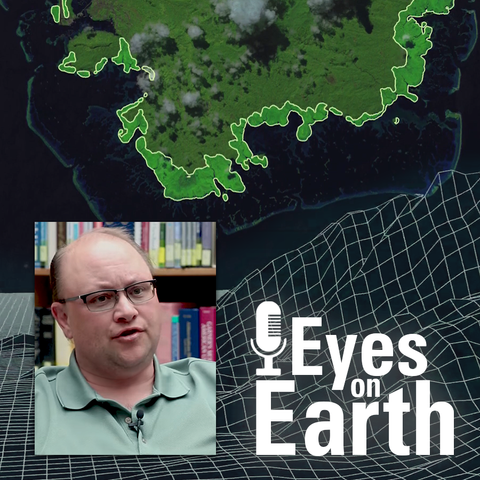
Eyes on Earth Episode 123 – Bathymetry Mapping
--
https://www.usgs.gov/centers/eros/science/eyes-earth-episode-123-bathymetry-mapping <-- shared link to podcast
--
https://www.linkedin.com/posts/gregcocks_gis-spatial-mapping-activity-7214045947876581377-4zcm <-- my earlier overview post
--
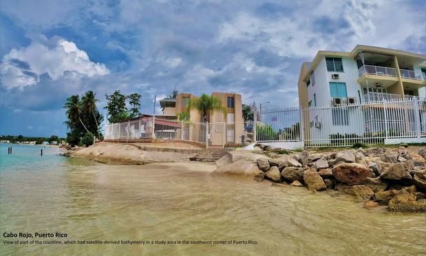
#GIS #spatial #mapping #research #remotesensing #earthobservation #landsat #satellite #water #hydrology #marine #hydrospatial #bathymetry #topobathy #elevation #seafloor #Landsat9 #LandsatNext #resolution #PuertoRico #Guam #oceanoptics #atmosphere #coast #coastline #podcast #interview
@USGS @EROS
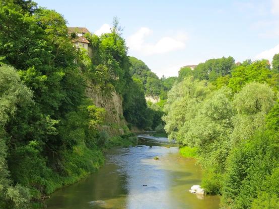
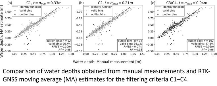
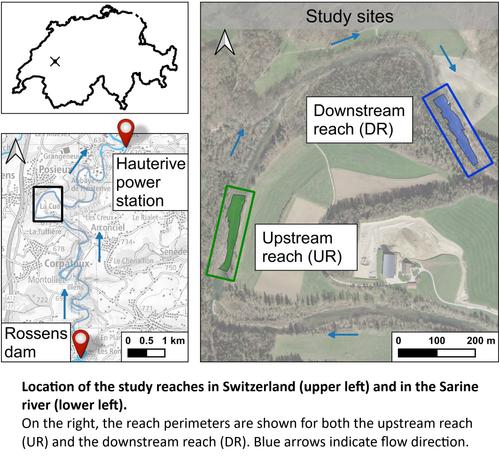
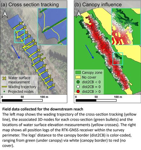
Performance And Accuracy Of Cross-Section Tracking Methods For Hydromorphological Habitat Assessment In Wadable Rivers With Sparse Canopy Conditions
--
https://doi.org/10.1002/rra.4252 <-- shared research article
--
#GIS #spatial #mapping #water #hydrology #streams #depth #bathymetry #RTK #GNSS #GPS #CPGPS #hydromorphological #hydromorphology #riverrestoration #monitoring #research #corrleation #metrics #turbidity #wadeable #canopy #vegetation #watermanagement #survey #efficient #lowcost #robust #methodology #comparasion #interpolation #SarineRiver #Fribourg #Switzerland #biodiversity #habitat #ecosystem #waterdepth #manual #treecanopy #tree #streamgaging #streamgauging #remotesensing #stream #topobathy
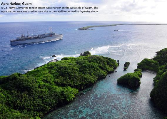
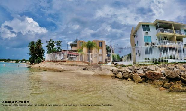
USGS Finds New Way To Measure Ocean Depth With Landsat
--
https://www.usgs.gov/centers/eros/news/usgs-finds-new-way-measure-ocean-depth-landsat <-- shared technical article
--
https://doi.org/10.3390/rs16050843 <-- shared paper
--
#GIS #spatial #mapping #research #remotesensing #earthobservation #landsat #satellite #water #hydrology #marine #hydrospatial #bathymetry #topobathy #elevation #seafloor #Landsat9 #LandsatNext #resolution #PuertoRico #Guam #oceanoptics #atmosphere #coast #coastline
@USGS @landsat @EROS @landsat9
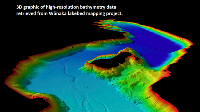
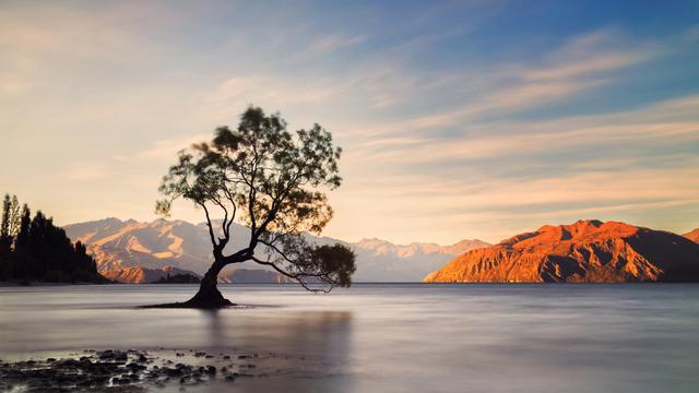
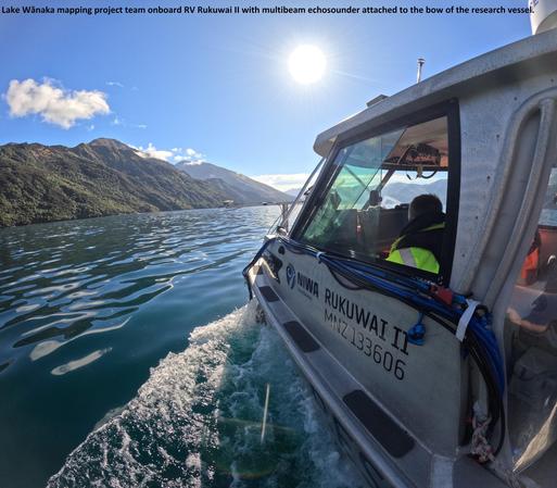
Lake Wānaka Mapped In Exquisite Detail [topobathy, New Zealand]
--
https://niwa.co.nz/news/lake-wanaka-mapped-exquisite-detail <-- shared technical article
--
#GIS #spatial #mapping #hydrospatial #bathymetry #remotesensing #LakeWanaka #Wanaka #NewZealand #topobathy #lake #floor #water #hydrology #survey #underwater #geology #geomorphometry #earthquake #fault #faulting #NIWA #lakebed #glacial #glacier #multibeam #echosounder #3dmodel #waterquality #landuse #freshwater #nutrients #sediment #sedimentation #climatechange #model #modeling #catchments #hydrodynamics
@niwa_nz
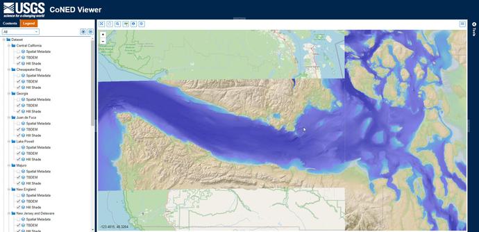
USGS Coastal National Elevation Database Applications (CoNED) Project Viewer
--
https://www.usgs.gov/special-topics/coastal-national-elevation-database-applications-project/data <-- project home page
--
https://www.usgs.gov/coastal-changes-and-impacts/coned <-- CoNED home page
--
#GIS #spatial #mapping #CoNED #USGS #topobathy #remotesensing #opendata #coast #coastal #USA #elevation #topography #bathymetry #hydrospatial #usecase #appliedscience #climatechange #flood #flooding #sealevel #SLR #sealevelrise #risk #hazard #extremeweather #risk #hazard #coastalcommunities #innundation #subsidence #geomorphology #geomorphometry #model #modeling #ecosystems #humanimpact #sediment #erosion #development #planning #cliff #shoreline #resources #naturalresources #datadownload #dataportal #spatialanalysis
@USGS
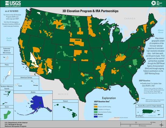
Inflation Reduction Act Accelerates USGS Effort To Collect High-Resolution Data Of Landscapes Across 25 States [3DEP LiDAR and other elevation open datasets]
--
https://www.usgs.gov/news/national-news-release/inflation-reduction-act-accelerates-usgs-effort-collect-high-resolution <-- USGS news release
--
#GIS #spatial #mapping #NGTOC #3DEP #elevation #lidar #ifsar #opendata #ira #infrastructure #USGS #CONUS #Alaska #topography #pointcloud #dem #costbenefit #roi #benefits #naturalresources #3delevationprogram #funding #seamless #1metre #topobathy #CoNED #tbdem #hydrospatial #bathymetry #landscapes #landcover #hydrology #riverbeds #precisionagriculture #floodmapping #flooding #ecosystems #partnerships
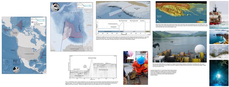
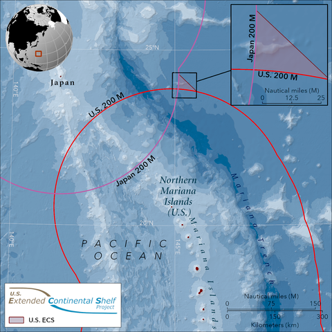
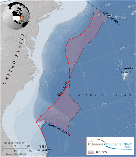
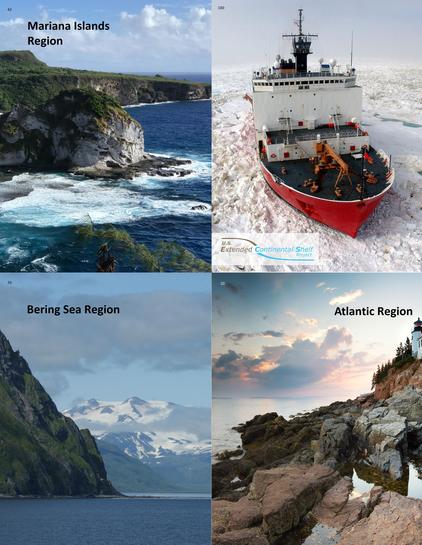
Continental Shelf Maps Could Add Egypt-Size Area To U.S. Territory – A Two-Decade Mapping Effort Yields Bounty Of Seafloor Data
--
https://www.science.org/content/article/continental-shelf-maps-could-add-egypt-size-area-u-s-territory <-- shared technical article
--
https://www.state.gov/the-us-ecs/ <-- US Dept. Of State Extended Continental Shelf (ECS) project page
--
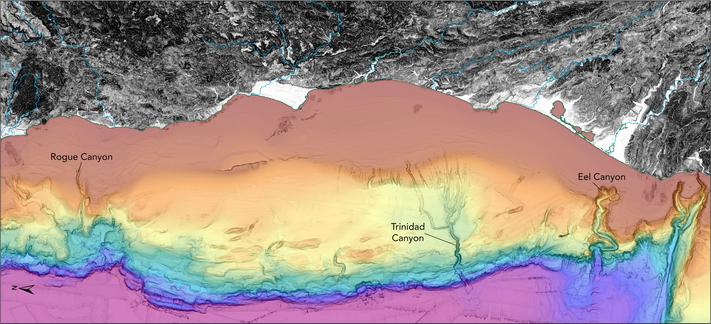
#GIS #spatial #mapping #ECS #ExtendedContinentalShelf #remotesensing #hydrospatial #bathymetry #bathy #topobathy #sonar #seafloor #economics #terrority #underseamapping #geology #biology #resources #energy #continental #continentalshelf #governmentinitiative #biodiversity #exploration #habitat #geoscience #minerals #submarine #mudslides #tsunami #sediments #deposition #seafloormapping #marine #ocean #multibeam #3d #sampling
@USGS @NOAA @StateDept
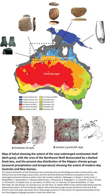
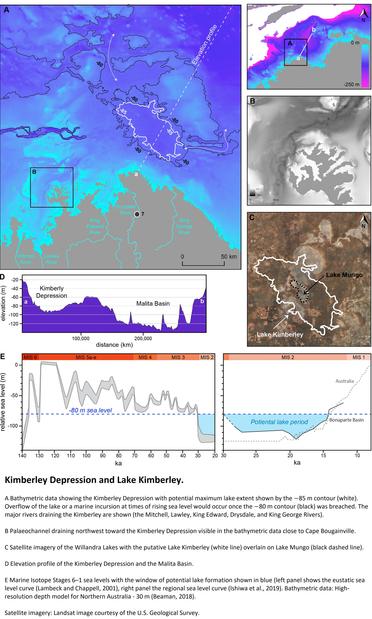
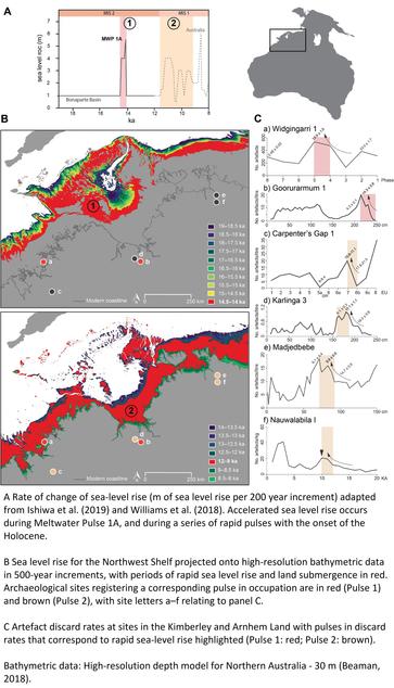
Sea Level Rise Drowned A Vast Habitable Area Of North-Western Australia Driving Long-Term Cultural Change
--
https://doi.org/10.1016/j.quascirev.2023.108418 <-- shared paper
--
[By modelling these geographic features, the team estimates that the region could have supported a population of between 50,000 and 500,000 people.]
#GIS #spatial #mapping #sealevelrise #demographics #remotesensing #climatechange #Pleistocene #Sahu #human #occupation #dispersal #archaeology #rockart #indigeneous #aborgines #firstnation #ancientpeoples #paleogeography #drownedlandscapes #Continentalshelf #Sealevelchange #bathymetry #topobathy #SLR #sealevel #sealevelrise #NewGuinea #PapuaNewGuinea #kimberley #arnhemland #NorthernAustralia #WesternAustralia #marine #ocean #innundation #model #modeling #archipelago
#australia #Wallacea #habitation #settlement #civilisation #maritime #economics #ancienthistory #sediment #sampling #geology #holocene
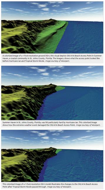
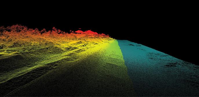
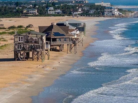
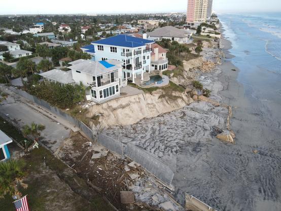
LiDAR Making Waves In Florida Beach Resilience
--
https://lidarmag.com/2023/12/31/lidar-making-waves-in-florida-beach-resilience/ <-- shared technical article
--
#GIS #spatial #mapping #remotesensing #geomorphology #survey #Florida #erosion #beach #engineeringgeology #coastal #coastalengineering #coast #LiDAR #coastalcommunities #tourism #economics #economy #geomorphology #topobathy #elevation #spatialanalysis #spatiotemporal #geomorphometry #risk #hazard #hurricance #stormsurge #extremeweather #climatechange #stormdamage #storm #shoreline #beach #beaches #beachfront #government
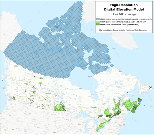
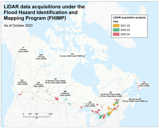
Canada’s National Elevation Data Strategy Update, November 2023
--
https://gogeomatics.ca/canadas-national-elevation-data-strategy-update-november-2023/ <-- shared article
--
https://open.canada.ca/data/en/dataset/957782bf-847c-4644-a757-e383c0057995 <-- HRDEM home page
--
https://natural-resources.canada.ca/science-and-data/science-and-research/natural-hazards/flood-hazard-identification-and-mapping-program/24044 <-- FHIMP home page
--
#GIS #spatial #identification #mapping #Canada #airborne #topobathy #CCMEO #CHN #FHIMP #floodhazard #GeoAI #HRDEM #LiDAR #PointCloud #elevation #data #NationalHydroNetwork #NHN #flood #hazard #risk #floodrisk #3d #3ddata #funding #program #appliedscience #flooding #water #hydrology #hydrospatial #opendata #NRCan #province #terrority #model #modeling
@NRCan
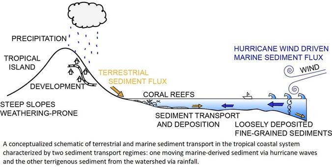
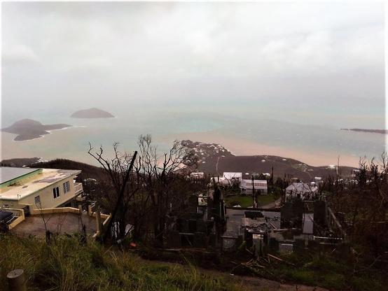
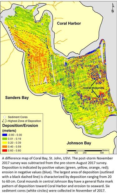
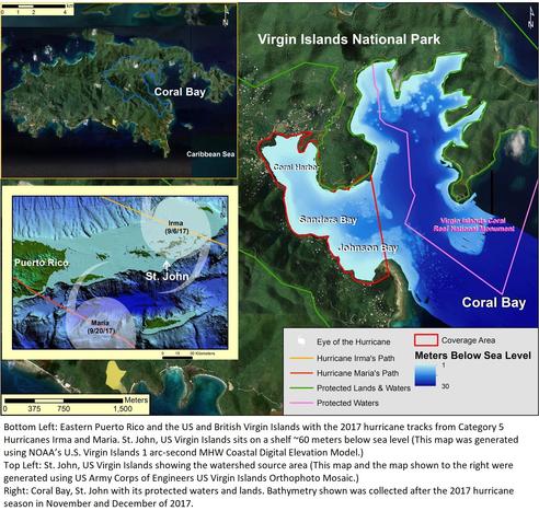
Widespread Deposition In A Coastal Bay Following Three Major 2017 Hurricanes (Irma, Jose, And Maria) [USVI]
--
https://doi.org/10.1038/s41598-019-43062-4 <-- shared paper
--
#GIS #spatial #mapping #remotesensing #bathymetry #topobathy #usvi #usvirginislands #sediment #deposition #marine #terrestrial #hurricane #irma #jose #maria #extremeweather #climatechange #coastal #coast #ecosystems #seafloor #rainfall #precipitation #impacts #offshore #surveys #CoralBay #StJohn #storm #stormsurge #morphology #geomorphometry #aggradation #benthic #model #modeling #watersheds #hydrology #hydrospatial #coral #seagrass #coralreefs #habitat #habitatloss #stormevents #SWAN #wavemodel
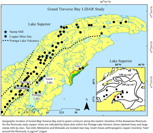
![aerial images - UAS high-resolution drone elevation and bathymetry surveys (base map 9 August 2022) of shoreline retreat at the original Gay pile location after bluff removal. Overlays along the beach edge trace shorelines in 2009, 2016, and 2022. The 78 m retreat over 6 years (2016–2022); equates to a 13 m/yr rate. The previous, nearly constant, long-term retreat rate prior to 2009 averaged 7.9 m/yr (ca. 26′) [7,57]. The original Jacobsville Sandstone shoreline, before stamp sands were discharged, is marked by the red border in the far-left upper region. Note white concrete basements of the two mills and remnants of both wooden and broken concrete launders in the northern region. Environmental recovery is beginning, as benthic organisms and fish are returning to clear underwater stretches of the bedrock shelf, where waves have removed stamp sands. Scattered trees (many birch) are beginning to colonise what is left of the original Gay Pile surface.](https://files.mastodon.social/cache/media_attachments/files/114/181/087/718/405/194/small/038a9daf7989314d.png)
