#NIFC #wildfires #firewx
NIFC New Or Updated Wildfire Perimeter
Incident Name: Post
Acres: 144.0 acres
Updated: Jun 20, 2025 05:20 UTC
Source: IRWIN
#PostFire #IDwx
#PostFire

#NIFC #wildfires #firewx
NIFC New Or Updated Wildfire Perimeter
Incident Name: Post
Acres: 139.3 acres
Updated: Jun 16, 2025 19:06 UTC
Source: IRWIN
#PostFire #IDwx

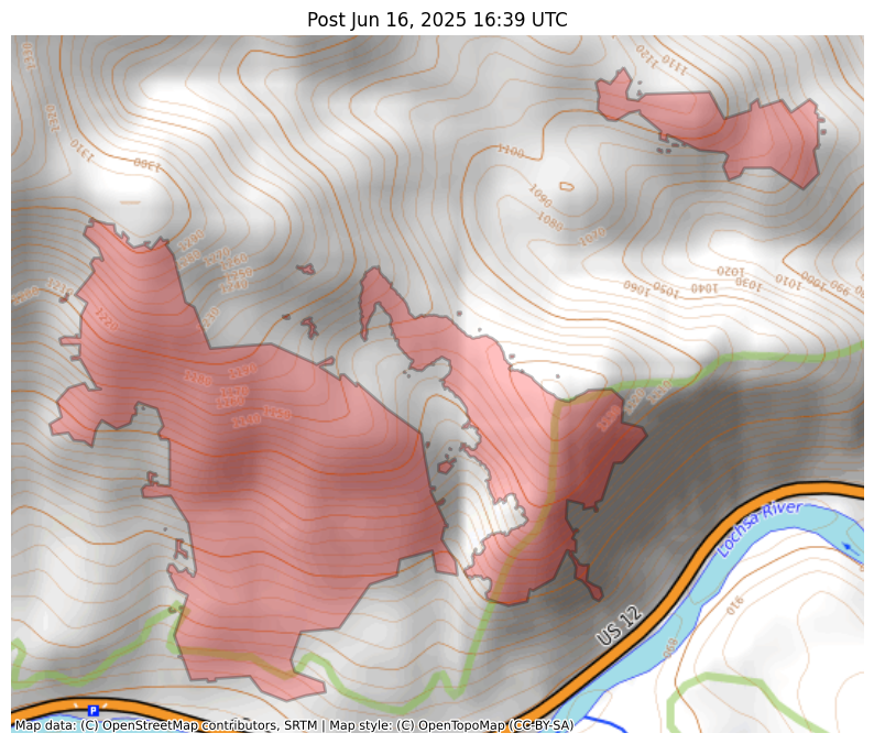
#NIFC #wildfires #firewx
NIFC New Or Updated Wildfire Perimeter
Incident Name: Post
Acres: 139.3 acres
Updated: Jun 16, 2025 16:39 UTC
Source: IRWIN
#PostFire #IDwx
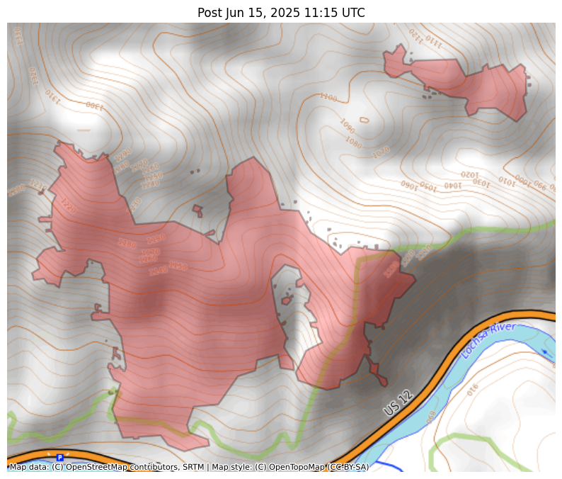
#NIFC #wildfires #firewx
NIFC New Or Updated Wildfire Perimeter
Incident Name: Post
Acres: 150.6 acres
Updated: Jun 15, 2025 11:15 UTC
Source: IRWIN
#PostFire #IDwx

#NIFC #wildfires #firewx
NIFC New Or Updated Wildfire Perimeter
Incident Name: Post
Acres: 150.6 acres
Updated: Jun 15, 2025 11:15 UTC
Source: IRWIN
#PostFire #IDwx
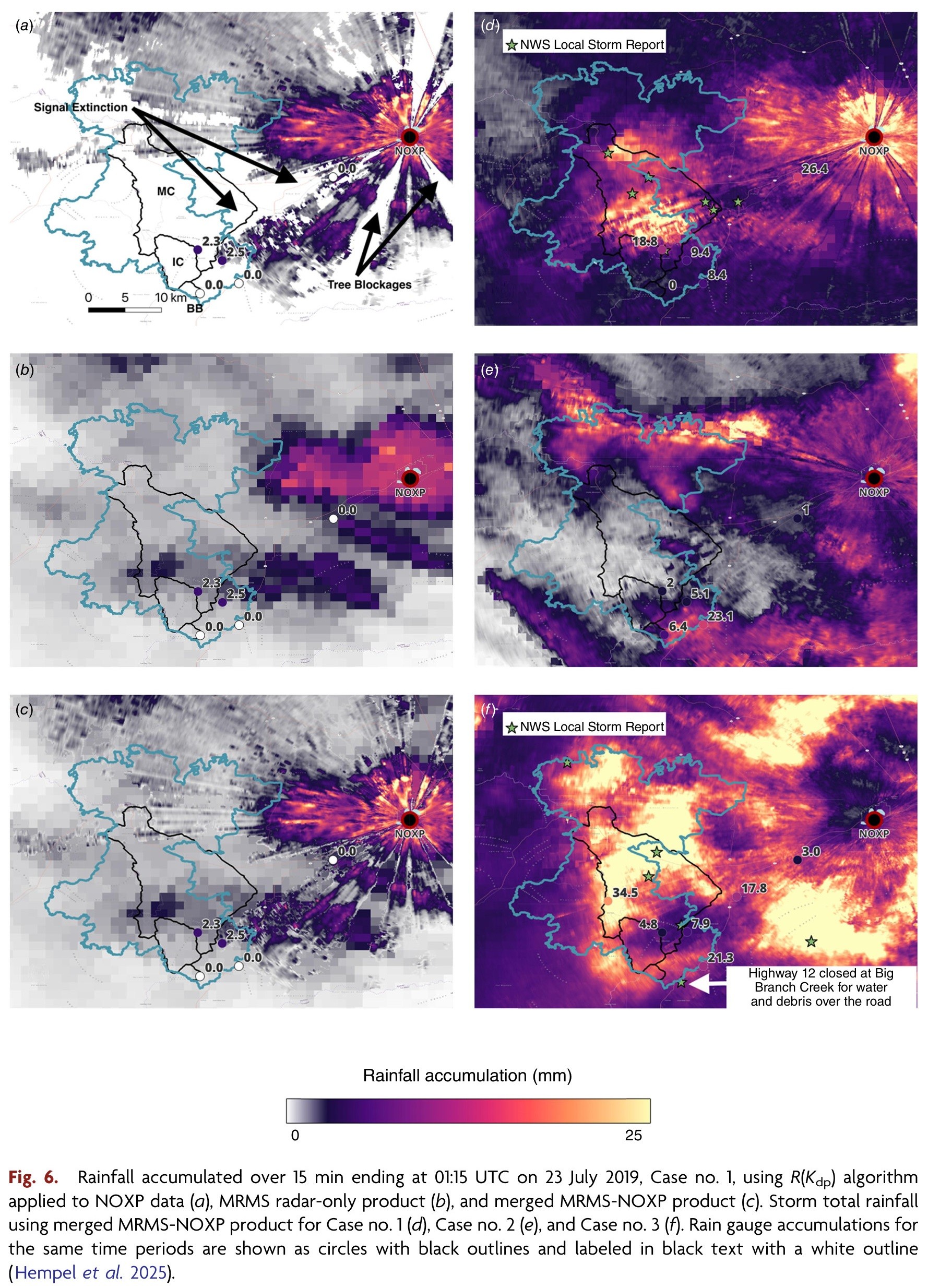
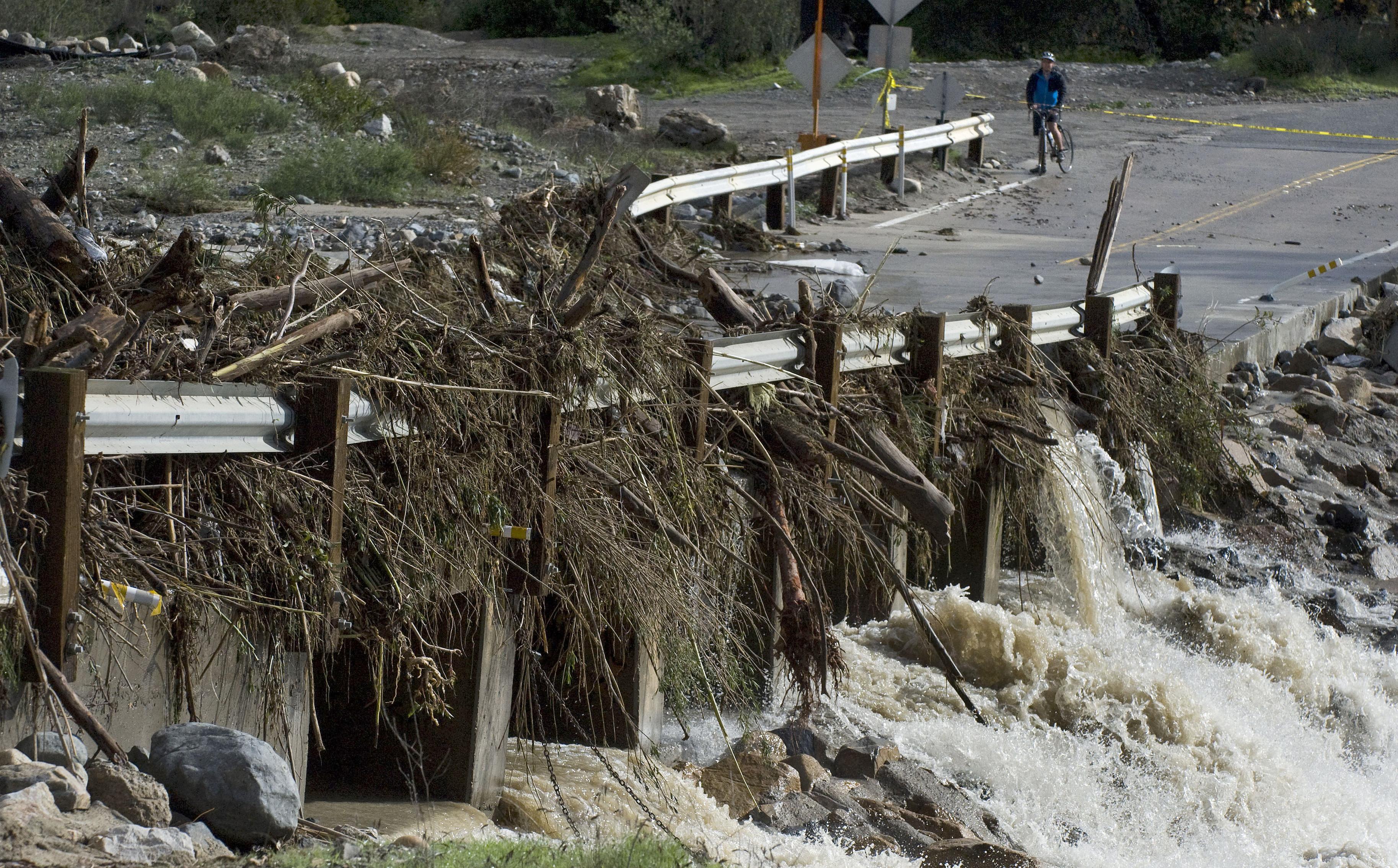
Mobile Radar Provides Insights Into Hydrologic Responses In Burn Areas
--
https://doi.org/10.1071/WF24163 <-- shared paper
--
#GIS #spatial #mapping #remotesensing #radar #water #hydrology #engineeringgeology #risk #hazard #massmovement #landslide #debrisflow #mobileobservatory #postfire #rainfall #precipitation #estimation #RockyMountains #streamradar #weatherradar #extremeweather # metrology #wildfire #fire #impacts #monitoring #hydrometeorological #instrumentation #burnarea #burnt #soil #basin #runoff #spatialanalysis #spatiotemporal #remoteareas #planning #management #mitigation

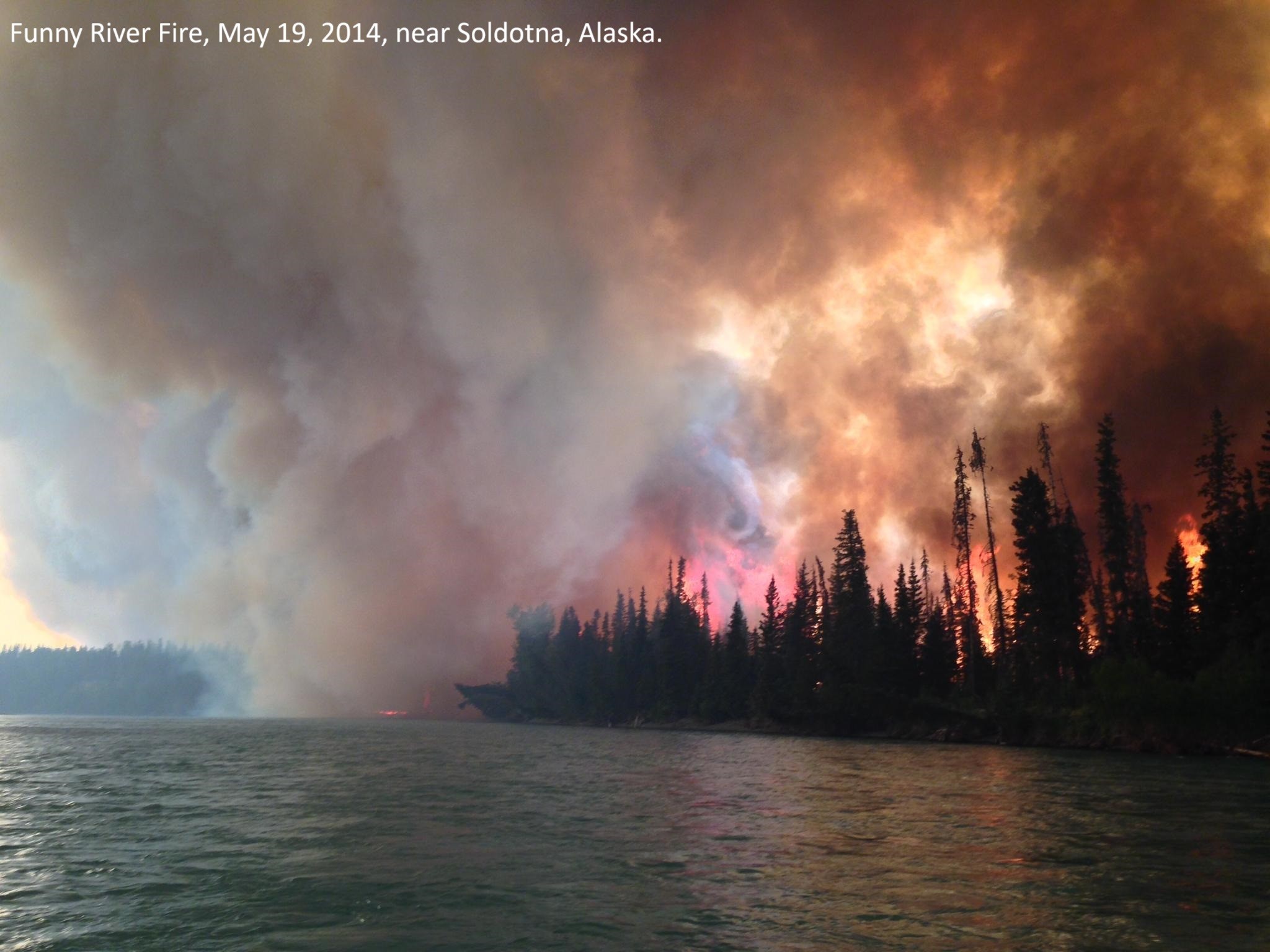
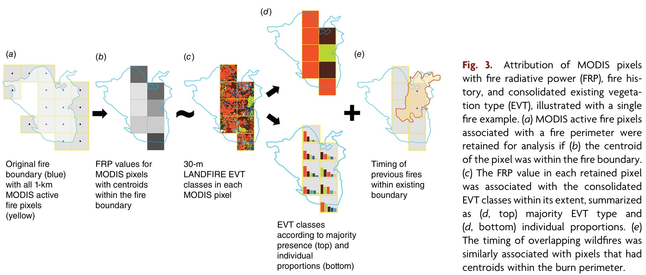
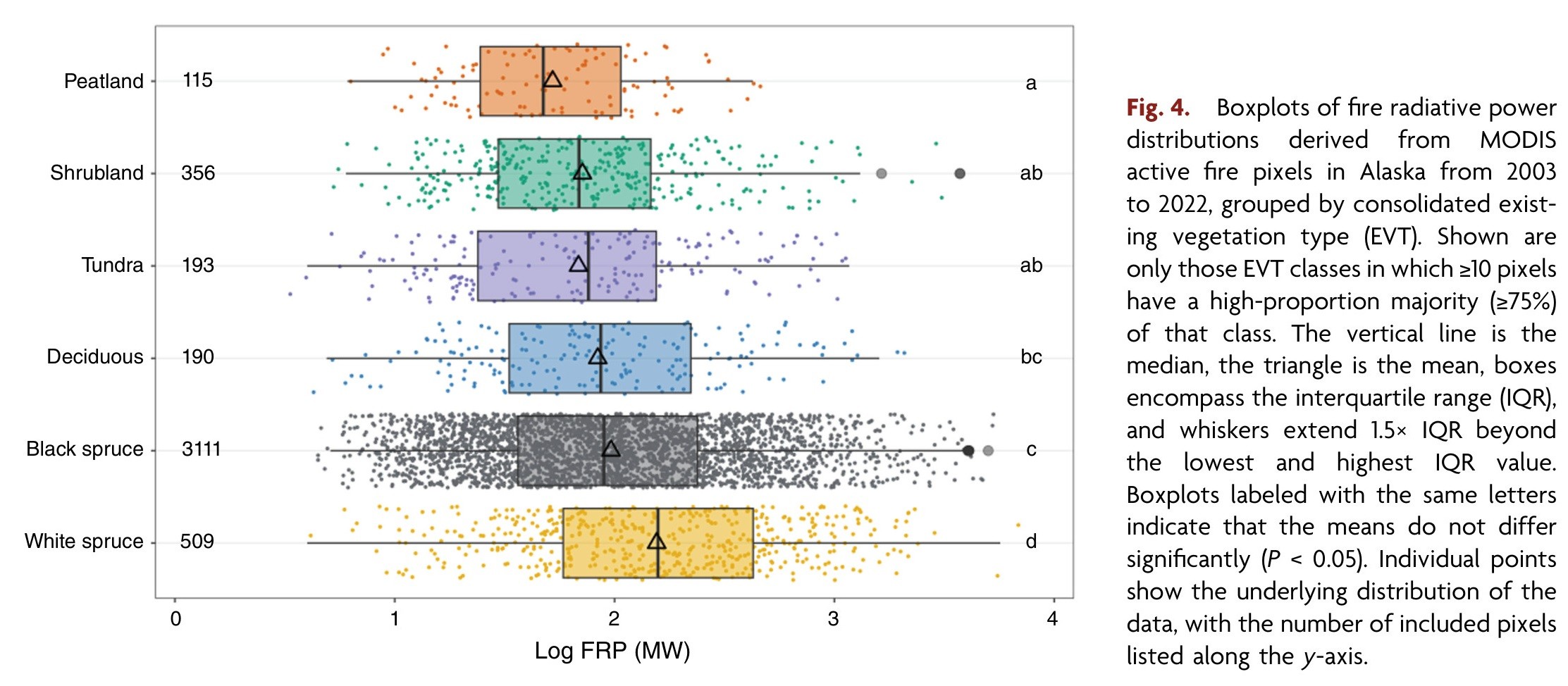
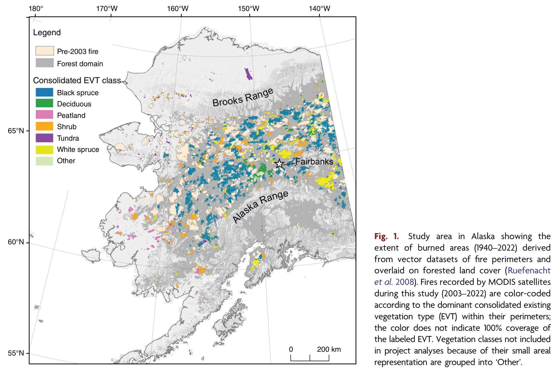
Understanding Wildfire Behaviour Across Alaska Using Remote Sensing Of Fire Intensity
--
https://www.usgs.gov/programs/ecosystems-land-change-science-program/news/understanding-wildfire-behavior-across-alaska <-- shared article
--
https://doi.org/10.1071/WF24062 <-- shared paper
--
https://www.sciencebase.gov/catalog/item/66c3aef6d34e03388287afd0 <-- shared USGS open data release - MODIS Fire Radiative Power Data Compiled From Active Fires In Alaska, 2003-2022
--
https://akfireinfo.com/ <-- shared Alaska Wildland Fire Information page
--
#GIS #spatial #mapping #WildfireScience #Alaska #RemoteSensing #satellite #WildfireAwarenessMonth #WildlandFireScience #fedscience #fedservice #wildfire #bushfire #blackspruce #boreal #fireintensity #fireradiativepower #FRP #MODIS #postfire #shrubland #tundra #whitespruce #peat #ecosystems #risk #hazard #management #planning #recovery #severity
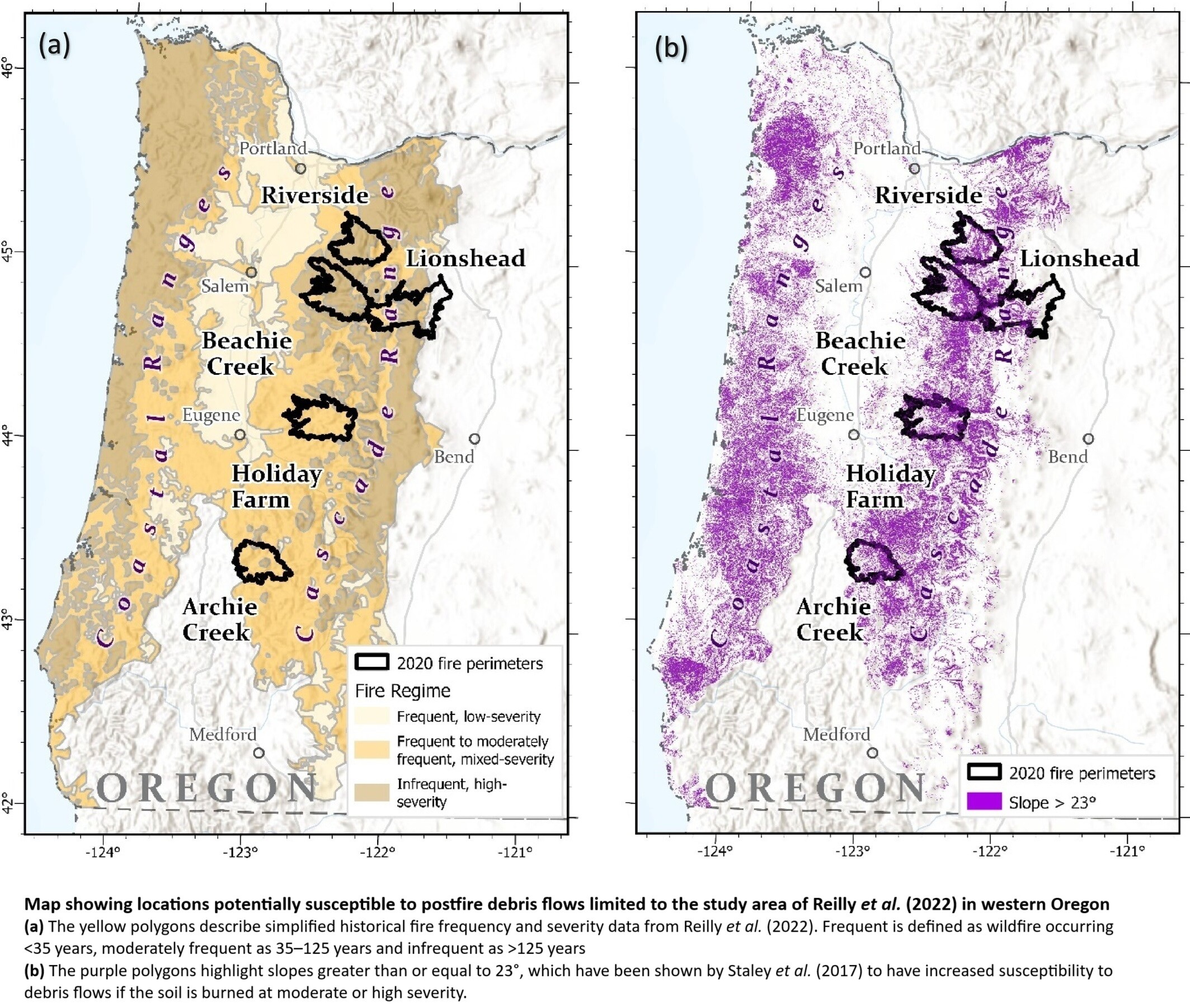
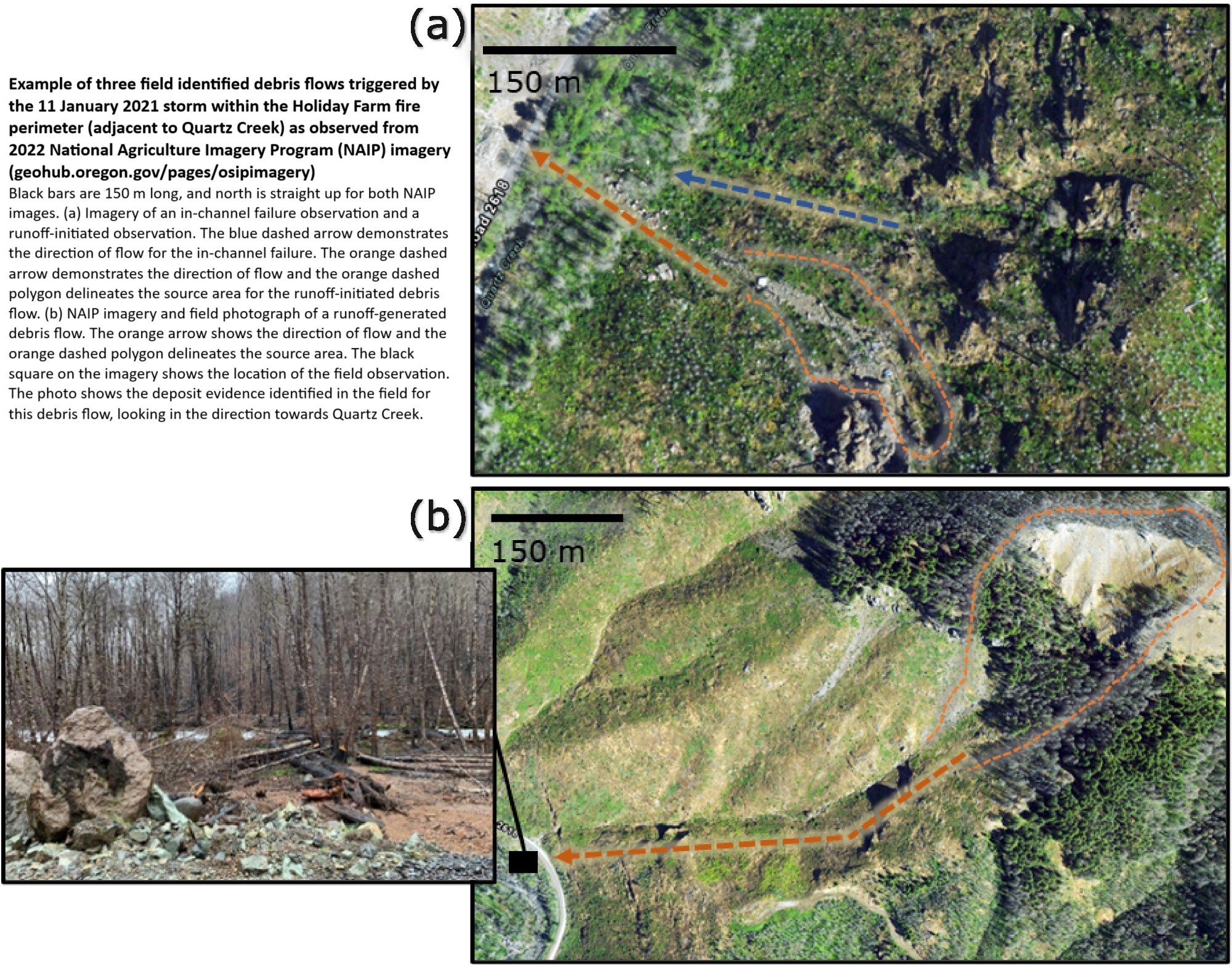
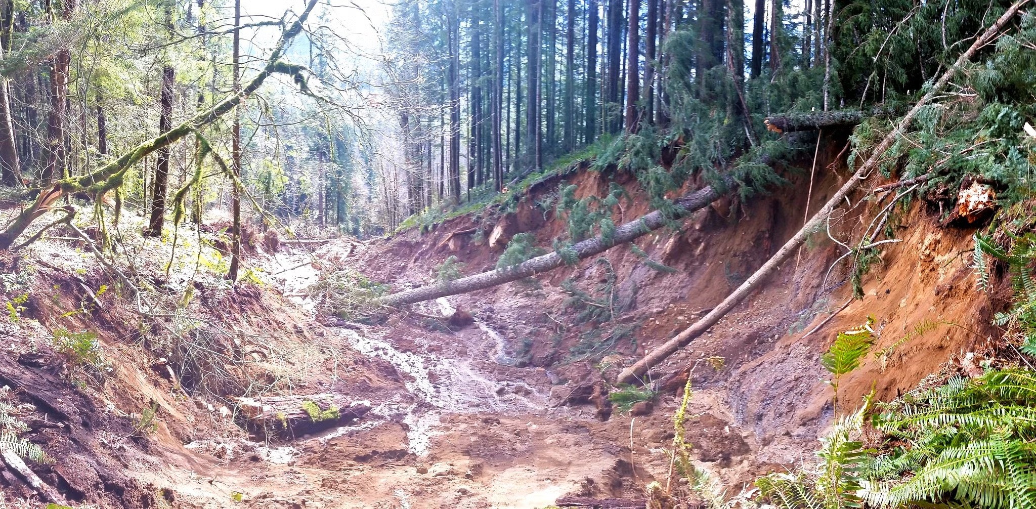
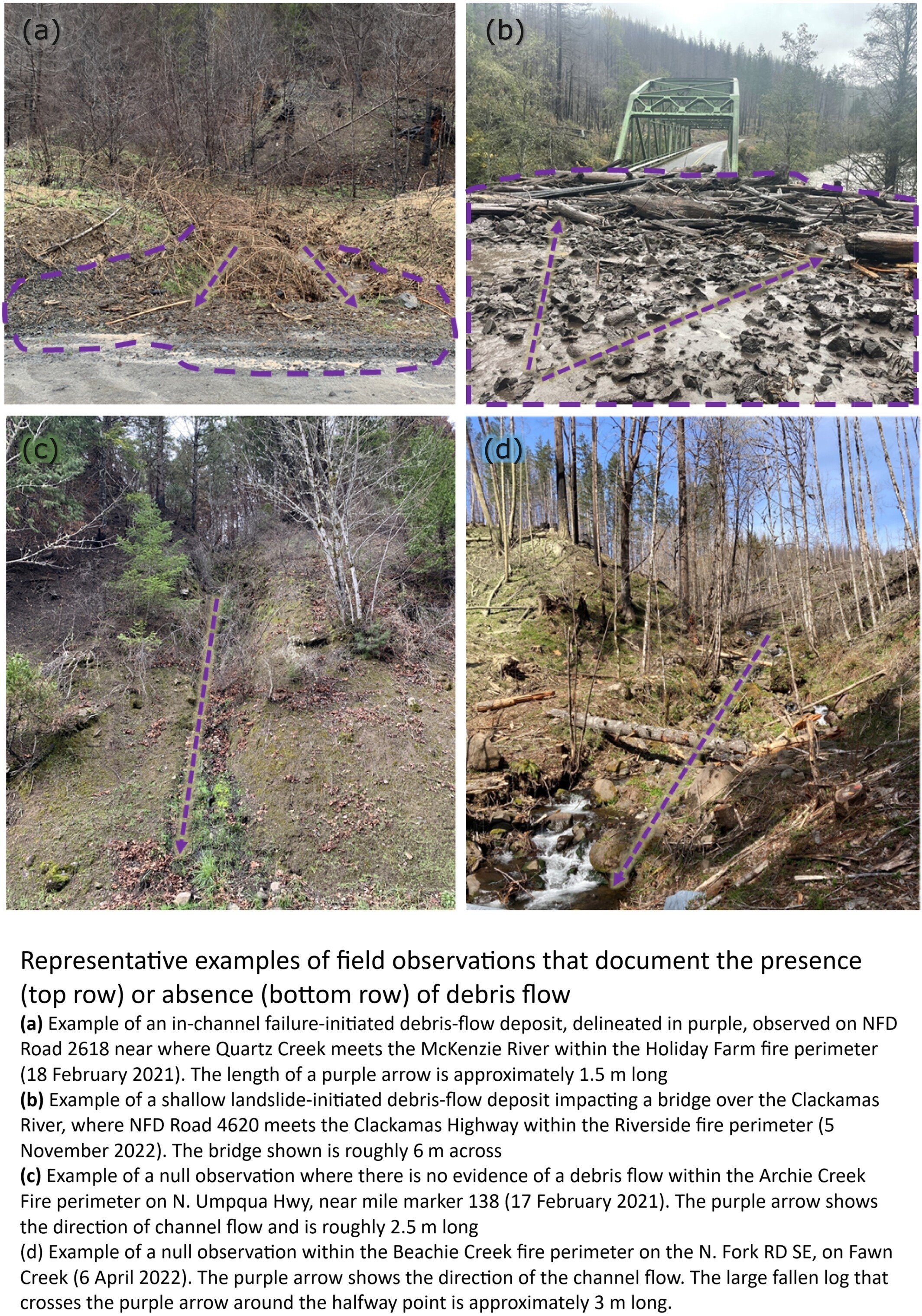
Assessment Of Western Oregon Debris-Flow Hazards In Burned And Unburned Environments
--
https://doi.org/10.1002/esp.70045 <-- shared paper
--
[with more and more catastrophic wildfires, the engineering geology awareness and possible mapping of post-fire debris flow risk is important]
#GIS #spatial #mapping #wildfire #fire #oregon #risk #hazard #geology #geomorphology #risk #hazard #landslide #massmovement #landslide #postfire #soil #spatialanalysis #spatiotemporal #engineeringgeology #extremeweather #naturaldisaster #debrisflow #mechasisms #property #infrastrure #publicsafety #lossoflife #model #modeling #calibration #water #hydrology #inventory #hazardassessment #geomorphometry
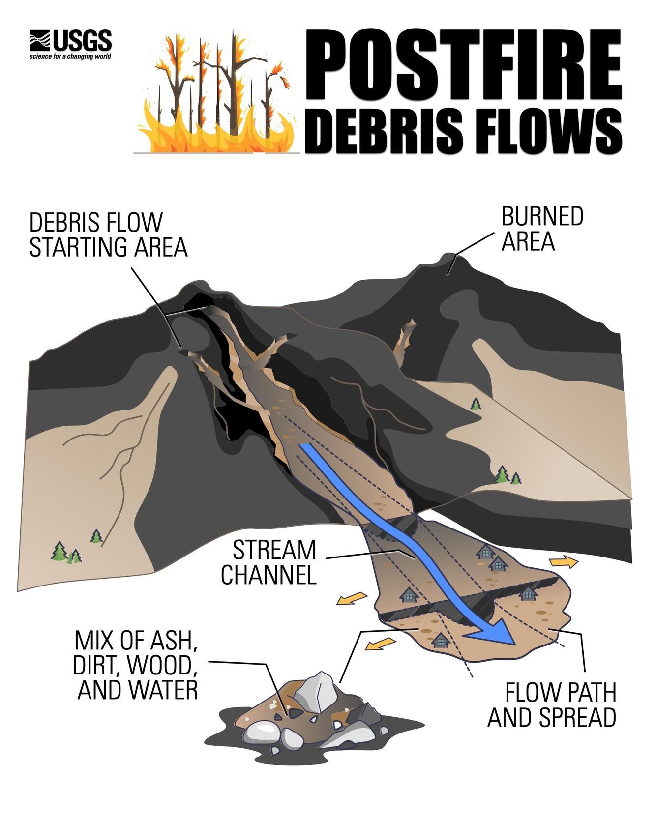
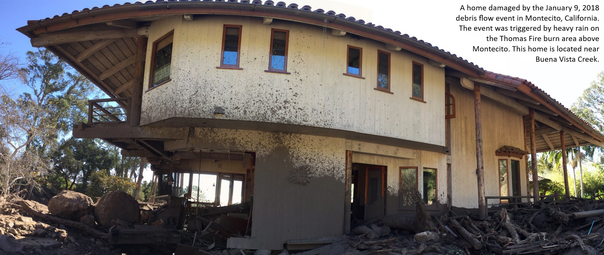
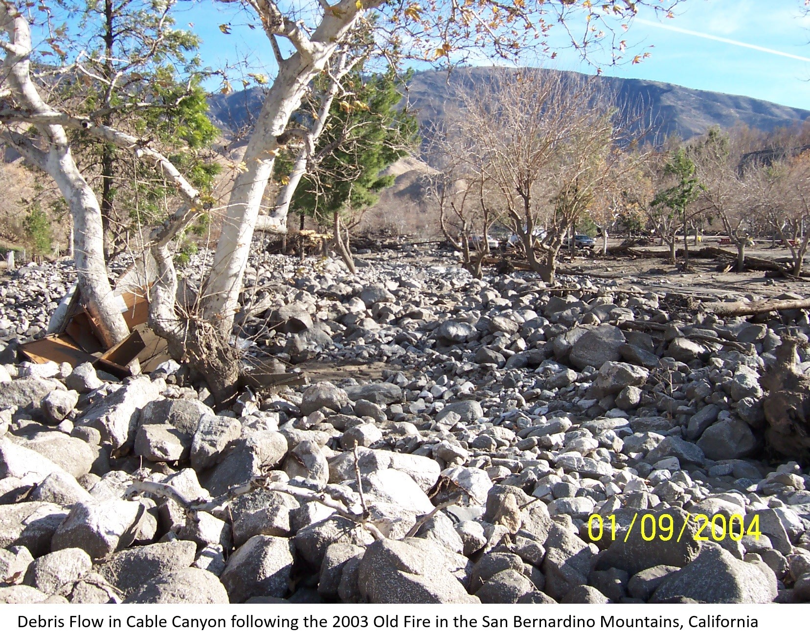
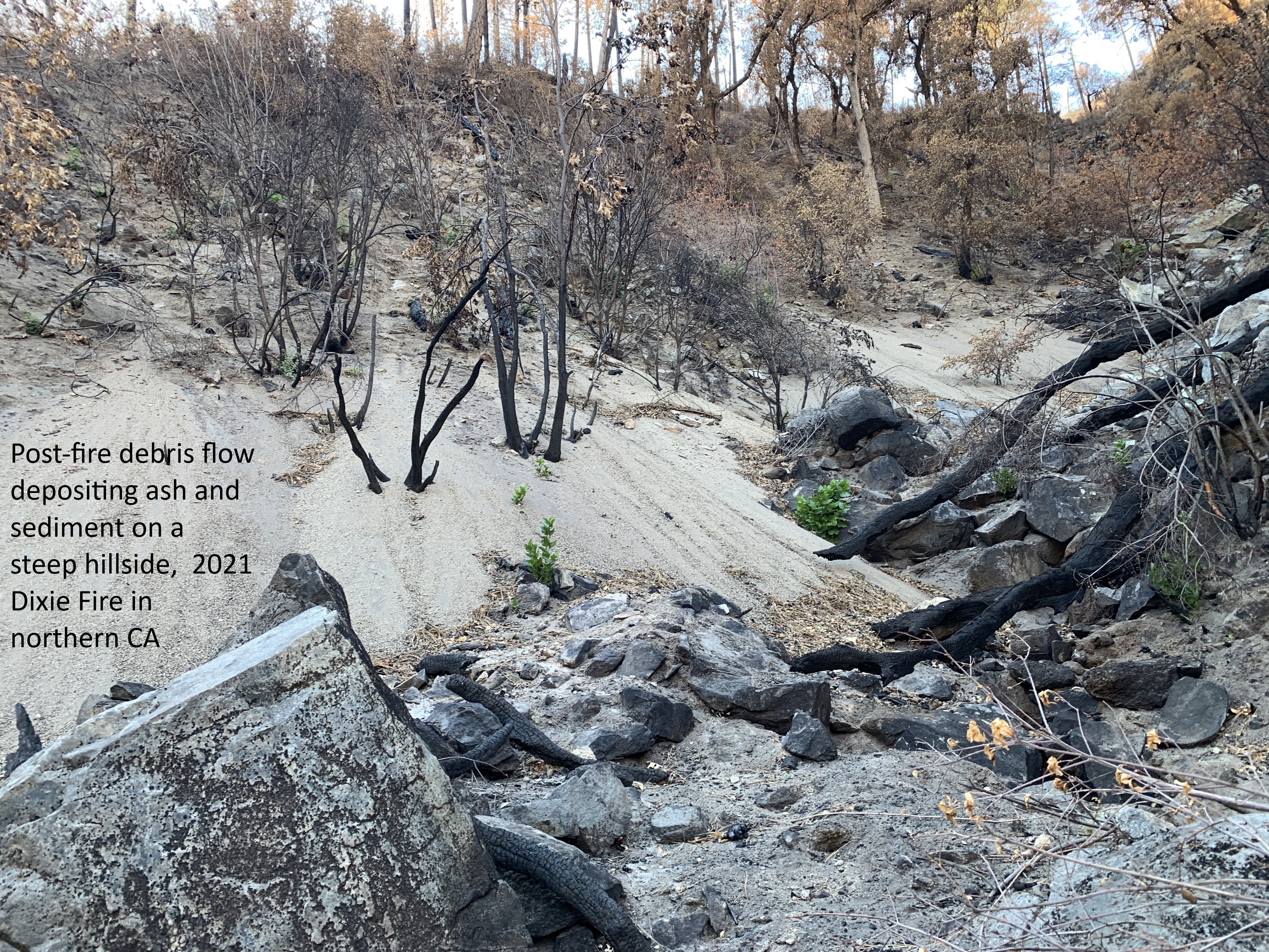
Postfire Debris-Flow Hazards
--
https://www.usgs.gov/programs/landslide-hazards/science/postfire-debris-flow-hazards <-- shared technical article / overview
--
http://alturl.com/po3yj <-- USGS Post-Fire Debris Flow Hazard Assessment Viewer
--
https://earthquake.usgs.gov/arcgis/rest/services/ls/ <-- Post-Fire Debris-Flow Hazards USGS spatial data / GIS Services
--
#GIS #spatial #mapping #USGS #LandslideHazardsProgram #NaturalHazards #3DEP #NGP #NationalGeospatialProgram #GIRT #GeospatialInformationResponseTeam #GIS #geology #hydrospatial #hydrology #landslides #debrisflows #fires #postfire #lidar #elevationdata #hazardassessments #preparedness #massmovement #engineeringgeology #risk #hazards #impacts #cost #economics #geomorphology #geomorphometry #spatialanalysis #spatiotemporal #remotesensing #soil #model #modeling #LosAngeles #LA #LosAngelesfires #California #wildfires #opendata
@USGS

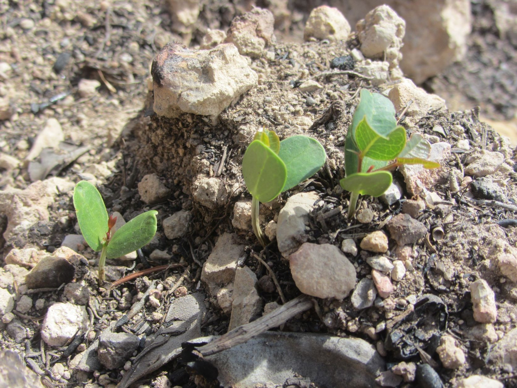
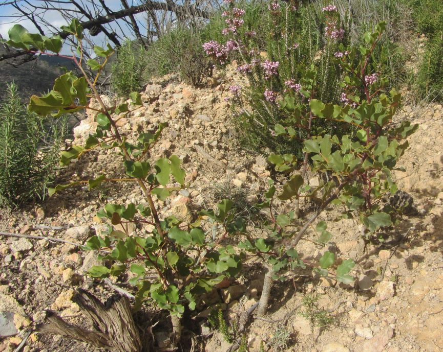
The #postfire seedling recruitment of the #Carob tree (#Ceratonia siliqua) that I observed 1 month after #fire (left) is thriving 3 years later (right). It's not that common to see this regeneration.
Azuebar fire (2021), eastern #Spain
#IFAzuebar #SerraEspadà @ecology @plants @botany @wildfirescience @plantscience @nature @biodiversity @conservation
Morning status of fires followed by BakersRelay
#CoffeePotFire ACRES: 12,705 CONTAIN.: 25%
#BearFire ACRES: 3,280 CONTAINMENT: 0%
#BooneFire ACRES: 12,200 CONTAINMENT: 5%
#CopperfieldFire ACRES: 3,802 CONTAIN.: 26%
#SolomonFire ACRES: 2,600 CONTAINMENT: 0%
#WileyFlatFire ACRES: 14,758 CONTAIN.: 0%
#WhiskyCreekFire ACRES: 2,092 CONT.: 25%
#WilliamsMineFire ACRES: 12,661 CONTAIN.: 31%
#PioneerFire ACRES: 38,735 CONTAINMENT: 23%
Fires no longer relayed by BakersRelay
#ChimineasFire ACRES: 1,200 CONTAINMENT: 90%
#PostFire ACRES: 1,200 CONTAINMENT: 90%
#RecordFire ACRES: 517.1 CONTAINMENT: 78%
#ChapmanFire ACRES: 18 CONTAINMENT: 50%
#OakCanyonFire ACRES: 15,170 CONTAIN: 75%
A couple of updates:
#SitesFire: The fire is now 100% Contained at 19,195 acres per Cal Fire LNU. This will be the final update on the Sites Fire unless conditions change.
#ApacheFire: Per Cal Fire the fire is 75% contained.
https://www.fire.ca.gov/incidents/2024/6/24/apache-fire
#EmpireFire: The fire is now 75% contained per CAL FIRE SCU
#PostFire: The fire is now 100% contained & has a final acreage of 15,563 acres per CAL FIRE
These will be the final updates by me on these fires unless conditions change.
Michael Silvester, Staff Reporter
Jun 21, 8:32 AM
The fire is now 61% contained per CAL FIRE.
BakersRelay signing off for the night. Please follow the hashtags below if you’re interested in the event.
#SitesFire CA https://share.watchduty.org/i/22172
#AeroFire CA https://share.watchduty.org/i/22207
#PostFire CA https://share.watchduty.org/i/21947
#McDonaldFire AK
#SouthForkFire NM https://share.watchduty.org/i/22124
#SaltFire NM https://share.watchduty.org/i/22195
Unnamed Tropical Depression
#CAwx #NMwx #TXwx
Be safe, be prepared, be weather aware. Catch you tomorrow morning.
Evacuation Downgrades (official notice) #PostFire #LosAngelesCounty #CAwx
Benjamin Kuo, Reporter
Jun 20, 1:30 PM
Per the Zonehaven evacuation map, CAS-PARADISERANCH is now back to normal status, and no longer has any evacuation warnings or orders. CAS-GOLDENSTATE-B also has been cleared of any evacuation warnings. CAS-GOLDENSTATE-A has downgraded to an Evacuation Warning.
Sekhar Padmanabhan, Staff Reporter
Jun 20, 9:53 AM
The fire is now 47% contained, per Los Angeles County Fire.
Evacuations for the Post Fire have been adjusted,
Per the Zonehaven evacuation map, CAS-PARADISERANCH is now back to normal status, and no longer has any evacuation warnings or orders. CAS-GOLDENSTATE-B also has been cleared of any evacuation warnings. CAS-GOLDENSTATE-A has downgraded to an Evacuation Warning.
BakersRelay signing off for the night. Please follow the hashtags below if you’re interested in the event.
#SideFire CA https://share.watchduty.org/i/22466
#SitesFire CA https://share.watchduty.org/i/22172
#SkyFire CA https://share.watchduty.org/i/22172
#AeroFire CA https://share.watchduty.org/i/22207
#PostFire CA https://share.watchduty.org/i/21947
#McDonaldFire AK
#SouthForkFire NM https://share.watchduty.org/i/22124
#SaltFire NM https://share.watchduty.org/i/22195
#Alberto Tropical Storm
Be safe, be prepared, be weather aware. Catch you tomorrow morning.
Adam Segal, Reporter
Jun 19, 11:01 AM
The fire is now 39% contained per CAL FIRE and remains at 15,690 acres.
Michael Silvester, Staff Reporter
Jun 18, 8:38 PM
The fire is now 15,690 acres & 31% contained per CAL FIRE.
Client Info
Server: https://mastodon.social
Version: 2025.07
Repository: https://github.com/cyevgeniy/lmst